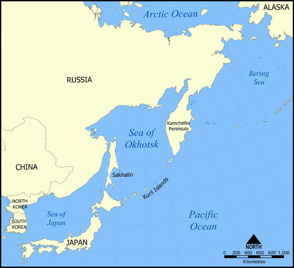
- Sea of Okhotsk
-
Coordinates: 55°N 150°E / 55°N 150°E
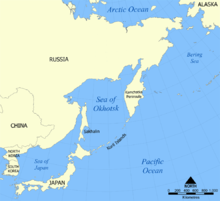 Map of the Sea of Okhotsk
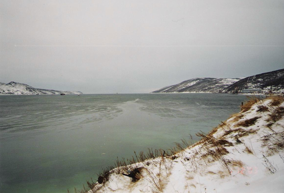
The Sea of Okhotsk (Russian: Охо́тское мо́ре; English Transliteration: Okhotskoye More) is a marginal sea of the western Pacific Ocean,[1] lying between the Kamchatka Peninsula on the east, the Kuril Islands on the southeast, the island of Hokkaidō to the far south, the island of Sakhalin along the west, and a long stretch of eastern Siberian coast (including the Shantar Islands) along the west and north. The northeast corner is Shelikhov Gulf. It is named after Okhotsk, the first Russian settlement in the Far East.
Contents
Geography
The Sea of Okhotsk covers 611,000 sq.mi. (1,583,000 km2), with a mean depth of 2,818 feet (859 metres). Its maximum depth is 11,063 feet (3,372 metres). It is connected to the Sea of Japan on either side of Sakhalin: on the west through the Sakhalin Gulf and the Gulf of Tartary; on the south, through the La Pérouse Strait.
In winter, navigation on the Sea of Okhotsk becomes difficult, or even impossible, due to the formation of large ice floes, because the large amount of freshwater from the Amur River lowers the salinity and raises the freezing point of the sea. The distribution and thickness of ice floes depends on many factors: the location, the time of year, water currents, and the sea temperatures.
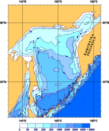 Depths
With the exception of Hokkaidō, one of the Japanese home islands, the sea is surrounded on all sides by territory administered by the Russian Federation. For this reason, it is generally considered as being under Russian sovereignty.
Extent
The International Hydrographic Organization defines the limits of the Sea of Okhotsk as follows:[2]
On the Southwest. The Northeastern and Northern limits on the Japan Sea [In La Perouse Strait (Sôya Kaikyô). A line joining Sôni Misaki and Nishi Notoro Misaki (45°55'N). From Cape Tuik (51°45'N) to Cape Sushcheva].
On the Southeast. A line running from Nosyappu Saki (Cape Noshap, 43°23'N) in the Island of Hokusyû (Yezo) through the Kuril or Tisima Islands to Cape Lopatka (South point of Kamchatka) in such a way that all the narrow waters between Hokusyû and Kamchatka are included in the Sea of Okhotsk.
Islands
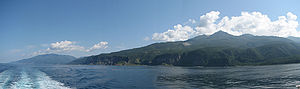
Some of the Islands limiting the Sea of Okhotsk from the south, like Hokkaidō and Sakhalin, are very large. Practically all islands in the Okhotsk Sea are either coastal islands or they belong to the Kuril island chain. Ion Island is the only island in the Sea of Okhotsk that is located in the open sea. The majority of the islands in the Okhotsk Sea are uninhabited, being an ideal breeding ground for seals and seabirds.
History
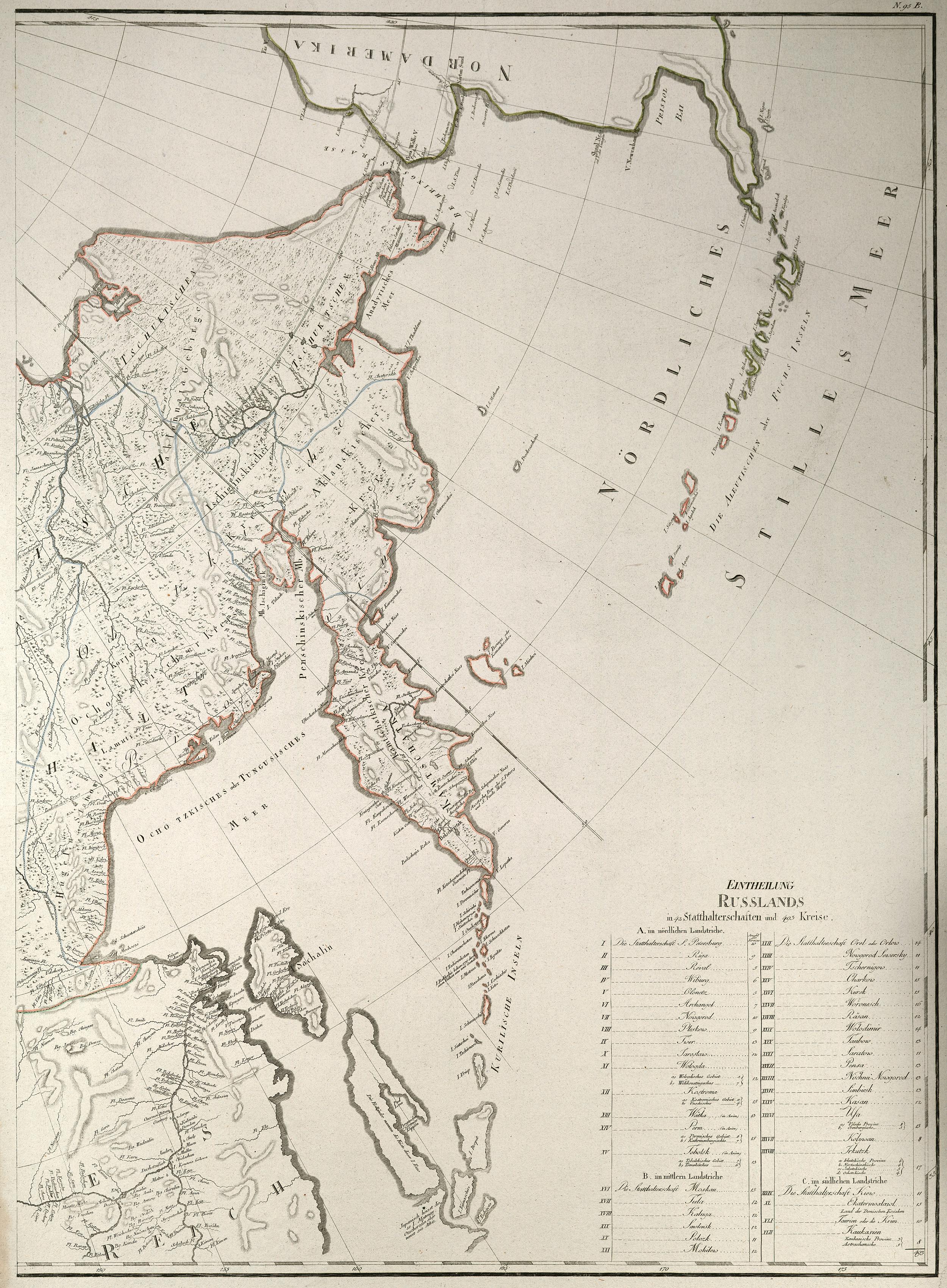
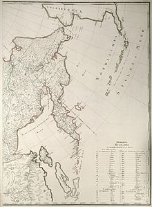 Most of the Sea of Okhotsk, with the exception of the Sakhalin Island, had been well mapped by 1792
The Russian explorers Ivan Moskvitin and Vassili Poyarkov were the first Europeans to visit the Sea of Okhotsk (and, probably, the island of Sakhalin[3]) in the 1640s. The Dutch captain Maarten Gerritsz Vries in the Breskens entered the Sea of Okhotsk from the south-east in 1643, and charted parts of the Sakhalin coast and Kurile Islands, but failed to realize that either Sakhalin or Hokkaido are islands.
The first and foremost Russian settlement on the shore was the port of Okhotsk, which relinquished commercial supremacy to Ayan in the 1840s. The Russian-American Company all but monopolized the commercial navigation of the sea in the first half of the 19th century.
The Second Kamchatka Expedition under Vitus Bering systematically mapped the entire coast of the sea, starting in 1733. Jean-François de La Pérouse and William Robert Broughton were the first non-Russian European navigators known to have passed through these waters other than Maarten Gerritsz Vries. Ivan Krusenstern explored the eastern coast of the Sakhalin in 1805. Mamiya Rinzō and Gennady Nevelskoy determined that the Sakhalin was indeed an island separated from the mainland by a narrow strait. The first detailed summary of the hydrology of the sea was prepared and published by Stepan Makarov in 1894.
During the Cold War, the Sea of Okhotsk was the scene of several successful U.S. Navy operations (including Operation Ivy Bells) to tap Soviet Navy undersea communications cables. These operations were documented in the book Blind Man's Bluff: The Untold Story of American Submarine Espionage. The sea (and surrounding area) were also the scene of the Soviet PVO Strany attack on Korean Air Flight 007 in 1983. The Soviet Pacific Fleet used the Sea as a ballistic missile submarine bastion, a strategy that Russia continues.
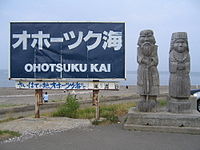 A signboard of Ohotsuku Kai with statues of Ainu people
In the Japanese language, the sea has no traditional Japanese name despite its close location to the Japanese territories and is called Ohōtsuku-kai (オホーツク海), which is a transcription of the Russian name. Additionally, Abashiri Subprefecture, the part of Hokkaidō which faces the sea, is often called the Okhotsk region (オホーツク地方 Ohōtsuku-chihō), named after the sea.
The Sea of Okhotsk was a hotbed for whaling in the mid-19th century. Beginning in 1845, American whaleships began hunting right whales in the southeastern part of the Sea of Okhotsk near the Kurile Islands. The first bowheads were caught in 1847; from 1849 bowheads dominated the catch. Between 1850 and 1853 the majority of the fleet focused their efforts on bowheads in the Bering Strait region. Following poor catches there, whaleships began shifting their attention to the stock of bowhead whales in the Sea of Okhotsk. In 1854 alone some 160 whaleships visited the region; the following year more than 130 ships. The next year, 1856, nearly 150 ships sailed to the Okhotsk. By 1857, the number of ships had declined to a little over 100. With declining catches from 1858 to 1860 the fleet shifted its focus back to the Bering Strait region.[4] Many of the ships converged on the Shantar Islands, anchoring within the archipelago's many sheltered bays. On July 28, 1854 the New Bedford ship Isabella reported ninety-four ships in sight from her deck. A few days later the Lexington, of Nantucket, reported one hundred whaleboats were about chasing whales. Ships continued to hunt whales in the Sea of Okhotsk until the early 20th century.
Oil reserves
Twenty-nine zones of possible oil and gas accumulation have been identified on the Sea of Okhotsk shelf which runs along the coast. Total reserves are estimated at 3.5 billion tons of equivalent fuel, including 1.2 billion tons of oil and 1.5 billion cubic meters of gas.[5]
Notable seaports
- Abashiri, Hokkaidō, Japan
- Magadan, Magadan, Russia
- Monbetsu, Hokkaidō, Japan
- Palana, Kamchatka, Russia
- Wakkanai, Hokkaidō, Japan
See also
- 100 Soundscapes of Japan
References
- ^ Kon-Kee Liu; Larry Atkinson (June 2009). Carbon and Nutrient Fluxes in Continental Margins: A Global Synthesis. Springer. pp. 331–333. ISBN 9783540927341. http://books.google.com/books?id=tpfrKj4G3EUC&pg=PA331. Retrieved 29 November 2010.
- ^ "Limits of Oceans and Seas, 3rd edition". International Hydrographic Organization. 1953. http://www.iho-ohi.net/iho_pubs/standard/S-23/S23_1953.pdf. Retrieved 7 February 2010.
- ^ Stephan, John J. (1971), Sakhalin: a history, Clarendon Press, p. 11, http://books.google.com/books?ei=KJ0GS66DF5OElQSCtNjwCQ
- ^ Bockstoce, John (1986). Whales, Ice, & Men: The History of Whaling in the Western Arctic. University of Washington Press. ISBN 0-295-97447-8.
- ^ Magadan Region from Kommersant, Russia's Daily Online. Retrieved 22 January 2007.

 Islands of the Sea of OkhotskAntsiferov · Arka · Atlasov · Banka Zotova · Baydukov Island · Belyakov Island · Bolshoy Chome · Bolshoy Shantar · Brat Chirpoyev · Broutona · Chastye Islands · Chetyre Paltsa · Chirinkotan · Chirpoy · Chkalov Island · Dobrzhansky Island · Ekarma · Feklistova · Hokkaidō · Iony Island · Iturup · Kamen-Mukdykyn · Kamen Opasnosti · Kekurniy Island · Ketoy · Khalpili Islands · Kharimkotan · Konus · Krayniy Island · Kunashir · Kuril Islands · Makanrushi · Matua · Menshikov Island · Morskaya Matuga · Nansikan Island · Nedorazumeniya · Onekotan · Oremif · Paramushir · Pilamif · Raikoke · Rasshua · Rechnaya Matuga · Reyneke Island · Rovnyy · Sakhalin · Shantar Islands · Shelikan · Shiashkotan · Shumshu · Simushir · Spafaryev Islands · Talan Island · Telan Island · Tretiy Island · Tyuleniy Island · Umara · Urup · Ush · Ushishir · Vtoroy · Yam Islands · Yengalychev Island · Zavyalov · ZubchatyCategories:
- Sea of Okhotsk
- Marginal seas of the Pacific Ocean
- Seas of Russia


Wikimedia Foundation. 2010.