- Davis Strait
-
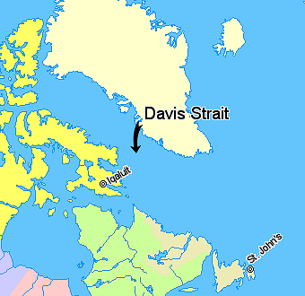
 Davis Strait, lying between Greenland and Nunavut, Canada.
 NunavutQuebecNewfoundland and LabradorRegions outside Canada (Greenland, Iceland)
Davis Strait (French: Détroit de Davis) is a northern arm of the Labrador Sea. It lies between mid-western Greenland and Nunavut, Canada's Baffin Island. The strait was named for the English explorer John Davis (1550–1605), who explored the area while seeking a Northwest Passage.
Contents
Extent
The International Hydrographic Organization defines the limits of the Davis Strait as follows:[1]
On the North. The Southern limit of Baffin Bay [The parallel of 70° North between Greenland and Baffin Land].
On the East. The Southwest coast of Greenland.
On the South. The parallel of 60° North between Greenland and Labrador.
On the West. The Eastern limit of the Northwestern Passages South of 70° North [the East coast of Baffin Island to East Bluff, its Southeastern extremity] and of Hudson Strait [A line from East Bluff, the Southeast extreme of Baffin Island (61°53′N 65°57′W / 61.883°N 65.95°W), to Point Meridian, the Western extreme of Lower Savage Islands, along the coast to its Southwestern extreme and thence a line across to the Western extreme of Resolution Island, through its Southwestern shore to Hatton Headland, its Southern point, thence a line to Cape Chidley, Labrador (60°24′N 64°26′W / 60.4°N 64.433°W)].
Geology
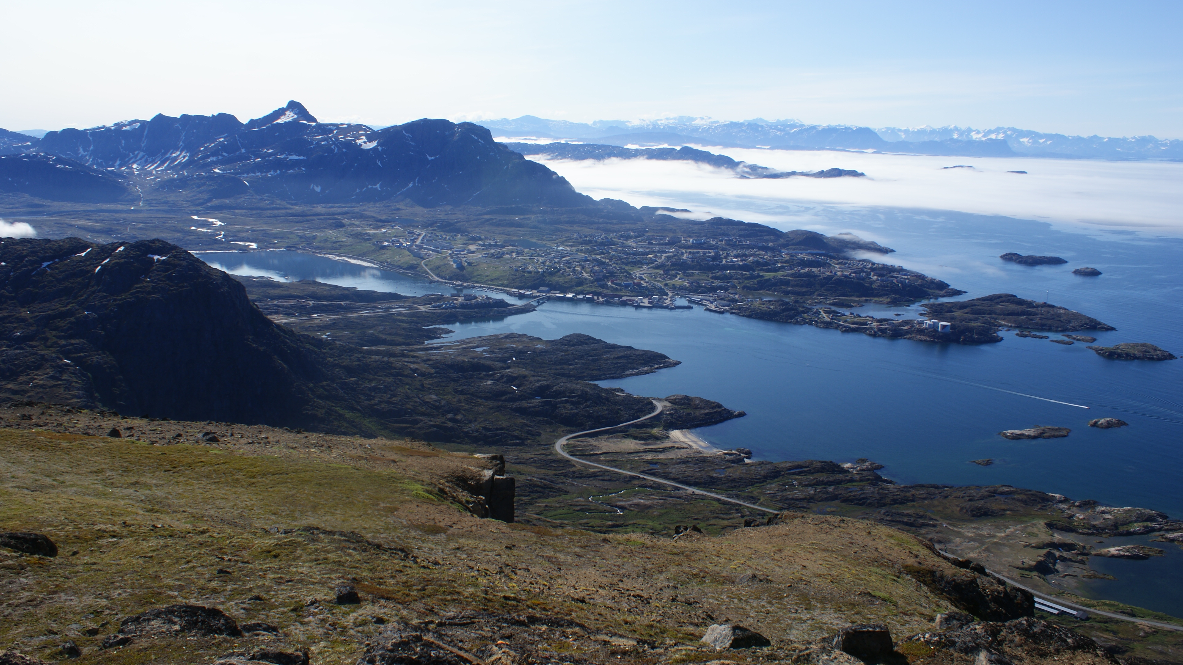
 The coast of Davis Strait in western Greenland
The Davis Strait is underlain by complex geological features of buried grabens (basins) and ridges, probably formed by strike-slip faulting during Paleogene times about 45 million to 62 million years ago. The strike-slip faulting transferred plate-tectonic motions in the Labrador Sea to Baffin Bay. It is the world's broadest strait.
Depth
With a water depth of between one and two thousand meters the strait is substantially shallower than the Labrador Sea to the south or Baffin Bay to the north.
Tides
The strait is famous for its fierce tides that can range from 30 to 60 ft (9.1 to 18 m), which discouraged many earlier explorers.[citation needed]
References
- ^ "Limits of Oceans and Seas, 3rd edition". International Hydrographic Organization. 1953. http://www.iho-ohi.net/iho_pubs/standard/S-23/S23_1953.pdf. Retrieved 6 February 2010.
Further reading
- Boertmann, David. Mapping of Oil Spill Sensitive Areas in the Davis Strait, West Greenland A Review of Biological Data in Relation to Oil Spill Sensitivity Mapping, with an Identification of Data Gaps. Copenhagen, Denmark: Greenland Environmental Research Institute, 1992.
- Crawford, R. E. Life History of the Davis Strait Greenland Halibut, with Reference to the Cumberland Sound Fishery. Winnipeg: Dept. of Fisheries and Oceans, 1992.
- Dr̐ưue , C., and G. Heinemann . 2001. "Airborne Investigation Of Arctic Boundary-Layer Fronts Over The Marginal Ice Zone Of The Davis Strait". Boundary-Layer Meteorology. 101, no. 2: 261-292.
- Heide-Jorgensen, M P, H Stern, and K L Laidre. 2007. "Dynamics of the Sea Ice Edge in Davis Strait". Journal of Marine Systems : Journal of the European Association of Marine Sciences and Techniques. 67, no. 1: 170.
- Jones, A G E, and Arthur Credland. 1998. "The Greenland and Davis Strait Trade, 1740-1880". The Polar Record. 34, no. 189: 162.
- J̐ưrgensen, O, C Hvingel, P M̐ưller, and M Treble. 2005. "Identification and Mapping of Bottom Fish Assemblages in Davis Strait and Southern Baffin Bay". Canadian Journal of Fisheries and Aquatic Sciences. 62: 1833-1852.
- Mallory ML, GJ Roberston, and A Moenting. 2006. "Marine Plastic Debris in Northern Fulmars from Davis Strait, Nunavut, Canada". Marine Pollution Bulletin. 52, no. 7: 813-5.
- Ross, W. Gillies. Arctic Whalers, Icy Seas Narratives of the Davis Strait Whale Fishery. Toronto, Canada: Irwin Pub, 1985. ISBN 0772515247
External links
- June 2005 Satellite photograph of Davis Strait from MODIS, showing meltwater ponds.
Straits of Nunavut Kitikmeot Region Alexandra · Bellot · Dease · Dolphin and Union · Franklin · James Ross · Rae · Simpson · Victoria · WellingtonKivalliq Region Qikiqtaaluk Region Categories:- Baffin Island
- Canada–Greenland border
- Davis Strait
- International straits
- Straits of Greenland
- Straits of Qikiqtaaluk Region
Wikimedia Foundation. 2010.