- Resolution Island (Nunavut)
Infobox Islands
name = Resolution Island
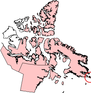
image caption = Resolution Island, Nunavut (red circle at edge of map).
image size =
locator
map_custom =
native name =
native name link = Inuktikut
nickname =
location =Northern Canada
coordinates = coord|61|35|N|65|00|W|display=inline,title
archipelago =Canadian Arctic Archipelago
total islands =
major islands =
area = convert|1015|km2|sqmi|abbr=on
highest mount =
elevation =
country = Canada
country admin divisions title = Territory
country admin divisions = flag|Nunavut
country largest city =Iqaluit
country largest city population = 6,184
country leader title =
country leader name =
population = Uninhabited
population as of =
density =
ethnic groups =Inuit
additional info =Resolution Island is one of the
Canadian arctic islands inNunavut ,Canada . It is located off the eastern tip ofBaffin Island at 61°30'N 65°00'W with an area of convert|1015|km2|sqmi|abbr=on. TheLower Savage Islands lie between Resolution Island and Baffin Island, while Graves Strait separates Resolution Island from the more northernEdgell Island .History
English explorer
Martin Frobisher landed on the island on July 28, 1576, while on a voyage to discover the fabledNorthwest Passage .The island was home to an American military base that became operational in 1954 as part of the Distant Early Warning (DEW) line. The base was vacated in 1973 and turned over to the Canadian government in 1974.
It was during site investigations between 1987 and 1990 that contamination at the site was first discovered. The contamination originates largely from spills from the radar equipment, which used
polychlorinated biphenyl s (PCBs) as insulators. Other pollutants include unused transformer fluids,hydrocarbon s,asbestos andheavy metals in the buildings and sprinkled throughout the site. Resolution Island has been identified as having the highest level of PCB contamination of all former military sites that fall underIndian and Northern Affairs Canada ’s (INAC) responsibility in the North.In 1993 and 1994, an environmental site assessment of the area was completed. As a result, temporary barriers were placed across drainage paths to stop the migration of PCBs into the water. Further investigations were done and, in 1997, INAC initiated remediation work with Qikiqtaaluk Corporation (QC). A large-scale remediation plan was developed, in cooperation with
Environment Canada , QC andQueen’s University . Steps were taken at that time to ensure that the contaminants were not posing a risk to humans and wildlife.References
* [http://atlas.nrcan.gc.ca/site/english/learningresources/facts/islands.html Other Arctic Islands, The Atlas of Canada, Natural Resources Canada]
Wikimedia Foundation. 2010.