- Cornwall Island (Nunavut)
-
Cornwall Island 
Cornwall Island, NunavutGeography Location Northern Canada Coordinates 77°37′N 094°52′W / 77.617°N 94.867°WCoordinates: 77°37′N 094°52′W / 77.617°N 94.867°W Archipelago Queen Elizabeth Islands
Canadian Arctic ArchipelagoArea 2,358 km2 (910.4 sq mi) Highest elevation 400 m (1,300 ft) Highest point McLeod Head Country CanadaTerritory  Nunavut
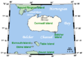
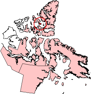
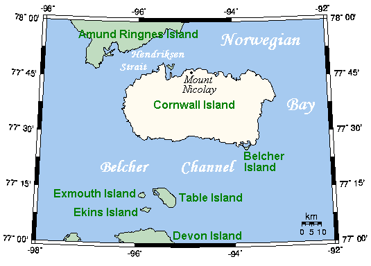
Demographics Population Uninhabited Cornwall Island is a small island in the high arctic region of the Canadian territory of Nunavut. To the north, it is separated from Amund Ringnes Island by Hendriksen Strait. To the south, it is separated from Devon Island by Belcher Channel. It is the largest of six islands (the others being Buckingham, Ekins, Exmouth, Graham Island, and Table) in the Norwegian Bay, west of Ellesmere Island.
Cornwall Island measures about 90 km (56 mi) long and 30 km (19 mi) wide, and has an area of 2,358 km2 (910 sq mi).
The tallest peaks are McLeod Head at 400 m (1,300 ft), and Mount Nicolay at 290 m (950 ft), both on the north coast. Coast features include Northeast Point and Gordon Head to the east; Pell Point and Cape O'Brien to the south; and Cape Butler in the southwest.[1]
The first known sighting of the island was by Sir Edward Belcher on 30 August 1852 and was named in honour of Prince Edward, Prince of Wales and Duke of Cornwall.[2]
-
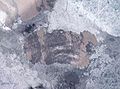
Closeup of Cornwall Island
-
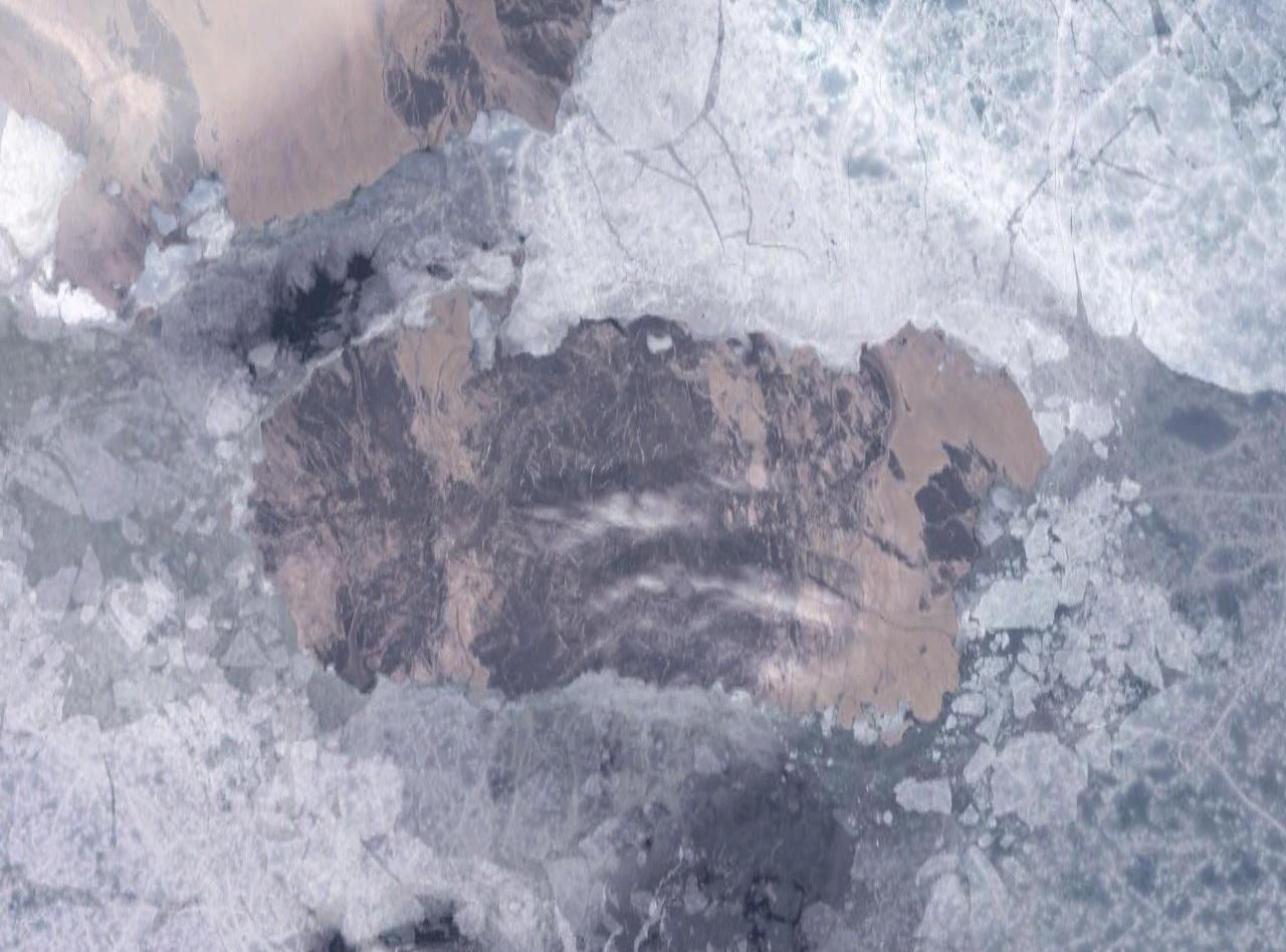
NASA Landsat photo of Cornwall Island
References
- ^ "Cornwall, Graham, Buckingham, Table, Exmouth, and Ekins Islands". uoguelph.ca. http://www.arctic.uoguelph.ca/cpe/environments/maps/detailed/islands/cornwall.htm. Retrieved 2008-05-14.
- ^ Mills, William James (2003). Exploring Polar Frontiers:A Historical Encyclopedia. ABC-CLIO. p. 163. ISBN 978-1-57607-422-0.
Further reading
- Hambley, Gregory, and Scott Lamoureux. 2006. "Recent Summer Climate Recorded in Complex Varved Sediments, Nicolay Lake, Cornwall Island, Nunavut, Canada". Journal of Paleolimnology. 35, no. 3: 629-640.
- Lamoureux, Scott. 1999. "Catchment and Lake Controls Over the Formation of Varves in Monomictic Nicolay Lake, Cornwall Island, Nunavut". Canadian Journal of Earth Sciences. 36: 1533-1546.
Queen Elizabeth Islands, Nunavut and Northwest Territories, Canada Ellesmere Island: Parry Islands (major): Devon • Melville • Bathurst • Prince Patrick • Cornwallis • Mackenzie King • Borden • Cornwall • Eglinton • Graham • Lougheed • Byam Martin • Île Vanier • Cameron • Brock • North Kent • Emerald Isle • Alexander • Massey • Little Cornwallis • Coburg • Helena • Baillie-Hamilton • Griffith • Hoved • Lowther • BuckinghamParry Islands (minor): Beechey • Berkeley • Browne • Cheyne • Cocked Hat • Crescent • Des Voeux • Dundas • Edmund Walker • Eight Bears • Ekins • Fairholme • Fitzwilliam Owen • Findlay Group • Grosvenor • Hans • Houston Stewart • Hyde Parker • Île Marc • John Barrow • Margaret • Nookap • Norman Lockyer • Patterson • Philpots • Pim • Princess Royal • Skraeling • Stupart • Table • Thor • TruroSverdrup Islands (major): Sverdrup Islands (minor): Fay • Gretha • Haig-Thomas • Hat • UlvingenIslands of the Qikiqtaaluk Region Adams · Akpatok · Alfred · Allen · Amherst · Arvalik · Aulitivik · Aulitiving · Baffin · Barth · Beloeil · Bergesen · Bjarnason · Bylot · Curry · Davids · Dexterity · Diana · Edgeworth · Eider · Elder · Emmerson · Fraser · Frechette · Gyrfalcon · Hamilton · Imiqqutailaqtuuq · Kaigosuiyat · Kilian · Lady Franklin · Landslip · Liddon · Lock · Low · Marvin · Nakoaiyet · Nova Zembla · Old Squaw · Ormonde · Otrick · Pandora · Payne · Peter Richards · Pisiktarfik · Plover · Prescott · Prince Leopold · Prince of Wales · Ragged · Round · Russell · Salikuit · Saneruarsuk · Scott · Sillem · Somerset · Spicer · Stephens · Trinity · Vesey Hamilton · Vivian · Ward Hunt · Wollaston · Yeoman · YoungBelcher Islands Islands of Cumberland Sound Akulagok · Anarnittuq · Aupaluktok · Aupaluktut · Beacon · Blacklead · Clear Passage · Drum · Ekallulik · Iglunga · Imigen · Ivisa · Kaigosuit · Kangigutsak · Kekertelung · Kekertelung · Kekerten · Kekertukdjuak · Kudjak · Maktaktujanak · Miliakdjuin · Moodie · Nimigen · Nunatak · Nuvujen · Opingivik · Sanigut · Saunik · Shakshukowshee · Shakshukuk · Tesseralik · Tuapait · Ugpitimik · Utsusivik · WarehamIslands of Davis Strait Akuglek · Alikdjuak · Angijak · Durban · Idjuniving · Kekertaluk · Kekertuk · Kekerturnak · Manitung · Monumental · Nedlukseak · Nudlung · Nunatsiaq · Nuvuktik · Padloping · Pilektuak · Qaqaluit · Rock · SatigsunIslands of Foxe Basin Air Force · Bird · Bray · Deer · Foley · Igloolik · Jens Munk · Koch · Neerlonakto · North Tweedsmuir · Prince Charles · Rowley · South Tweedsmuir · Tern · White · WinterIslands of Frobisher Bay Algerine · Alligator · Anchorage · Aubrey · Augustus · Bear · Beveridge · Bishop · Brigus · Brook · Bruce · Cairn · Camp · Carter · Chase · Coffin · Crimmins · Crowell · Culbertson · Daniel · Dog · Eden · Emerick · Falk · Faris · Field · Fletcher · Frobisher's Farthest · Gabriel · Gardiner · Gay · Gross · Halford · Hantzsch · Harper · Hill · Jenvey · Kudlago · Kungo · Lefferts · Leopold · Loks Land · Long · Low · Luella · Mair · Mark · Mary · McAllister · McBride · McLaren · McLean · Metela · Mitchell · Monument · Nest · Nouyarn · Ogden · Pan · Peak · Pichit · Pike · Pink Lady · Pope · Potter · Precipice · Ptarmigan · Pugh · Qarsau · Quadrifid · Redan · Resor · Sale · Scalene · Sliver · Smith · Sybil · Thompson · WhiskukunIslands of the Gulf of Boothia Islands of Hudson Bay Islands of Hudson Strait Alareak · Aulassivik · Avingasittuit Siqinirsipangat · Beacon · Big · Black Bluff · Bush · Button · Charles · Clark · Dolphin · Dorset · Edgell · Emma · Erhardt · Forder · Glasgow · Glencoe · Goodwin · Gudmusson · Hector · High Bluff · Holdridge · Ijjurittiak · Ivisaat · Juet · King · Lacy · Lavoie · Lawson · Leading · Lee · Lower Savage · MacColl · Mallik · Middle Savage · Mill · Niels · Nottingham · Nunajuak · Nuvursiit · Nuvursirpaaraaluk · Observation · Okolli · Point · Poodlatee · Rabbit · Resolution · Sakkiak · Salisbury · Sheer · Strathcona · Uugalautiit · WishartIslands of James Bay Akimiski · Bear · Big · Cape Hope · Carey · Charlton · Grey Goose · Gull · Jacob · North Twin · Paint Hills · Solomons Temple · South Twin · Spencer · Strutton · Sunday · Trodely · Twin · Walter · WestonIslands of the Labrador Sea Brevoort · Cape Chidley · Christopher Hall · Hozier · Hudson · Ilikok · Jackson · Killiniq · Knight · Leybourne · Little Hall · Muingmak · RogersQueen Elizabeth Islands Alexander · Baillie-Hamilton · Bathurst · Beechey · Berkeley • Borden · Brock · Browne · Buckingham · Byam Martin · Cameron · Cheyne · Coburg · Cocked Hat · Cornwall · Cornwallis · Crescent · Des Voeux · Devon · Dundas · Edmund Walker · Eglinton · Ekins · Ellesmere · Emerald · Exmouth · Fairholme · Findlay Group · Garrett · Graham · Griffith · Grosvenor · Hansdisputed · Helena · Houston Stewart · Hoved · Hyde Parker · John Barrow · Little Cornwallis · Lougheed · Lowther · Mackenzie King · Marc · Margaret · Massey · Melville · Nookap · Norman Lockyer · North Kent · Patterson · Philpots · Pim · Pioneer · Prince Patrick · Princess Royal · Seymour · Skraeling · Spit · Stupart · Table · Thor · Truro · VanierSverdrup Islands Amund Ringnes · Axel Heiberg · Ellef Ringnes · Fay · Gretha · Haig-Thomas · Hat · King Christian · Meighen · Stor · UlvingenSee also Islands of the Kitikmeot Region, Islands of the Kivalliq Region. Categories:- Queen Elizabeth Islands
- Uninhabited islands of Qikiqtaaluk Region
- Qikiqtaaluk Region, Nunavut geography stubs
-
Wikimedia Foundation. 2010.