- Mackenzie King Island
Infobox Islands
name = Mackenzie King Island
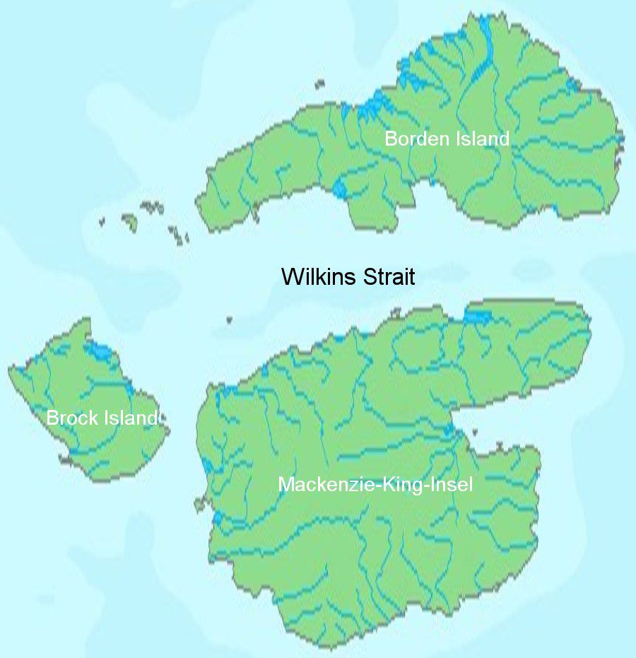
image caption = Mackenzie King Island and Borden Island
image size =
locator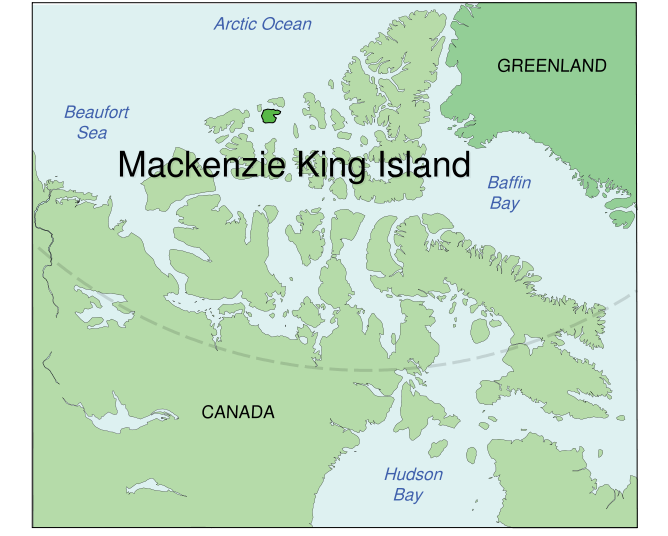
map_custom = no
native name =
native name link = Inuktikut
nickname =
location =Northern Canada
coordinates = coord|77|43|N|111|57|W|display=inline,title
archipelago =Queen Elizabeth Islands Canadian Arctic Archipelago
total islands =
major islands =
area = convert|5048|km2|sqmi|abbr=on
highest mount =
elevation =
country = Canada
country admin divisions title = Territory
country admin divisions = flag|Nunavut
country admin divisions title 1 =Qikiqtaaluk Region
country admin divisions 1 =
country admin divisions title 2 =
country admin divisions 2 =
country capital city =
country largest city =
country largest city population =
country leader title =
country leader name =
population = Uninhabited
population as of =
density =
ethnic groups =
additional info =Mackenzie King Island is one of the
Queen Elizabeth Islands north ofCanada . It lies north of Melville Island and south ofBorden Island , and like them is divided. Most of the island is inNorthwest Territories , while a few of its easternmost extremities lie inNunavut .Mackenzie King has an area of convert|5048|km2|sqmi|abbr=on, making it the 115th largest island in the world, and Canada's 26th largest island.
History
The low-lying island was reached by
Vilhjalmur Stefansson in 1915, and later named forWilliam Lyon Mackenzie King . [cite web |url=http://www2.parl.gc.ca/Parlinfo/Files/Parliamentarian.aspx?Item=b11f5b30-7d32-44e6-b23c-a24561c1eaf5&Language=E&Section=PrimeMinister |title=King, The Right Hon. William Lyon Mackenzie |accessdate=2008-05-18 |last= |first= |coauthors= |date= |work= |publisher=parl.gc.ca]References
Further reading
* Vilks, G. "Foraminiferal Study of East Bay, Mackenzie King Island, District of Franklin (Polar Continental Shelf Project)". [Ottawa] : Dept. of Mines and Technical Surveys, 1964.

Wikimedia Foundation. 2010.