- Cape Chidley Islands
Infobox Islands
name = Cape Chidley Islands
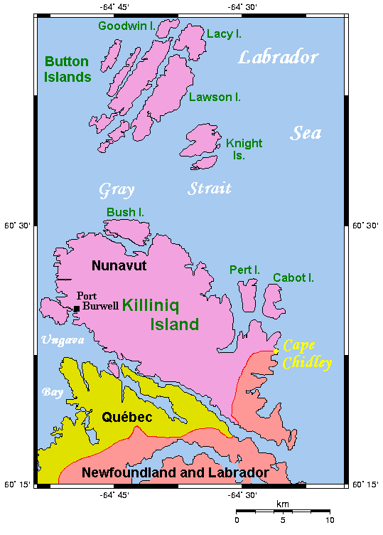
image caption = Cape Chidley Islands area
image size =
locator
map_custom =
native name =
native name link = Inuktikut
nickname =
location =Northern Canada
coordinates = coord|60|25|45|N|64|27|50|W|display=inline,title
archipelago =Canadian Arctic Archipelago
total islands =
major islands =
area = convert|10|km2|sqmi|abbr=on
highest mount =
elevation =
country = Canada
country admin divisions title = Territory
country admin divisions = flag|Nunavut
country admin divisions title 1 =Qikiqtaaluk Region
country admin divisions 1 =
country admin divisions title 2 =
country admin divisions 2 =
country capital city =
country largest city =
country largest city population =
country leader title =
country leader name =
population = Uninhabited
population as of =
density =
ethnic groups =
additional info =The Cape Chidley Islands [cite web |url=http://atlas.nrcan.gc.ca/site/english/search/search_results?expression=islands|title= 284 - Cape Chidley Islands, Nunavut |accessdate=2008-06-10 |last= |first= |coauthors= |date= |work= |publisher=Atlas of Canada ] are members of theCanadian Arctic Archipelago in the territory ofNunavut . They are located in theLabrador Sea at the south end of the entrance to theHudson Strait , north ofKilliniq Island 'sCape Chidley . Pert Island is the western of the two islands, while Cabot Island is to the east.Point Burwell lies convert|20|km|mi|abbr=on west of Pert Island.References
Wikimedia Foundation. 2010.