Innuitian Mountains

Innuitian Mountains

Geobox|Range
name=Innuitian Mountains


image_size=280
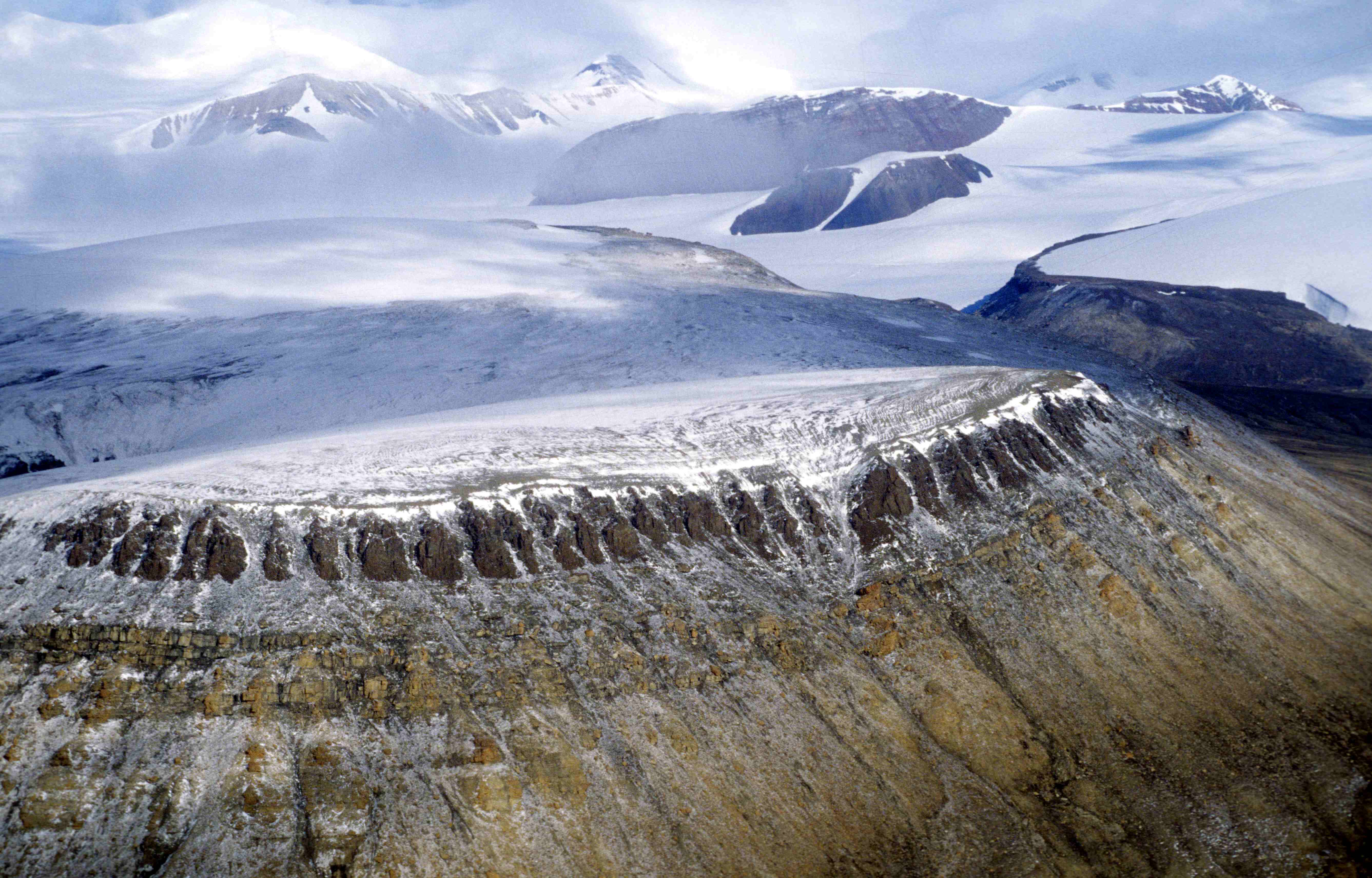
image_caption=British Empire Range, in the north of Tanquary Fiord
country=Canada
region=Nunavut
region1=Northwest Territories
parent=Arctic Cordillera
geology=Igneous
geology1=Metamorphic
geology2=Sedimentary
period=Mesozoic
orogeny=Innuitian
highest=Barbeau Peak
highest_elevation=2616
highest_lat_d=81|highest_lat_m=54|highest_lat_s=30|highest_lat_NS=N
highest_long_d=75|highest_long_m=01|highest_long_s=30|highest_long_EW=W


map_size=

The Innuitian Mountains are a mountain range in Canada's Arctic territories of Nunavut and the Northwest Territories. They are part of the Arctic Cordillera and are largely unexplored, due to the hostile climate. They are named after the northern indigenous people, who live in the region. In some locations the Innuitian Mountains measure over 2,500 metres in height, and 1290 km in length. The highest point is Barbeau Peak at convert|2616|m|ft|0. There are no trees or wildlife in the Innuitian Mountains due to the harsh cold climate as well as being located north of the Arctic tree line.

The Innuitian Mountains consists of numerous smaller mountain ranges. Some of these are the British Empire Range, the Princess Margaret Range and the United States Range, which is the world's northernmost mountain range.

The Innuitian Mountains were first seen in 1882 by the explorer Adolphus Greely from Lake Hazen.

Geology

The Innuitian Mountains present form was shaped during the Innuitian orogeny in the middle of the Mesozoic era when the North American Plate moved northward. The Innuitian Mountains contain igneous and metamorphic rocks, but for the most part are composed of sedimentary rock. They are younger than the Appalachians, and so erosion has not yet rounded them significantly.

The Innuitian Mountains resemble the Appalachian Mountains in composition and contain similar types of minerals. The mineral resources have not been greatly exploited, due to the cost of developing such a remote region while cheaper alternatives are available elsewhere.

ee also

*List of mountain ranges
*Arctic Cordillera

References

*Clark, Bruce W. and Wallace, John K. "Making Connections: Canada's Geography", 1999


Wikimedia Foundation. 2010.

Игры ⚽ Поможем сделать НИР

Look at other dictionaries:

  • Innuitian Region — The Innuitian Region is a physiographic division of the far northern hemisphere. The area is also considered part of the Arctic Archipelago.The Innuitian Region is characterized by three zones of mountains that are separated by extensive and… …   Wikipedia

  • Innuitian orogeny — The Innuitian orogeny, sometimes called the Ellesmere orogeny, was a major tectonic (mountain building) episode responsible for the formation of a series of mountain ranges in the Canadian Arctic. The episode started with the earliest Paleozoic… …   Wikipedia

  • Challenger Mountains — Range Country Canada Region Nunavut …   Wikipedia

  • Cunningham Mountains — Range Country Canada Region Nunavut …   Wikipedia

  • Torngat Mountains — Range Folded rocks of the Torngat Mountains …   Wikipedia

  • cañada — /keuhn yah deuh, yad euh/, n. Chiefly Western U.S. 1. a dry riverbed. 2. a small, deep canyon. [1840 50; < Sp, equiv. to cañ(a) CANE + ada n. suffix] * * * Canada Introduction Canada Background: A land of vast distances and rich natural resources …   Universalium

  • Canada — /kan euh deuh/, n. a nation in N North America: a member of the Commonwealth of Nations. 29,123,194; 3,690,410 sq. mi. (9,558,160 sq. km). Cap.: Ottawa. * * * Canada Introduction Canada Background: A land of vast distances and rich natural… …   Universalium

  • United States Range — Geobox | Range name=United States Range image size= image caption= country=Canada region=Nunavut parent=Innuitian Mountains geology= geology= geology2= period=Mesozoic orogeny=Innuitian highest=Mount Eugene highest elevation=1860 highest lat… …   Wikipedia

  • Arctic Cordillera — Geobox | Range name=Arctic Cordillera other name=Arctic Rockies image size=275 image caption=Baffin Mountains at the northern end of Auyuittuq National Park country=Canada region=Labrador region1=Baffin Island region2=Devon Island… …   Wikipedia

  • List of mountain ranges — Physiographic world map with mountain ranges and highland areas in brown and gray colors This is a list of mountain ranges organized alphabetically by continent. Ranges on other astronomical bodies are listed afterward. Contents …   Wikipedia

Share the article and excerpts

Direct link
Do a right-click on the link above
and select “Copy Link”