- Prince Charles Island
Infobox Islands
name = Prince Charles Island
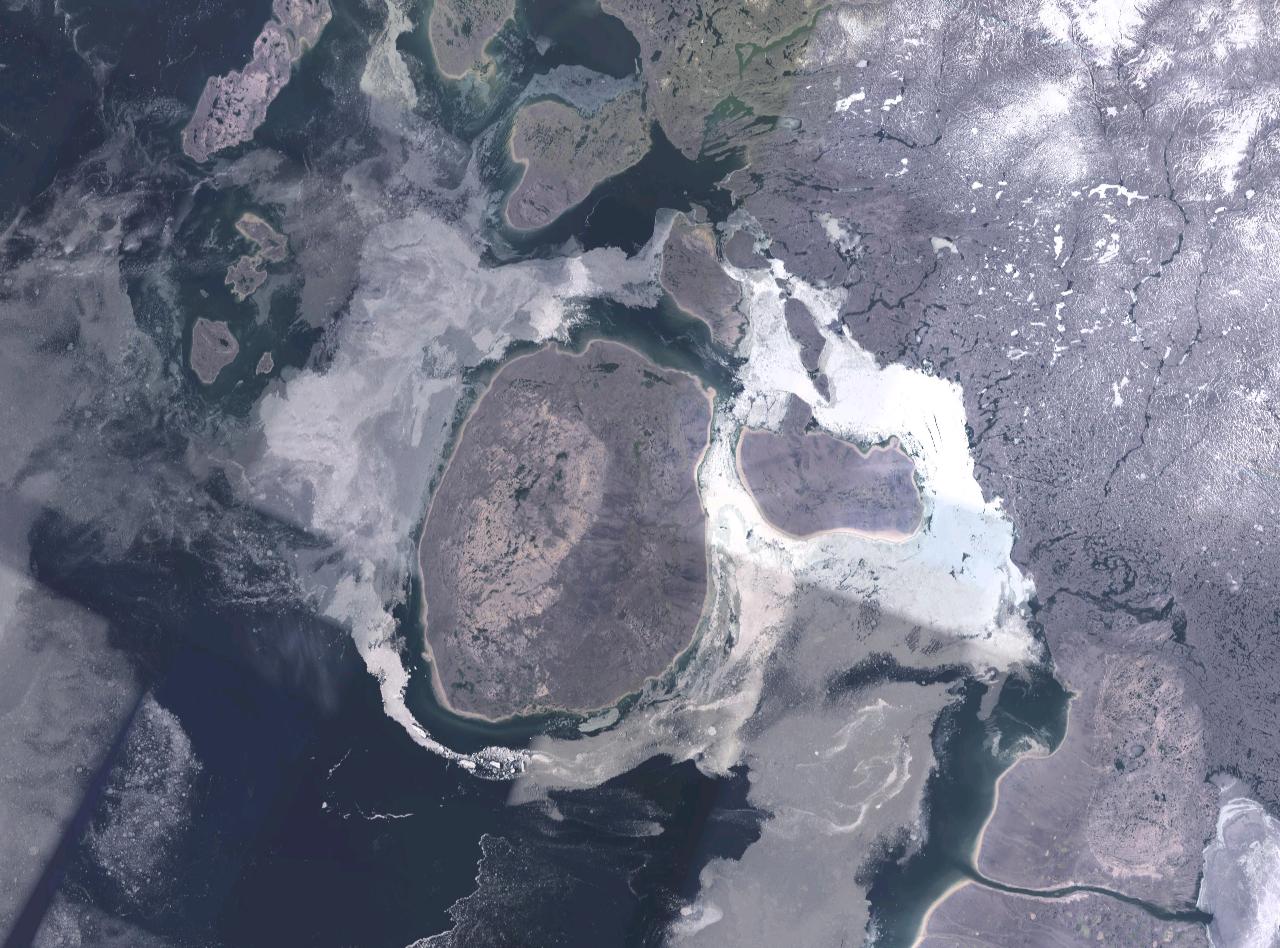
image caption = NASA Landsat image of Prince Charles Island
image size =
locator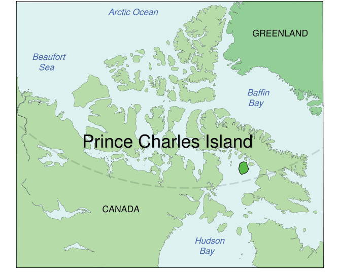
map_custom = no
native name =
native name link = Inuktikut
nickname =
location =Northern Canada
coordinates = coord|67|45|N|76|00|W|display=inline,title
archipelago =
total islands =
major islands =
area = convert|9521|km2|sqmi|abbr=on
highest mount =
elevation =
country = Canada
country admin divisions title = Territory
country admin divisions = flag|Nunavut
country largest city =Iqaluit
country largest city population = 6,184
country leader title =
country leader name =
population = Uninhabited
population as of =
density =
ethnic groups =Inuit
additional info =Prince Charles Island is a large, low-lying island with an area of convert|9521|km2|sqmi|abbr=on, making it the world's 78th largest island and the 19th largest island in Canada. It is located in
Foxe Basin , off the west coast ofBaffin Island , in theQikiqtaaluk Region ofNunavut ,Canada . Despite the island's size, the first recording of it was in 1948 by Albert-Ernest Tomkinson navigating anRCAF Avro Lancaster , though it was likely known to the localInuit long before that. The island was named for Prince Charles, who was born the same year. The island is uninhabited and its temperatures are extremely cold.References
* [http://atlas.nrcan.gc.ca/site/english/learningresources/facts/islands.html Sea islands: Atlas of Canada; Natural Resources Canada]
Further reading
* Morrison, R. I. G. 1997. "The Use of Remote Sensing to Evaluate Shorebird Habitats and Populations on Prince Charles Island, Foxe Basin, Canada". "Arctic". 50, no. 1: 55.

Wikimedia Foundation. 2010.