- Byam Martin Mountains
Geobox|Range
name=Byam Martin Mountains
map_size=275
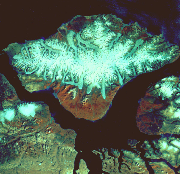
map_caption=USGS satellite image of Bylot Island, including the Byam Martin Mountains
image_size=275
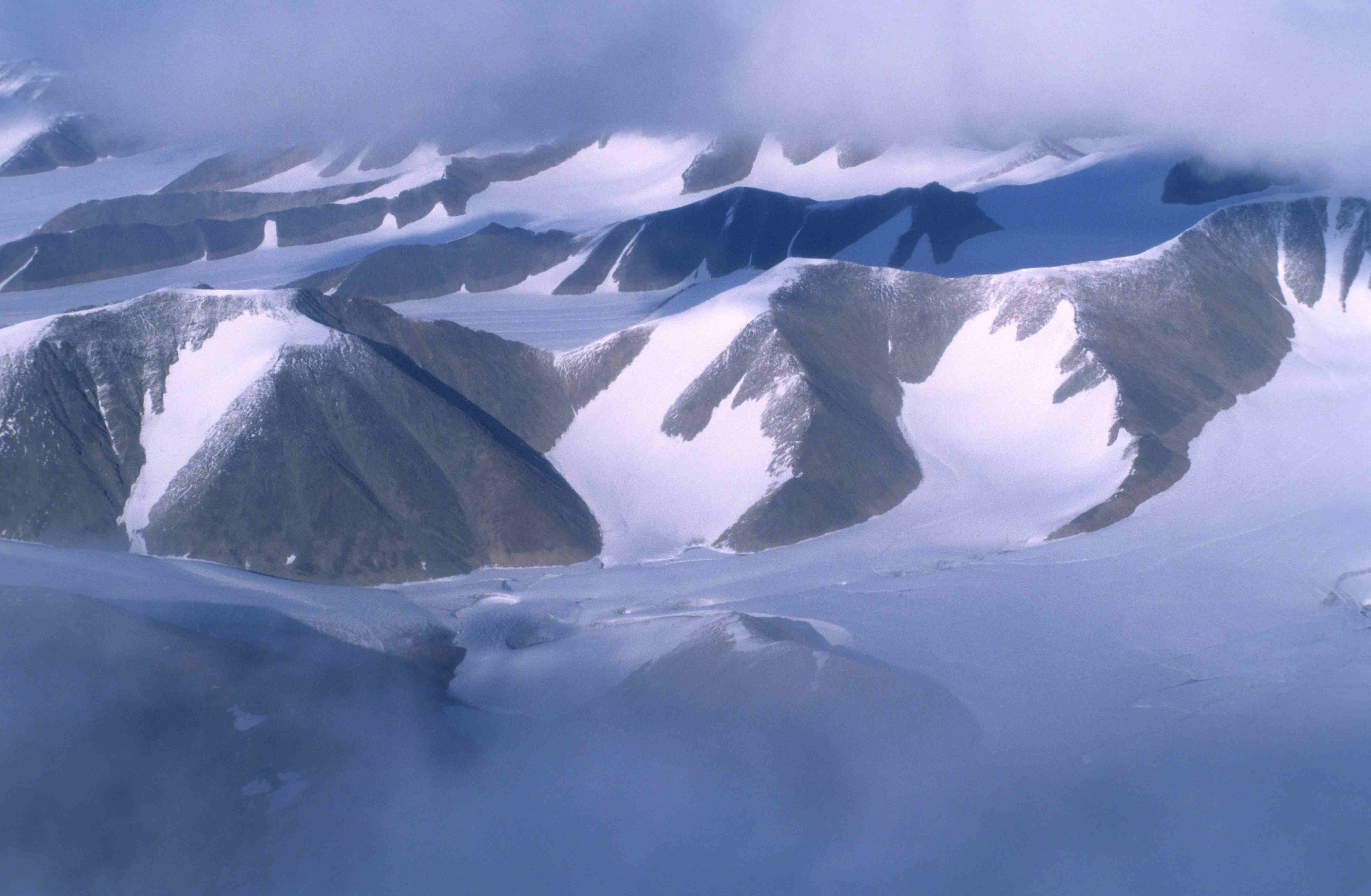
image_caption=Byam Martin Mountains
country=Canada
region=Bylot Island
region1=
geology=
period=
orogeny=
parent=Baffin Mountains
highest=Angilaaq Mountain
highest_elevation=1951
highest_lat_d=73|highest_lat_m=13|highest_lat_s=41.9|highest_lat_NS=N
highest_long_d=78|highest_long_m=37|highest_long_s=14.9|highest_long_EW=WThe Byam Martin Mountains are a rugged
mountain range extending east to west acrossBylot Island ,Nunavut ,Canada . It is one of the most northern ranges in the world and is an extension of theBaffin Mountains which in turn form part of theArctic Cordillera mountain system. The highest mountain in the range isAngilaaq Mountain , Unit m|1951|0, located near the island's center. Sharp peaks andridge s, divided by deep glacier-filledvalley s are typical features in the range [ [http://www.oceandots.com/arctic/canada/bylot.html Canadian Arctic - Bylot Island] Retrieved2007-11-16 ] and has been extensively modified by glacialerosion . The Byam Martin Mountains have not been conducive to habitation. While there are no permanent settlements in the Byam Martin Mountains,Inuit from Pond Inlet and elsewhere regularly travel to the range.The Byam Martin Mountains are made up of
Archean -Aphebian igneous crystalline rock andProterozoic metasedimentary andmetamorphic rock , such asgneiss .History
The first
mountaineering expedition to the Byam Martin Mountains was byPat Biard , in whichMount Thule Unit m|1711|0 was first climbed. In 1954 American Ben Farris and a companion repeated Pat Biard's climb of Mount Thule. In 1963 British explorerBill Tilman sailed has boat to the north coast and traversed the island, but did not climb any of the larger peaks. In 1977 a Canadian expedition of Rob Kelly, etc. climbed 20 peaks and in 1984 Mike Schmidt, etc. climbed 28 peaks, including 16 first ascents.References
Wikimedia Foundation. 2010.