- Northwest Territories
-
For the former United States territory, see Northwest Territory. For other geographical names that include "Northwest", see Northwest.
Coordinates: 64°16′N 119°11′W / 64.267°N 119.183°W
Northwest Territories
Territoires du Nord-Ouest (French)
Nunatsiaq (Inuinnaqtun)
ᓄᓇᑦᓯᐊᖅ (Inuktitut)
Flag Coat of arms Motto: No official motto [1] 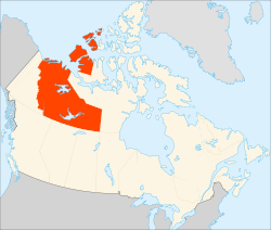
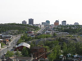
Capital Yellowknife Largest city Yellowknife Largest metro Yellowknife Official languages Chipewyan, Cree, English, French, Gwich’in, Inuinnaqtun, Inuktitut, Inuvialuktun, North Slavey, South Slavey, Tłįchǫ[2] Demonym Northwest Territorian[3] Government Type Commissioner George Tuccaro[4] Premier Bob McLeod (Consensus government, no party affiliations) Legislature Legislative Assembly of the Northwest Territories Federal representation in Canadian parliament House seats 1 of 308 (0.3%) Senate seats 1 of 105 (1%) Confederation July 15, 1870 (Hudson's Bay Company cedes territory to Canada) (6th) Area Ranked 3rd Total 1,346,106 km2 (519,734 sq mi) Land 1,140,835 km2 (440,479 sq mi) Water (%) 205,271 km2 (79,256 sq mi) (15.2%) Proportion of Canada 13.5% of 9,984,670 km2 Population Ranked 11th Total (2010) 43,529 (est.)[5] Density (2010) 0.04 /km2 (0.10 /sq mi) GDP Ranked 11th Total (2006) C$4.103 billion[6] Per capita C$76,000 (1st) Abbreviations Postal NT ISO 3166-2 CA-NT Time zone UTC-7 Postal code prefix X0, X1 (Yellowknife) Flower Mountain avens Tree Tamarack Larch Bird Gyrfalcon Website www.gov.nt.ca Rankings include all provinces and territories The Northwest Territories (NWT or NT; French, les Territoires du Nord-Ouest, TNO) is a federal territory of Canada.
Located in northern Canada, the territory borders Canada's two other territories, Yukon to the west and Nunavut to the east, and three provinces: British Columbia to the southwest, and Alberta and Saskatchewan to the south. It has a land area of 1,140,835 km2 (440,000 sq mi) and a population of 41,464 as of the 2006 census, an increase of 11.0% from 2001.[7] In 1967, as a result of recommendations by the Carrothers Commission, Yellowknife became the capital.
Geographical features include Great Bear Lake, the largest lake entirely within Canada,[8] Keller Lake, and Great Slave Lake, as well as the Mackenzie River and the canyons of the Nahanni National Park Reserve, a national park and UNESCO World Heritage Site. Territorial islands in the Canadian Arctic Archipelago include Banks Island, Borden Island, Prince Patrick Island, and parts of Victoria Island and Melville Island. Its highest point is Mount Nirvana near the border with Yukon at an elevation of 2,773 metres (9,098 ft).
While Nunavut is mostly Arctic tundra, the Northwest Territories has a slightly warmer climate and is mostly boreal forest (taiga), although about half of the territory is north of the tree line.
Contents
History
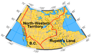 North-Western Territory in 1859
 Main articles: History of the Northwest Territories and History of Northwest Territories capital cities
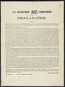
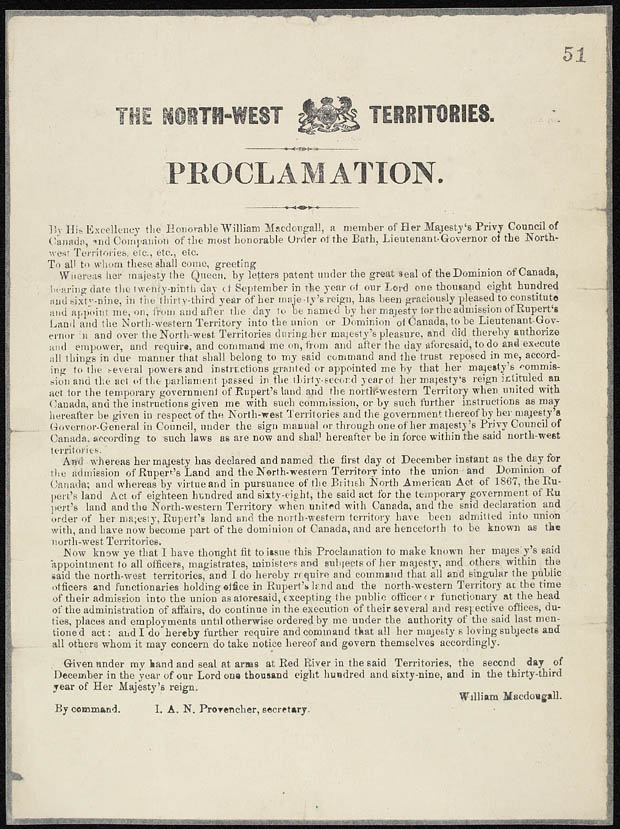
The present-day territory was created in June 1870, when the Hudson's Bay Company transferred Rupert's Land and North-Western Territory to the government of Canada. This immense region comprised all of non-confederation Canada except British Columbia, the coast of the Great Lakes, the Saint Lawrence River valley and the southern third of Quebec, the Maritimes, Newfoundland, and the Labrador coast. It also excluded the Arctic Islands except the southern half of Baffin Island; these remained under direct British claim until 1880.[9]
After the transfer, the territories were gradually whittled away. The province of Manitoba was created on July 15, 1870, a tiny square around Winnipeg, and then enlarged in 1881 to a rectangular region composing the modern province's south. By the time British Columbia joined Confederation on July 20, 1871, it had already (1866) been granted the portion of North-Western Territory south of 60 degrees north and west of 120 degrees west, an area that had comprised most of the Stickeen Territories. In 1882, Regina in the District of Assiniboia became the territorial capital; after Alberta and Saskatchewan became provinces in 1905, Regina became the provincial capital of Saskatchewan.
In 1876, the District of Keewatin, at the centre of the territory, was separated from it. In 1882 and again in 1896, the remaining portion was divided into the following districts (corresponding to the following modern-day areas):
- Alberta (southern Alberta);
- Assiniboia (southern Saskatchewan);
- Athabasca (northern Alberta and Saskatchewan);
- Franklin (the Arctic islands and Boothia and Melville Peninsulas);
- Mackenzie (mainland NWT and western Nunavut);
- Saskatchewan (central Saskatchewan);
- Ungava (modern-day northern Quebec and inland Labrador, as well as an offshore area in Hudson Bay);
- Yukon (modern Yukon).
Keewatin was returned to the Northwest Territories in 1905.
In the meantime, the Province of Ontario was enlarged northwestward in 1882. Quebec was also extended northwards in 1898, and the Yukon was made a separate territory in that same year in order to deal with the Klondike Gold Rush, and also to remove the NWT's government from the burden of administering the sudden boom of population, economic activity, and the influx of non-Canadians.
The provinces of Alberta and Saskatchewan were created in 1905, and Manitoba, Ontario, and Quebec acquired the last of their modern territories from the NWT in 1912. This left only the districts of Mackenzie, Franklin (which absorbed the remnants of Ungava in 1920), and Keewatin. In 1925, the boundaries of the NWT were extended all the way to the North Pole on the sector principle, vastly expanding its territory onto the northern ice cap. The reduced Northwest Territories was not represented in the Canadian House of Commons from 1907 until 1947, when the electoral district of Yukon—Mackenzie River was created. This riding only included the District of Mackenzie. The rest of the Northwest Territories had no representation in the House of Commons until 1962, when the Northwest Territories electoral district was created in recognition of the Inuit having been given the right to vote in 1953.
In 1912, the Parliament of Canada made the official name of these territories the Northwest Territories, dropping all hyphenated forms of it. Between 1925 and 1999, the Northwest Territories covered a land area of 3,439,296 km2 (1,327,920 sq mi) – larger than that of India.
On April 1, 1999, the eastern three-fifths of the Northwest Territories (including all of the District of Keewatin and much of that of Mackenzie and Franklin) became a separate Canadian territory named Nunavut.
There was some discussion of changing the name of the Northwest Territories after the splitting off of Nunavut, possibly to a term from an Aboriginal language. One proposal was "Denendeh" (an Athabaskan language word meaning "our land"). This idea was advocated by the former premier Stephen Kakfwi, among others. One of the most popular proposals for a new name – one to name the territory "Bob" – began as a prank, but for a while it was at or near the top in the public-opinion polls.[10][11]
In the end a poll conducted prior to division showed that strong support remained for retaining the name "Northwest Territories". This name arguably became more appropriate following division than it had been when the territories actually extended far into Canada's north-central and northeastern areas.[12][13]
In Inuktitut, the Northwest Territories are referred to as ᓄᓇᑦᓯᐊᖅ (Nunatsiaq), "beautiful land."[citation needed]
Climate
The Northwest Territories reaches for over 1,300,000 km2 (500,000 sq mi) so there is a large climate variant from south to north. The southern part of the Territory (most of the mainland portion) has a subarctic climate while the islands and northern coast have a polar climate.
Summers in the north are short and cool, with daytime highs in the mid teens, and lows in the single degrees. Winters are long and harsh, daytime highs in the mid −20 °C (−4 °F) and lows around −40 °C (−40 °F). Extremes are common with summer highs in the south reaching 36 °C (97 °F) and lows reaching into the negatives. In winter in the south it is not uncommon for the temperatures to reach the −40 °C (−40 °F)'s but can also reach the low teens during the day. In the north temperatures can reach highs of 30 °C (86 °F), and lows can reach into the low negatives.
In winter in the north it is not uncommon for the temperatures to reach the −50 °C (−58 °F) but can also reach the single digits during the day. Thunderstorms are not rare in the south, but in the north they are very rare but do occur. Tornadoes are extremely rare but have happened with the most notable one happening just outside of Yellowknife that destroyed a communications tower. The Territory has a fairly dry climate due to the mountains in the west.
About half of the territory is above the tree line. There are no trees in most of the eastern areas of the territory, or the north islands.[14]
Demographics
The NWT is one of two jurisdictions in Canada, Nunavut is the other, where Aboriginal peoples are in the majority with 50.3% of the population.[7]
According to the 2006 Canadian census the 10 major ethnic groups were:[15]
- North American Indian – 36.5%
- English – 17.2%
- Canadian – 14.7%
- Scottish – 14.3%
- Irish – 11.8%
- Inuit (Inuvialuit) – 11.1%
- French – 10.5%
- German – 8.5%
- Métis – 6.9%
- Ukrainian – 3.5%
Population of the Northwest Territories since 1871[16][17]
Year Population five-year
% changeten-year
% changeRank among provinces
and territories1871 48,000 n/a n/a 6 1881 56,446 n/a 17.6 7 1891 98,967 n/a 75.3 7 1901 20,1291 n/a −79.7 11 1911 6,5072 n/a −67.7 11 1921 8,143 n/a 25.1 10 1931 9,316 n/a 14.4 10 1941 12,028 n/a 29.1 10 1951 16,004 n/a 33.1 11 1956 19,313 20.7 n/a 11 1961 22,998 19.1 43.7 11 1966 28,738 25.0 48.8 11 1971 34,805 21.1 51.3 11 1976 42,610 22.4 48.3 11 1981 45,740 7.3 31.4 11 1986 52,235 14.2 22.6 11 1991 57,649 10.3 26.0 11 1996 64,402 11.7 23.2 11 2001 37,3603 −42.0 −35.2 11 2006 41,4644 12.0 −35.0 11 - 1.^ Yukon was ceded from the Northwest Territories in 1898.
- 2.^ Alberta and Saskatchewan were created from parts of the Northwest Territories in 1905.
- 3.^ Data through 1996 includes Nunavut. 2001 data does not include Nunavut.
- 4.^ 2006 census data.
Religion
The largest denominations by number of adherents according to the 2001 census were Roman Catholic with 16,940 (46.7%); the Anglican Church of Canada with 5,510 (14.9%); and the United Church of Canada with 2,230 (6.0%), while a total of 6,465 (17.4%) people stated no religion.[18]
Language
French was made an official language in 1877 by the territorial government. After a lengthy and bitter debate resulting from a speech from the throne in 1888 by Lieutenant Governor Joseph Royal the members of the day voted on more than one occasion to nullify and make English the only language used in the assembly. After some conflict with Ottawa and a decisive vote on January 19, 1892, the assembly members voted for an English-only territory.
In the early 1980s, the federal government pressured the government of the Northwest Territories to reintroduce French as an official language. Some Native members walked out of the assembly, protesting that they were not permitted to speak their own language. The executive council appointed a special committee to study the matter[citation needed], which decided that if French was to be an official language, then the other languages in the territories must also be allowed.
The Northwest Territories' Official Languages Act recognizes the following eleven official languages, which are more than in any other political division in the Americas:[2]
NWT residents have a right to use any of the above languages in a territorial court and in debates and proceedings of the legislature. However, laws are legally binding only in their French and English versions, and the NWT government only publishes laws and other documents in the territory's other official languages when the legislature asks it to. Furthermore, access to services in any language is limited to institutions and circumstances where there is significant demand for that language or where it is reasonable to expect it given the nature of the services requested. In practical terms, English language services are universally available, and there is no guarantee that other languages, including French, will be used by any particular government service except for the courts.
The 2006 census returns showed a population of 41,464. Of the 40,680 singular responses to the census question regarding inhabitants "mother tongue", the most reported languages were the following:
1 English 31,545 77.5% 2 Dogrib (Tłı̨chǫ) 1,950 4.8% 3 South Slavey 1,285 3.2% 4 French 975 2.4% 5 North Slavey 835 2.1% 6 Inuktitut 695 1.7% 7 Tagalog 505 1.2% 8 Chipewyan 390 1.0% 9 Vietnamese 305 0.8% 10 Chinese 260 0.6% 11= Cree 190 0.5% 11= Gwich'in 190 0.5% 13 Inuinnaqtun 55 0.1% There were also 320 responses of both English and a "non-official language"; 15 of both French and a "non-official language"; 45 of both English and French, and about 400 people who either did not respond to the question, or reported multiple non-official languages, or else gave some other un-enumeratable response. The Northwest Territories' official languages are shown in bold.
(Figures shown are for the number of single language responses and the percentage of total single-language responses)[19]
Communities
 Main articles: List of communities in the Northwest Territories and List of ghost towns in the Northwest Territories
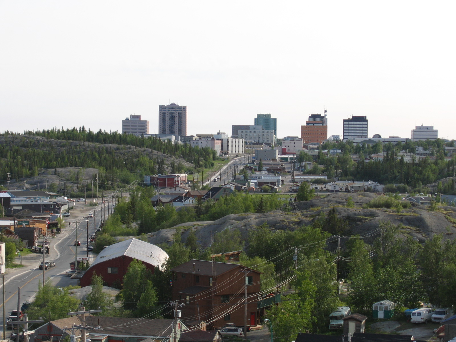
As of 2010 there are 33 official communities in the NWT.[20] These range in size from Yellowknife with a population of 18,700[21] to Kakisa with 52 people.[21] Governance of each community differs, some are run under various types of First Nations control, while others are designated as a city, town, village or hamlet, but most communities are municipal corporations.[20][22] Yellowknife is the largest community and has the largest number of Aboriginal peoples, 4,105 (22.2%) people.[21] However, Behchoko, with a population of 1,894, is the largest First Nations community, 1,730 (91.5%),[23] and Inuvik with 3,484 people is the largest Inuvialuit community, 1,335 (38.9%).[24] There is one Indian reserve in the NWT, Hay River Reserve, located on the south shore of the Hay River.
Five largest municipalities by population Municipality 2006 Yellowknife[21] 18,700 Hay River[25] 3,648 Inuvik[24] 3,484 Fort Smith[26] 2,364 Behchoko[23] 1,894 Economy
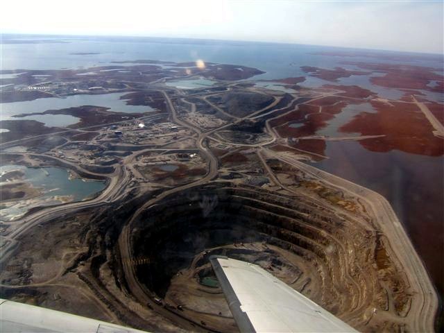
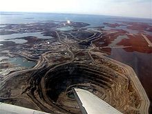 Diavik Diamond Mine in the North Slave Region
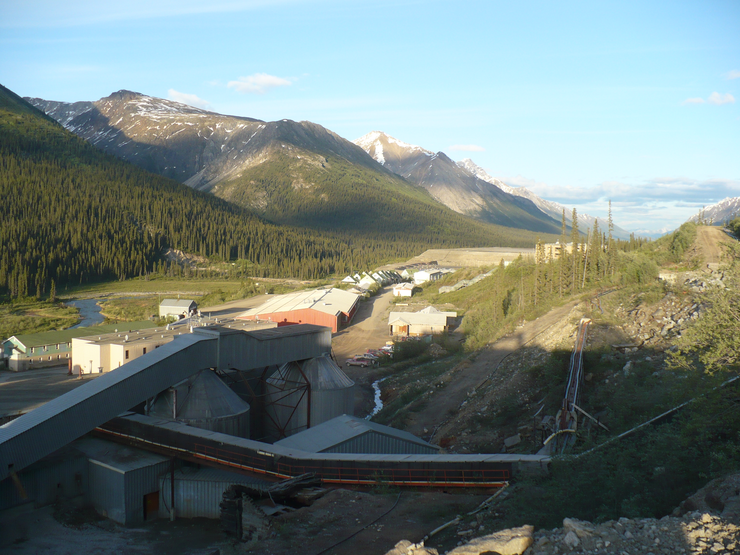
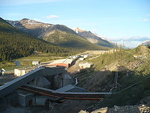 Cantung Mine
The NWT's geological resources include gold, diamonds, natural gas and petroleum. BP is the only oil company currently producing oil in the Territory. NWT diamonds are promoted as an alternative to purchasing blood diamonds.[27] Two of the biggest mineral resource companies in the world, BHP Billiton and Rio Tinto mine many of their diamonds from the NWT. In 2010, NWT accounted for 28.5% of Rio Tinto's total diamond production (3.9 million carats, 17% more than in 2009, from the Diavik Diamond Mine) and 100% of BHP's (3.05 million carats from the EKATI mine).[28][29]
The Northwest Territories has the highest per capita GDP of all provinces or territories in Canada, C$76,000 in 2009.[30]
Major territorial mines
- Eldorado Mine – 1933–1940, 1942–1960, 1976–1982 (radium, uranium, silver, copper)
- Con Mine – 1938–2003 (gold)
- Negus Mine – 1939–1952 (gold)
- Ptarmigan and Tom Mine – 1941–1942, 1986–1997 (gold)
- Thompson-Lundmark Mine – 1941–1943, 1947–1949 (gold)
- Giant Mine – 1948–2004 (gold)
- Discovery Mine – 1950–1969 (gold)
- Rayrock Mine – 1957–1959 (uranium)
- Camlaren Mine – 1962–1963, 1980–1981 (gold)
- Cantung Mine – 1962–1986, 2002–2003, 2005–current (tungsten)
- Echo Bay Mines Limited – 1964–1975 (silver and copper)
- Pine Point Mine – 1964–1988 (lead and zinc)
- Tundra Mine – 1964–1968 (gold)
- Terra Mine – 1969–1985 (silver and copper)
- Salmita Mine – 1983–1987 (gold)
- Colomac Mine – 1990–1992, 1994–1997 (gold)
- Ekati Diamond Mine – 1998–current (diamonds)
- Diavik Diamond Mine – 2003–current (diamonds)
- Snap Lake Diamond Mine – 2007–current (diamonds)
Government
As a territory, the NWT has fewer rights than the provinces. During his term, Premier Kakfwi pushed to have the federal government accord more rights to the territory, including having a greater share of the returns from the territory's natural resources go to the territory.[31] Devolution of powers to the territory was an issue in the 20th general election in 2003, and has been ever since the territory began electing members in 1881.
The commissioner of the NWT is the chief executive and is appointed by the Governor-in-Council of Canada on the recommendation of the federal Minister of Aboriginal Affairs and Northern Development. The position used to be more administrative and governmental, but with the devolution of more powers to the elected assembly since 1967, the position has become symbolic. Since 1985 the commissioner no longer chairs meetings of the Executive Council (or cabinet), and the federal government has instructed commissioners to behave like a provincial lieutenant governor. Unlike lieutenant governors, the commissioner of the Northwest Territories is not a formal representative of the Queen of Canada. The NWT comprises of a single Senate division and House of Commons electoral district in the Parliament of Canada titled Western Arctic.
Unlike provincial governments and the Yukon, the government of the Northwest Territories does not have political parties, except for the period between 1898 and 1905. It is a consensus government called the Legislative Assembly. This group is composed of one member elected from each of the nineteen constituencies. After each general election, the new parliament elects the premier and the speaker by secret ballot. Seven MLAs are also chosen as cabinet ministers, with the remainder forming the opposition. The territory's most recent general election was on October 1, 2007. The head of state for the territories is a Commissioner appointed by the federal government. The Commissioner had full governmental powers until 1980 when the territories were given greater self government. The legislature then began electing a cabinet and Government Leader later known as the Premier.
The current Legislative Assembly is the 17th and the most recent election was held October 3, 2011.[32] The Premier is Bob McLeod. The member of Parliament for Western Arctic, the riding that comprises the Northwest Territories, is Dennis Bevington (New Democratic Party). The Commissioner of the Northwest Territories is George Tuccaro and the Deputy Commissioner is Margaret Thom.
Culture
Aboriginal issues in the Northwest Territories include the fate of the Dene who, in the 1940s, were employed to carry radioactive uranium ore from the mines on Great Bear Lake. Of the thirty plus miners who worked at the Port Radium site, at least fourteen have died due to various forms of cancer. A study was done in the community of Deline, called A Village of Widows by Cindy Kenny-Gilday, which indicated that the number of people involved were too small to be able to confirm or deny a link.[33][34][35][36]
There has been racial tension based on a history of violent conflict between the Dene and the Inuit,[37] who have now taken recent steps towards reconciliation.
Land claims in the NWT culminated with the creation of the Inuit homeland of Nunavut, the result of the Nunavut Land Claims Agreement, the largest land claim in Canadian history.[38]
Another land claims agreement with the Tłı̨chǫ people created a region within the NWT called Tli Cho, between Great Bear and Great Slave Lakes, which will give the Tłı̨chǫ their own legislative bodies, taxes, resource royalties, and other affairs, though the NWT will still maintain control over such areas as health and education. This area includes two of Canada's three diamond mines at Ekati and Diavik.[39]
See also
- Northwest Territories lists:
- Symbols of the Northwest Territories
- List of National Parks of Canada
- Scouting and Guiding in the Northwest Territories
References
- ^ "What is the official motto of the Northwest Territories?". Assembly.gov.nt.ca. http://www.assembly.gov.nt.ca/_live/pages/wpPages/visitorfaq.aspx#question3. Retrieved February 22, 2011.
- ^ a b Northwest Territories Official Languages Act, 1988 (as amended 1988, 1991–1992, 2003)
- ^ The terms Northwest Territorian(s) Hansard, Thursday, March 25, 2004, and (informally) NWTer(s) Hansard, Monday, October 23, 2006, occur in the official record of the territorial legislature. According to the Oxford Guide to Canadian English Usage (ISBN 0-19-541619-8; p. 335), there is no common term for a resident of Northwest Territories.
- ^ Northern News Services. "New commissioner sworn in". Nnsl.com. http://nnsl.com/northern-news-services/stories/papers/may31_10nc.html. Retrieved February 22, 2011.
- ^ "Canada's population estimates: Table 2 Quarterly demographic estimates". Statcan.gc.ca. June 28, 2010. http://www.statcan.gc.ca/daily-quotidien/100628/t100628a2-eng.htm. Retrieved June 30, 2010.[dead link]
- ^ "Gross domestic product, expenditure-based, by province and territory". 0.statcan.ca. November 4, 2010. http://www40.statcan.ca/l01/cst01/econ15.htm. Retrieved February 22, 2011.
- ^ a b "Canada Census 2006". 2.statcan.ca. December 6, 2010. http://www12.statcan.ca/english/census06/data/profiles/community/Details/Page.cfm?Lang=E&Geo1=PR&Code1=61&Geo2=PR&Code2=01&Data=Count&SearchText=Northwest%20Territories&SearchType=Begins&SearchPR=01&B1=All&GeoLevel=&GeoCode=61. Retrieved February 22, 2011.
- ^ Great Bear Lake
- ^ "Canadian Heritage – Northwest Territories". Pch.gc.ca. July 13, 2010. http://www.pch.gc.ca/pgm/ceem-cced/symbl/101/119-eng.cfm. Retrieved February 22, 2011.
- ^ "Northwest Territories looking for new name – "Bob" need not apply". Canada: CBC. January 11, 2002. http://www.cbc.ca/canada/story/2002/01/11/nwt020111.html. Retrieved February 22, 2011.
- ^ "Western Arctic to Northwest Territories: MP calls for riding name change". Canada: CBC. June 25, 2008. http://www.cbc.ca/canada/north/story/2008/06/25/nwt-change.html. Retrieved February 22, 2011.
- ^ "Tundra for two: dividing Canada's far-north is no small task". Web.archive.org. Archived from the original on April 5, 2005. http://web.archive.org/web/20050405201955/http://caldercup.com/CNEWSNunavut/feature11.html. Retrieved February 22, 2011.
- ^ Jon Willing. "What about Bob, Water-Lou?". Web.archive.org. Archived from the original on January 18, 2003. http://web.archive.org/web/20030118152558/http://imprint.uwaterloo.ca/issues/112699/4Features/Features2.shtml. Retrieved February 22, 2011.
- ^ "Publications & Maps". Globalforestwatch.org. http://www.globalforestwatch.org/english/us/maps.htm. Retrieved February 22, 2011.
- ^ StatCan (January 2006). "Population by selected ethnic origins, by province and territory". http://www40.statcan.gc.ca/l01/cst01/demo26m-eng.htm. Retrieved March 16, 2010.[dead link]
- ^ Population urban and rural, by province and territory (Northwest Territories). Statistics Canada, 2005.
- ^ Canada's population. Statistics Canada. Last accessed September 28, 2006.
- ^ "Selected Religions, for Canada, Provinces and Territories – 20% Sample Data". 2.statcan.ca. http://www12.statcan.ca/english/census01/products/highlight/Religion/Page.cfm?Lang=E&Geo=PR&View=1a&Code=61&Table=1&StartRec=1&Sort=2&B1=61&B2=All. Retrieved February 22, 2011.
- ^ Detailed Mother Tongue (186), Knowledge of Official Languages (5), Age Groups (17A) and Sex (3) for the Population of Canada, Provinces, Territories, Census Metropolitan Areas and Census Agglomerations, 2001 and 2006 Censuses – 20% Sample Data. 2007. http://www12.statcan.ca/english/census06/data/topics/RetrieveProductTable.cfm?ALEVEL=3&APATH=3&CATNO=&DETAIL=0&DIM=&DS=99&FL=0&FREE=0&GAL=0&GC=99&GK=NA&GRP=1&IPS=&METH=0&ORDER=1&PID=89201&PTYPE=88971&RL=0&S=1&ShowAll=No&StartRow=1&SUB=701&Temporal=2006&Theme=70&VID=0&VNAMEE=&VNAMEF=.
- ^ a b "Municipal and Community Affairs". Maca.gov.nt.ca. http://www.maca.gov.nt.ca/governments/index.asp. Retrieved February 22, 2011.
- ^ a b c d "2006 Census, Yellowknife". Government of Canada. http://www12.statcan.ca/english/census06/data/profiles/community/Details/Page.cfm?Lang=E&Geo1=CMA&Code1=995__&Geo2=PR&Code2=01&Data=Count&SearchText=Northwest%20Territories&SearchType=Begins&SearchPR=01&B1=All.
- ^ "Differences in Community Government Structures" (PDF). http://www.maca.gov.nt.ca/resources/Differences_in_Comm_Govt_Structure.pdf. Retrieved February 22, 2011.
- ^ a b "2006 Aboriginal Population Profile – Behchoko". 2.statcan.ca. December 6, 2010. http://www12.statcan.ca/census-recensement/2006/dp-pd/prof/92-594/details/page.cfm?Lang=E&Geo1=CSD&Code1=6106031&Geo2=PR&Code2=61&Data=Count&SearchText=Behchok%F2&SearchType=Begins&SearchPR=01&B1=All&Custom=. Retrieved February 22, 2011.
- ^ a b 2006 Aboriginal Population Profile – Inuvik
- ^ "2006 Community Profiles – Hay River". 2.statcan.ca. December 6, 2010. http://www12.statcan.ca/census-recensement/2006/dp-pd/prof/92-591/details/Page.cfm?Lang=E&Geo1=CSD&Code1=6106016&Geo2=PR&Code2=61&Data=Count&SearchText=Hay%20River&SearchType=Begins&SearchPR=01&B1=All&Custom=. Retrieved February 22, 2011.
- ^ "2006 Community Profiles – Fort Smith". 2.statcan.ca. December 6, 2010. http://www12.statcan.ca/census-recensement/2006/dp-pd/prof/92-591/details/Page.cfm?Lang=E&Geo1=CSD&Code1=6106001&Geo2=PR&Code2=61&Data=Count&SearchText=Fort%20Smith&SearchType=Begins&SearchPR=01&B1=All&Custom=. Retrieved February 22, 2011.
- ^ "BHP Billiton diamond marketing". Bhpbilliton.com. http://bhpbilliton.com/bb/productEnquiries/diamondsSpecialtyProducts.jsp. Retrieved February 22, 2011.
- ^ "Rio Tinto 4th quarter 2010 Operations". 2011. http://www.riotinto.com/documents/110118_Fourth_quarter_2010_operations_review.pdf.
- ^ "BHP Billiton 2010 Annual Report page 124". 2010. http://www.bhpbilliton.com/bbContentRepository/docs/2010Form20f.pdf.
- ^ Government of the Northwest Territories: Industry, Tourism and Investment. "Did You Know?". http://www.iti.gov.nt.ca/mediaroom/dyk.shtml. Retrieved April 10, 2010.
- ^ "NWT Premier asks provincial leaders for backing". Globeandmail.com. http://www.globeandmail.com/servlet/story/RTGAM.20030703.wnwt0703/BNStory/National/. Retrieved February 22, 2011.
- ^ Fixed election date in the N.W.T.: What does it mean, and why?
- ^ "A Village of Widows". Arcticcircle.uconn.edu. http://arcticcircle.uconn.edu/SEEJ/Mining/gilday.html. Retrieved February 22, 2011.
- ^ "Echoes of the Atomic Age". Ccnr.org. http://www.ccnr.org/deline_deaths.html. Retrieved February 22, 2011.
- ^ "Report into former N.W.T. uranium mine recommends immediate remediation". Health.mytelus.com. July 15, 2008. http://health.mytelus.com/channel_health_news_details.asp?news_id=7750&channel_id=12. Retrieved February 22, 2011.
- ^ "Uranium exposure insufficient to cause cancer in Deline workers: report". Canada: CBC. August 12, 2005. http://www.cbc.ca/canada/north/story/2005/08/12/deline-uranium120805.html. Retrieved February 22, 2011.
- ^ Relations with their Southern Neighbours[dead link]
- ^ "Agreement between the Inuit of the Nunavut Settlement Area and Her Majesty The Queen in Right of Canada" (PDF). http://www.nucj.ca/library/bar_ads_mat/Nunavut_Land_Claims_Agreement.pdf. Retrieved January 10, 2009.
- ^ Government of the NWT news release on land claims signing[dead link]
Further reading
- Coates, Kenneth (1985). Canada's colonies: a history of the Yukon and Northwest Territories. Lorimer. ISBN 0888629311. http://books.google.ca/books?id=sPXVRynQH5wC&lpg=PA16&dq=Yukon&pg=PP1#v=onepage&q&f=true
- Choquette, Robert (1995). The Oblate assault on Canada's northwest. University of Ottawa Press. ISBN 0776604023. http://books.google.ca/books?id=_mEZte0EkGAC&lpg=PA216&dq=Northwest%20Territories&pg=PP1#v=onepage&q&f=true
- Ecosystem Classification Group, and Northwest Territories. Ecological Regions of the Northwest Territories Taiga Plains. Yellowknife, NWT: Dept. of Environment and Natural Resources, Govt. of the Northwest Territories, 2007. ISBN 0-7708-0161-7
External links
- Government of the Northwest Territories
- Northwest Territories at the Open Directory Project
- Northwest Territories Tourism Canada
- Prince of Wales Northern Heritage Centre
- Aurora College
- NWT Archives
- NWT Literacy Council
- Language Commissioner of the Northwest Territories
- Lessons From the Land: interactive journeys of NWT traditional Aboriginal trails
- CBC Digital Archives – Northwest Territories: Voting in Canada's North
Categories:- 1870 in Canada
- Beaufort Sea
- Northwest Territories
- Provinces and territories of Canada
- Arctic Ocean
- States and territories established in 1870


Wikimedia Foundation. 2010.