- Colville Lake, Northwest Territories
-
Colville Lake
K'áhbamį́túé— Settlement Corporation — 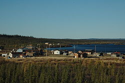
 Colville Lake
Coordinates: 67°02′18″N 126°05′32″W / 67.03833°N 126.09222°WCoordinates: 67°02′18″N 126°05′32″W / 67.03833°N 126.09222°W Country  Canada
Territory  Northwest Territories
Region Sahtu Region Constituency Sahtu Census division Inuvik Region, Northwest Territories Government - Chief Richard Kochon - Senior Administrative Officer Joseph Kochon - MLA Norman Yakeleya Area - Land 128.3 km2 (49.5 sq mi) Elevation 259 m (850 ft) Population - Total 126 - Density 1.0/km2 (2.6/sq mi) Time zone Mountain (MST) (UTC-7) - Summer (DST) MDT (UTC-6) Canadian Postal code X0E 1L0 Area code(s) 867 Telephone exchange 709 Prices - Living cost 167.5A - Food price index 185.8B Sources:Community Governance Data List[1],
2006 Canada Census[2],
Prince of Wales Northern Heritage Centre[3],
Colville Lake profile at the Legislative Assembly[4]
Canada Flight Supplement[5]
^A 2005 figure based on Edmonton = 100[6]
^B 2004 figure based on Yellowknife = 100[6]Historical populations Year Pop. %± 1996 89 – 1997 96 7.9% 1998 96 0.0% 1999 108 12.5% 2000 107 -0.9% 2001 114 6.5% 2002 118 3.5% 2003 122 3.4% 2004 126 3.3% 2005 126 0.0% 2006 130 3.2% 2007 141 8.5% 2008 147 4.3% 2009 147 0.0% Sources: NWT Bureau of Statistics[6] Colville Lake (K'áhbamį́túé meaning "ptarmigan net place") is a settlement corporation located in the Sahtu Region of the Northwest Territories, Canada. The community is located 50 km north of the Arctic Circle, on a lake of the same name, and is northeast of Norman Wells.
Population is 126 according to the 2006 Census, of which the majority are Sahtu Dene.[2] In 2009 the Government of the Northwest Territories reported that the population was 147 with an average yearly growth rate of 3.9 from 1996.[6] They are represented by the Behdzi Ahda First Nation and belong to the Sahtu Dene Council[7]
Contents
Geography and climate
Colville Lake is located 745-air km northwest of Yellowknife. The terrain is characterized by black spruce and tends to be small and sparse. Other vegetation includes mosses, lichens, grasses and alders.[8] The winter months begin in October and last until April. The month of May is considered the spring or breakup period. By the end of May or Early June the lakes and rivers are normally free of ice, although this varies. June, July and August are considered the summer months and temperatures range in the mid twenties. At times the temperature has climbed into the low thirties. By late September, freeze up is well underway again.[8]
History
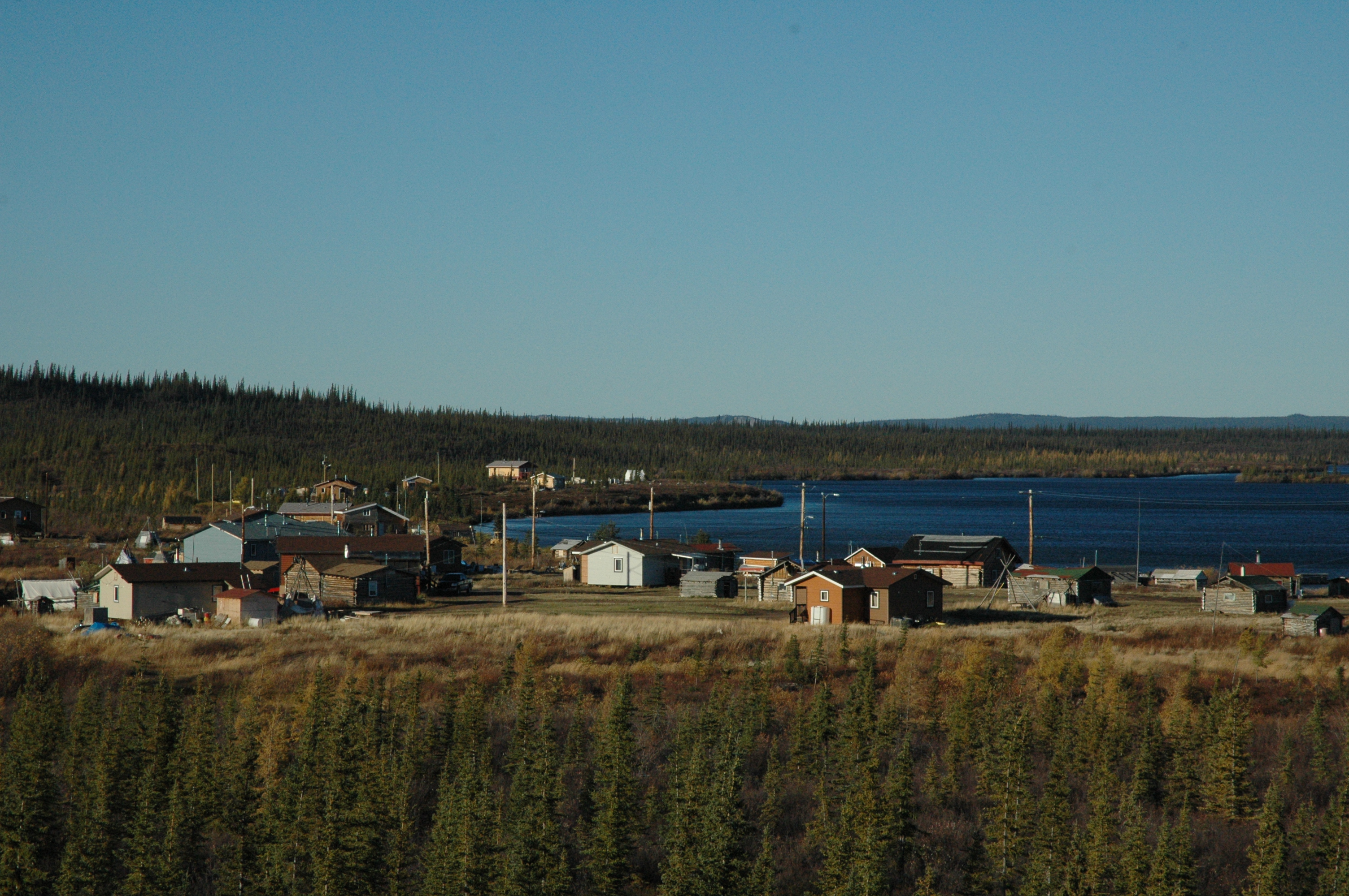
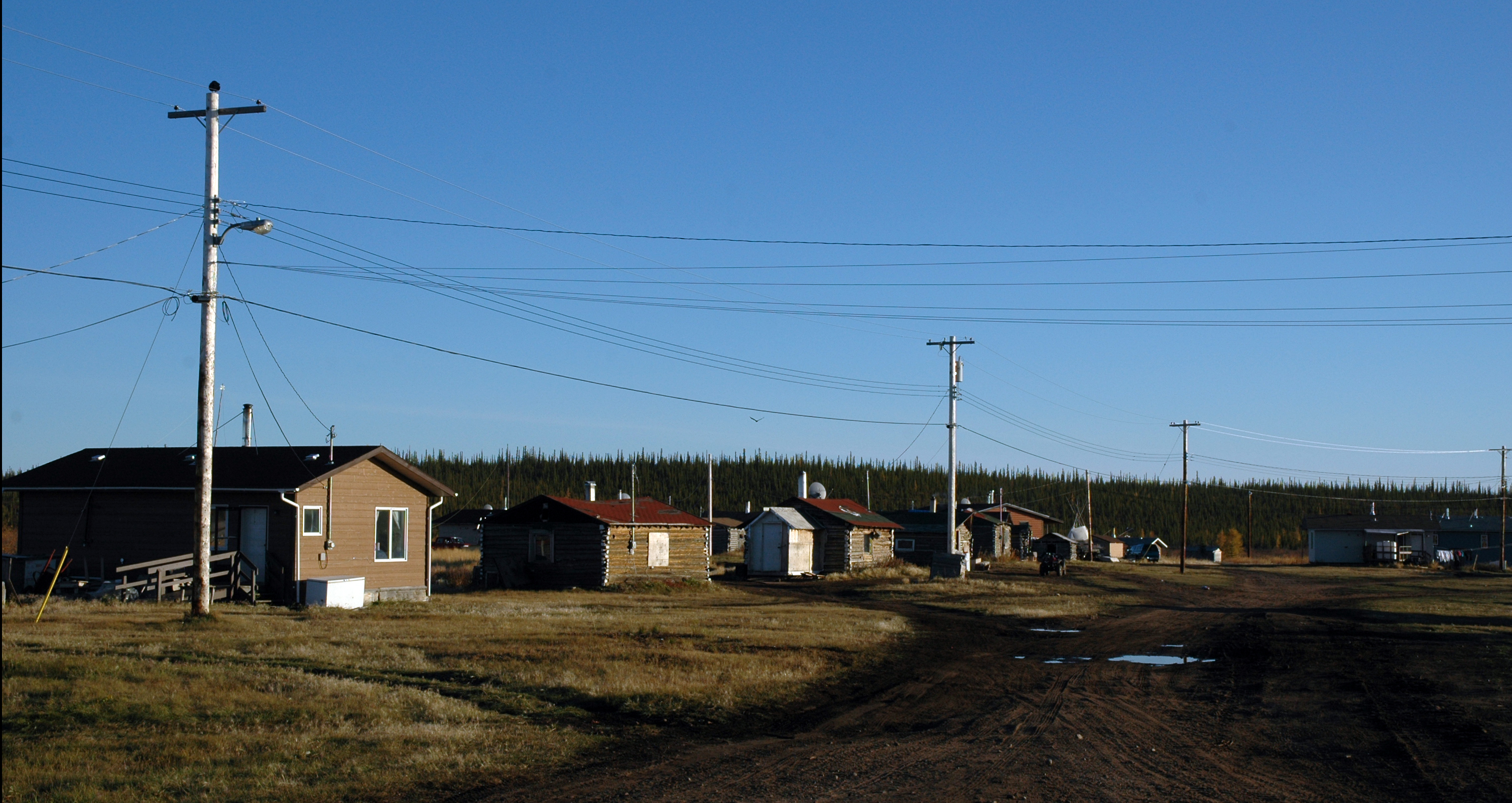
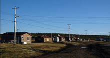 The community in autumn
The community of Colville Lake is the ancestral homeland of the Hareskin Dene who still inhabit the area. The Hareskin Dene were never very numerous, with a population of less than one thousand people, living in six or seven bands, at the time of European contact. The Hareskins were a peaceful group, known for their use of small animals such as the arctic hare. Located within the traditional homeland of the North Slave Dene tribe, Colville Lake is a completely traditional community in every sense. Although Father Émile Petitot brought Christianity to the area in 1864, organization of the community did not occur until 1962 when a Roman Catholic mission was established. [8]
Today
Today you can visit the site of the mission Our Lady of the Snows. One main attraction is a fishing lodge. Colville Lake is home to grayling, trout and pike fish. There is also a small art gallery and museum located next to the lodge. Rounding off the town, there is a Bed and Breakfast and two stores.[9]
See also
References
- ^ Community Governance Data List
- ^ a b 2006 census
- ^ Prince of Wales Northern Heritage Centre - official names
- ^ Legislative Assembly of the Northwest Territories, Colville Lake profile
- ^ Canada Flight Supplement. Effective 0901Z 20 October 2011 to 0901Z 15 December 2011
- ^ a b c d Colville Lake - Statistical Profile at the GNWT
- ^ Indian and Northern Affairs Canada
- ^ a b c Communities Economic Reference Library; Department of Industry, Tourism and Investment. pg 13.(2006).
- ^ Spectacular NWT Tourism
External links
- Colville Lake - Statistical Profile at the GNWT
- NWT Tourism for Colville Lake
- Legislative Assembly of the NWT
 Subdivisions of the Northwest Territories
Census divisions Dehcho Region Inuvik Region Aklavik · Fort McPherson · Inuvik · Paulatuk · Sachs Harbour · Tsiigehtchic · Tuktoyaktuk · UlukhaktokNorth Slave Region Sahtu Region South Slave Region Enterprise · Fort Providence · Fort Resolution · Fort Smith · Hay River Reserve · Hay River · Kakisa Category:Northwest Territories ·
  Portal:Northwest Territories ·
  WikiProject:Canadian TerritoriesCategories:
- Communities in the Sahtu Region
- Dene communities
- Populated places in Arctic Canada
- Northwest Territories geography stubs

Wikimedia Foundation. 2010.