- Census geographic units of Canada
-
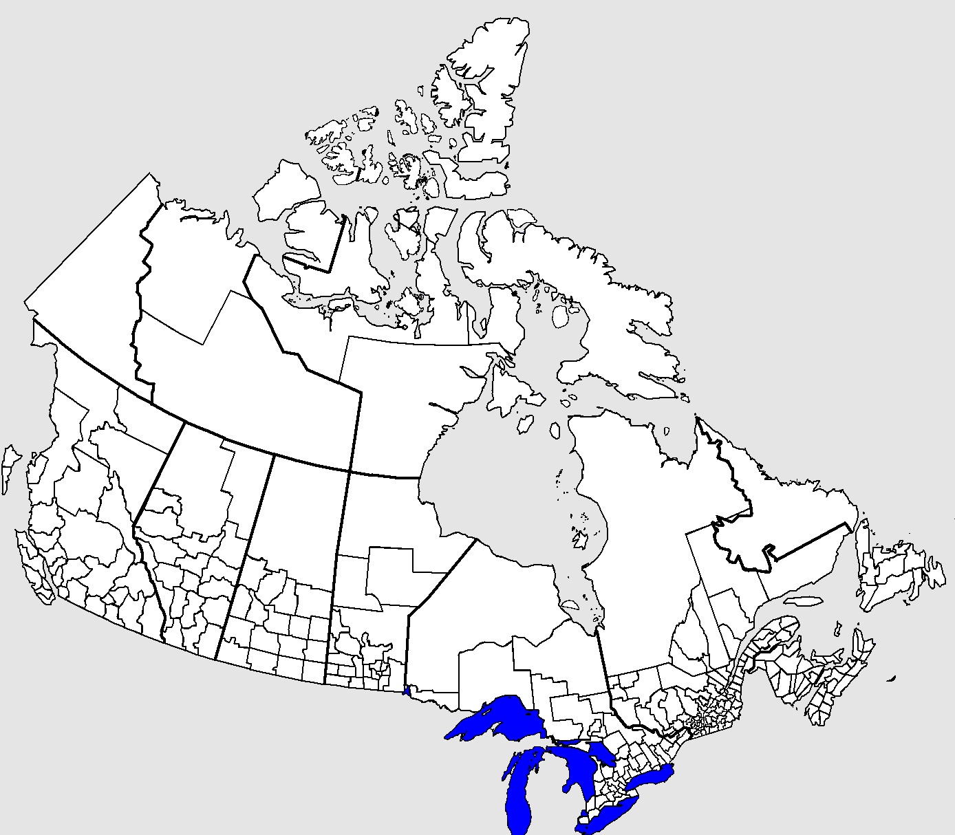
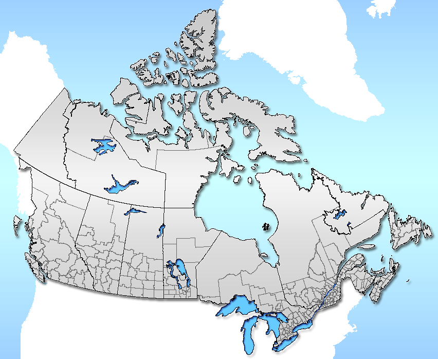
 Outline map of Canada's census divisions in 2001.
The census geographic units of Canada are the country subdivisions defined and used by Canada's federal government statistics bureau Statistics Canada[1] to conduct the country's five-yearly census. They exist on four levels: the top-level (first-level) divisions are Canada's provinces and territories; these are divided into second-level census divisions, which in turn are divided into third-level census subdivisions (roughly corresponding to municipalities) and fourth-level dissemination areas.
In some provinces, a census division also corresponds to a county or another similar unit of political organization, while in other provinces the boundaries are chosen arbitrarily as no such level of government exists. Two of Canada's three territories are also divided into census divisions.
Contents
Census divisions
Canada's second-level geographic units are called "census divisions". In terms of size, they generally lie between the top-level administrative divisions of the province and territory and third-level administrative divisions such as sections, townships and ranges. Census divisions are divided into census subdivisions (see section below).
Nature of Canada's census divisions by province or territory Province/Territory Nature of census divisions Alberta
Manitoba
SaskatchewanCensus divisions consist of groups of municipalities such as cities, municipal districts, and rural municipalities. Each census division is numbered. British Columbia Census divisions correspond with regional districts or municipalities. New Brunswick
Nova Scotia
Prince Edward IslandCensus divisions correspond with counties. Newfoundland and Labrador Census divisions are delineated without reference to administrative or other forms of division and are numbered.[2] Northwest Territories Census divisions do not correspond with the administrative regions of the Northwest Territories. Nunavut Census divisions correspond with the administrative regions of Nunavut. Ontario Census divisions consist of "upper-tier" municipalities (counties, districts, regional municipalities, single-tier cities). Quebec Census divisions mostly correspond to regional county municipalities or equivalent territories. Yukon A territory treated as a single census division. In most cases, a census division corresponds to a single unit of the appropriate type listed above. However, in a few cases, Statistics Canada groups two or more units into a single statistical division:
- In Ontario, Haldimand County and Norfolk County are grouped as a single census division, as are Brant and Brantford.
- In Quebec, 93 of 98 census divisions correspond precisely to the territory of one regional county municipality (with the addition of Indian reserves, which do not legally belong to RCMs) or a "territory equivalent to an RCM" (which usually corresponds to a single independent city). However, there are five census divisions consisting of two or three RCMs or equivalent territories each. For a list of these, see List of regional county municipalities and equivalent territories in Quebec#Use as census divisions
In almost all such cases, the division in question was formerly a single unit of the standard type, which was divided into multiple units by its province after the Canada 2001 Census.
Census subdivisions
Census subdivisions generally correspond to the municipalities of Canada, as determined by provincial and territorial legislation.[3] They are also areas that are deemed to be equivalents to municipalities for statistical reporting purposes, such as Indian reserves, Indian settlements, and unorganized territories.[3] Statistics Canada has created census subdivisions in cooperation with the provinces of British Columbia, Newfoundland and Labrador, and Nova Scotia as equivalents for municipalities.[4] The Indian reserve and Indian settlement census subdivisions are determined according to criteria established by Indian and Northern Affairs Canada.[5]
Dissemination areas
Dissemination areas are the smallest standard geographic unit in Canada and cover the entire country.[6] As small areas, they comprise one or more dissemination blocks and have a population between 400 and 700 people.[6]
Specially-defined geographic units
Census metropolitan areas
- See template below for links to census metropolitan areas by size.
A "census metropolitan area" (CMA) is a grouping of census subdivisions comprising a large urban area (the "urban core") and those surrounding "urban fringes" and fringes" with which it is closely integrated. To become a CMA, an area must register an urban core population of at least 100,000 at the previous census. CMA status is retained even if this core population later drops below 100,000.
CMAs may cross census division and provincial boundaries, although the Ottawa-Gatineau metropolitan area in Ontario and Quebec is the only one that currently crosses a provincial border.
Census agglomerations
See also: List of census agglomerations by province or territory and List of the 100 largest metropolitan areas in CanadaA "census agglomeration" (CA) is a smaller version of a CMA in which the urban core population at the previous census was greater than 10,000 but less than 100,000.
Census tracts
CMAs and CAs with a population greater than 50,000 are subdivided into census tracts which have populations ranging from 2,000 to 8,000.
Urban areas
An "urban area" (UA) is any grouping of contiguous dissemination areas that has a minimum population of 1,000 and an average population density of 400 persons per square kilometre or greater.[7] For the 2011 census, urban area has been renamed to "population centre".[8][9]
Population centres
A "population centre" is the level of geography that will succeed "urban area" in the 2011 census.[9] It will retain the same definition of urban area, being an area with a population of at least 1,000 and a density of 400 or more people per square kilometre.[9] The population centre level of geography will be further divided into the following three groupings based on population.[9]
- "small population centre" – 1,000 to 29,999
- "medium population centre" – 30,000 to 99,999
- "large urban population centre" – 100,000 and greater
See also
- Census division statistics of Canada
- Census divisions of Alberta · Newfoundland and Labrador · Ontario · Saskatchewan
- Counties of New Brunswick · Nova Scotia · Prince Edward Island
- Regions of Manitoba · Northwest Territories · Nunavut
- Regional county municipalities of Quebec
- Regional districts of British Columbia
- Standard Geographical Classification code
References
- ^ Statistics Canada. "Illustrated Glossary: Census Geography". http://geodepot.statcan.ca/Diss/Reference/COGG/Index_e.cfm. Retrieved 2006-10-11.
- ^ Sometimes used for municipal organization or as health regions.
- ^ a b "Census subdivision (CSD)". Statistics Canada. 2010-06-14. http://www12.statcan.gc.ca/census-recensement/2006/ref/dict/geo012-eng.cfm. Retrieved 2011-08-29.
- ^ "Interim List of Changes to Municipal Boundaries, Status, and Names". Statistics Canada. April 2011. p. 7&8. http://www.statcan.gc.ca/pub/92f0009x/92f0009x2011000-eng.pdf. Retrieved 2011-08-29.
- ^ "More information on Census subdivision (CSD)". Statistics Canada. 2011-04-04. http://www12.statcan.gc.ca/census-recensement/2006/ref/dict/geo012a-eng.cfm. Retrieved 2011-08-29.
- ^ a b "2006 Census Dictionary: Dissemination area (DA)". Statistics Canada. 2009-11-20. http://www12.statcan.gc.ca/census-recensement/2006/ref/dict/geo021-eng.cfm. Retrieved 2011-09-21.
- ^ "2006 Census Dictionary: Urban area (UA)". Statistics Canada. 2009-11-20. http://www12.statcan.gc.ca/census-recensement/2006/ref/dict/geo049-eng.cfm. Retrieved 2011-09-21.
- ^ "Preview of Census Products and Services: Highlight tables". Statistics Canada. 2011-09-21. http://www12.statcan.gc.ca/census-recensement/2011/ref/preview-avantgout/data-donnees/hl-fs-eng.cfm. Retrieved 2011-09-21.
- ^ a b c d "From urban areas to population centres". Statistics Canada. 2011-05-05. http://www.statcan.gc.ca/subjects-sujets/standard-norme/sgc-cgt/urban-urbain-eng.htm. Retrieved 2011-09-21.
External links
- Reference maps for census divisions at Statistics Canada.
- Hierarchy of census geography
Census metropolitan areas (CMAs) in Canada by size Toronto, ON · Montreal, QC · Vancouver, BC · Ottawa, ON · Calgary, AB · Edmonton, AB · Quebec City, QC · Winnipeg, MB · Hamilton, ON · London, ON · Cambridge-Kitchener-Waterloo, ON · St. Catharines-Niagara, ON · Halifax, NS · Oshawa, ON · Victoria, BC · Windsor, ON · Saskatoon, SK · Regina, SK · Sherbrooke, QC · St. John's, NL · Barrie, ON · Kelowna, BC · Abbotsford, BC · Greater Sudbury, ON · Kingston, ON · Saguenay, QC · Trois-Rivières, QC · Guelph, ON · Moncton, NB · Brantford, ON · Thunder Bay, ON · Saint John, NB · Peterborough, ON
 Census divisions of Canada (by province or territory)
- Alberta
- British Columbia
- Manitoba
- New Brunswick
- Newfoundland and Labrador
- Nova Scotia
- Ontario
- Prince Edward Island
- Quebec
- Saskatchewan
- Northwest Territories
- Nunavut
- Yukon
Articles on second-level administrative divisions of North American countries Belize · Canada · Costa Rica · Cuba · Dominican Republic · El Salvador · Guatemala · Haiti · Honduras · Mexico · Nicaragua · Panama · United States
Categories:- Census divisions of Canada
- Subdivisions of Canada
- Country subdivisions of the Americas
- Second-level administrative country subdivisions
- Statistics Canada
Wikimedia Foundation. 2010.