- Haldimand County, Ontario
Infobox Settlement
official_name = Municipality of Haldimand County
native_name =
nickname =
settlement_type = Single-tier municipality
motto =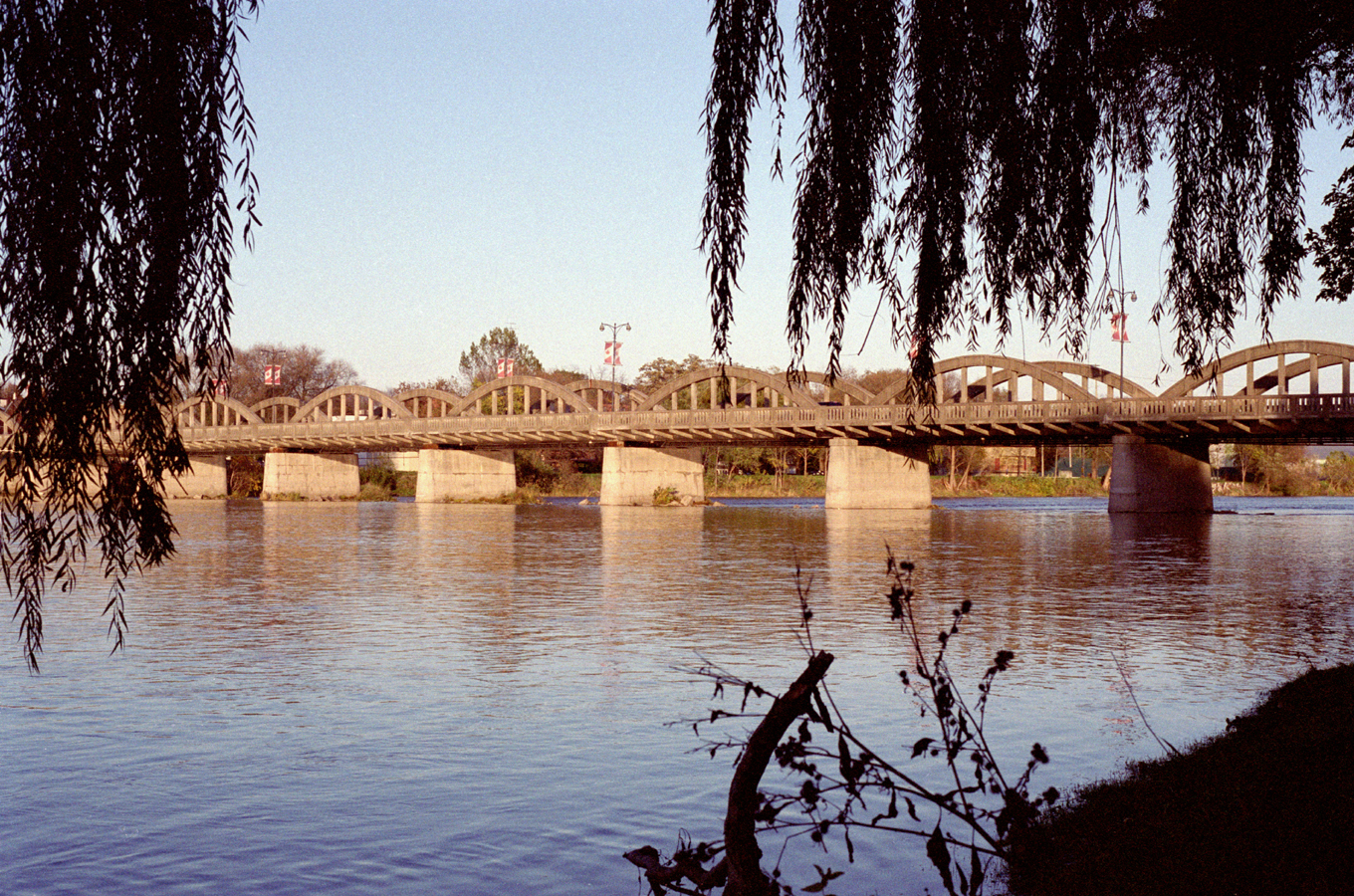
imagesize =
image_caption = The Grand River Bridge, which carries Argyle St. over the Grand River in Caledonia.
image_
image_shield =
image_blank_emblem =
blank_emblem_size =
image_
image_shield =
image_blank_emblem =
blank_emblem_size =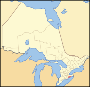
mapsize =
map_caption =
subdivision_type = Country
subdivision_name =Canada
subdivision_type1 = Province
subdivision_name1 =Ontario
subdivision_type2 =
subdivision_name2 =
subdivision_type3 =
subdivision_name3 =
subdivision_type4 =
subdivision_name4 =
government_type =
leader_title = Mayor
leader_name =Marie Trainer
leader_title1 = Governing Body
leader_name1 = Municipal Council of Haldimand County
leader_title2 = MPs
leader_name2 =Diane Finley (Con)
leader_title3 = MPPs
leader_name3 =Toby Barrett (Con)
established_title =
established_date =
established_title2 =
established_date2 =
established_title3 =
established_date3 =
area_magnitude =
area_total_km2 = 1251.58
area_land_km2 =
area_land_sq_mi =
area_water_km2 =
area_water_sq_mi =
area_water_percent =
area_urban_km2 =
area_urban_sq_mi =
area_metro_km2 =
area_metro_sq_mi =
population_as_of =
population_note =
population_total = 45212
population_footnotes =
population_metro =
population_density_km2 = 36.1
population_density_sq_mi =
population_density_metro_km2 =
population_density_metro_sq_mi =
population_urban =
population_density_urban_km2 =
population_density_urban_mi2 =
timezone = EST
utc_offset = -5
timezone_DST = EDT
utc_offset_DST = -4
elevation_m =
elevation_ft =
postal_code_type = Postal code span
postal_code =
area_code = 519,905
website =
footnotes =Haldimand (2006 population 45,212) is a single-tier municipality (but called a county) on the
Niagara Peninsula in southernOntario ,Canada , on the north shore ofLake Erie , and on the Grand River. Municipal offices are located in Cayuga.History
Haldimand's history has been closely associated with that of the neighbouring Norfolk County. Haldimand was first created as a
county in 1800, from a portion of Norfolk. It was named after the governor of theProvince of Quebec SirFrederick Haldimand . In 1844 the land was surrendered by Six Nations to the Crown in an agreement that was signed by the vast majority of Chiefs in the Haldimand tractFact|date=September 2008. The two counties were separate until 1974, when they were reunited as the Regional Municipality of Haldimand-Norfolk.In 2001, the counties were separated again. Although they both retain the name "county" for historical reasons, each is governed as a single municipality, with no formal level of government below that of the county, and thus neither is a true county.
Beginning in February 2006, a land dispute by native protestors began near Caledonia over a housing development being built on the outskirts of town, which members of the nearby Mohawk Six Nations people claim the is rightfully their land, see the
Caledonia land dispute .Communities
The main centres in Haldimand are Jarvis, Hagersville, Caledonia, Cayuga and Dunnville. Part of the Six Nations Reserve is in Haldimand County, but not within its jurisdiction. Most of Haldimand is agricultural land, although some heavy industry, including the
Nanticoke Generating Station , is located here.Smaller communities within the municipality are Attercliffe Station, Balmoral, Bodri Bay, Brookers Bay, Byng, Canborough, Canfield, Cheapside, Clanbrassil, Cranston, Crescent Bay, Darling Road, Decewsville, Dufferin, Empire Corners, Erie, Eriestone, Featherstone Point, Fisherville, Garnet, Hickory Beach, Hoover Point, Kohler, Lambs Corners, Little Buffalo, Lowbanks, Lythmore, Moulton, Mount Carmel, Mount Healy, Nanticoke, Nelles Corners, Peacock Point, Port Maitland, Rainham Centre, Sandusk, Selkirk, Sims Lock Road, South Cayuga, Springvale, Stromness, Sweets Corners, Townsend, Upper, Varency, Willow Grove, Woodlawn Park and York.
The ghost town of Indiana is also located within Haldimand.
Historic townships
Haldimand County area convert|284817|acre|km2|0 was formed from part of the land grant to the
Six Nations in 1783. The County was purchased by treaty and opened for general settlement in 1832. It was first settled by white veterans ofButler's Rangers established there byJoseph Brant . A large number of Germans were among the first settlers.*Canborough, area convert|21586|acre|km2|0. Granted in 1794 by Joseph Brant to John Dochstader of Butler's Rangers. Purchased by Benjamin Canby in 1810 for 5,000, he named the village-site "Canborough. Community centre: Canborough, Darling and it touches Dunnville
*Dunn, area convert|15122|acre|km2|0. Opened for settlement in 1833. Community centre: Dunnville
*Moulton, area convert|27781|acre|km2|0. Landowner Henry John Boulton named the township from the Boulton family seat in England.
*North Cayuga, area convert|32825|acre|km2|0.
*Oneida, area convert|32598|acre|km2|0. Joseph Brant granted a 999 year lease of part of Oneida and Seneca townships to Henry Nelles, of Butler's Rangers and his sons, Robert, Abraham, William, Warner and John. Community centres: Caledonia, Dufferin and Hagersville.
*Rainham, area convert|25705|acre|km2|0 Community centres: Balmoral, Selkirk, Rainham Centre and Fisherville.
*Seneca, area convert|41721|acre|km2|0. Community centres: York and Caledonia (Haldimand)
*Sherbrooke, area convert|5098|acre|km2|0, the smallest township in Ontario. Opened in 1825 and named from SirJohn Coape Sherbrooke , a Governor-General of Canada. The Township was granted by the Indians to William Dickson (a lawyer) as a professional fee. Community centres: Stromness and Port Maitland.
*South Cayuga, area convert|13293|acre|km2|0. Community centre: (Haldimand)
*Walpole, area convert|66213|acre|km2|0. Community centres were: Hagersville, Selkirk, Cheapside and Nantikoke. (Majority gone to Nanticoke while the remainder went to Haldimand)Source: "Province of Ontario -- A History 1615 to 1927" by Jesse Edgar Middleton & Fred Landon, copyright 1927, Dominion Publishing Company, Toronto
Demographics
:::N/A=Data Not Available
People
Current Mayor:
Marie Trainer Previous Mayors:
* 2000-2004:
Lorraine Bergstrand *birthplace of Canadian Olympic high jump medalist
Ethel Catherwood .Highways
Highways that travel through Haldimand include: Kings Highway #3, and Kings Highway #6
Protected areas
*Haldimand Conservation Area
*Selkirk Provincial Park
*Taquanyah Conservation Area
*Hedley Forest Conservation Area
*Canborough Conservation Area
*Ruigrok Tract Conservation Area
*Oswego Conservation Area
*Byng Island Conservation Area
*Rock Point Provincial Park
*Mohawk Island National Wildlife Area Attractions
*Mohawk Island Lighthouse (abandoned)
*Port Maitland Outer Range Light
*Canadian HeritageGrand River
*Grand Valley Trail
*Toronto Motorsports Park (Dragway Park)
*Indiana Ghost Town
*Ruthven Park National Historic Site Mansion and Park
*Haldimand County Museum & Archives (Cayuga)
*Cayuga Speedway
*Grand River Dunner Cruises
*Edinburgh Square Heritage Centre (Caledonia)
*Killman Zoo
*Townsend Planned Community (1970)
*Cottonwood Mansion
*Caledonia Grand Trunk Station
*Wilson MacDonald School Museum
*No. 6 RCAF Dunnville Museum
*Canadian Drilling Rig Museum
*Caledonia Old Mill
*Nanticoke Generating Station urrounding Counties
*Norfolk County
*County of Brant
*City of Hamilton
*Regional Municipality of NiagaraExternal links
* [http://www.haldimandcounty.on.ca Haldimand County official website]
* [http://www.TourismHaldimand.com Haldimand County Tourism official website]
* [http://www.haldimand-collection.ca Haldimand Collection]Canadian City Geographic Location
North=Hamilton, West Lincoln
West=County of Brant, Six Nations of the Grand River, Norfolk County
Center=Haldimand County
East=Township of Wainfleet
South=Lake Erie
Wikimedia Foundation. 2010.