- London, Ontario
-
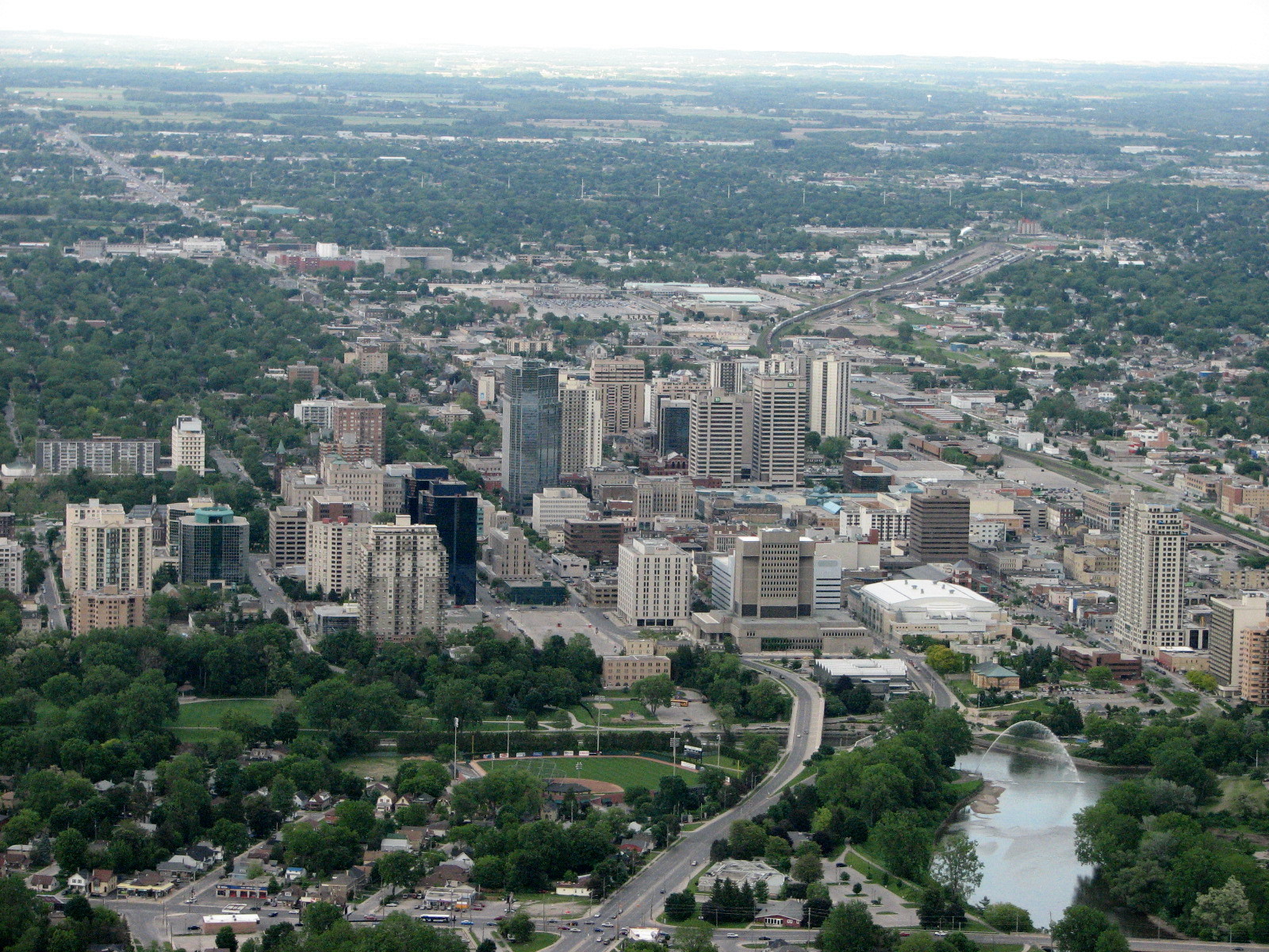
London — City — City of London Downtown London skyline in 2009

FlagNickname(s): "The Forest City" Motto: Labore et Perseverantia (Latin)
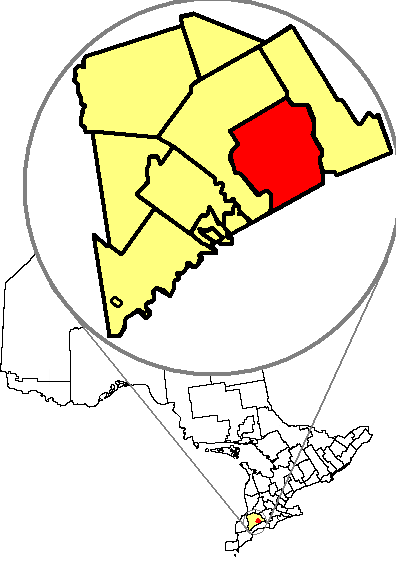
"Through Labour and Perseverence"Location of London in relation to Middlesex County and the Province of Ontario.
Coordinates: 42°59′01″N 81°14′59″W / 42.9837°N 81.2497°WCoordinates: 42°59′01″N 81°14′59″W / 42.9837°N 81.2497°W Country  Canada
Province  Ontario
County Middlesex Settled 1826 (as village) Incorporated 1855 (as city) Government - City Mayor Joe Fontana - Governing Body London City Council - MPs Ed Holder (Conservative)
Susan Truppe (Conservative)
Irene Mathyssen (NDP)
Joe Preston (Conservative)- MPPs Teresa Armstrong (NDP)
Chris Bentley (OLP)
Deb Matthews (OLP)
Jeff Yurek (PC)Area[1][2] - Land 420.57 km2 (162.4 sq mi) - Urban 218.04 km2 (84.2 sq mi) - Metro 2,665.28 km2 (1,029.1 sq mi) Elevation 251 m (823 ft) Population (2006)[1][2] - City 352,395 (15th) - Density 837.9/km2 (2,170.2/sq mi) - Urban 353,069 (11th) - Urban density 1,619.3/km2 (4,194/sq mi) - Metro 457,720 (10th) - Metro density 171.7/km2 (444.7/sq mi) Time zone EST (UTC−5) - Summer (DST) EDT (UTC−4) Postal code span N5V to N6P Area code(s) 519 and 226 Website www.london.ca London is a city in Southwestern Ontario, Canada, situated along the Quebec City – Windsor Corridor. The city has a population of 352,395, and the metropolitan area has a population of 457,720, according to the 2006 Canadian census; the metro population in 2009 was estimated at 489,274.[3] The city is named after London, England.[4] London is the seat of Middlesex County, at the forks of the non-navigable Thames River, approximately halfway between Toronto, Ontario and Detroit, Michigan. The City of London is a separated municipality, politically separate from Middlesex County, though it remains the official county seat.
London was first settled by Europeans between 1801 and 1804 by Peter Hagerman[5] and became a village in 1826. Since then, London has grown into the largest Southwestern Ontario municipality, annexing many of the smaller communities that surrounded it. The city has developed a strong focus towards education, health care, tourism, and manufacturing.
London is home to Fanshawe College and the University of Western Ontario, which contributes to the city's reputation as an international centre of higher education, scientific research and cultural activity. The city hosts a number of musical and artistic exhibits. London's festivals contribute to its tourism industry, but its economic activity is centred on education, medical research, insurance, and information technology. London's university and hospitals are among its top ten employers. London lies at the junction of Highway 401 and 402, connecting it to Toronto, Detroit, and Sarnia, but lacks an internal freeway. It also has an international airport, train and bus stations.
Contents
History
Founding
Prior to European contact in the 18th century, the present site of London was occupied by several Neutral and Odawa/Ojibwa villages. One Anishinaabe community site was described as located near the forks of Askunessippi (Anishinaabe language: Eshkani-ziibi, "Antler River"; now called the Thames River) in circa 1690[6] and was referred to as Pahkatequayang[7] ("Baketigweyaang":"At the River Fork" (lit: at where the by-stream is)). Archaeological investigations in the region indicate that aboriginal people have resided in the area for at least the past 10,000 years.[8]
The current location of London was selected as the site of the future capital of Upper Canada in 1793 by Lieutenant-Governor John Graves Simcoe. Simcoe intended to name the settlement Georgina,[9] in honour of King George III, and renamed the river. However, the choice of a capital site in the midst of extensive hardwood forests was rejected by Guy Carleton (Governor Dorchester).[10] In 1814, there was a skirmish during the War of 1812 in what is now southwest London at Reservoir Hill, formerly Hungerford Hill.[11]
The village of London, named after the English capital of London,[4] was not founded until 1826, and not as the capital Simcoe envisioned.[12] Rather, it was an administrative seat for the area west of the actual capital, York (now Toronto).[12] Locally, it was part of the Talbot Settlement, named for Colonel Thomas Talbot, the chief coloniser of the area, who oversaw the land surveying and built the first government buildings for the administration of the Western Ontario peninsular region.[12] Together with the rest of Southwestern Ontario, the village benefited from Talbot's provisions, not only for building and maintaining roads, but also for assignment of access priorities to main routes to productive land.[12] At the time, Crown and clergy reserves were receiving preference in the rest of Ontario.
In 1832, the new settlement suffered an outbreak of cholera.[13] London proved a centre of strong Tory support during the Upper Canada Rebellion of 1837, notwithstanding a brief rebellion led by Dr. Charles Duncombe.[12] Consequently, the British government located its Ontario peninsular garrison there in 1838, increasing its population with soldiers and their dependents, and the business support populations they required.[12] London was incorporated as a town in 1840.[13]
On April 13, 1845, fire destroyed much of London, which was at the time largely constructed of wooden buildings.[14] One of the first casualties was the town's only fire engine. This fire burned nearly 30 acres of land destroying 150 buildings before burning itself out later the same day. One-fifth of London was destroyed and this was the province's first million dollar fire.[15]
On January 1, 1855, London was incorporated as a "city" (10,000 or more residents).[12] London was a "city within a forest" and as such earned the nickname "The Forest City."[16]
In the 1860s, a sulphur spring was discovered at the forks of the Thames River while industrialists were drilling for oil.[17] The springs became a popular destination for wealthy Ontarians, until the turn of the 20th century when a textile factory was built at the site, replacing the spa.
Development
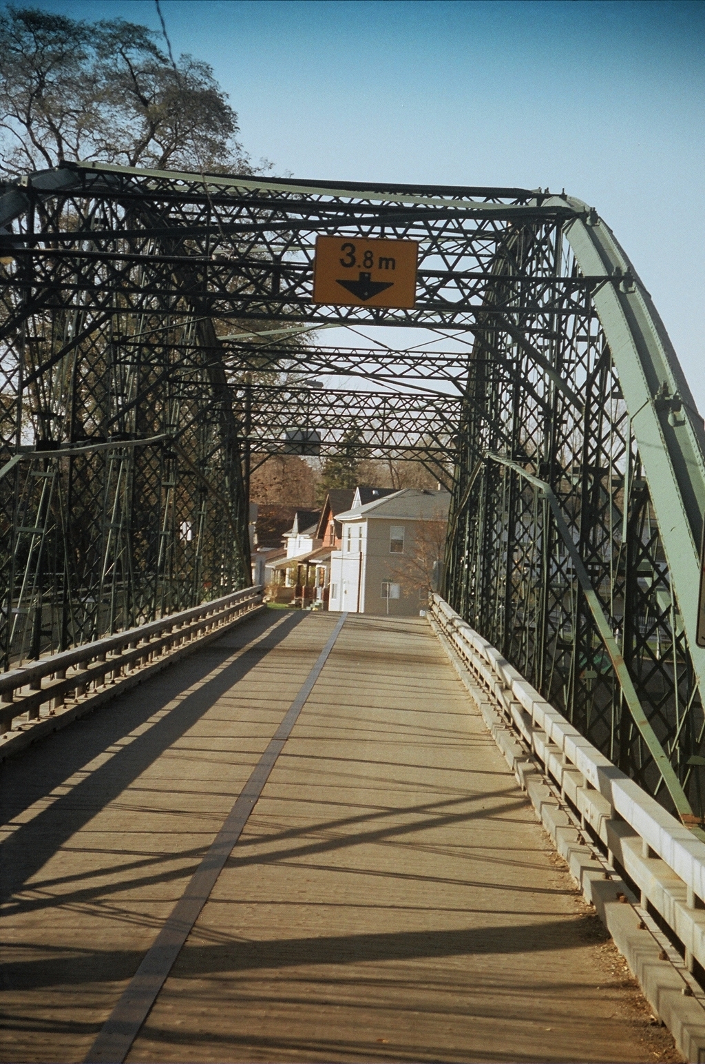
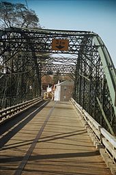 Blackfriars Bridge
Sir John Carling, Tory MP for London, gave three events to explain the development of London in a 1901 speech. They were: the location of the court and administration in London in 1826; the arrival of the military garrison in 1838; and the arrival of the railway in 1853.[18]
In 1875, London's first iron bridge, the Blackfriars Street Bridge, was constructed.[14] It replaced a succession of flood-failed wooden structures that had provided the city's only northern road crossing of the river. A rare example of a bowstring truss bridge, the Blackfriars remains open to vehicular traffic.[19] The Blackfriars, amidst the river-distance between the Carling Brewery and the historic Tecumseh Park (including a major mill), linked London with its western suburb of Petersville, named for Squire Peters of Grosvenor Lodge. That community joined with the southern subdivision of Kensington in 1874, formally incorporating as the municipality of Petersville.[12] Although it changed its name in 1880 to the more inclusive "London West", it remained a separate municipality until ratepayers voted for amalgamation with London in 1897,[12] largely due to repeated flooding. The most serious flood was that of July 1883, which resulted in serious loss of life and property devaluation.[20] This area retains much original and attractively maintained 19th-century tradespeople's and workers' housing, including Georgian cottages as well as larger houses, and a distinct sense of place.
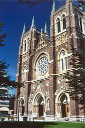 St. Peter's Cathedral Basilica, seat of the Roman Catholic Diocese of London
London's eastern suburb, London East, was (and remains) an industrial centre, which also incorporated in 1874.[12] Attaining the status of town in 1881,[21] it continued as a separate municipality until concerns over expensive waterworks and other fiscal problems led to amalgamation in 1885.[22] The southern suburb of London, including Wortley Village, was collectively known as "London South". Never incorporated, the South was annexed to the city in 1890,[12] although Wortley Village still retains a distinct sense of place. By contrast, the settlement at Broughdale on the city's north end had a clear identity, adjoined the university, and was not annexed until 1961.[23]
On May 24, 1881, the ferry SS Victoria capsized in the Thames River, drowning approximately 200 passengers, the worst disaster in London's history.[14] Two years later, on July 12, 1883,[14] the first of the two most devastating floods in London's history killed 17 people. The second major flood, on April 26, 1937, destroyed more than a thousand houses and caused over $50 million dollars in damages, particularly in West London.[24][25] After repeated floods the Upper Thames River Conservation Authority in 1953 opened Fanshawe Dam on the North Thames to control the downstream rivers.[26] Financing for this project came from the federal, provincial, and municipal governments. Other natural disasters include a 1984 tornado that led to damage on several streets in the White Oaks area of South London.[27]
London's role as a military centre continued into the 20th century during the two World Wars, serving as the administrative centre for the Western Ontario district. In 1905, the London Armoury was built and housed the First Hussars until 1975. A private investor purchased the historic site and built a new hotel (1996)in its place preserving the shell of the historic building. The Delta London Armouries Hotel has a gallery on the 2nd floor, reflecting London in the early 1900s. In the 1950s, two reserve battalions amalgamated and became London and Oxford Rifles (3rd Battalion), The Royal Canadian Regiment.[28] This unit continues to serve today as 4th Battalion, The Royal Canadian Regiment. The Regimental Headquarters of The Royal Canadian Regiment remains in London at Wolseley Barracks on Oxford Street. The barracks are home to the First Hussars militia regiment as well.[28]
Annexation to present
London annexed many of the surrounding communities in 1961, including Byron and Masonville, adding 60,000 people and more than doubling its area.[12] After this amalgamation, suburban growth accelerated as London grew outward in all directions, creating expansive new subdivisions such as Westmount, Oakridge, Whitehills, Pond Mills, White Oaks and Stoneybrook.[12]
In 1992, London annexed nearly the entire Township of Westminster, a large, primarily rural municipality directly south of the city, including the police village of Lambeth.[29] With this massive annexation, London almost doubled in area again, adding several thousand more residents. London now stretches south to the boundary with Elgin County.
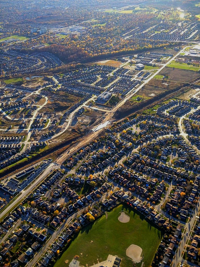
The 1993 annexation made London one of the largest urban municipalities in Ontario.[30] Intense commercial and residential development is presently occurring in the southwest and northwest areas of the city. Opponents of this development cite urban sprawl,[31] destruction of rare Carolinian zone forest and farm lands,[32] replacement of distinctive regions by generic malls, and standard transportation and pollution concerns as major issues facing London. The City of London is currently the eleventh-largest urban area in Canada, tenth-largest census metropolitan area in Canada, and the sixth-largest city in Ontario.[33][34]
Geography
The area was formed during the retreat of the glaciers during the last ice age, which produced areas of marshland, notably the Sifton Bog (which is actually a fen), as well as some of the most agriculturally productive areas of farmland in Ontario.[35] The eastern half of the city is generally flat, except for around the five neighbouring ponds in the south, and the west and north are characterized by gently rolling hills.[citation needed]
The Thames River dominates London's geography. The North and South branches of the Thames River meet at the centre of the city, a location known as "The Forks" or "The Fork of the Thames."[36] The North Thames runs through the man-made Fanshawe Lake, located in northeast London. Fanshawe Lake was created by Fanshawe Dam, constructed to protect the downriver areas from the catastrophic flooding which affected the city in 1883 and 1937.[37]
Climate
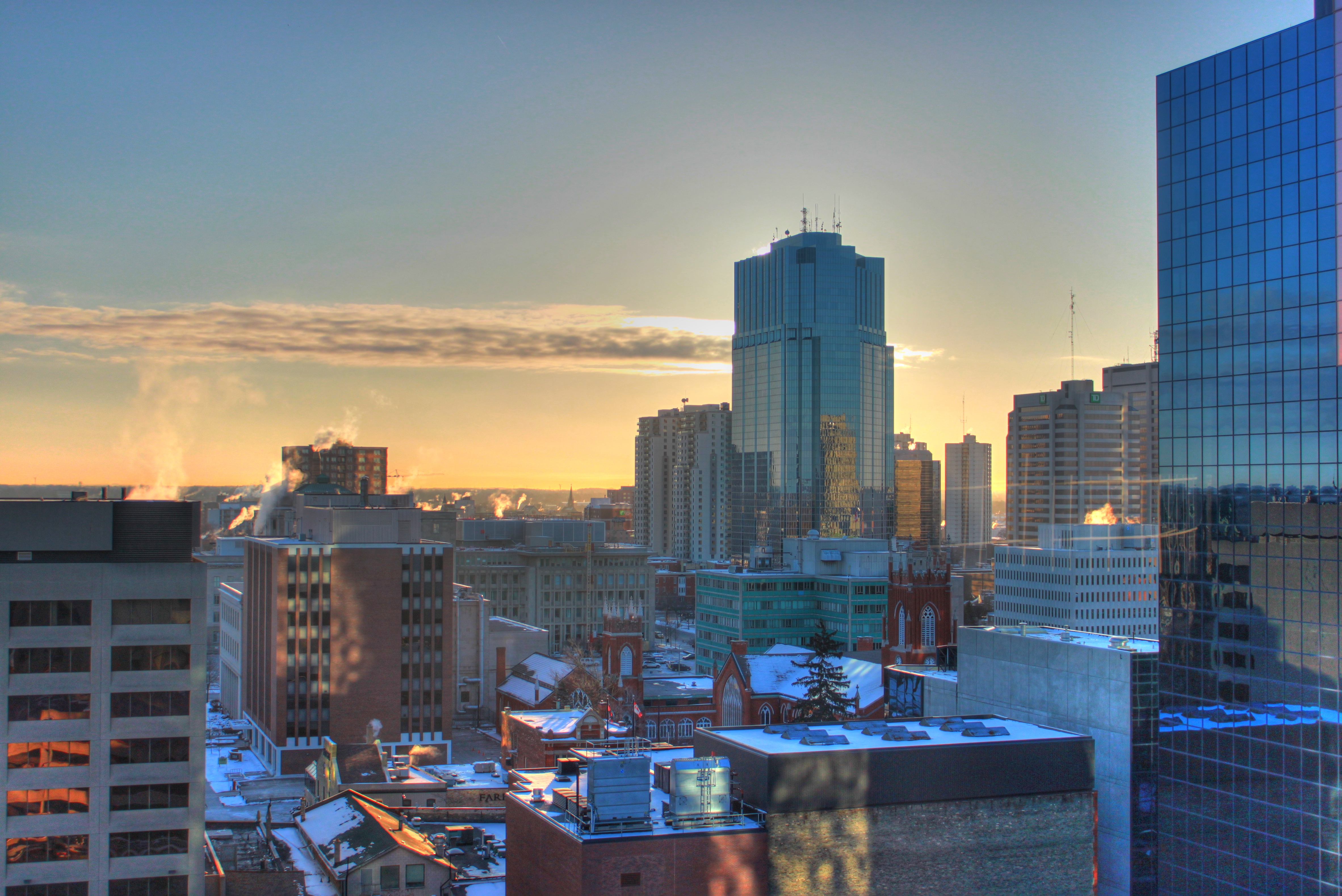
 Downtown London on a winter morning in January 2011.
London has a humid continental climate (Koppen Dfb), though due to its windward location relative to Lake Huron it is virtually on the Dfa-Dfb (hot summer) boundary. Because of its location in the continent and its proximity to the Great Lakes, London experiences large seasonal contrast. The summers are usually warm to hot and humid, with a July average of 20.5 °C (68.9 °F), and highs may rise above 30 °C (86 °F) on an average 8 days per annum. The city is affected by thunderstorms more than any other major city in Canada,[38] due to the convergence of breezes originating from Lake Huron and Lake Erie. Spring and autumn in between are not long, and winters are cold but witness frequent thaws. Annual precipitation averages nearly 990 millimetres (39.0 in).[39] Its winter snowfall totals are heavy, averaging slightly over 200 centimetres (79 in) per year.[39] The majority of it comes from lake effect snow and snow squalls originating from Lake Huron, some 60 kilometres (37 mi) to the northwest, which occurs when strong, cold winds blow from that direction. From December 5, 2010, to December 9, 2010, London experienced record snowfall when up to 200 centimetres (79 in) of snow fell in parts of the city.[40] Schools and business were closed for three days and bus service was cancelled after the second day of snow.[40]
Climate data for London International Airport Month Jan Feb Mar Apr May Jun Jul Aug Sep Oct Nov Dec Year Record high °C (°F) 16.7
(62.1)17.8
(64.0)24.8
(76.6)29.4
(84.9)32.4
(90.3)38.2
(100.8)36.7
(98.1)37
(99)34.4
(93.9)30
(86)24.4
(75.9)18.5
(65.3)38.2
(100.8)Average high °C (°F) −2.4
(27.7)−1.4
(29.5)4.2
(39.6)11.6
(52.9)19
(66)23.8
(74.8)26.3
(79.3)25.2
(77.4)20.9
(69.6)14
(57)6.9
(44.4)0.6
(33.1)12.4 Daily mean °C (°F) −6.3
(20.7)−5.5
(22.1)−0.3
(31.5)6.3
(43.3)13
(55)18
(64)20.5
(68.9)19.5
(67.1)15.3
(59.5)9
(48)3.1
(37.6)−3
(27)7.5 Average low °C (°F) −10.1
(13.8)−9.7
(14.5)−4.7
(23.5)1
(34)7
(45)12.1
(53.8)14.6
(58.3)13.7
(56.7)9.6
(49.3)4
(39)−0.7
(30.7)−6.5
(20.3)2.5 Record low °C (°F) −31.7
(−25.1)−29.5
(−21.1)−24.8
(−12.6)−12.2
(10.0)−5
(23)−0.6
(30.9)5
(41)1.5
(34.7)−3.3
(26.1)−11.1
(12.0)−18.3
(−0.9)−26.9
(−16.4)−31.7
(−25.1)Precipitation mm (inches) 74.2
(2.921)60.0
(2.362)78.4
(3.087)82.2
(3.236)82.9
(3.264)86.8
(3.417)82.2
(3.236)85.3
(3.358)97.7
(3.846)77.6
(3.055)91.1
(3.587)88.6
(3.488)987.1
(38.862)Rainfall mm (inches) 31.1
(1.224)29.1
(1.146)53.8
(2.118)73.8
(2.906)82.6
(3.252)86.8
(3.417)82.2
(3.236)85.3
(3.358)97.7
(3.846)74.9
(2.949)73.7
(2.902)47.0
(1.85)817.9
(32.201)Snowfall cm (inches) 52.6
(20.71)38.1
(15)28.6
(11.26)9.2
(3.62)0.3
(0.12)0
(0)0
(0)0
(0)0
(0)2.7
(1.06)19.7
(7.76)51.1
(20.12)202.4
(79.69)Avg. precipitation days 19.4 15.7 15.8 13.7 12.2 11.6 11.0 10.9 12.1 13.1 16.2 18.7 170.4 Avg. rainy days 5.6 5.1 8.6 11.5 12.1 11.6 11.0 10.9 12.1 12.9 11.2 7.7 120.3 Avg. snowy days 16.5 12.8 9.7 3.6 0.2 0 0 0 0 1.3 7.0 14.4 65.5 Sunshine hours 65.9 91.5 119.5 162.1 220.6 243.4 262 221.9 162.8 128.2 69.7 52.4 1,800 Source: Environment Canada[41] Parks
 The Thames River in Springbank Park.
London has a number of parks. Victoria Park in downtown London is a major centre of community events, attracting an estimated 1 million visitors per year.[36] Other major parks include Harris Park, Gibbons Park, Fanshawe Conservation Area, Springbank Park, and Westminster Ponds. The city also maintains a number of gardens and conservatories.[36]
Demographics
According to the 2006 census, the city proper of London had a population of 352,395 people, 48.2% male and 51.8% female.[42] Children under five accounted for approximately 5.2% of the resident population of London.[42] 13.7% of the resident population in London were of retirement age (65 and over), which is also the percentage for Canada as a whole.[42] The average age is 38.2 years of age, compared to 39.5 years of age for all of Canada.[42]
Between 2001 and 2006, the population of metropolitan London grew by 4.7%, compared with an increase of 6.6% for Ontario as a whole.[42] Population density of London averaged 837.9 people per square kilometre, compared with an average of 13.4 for Ontario altogether.[42]
According to the 2001 census, the majority of Londoners profess a Christian faith, which accounts for 74.1% of the population (Protestant 40.7%, Roman Catholic: 29.1%, other Christian: 4.3%).[43] Other religions include Islam: 3.4%, Buddhism: 0.7%, Judaism: 0.5% and Hinduism: 0.4%, with 20.1% of the population reporting no religious affiliation.[43] There are also centres for the International Gnostic Movement, Theosophy and Eckankar devotees, as well as a centre for Unitarians.[citation needed] There is also an active Bahá'í community in London.[citation needed]
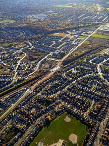 Disjointed urban sprawl in London
Ethnic Origin, 2001[44] Ethnic Origin Percentage English 31.9% Canadian 31.8% Scottish 21.6% Irish 19.1% German 10.6% French 9.2% Dutch 5.8% Italian 4.6% Polish 4.4% Portuguese 2.5% Ukrainian 2.4% multiple responses included According to the 2006 census, 84.8% of the population of London are White, 2.2% are Latin American, 2.2% are Arab, 2.2% are Black, 1.8% are Chinese, 1.8% are South Asian, 1.4% are Aboriginal, 1.1% are Southeast Asian, 0.6% are West Asian, and 1.9% are other ethnicities.[42]
Economy
London's economy is dominated by medical research, locomotive production, insurance, and information technology.[citation needed] The London Life Insurance Company was founded there,[45] and Electro-Motive Diesels, Inc. (formerly General Motors' Electro-Motive Division) now builds most of its locomotives in London.[46] General Dynamics Land Systems also builds armoured personnel carriers in the city.[47] London is a centre of life sciences and biotechnology-related research; much of this is conducted or supported by the University of Western Ontario. The university adds about C$1.5 billion to the London economy annually.[48] The headquarters of the Canadian division of 3M are located in London, and both the Labatt and Carling breweries were founded there. A $223 million expansion project began in 1984, making Kellogg's Canada's 106,000 m2 (1,140,000 sq ft) London plant one of the most technologically advanced manufacturing facilities in the Kellogg Company.[49] A portion of the city's population work in factories outside of the city limits, including Ford and the General Motors automotive plant CAMI, and a Toyota plant in Woodstock. In 1999 the Western Fair Association introduced slot machines. Currently, 750 slot machines operate at the fair grounds year-round.[50] McCormick Canada, formerly Club House Foods, was founded in 1883 and currently employs more than 500 Londoners.
London's city centre mall, Galleria, named Citi Plaza in 2009, has suffered since the 2000 collapse of Eaton's and the loss of its Hudson's Bay Company store.[51] The large space left empty by the departure of the Bay has since been filled by London's central library.[51] Other sections of Galleria/Citi Plaza have also lost businesses, which have been replaced by campuses for London's major post-secondary education schools, Fanshawe College and the University of Western Ontario.[51]
A new $11-million cargo terminal was announced to be built at the London International Airport.[52] Two interchanges will also be upgraded to Parclo A4 configuration.
Prior to its dissolution, regional airline Air Ontario was headquartered in London.[53]
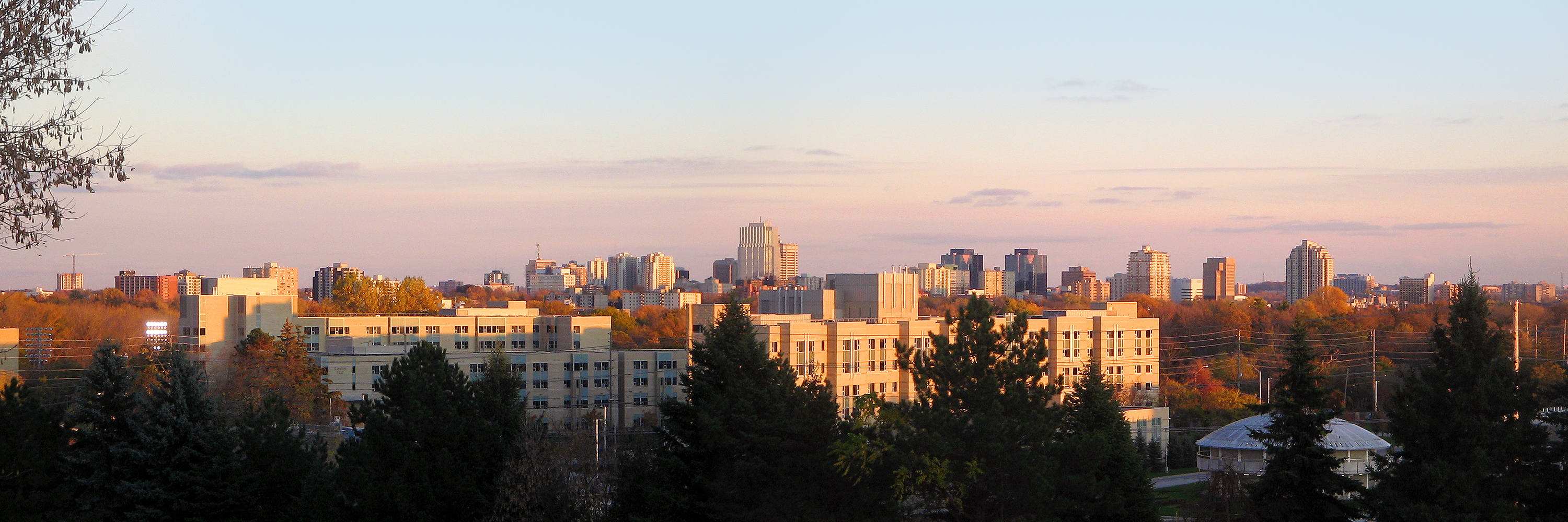
 Downtown London skyline in October 2011 viewed from Brescia College at the University of Western Ontario.
Culture
See also: Media in London, Ontario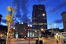 Boldly coloured metal trees in downtown are an example of cultural art in London.
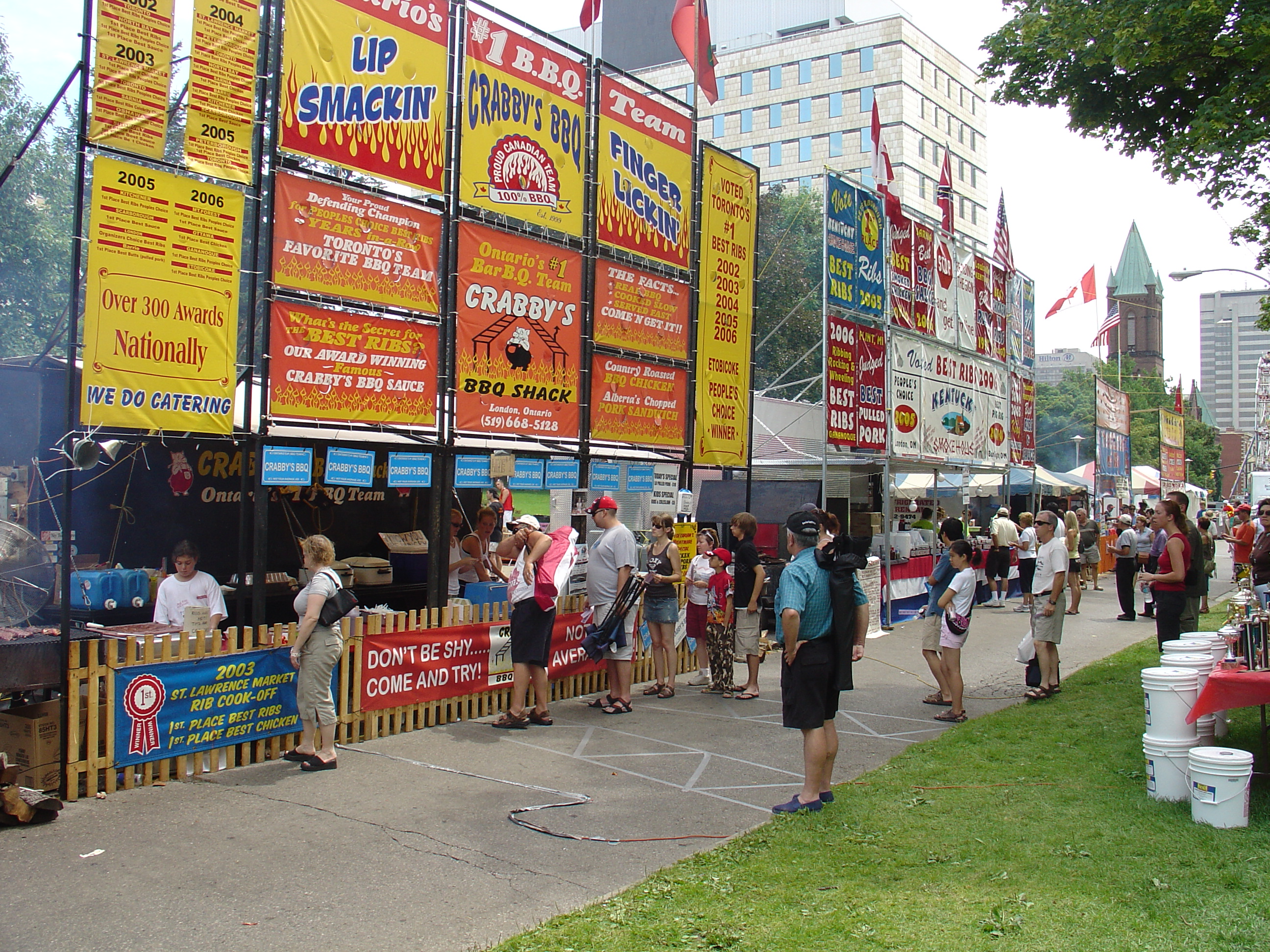
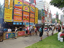 Patrons queue at the 2006 Rib-Fest in Victoria Park.
The city is home to many festivals, including Sunfest, the Home County Folk Festival, the London Fringe Theatre Festival, the Expressions in Chalk Street Painting Festival, Rock the Park, Western Fair, the London Ontario Live Arts Festival (LOLA) and The International Food Festival. The London Rib-Fest, where barbecue ribs are cooked and served, is the second largest barbecue rib festival in North America.[54] Pride London Festival is one of the biggest Pride festivals in Ontario.[55] Sunfest, a World music festival, is the second biggest in Canada after Caribana in Toronto, and is among the top 100 summer destinations in North America.[56]
Musically, London is home to Orchestra London, the London Youth Symphony, noise music pioneers the Nihilist Spasm Band, and the Amabile Choirs of London, Canada. There are several museums in London, including Museum London, which is located at the Forks of the Thames. Museum London exhibits art by a wide variety of local, regional and national artists.[57] London is also home to the Museum of Ontario Archaeology, owned by the University of Western Ontario (UWO). Its main feature is Canada's only on-going excavation and partial reconstruction of a prehistoric village of the Neutral Nation (Lawson Site).[58] Other museums include the London Regional Children’s Museum, the Royal Canadian Regiment Museum, and the Secrets of Radar Museum. The Guy Lombardo museum closed to the public in 2007 but its collection remains in London.[59][60]
London is also home to the McIntosh Gallery, an art gallery on the UWO campus, and the Grand Theatre, which is a professional theatre. The Open House Arts Collective is involved in promoting cultural activities in London.[61] The London Public Library also hosts art exhibitions and author readings.[62] The Writers Resource Center is the home of the Canadian Poetry Association London Chapter. The Forest City Gallery is one of Canada's first artist run centres.
Eldon House is the former residence of the prominent Harris Family and oldest surviving such building in London. The entire property was donated to the city of London in 1959 and is now a heritage site. An Ontario Historical Plaque was erected by the province to commemorate The Eldon House's role in Ontario's heritage.[63] The Banting House National Historic Site of Canada is the house where Sir Frederick Banting thought of the idea that led to the discovery of insulin. Banting lived and practiced in London for ten months, from July 1920 to May 1921. London is also the site of the Flame of Hope, which is intended to burn until a cure for diabetes is discovered.[64]
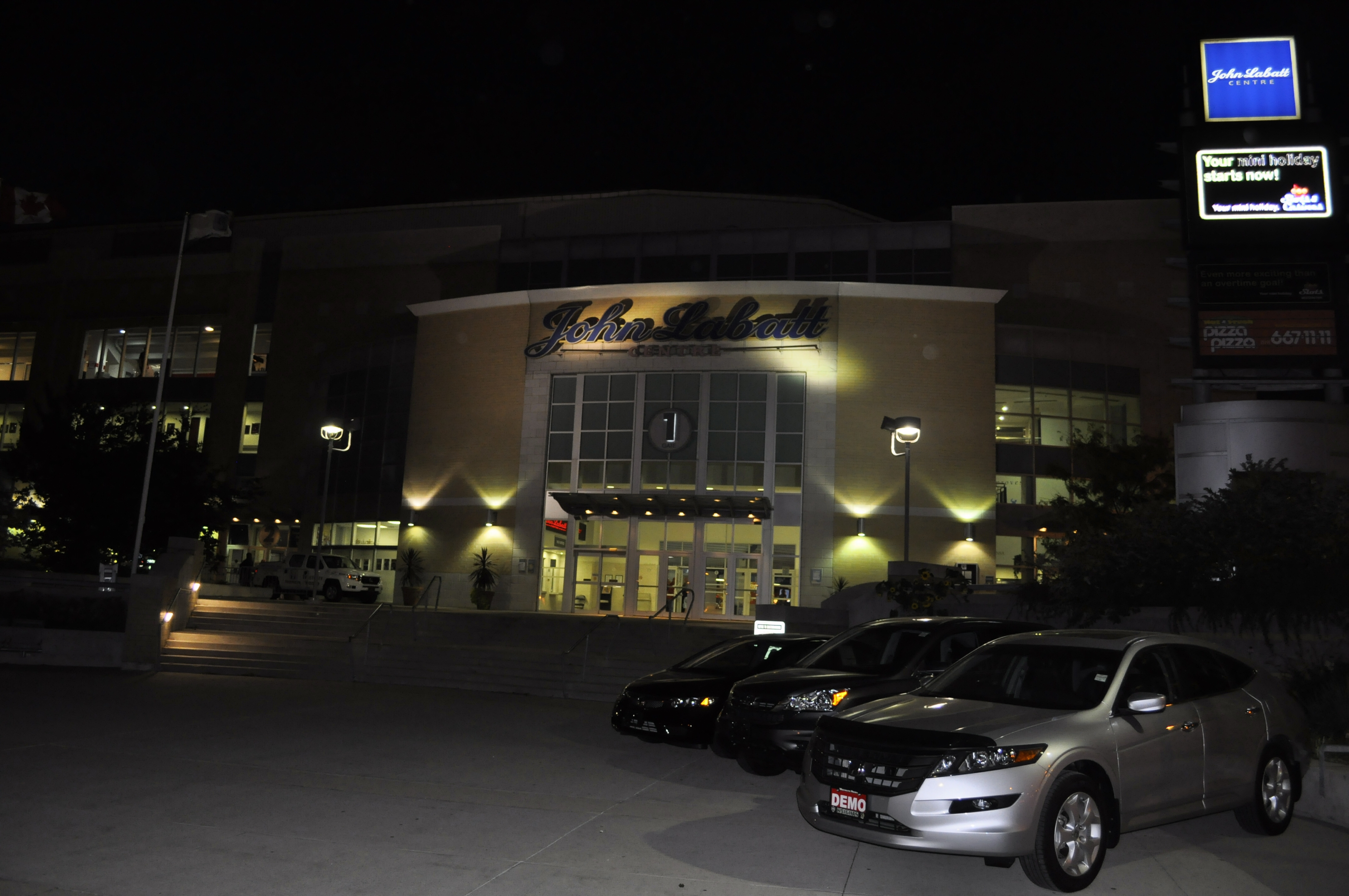
Sports
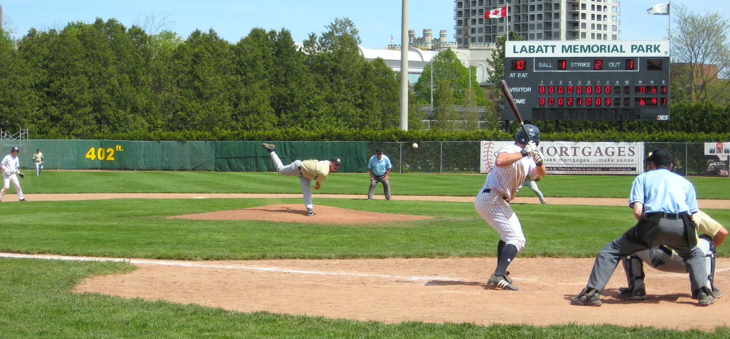
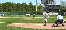 London Majors, Spring 2008
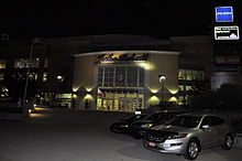
London is currently the home of the London Knights of the Ontario Hockey League, who play at the John Labatt Centre (JLC). The JLC was the host arena of the 2005 Memorial Cup.[65] The Knights were both 2004-2005 OHL and Memorial Cup Champions.[66] During the summer months, the London Majors of the Intercounty Baseball League play at Labatt Park. London City of the Canadian Soccer League, the second tier of professional Canadian Association Football, is the highest level of soccer in London. The club was founded in 1973; it is the oldest active professional soccer franchise in North America.[67] The squad plays at Cove Road Stadium at the German Canadian Club. This growth trend has led to discussions on more soccer fields and a larger indoor soccer complex within the city. Other sports teams include the London Silver Dolphins Swim Team, the Forest City Volleyball Club, the London St. George's Rugby Club, the London Aquatics Club, the London Rhythmic Gymnastics Club, London City Soccer Club and Forest City London.
Football teams include the London Silverbacks (North American Football League), the London Beefeaters (Ontario Football Conference), Forest City Thunderbirds (Ontario Football Conference) and London Falcons (Ontario Varsity Football League).
Starting in fall 2011, the London Lightning will begin play at the John Labatt Centre as members of the National Basketball League of Canada.
There are also a number of former sports teams that have now either moved or folded. London's four former baseball teams are the London Monarchs (Canadian Baseball League), the London Werewolves (Frontier League), the London Tecumsehs (International Association) and the London Tigers (AA Eastern League). Other former sports teams include the London Lasers (Canadian Soccer League) and the London Nationals (Western Ontario Hockey League).
The University of Western Ontario teams play under the name Mustangs. The university's football team plays at TD Waterhouse Stadium.[68] Western's Rowing Team rows out of one of two National Training Centres at Fanshawe Lake. Fanshawe College teams play under the name Falcons. The Women's Cross Country team has won 3 consecutive CCAA National Championships.[69] In 2010, the program cemented itself as the first CCAA program to win both Men's and Women's National team titles, as well as CCAA Coach of the Year.[70]
The Western Fair Raceway, a half-mile (802 m) harness racing track and simulcast centre, operates year-round.[71] The grounds include a coin slot casino, a former IMAX theatre, and Sports and Agri-complex. Labatt Memorial Park is the world's oldest continuously used baseball grounds[72] (established as Tecumseh Park in 1877; it was renamed in 1937);[73] the claim is disputed by Clinton, Massachusetts, because the London field has been flooded and rebuilt twice (1883 and 1937), including a re-orientation of the bases (after the 1883 flood), and there is doubt Tecumseh Field was in continuous use after the 1883 flood.[74] The Forest City Velodrome, located at the former London Ice House, is the only indoor cycling track in Ontario and the third to be built in North America, opened in 2005.[75]
Current franchises
Active sports teams in London Club League Sport Venue Established Championships London Knights OHL Ice hockey John Labatt Centre 1965 1 London Lightning NBL Canada Basketball John Labatt Centre 2011 0 London Majors IBL Baseball Labatt Memorial Park 1925 9 London St. George's RFC ORU (Marshall Premiership) Rugby Union London St. George's Club 1959 0 London City CSL Soccer Cove Road Stadium 1973 0 Forest City London USL Premier Development League Soccer TD Waterhouse Stadium 2009 0 London Beefeaters CJFL Canadian Football TD Waterhouse Stadium 1975 0 London Blue Devils Ontario Junior B Lacrosse League Lacrosse Earl Nichols Recreation Centre 2003 0 Forest City Thunderbirds Ontario Football Conference Canadian Football Westminster Secondary School 2000 3 London Thunder North American Football League American Football City Wide Sports Park 2010 0 Law and government
See also: London City Council and List of mayors of London, Ontario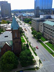 Wellington Street in downtown London viewed atop London City Hall.
London's municipal government is divided among fourteen councillors (one representing each of London's fourteen wards) and the mayor. London's current mayor is Joe Fontana. Until the elections in 2010, there was a Board of Control, consisting of four controllers and the mayor, all elected city-wide.[76]
The composition of the City Council was challenged by two ballot questions during the civic election of 2003.[77] A proposal to restructure the municipal government would have seen the council reduced to ten wards and the Board of Control eliminated.[77] The council could not come to a determination and as a result decided to put two questions on the ballot for the fall 2003 election: whether city council should be reduced in size and whether the Board of Control should be eliminated.[77] While the "yes" votes prevailed in both instances, the voter turnout failed to exceed 50 per cent and was therefore insufficient to make the decisions binding under the Municipal Act.[77] When the council voted to retain the status quo, Imagine London, a citizens group, petitioned the Ontario Municipal Board (OMB) to change the ward composition of the city from seven wards in a roughly radial pattern from the downtown core, to 14 wards defined by communities of interest.[77]
The OMB ruled for the petitioners in December 2005 and, while the city sought leave to appeal the OMB decision via the courts, leave was denied on February 28, 2006, in a decision of Superior Court's Justice McDermid.[78] In response, the city conceded change, but asked for special legislation from the province to ensure that there will only be one councillor in each of the 14 new wards, not two.[79] On June 1, 2006, the Ontario bill received royal assent, which guarantees that London will have one councillor per ward.[79]
Although London has many ties to Middlesex County, it is now "separated" and the two have no jurisdictional overlap. The exception is the Middlesex County courthouse and former jail, as the judiciary is administered directly by the province.[80]
In the provincial government, London is represented by two Liberals: Chris Bentley (London West) and Deb Matthews (London North Centre), PC: Jeff Yurek (Elgin—Middlesex—London), and NDP: Teresa Armstrong (London—Fanshawe).[81] In the federal government, London is represented by Conservatives Ed Holder (London West), Joe Preston (Elgin—Middlesex—London) and Susan Truppe (London North Centre), and NDP Irene Mathyssen (London—Fanshawe).[82]
Civic initiatives
Special City of London initiatives in Old East London are helping to create a renewed sense of vigour in the East London Business District. Specific initiatives include the creation of the Old East Heritage Conservation District under Part V of the Ontario Heritage Act, special Building Code policies and Facade Restoration Programs.[83]
London is home to heritage properties representing a variety of architectural styles,[84] including Queen Anne, Art Deco, Modern, and Brutalist
Londoners have become protective of the trees in the city, protesting "unnecessary" removal of trees.[85] The City Council and tourist industry have created projects to replant trees throughout the city. As well, they have begun to erect metal trees of various colours in the downtown area, causing some controversy.[86]
Transportation
See also: List of roads in London, OntarioRoad transportation
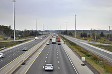
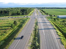
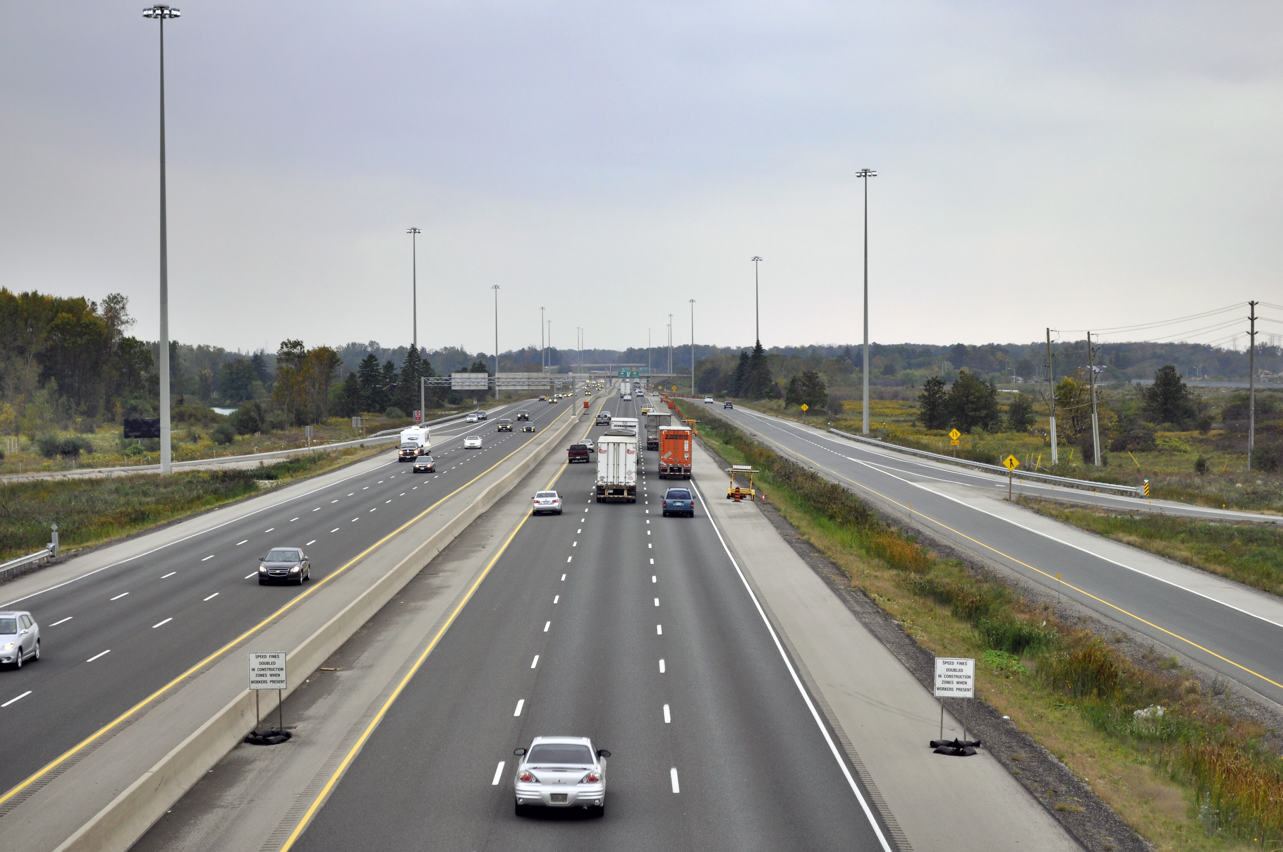
London is at the junction of Highway 401 that connects the city to Toronto and Detroit, and Highway 402 to Sarnia.[87][88] Also, Highway 403, which diverges from the 401 at nearby Woodstock, Ontario, provides ready access to Brantford, Hamilton, the Golden Horseshoe area, and the Niagara Peninsula.[89] Many smaller two-lane highways also pass through or near London, including Kings Highways 2, 3, 4, 7 and 22. Many of these are "historical" names, as provincial downloading in the 1980s and 1990s put responsibility for most provincial highways on municipal governments.[90] Nevertheless, these roads continue to provide access from London to nearby communities and locations in much of Western Ontario, including Goderich, Port Stanley and Owen Sound.
Within London, the lack of a municipal freeway (either through or around the city) as well as the presence of two significant railways (each with attendant switching yards and few over/under-passes) contributes heavily to rush hour congestion.[91] These conditions cause travel times to be highly variable.[91] The Guy Lombardo Bridge section of Wonderland Road (between Springbank Drive and Riverside Drive) is London's busiest section of roadway, with more than 45,000 vehicles using the span on an average day[92] Since the 1970s, London has improved urban road alignments that eliminated "jogs" in established traffic patterns over 19th-century street mis-alignments.
London's public transit system is run by the London Transit Commission, which has 38 bus routes throughout the city.[93] The Transit Commission has been improving bus service over the years, but not enough to cope with the city's growing number of riders during peak periods.[91] Bus service is currently the only mode of public transit available to the public in London, with no ground light rail or rapid transit networks like those used in other Canadian cities.[91] London does have several taxi and for-hire limousine services. Recently, London has constructed cycleways along some of its major arteries in order to encourage a reduction in automobile use.[91]
"London Ring Road" controversy
City council rejected early plans for the construction of a freeway, and instead accepted the Veterans Memorial Parkway to serve the east end.[94] Another freeway near the city's western edge was also under consideration, as future traffic volumes for the city may outpace capacity for the north/south western arteries, even with massive widening projects.[91] Some Londoners have expressed concern that the absence of a local freeway may hinder London's economic and population growth,[91] which have been far behind growth rates of other Canadian cities for some time. Many other Londoners have voiced concern that such a freeway would destroy environmentally sensitive areas and further contribute to London's already uncontrolled suburban sprawl.[91]
Road capacity improvements have been made to Veterans Memorial Parkway (formerly named Airport Road and Highway 100) in the industrialized east end.[95] However, the Parkway has received criticism for not being built as a proper highway; a recent city-run study suggested upgrading it by replacing the intersections with interchanges.[96]
Intercity transport
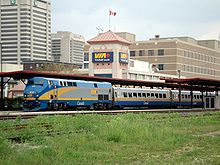 The Via Rail station in downtown London is Canada's fourth busiest railway terminal.
London is on the Canadian National Railway main line between Toronto and Chicago (with a secondary main line to Windsor) and the Canadian Pacific Railway main line between Toronto and Detroit.[97] Via Rail operates regional passenger service through London station as part of the Quebec City-Windsor Corridor, with connections to the United States.[98] Via Rail's London terminal is the fourth-busiest passenger terminal in Canada.[97]
London is also a destination for inter-city bus travellers. London is the seventh-busiest Greyhound Canada terminal in terms of passengers,[99] and connecting services radiate from London throughout southwestern Ontario and through to the American cities of Detroit, Michigan and Chicago, Illinois.
Aboutown Transportation is a diversified transportation company based in the city that operates the North Link,[100] intercity bus service from Owen Sound, and six transit bus routes between Kings and Brescia Colleges, and the main campus at the University of Western Ontario.
London International Airport (YXU) is the 12th busiest passenger airport in Canada and the 11th busiest airport in Canada by take-offs and landings.[97] It is served by airlines including Air Canada Jazz, United Airlines and WestJet, and provides direct flights to both domestic and international destinations, including Toronto, Chicago, Las Vegas, Orlando, Ottawa, Winnipeg, Calgary and Cancun Mexico.[101]
Plans
The city of London is considering bus rapid transit (BRT), ground light rail (GLR), and/or high-occupancy vehicle lanes (HOV) to help it achieve its long-term transportation plan.[91] Additional cycleways are planned for integration in road-widening projects, where there is need and sufficient space along routes.[91] An expressway/freeway network is possible along the eastern and western ends of the city, from Highway 401 (and Highway 402 for the western route) past Oxford Street, potentially with another highway, joining the two in the city's north end.[91]
A parclo interchange between Highway 401 and Wonderland Road has been planned to move traffic more efficiently through the city's southwest end.[102] It will probably be built when the Ontario Ministry of Transportation widens Highway 401 from four to six lanes between Highway 4 and Highway 402 and reconstructs the outdated cloverleaf interchange with nearby Colonel Talbot Road.[103] Construction could start as early as 2015.[104]
The City of London has assessed the entire length of the Veterans Memorial Parkway, identifying areas where interchanges can be constructed, grade separations can occur, and where cul-de-sacs can be placed. Upon completion, the Veterans Memorial Parkway would no longer be an expressway, but a freeway, for the majority of its length.[105]
Education
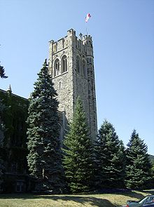 Middlesex Memorial Tower, University College, UWOSee also: List of schools in London, Ontario
London public elementary and secondary schools are governed by four school boards – the Thames Valley District School Board, the London District Catholic School Board and the French first language school boards (le Conseil scolaire de district du Centre-Sud-Ouest and le Conseil scolaire de district des écoles catholiques du Sud-Ouest).[106] There are also over twenty private schools in the city.[106]
The city is home to two post-secondary institutions: the University of Western Ontario (UWO) and Fanshawe College, a college of applied arts and technology.[106] The UWO, founded in 1878, has about 3500 full time faculty and staff members and almost 30,000 undergraduate and graduate students.[107] It placed tenth in the 2008 Maclean's magazine rankings of Canadian universities.[108] The Richard Ivey School of Business, part of UWO, was formed in 1922 and ranked among the best business schools in the country by the Financial Times in 2009.[109] UWO has three affiliated colleges: Brescia University College, founded in 1919 (Canada's only university-level women's college);[110][111] Huron University College, founded in 1863 (also the founding college of UWO) and King's University College, founded in 1954.[112][113] All three are liberal arts colleges with religious affiliations: Huron with the Anglican Church of Canada, King's and Brescia with the Roman Catholic Church.[114] London is also home to Lester B. Pearson School for the Arts one of few of its kind.
Fanshawe College has an enrollment of approximately 15,000 students, including 3,500 apprentices and over 500 international students from over 30 countries.[115] It also has almost 40,000 students in part-time continuing education courses.[115] Fanshawe's Key Performance Indicators (KPI) have been over the provincial average for many years now, with increasing percentages year by year.[116]
The Ontario Institute of Audio Recording Technology (OIART) is also in London. Founded in 1983, it offers recording studio experience for audio engineering students.[117]
Sister cities
London currently has one sister city:[118]
See also
- List of people from London, Ontario
- List of tallest buildings in London, Ontario
- CFB London
References
- ^ a b "London (City) community profile". 2006 Census data. Statistics Canada. http://www12.statcan.gc.ca/census-recensement/2006/dp-pd/prof/92-591/details/page.cfm?Lang=E&Geo1=CSD&Code1=3539036&Geo2=PR&Code2=35&Data=Count&SearchText=London&SearchType=Begins&SearchPR=01&B1=All&Custom=. Retrieved 2011-02-15.
- ^ a b "London (Census metropolitan area) community profile". 2006 Census data. Statistics Canada. http://www12.statcan.gc.ca/census-recensement/2006/dp-pd/prof/92-591/details/page.cfm?Lang=E&Geo1=CMA&Code1=555&Geo2=PR&Code2=35&Data=Count&SearchText=London&SearchType=Begins&SearchPR=01&B1=All&Custom=. Retrieved 2011-02-15.
- ^ Annual Demographic Estimates: Subprovincial Areas: Table 1.3-1 — Annual population estimates and demographic factors of growth by census metropolitan area, Canada, from July t...
- ^ a b Canada: wonderland of surprises, Max Braithwaite, Dodd, Mead, 1967
- ^ Guy St-Denis, Byron:Pioneer Days in Westminster Township (Crinklaw Press, Lambeth Ontario,1985, ISBN 0-919939-10-4), pgs. 21-22.
- ^ Greg Curnoe, Deeds/Abstracts: The History of a London Lot (Brick Books, London Ontario,1995, ISBN 0-919626-78-5), pgs.41.
- ^ "Missionary work Among The Ojebway Indians chap. 14". PROJECT GUTENBERG. http://www.ireadingroom.com/literature/etext04/ojebw10.txt. Retrieved 2008-07-02.[dead link]
- ^ Ellis, Christopher; D. Brian Deller. "An Early Paleo-Indian Site near Parkhill, Ontario". ASC Publications. Archived from the original on 2007-09-30. http://web.archive.org/web/20070930050430/http://www.civilization.ca/cmc/archeo/emercury/159.htm. Retrieved 2009-09-24.
- ^ Graeme Mercer Adam, Charles Pelham Mulvany, Christopher Blackett Robinson (1885). History of Toronto and County of York, Ontario: Containing an Outline of the History of the Dominion of Canada; a History of the City of Toronto and the County of York, with the Townships, Towns, General and Local Statistics; Biographical Sketches (Part II: The County of York). 1. C.B. Robinson. p. 9. "He was much in favour of the present site of London the Less, where he at one time had serious intentions of founding a city to be called Georgina, in honour of His Majesty King George III. But the founding of the Forest City was to be the work of other hands than his."
- ^ Spelt, J (1972). Urban development in south-central Ontario. McClelland and Stewart.
- ^ "Reservoir Hill". Ontario Municipal Board. February 2001. p. 40. http://www.ul.london.on.ca/urbanweb/News/News2005/OMBreservoirhill.pdf. Retrieved 2009-09-24.
- ^ a b c d e f g h i j k l m "The beginnings". City of London. 2009. http://www.london.ca/d.aspx?s=/About_London/london_history.htm. Retrieved 2009-09-24.
- ^ a b "Event Highlights for the City of London 1793 - 1843". City of London. http://www.london.ca/d.aspx?s=/About_London/timeline1-2.htm. Retrieved 2009-09-24.
- ^ a b c d "Event Highlights for the City of London 1844 - 1894". City of London. http://www.london.ca/d.aspx?s=/About_London/timeline3.htm. Retrieved 2009-09-24.
- ^ Adams, Bill (2002), The History of the London Fire Department of heroes, helmets and hoses. (1st ed.), London, Ontario Canada: London Fire Department, p. 13, ISBN 0-9732159-0-9
- ^ It was so called not because of the tree-lined streets, but because for many years it inhabited a cleared space in the encompassing forest. A more descriptive, if less elegant, cognomen was “London-in-the-Bush.” - London 200: An Illustrated History pg. 118
- ^ "Ontario White Sulphur Springs". The London and Middlesex Historical Society. http://www.londonhistory.org/bath.htm. Retrieved 2008-06-02.
- ^ John H. Lutman, The Historic Heart of London (Corporation of the City of London, 1977), p. 6.
- ^ The Blackfriars Street Bridge was produced by the Wrought Iron Bridge Company of Canton, Ohio. However, a local, Isaac Crouse (1825–1915), was its contractor. Crouse was also responsible for portions of the construction of a number of other bridges in the City. Although many repairs and modifications have been made to the bridge, it remains a historic relic designated under Part IV of the Ontario Heritage Act, continuously serving its original purpose.
- ^ Gregory K. R. Stott, The Maintenance of Suburban Autonomy: The Story of the Village of Petersville-London West, Ontario, 1874-1897, MA thesis, Department of History, University of Western Ontario, 1999, Ch. Four.
- ^ "Item 9b". London Advisory Committee on heritage. http://council.london.ca/meetings/Archives/Agendas/Planning%20Committee%20Agendas/Planning%20Committee%20Agendas%202004/2004-08-30%20Agenda/Item%209b.pdf. Retrieved 2009-09-25.
- ^ Wilson, Robert. "London East". London and Middlesex Historical Society. http://www.londonhistory.org/Londoneast.htm. Retrieved 2009-09-25.
- ^ "Broughdale Community Association". BCA. http://broughdale.ca/. Retrieved 2009-09-25.
- ^ "Event Highlights for the City of London 1930 - 1949". City of London. http://www.london.ca/d.aspx?s=/About_London/timeline6.htm. Retrieved 2009-09-25.
- ^ "Historical Flood-Related Events". Environment Canada. 2009-02-18. http://ontario.hazards.ca/historical/Flood_Ontario-e.html. Retrieved 2009-10-21.
- ^ "Event Highlights for the City of London 1950 - 1959". City of London. http://www.london.ca/d.aspx?s=/About_London/timeline7.htm. Retrieved 2009-09-25.
- ^ "Event Highlights for the City of London 1980 - 1989". City of London. http://www.london.ca/d.aspx?s=/About_London/timeline.htm. Retrieved 2009-09-25.
- ^ a b "London, Ontario". Department of National Defence. http://www.army.forces.gc.ca/land-terre/units-unites/index-eng.asp?action=City&id=39&rid=267#267. Retrieved 2009-09-25.
- ^ "Event Highlights for the city of London 1990 - 2000". City of London. http://www.london.ca/d.aspx?s=/About_London/timeline11.htm. Retrieved 2009-09-25.
- ^ Martin, Chip (December 29, 2007). "Did Annexation Work?". Special Report (London: London Free Press). http://74.125.95.132/search?q=cache:s9hkV_RIV10J:www.lfpress.ca/cgi-bin/publish.cgi%3Fp%3D220108%26s%3Dsociete+%22did+annexation+work%3F%22&cd=1&hl=en&ct=clnk&gl=ca.
- ^ "New Directions in Urban Planning". Urban League of London. http://www.ul.london.on.ca/urbanweb/Links/UrbanPlanning/index.htm. Retrieved 2009-09-25.
- ^ "Environmentally Significant Areas". Urban League of London. 2006. http://www.ul.london.on.ca/urbanweb/ActiveCitizen/ESA/index.htm. Retrieved 2009-09-25.
- ^ "Population and dwelling counts, for census metropolitan areas, 2006 and 2001 censuses - 100% data". Statistics Canada. 2008-12-19. http://www12.statcan.gc.ca/census-recensement/2006/dp-pd/hlt/97-550/Index.cfm?TPL=P1C&Page=RETR&LANG=Eng&T=205&SR=1&S=3&O=D&RPP=33. Retrieved 2009-10-21.
- ^ "Population and dwelling counts, for urban areas, 2006 and 2001 censuses - 100% data". Statistics Canada. 2008-11-05. http://www12.statcan.ca/english/census06/data/popdwell/Table.cfm?T=801&PR=0&SR=1&S=3&O=D. Retrieved 2009-10-21.
- ^ "Ontario". Historica-Dominion. 2009. http://www.thecanadianencyclopedia.com/index.cfm?Params=A1ARTA0005936&PgNm=TCE. Retrieved 2009-09-25.
- ^ a b c "Your Guide to London's Major Public Parks & Gardens". City of London. http://www.london.ca/d.aspx?s=/Parks_and_Natural_Areas/Parks_guide.htm. Retrieved 2009-09-25.
- ^ "Fanshawe Dam". Upper Thames River Conservation Authority. http://www.thamesriver.on.ca/Water_Management/Fanshawe_Dam.htm. Retrieved 2009-09-25.
- ^ "Atlas of Canada - Weather". Natural Resources Canada. 2009. http://atlas.nrcan.gc.ca/site/english/learningresources/facts/superweather.html. Retrieved 2009-09-24.
- ^ a b "Canadian Climate Normals". Environment Canada. April 2009. http://www.climate.weatheroffice.ec.gc.ca/climate_normals/results_e.html?Province=ALL&StationName=London&SearchType=BeginsWith&LocateBy=Province&Proximity=25&ProximityFrom=City&StationNumber=&IDType=MSC&CityName=&ParkName=&LatitudeDegrees=&LatitudeMinutes=&LongitudeDegrees=&LongitudeMinutes=&NormalsClass=A&SelNormals=&StnId=4789&. Retrieved 2009-09-25.
- ^ a b http://www.lfpress.com/news/london/2010/12/07/16460466.html
- ^ Environment Canada—Canadian Climate Normals 1971–2000. Retrieved 13 August 2009.
- ^ a b c d e f g "2006 Community Profiles". Statistics Canada. 2006. http://www12.statcan.ca/census-recensement/2006/dp-pd/prof/92-591/details/Page.cfm?Lang=E&Geo1=CSD&Code1=3539036&Geo2=PR&Code2=35&Data=Count&SearchText=London&SearchType=Begins&SearchPR=01&B1=All&Custom=. Retrieved 2009-09-24.
- ^ a b "2001 Community Profiles". Statistics Canada. http://www12.statcan.ca/english/Profil01/CP01/Details/Page.cfm?Lang=E&Geo1=CSD&Code1=3539036&Geo2=PR&Code2=35&Data=Count&SearchText=london&SearchType=Begins&SearchPR=01&B1=All&Custom=. Retrieved 2009-09-25.
- ^ Ethnic Origins in Lond,on Ontario. Statistics Canada. Retrieved on 14 December 2010.
- ^ "Company Overview". Corporate Information. London Life. 2006. http://www.londonlife.com/002/Home/CorporateInformation/CompanyOverview/index.htm. Retrieved 2009-07-19.
- ^ "Partnership with EMD". Rail Action. http://www.railaction.ca/english/partnership.php. Retrieved 2009-07-19.
- ^ "General Dynamics Awarded $5 Million Contract to Perform Engineering Studies in Support of Mobile Gun System". General Dynamics Land Systems. October 22 , 2004. http://www.gdlscanada.com/news/releases/Oct-22-2004.asp. Retrieved 2009-07-19.
- ^ "London Labour Market Monitor". Service Canada. January 2009. http://www.servicecanada.gc.ca/eng/on/offices/1208lmb/london.shtml. Retrieved 2009-07-19.
- ^ "Kellogg Canada London Plant". Kellogg Canada Inc. 2006. http://www.kelloggs.ca/whoweare/london_plant.htm. Retrieved 2009-07-19.
- ^ "Western Fair Slots". Londonkiosk. http://www.londonkiosk.ca/westernfairslots.php. Retrieved 2009-07-19.
- ^ a b c Clark, Christopher (May 2009). "Transformation Citi". Business London. http://www.christopherclarkwriter.com/citi%20plaza%20website.doc. Retrieved 2009-10-21.
- ^ "[1]" London International Airport.Retrieved on November 30, 2009.
- ^ "Contact." Air Ontario. Retrieved on May 21, 2009.
- ^ "Ribfest". Family Shows Canada. http://www.festivalsontario.com/. Retrieved 2009-09-24.
- ^ "Pride London Festival". Pride London Festival. http://www.pridelondon.ca/. Retrieved 2009-09-24.
- ^ "About Sunfest". Sunfest. http://www.sunfest.on.ca/. Retrieved 2009-09-24.
- ^ "About Us". Museum London. http://www.londonmuseum.on.ca/d.aspx?s=/About_Us/default.htm. Retrieved 2009-09-25.
- ^ "Museum of Ontario Archaeology". University of Western Ontario. http://www.uwo.ca/museum/. Retrieved 2009-09-25.
- ^ "Clock strikes midnight for Guy Lombardo museum". National Post, Toronto Canada. October 29, 2007. http://www.canada.com/nationalpost/news/canada/story.html?id=98ede43c-eb4c-46f4-bd96-6c57874593a2. Retrieved 2009-10-23.
- ^ "Lombardo relics off limits to city". The London Free Press. January 30, 2009.
- ^ "About". Open House Arts Collective. http://openhouseartscollective.com/?page_id=2. Retrieved 2009-09-25.
- ^ "London Public Library". http://www.londonpubliclibrary.ca/. Retrieved 2009-09-25.
- ^ "Eldon House Historical Plaque". Archives of Ontario. 2005. http://www.ontarioplaques.com/Plaques_MNO/Plaque_Middlesex13.html. Retrieved 2009-09-24.
- ^ "Sir Frederick G. Banting Square". Canadian Diabetes Association. http://www.diabetes.ca/about-us/who/banting-house/banting-square/. Retrieved 2009-09-25.
- ^ "John Labatt Centre A-Z Guide". John Labatt Centre. http://johnlabattcentre.com/a-to-z.html. Retrieved 2009-09-27.
- ^ "History". John Labatt Centre. http://johnlabattcentre.com/generalinfo-history.html. Retrieved 2009-09-27.
- ^ "Canadian Soccer League". 2007. http://www.canadiansoccerleague.ca/news_archive.php?news_id=76064. Retrieved 2009-09-24.
- ^ "Facilities". University of Western Ontario. 2009. http://www.westernmustangs.ca/sports/2009/7/6/GEN_0706090232.aspx?tab=facilities. Retrieved 2009-09-27.
- ^ "Les coureurs de Lethbridge franchissent la ligne d'arrivée en premier au Championnat ouvert de Course de Cross country 2008 de l'ACSC" (in French). CCAA. June 2009. http://www.ccaa.ca/web/index.php/fr/cc-nouvelles-archivees/190-lethbridge-runners-cross-the-finish-line-first-at-the-2008-ccaa-cross-country-running-open. Retrieved 2009-09-27.
- ^ "Alberta Runners Top 2010 CCA Cross Country Running Nationals". ccaa.ca. http://www.ccaa.ca/web/index.php/en/cc-news-archive/601-alberta-runners-top-2010-ccaa-cross-country-running-nationals.
- ^ "Western Fair Raceway". Western Fair Entertainment Centre. 2006. http://www.westernfair.com/race/home.html. Retrieved 2009-09-27.
- ^ "Parks and Recreation Newsletter". City of London. June 2008. http://www.london.ca/Sports_and_Recreation/PDFs/2008Newsletter.pdf. Retrieved 2009-09-27.
- ^ Boswell, Randy. "Claim to oldest baseball field 'in limbo'", Saskatoon Star Phoenix (from Canwest news wire), 6 October 2008, p.B5.
- ^ Boswell, p.B5.
- ^ "Attractions". City of London. 2009. http://www.london.ca/d.aspx?s=/Attractions/default.htm. Retrieved 2009-09-27.
- ^ "Your December 2006 - November 2010 Council". City of London. 2006. http://www.london.ca/d.aspx?s=/City_Council/default.htm. Retrieved 2009-09-27.
- ^ a b c d e "PL050623". Ontario Municipal Board. November 2005. http://www.omb.gov.on.ca/e-decisions/pl050623_%233072.pdf. Retrieved 2009-09-27.
- ^ Sher, Jonathan (March 1, 2006). "Judge rejects ward appeal". London Free Press.
- ^ a b "An Act respecting the City of London". Government of Ontario. June 2006. http://www.lois-en-ligne.gouv.on.ca/Download?dID=167114. Retrieved 2009-09-27.
- ^ "Middlesex County Information". Middlesex County. http://www.county.middlesex.on.ca/CountyInformation/About_Middlesex.asp. Retrieved 2009-09-27.
- ^ "Current MPPs". Legislative Assembly of Ontario. http://www.ontla.on.ca/web/members/members_current.do?locale=en&ord=Riding&dir=ASC&list_type=all_mpps. Retrieved 2009-09-27.
- ^ "Members of Parliament". Parliament of Canada. http://webinfo.parl.gc.ca/MembersOfParliament/MainMPsCompleteList.aspx?TimePeriod=Current&Language=E. Retrieved 2011-06-07.
- ^ "Re-establishing Value". Ontario Professional Planners Institute. http://www.oldeastvillage.com/pdf_reports/Re-establishingValue-aPlanfortheOldEastVillage.pdf. Retrieved 2009-07-17.
- ^ "Heritage Inventory". City of London. http://www.london.ca/d.aspx?s=/Heritage/HeritageCitymap.htm. Retrieved 2009-09-24.
- ^ "London Tourism Information". London Kiosk. 2009. http://www.londonkiosk.ca/london-tourism.php. Retrieved 2009-09-27.
- ^ Haggarty, Jaclyn (2008-09-30). "Metal Tree Planting Continues". UWO Gazette. p. 1. http://www.gazette.uwo.ca/pdf/Gazette-2008-09-30.pdf. Retrieved 2009-10-21.
- ^ "Getting to London". LEDC. 2006. Archived from the original on 2008-05-03. http://web.archive.org/web/20080503121435/http://goodmovelondon.com/gettingto/. Retrieved 2009-09-27.
- ^ "Ontario government improving Highway 402 between London and Sarnia". Government of Ontario. 2009. http://www.mto.gov.on.ca/english/news/regional/2000/2000-0001.shtml. Retrieved 2009-09-27.
- ^ Bevers, Cameron (2002). "The King's Highway 403". http://www.thekingshighway.ca/Highway403.htm. Retrieved 2009-09-27.
- ^ Bevers, Cameron (2002). "The King's Highway 24". http://www.thekingshighway.ca/Highway24.htm. Retrieved 2009-09-27.
- ^ a b c d e f g h i j k "TRANSPORTATION MASTER PLAN". City of London. May 2004. pp. 1–3, 9, 19–20. http://www.london.ca/Transportation/PDFs/TMPFinal.pdf. Retrieved 2009-09-27.
- ^ City of London (Year 2002 traffic volumes). "City of London Traffic Volume Data". http://www.london.ca/d.aspx?s=/Transportation/trafficvol.htm. Retrieved April 28, 2010. "Did you know that Wonderland Road between Riverside Drive and Springbank Drive is London's most travelled section of roadway carrying 45,000 vehicles per day?"
- ^ "Routes and Schedules". London Transit Commission. http://www.ltconline.ca/Routes.htm#first-section. Retrieved 2009-09-27.
- ^ "Long-Term Transportation Corridor Protection Study". City of London. http://www.london.ca/d.aspx?s=/Transportation/corridorstudy.htm. Retrieved 2009-09-27.
- ^ Steeves, Scott (2004). "King's Highway 401 - Images". Archived from the original on 2007-08-07. http://web.archive.org/web/20070807234534/http://onthighways.com/hwy_401_images/Hwy401_p4_images.htm. Retrieved 2009-09-28.
- ^ "VETERANS MEMORIAL PARKWAY". City of London. 2007. http://www.london.ca/Transportation/PDFs/VMP-PicBoard2.pdf. Retrieved 2009-10-21.
- ^ a b c "Transportation". London Economic Development Corporation. 2006. Archived from the original on 2007-08-09. http://web.archive.org/web/20070809231730/http://www.londonedc.com/forsiteselectors/infrastructure/transportation/. Retrieved 2009-09-28.
- ^ "Train routes to/from London". Via Rail. http://www.viarail.ca/en/stations/ontario/london/routes. Retrieved 2009-09-28.
- ^ "Facts & Figures". Greyhound Canada. http://www.greyhound.ca/HOME/en/About/FactsAndFigures.aspx. Retrieved 2009-09-28.
- ^ "Aboutown Northlink". Aboutown. Archived from the original on May 6, 2008. http://web.archive.org/web/20080506140347/http://www.aboutown.ca/northlink/index.html. Retrieved 2009-09-24.
- ^ "Airlines and Tour Operators". London International Airport. http://www.londonairport.on.ca/airlines.html. Retrieved 2011-02-19.
- ^ "Item 19". City of London. July 2009. http://council.london.ca/meetings/Planning%20Agendas/2009-07-20%20Agenda/Item%2019.pdf. Retrieved 2009-09-28.
- ^ City of London (November 19, 2009). "London Transportation Report- Southwest Area Plan". http://www.london.ca/Reference_Documents/PDFs/TransportationReport.pdf. Retrieved April 16, 2010. "Future Interchanges/Upgrade: Colonel Talbot at Highway 401"[dead link]
- ^ Ontario Ministry of Transportation (October 2010). "Southern Highways Program 2010–2014". http://www.mto.gov.on.ca/english/pubs/highway-construction/southern-highway-2010/projects-beyond-2014.shtml. Retrieved October 24, 2010. "Projects beyond 2014: Highway 401 – Highway 402 to Highway 4, London"
- ^ City of London and Giffels (December 13, 2007). "VETERANS MEMORIAL PARKWAY INTERCHANGE CLASS ENVIRONMENTAL ASSESSMENT STUDY AND CONCURRENT APPLICATION TO AMEND THE OFFICIAL PLAN AND ZONING BY-LAW". http://www.london.ca/Transportation/PDFs/VMP-Notice2.pdf. Retrieved November 5, 2010. "The freeway design will reduce the congestion on the road network and improve overall safety while maintaining shorter travel time along the entire corridor to full build out conditions.."
- ^ a b c "Education". City of London. 2009. http://london.ca/d.aspx?s=/Education/default.htm. Retrieved 2009-09-28.
- ^ "About Western". University of Western Ontario. http://communications.uwo.ca/about/waywewere.htm. Retrieved 2009-09-28.
- ^ Travis, Heather (November 11, 2008). "Western 10th in Maclean's ranking". Western News. University of Western Ontario. http://communications.uwo.ca/com/western_news/stories/western_10th_in_maclean%27s_ranking_20081111443145/. Retrieved 2009-09-28.
- ^ "Global MBA Rankings 2009". Financial Times Ltd. 2009. http://rankings.ft.com/businessschoolrankings/global-mba-rankings. Retrieved 2009-09-24.
- ^ "A University Built for Women by Women". Brescia University College. http://www.brescia.uwo.ca/about/index.html. Retrieved 2009-09-28.
- ^ Kuntz, Dolores. "About Brescia". Brescia University College. Archived from the original on June 2, 2008. http://web.archive.org/web/20080602183103/http://www.brescia.uwo.ca/about/brescia/history/index.html. Retrieved 2009-09-28.
- ^ "Historical Information". Huron University College. Archived from the original on June 18, 2008. http://web.archive.org/web/20080618074047/http://www.huronuc.on.ca/about_huron/more_about_huron/historical_information/. Retrieved 2009-09-28.
- ^ "Quick Facts". King's University College. http://www.kings.uwo.ca/about/quick_facts/. Retrieved 2009-09-28.
- ^ "Western Facts". University of Western Ontario. 2008. http://www.ipb.uwo.ca/facts.php. Retrieved 2009-09-24.
- ^ a b "Why Fanshawe?". Fanshawe College. http://www.fanshawec.ca/EN/counsellors/teachers/why.html. Retrieved 2009-09-28.
- ^ "Key Performance Indicators". Fanshawe College. http://www.fanshawec.ca/EN/kpi/. Retrieved 2009-09-24.
- ^ "Practical Studio Experience". OIART. http://www.oiart.org/school/. Retrieved 2009-09-28.
- ^ "Board of Director Biographies". ReForest London. 2009. http://www.reforestlondon.ca/board-director-biographies. Retrieved 2009-10-21.[dead link]
Further reading
- Frederick H. Armstrong and John H. Lutman, The Forest City: An Illustrated History of London, Canada. Burlington, Ontario: Windsor Publications; 1986.
- Orlo Miller, London 200: An Illustrated History. London: London Chamber of Commerce; 1993.
- L. D. DiStefano and N. Z. Tausky, Victorian Architecture in London and Southwestern Ontario, Symbols of Aspiration. University of Toronto Press; 1986
- Greg Stott, “Safeguarding ‘The Frog Pond’: London West and the Resistance to Municipal Amalgamation, 1883-1897.” Urban History Review 2000 29(1): 53-63.
External links
- City of London Official website
- London Building Diagrams on Skyscraper Page
- Museum of Ontario Archeology
- Local Weather
- London Chamber of Commerce
- London Economic Development Corporation

Middlesex Centre Middlesex Centre 
Thames Centre  London

Southwold, Central Elgin Categories:


Wikimedia Foundation. 2010.