- Lambton County, Ontario
Infobox Settlement
name =
official_name =Lambton
other_name =
native_name =
nickname =
settlement_type =County
total_type =
motto =
imagesize =
image_caption =
flag_size =
image_
seal_size =
image_shield =
shield_size =
image_blank_emblem =
blank_emblem_type =
blank_emblem_size =
imagesize =
image_caption =
flag_size =
image_
seal_size =
image_shield =
shield_size =
image_blank_emblem =
blank_emblem_type =
blank_emblem_size =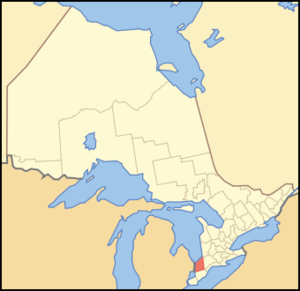
mapsize = 300px
map_caption = Location of Lambton County
mapsize1 =
map_caption1 =
image_dot_
dot_mapsize =
dot_map_caption =
dot_x = |dot_y =
pushpin_
pushpin_label_position =
pushpin_map_caption =
pushpin_mapsize =
subdivision_type = Country
subdivision_name = CAN
subdivision_type1 = Province
subdivision_name1 = ONT
subdivision_type2 =
subdivision_name2 =
seat_type =County seat
seat =Wyoming
parts_type =Municipalities
parts_style =
parts =
p1 =City of Sarnia
p2 = Municipality (city) of Lambton Shores
p3= Town of Petrolia
p4= Town of Plympton-Wyoming
p5= Township of Brooke-Alvinston
p6=Township of Dawn-Euphemia
p7= Township of Enniskillen
p8=Township of St. Clair
p9= Township of Warwick
p10= Village of Oil Springs
p11 =Village of Point Edward
government_footnotes =
government_type =
leader_title =
leader_name =
leader_title1 =
leader_name1 =
established_title = Formed
established_date = 1849
area_magnitude =
unit_pref =Imperial
area_footnotes =cite web |url=http://www12.statcan.ca/english/census06/data/profiles/community/Details/Page.cfm?Lang=E&Geo1=CD&Code1=3538&Geo2=PR&Code2=35&Data=Count&SearchText=Lambton&SearchType=Begins&SearchPR=35&B1=All&Custom= |title=Community highlights for Lambton |accessdate=2007-12-28 |date=2006 |work= |publisher=]
area_total_km2 =
area_land_km2 =3001.70
area_water_km2 =
area_total_sq_mi =
area_land_sq_mi =1158.96
area_water_sq_mi =
area_water_percent =
elevation_footnotes =
elevation_m =
elevation_ft =
elevation_max_m =
elevation_max_ft =
elevation_min_m =
elevation_min_ft =
population_as_of =2006
population_footnotes =
population_note =
population_total =128204
population_density_km2 =42.7
population_density_sq_mi =110.6
timezone = EST
utc_offset = -5
timezone_DST = EDT
utc_offset_DST = -4
coor_type =
latd= |latm= |lats= |latNS=
longd= |longm= |longs= |longEW=
postal_code_type =
postal_code =
area_code =
website = [http://www.lambtononline.ca/ www.lambtononline.ca/]
footnotes =Lambton County, Ontario (2006 pop. 128,204) is a
census division of theCanadian province ofOntario . Thecounty is located inSouthwestern Ontario . It is bordered on the north byLake Huron , which flows into theSt. Clair River , the county's western border and part of theCanada -United States border. To the south is Lake Saint Clair and Chatham-Kent, another county in Ontario. Lambton County's eastern border follows the Ausable River north until it reachesLake Huron at the beach community of Grand Bend. The county seat is in the township of Wyoming.Cite web|url=http://www.lambtononline.com/contact_us|title=Contact Us - The Corporation of the County of Lambton|accessdate = 2006-11-19]Lambton County started as a part of the District of Hesse. The district of Hesse included British territories west of
Long Point , (practically all of western Ontario). The district was latter divided and renamed using English district names (Essex, Sulfolk, Kent, etc). Lambton was part of Kent county. In 1849 districts were abolished and the County of Lambton was formed. Lambton and Kent first shared the capital city of Sandwich (since renamed asWindsor, Ontario ). In 1852 the partnership was devolved and Lambton become of full county. It is named in honour of the Earl of Durham who lived inLambton Castle . (Source: "London Free Press", July 15, 1939, by W.G. Trestain)The largest city in Lambton County is Sarnia,Cite web|url=http://www.city.sarnia.on.ca/visit.asp?sectionid=409|title=City of Sarnia - Population and Location|accessdate = 2006-11-19] which is located at the mouth of the St. Clair River. The two
Blue Water Bridge s cross the river at Sarnia, connecting it toPort Huron, Michigan . The bridges are one of the busiest border crossings between the two countries. The river is also traversed by two passenger ferries further south, and a rail tunnel, also at Sarnia, runs underneath it.Today, the petrochemical industry is arguably the most important sector of Lambton County's economy. Established during
World War II , Sarnia and the area along the St. Clair River is home to a major processing centre for oil fromAlberta . Lambton County is the site of North America's first drilled commercial oil well atOil Springs, Ontario in 1858. Now, the petrochemical industry is so pervasive that it has earned this region along the river the nickname "Chemical Valley". Often themoniker is used after a chemical spill into the river or a day of extremeair pollution .Tourism is another important industry in Lambton County, especially along the lake and river. The community of
Grand Bend , and thePinery Provincial Park are especially popular tourist destinations, attracting thousands of people each week throughout the summer to their long, uninterrupted beaches. The part of Lambton County along Lake Huron known as Lambton Shores depends almost entirely upon the seasonal industries of tourism and agriculture for its well-being. There are also popular conservation areas along the St. Clair River, and a conservation area namedRock Glen Falls near Arkona along the Ausauble River internationally known for its Devonian Era fossils.Though no longer as important to the county's economy, agriculture is still what sustains many small towns in the interior of Lambton County. The three most popular crops are corn,
wheat , andsoybeans , althoughcanola andsugar beet s (among other things) are sometimes planted. Many farmers raisecattle in addition to growing crops.Highways
*, where it meets at the U.S. border and connects with
*.Municipalities
Cities and Towns
* City of Sarnia
* Municipality (city) of Lambton Shores
* Town of Petrolia
* Town of Plympton-WyomingTownships and Villages
* Township of Brooke-Alvinston
* Township of Dawn-Euphemia
* Township of Enniskillen
* Township of St. Clair
* Township of Warwick
* Village of Oil Springs
* Village of Point EdwardOjibwe andFirst Nation CommunitiesThe
Chippewas of Kettle and Stony Point First Nation occupy the Kettle Point area, separate from the surrounding municipality of Lambton Shores but included in the county. TheAamjiwnaang First Nation is located in the shadows of many of the refineries in Sarnia's Chemical Valley.Walpole Island also has a First Nation community, near Wallaceberg.Communities
*Alvinston
*Arkona
*Brigden
*Brights Grove
*Corunna
*Courtright
*Forest
*Grand Bend
*Petrolia
*Port Franks
*Port Lambton
*Sarnia
*Sombra
*Thedford
*Walpole Island
*Watford
*WyomingAdjacent counties and municipalities
* Huron County (northeast)
* Middlesex County (east)
*Chatham-Kent (south)
* St. Clair County,Michigan , US (west)ee also
*
List of Ontario Census Divisions References
External links
* [http://www.grandbendstrip.com/ "Grand Bend Strip" community newspaper - serving north Lambton County (Grand Bend and Port Franks).]
* [http://www.visitgrandbend.com Visit Grand Bend - North Lambton Visitor Guide]
* [http://www.historicbridges.org/b_c_on_lambton.htm Historic bridges in Lambton County]
* [http://www.lambtononline.ca/ Lambton County - The Corporation of the County of Lambton.]
* [http://www.ourroots.ca/e/toc.aspx?id=3683 Lambton County History.]
* [http://www.sarnialiberals.ca Sarnia-Lambton Federal Liberal Association.]
Wikimedia Foundation. 2010.