- List of roads in London, Ontario
-
The following is a List of the major roads in London, a major city in southwestern Ontario.
Adelaide Street
Adelaide Street is a north-south arterial road in London, Ontario, Canada.
Its northern terminus is at Highway 7. It runs through London where it is bisected into northern and southern halves by the south branch of the Thames River and ends at Commissioners Road East. It continues two kilometres south at Southdale Road East where it ends south of Newbold Street, just metres north of Highway 401.
History
The reason for the road interruption is because Westminster Ponds is situated between Commissioners and Southdale Roads.
In the early 1970s, there had existed plans to extend Adelaide as a four-lane road to meet with Pond Mills Road at Southdale using a CNR track's right-of-way, or to meet with its southern continuation. These plans were abandoned after Westminster Ponds were declared an environmentally significant area.
At the same time, transportation-oriented studies suggested that Adelaide Street South be connected with Exeter Road, the then-Highway 135. These plans have since been abandoned as Exeter Road was eventually connected to Highway 401 via a westbound-only interchange.
The city outlined in their 2005 edition of their official plan to extend Adelaide Street south of Highway 401 to meet Sise Road at Wilton Grove Road. There is yet to be a timeline to be announced for this roadwork.
Boler Road
Boler Road is a north-south arterial road, extending from the Thames River (where it connects to Sanatorium Road), southward through Byron to end at Southdale Road. Sanatorium Road continues north, joining Riverside Drive and ending at Oxford Street in the Oakridge area.
History
Boler Road originally ran southward from Old Bridge Road in Byron. In the mid-1960s, the one-lane truss bridge over the Thames River connecting Boler Road to Riverside Drive was replaced with a deck bridge, and Boler Road was diverted onto the new bridge.
In the 1970s, there were conceptual plans to realign Boler Road south of Baseline Road to join Colonel Talbot Road north of Southdale Road. This bypass, which was never constructed, would have departed present-day Boler Road at Wayne Road. This area has since been developed.
There have been conceptual plans for a number of years to join Boler and Colonel Talbot Roads via an extension south of Southdale Road, which would join Colonel Talbot Road in the vicinity of Pack Road, north of Lambeth. A timeline for this extension has yet to be determined.
Bradley Avenue
Bradley Avenue is an east-west arterial road in the southern portion of the city.
History
Compared to other major streets in London, Bradley Avenue has a relatively modern existence. Its construction was the result of the massive suburban growth in the south end of the city during the 1970s and 1980s. The road was built in stages to correlate with this growth. Bradley Avenue is built on its own alignment between White Oak Road and Highbury Avenue, with the remainder of the road located on former Pond View Road.
In 2007, it was voted as the second worst road in Ontario in a CAA poll.[1]
Future extension
Bradley Avenue is proposed to be extended from its current western terminus at White Oak Road to connect with Pack Road. Construction is tied to the completion of new housing development in the area. No definitive time line is set for this construction.[citation needed]
Clarke Road
Clarke Road is a main thoroughfare in the eastern part of London, starting at Hamilton Road and proceeding north past the city limits, alignment following the London Township sideroad right-of-way. Much of the route is two-lane road.
Colonel Talbot Road
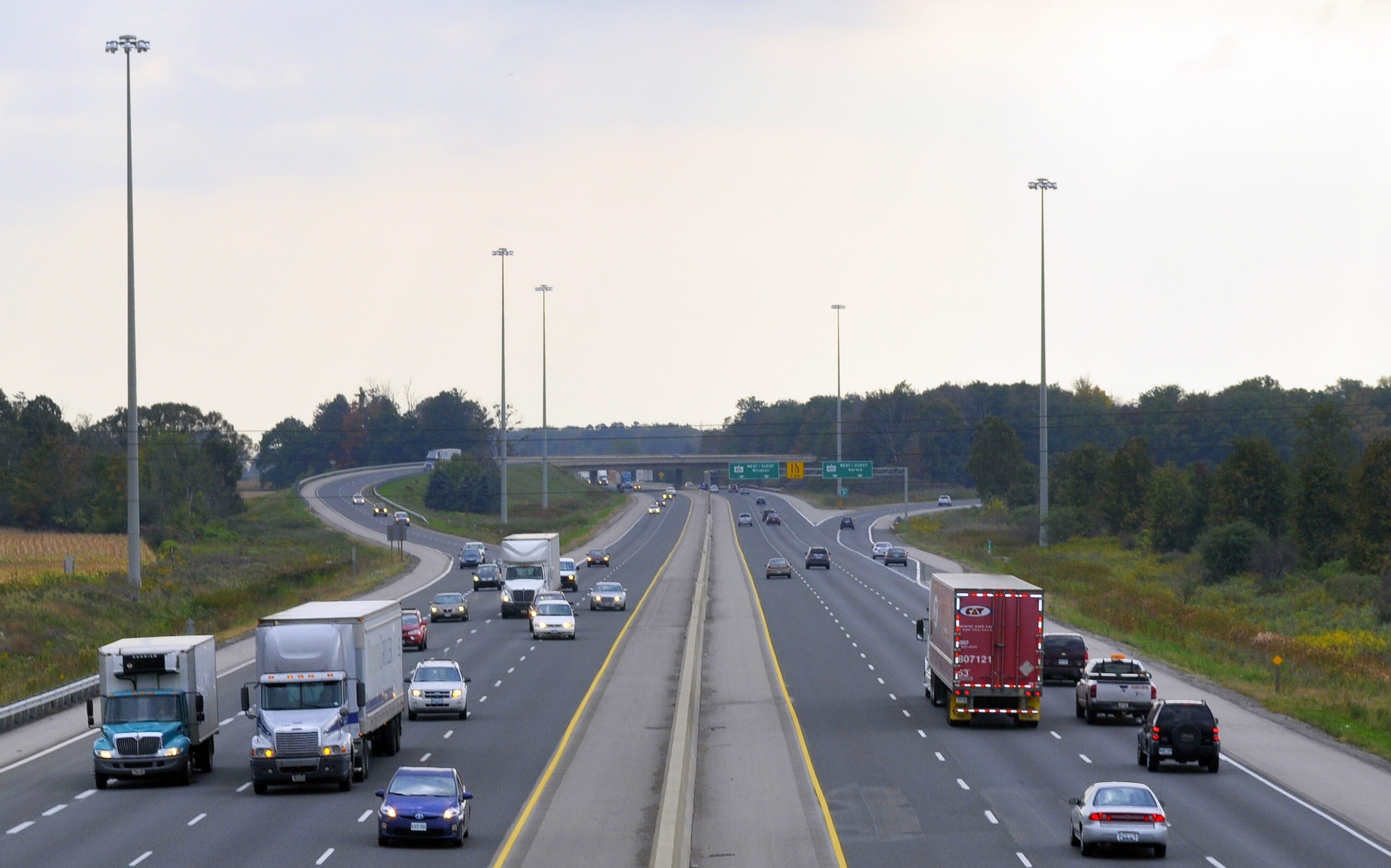
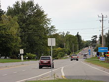 Highway 4 / Colonel Talbot Road looking south towards Lambeth from the Highway 4 / Highway 402 interchange in London.
Colonel Talbot Road is a well known roadway in the London area. Its northmost point starts at Byron Baseline Road in the east area of Byron and runs down to Lambeth, where it intersects with Longwoods Road and becomes Highway 4. From there, the highway crosses over Highway 402 and Highway 401 and ends shortly thereafter at Southminster Bourne (County Road 18). Highway 4 continues a short distance to the south, to Highway 3 at Talbotville. The road also continues a short distance north of Byron Baseline Road to Commissioners Road, as North Street.
The road is named after Colonel Thomas Talbot, who was in charge of settling the area in the 19th century. For many years, the road was known as North Talbot Road, and assumed its current name in the late 1980s. Prior to the City of London annexation of Westminster Township in 1993, the road was also known as Middlesex County Road 40 north of Lambeth.
Colonel Talbot Road interchanges with Highway 401 using an outdated cloverleaf interchange design. This junction is planned to be reconstructed along with the widening of Highway 401 between Highway 4 and Highway 402 (including a new interchange with Wonderland Road).[2][3]
Commissioners Road
Commissioners Road is an east-west thoroughfare south of the Thames River. Although it roughly parallels Base Line Road (which was never completely built as Concession Road 1 of Westminster Township), it is the next main thoroughfare north of Southdale Road, extending in the east to join Hamilton Road, and in the west to join Oxford Street West.
Dingman Drive
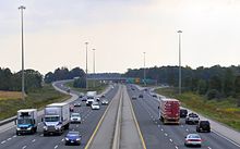 The Highway 401 / Highway 402 interchange viewed from the Dingman Drive overpass.
Dingman Drive is a rural arterial road in south-central London at the edge of the city's urban growth boundary. It overpasses Highway 401 just east of the Highway 402 interchange.
Dundas Street
Dundas Street is a main east-west road through central and eastern London, with much of it designated as Ontario Highway 2 until the late 1990s. It begins where Riverside Drive eastbound crosses the Thames River, and ends at the eastern city limits, although travelers continuing east through Thamesford and Woodstock also will be on Dundas Street. Except in the downtown core, west of Wellington Street, the road is a four-lane road, with no median strip. A former extension known as Dundas Street West was incorporated into Riverside Drive in the 1970s.
Fanshawe Park Road
Fanshawe Park Road is an east-west arterial road. It extends from the Fanshawe Conservation Area east of Clarke Road westward to the city limits where it continues as Egremont Drive, Middlesex County Road 22. Fanshawe Park is bisected into eastern and western halves by Richmond Street.
Hamilton Road
Hamilton Road is a main east-west route, on a diagonal with the grid network, from the core area to the southeast city limits. Although it begins at Bathurst and Burwell Streets, it does not become a thoroughfare for two blocks, where it crosses Horton Street. When it reaches the junction with Commissioners Road and Old Victoria Road, it continues east as if a natural continuation of Commissioners Road. Its name apparently references its 19th Century history as a road used for travelers headed to the city of Hamilton.
Highbury Avenue
Main article: Highbury AvenueHighbury Avenue is a main thoroughfare in the eastern part of London, in the form of a former sideroad in London Township, from Hamilton Road northward. South of Hamilton Road, Highbury Avenue is a municipal expressway in the southeast part of the city which connects south to St. Thomas, built in 1966 as part of a larger expressway plan that was cancelled amid public opposition. At varying times, the portion of Highbury between Hamilton and Fanshawe Park Roads was rebuilt from a 2-lane road to a 4-lane road.
Horton Street
Horton Street is a main thoroughfare in the core area of London, the most direct and widest artery south of the CNR railway tracks, between Hamilton Road and Springbank Drive.
History
Horton Street was originally part of the grid of streets south of the CNR tracks, with its west end at Thames Street and most traffic turning a block east at Ridout to enter or exit Horton. The east end was mainly residential, with traffic flowing onto and off of Hamilton just east of Maitland Street where Horton met Horton.
After years of controversy, in the late 1970s, Horton was extended west across the Thames River, between the CNR tracks and Beaconsfield Avenue to Wharncliffe Road, then assumed the Beaconsfield right-of-way from there to end at Springbank Drive.
Huron Street
Huron Street is a main thoroughfare in the eastern part of London, traversing the north edge of the city's older grid-network neighbourhoods, from the Thames River at Gibbons Park to the London International Airport. It is interrupted by a ravine between William and Maitland Streets, being of minor significance west of this interruption; most of the route is two-lane road.
Hyde Park Road
Hyde Park Road is a north-south arterial road in London, Ontario, Canada. It extends from the Thames River in the Oakridge area northward through the village and road namesake of Hyde Park and north of the city to Highway 7.
History
Hyde Park Sideroad originally ran northward on a fairly straight alignment through the lowlands east of the Byron Bog. North of Oxford Street, it crossed the Canadian National Railway via a narrow truss bridge, and then crossed the Canadian Pacific Railway south of Hyde Park via a one-lane subway. In the early 1980s, Hyde Park Road was largely bypassed to the east between Oxford Street and Riverside Drive, completely avoiding the environmentally sensitive area near the bog which also included very steep grades. In the 1970s, there were conceptual plans for Hyde Park Road to bypass Hyde Park, to the east. This bypass was never constructed. In 1985, the CNR and CPR grade separations were replaced with new, wider structures.
Hyde Park Road today is two lanes for its entire length, and experiences a high degree of traffic congestion between Oxford Street and Fanshawe Park Road; There are plans to widen the road to four-lanes from Oxford Street to Sunningdale Road by 2017[citation needed].
Oxford Street
Oxford Street is an east-west arterial road. It extends from Crumlin Road near London International Airport westward through the city to the western limits of the city, where it continues as Middlesex County Road 14.
Until 2003, Oxford Street ended at the Thames River heading westward. In November of that year, a new bridge opened, extending Oxford Street westward over the river and linking it with Commissioners Road west of Kains Road. Commissioners Road west of there became part of Oxford Street, and Commissioners Road itself was trunicated at the new Oxford Street extension. The bridge was built wide enough to accommodate four lanes of traffic, but remained two lanes wide until late 2009. It is currently 4-lanes wide.
Oxford Street was widened from two lanes to four lanes between Hyde Park Road and the C.N.R. subway in 2006.
Richmond Street
Richmond Street is a main thoroughfare from the core area of London to the northern limits. It starts at the Thames River where it connects with the residential Carfrae Crescent, passing through the very core of the city, veering westward beyond Huron Street and continuing northward beyond Windermere Road. It is a four-lane undivided road along most of its length, including the core area.
Riverside Drive
Riverside Drive is an east-west arterial road. It extends from the Forks of the Thames River in the Downtown area westward towards the suburb of Byron. The name was created due to its close proximity to the Thames River.
History
The modern-day Riverside Drive is made up of three separate London roads. The original Riverside Drive existed from the Thames River at Byron to the Canadian National Railway bridge near Mount Pleasant Cemetery; part of Mount Pleasant Avenue, which originall existed from the CNR bridge to Wharncliffe Road, and Dundas Street west of the forks of the Thames River to Wharncliffe Road.
In the 1970s, Dundas Street was extended through the Kensington neighbourhood west from Wharncliffe Road to meet Mount Pleasant Avenue west of Charles Street. This necessitated the demolition of a number of houses in Kensington. The Dundas extension was built as a four-lane facility. Previously traffic heading westbound on Dundas Street had to turn right at Wharncliffe Road in order to get to Mount Pleasant Avenue.
The original CNR bridge connecting Riverside Drive to Mount Pleasant Avenue included sharp curves at the approaches, as the bridge crossed at a 90-degree angle to the railway tracks. In 1974, the corridor was realigned with a new deck bridge located just north of the original one. This bridge was built wide enough to accommodate a four-lane road, but the road remains two lanes today. Around this time the Riverside Drive designation was extended eastward along Mount Pleasant Avenue and Dundas Street to the Kensington Bridge.
Riverside Drive was also realigned in 1977 at Hutton Road when the Guy Lombardo Bridge was built, with a four-lane diversion to the north of the original alignment.
Southdale Road
Southdale Road is an east-west arterial road. It extends from Pond Mills Road westward through the city to the western limits of the city with its terminus at Westdel Bourne.
Southdale is 2-lanes from Pond Mills Road to east of Wellington Road, where it expands to 4-lanes. From Wellington to west of Wharncliffe Road it continues as a 4-lane road, and goes back 2-lanes from west of Wharncliffe to east of Wonderland Road.
London has looked into feasibility studies of expanding Southdale Road in between Wharncliffe and Wonderland to a 4-lane road. This would be to reduce traffic congestion due to recent development of big box stores and housing in the area.[4]
Veterans Memorial Parkway
Main article: Veterans Memorial Parkway
Veterans Memorial Parkway
Location: London Length: 9.2 km (5.7 mi) Existed: 1977
Widened in 2006 to a modern, at-grade expressway–presentThe Veterans Memorial Parkway (VMP) is a 9.2 km (5.7 mi) expressway located in London, Ontario. The expressway was previously known as Highway 100 from 1977 until 1994 and as Airport Road prior to September 2006.[5] It is currently an at-grade, four-lane expressway. Long term plans / proposals for the route include north and south extensions of the road and grade separated interchanges along its entire length, converting it to a freeway.[6]
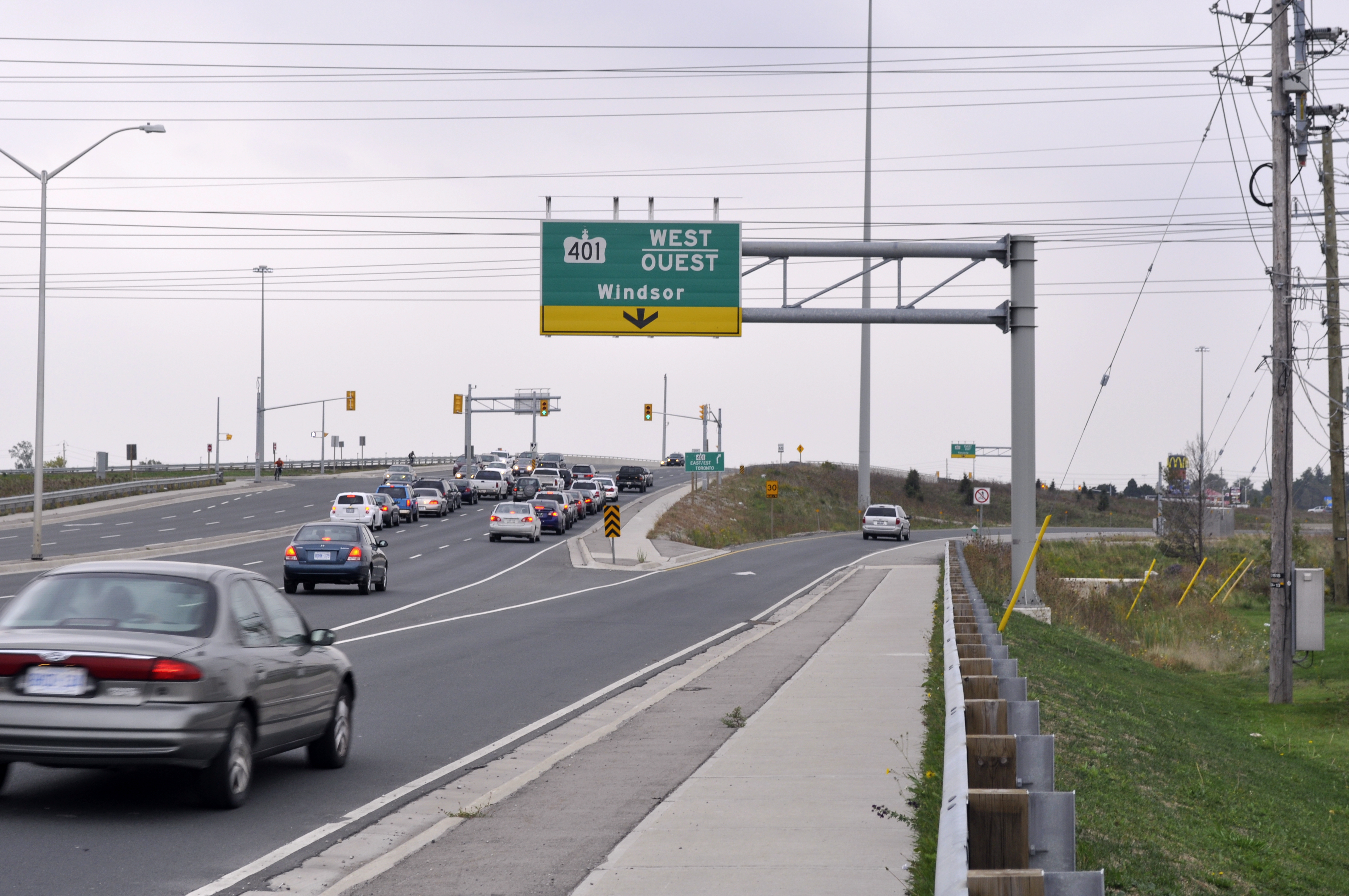
Wellington Road
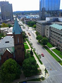 Wellington Street in downtown London viewed from city hall.
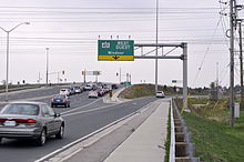 Wellington Road / Highway 401 interchange: London's downtown gateway.
Wellington Road is a major arterial road which forms a key route for both local and out-of-town traffic between St. Thomas, Highway 401 and London's downtown core. It runs in a north-south direction for most of its length.
Most of the Wellington Road corridor is home to many commercial and institutional establishments such as White Oaks Mall, LHSC Victoria Hospital and various hotels and restaurants.
North of the Thames River, it adjoins Wellington Street, which extends through the core area and quickly becomes a residential street at Central Avenue, interrupted at the CPR railway tracks, and ending near Huron Street.
Western Road
Western Road is a north-south arterial road which skirts around the west side of the University of Western Ontario campus, University Hospital, and various student residences including Saugeen-Maitland Hall. Western Road starts at Richmond Street just south of the Masonville Place shopping centre continuing southward to connect with Wharncliffe Road.
History
Western Road takes its name after the University of Western Ontario and is one of the main access routes to the campus. It also acts as a key corridor for traffic bypassing the some of the older, more congested neighborhoods of north London. The road was primary rural until the 1960s, becoming more urbanized with the growth of the university.
Expansive residential growth in North London, along with its proximity to the university campus and hospital, led to serious road deficiencies. The road experienced congestion during peak travel periods as well as numerous potholes and worn pavement.
Due to this, Western Road was nominated as one of the worst roads in Ontario by the Canadian Automobile Association [1]. In 2007, Western Road was widened to four lanes from Huron University College to Richmond Street. The road now features a wide, treed boulevard within the campus area.
Wharncliffe Road
Wharncliffe Road is a main thoroughfare just west of the core area of London. It starts with a one-block residential section north of Western Road, then serves as a main artery from the south end of Western Road, across Oxford Street, Riverside Drive, the Thames River, Horton Street and Commissioners Road, to Southdale, where it turns to the southwest to end in Lambeth where it adjoins Longwoods Road.
Wonderland Road
Main article: Wonderland RoadWonderland Road is a major north-south arterial road and the busiest road in London, carrying on average over 45,000 vehicles daily between Springbank Drive and Riverside Drive in 2002.[7] Wonderland Road takes its name from the Wonderland Gardens concert hall located near Springbank Park. The present-day Wonderland Road corridor is made up of part or all of six London-area roads.
York Street
York Street is a main thoroughfare in downtown London, preferred over Dundas Street (two blocks north) as a main artery through the core area as it is four-lane road along its entire length east of Ridout Street. At Rectory Street, it is interrupted by the Queens Park grounds, and traffic east of Rectory follows Florence Street (three blocks south of Dundas) as far as Highbury and Dundas.
References
- ^ "Top 20 Worst Municipal Roads in Ontario for 2007". Canadian Automobile Association. 2007. http://www.worstroads.ca/rankings/roadfinal.asp. Retrieved 2007-12-26.
- ^ City of London (November 19, 2009). "London Transportation Report- Southwest Area Plan". http://www.london.ca/Reference_Documents/PDFs/TransportationReport.pdf. Retrieved April 16, 2010. "Future Interchanges/Upgrade: Colonel Talbot at Highway 401"[dead link]
- ^ Ontario Ministry of Transportation (August 2009). "Southern Highways Program 2008-2012". http://www.mto.gov.on.ca/english/pubs/highway-construction/southern-highway-2008/partS.shtml. Retrieved April 26, 2010. "Projects beyond 2012: Highway 401 - Highway 402 to Highway 4, London"
- ^ http://london.ca/d.aspx?s=/Transportation/trans_planning.htm
- ^ Cameron Bevers. "The King's Highway 100 (#2)". http://www.thekingshighway.ca/Highway100_2.htm. Retrieved November 5, 2010. "The second King's Highway 100 was a staged freeway constructed along the eastern side of London during the 1970s."
- ^ Doug Green (October 16, 2006). "COMMENCEMENT OF THE VETERANS MEMORIAL PARKWAY INTERCHANGE CLASS ENVIRONMENTAL ASSESSMENT AND CONCURRENT NOTICE OF APPLICATION TO AMEND THE OFFICIAL PLAN & ZONING BY-LAW". http://www.london.ca/Transportation/PDFs/EA_Notice_VMP_Interchanges.doc. Retrieved November 5, 2010. "The City of London proposes to identify interchange locations along the entire length of the Veteran’s Memorial Parkway (formerly Airport Road) corridor."
- ^ City of London (Year 2002 traffic volumes). "City of London Traffic Volume Data". http://www.london.ca/d.aspx?s=/Transportation/trafficvol.htm. Retrieved April 28, 2010. "Did you know that Wonderland Road between Riverside Drive and Springbank Drive is London's most travelled section of roadway carrying 45,000 vehicles per day?"
Categories:- Lists of roads in Ontario
- Roads in London, Ontario


Wikimedia Foundation. 2010.