- Ontario Highway 401
-
"Highway 401" redirects here. For other uses, see List of highways numbered 401.
Highway 401 Macdonald–Cartier Freeway
Highway of Heroes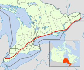
Highway 401 (in red) within Southern Ontario.Route information Maintained by the Ministry of Transportation of Ontario Length: 816.6 km[2][a] (507.4 mi) History: Proposed 1938
Opened December 1947 – October 11, 1968[1]Major junctions West end:  Highway 3 to Windsor
 Highway 402 in London
 Highway 403 near Woodstock
 Highway 407 near Milton
 Highway 403 / Highway 410 in Mississauga
 Highway 427 in Toronto
 Highway 409 in Toronto
 Highway 400 in Toronto

 Don Valley Parkway / Highway 404
to downtown Toronto / Newmarket
 Highway 416 towards Ottawa
East end:  A-20 towards Montreal, QC
Location Major cities: Windsor, London, Kitchener, Mississauga, Toronto, Oshawa, Kingston Highway system Ontario provincial highways
400-series • Former←  Highway 400
Highway 402  →
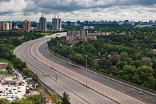
→King's Highway 401, also known by its official name as the Macdonald–Cartier Freeway and colloquially as the four-oh-one,[3] is a 400-Series Highway in the Canadian province of Ontario stretching 816.6 kilometres (507.4 mi) from Windsor to the Quebec border. The segment of Highway 401 passing through Toronto is the busiest highway in North America,[4] and one of the widest and busiest in the world.[5][6] Together with Quebec Autoroute 20, it forms the transportation backbone of the Quebec City – Windsor Corridor, along which over half of Canada's population resides. The entire route is maintained by the Ministry of Transportation of Ontario (MTO) and patrolled by the Ontario Provincial Police. The posted speed limit is 100 km/h (62 mph) throughout its length.
Three individual highways were renumbered "Highway 401" by the end of 1952: the Toronto Bypass between Weston Road and Highway 11 (Yonge Street); Highway 2A between West Hill and Newcastle; and the Scenic Highway between Gananoque and Brockville, now known as the Thousand Islands Parkway. These three sections of highway were 11.8 km (7.3 mi), 54.7 km (34.0 mi) and 41.2 km (25.6 mi) long, respectively, at the time of their assumption. Highway 401 became fully navigable from Windsor to the Quebec border in 1964. In 1965, it was given a second designation, the Macdonald–Cartier Freeway, in honour of the fathers of Confederation. By the end of 1968, the Gananoque–Brockville section was bypassed and the final intersection grade-separated near Kingston, making Highway 401 a freeway for its entire 816 km (507 mi) length. On August 24, 2007, the portion of the highway between Glen Miller Road in Trenton and the Don Valley Parkway/Highway 404 Junction in Toronto was designated the Highway of Heroes, as the road is travelled by a funeral convoy for fallen Canadian Forces personnel from CFB Trenton to the coroner's office in Toronto.
Contents
Route description
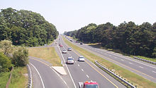
Highway 401 extends across Southwestern, Central and Eastern Ontario. In foresight of the future expansion of the highway, the planners purchased a 91.4-metre-wide (300 ft) right-of-way along the entire length. Generally the highway occupies only a portion of this allotment.[7] It is one of the world's busiest highways;[5] a 2008 analysis stated that the annual average daily traffic (AADT) count between Weston Road and Highway 400 in Toronto was approximately 450,000,[2] while a second study estimates that over 500,000 vehicles travel that section on some days.[4] This makes it the busiest roadway in North America, surpassing the Santa Monica Freeway in Los Angeles, Interstate 10 (I-10) in Houston and I-75 in Atlanta.[8] The just-in-time auto parts delivery systems of the highly integrated auto industry of Michigan and Ontario have contributed to the highway's status as the busiest truck route in the world,[9] carrying 60% of vehicular trade between Canada and the US.[8]
Highway 401 also features the busiest multi-structure bridge in North America, located at Hogg's Hollow in Toronto.[9] The four bridges, two for each direction with the collector and express lanes, carried an average of 373,700 vehicles daily in 2006.[2] The highway is one of the major backbones of a network in the Great Lakes region, connecting the populous Quebec City – Windsor corridor with Michigan, New York and central Ontario's cottage country.[10] It is the principal connection between Toronto and Montreal, becoming Autoroute 20 at the Quebec border.[11]
Southwestern Ontario
Though Highway 401 does not physically extend the last few kilometres to Detroit,[a][12] a proposed Windsor–Detroit border crossing may result in Highway 401 connecting directly to the border as early as 2013.[13] At present, Highway 401 begins at Huron Church Road (formerly Highway 3) in Windsor,[14] with four lanes diverging north and leaving Talbot Road (Highway 3) at Howard Avenue. At Dougall Avenue, the highway turns east, widens to six lanes and exits Windsor.[15] From here, Highway 401 mostly parallels the former route of Highway 98 from Windsor to Tilbury.[14]
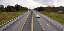
The topography in southwestern Ontario is flat and the land use primarily agricultural, taking advantage of the fertile clay soil deposited throughout the region.[16][17] The primary river through the region is the Thames River, which drains the second largest watershed in southern Ontario, though several smaller creeks are interspersed throughout the region. Southwestern Ontario is also home to some of the few remaining stands of Carolinian forest.[18]
From Tilbury, the highway loses its tall wall median barrier and narrows to four lanes, following lot lines laid between concession roads in a plan designed to limit damage to the sensitive agricultural lands through which the highway runs.[19] Due to fatigue caused by the lack of driver engagement along the flat and straight lengths of highway,[20] the section of Highway 401 from Windsor to London (especially west of Tilbury) has become known for deadly car accidents and pile-ups, earning it the nickname Carnage Alley.[21] As the highway approaches London, Highway 402 merges in,[15] resulting in a six lane cross-section.[22][23] Within London, it intersects the city's two municipal expressways, Highbury Avenue and the Veterans Memorial Parkway.[24]
The section between London and Woodstock generally parallels the former Highway 2 but lies on the south side of the Thames River.[15] While the topography in this area is less flat, the highway is generally straight. This part of Highway 401 often experiences heavy snowsqualls in early winter, sometimes extending as far east as Toronto. To the south of Woodstock, Highway 401 curves northeast and encounters the western terminus of Highway 403.[24] The highway heads towards Kitchener and Cambridge, where it encounters Highway 8 and returns to its eastward orientation.[15][25] East of Kitchener, the highway meanders towards Milton, passing through hills and cut rock along the way.[26]
Greater Toronto Area
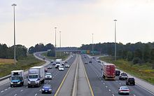
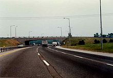
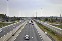
See also: Local-express lanes and Express lane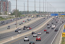 Throughout the Greater Toronto Area, Highway 401 uses a collector-express roadway configuration, ranging from 12 to 18 lanes wide, to manage its high traffic volumes
As Highway 401 approaches the Greater Toronto Area (GTA), it descends through the ecologically protected Niagara Escarpment to the west of Milton.[27][28] After passing through the town, it enters the western side of Toronto's Greenbelt, a zone around Toronto protected from development.[27] After this 10 km (6.2 mi) gap, the highway interchanges with the Highway 407 Express Toll Route and enters the first urbanized section of the GTA, passing through only a few rural areas between the cities of Mississauga and Oshawa.[15][29] Within the GTA, the highway passes several major shopping malls including Yorkdale Shopping Centre, Scarborough Town Centre and Pickering Town Centre.[30][31][32]
As Highway 401 approaches the large Highway 403 / Highway 410 junction in Mississauga, it widens into a collector-express system,[33] a concept inspired by the Dan Ryan Expressway in Chicago.[7] The system divides each direction of travel into collector and express lanes.[34] This gives the highway a wide span and four carriageways. To avoid confusion between carriageways, blue signs are used over the collector lanes and green signs over the express lanes. Unlike the collector lanes, which provide access to every interchange, the express lanes only provide direct access to a select few. Access between the two is provided by transfers, which are strategically placed to prevent disruptions caused by closely spaced interchanges.[35] The overall purpose of the collector-express system is to maximize traffic flow for both local and long-distance traffic and, along with the COMPASS system, to manage traffic flow.[36]
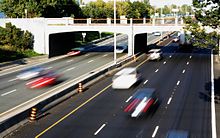
 Different signs on Highway 401's collector-express system are utilized to avoid confusion. The express lanes use green signs and the collector lanes use blue. These particular signs are located at The Basketweave.
Two sets of collector-express systems exist in the GTA. The first set is currently 6.6 km (4.1 mi) long and connects Highway 403, Highway 410 and Highway 427.[37] This system primarily serves to accommodate and organize various traffic movements from the Highway 403 / 410 and Highway 427 interchanges along Highway 401, replacing an earlier plan that would have run Highway 403 directly to Eglinton Avenue and the never-built Richview Expressway.[38] East of the interchange with Renforth Drive, the collector lanes diverge to become the on-ramps to Highway 27, 427 and Eglinton Avenue. The second 43.7 km (27.2 mi) system passes through the centre of Toronto and ends in Pickering to the east.[39] The 5 km (3.1 mi) gap between the two systems is a traffic bottleneck. However, the interchange cannot currently accommodate future widening of Highway 401.[40]
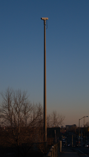 Traffic cameras are mounted at every exit within Toronto and form one part of the COMPASS system
Highway 401 widens to a total of eighteen lanes south of Toronto Pearson International Airport.[8] Progressing eastward, eight lanes are carried beneath the large spaghetti junction at Highway 427. The highway curves northeast and follows a power transmission corridor to Highway 409, which merges with the mainline and forms the collector lanes. It returns to its eastward route through Toronto, now carrying fourteen to sixteen lanes of traffic on four carriageways.[33][41]
To manage traffic through this heavily travelled section of roadway, Highway 401 was equipped with a traffic camera system called COMPASS in early 1991.[42] Using a combination of closed-circuit television cameras, vehicle detection loops and LED changeable message signs, COMPASS allows the Ontario Ministry of Transportation Traffic Operations Centre to obtain a real-time assessment of traffic conditions and alert drivers of collisions, congestion and construction.[36] The system currently stretches from the Highway 403 / 410 interchange in Mississauga to Harwood Avenue in Ajax.[43]
Highway 401 is often congested in this section, with an average of 442,900 vehicles passing between Weston Road and Highway 400 per day as of 2008.[2][8] In spite of this congestion, it is the primary commuting route in Toronto; over 50% of vehicles bound for downtown Toronto use the highway.[44]
East of Highway 400 is The Basketweave, a criss-crossing transfer between the express and collectors carriageways.[33] Twelve lanes pass beneath a complicated interchange with Allen Road, built to serve the cancelled Spadina Expressway. Further east, the highway crosses Hogg's Hollow, over the West Don River and Yonge Street in the centre of Toronto. It then crosses the East Don River and climbs toward the Don Valley Parkway, which provides access to downtown Toronto and Highway 404, which provides access to the suburbs to the north. Progressing eastward, the highway continues through mostly residential areas in Scarborough, eventually reaching the Rouge Valley on the city's eastern edge and crossing into Pickering.[33]
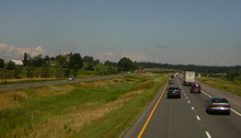 East of Highway 416, Highway 401 has lower traffic volumes
East of Pickering, it again meets the former Highway 2, which thereafter parallels Highway 401 to the Quebec border.[15] As the highway approaches Brock Road in Pickering, the collector and express lanes converge, narrowing the fourteen lane cross-section to ten, divided only at the centre.[41] It remains this width as it passes into Ajax,[33] before narrowing back to six lanes at Salem Road.[45]
The stretch of Highway 401 through Whitby and Oshawa features several structures completed during the initial construction of the highway in the 1940s.[40] Several of these structures are slated for demolition, either due to their age, or to prepare for the planned widening of Highway 401 through this area.[46] A former Canadian National Railway overpass, which was fenced off but commonly used by pedestrians during Highway of Heroes repatriations, was demolished on the night of June 11, 2011. A second structure in Bowmanville is to be demolished during two overnight closures on July 9 and July 16.[47] At Harmony Road, the suburban surroundings are quickly replaced by agricultural land. The highway curves around the south side of Bowmanville and travels towards Highway 35 and Highway 115.[29]
Eastern Ontario
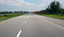 Highway 401 ends as it begins, unceremoniously, at the Ontario–Quebec border
From east of Highway 35 and Highway 115 to Cobourg, Highway 401 passes through a mix of agricultural land and forests, maintaining a straight course.[48] As the highway passes through Cobourg, it narrows to four lanes and the terrain becomes undulating, with the highway veering around hills and through valleys along the shores of Lake Ontario.[49] At Trenton, the highway crosses the Trent Canal and returns to an agricultural setting. It then crosses the Moira River as it goes through Belleville before heading eastward to Kingston. The Kingston portion of the highway, originally named the Kingston-Bypass, was one of the first sections of the highway to be completed.[50]
East of Kingston, the highway continues through a predominantly agricultural area alongside the Saint Lawrence River to Gananoque, where it splits with the Thousand Islands Parkway.[51] The current Highway 401 runs parallel to the parkway several kilometres inland from the river. The Canadian Shield returns through this heavily forested section of the highway. Highway 401 rejoins the Thousand Islands Parkway immediately southwest of Brockville, now heading northeast.[52]
The remainder of the highway runs parallel to the former Highway 2 along the shore of the Saint Lawrence River within the St. Lawrence Valley. Northeast of Brockville is the interchange with Highway 416, which heads north towards Ottawa.[53] At the Quebec border, Highway 401 becomes Autoroute 20 and continues to Montreal.[54]
History
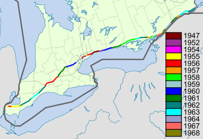 Highway 401 colour-coded by the year each section opened to traffic
Predecessors
Highway 401's history predates its designation by over two decades. As automobile use in southern Ontario grew in the early 20th century, road design and construction advanced significantly. Following frequent erosion of Lake Shore Road, then Macadamized,[55] a cement road known as the Toronto–Hamilton Highway was proposed in January 1914.[56] The highway was designed to run along the lake shore, instead of Dundas Street to the north, because the numerous hills encountered along Dundas would have increased costs without improving accessibility. Middle Road, a dirt lane named because of its position between the two, was not considered since Lake Shore and Dundas were both overcrowded and in need of serious repairs.[57] The road was formally opened on November 24, 1917,[55] 5.5 m (18 ft) wide and nearly 64 km (40 mi) long. It was the first concrete road in Ontario, as well as one of the longest stretches of concrete road between two cities in the world.[58]
Over the next decade, vehicle usage increased substantially, and by 1920 Lakeshore Road was again congested, particularly during weekends.[59] In response, the Department of Highways examined improving another road between Toronto and Hamilton. The road was to be more than twice the width of Lakeshore Road at 12 m (39 ft) and would carry two lanes of traffic in either direction.[60] Construction on what was then known as the Queen Street Extension west of Toronto began in early 1931.[61]
 The former Highway 2A near Highland Creek, aside from a resurfaced pavement, has not been altered since it opened in 1947
Before the highway could be completed, Thomas McQuesten was appointed the new minister of the Department of Highways, with Robert Melville Smith as deputy minister, following the 1934 provincial elections.[40] Smith, inspired by the German autobahns — new "dual-lane divided highways" — modified the design for Ontario roads,[62] and McQuesten ordered that the Middle Road be converted into this new form of highway.[63][64][65] A 40 m (130 ft) right-of-way was purchased along the Middle Road and construction began to convert the existing sections to a divided highway. Work also began on Canada's first interchange at Highway 10.[60]
Beginning in 1935, McQuesten applied the concept of a dual-highway to several projects along Highway 2, including along Kingston Road in Scarborough Township.[40][66] When widening in Scarborough reached the Highland Creek ravine in 1936, the Department of Highways began construction on a new bridge over the large valley, bypassing the former alignment around West Hill.[67] From here the highway was constructed on a new alignment to Oshawa, avoiding construction on the congested Highway 2.[7] As grading and bridge construction neared completion on the new highway between West Hill and Oshawa in September 1939, World War II broke out and gradually money was siphoned from highway construction to the war effort.[40]
They are designed for sustained speed, with the best alignments, fewest curves and least grades possible and by-passing centres of population.
“”Thomas McQueston[68]At the same time, between September 6 and 8, 1939, the Ontario Good Roads Association Conference was held at Bigwin Inn, near Huntsville,[69] drawing highway engineers from across North America to discuss the new concept of "Dual Highways". On the first day of the convention, McQuesten announced his vision of the freeway: an uninterrupted drive through the scenic regions of Ontario, discouraging local business and local traffic from accessing the highway except at infrequent controlled-access points.[68] It was quickly announced in the days thereafter that this concept would be applied to a new "trans-provincial expressway", running from Windsor to the Quebec border.[70]
Highway engineers evaluated various factors, including grading, curve radius and the narrow median used along the Middle Road (which was inaugurated on August 23, 1940, as the Queen Elizabeth Way),[71] and began to plan the course of a new dual highway mostly parallel to Highway 2, with precedence given to areas most hampered by congestion. Unlike the Queen Elizabeth Way (QEW), this highway would not be built along an existing road, but rather on a new right-of-way, avoiding the need to provide access to properties.[40][68]
 The Highway 400 interchange in 1953. Today, the former cloverleaf has been replaced with a multilevel interchange.
Along with immense improvements to machinery and construction techniques over its six-year course, the war provided ample opportunity for planners to conduct a large-scale survey of 375,000 drivers, asking what their preferred route would be to get to where they needed to go. Using this information, a course was plotted from Windsor to Quebec, bypassing all towns along the way.[7][72]
Highway 2S, for Scenic, was the first completed section of new roadway. Built to connect with the Thousand Islands Bridge at Ivy Lea and opened as a gravel road in late 1941 or early 1942,[73] the road followed the shore of the St. Lawrence River and connected with the western end of the twinned Highway 2 near Brockville.[15]
Following the war, construction resumed on roadways throughout Ontario. The expressway between Highland Creek and Oshawa was completed in December 1947,[7] while other sections remained on the back burner. The Toronto–Barrie Highway was the primary focus of the Department of Highways at the time, and the onset of the Korean War in 1949 continued to stall construction. Despite the delays, highway minister George Doucette officially announced the plans for construction of the new trans-provincial expressway in 1950, with the Toronto to Oshawa expressway serving as a model for the design.[40] Work on the most important link, the Toronto Bypass, began in 1951,[40] but it would not open with that name.
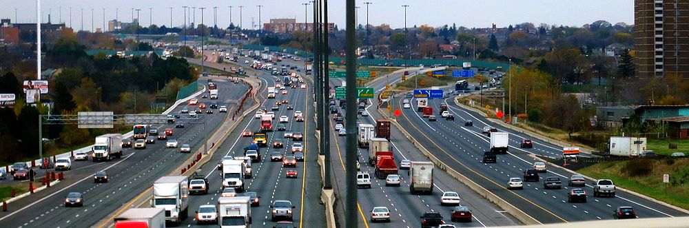
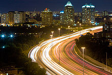 Heavy traffic traverses Highway 401 within Toronto 24 hours a day
Assumption
In July 1952 (possibly July 1, the same day Highway 400 was numbered),[b][74] the Highland Creek to Oshawa expressway and Highway 2S were designated Controlled-Access Highway No 401,[7] a move scorned by one critic because of the lack of thought into the numbered name.[75] That same year, construction wrapped up on several sections of the Toronto Bypass; between Highway 400 and Dufferin Street in August, west to Weston Road in September, east to Bathurst Street in October and finally to Yonge Street in December.[1] Extensions east and west began in 1953; the eastern extension to Bayview Avenue would open in April 1955,[1] the western extension was delayed by Hurricane Hazel's arrival on October 15, 1954, which nearly destroyed the new bridge over the Humber River. The reconstruction would take until July 8, 1955,[76] and the highway was opened between Weston and Highway 27 in September 1955.[1]
The entire bypass, including the widening of Highway 27 into an expressway south of Highway 401,[77] was completed in August 1956.[1][7] Upon its opening, the bypass was described by one reporter as "a motorist's dream" providing "some of the most soothing scenery in the Metropolitan area." The reporter continued, with regard to the eastern section through Scarborough, that it "winds smoothly through pastures across streams and rivers, and beside green thickets. It seems a long way from the big city."[7] By 1959 however, the bypass was a lineup of cars, as 85,000 drivers crowded the roadway, designed to handle a maximum of 48,000 vehicles, on a daily basis.[7] The convenience of a road to get across the city helped influence the suburban shift in Toronto and continues to be a driving force of urban sprawl today.[74]
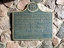 A plaque near Brockville commemorates the official completion of the highway
Meanwhile, beyond Toronto, the highway was being built in a patchwork fashion, focusing on congested areas first.[40] Construction west from Highway 27 began in late 1954,[50] as did the Kingston Bypass in Eastern Ontario.[78] Work began to connect the latter with the Scenic Highway in 1955.[50] By 1956, construction had begun on the segment between Highway 4 in London and Highway 2 in Woodstock, as well as on the section between Windsor and Tilbury.[79]
By the end of 1960, the Toronto section of the highway was extended both eastwards and westwards: first, to the east between Newcastle and Port Hope by June 30, then later to the west between Highway 25 in Milton and Highway 8 south of Kitchener on November 17.[1] By mid-1961, the section between Brighton and Marysville had opened.[80] The gap to the east, from Highway 28 in Port Hope to Highway 30 in Brighton was opened on July 20, 1961.[81]
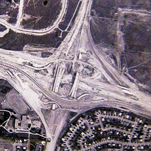 The widening of Highway 401 from four to twelve lanes in Toronto took nine years and was accomplished with at least four lanes open at all times. Shown here is the Highway 401 / Don Valley Parkway / Highway 404 interchange under construction in 1965.
The gap between Woodstock and Kitchener was completed on November 9, 1961, while the gap between Tilbury and London was completed two lanes at a time; the northbound lanes were completed on October 22, 1963, the southbound on July 20, 1965.[1] The gap between Marysville and Kingston was opened by 1962.[80] The final sections, from west of Cornwall to Lancaster, were opened in 1963 and 1964.[80][82] Finally, on October 11, 1968, the Thousand Islands Bypass opened.[7] This final piece was commemorated with a plaque to signify the completion of Highway 401.[40]
In Toronto, engineers and surveyors were examining the four-lane bypass, while planners set about designing a way to handle the commuter highway. In 1963, transportation minister Charles MacNaughton announced the widening of Highway 401 in Toronto from four to a minimum of twelve lanes between Islington Avenue and Markham Road. The design was taken from the Dan Ryan Expressway in Chicago, which was widened into a similar configuration around the same time.[7] Construction began immediately. While the plan initially called for construction to end in 1967, it continued for nearly a decade. A minimum of four lanes were always open during the large reconstruction project, which included complex new interchanges at Highway 27, Highway 400, the planned Spadina Expressway and the Don Valley Parkway. The system was completed in 1972, along with the Highway 27 bypass north of Highway 401. Most of the interchanges in Toronto were reconstructed as partial cloverleafs and a continuous lighting system was installed.[40]
On January 11, 1965, at the dinner celebration of Sir John A. Macdonald's 150th birthday, John Robarts, designated Highway 401 the Macdonald–Cartier Freeway to honour Macdonald and George-Étienne Cartier, two of Canada's Fathers of Confederation.[83][84] Unlike other names later applied to the highway, the Macdonald–Cartier Freeway designation covers the entire length of Highway 401. Signs designating the freeway and shields with the letters 'M-C' were installed, but these disappeared by 1997.[85] In 2003, 38 years after Robarts' naming of the highway, an MPP attempted to get the Macdonald-Cartier Freeway highway name enshrined into law; the bill only passed first reading and was not enacted.[86]
 Highway 401 at Meadowvale Road in 1989, before being widened to a 14-lane collector-express system
In the 1970s, Highway 401 was widened to six lanes in Durham, but otherwise saw little improvement.[40] The 1980s saw more sections widened, as well as a new collector-express system between Highway 403 / 410 and Highway 427 completed in mid-1985.[87] Plans were made to extend the eastern system from Neilson Road to Brock Road in Pickering in the late 1980s,[88] and took over a decade to reach fruition by 2000.[89][90] This was followed shortly thereafter by the widening of the highway through Ajax and a new interchange at Pickering Beach Road (renamed Salem Road) and Stevenson Road.[91]
The 1990s also saw the first step in widening the highway to six lanes from Toronto to London.[92] A project in the mid-1990s brought the highway up to a minimum of six lanes between Highway 8 in Kitchener and Highway 35 / 115 in Newcastle.[93] Other projects prepared sections for eventual widening.[94]
In 1993, the stretch of Highway 401 eastbound near Milton and westbound near Whitby had chevrons painted in each lane in an effort to reduce tailgating, a concept borrowed from France and Britain. Signs advised motorists to keep at least two chevrons apart, in essence warning them not to follow too closely.[95] Some of these chevrons remain intact in the westbound lanes in Whitby, though the signs stating their use have since been removed.[96]
Beginning in 1998, several projects were initiated on Highway 401 within Toronto. These included the addition of one lane through the Highway 427 interchange in 2005, as well as the resurfacing of the pavement through the city.[5]
Advantage I-75
Between June 1990 and 1998, Highway 401 and Interstate 75 were used for a pilot project named Advantage I-75 to test out the reliability and versatility of an automated tracking system for transport trucks. Termed MACS for Mainline Automated Clearance System, it would allow a truck to travel from Florida to Ontario without a second inspection.[97] MACS was initially tested out at two truck inspection stations in Kentucky, with transponders installed in 220 trucks. Exact time, date, location, weight and axle data were logged as a truck approached an equipped station.[98] Following initial tests, MACS was deployed at every inspection station along I-75 from Miami to Detroit and along Highway 401 from Windsor to Belleville in 1994.[97] The project demonstrated the effectiveness of electronic systems in enforcing freight restrictions without delaying vehicles, while alleviating security fears that such systems could be easily compromised. The concept has since been applied to many parts of Canada, including Highway 407's electronic tolling system.[99]
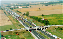 The 87-vehicle pile up on September 3, 1999
"Carnage Alley"
The section of Highway 401 between Windsor and London has often been referred to as Carnage Alley, in reference to the numerous accidents that occurred throughout its history. The term became more commonplace following several deadly pileups during the 1990s.[40] The narrow and open grass median was an ineffective obstacle in preventing cross-median collisions. The nature of that section of highway, described as largely a straight road with a featureless agricultural landscape, was said to make drivers feel less involved and lose focus on the road. Several accidents resulted from motorists deviating from their lane and losing control of their vehicles.[100][101]
Various other names, including The Killer Highway circulated for a time,[102] but Carnage Alley became predominant following an 87-vehicle pile-up on September 3, 1999, the worst in Canadian history, that resulted in eight deaths and forty five injured individuals.[103]
Only a few days prior, then-Transportation Minister David Turnbull had deemed the highway "pleasant" to drive.[104] On the morning of September 3, the local weather station reported clear conditions due to a malfunction,[103] while a thick layer of fog rolled onto the highway. Dozens of vehicles including several semi-trailers quickly crashed into each other shortly after 8 a.m., one following another in the dense fog, and the accumulating wreckage caught traffic traveling in the opposite direction.[105][106] Immediately following the accident, the MTO installed paved shoulders with rumble strips[107] and funded additional police to patrol the highway, a move criticized as being insufficient.[108]
Beginning in 2004, 46 km (29 mi) of the highway was widened from four asphalt lanes to six concrete lanes, paved shoulders were added, a concrete Ontario Tall Wall median was installed,[109] which was the solution that the Canadian Automobile Association promoted in 1999.[101] Interchanges were improved and signage was upgraded as part of a five-phase project to improve Highway 401 from Highway 3 in Windsor to Essex County Road 42 (formerly Highway 2) on the western edge of Tilbury.[22]
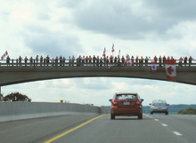 Canadians line overpasses along the Highway of Heroes to pay their respects to the fallen soldiers who pass
Highway of Heroes
On August 24, 2007, the MTO announced that the stretch of Highway 401 between Glen Miller Road in Trenton and the intersection of the Don Valley Parkway and Highway 404 in Toronto would bear the additional name Highway of Heroes, in honour of Canada's fallen servicemen and servicewomen,[110] though Highway 401 in its entirety remains designated as the Macdonald–Cartier Freeway.[111] This length of the highway is often travelled by a convoy of vehicles carrying a fallen soldier's body, with his or her family, from CFB Trenton to the coroner's office at the Centre for Forensic Sciences in Toronto. Since 2002, when the first of Canada's fallen soldiers were returned from Afghanistan, crowds have lined the overpasses to pay their respects as convoys pass.[112]
 Police momentarily stop traffic near Trenton to allow a convoy to enter the highway
The origin of the name can be traced to a June 23, 2007 article in the Toronto Sun by columnist Joe Warmington, in which he interviewed Northumberland photographer Pete Fisher. Fisher, along with Bob Jenkins, an emergency dispatcher, were responsible for organizing the first bridge salutes following the death of four soldiers on April 18, 2002.[113] Warmington described the gathering of crowds on overpasses to welcome fallen soldiers as a "highway of heroes phenomena."[114] This led a Crahame Township volunteer firefighter to contact Fisher on July 10 about starting a petition, leading Fisher to publish an article which was posted to the Northumberland Today website.[115] The online article eventually caught the attention of London resident Jay Forbes. Forbes began a petition, which received over 20,000 signatures[110] before being brought to the Minister of Transportation on August 22.[116] Following the announcement on August 24, the provincial government and MTO set out to design new signs. The signs were erected and unveiled on September 7,[111] and include a smaller reassurance marker (shield), as well as a larger billboard version.[117]
 Highway 401 was closed during a series of propane explosions in Toronto in 2008, allowing for this rare photo of the 14-lane highway occupied by a single vehicle
Since 2008
On August 10, 2008, following a series of explosions at a propane facility in Toronto, Highway 401 was closed between Highway 400 and Highway 404 as a precautionary measure, the largest closure of the highway in its history.[118] The highway remained closed until 8 p.m., though several exits near the blast remained closed thereafter.[119][120]
Between 2006 and 2008, Highway 401 was widened from four to six lanes between Highway 402 and Wellington Road in London. This included replacing the original Wellington Road overpass.[22] In Oshawa, Exit 416 (Park Road) was replaced by a new interchange at Exit 415 (Stevenson Road). The contract, which began September 7, 2005, included the interchange and the resurfacing of 23.4 km (14.5 mi) of the highway between Oshawa and Highway 35 / Highway 115.[121] The westbound ramps were opened in mid-September 2007[122] and the eastbound ramps in mid-2009. The resurfacing was completed mid-2010.[121]
In November 2010, the widening of Highway 401 from four to six lanes between Woodstock and Kitchener was completed after many years of planning and construction.[123] The project included the installation of a tall-wall median barrier, straightening curves and adding additional interchanges on the freeway, allowing it to be easily vacated in an emergency event.[124]
 The Highway 401 corridor in Oshawa is currently under reconstruction. The bridge in this image was demolished on June 11, 2011 as part of this work.
Future
The MTO intends to widen all of the remaining four-lane sections to a minimum of six and place an Ontario Tall Wall along the entire length of the highway.[109][125]
Windsor–Essex Parkway
In 2004, it was jointly announced by the American and Canadian governments that a new border crossing would be constructed between Detroit and Windsor. The Detroit River International Crossing (DRIC) was formed as a bi-national committee to manage the project.[126] The MTO took advantage of this opportunity to extend Highway 401 to the international border and began an environmental assessment on the entire project in late 2005.[126] The City of Windsor also hired New York traffic consultant Sam Schwartz to design a parkway to the border. Schwartz's proposal would eventually inspire the DRIC's own design, but his route was not chosen, with the DRIC opting instead to take a northern route.[127] On February 8, 2008, the MTO announced that it had begun purchasing property south of the E.C. Row Expressway, upsetting many area residents who had purchased properties in the years prior.[128][129]
On March 3, 2008, the Michigan Department of Transportation and the MTO (in partnership with Transport Canada, the Federal Highway Administration of the United States and the Detroit River International Crossing group) completed a joint assessment on the soils along the Detroit River and determined that they could indeed support the weight of a new bridge; the stability of the underlying soil and clay and the impact of the nearby Windsor Salt mine had caused a great deal of concern for all parties involved in the project.[130]
Despite protest from area residents,[131] as well as a dismissed lawsuit from Ambassador Bridge owner Matty Moroun,[132][133] it was announced on May 1, 2008, that a preferred route had been selected and that the new route would be named the Windsor–Essex Parkway.[13] The new parkway will be below-grade and have six through-lanes. It will follow (but not replace) Talbot Road and Huron-Church Road from a new interchange at the current end of Highway 401 to the E.C. Row Expressway, where it will run concurrently westward for 2 km (1.2 mi). From there, it will turn northwest and follow a new alignment to the border.[134] Initial construction of a noise barrier from North Talbot Road to Howard Avenue began in March 2010. Two new bridges south of the current Highway 3/401 junction are also under construction.[135] Full construction has begun as of August 2011,[136] with an expected completion date of 2013.[137]
 A typical section of Highway 401 between Highways 4 and 402. This stretch is to be reconstructed in 2013 and include a new interchange with Wonderland Road.
Southwestern Ontario
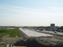
In Southwestern Ontario, several improvements are under way to provide six lanes on Highway 401 from Windsor to Toronto,[125] in response to the Carnage Alley pile-up in 1999.[109][138] West of Manning Road, the highway is currently being widened in anticipation of the Windsor–Essex Parkway.[13][139] Between Tilbury and Highway 402, the highway remains four lanes wide with a grass median. The widening and upgrading of this section is in the planning stages, with construction possibly beginning in 2012 and lasting for several years. Several interchanges are slated to be upgraded as part of this construction.[140]
Within the London area, traffic volumes are expected to increase considerably, leading to poor highway conditions. The province has put in place an extensive plan to widen and reconstruct the London corridor between 2006 and 2021.[141] This includes building a new interchange with Wonderland Road to help improve access to Highway 401 westbound from the city's southwest end. This may also include partial interchanges along White Oaks Road with Highways 401 and 402.[142] This project will coincide with reconstructing the outdated cloverleaf interchange at Colonel Talbot Road[143] and widening Highway 401 from four to six lanes between Highway 4 and Highway 402. Construction will start in 2013.[144] In addition, an environmental assessment is underway to examine the impact of reconstructing the three-way trumpet interchange with the Veterans Memorial Parkway into a four-way interchange in order to extend the expressway south of Highway 401.[145][146] The Ontario Ministry of Transportation is also planning on widening Highway 401 from six to eight lanes through part of the London corridor.[147][148]
Long term plans call for Highway 401 in the Waterloo region to be widened to eight lanes as well. The interchange between Highway 401 and Highway 8 (King Street) is to be reconstructed to make it free-flowing for all directions of travel, easing congestion and improving traffic flow in the area.[149]
 Work is underway to widen Highway 401 from six to fourteen lanes between Highway 410 and Hurontario Street
Central Ontario

In their 2007 plan for southern Ontario, the MTO announced long-term plans to create high-occupancy vehicle (HOV) lanes from Mississauga Road west to Milton.[150] Construction is also underway to widen Highway 401 to a collector-express system from Highway 403 and Highway 410 west to Hurontario Street, a distance of 2.8 km (1.7 mi).[151]
Within Toronto, a select number of projects are being completed during overnight construction projects, including the widening and rehabilitation of the Hogg's Hollow bridge,[152] the replacement of the original gantries throughout the collector-express system,[153] and reconstructing the Highway 401/400 interchange.[154]
Current expansion plans in Durham include the construction of two new freeways north from Highway 401. The first will be directly east of Durham Regional Road 23 (Lakeridge Road),[155] while the second will lie to the east of Durham Regional Road 34 (Courtice Road).[156] Alongside the extension of Highway 407, Highway 401 will be widened to twelve lanes, forming an extension to the current collector-express system, from its current end at Durham Regional Road 1 (Brock Road) in Pickering to Durham Regional Highway 12 (Brock Street) in Whitby.[157] Long term plans also call for HOV lanes to run from Brock Road to Durham Regional Road 33 (Harmony Road), though no planning has commenced.[150]
Eastern Ontario
East of Durham, the MTO is planning to widen the entire length of Highway 401 to six lanes.[125] Preliminary work includes the widening of the bridge over the Trent River in Trenton,[158] as well as the realignment of some roads alongside the highway.[159] By mid 2012, the highway will be widened for 6 km (3.7 mi) through Kingston.[160]
Services
 A new "ONroute" service station near Tilbury
Highway 401 features 19 service centres controlled by the MTO. These service centres were announced in 1961 following public outcry to the lack of rest stops. They provide a place to park, rest, eat and refuel 24 hours a day.[7]
The centres were originally leased to and operated by several major gasoline distributors; however, those companies have chosen not to renew their leases as the terms end. In response, the MTO put the operation of the full network of service centres out for tender, resulting in a 50-year lease with Host Kilmer Service Centres, a joint venture between hospitality company HMSHost (a subsidiary of Autogrill) and Larry Tanenbaum's investment company Kilmer van Nostrand.[161]
Seventeen of the centres along Highway 401 will be reconstructed entirely. Two centres that were rebuilt in the late 1990s, specifically Newcastle and Ingersoll, will not be redeveloped at this time. Work on 15 of the 17 service centres to be reconstructed began in late 2009 or early 2010. The new service centres, opening in phases beginning in July 2010, feature a Canadian Tire gas station, an HMSHost-operated convenience store known as "The Market", as well as fast food brands such as Tim Hortons, A&W and Burger King.[162]
Service centres are located at the following points along Highway 401:
Location Direction(s) Nearby Exits[163] Status[162] Tilbury North
Tilbury SouthWestbound
Eastbound56, 63[164] Reopened as of October 1, 2010[165] West Lorne
DuttonWestbound
Eastbound137, 149 Reopened as of October 1, 2010[165] Ingersoll Westbound 222, 230 Will not be redeveloped at this time. Leased by Imperial Oil. Woodstock Eastbound 222, 230 Closed for reconstruction on March 31, 2010; reopened July 2011 [166] Cambridge North
Cambridge SouthWestbound
Eastbound286, 295 Closed for reconstruction as of September 7, 2011[167] Mississauga Eastbound 333, 336[168] Permanently closed as of September 30, 2006 Newcastle Westbound 440, 448 Will not be redeveloped at this time. Leased by Imperial Oil. Port Hope Eastbound 458,456 Was reopened by July 2011 Trenton North Westbound 509, 522 Reopened as of October 1, 2010[165] Trenton South Eastbound Limited services including fuel; full services to return early 2011 Camden East Westbound 582, 593 Closed for reconstruction March 31, 2010;[169] reopened July 2011 Odessa Eastbound 599, 611 Open during 2010-11 reconstruction (while a new structure was built directly west of a now-demolished original facility on same property). New facility opened July 2011. Mallorytown North
Mallorytown SouthWestbound
Eastbound675, 685 Closed for reconstruction;[170] to reopen late 2011 Morrisburg Eastbound 750, 758 Reopened as of October 1, 2010[165] Ingleside Westbound 758, 770 Reopened Early 2011[165] Bainsville Westbound 825 Reopened as of October 1, 2010[165] Closed Exit list
Division Location km[2] Exit[15] Destinations Notes Canada–U.S. border 0.0 0  Continues as Interstate 75 in Detroit, MI via a new bridge crossing over the Detroit River, planned
Windsor 1 Ojibway Parkway Under construction 2 E. C. Row Expressway Under construction, westbound exit and eastbound entrance 3 Highway 3 - Huron Church Road – Ambassador Bridge to USUnder construction 4 Todd Lane Under construction 6 Service Road Under construction Highway 3 west – Ambassador Bridge to USWestbound exit and eastbound entrance, full interchange under construction 12.6 13 Dougall Avenue – Detroit-Windsor Tunnel to US Westbound exit and eastbound entrance; Formerly Highway 3B / Highway 401A 13.4 14  County Road 46 (Walker Road) – Windsor, Essex
Formerly Highway 98 Essex Tecumseh 20.4 21  County Road 19 (Manning Road) – Tecumseh
Lakeshore 27.5 28  County Road 25 (Puce Road) – Puce
33.7 34  County Road 27 (Belle River Road) – Woodslee, Belle River
40.0 40  County Road 31 (French Line Road) – St. Joachim
47.3 48  Highway 77 south – Leamington
 County Road 35 north (Comber Road) – Stoney Point
55.7 56  County Road 42 – Tilbury
Formerly Highway 2 Chatham-Kent Tilbury 62.8 63 County Road 2 (Queen's Line) Formerly Highway 2 Chatham 80.9 81 County Road 27 (Bloomfield Road) 89.3 90  Highway 40 north
County Road 11 south (Communication Road) – Blenheim101.0 101 County Road 15 (Kent Bridge Road) – Dresden, Ridgetown 108.3 109 County Road 17 / County Road 21 (Victoria Road) – Thamesville, Ridgetown Formerly Highway 21 116.2 117 County Road 20 (Orford Road) – Highgate Elgin West Elgin 129.2 129 County Road 103 (Furnival Road) – Wardsville, Rodney 137.3 137 County Road 76 (Graham Road) – West Lorne Formerly Highway 76 Dutton/Dunwich 148.5 149 County Road 8 (Currie Road) – Dutton 157.4 157 County Road 14 (Iona Road) – Melbourne, Iona Southwold 164.1 164 County Road 20 (Union Road) – Port Stanley, Shedden London 176.7 177  Highway 4 (Colonel Talbot Road) – St. Thomas
Signed as exits 177A (south) and 177B (north) 179 Wonderland Road Planned, construction to begin in 2013 183.2 183 Highway 402 west – SarniaWestbound exit and eastbound entrance 185.9 186 Wellington Road 186.8 187 Exeter Road Formerly Highway 135 west 189.1 189 Highbury Avenue – St. Thomas Formerly Highway 126 193.6 194 Veterans Memorial Parkway Formerly Highway 100 Middlesex Thames Centre 195.5 195 County Road 74 (Westchester Bourne) – Nilestown, Belmont Formerly Highway 74 199.3 199 County Road 32 (Dorchester Road) – Dorchester 203.0 203 County Road 73 (Elgin Road) – Aylmer Formerly Highway 73 208.5 208 County Road 30 (Putnam Road) – Putnam, Avon Oxford South-West Oxford,
Ingersoll216.0 216 County Road 10 (Culloden Road) 218.5 218  Highway 19 south
County Road 119 north (Plank Line) – TillsonburgSouth-West Oxford 222.2 222 County Road 6 – Stratford, Embro 229.8 230 County Road 12 (Sweaburg Road / Mill Street) – Sweaburg Woodstock 231.9 232 County Road 59 – Delhi Formerly Highway 59 235.3 235 Highway 403 east – Brantford, HamiltonEastbound exit and westbound entrance Norwich 236.3 236 County Road 15 (Towerline Road) – Woodstock 237.9 238 County Road 2 – Paris, Woodstock Formerly Highway 2 Woodstock Blandford-Blenheim 250.1 250 County Road 29 (Drumbo Road) – Innerkip, Drumbo Waterloo North Dumfries 267.9 268 Regional Road 97 (Cedar Creek Road) – Cambridge, Plattsville, Ayr Signed as exits 268A (east) and 268B (west) eastbound; formerly Highway 97 Kitchener, Cambridge 275.0 275 Regional Road 28 (Homer Watson Boulevard / Fountain Street) Replaced Doon-Blair Road exit in the 1970s 277.9 278  Highway 8 north – Kitchener, Waterloo
Regional Road 8 south – CambridgeSigned as exits 278A (east) and 278B (west) eastbound Cambridge 282.5 282 Regional Road 24 (Hespeler Road) to  Highway 24
284 Regional Road 36 south (Franklin Boulevard) Eastbound exit and westbound entrance 286.5 286 Regional Road 33 (Townline Road)
County Road 33 (Townline Road)Wellington Puslinch 295.7 295  Highway 6 north – Guelph
West end of Highway 6 overlap 300.1 299 Highway 6 south – Hamilton
County Road 46 (Brock Road) – Guelph, HamiltonEast end of Highway 6 overlap Halton Milton 311.9 312 Regional Road 1 (Guelph Line) – Burlington, Campbellville 320.1 320 Regional Road 25 – Acton, Milton Formerly Highway 25; GO Transit bus stop on eastbound ramp. 323.8 324 Regional Road 4 (James Snow Parkway) 328.0 328 Regional Road 3 (Trafalgar Road) – Oakville, Halton Hills, Georgetown 330.4 330  Highway 407
Signed as exit 330 westbound; as exits 330A (west) and 330B (east) eastbound; no access from westbound 407 to eastbound 401 or westbound 401 to eastbound 407 Peel Mississauga 332.7 333 Winston Churchill Boulevard 336.1 336 Regional Road 1 (Mississauga Road / Erin Mills Parkway) 339.6 340 Mavis Road 341.7 342 Hurontario Street Formerly Highway 10 344.5 344 Highway 403 / Highway 410 – Hamilton, BramptonNo access from eastbound 401 to westbound 403 or eastbound 403 to westbound 401 346.0 346 Regional Road 4 (Dixie Road) 350.3–
351.1348 Highway 427 / Renforth Drive – Toronto Pearson International Airport, Downtown Toronto401-427 interchange. Exit 348 (eastbound exit and westbound entrance), Exit 350 (eastbound exit and westbound entrance), Exit 351 (westbound exit and eastbound entrance) and Exit 352 (westbound exit and eastbound entrance) Toronto 350 Eglinton Avenue 351 Carlingview Drive 352 Highway 427 south353.5 354 Dixon Road / Martin Grove Road 355 Highway 409 – Toronto Airport
Belfield RoadWestbound exit and eastbound entrance 356.0 356 Islington Avenue 357.4 357 Weston Road 358.9 359 Highway 400 north (south to Black Creek Drive) – BarrieEastbound express access to Highway 400 360.5 360 Jane Street Ramps removed, access to Jane Street via Black Creek Drive. 362.0 362 Keele Street 364.0 364 Dufferin Street, Yorkdale Road Eastbound exit and westbound entrance 364.8 365  Allen Road, Yorkdale Road
366.2 366 Bathurst Street Westbound exit and eastbound entrance 367.3 367 Avenue Road Formerly Highway 11A 369.0 369 Yonge Street Formerly Highway 11 371.0 371 Bayview Avenue 372.9 373 Leslie Street 374.9 375 Highway 404 north – Richmond Hill, Newmarket
Don Valley Parkway – Downtown Toronto376.3 376 Victoria Park Avenue 377.6 378 Warden Avenue 379.2 379 Kennedy Road 380.8 380 Brimley Road south, Progress Avenue Eastbound exit and westbound entrance from northbound Brimley Road 381.6 381 McCowan Road 383.2 383 Markham Road Formerly Highway 48 Progress Avenue 385.0 385 Neilson Road 386.5 387 Morningside Avenue 389.0 389 Meadowvale Road 390.3 390  Highway 2 / Highway 2A (Kingston Road, Sheppard Avenue (westbound), Port Union Road (eastbound))
Signed as exit 392 westbound Durham Pickering 394.0 394  Regional Road 38 (Whites Road)
Exit added in 1983[171] 396.6 397  Regional Road 29 (Liverpool Road)
Westbound exit and entrance 398.3 399  Regional Road 1 (Brock Road)
Ajax 400 Church Street Removed, exit replaced with Westney Road interchange (Exit 401) in 1988 401.3 401  Regional Road 31 (Westney Road)
Replaced Exit 400 (Church Street) in 1988 402.5 403  Regional Road 44 (Harwood Avenue)
Removed, exit replaced with Salem Road interchange (Exit 404) in 2003 404.3 404  Regional Road 41 (Salem Road)
Replaced Exit 403 (Harwood Avenue) in 2003 Whitby 409.6 410  Durham Regional Highway 12 (Brock Street)
Formerly Highway 12 412.1 412  Regional Road 26 (Thickson Road)
Oshawa 415  Regional Road 53 (Stevenson Road)
Replaced Exit 416 (Park Road) in 2009 415.8 416  Regional Road 54 (Park Road)
Removed, exit replaced with nearby Stevenson Road interchange (Exit 415) in 2009 417.6 417  Regional Road 2 (Simcoe Street)
Westbound exit is via exit 418 418.5 418  Regional Road 16 (Ritson Road)
419.4 419 
 Regional Road 22 / Regional Road 33 (Bloor Street / Harmony Road)
Clarington 425.4 425  Regional Road 34 (Courtice Road) – Courtice
428.4 428 Holt Road (Darlington Nuclear Generating Station) Eastbound exit and westbound entrance 431.3 431  Regional Road 57 (Waverley Road) – Bowmanville
432.4 432  Regional Road 14 (Liberty Street) – Bowmanville, Port Darlington
435.2 435 Bennett Road 436.3 436 
 Highway 35 / Highway 115 – Peterborough, Orono, Lindsay
440.1 440  Regional Road 17 (Mill Street) – Newcastle, Bond Head
448.1 448  Regional Road 18 (Newtonville Road) – Newtonville
Northumberland Port Hope 456.6 456 Wesleyville Road 461.4 461 County Road 2 – Welcome Formerly Highway 2 464.8 464 County Road 28 – Peterborough, Bewdley Formerly Highway 28 Cobourg, Hamilton 472.6 472 County Road 18 (Burnham Street) – Gores Landing 474.5 474 County Road 45 – Norwood, Baltimore Formerly Highway 45 Alnwick/Haldimand 487.0 487 County Road 23 (Lyle Street) – Centreton, Grafton Cramahe 497.2 497 County Road 25 (Percy Street / Big Apple Drive) – Colborne, Castleton Brighton 509.7 509 County Road 30 – Brighton, Campbellford Formerly Highway 30 Hastings Quinte West 520.4 522 County Road 40 (Wooler Road) – Trenton 525.4 525 County Road 33 – Trenton, Frankford, Batawa Formerly Highway 33 526.5 526 County Road 4 (Glen Miller Road) – Trenton, CFB Trenton 538.5 538 County Road 1 (Wallbridge-Loyalist Road) – Stirling Belleville 542.7 543  Highway 62 – Marmora, Madoc to County Road 14
Signed as exits 543A (south) and 543B (north); formerly Highway 14 543.2 544  Highway 37 – Tweed
Tyendinaga 555.7 556 County Road 7 (Shannonville Road) – Shannonville, Tyendinaga Mohawk Territory 566.4 566  Highway 49
County Road 15 (Marysville Road) – Picton, Deseronto, Tyendinaga Mohawk Territory570.5 570 County Road 10 (Deseronto Road) – Deseronto Lennox and Addington Greater Napanee 578.8 579 County Road 41 – Napanee, Kaladar Formerly Highway 41 582.1 582 County Road 5 (Palace Road) – Napanee, Newburgh Loyalist 593.4 593 County Road 4 (Camden East Road) – Millhaven, Camden East Formerly Highway 133 598.8 599 County Road 6 (Wilton Road) – Yarker, Amherstview, Odessa Frontenac Kingston 610.8 611 County Road 38 – Harrowsmith, Sharbot Lake Formerly Highway 38 613.0 613 County Road 9 (Sydenham Road), Sydenham 615.3 615 Sir John A. Macdonald Boulevard 617.0 617 County Road 10 (Division Street) – Westport 619.0 619 County Road 11 (Montreal Street) – Battersea 623.0 623  Highway 15 – Smiths Falls, Ottawa
631.9 632 County Road 16 (Joyceville Road) – Joyceville Leeds and Grenville Gananoque, Leeds and the Thousand Islands 645.1 645 County Road 32 – Crosby Formerly Highway 32 646.7 647 Thousand Islands Parkway – Ivy Lea, Rockport Eastbound exit and westbound entrance Leeds and the Thousand Islands 647.9 648 Highway 2 – Gananoque
County Road 2Eastbound via exit 647 658.8 659 County Road 3 (Reynolds Road) – Ivy Lea, Lansdowne, Rockport 661.0 661  Highway 137 (
 I-81 to US)
Front of Yonge 675.5 675 County Road 5 (Mallorytown Road) – Mallorytown, Athens, Rockport Elizabethtown-Kitley 684.7 685 Thousand Islands Parkway Westbound exit and eastbound entrance 686.7 687 County Road 2 – Brockville Formerly Highway 2 Brockville 696.2 696 County Road 29 – Brockville, Smiths Falls Formerly Highway 29 / Highway 42 698.0 698 North Augusta Road – Brockville, North Augusta Augusta 704.8 705 County Road 15 (Maitland Road) – Merrickville, Maitland Prescott 716.2 716 County Road 18 (Edward Street) – Prescott, Domville Edwardsburgh/Cardinal 720.1 721A Highway 416 north – Ottawa, KemptvilleEastbound exit and westbound entrance; signed as exit 721 eastbound 721.2 721B  Highway 16 (to NY 37) – Kemptville, Johnstown, US
Signed as exit 721 westbound 730.0 730 County Road 22 (Shanly Road) – Cardinal Stormont, Dundas and Glengarry South Dundas 737.8 738 County Road 1 (Carman Road) – Iroquois 750.2 750 County Road 31 – Ottawa, Morrisburg, Winchester Formerly Highway 31 758.2 758 Upper Canada Road South Stormont 769.5 770 County Road 14 (Dickinson Drive) – Ingleside 777.8 778 County Road 35 (Moulinette Road) – Long Sault 786.4 786 County Road Power Dam Drive Eastbound exit and westbound entrance Cornwall 789.5 789  Highway 138 (Brookdale Avenue) – Ottawa, Hawkesbury, Three Nations Crossing to US
791.8 792 McConnell Avenue 796.1 796 County Road 44 (Boundary Road) South Glengarry 804.6 804 County Road 27 (Summerstown Road) – Summerstown 813.8 814 County Road 2 / County Road 34 – Lancaster, Alexandria, Hawkesbury Formerly Highway 2 south / Highway 34 north 825.4 825 County Road 23 (4th Line Road, Curry Hill Road) Ontario–Quebec boundary 828.0  Continues east as A-20 towards Montreal, QC
1.000 mi = 1.609 km; 1.000 km = 0.621 mi
Concurrency terminus • Closed/Former • Incomplete access • UnopenedSee also
References
Notes
- ^ a b The first interchange on Highway 401 (Dougall Avenue) is numbered exit 13, but is only 2 km from Highway 3. The Windsor–Essex Parkway will likely incorporate the initial kilometres into exit numbers along its length.
- ^ The Department of Highways Fiscal Report for the year ending March 31, 1952, claims "Controlled Access Highways nos. 400 and 401 were signed". However, all other sources claim July.
Sources
- ^ a b c d e f g Ministry of Transportation and Communications pp. 8–9
- ^ a b c d e Ministry of Transportation of Ontario (2008). "Annual Average Daily Traffic (AADT) counts". Government of Ontario. http://www.raqsb.mto.gov.on.ca/techpubs/TrafficVolumes.nsf/tvweb?OpenForm&Seq=5. Retrieved November 3, 2011.
- ^ "Appendix 3" (pdf). 2009–2010 OBW/ORA Handbook for Students Coming to Ontario from Baden-Württemberg Rhône-Alpes. Ontario Program Office, OBW/ORA Student Exchange Programs, York University. 7 August 2009. p. 26. http://www.yorku.ca/ontbw/doc/BW_RA_Handbook_09-10.pdf. Retrieved April 9, 2010. "401 The Four-Oh-One: highway between Windsor and the Ontario / Quebec border"
- ^ a b Maier, Hanna (October 9, 2007). Long-Life Concrete Pavements in Europe and Canada (Report). Federal Highway Administration. http://international.fhwa.dot.gov/pubs/pl07027/llcp_07_02.cfm. Retrieved May 1, 2010. "The key high-volume highways in Ontario are the 400-series highways in the southern part of the province. The most important of these is the 401, the busiest highway in North America, with average annual daily traffic (AADT) of more than 425,000 vehicles in 2004 and daily traffic sometimes exceeding 500,000 vehicles."
- ^ a b c Canadian NewsWire (August 6, 2002). Ontario government investing $401 million to upgrade Highway 401 (Report). Ministry of Transportation of Ontario. "Highway 401 is one of the busiest highways in the world and represents a vital link in Ontario's transportation infrastructure, carrying more than 400,000 vehicles per day through Toronto."
- ^ Thün, Geoffrey; Velikov, Kathy. "The Post-Carbon Highway". Alphabet City. http://alphabet-city.org/issues/fuel/articles/the-post-carbon-highway. Retrieved March 5, 2010. "It is North America’s busiest highway, and one of the busiest in the world. The section of Highway 401 that cuts across the northern part of Toronto has been expanded to eighteen lanes, and typically carries 420,000 vehicles a day, rising to 500,000 at peak times, as compared to 380,000 on the I-405 in Los Angeles or 350,000 on the I-75 in Atlanta (Gray)."
- ^ a b c d e f g h i j k l Shragge pp. 93–94
- ^ a b c d Thün, Geoffrey; Velikov, Kathy. "The Post-Carbon Highway". Alphabet City. http://alphabet-city.org/issues/fuel/articles/the-post-carbon-highway. Retrieved April 16, 2010.
- ^ a b "Engineering Feats: 401 is the busiest highway in North America". The Midland Free Press (Sun Media). 2008. http://www.midlandfreepress.com/ArticleDisplay.aspx?archive=true&e=919985. Retrieved March 5, 2010.
- ^ Ministry of Transportation (2003). Southern Ontario Road Maps (Map). Cartography by Bryan Simmons, Lori-Anne Martin. http://www.mto.gov.on.ca/english/traveller/map/southindexpdf.shtml. Retrieved March 5, 2010.
- ^ Google, Inc. Google Maps – Driving directions from Toronto, ON to Montreal, QC (Map). Cartography by Google, Inc. http://maps.google.ca/maps?f=d&source=s_d&saddr=Toronto,+ON&daddr=Montreal,+QC&hl=en&geocode=&mra=ls&sll=42.78714,-80.976825&sspn=3.377959,6.987305&ie=UTF8&ll=44.606113,-76.508789&spn=3.277071,6.987305&t=h&z=7. Retrieved March 5, 2010.
- ^ Ministry of Transportation (2003) (PDF). Official Ontario road map (Map). Section T18–19. http://www.mto.gov.on.ca/english/traveller/map/images/pdf/southont/sheets/Map1.pdf. Retrieved March 5, 2010.
- ^ a b c Detroit River International Crossing Study team (May 1, 2008). "News Release – The DRIC Announces Preferred Access Road". URS Corporation. http://www.weparkway.ca/NewsRelease.html. Retrieved February 26, 2010.
- ^ a b Government of Ontario (1990). Ontario Official Road Map (Map).
- ^ a b c d e f g h Peter Heiler Ltd (2010). Ontario Back Road Atlas (Map). Cartography by MapArt. ISBN 978-1-55198-226-7.
- ^ "Location and Geography of Sarnia-Lambton". Government of Ontario. http://www.liveinlambton.ca/newcomers/AboutLambton/Sarnia-Lambton/locationsarnia/Pages/default.aspx. Retrieved May 7, 2011.
- ^ Planning Department. "Land Use History". City of Windsor. http://www.citywindsor.ca/000499.asp. Retrieved August 5, 2010.
- ^ "Thames River - Fact Sheet". The Canadian Heritage Rivers System. http://www.chrs.ca/Rivers/Thames/Thames-F_e.htm. Retrieved August 5, 2010.
- ^ Butorac p. 10
- ^ Hall, Joseph (October 2, 1999). "Boredom becomes a killer on 401 ; Straight and smooth, 'carnage alley' encourages a lethal lack of attention". The Toronto Star: p. 1. http://pqasb.pqarchiver.com/thestar/access/427965901.html?FMT=ABS&FMTS=ABS:FT&type=current&date=Oct+2%2C+1999&author=Joseph+Hall&pub=Toronto+Star&edition=&startpage=1&desc=Boredom+becomes+a+killer+on+401+%3B+Straight+and+smooth%2C+%27carnage+alley%27+encourages+a+lethal+lack+of+attention. Retrieved March 24, 2010.
- ^ The Daily Mercury (June 8, 2000). "Crash area long known as 'Carnage Alley'". The Toronto Star: p. A. 4. http://pqasb.pqarchiver.com/thestar/access/445894321.html?FMT=ABS&FMTS=ABS:FT&type=current&date=Jun+8%2C+2000&author=&pub=Daily+Mercury&edition=&startpage=A.4&desc=Crash+area+long+known+as+%27Carnage+Alley%27. Retrieved March 24, 2010.
- ^ a b c Ministry of Transportation of Ontario (March 2007). Canada and Ontario Making Improvements to Highway 401 in Essex County (Report). Canadian News Wire.
- ^ Ministry of Transportation of Ontario (June 26, 2006). "Canada and Ontario Improving Highway 401 in London". Transport Canada. http://www.tc.gc.ca/eng/mediaroom/releases-nat-2006-06-h064e-2767.htm. Retrieved March 14, 2010.
- ^ a b MapArt (2008). London & Area (Map). ISBN 978-1-55368-648-4.
- ^ Ministry of Transportation (2003) (PDF). Official Ontario road map (Map). Section R23–24. http://www.mto.gov.on.ca/english/traveller/map/images/pdf/southont/sheets/Map2.pdf. Retrieved February 27, 2010.
- ^ Butorac
- ^ a b Carter-Whitney, Maureen; Esakin, Thomas C. (2010) (PDF). Ontario's Greenbelt in an International Context (Report). Canadian Institute for Environmental Law and Policy. p. 7. ISBN 978-0-9812103-4-6. http://www.cielap.org/pdf/GreenbeltInternationalContext2010.pdf. Retrieved May 5, 2010.
- ^ McIlwraith p. 222
- ^ a b Rand McNally (2007). Toronto & area map book (Map). p. Page 4. ISBN 978-0-88640-928-9.
- ^ "Directions". Yorkdale Shopping Centre. http://www.yorkdale.com/plan-your-visit/directions/. Retrieved March 10, 2011.
- ^ "Directions". Scarborough Town Centre. http://www.scarboroughtowncentre.com/DIRECTIONS.aspx. Retrieved March 10, 2011.
- ^ "Directions / Mall Hours". Pickering Town Centre. http://pickeringtowncentre.com/directions-and-hours/. Retrieved March 10, 2011.
- ^ a b c d e Peter Heiler Ltd (2008). Golden Horseshoe (Map). pp. 103, 107–112, 266–267, 459, 466, section E3–K44, R8–S16, E44–F46. ISBN 978-1-55198-877-1.
- ^ Lorenz, Matt; Elefteriadou, Lily (July 2000). "A Probabilistic Approach to Defining Freeway Capacity and Breakdown" (PDF). Fourth International Symposium on Highway Capacity, Proceedings (The Pennsylvania Transportation Institute): 85. http://onlinepubs.trb.org/onlinepubs/circulars/ec018/08_52.pdf. Retrieved June 10, 2010.
- ^ Yagar, Sam; Hui, Richard (January 26, 2007). Systemwide Analysis of Freeway Improvements. 1554. Transportation Research Board of the National Academies. pp. 172–183. ISSN 0361-1981. http://trb.metapress.com/content/f70232883451r344/. Retrieved April 23, 2010.
- ^ a b Ministry of Transportation of Ontario. "Freeway Traffic Management Systems". Government of Ontario. http://www.mto.gov.on.ca/english/traveller/trip/compass-ftms.shtml. Retrieved March 1, 2010.
- ^ Google, Inc. Google Maps – Highway 401 between the Highway 403 and 410 junction and Highway 427 (Map). Cartography by Google, Inc. http://maps.google.ca/maps?f=d&source=s_d&saddr=43.63731,-79.665046&daddr=King's+Hwy+401%2FMacDonald-Cartier+Fwy&hl=en&geocode=%3BFZxOmgIdJHxB-w&mra=dme&mrcr=0&mrsp=0&sz=18&sll=43.637966,-79.662455&sspn=0.00368,0.006523&ie=UTF8&ll=43.65595,-79.617233&spn=0.470954,0.834961&t=h&z=11. Retrieved April 28, 2009.
- ^ Toronto transportation plan, 1959
- ^ Google, Inc. Google Maps – Highway 401 between Highway 409 and Brock Road (Map). Cartography by Google, Inc. http://maps.google.ca/maps?f=d&source=s_d&saddr=King's+Hwy+401%2FMacDonald-Cartier+Fwy&daddr=43.838071,-79.072021&hl=en&geocode=FTXUmgId7v9B-w%3B&mra=dme&mrcr=0&mrsp=1&sz=18&sll=43.837553,-79.072407&sspn=0.003668,0.006523&ie=UTF8&ll=43.733399,-79.315796&spn=0.470346,0.834961&t=h&z=11. Retrieved April 28, 2009.
- ^ a b c d e f g h i j k l m Shragge, John G. (2007). "Highway 401 – The story". Archived from the original on March 28, 2008. http://web.archive.org/web/20080328001341/http://www.roadscholar.on.ca/lateststory.html. Retrieved February 12, 2010.
- ^ a b Ministry of Natural Resources Canada. Canadian Topographic Atlas – Merging of Highway 401's four carriageways into two (Map). http://atlas.nrcan.gc.ca/site/english/maps/topo/map?layers=nodata_ntdb_50k%20north_arrow%20other_features%20roads%20hydrography%20boundary%20builtup%20vegetation%20populated_places%20railway%20power_network%20manmade_features%20designated_areas%20water_features%20water_saturated_soils%20relief%20contours%20toponymy%20contour&scale=300000.000000&mapxy=1388087.1145965795%20-369619.86823442107&map_layer%5Bnortharrow%5D_class%5B0%5D_style%5B0%5D=ANGLE%20-15.446039104962495&mapsize=750%20666&urlappend=. Retrieved June 9, 2010.
- ^ Ministry of Transportation of Ontario. "About COMPASS – Systems in Operation". Government of Ontario. http://www.mto.gov.on.ca/english/traveller/trip/compass-sio.shtml. Retrieved March 1, 2010.
- ^ Ministry of Transportation of Ontario. "Interactive Map". Government of Ontario. http://www.mto.gov.on.ca/english/traveller/trip/map.shtml?ll=43.696424,-79.459648&z=6. Retrieved March 1, 2010.
- ^ M.M Dillon Limited (July 1983). Don Valley Corridor Transportation Study (Report). Metropolitan Toronto Technical Transportation Planning Committee. p. iii. "nearly 52% of the vehicles entering the [study] corridor arrived via Highway 401."
- ^ Google, Inc. Google Maps – Reduction of through-lanes on Highway 401 near Salem Road in Ajax (Map). Cartography by Google, Inc. http://maps.google.com/?ie=UTF8&hq=&hnear=Toronto,+Toronto+Division,+Ontario,+Canada&ll=43.855744,-79.010314&spn=0.004154,0.011351&t=k&z=17. Retrieved June 10, 2010.
- ^ Follert, Jillian (October 10, 2009). "Oshawa man frustrated by empty bridge during repatriations". Oshawa This Week. http://www.newsdurhamregion.com/news/oshawa/article/137211. Retrieved January 9, 2010.
- ^ "Notice of Construction at Hwy 401 in City of Oshawa and Bowmanville". Ontario Trucking Association. May 27, 2011. http://www.ontruck.org/imispublic/Operations2/AM/ContentManagerNet/ContentDisplay.aspx?Section=Operations2&ContentID=9083&Print=1. Retrieved June 25, 2011.
- ^ Google, Inc. Google Maps – Highway 401 from Highway 35/115 junction to Cobourg (Map). Cartography by Google, Inc. http://maps.google.ca/maps?f=d&source=s_d&saddr=ON-401+E&daddr=ON-401+E&hl=en&geocode=FbrqnQId8F1Q-w%3BFSEgnwIdjUpW-w&mra=dme&mrcr=0&mrsp=1&sz=15&sll=43.983613,-78.218408&sspn=0.014112,0.027595&ie=UTF8&ll=43.944878,-78.431396&spn=0.223958,0.441513&t=h&z=11. Retrieved May 11, 2010.
- ^ Ministry of Natural Resources Canada. Canadian Topographic Atlas – Cobourg to Trenton near Lake Ontario (Map). http://atlas.nrcan.gc.ca/site/english/maps/topo/map?layers=nodata_ntdb_50k%20north_arrow%20other_features%20roads%20hydrography%20boundary%20builtup%20vegetation%20populated_places%20railway%20power_network%20manmade_features%20designated_areas%20water_features%20water_saturated_soils%20relief%20contours%20toponymy%20contour&scale=300000.000000&mapxy=1388087.1145965795%20-369619.86823442107&map_layer&91northarrow%93_class%910%93_style%910%93=ANGLE%20-15.446039104962495&mapsize=750%20666&urlappend=. Retrieved June 9, 2010.
- ^ a b c "Link Kingston Bypass With Scenic Highway". The Ottawa Citizen (Southam Newspapers) 112 (8): p. 16. July 8, 1954. http://news.google.ca/newspapers?id=RCEvAAAAIBAJ&sjid=od0FAAAAIBAJ&dq=highway-401&pg=4420%2C1231189. Retrieved February 9, 2010.
- ^ MapArt (2010). Eastern Ontario (Map). Section C59. ISBN 978-1-55368-222-6.
- ^ MapArt 2010, pp. 37, 50 section A59–C61
- ^ MapArt 2010, p. 50 section X64–Y64
- ^ MapArt 2010, p. 69 section S73–T74
- ^ a b Emery pp. 179–182
- ^ "Toronto–Hamilton Highway Proposed". The Toronto World 34 (12125): p. 14. January 22, 1914. http://news.google.ca/newspapers?id=7jEBAAAAIBAJ&sjid=zSgDAAAAIBAJ&dq=toronto-hamilton%20highway&pg=6083%2C3025629. Retrieved February 9, 2010.
- ^ Shragge p. 55
- ^ Shragge p. 55 "...the Toronto-to-Hamilton highway which, when completed in 1917, was both Ontario's first concrete highway and one of the longest such inter-city stretches in the world."
- ^ "Increased Volume of Traffic". Toronto World 40 (14472): p. 7. June 26, 1920. http://news.google.ca/newspapers?id=txE7AAAAIBAJ&sjid=jCoMAAAAIBAJ&dq=toronto%20hamilton%20highway%20traffic&pg=1299%2C13425430. Retrieved February 12, 2010.
- ^ a b Shragge pp. 79–81
- ^ Filey pp. 61–62
- ^ Stamp pp. 19–20
- ^ "Hopes to Improve Roads". The Gazette (Montreal) 165 (42): p. 14. February 18, 1936. http://news.google.ca/newspapers?id=b74tAAAAIBAJ&sjid=xpgFAAAAIBAJ&dq=mcqueston%20highway&pg=3117%2C2124256. Retrieved February 9, 2010.
- ^ English, Bob (March 16, 2006). "Remember that 'little four-lane freeway?'". Globe And Mail (Toronto). http://www.theglobeandmail.com/auto/article159893.ece. Retrieved February 9, 2010. "...the freeway concept was promoted by Hamiltonian Thomas B. McQuesten, then the highway minister. The Queen Elizabeth Way was already under construction, but McQuesten changed it into a dual-lane divided highway, based on Germany's new autobahns."
- ^ Stamp pp. 11–12
- ^ "Highway Conditions In Eastern Ontario". The Ottawa Citizen (Southam Newspapers) 94 (127): p. 29. November 13, 1936. http://news.google.ca/newspapers?id=jPAuAAAAIBAJ&sjid=z9sFAAAAIBAJ&dq=highway%20woodstock%20ontario&pg=5736%2C2815251. Retrieved February 16, 2010.
- ^ Brown p. 105
- ^ a b c "Ontario To Bar All Gas Stands On Speedways". The Gazette (Montreal) 167 (214): pp. 1, 19. September 7, 1938. http://news.google.ca/newspapers?id=k4kxAAAAIBAJ&sjid=bqgFAAAAIBAJ&dq=mcquesten%20minister&pg=6274%2C726272. Retrieved February 12, 2010.
- ^ "Road Convention Dates Announced". The Gazette (Montreal). June 7, 1938. http://news.google.ca/newspapers?id=xb00AAAAIBAJ&sjid=ZKgFAAAAIBAJ&dq=mcquesten%20minister&pg=5285%2C1156165. Retrieved February 10, 2010.
- ^ "Debts Conversion Urged By Hepburn", The Gazette (Montreal) 67 (296): p. 10, September 12, 1938, http://news.google.ca/newspapers?id=3iIyAAAAIBAJ&sjid=ZqgFAAAAIBAJ&dq=dual%20highway%20toronto&pg=4587%2C1600112, retrieved February 17, 2010
- ^ Stamp p. 31
- ^ "Bypassing Approved". The Gazette (Montreal) 167 (214): p. 19. September 7, 1938. http://news.google.ca/newspapers?id=k4kxAAAAIBAJ&sjid=bqgFAAAAIBAJ&dq=highway%20by-passing%20ontario&pg=4187%2C842028. Retrieved March 16, 2010.
- ^ Ontario Department of Highways (April 1942). Annual Report for the Fiscal Year Ending March 31st, 1942 (Report). p. 9.
- ^ a b Shragge p. 89
- ^ Woodsworth, Charles J. (October 17, 1952). "Tasteless Names For Ontario Roads". The Evening Citizen (Ottawa: Southam Newspapers) 110 (93): p. 40. http://news.google.ca/newspapers?id=8wAxAAAAIBAJ&sjid=M94FAAAAIBAJ&dq=highway%20ontario&pg=3146%2C3392246. Retrieved February 9, 2010.
- ^ "Chronology of Storm Events". Toronto and Region Conservation. http://www.hurricanehazel.ca/ssi/about_chronology.shtml. Retrieved March 18, 2010.
- ^ "Speed Limit In Ontario Now At 60". The Ottawa Citizen (Southam Newspapers) 116 (281): p. 23. May 29, 1959. http://news.google.ca/newspapers?id=zvoxAAAAIBAJ&sjid=cOQFAAAAIBAJ&dq=toronto-bypass&pg=3054%2C3466986. Retrieved March 25, 2010.
- ^ McKendry, Jennifer (2004). "Chronology of the History of Kingston". Kingston Historical Society. http://www.kingstonhistoricalsociety.ca/chrono.html. Retrieved March 25, 2010.
- ^ "Ontario Faces Backlog Totalling 920,000,000 In Highways Building". The Ottawa Citizen (Southam Newspapers) 113 (206): p. 23. March 1, 1956. http://news.google.ca/newspapers?id=vfkxAAAAIBAJ&sjid=KeQFAAAAIBAJ&dq=london%20highway%20401&pg=7076%2C142492. Retrieved March 31, 2010.
- ^ a b c Heine, William C. (July 15, 1961). "Highway For Half Canada's Population". The Ottawa Citizen (Southam Newspapers) 11 (28): pp. 1–4, 22. http://news.google.ca/newspapers?id=MNsxAAAAIBAJ&sjid=N-UFAAAAIBAJ&dq=highway%20401&pg=1482%2C2836214. Retrieved April 1, 2010.
- ^ "Drivers Itch To Try Out Road Link". The Ottawa Citizen (Southam Newspapers) 118 (632): p. 14. July 22, 1961. http://news.google.ca/newspapers?id=M9sxAAAAIBAJ&sjid=N-UFAAAAIBAJ&dq=highway%20401&pg=4993%2C4176279. Retrieved April 1, 2010.
- ^ "Freeway Alters Life in Ontario". New York Times: p. 45. January 17, 1964. http://select.nytimes.com/gst/abstract.html?res=FA091FF7385C147A93C5A8178AD85F408685F9. Retrieved April 2, 2010.
- ^ "401 May Be Renamed Macdonald-Cartier". The Globe and Mail (Toronto) 121 (35,907): p. 1. January 9, 1965. "Premier John Robarts is expected to announce Monday at the 150th birthday dinner for Sir John A. Macdonald that Highway 401 will be renamed the Macdonald–Cartier Freeway. The naming will be in honour of Canada's first prime minister and Georges Etienne Cartier, the Quebec leader in confederation."
- ^ Annual Report (Report). Department of Highways. March 31, 1966. p. 324.
- ^ "Heritage issue drives highway sign debate". The Record (Kitchener): p. B5. December 23, 1997.
- ^ Macdonald-Cartier Freeway Act. Ontario Legislative Assembly. June 11, 2003. http://www.ontla.on.ca/web/house-proceedings/house_detail.do?Date=2003-06-11&Parl=37&Sess=4&locale=en#P150_22954. Retrieved June 15, 2010.
- ^ Annual Report 1983–1984 (Report). Ontario Ministry of Transportation and Communications. March 31, 1984. http://books.google.com/books?ei=RrEjTNC4E4P7lweD7KyDAQ&ct=result&id=scA7AAAAMAAJ&dq=annual+report+Highway+403&q=403. Retrieved June 24, 2010.
- ^ Josey, Stan (February 10, 1987). "12 lanes to solve tie-ups on 401". The Toronto Star: p. E1. http://pqasb.pqarchiver.com/thestar/access/472519071.html?dids=472519071:472519071&FMT=ABS&FMTS=ABS:FT&type=current&date=Feb+10%2C+1987&author=Stan+Josey+Toronto+Star&pub=Toronto+Star&desc=12+lanes+to+solve+tie-ups+on+401&pqatl=google. Retrieved April 10, 2010.
- ^ Byrne, Caroline (July 4, 1989). "Highway 401 work will cause chaos for 8 more years". The Toronto Star: p. E2. http://pqasb.pqarchiver.com/thestar/access/470696341.html?dids=470696341:470696341&FMT=ABS&FMTS=ABS:FT&type=current&date=Jul+04%2C+1989&author=Caroline+Byrne+Toronto+Star&pub=Toronto+Star&desc=Highway+401+work+will+cause+chaos+for+8+more+years&pqatl=google. Retrieved April 10, 2010.
- ^ LEA Consulting. "Highway 401 Widening to Express/Collector System" (PDF). http://www.lea.ca/services/pdf/1540-fst.pdf. Retrieved April 6, 2010.
- ^ Josey, Stan (July 4, 1989). "Diverse area faces many challenges". The Toronto Star: p. 1. http://pqasb.pqarchiver.com/thestar/access/427263471.html?dids=427263471:427263471&FMT=ABS&FMTS=ABS:FT&type=current&date=Jan+01%2C+1999&author=Stan+Josey&pub=Toronto+Star&desc=Diverse+area+faces+many+challenges&pqatl=google. Retrieved April 10, 2010.
- ^ Crone, Greg (February 11, 1993). "Highway 401 from Kitchener to Toronto headed for six lanes, straight through". Kitchener–Waterloo Record: p. A1. http://pqasb.pqarchiver.com/thestar/access/504139561.html?dids=504139561:504139561&FMT=ABS&FMTS=ABS:FT&type=current&date=Feb+11%2C+1993&author=Greg+Crone&pub=The+Record&desc=Milton-Cambridge+401+to+be+six+lanes+by+%2797&pqatl=google. Retrieved April 17, 2010.
- ^ "Highway 401 from Kitchener to Toronto headed for six lanes, straight through". The Toronto Star: p. A3. February 3, 1996. http://pqasb.pqarchiver.com/thestar/access/497652231.html?dids=497652231:497652231&FMT=ABS&FMTS=ABS:FT&type=current&date=Feb+03%2C+1996&author=&pub=The+Record&desc=Highway+401+from+Kitchener+to+Toronto+headed+for+six+lanes%2C+straight+through&pqatl=google. Retrieved April 10, 2010.
- ^ "Highway 401 will get major reconstruction". Kitchener–Waterloo Record. May 15, 1991. p. A1. http://pqasb.pqarchiver.com/thestar/access/514135201.html?dids=514135201:514135201&FMT=ABS&FMTS=ABS:FT&type=current&date=May+15%2C+1991&author=&pub=The+Record&desc=Highway+401+will+get+major+reconstruction&pqatl=google. Retrieved April 10, 2010.
- ^ Malloy, Gerry (October 16, 1993). "Highway chevrons aimed at curbing crashes". The Toronto Star: p. 16. http://pqasb.pqarchiver.com/thestar/access/572432711.html?dids=572432711:572432711&FMT=ABS&FMTS=ABS:FT&type=current&date=Oct+16%2C+1993&author=Gerry+Malloy+Special+to+The+Star&pub=Toronto+Star&desc=Highway+chevrons+aimed+at+curbing+crashes&pqatl=google. Retrieved February 26, 2010.
- ^ Google, Inc. Google Maps – Chevrons on Highway 401 near Whitby. No signs indicate their use. (Map). Cartography by Google, Inc. http://maps.google.ca/?ie=UTF8&hq=&hnear=Toronto,+Toronto+Division,+Ontario&ll=43.864362,-78.971786&spn=0,359.97262&z=15&layer=c&cbll=43.864333,-78.971938&panoid=tW1H89_PVFDP1pN4x94Eew&cbp=12,239.8,,0,15.81. Retrieved February 27, 2010.
- ^ a b Crabtree, Joe (Autumn 1995). Advantage I-75 Prepares to Cut Ribbon on Electronic Clearance. 59. United States Federal Highway Administration. http://www.fhwa.dot.gov/publications/publicroads/95fall/p95au16.cfm. Retrieved March 8, 2011.
- ^ ITS America (Winter 1995). Along The Road (Report). 59. United States Federal Highway Administration. http://www.fhwa.dot.gov/publications/publicroads/95winter/alongroad.cfm. Retrieved February 27, 2010.
- ^ Transport Canada (November 1999) (PDF). En Route to Intelligent Mobility (Report). Government of Canada. p. xiii. http://www.irfnet.ch/files-upload/knowledges/Canda_its_plan.pdf. Retrieved March 8, 2011.
- ^ Annett, Doug (March 2000). "Highway Safety: A Drive in the Country". Canadian Occupational Health and Safety Magazine (Business Information Group). http://www.ohscanada.com/issues/story.aspx?aid=1000156610&type=Print%20Archives. Retrieved August 5, 2010.
- ^ a b Seidel, Jeff (December 21, 1999). "'Carnage Alley': Ontario's Highway 401 was a road of death in 1999.". Knight Ridder (Tribune News Service). http://www.accessmylibrary.com/article-1G1-58343268/carnage-alley-ontario-highway.html. Retrieved August 5, 2010.
- ^ "Killer highway claims ten more car smash victims". The Birmingham Post. September 4, 1999. http://www.highbeam.com/doc/1G1-60466926.html. Retrieved February 22, 2010.
- ^ a b Robson, Dan (August 30, 2009). "Reliving the horror of the 401 fog". The Toronto Star. http://www.thestar.com/Article/688425. Retrieved February 22, 2010.
- ^ McCann, Wendy (August 31, 1999). "Killer Highway 'Pleasant' To Drive". The Hamilton Spectator: p. 3. http://pqasb.pqarchiver.com/thestar/access/446842601.html?dids=446842601:446842601&FMT=ABS&FMTS=ABS:FT&type=current&date=Aug+31%2C+1999&author=WENDY+MCCANN%2C+THE+CANADIAN+PRESS&pub=The+Spectator&edition=&startpage=C.3&desc=KILLER+HIGHWAY+%27PLEASANT%27+TO+DRIVE. Retrieved February 22, 2010.
- ^ "401 Incident – Timeline". Windsor Fire and Rescue Services. http://www.windsorfire.com/history-major-incidents-401-incident-timeline. Retrieved March 21, 2010.
- ^ "Cleanup continues after horrific highway crash". Canadian Broadcasting Corporation. September 5, 1999. http://www.cbc.ca/canada/story/1999/09/04/crash990904.html. Retrieved February 22, 2010.
- ^ "Ontario puts more money into highways than ever before". Today's Trucking. Newcom Business Media. January 5, 2000. http://www.todaystrucking.com/news.cfm?intDocID=9293&CFID=1161538&CFTOKEN=62794508. Retrieved February 22, 2010.
- ^ "Upgrades, extra police planned for Canada 401". The Blade (Toledo, Ohio): p. 8. September 18, 1999. http://news.google.ca/newspapers?id=Yh4VAAAAIBAJ&sjid=3gMEAAAAIBAJ&dq=police%20highway%20401&pg=3525%2C766211. Retrieved February 22, 2010.
- ^ a b c Robson, Dan (August 30, 2009). "Improvements made to 'Carnage Alley'". The Toronto Star. http://www.thestar.com/Article/688426. Retrieved February 19, 2010.
- ^ a b "Stretch of 401 to be renamed 'Highway of Heroes'". CTV Toronto. August 24, 2007. http://toronto.ctv.ca/servlet/an/local/CTVNews/20070824/online_petition_070824/20070824/?hub=TorontoHome. Retrieved February 3, 2010.
- ^ a b Office of the Premier (September 7, 2007). "Highway of Heroes" Signs Unveiled Along Highway 401 (Report). Government of Ontario. http://www.premier.gov.on.ca/news/event.php?ItemID=3752&Lang=En. Retrieved February 3, 2010.
- ^ "Hwy. 401 Will Be Renamed 'Highway of Heroes' to Honour Soldiers". City News. August 24, 2007. http://www.citytv.com/toronto/citynews/news/local/article/16147--hwy-401-will-be-renamed-highway-of-heroes-to-honour-soldiers. Retrieved February 3, 2010.
- ^ Fisher, Pete (August 14, 2011). "Salute to 'Brothers'". The Toronto Sun (Sun Media): p. 6–7.
- ^ Warmington, Joe (June 23, 2007). "Our own Trail of Tears". The Toronto Sun (Sun Media).
- ^ Pete Fisher (July 13, 2007). "Highway of Heroes: Let's make it official". Northumberland Today. Sun Media. http://www.northumberlandtoday.com/ArticleDisplayGenContent.aspx?e=3532. Retrieved February 3, 2010.
- ^ "Section of 401 to be renamed for fallen". The Record (Kitchener). August 24, 2007. http://news.therecord.com/News/CanadaWorld/article/232740. Retrieved February 3, 2010.
- ^ Cassin, J. "Highway of Heroes officially dedicated in Port Hope". Northumberland Today (Sun Media). http://www.northumberlandtoday.com/ArticleDisplayGenContent.aspx?e=3611. Retrieved August 5, 2010.
- ^ "Evacuees begin returning home after fireball consumes Toronto propane plant". CanWest News Service. August 10, 2010. http://www.canada.com/windsorstar/news/story.html?id=8ef01ab5-9b21-4027-868b-efa6ea63fdc4. Retrieved February 21, 2010. "Ontario Provincial Police spokesman Sgt. Cam Woolley said the incident triggered the biggest closure of the 401 in the highway’s history."
- ^ Taylor, Bill (August 11, 2008). "Residents return after blast". The Toronto Star. http://www.thestar.com/News/GTA/article/475696. Retrieved February 21, 2010. "...a 10-kilometre stretch of Canada’s busiest highway, the 401, was shut down as was the southern end of Highway 400, which carries people to and from cottage country. The highway was re-opened at around 8 p.m., but the restricted ramps will remain closed for some time."
- ^ "Highway 401 Reopens Following Propane Facility Blast". CityNews. August 10, 2010. http://www.citytv.com/toronto/citynews/news/local/article/3985--highway-401-reopens-following-propane-facility-blast. Retrieved February 21, 2010.
- ^ a b Ministry of Transportation of Ontario (September 7, 2005). "Contract #: 2005-2014". Government of Ontario. Archived from the original on October 30, 2007. http://web.archive.org/web/20071030015156/http://www.roadinfo.mto.gov.on.ca/english/traveller/construction/maps/Contract.asp?No=2&No=2005-2014+475930000. Retrieved February 22, 2010.
- ^ "Stevenson interchange open". Oshawa This Week. Metroland Media Group. September 14, 2007. http://newsdurhamregion.com/news/article/85902. Retrieved October 4, 2007.
- ^ Ministry of Transportation of Ontario (July 14, 2008). "Contract #: 2008-3004". http://www.mto.gov.on.ca/english/traveller/trip/construction_reports-central.shtml#Contract2008-3004. Retrieved March 14, 2010.
- ^ Cornies, Larry (2010-12-04). "'Need for speed' creates havoc on 401" (HTML). London, Ontario, Canada: London Free Press. http://www.lfpress.com/comment/2010/12/03/16421491.html. Retrieved 2011-06-08. "Except for a few crowning touches that will wait until spring, the massive construction project on a 20-kilometre stretch of Hwy. 401 just east of Woodstock is finally finished."
- ^ a b c Hertz, Barry (July 25, 2007). "Province plans to create 6-lane Highway 401". The National Post (Toronto). http://network.nationalpost.com/np/blogs/toronto/archive/2007/07/25/province-plans-to-create-six-lane-highway-401.aspx. Retrieved February 25, 2010.
- ^ a b DRIC study team. "DRIC Reports (Canada)". Detroit River International Crossing Project. http://www.partnershipborderstudy.com/. Retrieved February 26, 2010.
- ^ "Windsor's 'Garden of Eden'". Windsor Star. October 9, 2007. http://www.canada.com/windsorstar/story.html?id=c2d4a7a3-97cf-42ca-a11a-3dac8bed7d2c. Retrieved February 26, 2010.
- ^ Pearson, Craig (February 14, 2008). "Province buying up land for 401 extension". Windsor Star: p. 1. http://www.canada.com/windsorstar/story.html?id=9ec7a01e-af9f-4e0c-936d-c09f6cf0ef4a&k=49700. Retrieved February 26, 2010.
- ^ "Couple worries new parkway will surround their home". Canadian Broadcasting Corporation. November 27, 2009. http://www.cbc.ca/canada/windsor/story/2009/11/27/windsor-highway-land-fight.html#socialcomments. Retrieved February 26, 2010.[dead link]
- ^ Government of Canada (March 3, 2008). "Border transportation partnership reaches milestone". Transport Canada. http://www.tc.gc.ca/mediaroom/releases/nat/2008/08-h063e.htm. Retrieved February 26, 2010.
- ^ Liltwin, Natalie (June 3, 2009). "DRIC controversy goes on". Windsor Star (Canwest Publishing). http://www2.canada.com/windsorstar/news/editorial/story.html?id=81cc9ee0-8f37-405e-aadf-d01c1cf7723b. Retrieved June 16, 2010.
- ^ "Ambassador Bridge boss sues Canada, U.S.". CBC news. March 25, 2010. http://www.cbc.ca/news/world/story/2010/03/25/windsor-ambassador-bridge-owner-sues.html. Retrieved June 16, 2010.
- ^ Kristy, Dylan (May 5, 2011). "Sierra Club, bridge lose bid to derail DRIC". The Windsor Star. http://www.windsorstar.com/technology/Sierra+Club+bridge+lose+derail+DRIC/4729384/story.html. Retrieved May 10, 2011.
- ^ Detroit River International Crossing Study team (May 1, 2008). "Parkway Map" (PDF). URS Corporation. http://www.weparkway.ca/pdfs/Prelim_Parkway-Rendered_June09(608x2250)2.pdf. Retrieved February 26, 2010.
- ^ Detroit River International Crossing Study team (2010). "What's Next" (PDF). URS Corporation. http://www.weparkway.ca/pdfs/FS-WhatsNextWEP.pdf. Retrieved July 6, 2010.
- ^ Doelen, Chris Vander (August 12, 2011). "Parkway work to start in August, MPP says". The Windsor Star. http://www.windsorstar.com/news/Parkway+project+will+bonanza/5244672/story.html. Retrieved August 13, 2011.
- ^ Detroit River International Crossing Study team (July 2009). "Initial Construction" (PDF). URS Corporation. http://www.weparkway.ca/pdfs/Initial-Construction.pdf. Retrieved February 26, 2010.
- ^ Ministry of Transportation of Ontario (2008). "Borders and Gateways". http://www.mto.gov.on.ca/english/pubs/highway-construction/southern-highway-2008/partE.shtml. Retrieved March 15, 2010.
- ^ Ministry of Transportation of Ontario (August 27, 2007). "Contract #: 2007–3043". http://www.mto.gov.on.ca/english/traveller/trip/construction_reports-central.shtml#Contract2007-3043. Retrieved March 14, 2010.
- ^ "401 widening won't happen for years". Chatham This Week (Sun Media). December 5, 2007. http://www.chathamthisweek.com/ArticleDisplay.aspx?archive=true&e=1927687. Retrieved March 15, 2010.
- ^ City of London, Ontario Ministry of Transportation (January 12, 2004). "London 401 PDS". http://www.scribd.com/doc/33919900/London-401-PDS. Retrieved July 5, 2010. "Examine the Highway 401 Corridor in London"
- ^ City of London (May 10, 2004). "London Transportation Master Plan" (PDF). http://www.london.ca/Transportation/PDFs/TMPFinal.pdf. Retrieved June 10, 2010. "Planned Capital Project: Wonderland Road South/Highway 401 interchange"
- ^ City of London (May 5, 2010). "London Transportation Report- Southwest Area Plan" (PDF). http://www.london.ca/Planning_and_Development/PDFs/Area_Plans/SWAP-Transportation-May5-10.pdf. Retrieved June 10, 2010. "Future Interchanges/Upgrade: Colonel Talbot at Highway 401"
- ^ Ontario Ministry of Transportation (August 2011). "Southern Highways Program 2011–2015". http://www.mto.gov.on.ca/english/pubs/highway-construction/southern-highway-2011/southern-ontario-expansion-2011-to-2015.shtml. Retrieved August 21, 2010. "2013-2016: Highway 401 "Colonel Talbot Rd. to Veterans Memorial Parkway, London including Wonderland Road and Veterans Memorial Pkwy New interchange / interchange improvements""
- ^ City of London Transportation division (November 13, 2007). "Veterans Memorial Parkway, Environmental Study, Official Plan and Zoning Amendment" (PDF). http://www.london.ca/Transportation/PDFs/VMP-PIC_PLANS.pdf. Retrieved April 26, 2010.
- ^ City of London Transportation division (May 30, 2007). "Veterans Memorial Parkway, Interchange-class environmental assessment study" (PDF). http://www.london.ca/Transportation/PDFs/Revised_Final_PIC_Boards.pdf. Retrieved April 26, 2010. "Reformatting the Highway 401/VMP interchange."
- ^ City of London (April 4, 2001). "London Long Term Transportation Corridor Protection Study" (PDF). http://www.london.ca/Transportation/PDFs/LondonExecSumApril5.pdf. Retrieved April 27, 2010. "Note that the proposed widening of Highway 401 to eight lanes through London could reduce the need to widen crossing roadway corridors along Exeter Road and Dingman Drive."
- ^ Ontario Ministry of Transportation (October 2010). "Southern Highways Program 2010–2014". http://www.mto.gov.on.ca/english/pubs/highway-construction/southern-highway-2010/projects-beyond-2014.shtml. Retrieved October 24, 2010. "Projects beyond 2014: Wellington Rd to Highbury Ave, London"
- ^ Planning Housing and Community Services – Transportation Planning (March 31, 2009). "Highway 8 and Highway 401 Interchange Improvements" (PDF). Region of Waterloo. http://www.region.waterloo.on.ca/web/region.nsf/8ef02c0fded0c82a85256e590071a3ce/790B281C9D0A0AC585257586005563E5/$file/P-09-032.pdf. Retrieved April 26, 2010.
- ^ a b Ministry of Transportation of Ontario (May 24, 2007). "Ontario’s High Occupancy Vehicle Lane Network: Summary of the Plan for the 400-Series Highways in the Greater Golden Horseshoe". Government of Ontario. http://www.mto.gov.on.ca/english/traveller/hov/summary2007.htm. Retrieved February 25, 2010. "Figure 2 proposes a vision for “growing the corridors” by building on existing HOV lanes. This involves extending the HOV lanes on Highways 400 and 404 farther north and adding lanes to other key sections such as Highway 401 in Peel Region."
- ^ Ministry of Transportation of Ontario (August 19, 2009). "Contract #: 2009-2031". Government of Ontario. http://www.mto.gov.on.ca/english/traveller/trip/construction_reports-central.shtml#Contract2009-2031. Retrieved February 22, 2010.
- ^ Ministry of Transportation of Ontario (November 30, 2008). "Contract #: 2008-2017". Government of Ontario. http://www.mto.gov.on.ca/english/traveller/trip/construction_reports-central.shtml#Contract2008-2017. Retrieved February 22, 2010.
- ^ Ministry of Transportation of Ontario (July 22, 2009). "Contract #: 2009-2029". Government of Ontario. http://www.mto.gov.on.ca/english/traveller/trip/construction_reports-central.shtml#Contract2009-2029. Retrieved February 22, 2010.
- ^ Ontario Ministry of Transportation (August 2009). "Southern Highways Program 2008–2012". Government of Ontario. http://www.mto.gov.on.ca/english/pubs/highway-construction/southern-highway-2008/partS.shtml. Retrieved June 11, 2010. "Projects beyond 2012: Highway 401/400 Interchange, Toronto"
- ^ Totten Sims Hubiki Associates (August 17, 2009) (PDF). Highway 407 Environmental Assessment, West Durham Link at Highway 401 (Report). Ministry of Transportation of Ontario. p. 7. http://www.407eastea.com/downloads/2009/Aug/appendix/Appendix%20D%20for%20posting/Page%207.pdf. Retrieved February 17, 2010.
- ^ Totten Sims Hubiki Associates (August 17, 2009) (PDF). Highway 407 Environmental Assessment, East Durham Link at Highway 401 (Report). Ministry of Transportation of Ontario. p. 9. http://www.407eastea.com/downloads/2009/Aug/appendix/Appendix%20D%20for%20posting/Page%209.pdf. Retrieved February 17, 2010.
- ^ Szekely, Reka (June 30, 2009). "Highway 401 between Ajax and Whitby to be widened". Ajax-Pickering News Advertiser (Metroland Media Group). http://www.durhamregion.com/news/article/1127645--highway-401-between-ajax-and-whitby-to-be-widened. Retrieved February 17, 2010.
- ^ Ministry of Transportation of Ontario (October 14, 2008). "Contract #: 2008-4006". Government of Ontario. http://www.mto.gov.on.ca/english/traveller/trip/construction_reports-eastern.shtml#Contract2008-4006. Retrieved March 11, 2010.
- ^ Ministry of Transportation of Ontario (November 9, 2009). "Contract #: 2009-4003". Government of Ontario. http://www.mto.gov.on.ca/english/traveller/trip/construction_reports-eastern.shtml#Contract2009-4003. Retrieved March 11, 2010.
- ^ Ministry of Transportation of Ontario (September 13, 2008). "Contract #: 2008-4009". Government of Ontario. http://www.mto.gov.on.ca/english/traveller/trip/construction_reports-eastern.shtml#Contract2008-4009. Retrieved March 11, 2010.
- ^ "HMSHost Corporation and Kilmer Van Nostrand Co. Limited Ink 50-Year Agreement to Build 23 World-Class Service Centres on Major Canadian Highways". CNW Group. April 7, 2010. http://www.newswire.ca/en/releases/archive/April2010/07/c8462.html. Retrieved June 5, 2010.
- ^ a b "Ontario Finalizes Plans For Highway Service Centres". Brockville: Brock News. April 7, 2010. http://www.brocknews.ca/index.php?option=com_content&view=article&id=1778:ontario-finalizes-plans-for-highway-service-centres&catid=44:local-news&Itemid=162. Retrieved April 9, 2010.
- ^ Ministry of Transportation (2003). Official Ontario road map (Map). Cartography by Bryan Simmons, Lori-Anne Martin. http://www.mto.gov.on.ca/english/traveller/map/. Retrieved February 27, 2010.
- ^ "ONroute Locations". Host Kilmer Service Centres. http://onroute.ca/locations/. Retrieved October 1, 2010.
- ^ a b c d e f Host Kilmer Service Centres (press release) (October 1, 2010). "First Phase of Highway 401 Service Centres Complete". CNW Group. http://www.newswire.ca/en/releases/archive/October2010/01/c7073.html. Retrieved October 1, 2010.
- ^ Wightman (March 20, 2010). "Celebrating the Doomed Domes of Woodstock Service Centre". Digital Journal. http://www.digitaljournal.com/article/289344. Retrieved September 26, 2010.
- ^ Brian Caldwell (May 12, 2010). "401 service centres east of Cambridge last to be spruced up". Cambridge Reporter. Metroland Media Group. http://www.cambridgereporter.com/news/article/209742. Retrieved June 6, 2010.
- ^ Butorac pp. 158–159
- ^ Norris, Mike (February 2010). "Centres forced to close". Whig Standard (Kingston: Sun Media). http://www.thewhig.com/ArticleDisplay.aspx?e=2274409. Retrieved April 9, 2010.
- ^ Ministry of Transportation of Ontario (February 18, 2010). "Ontario Service Centres FAQ". Government of Ontario. http://www.mto.gov.on.ca/english/traveller/service-centres/questions-and-answers.shtml#three. Retrieved February 27, 2010.
- ^ Annual Report 1983–1984 (Report). Ontario Ministry of Transportation and Communications. March 31, 1984. http://books.google.com/books?ei=RrEjTNC4E4P7lweD7KyDAQ&ct=result&id=scA7AAAAMAAJ&dq=annual+report+Highway+403&q=Highway+403#search_anchor. Retrieved June 24, 2010.
Bibliography
- Books
- Brown, Ron (1997). Toronto's Lost Villages. Toronto: Polar Bear Press. ISBN 1-896757-02-2.
- Butorac, Yvonne (June 1, 1995). Great Exits – The 401. Boston Mills Press. ISBN 1550461370.
- Emery, Claire; Ford, Barbara (1967). From Pathway to Skyway. Burlington, Ontario: Confederation Centennial Committee of Burlington. pp. 179–182. http://www.ourroots.ca/e/page.aspx?id=946226. Retrieved May 3, 2010.
- Filey, Mike (1994). Toronto sketches 3: the way we were. Toronto: Dundurn Press. pp. 61–62. ISBN 1-55002-227-X. http://books.google.ca/books?id=WCQKzZ6xW6sC&lpg=PA62&ots=CCJJJI8o_T&dq=%22Canada's%20First%20Superhighway%22&pg=PA61#v=onepage&q=%22Some%20Superhighway%20History%22&f=false. Retrieved February 10, 2010.
- McIlwraith, Thomas F. (1997). Looking for old Ontario: two centuries of landscape change. Toronto: University of Toronto Press. http://books.google.ca/books?id=XuhzkQTr8Y4C&lpg=PA222&ots=X8yp2HRxeq&dq=%22Highway%20401%22%20crosses%20%22Niagara%20Escarpment%22%20-encyclopedia&pg=PA222#v=onepage&q=&f=false. Retrieved March 13, 2010.
- '401' The Macdonald–Cartier Freeway. Ministry of Transportation and Communications. 1972.
- Shragge, John; Bagnato, Sharon (1984). From Footpaths to Freeways. Ontario Ministry of Transportation and Communications, Historical Committee. ISBN 0-7743-9388-2.
- Stamp, Robert M. (1987). QEW – Canada's First Superhighway. The Boston Mills Press. ISBN 0-919783-84-8.
- Maps
- Ministry of Transportation of Ontario (2003). Official Ontario road map (Map). Cartography by Bryan Simmons. http://www.mto.gov.on.ca/english/traveller/map/. Retrieved June 14, 2010.
- Peter Heiler Ltd (2010). Ontario Back Road Atlas (Map). Cartography by MapArt. ISBN 978-1-55198-226-7.
External links

Wikimedia Commons has media related to: - Ontario Ministry of Transportation
- Live COMPASS Traffic Cameras
- Highway 401 at OntHighways
- Highway 401 at vintagekingshighways.com
- Video of Highway 401 between the Humber River and Mississauga Road
- Video of Highway 401 between Highway 4 and the Veterans Memorial Parkway
- Windsor-Essex Parkway web site
Controlled-access highways of Ontario 400-series highways Other highways Current: 2A · 11 · 58 · 115 · 137 · Conestoga Pkwy. · Dougall Pkwy. · E.C. Row Expwy. · Hanlon Pkwy. · Queensway · Thunder Bay Expwy.
Municipal: Black Creek Dr. · Burlington St. · Cootes Dr. · Don Valley Pkwy. · Gardiner Expwy. · Harbour Expwy. · Highbury Ave. · Lincoln M. Alexander Pkwy. · Queensway · Red Hill Valley Pkwy. · Vets Mem. Pkwy. · W.R. Allen Rd.
Proposed: GTA West Corridor · Halton–Peel Freeway · Mid-Peninsula Highway · Bradford Bypass · West Durham Link · East Durham LinkCounty roads in Ontario · Ontario numbered highways · Expressways and 400-series highways · King's Highways · Secondary highways · Tertiary and 7000-series highways · List of Ontario provincial highways · List of former provincial highways in Ontario · Highways in Ontario · List of Ontario expressways · Trans-Canada Highway · Connecting Link · Emergency Detour RouteThe King's Highways of Ontario Current highwaysFormer highways- 2A
- 2B
- 2S
- 3B
- 4A
- 5A
- 7B
- 8A
- 12B
- 14
- 15A
- 18
- 18A
- 22
- 24A
- 25
- 27
- 29
- 30
- 31
- 32
- 35A
- 35B
- 36
- 38
- 39
- 40B
- 42
- 43
- 44
- 45
- 46
- 47
- 48B
- 50
- 51
- 52
- 53
- 54
- 55
- 56
- 57
- 59
- 68
- 70
- 73
- 74
- 75
- 76
- 78
- 79
- 80
- 81
- 82
- 83
- 84
- 86
- 87
- 88
- 90
- 91
- 92
- 95
- 96
- 97
- 98
- 99
- 100
- 103
- 104
- 106
- 107
- 109
- 110
- 111
- 114
- 116
- 117
- 119
- 120
- 121
- 122
- 123
- 126
- 128
- 131
- 133
- 134
- 135
- 136
- 169
- 400A
- 401A
County roads in Ontario · Ontario numbered highways · Expressways and 400-series highways · King's Highways · Secondary highways · Tertiary and 7000-series highways · List of Ontario provincial highways · List of former provincial highways in Ontario · Highways in Ontario · List of Ontario expressways · Trans-Canada Highway · Connecting Link · Emergency Detour RouteCategories:- 400-series highways in Ontario
- 1947 establishments


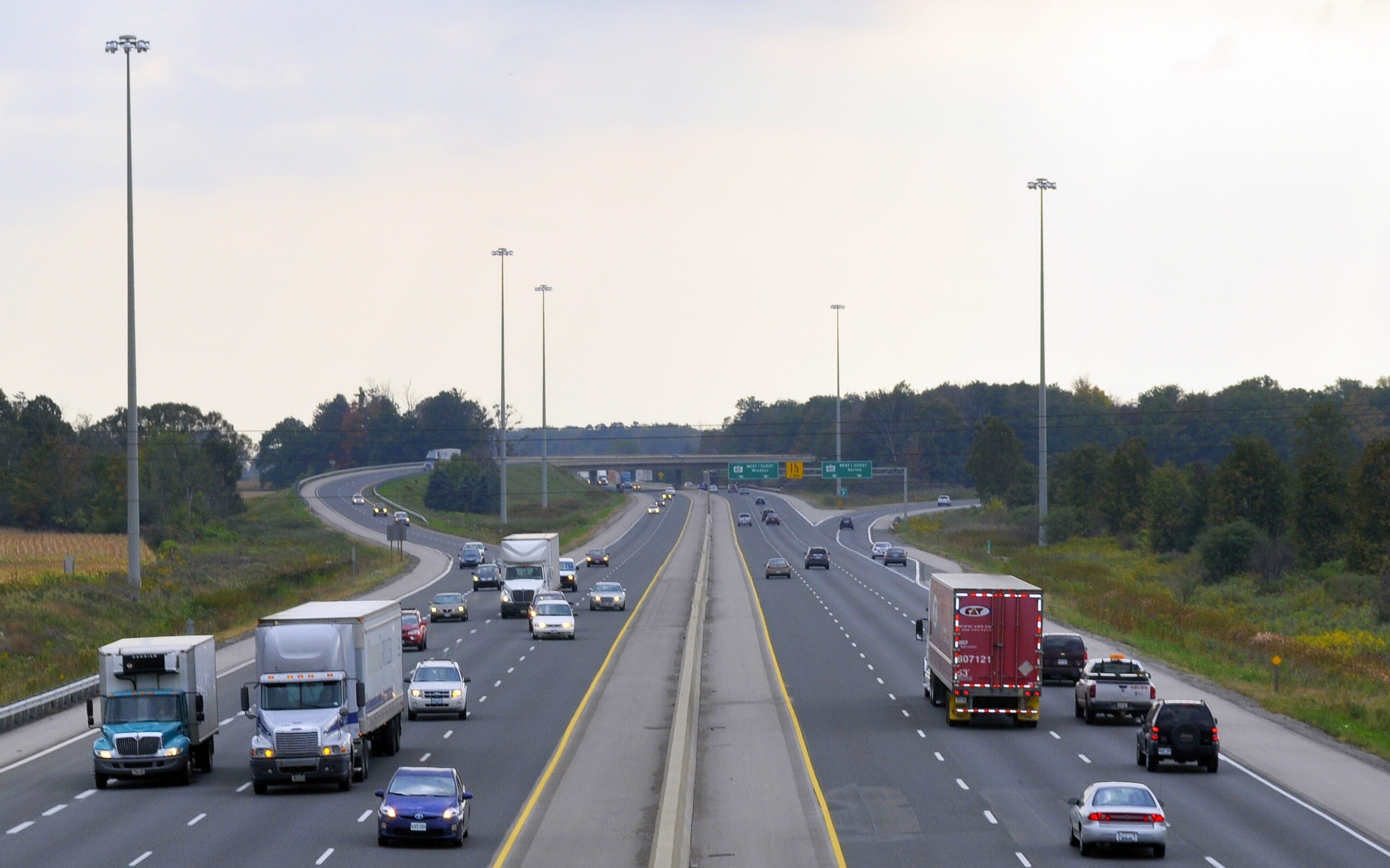
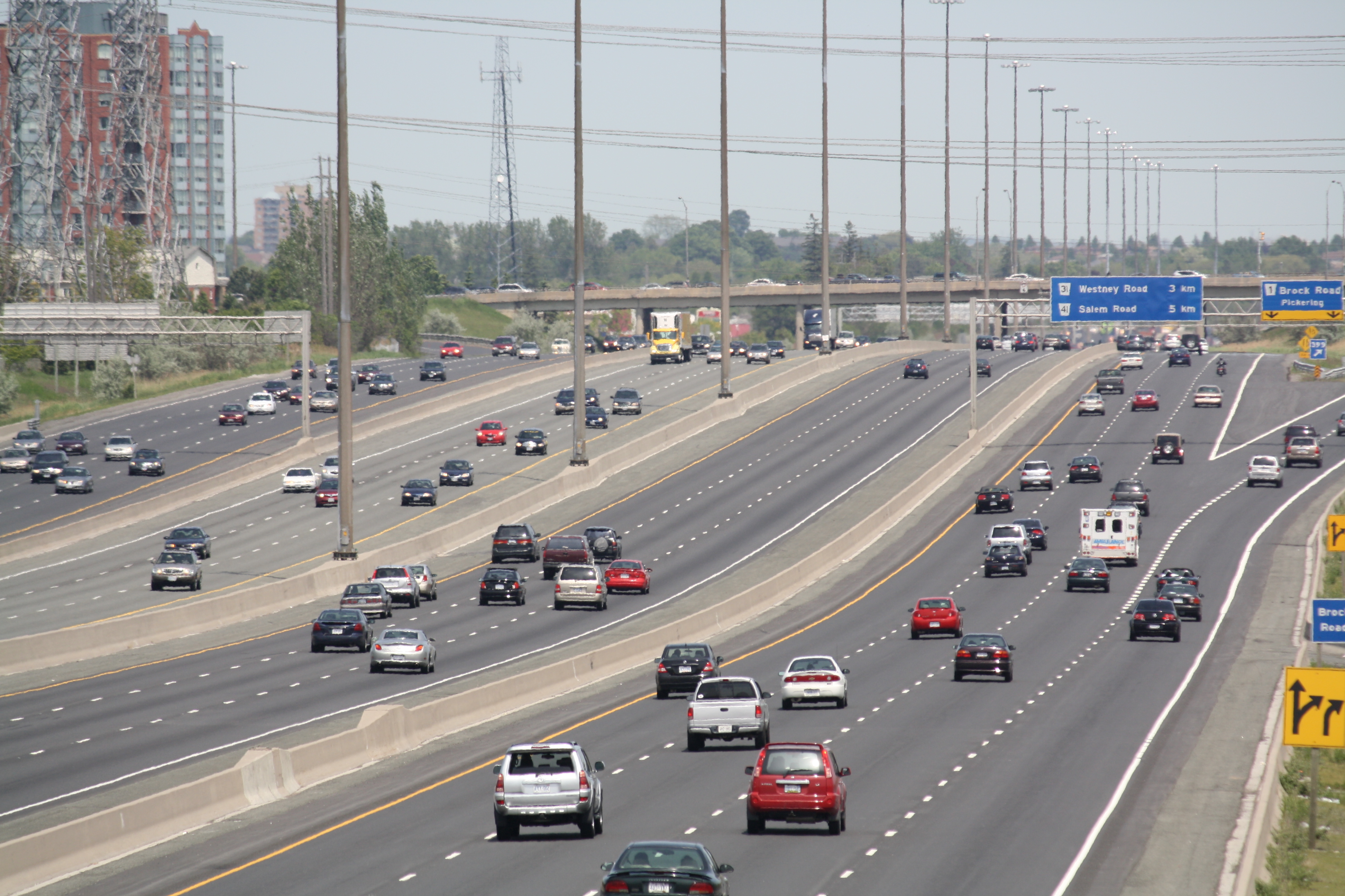
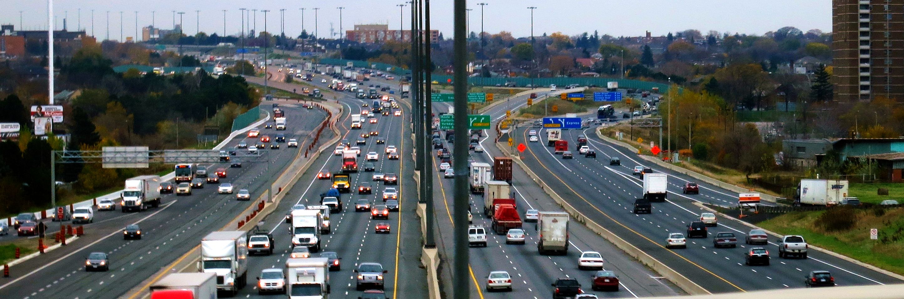
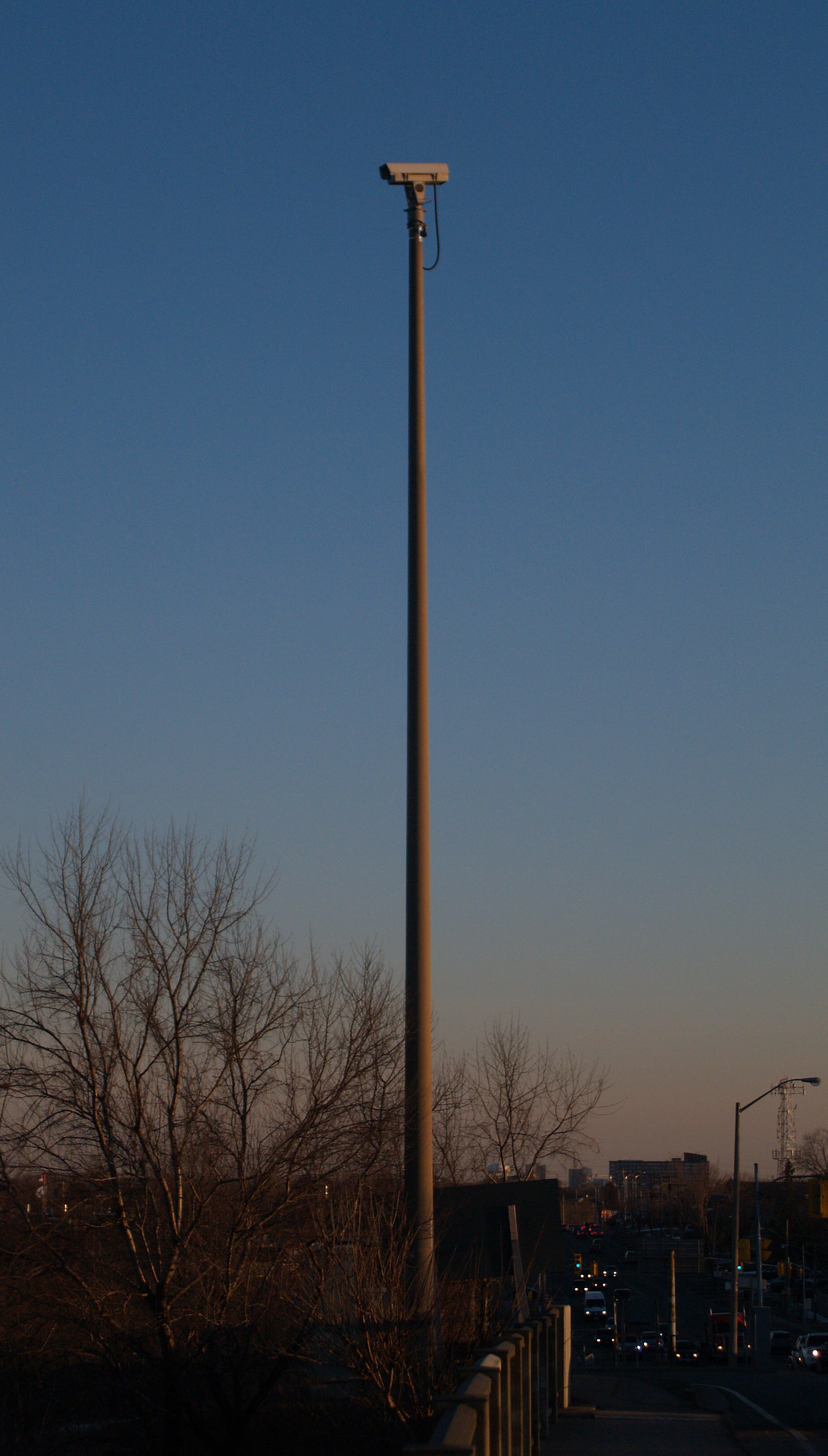
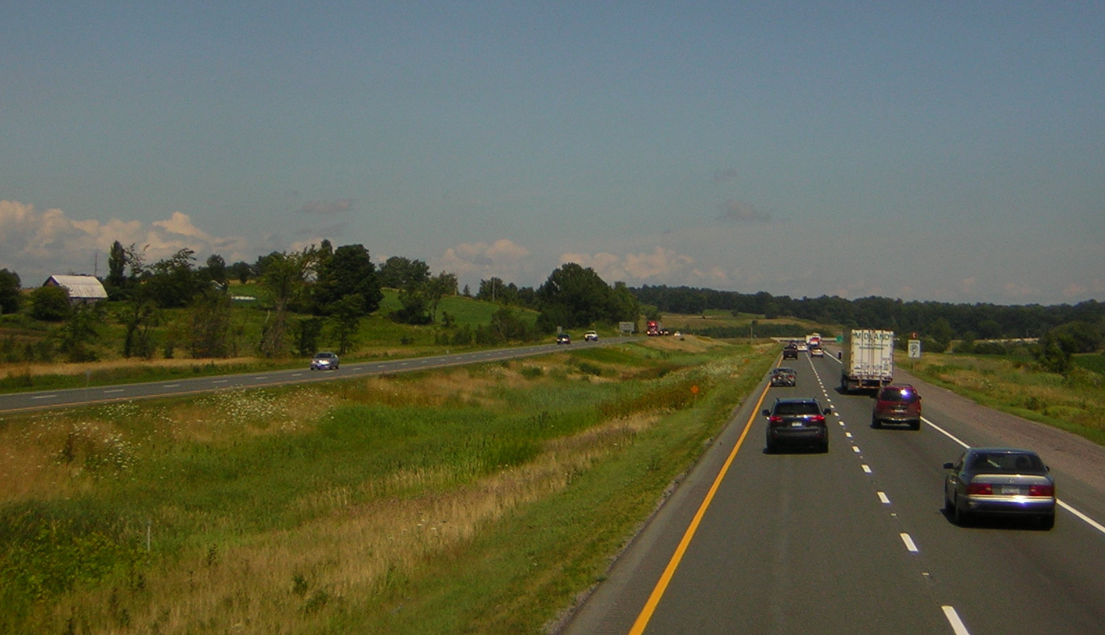
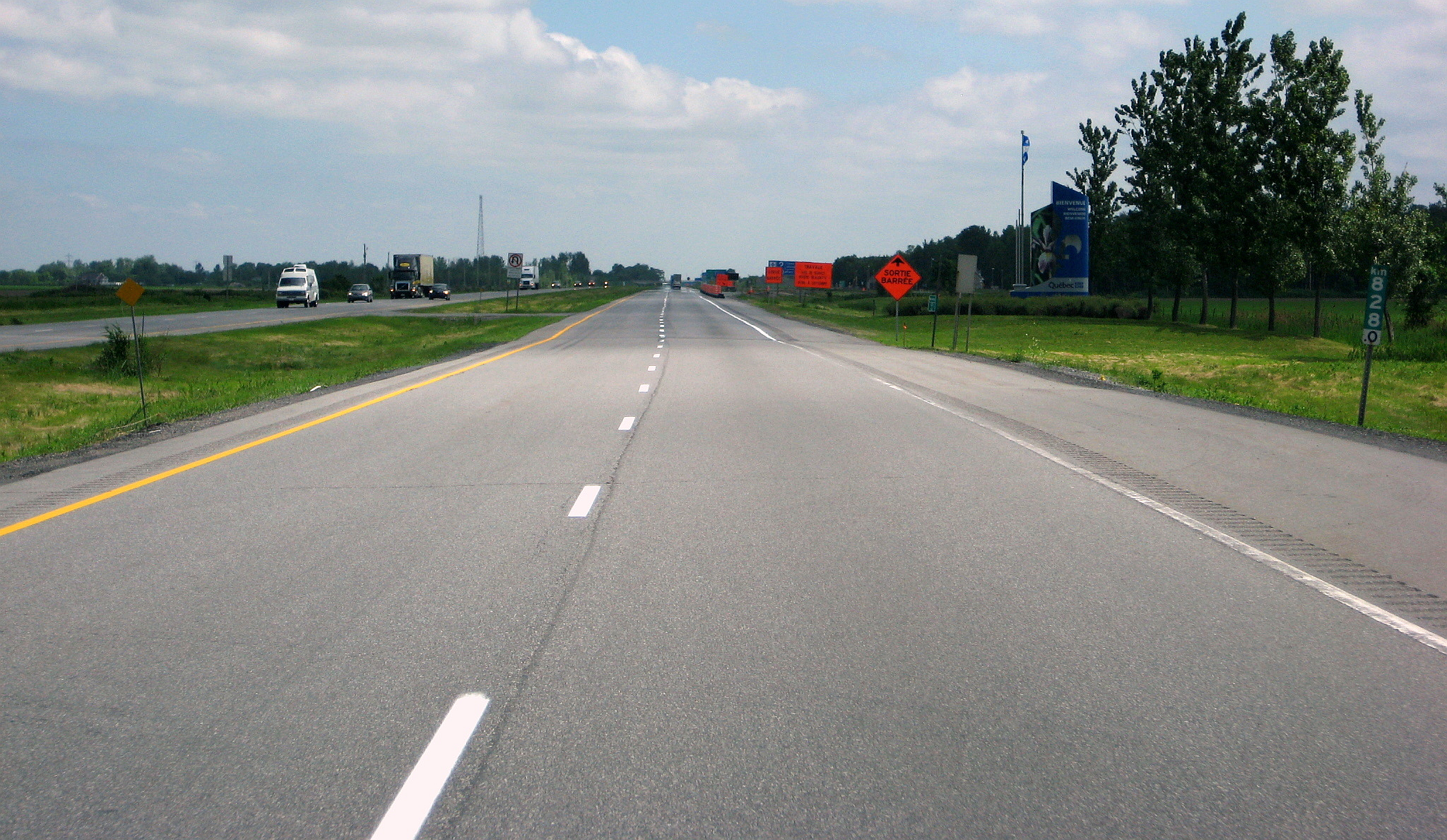

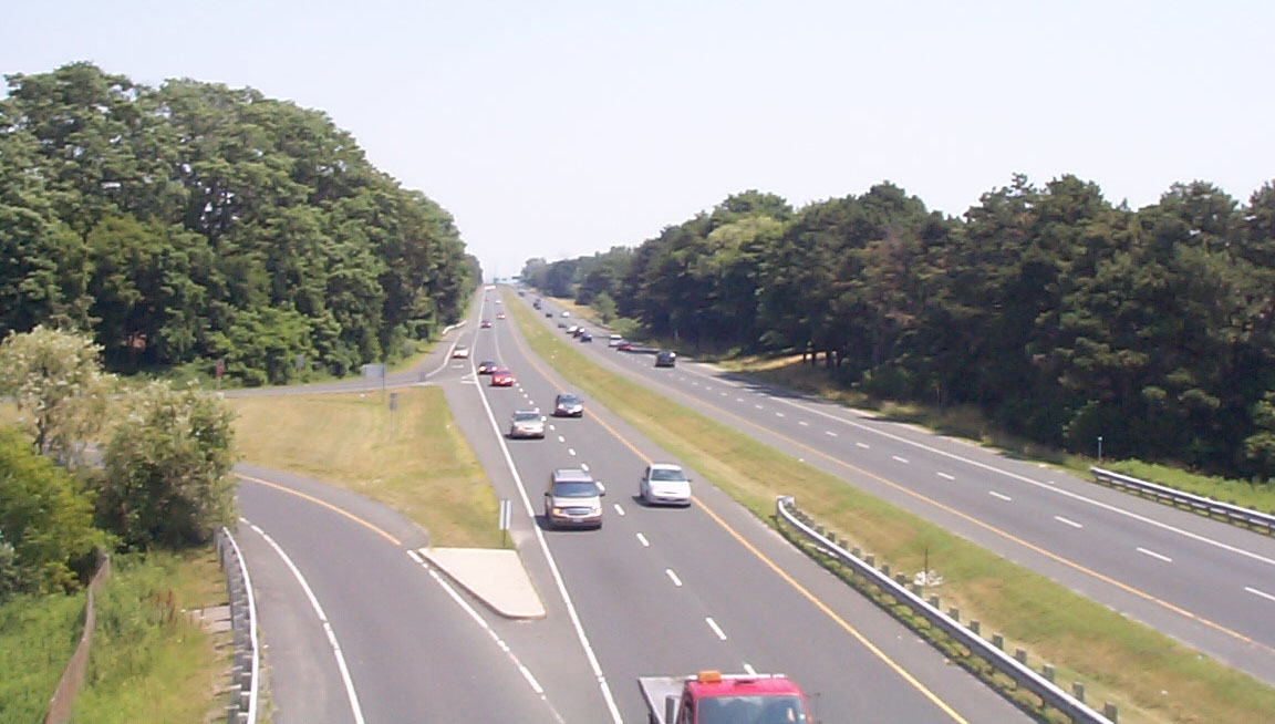
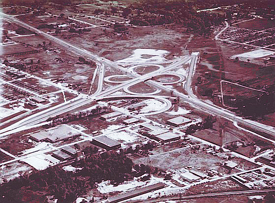

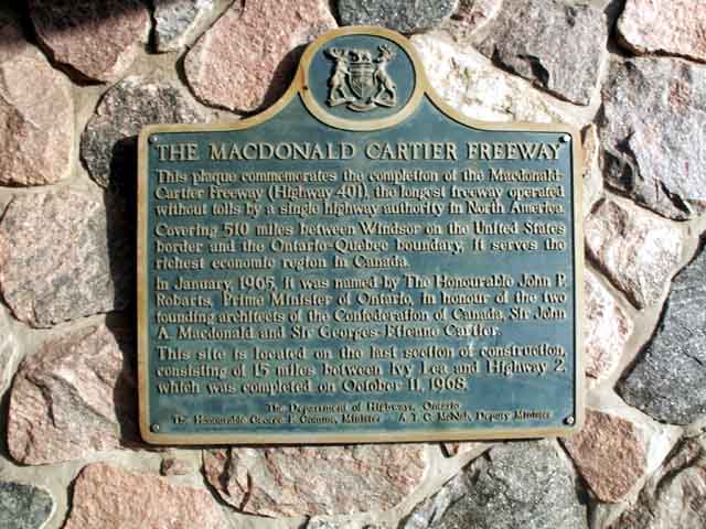
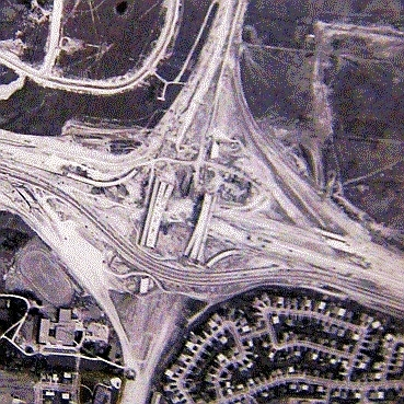
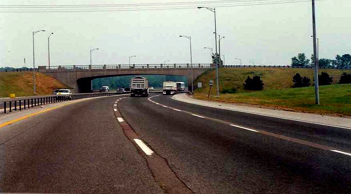
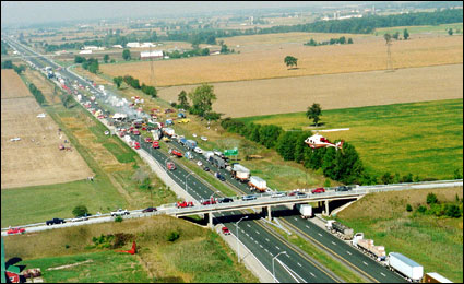
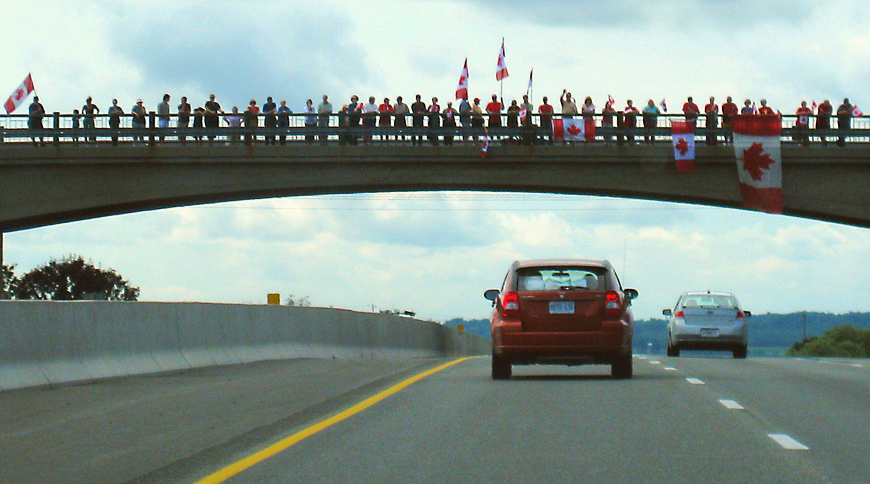
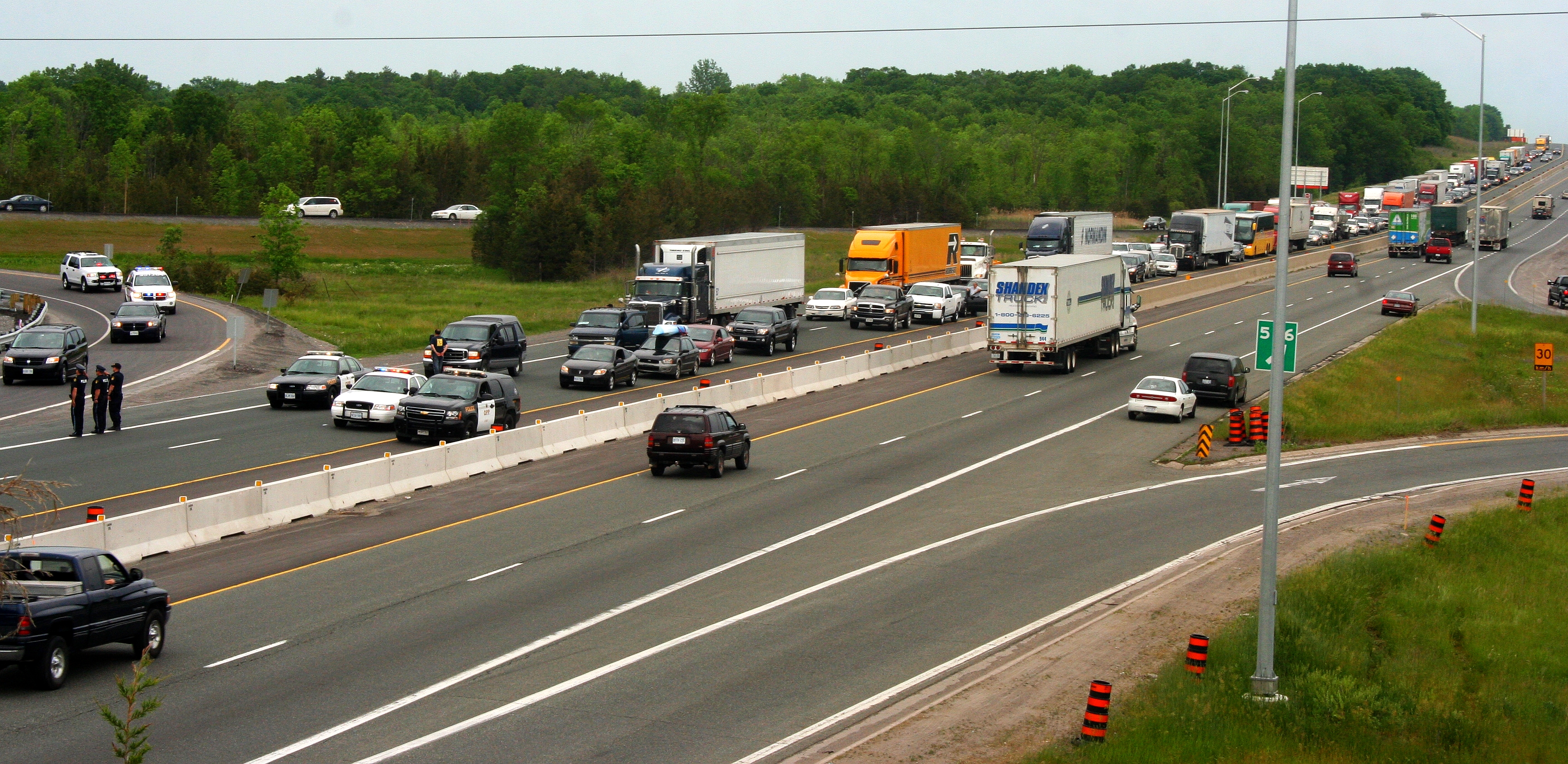
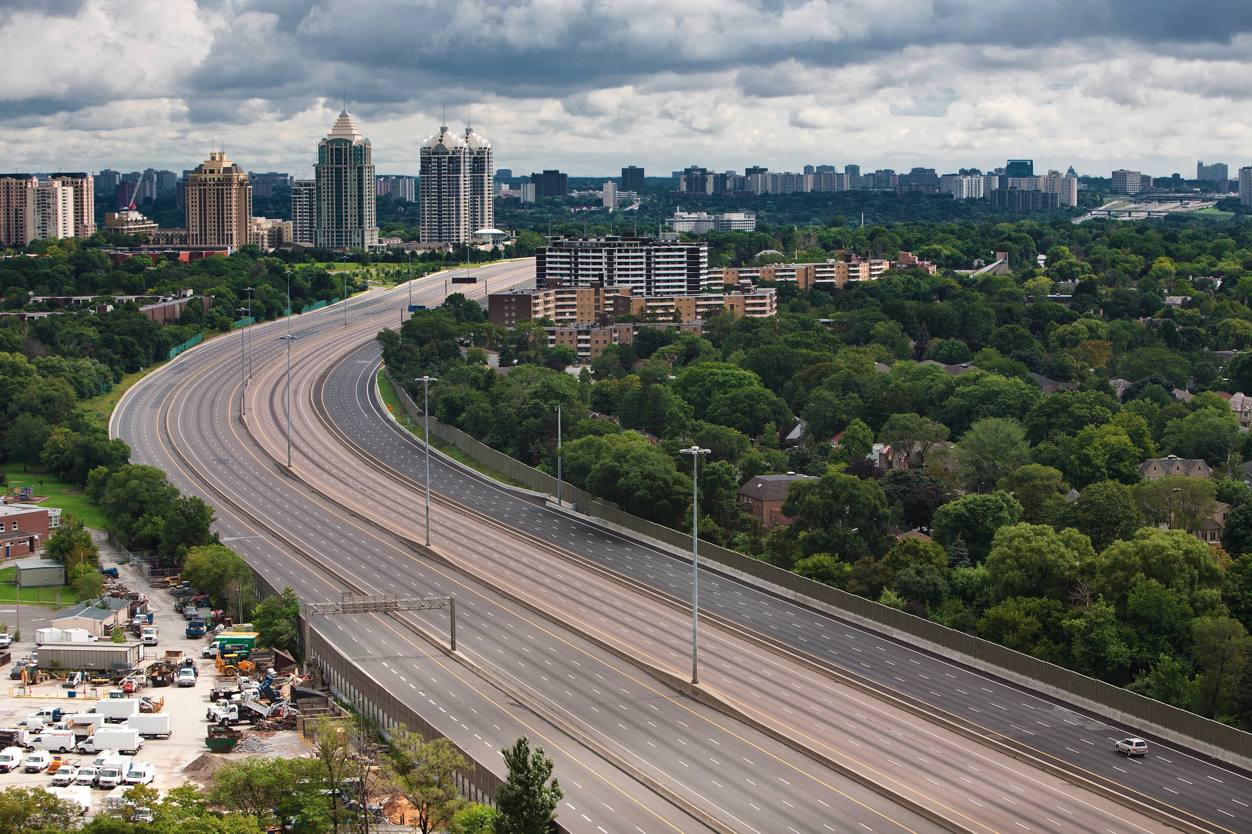
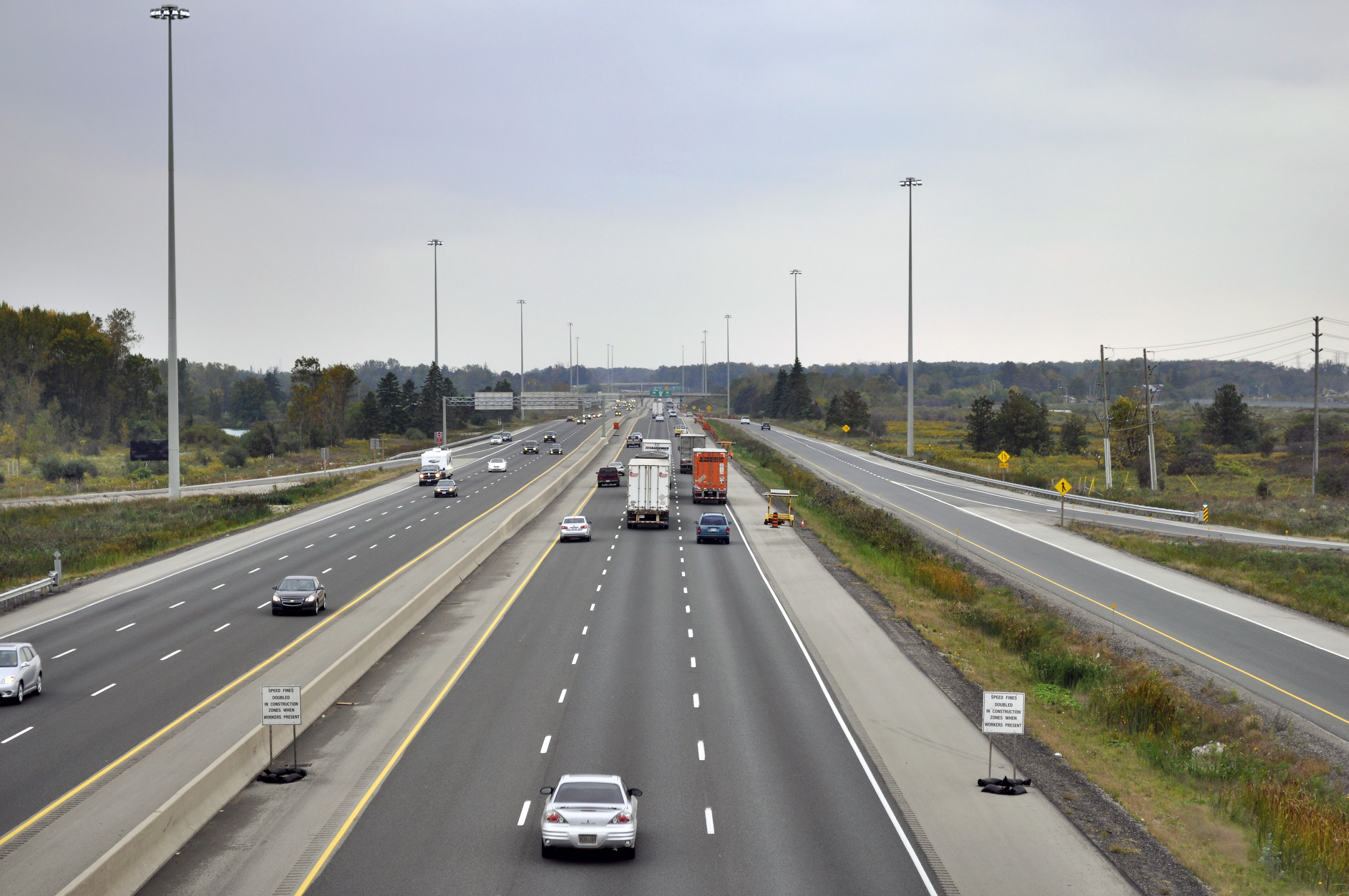
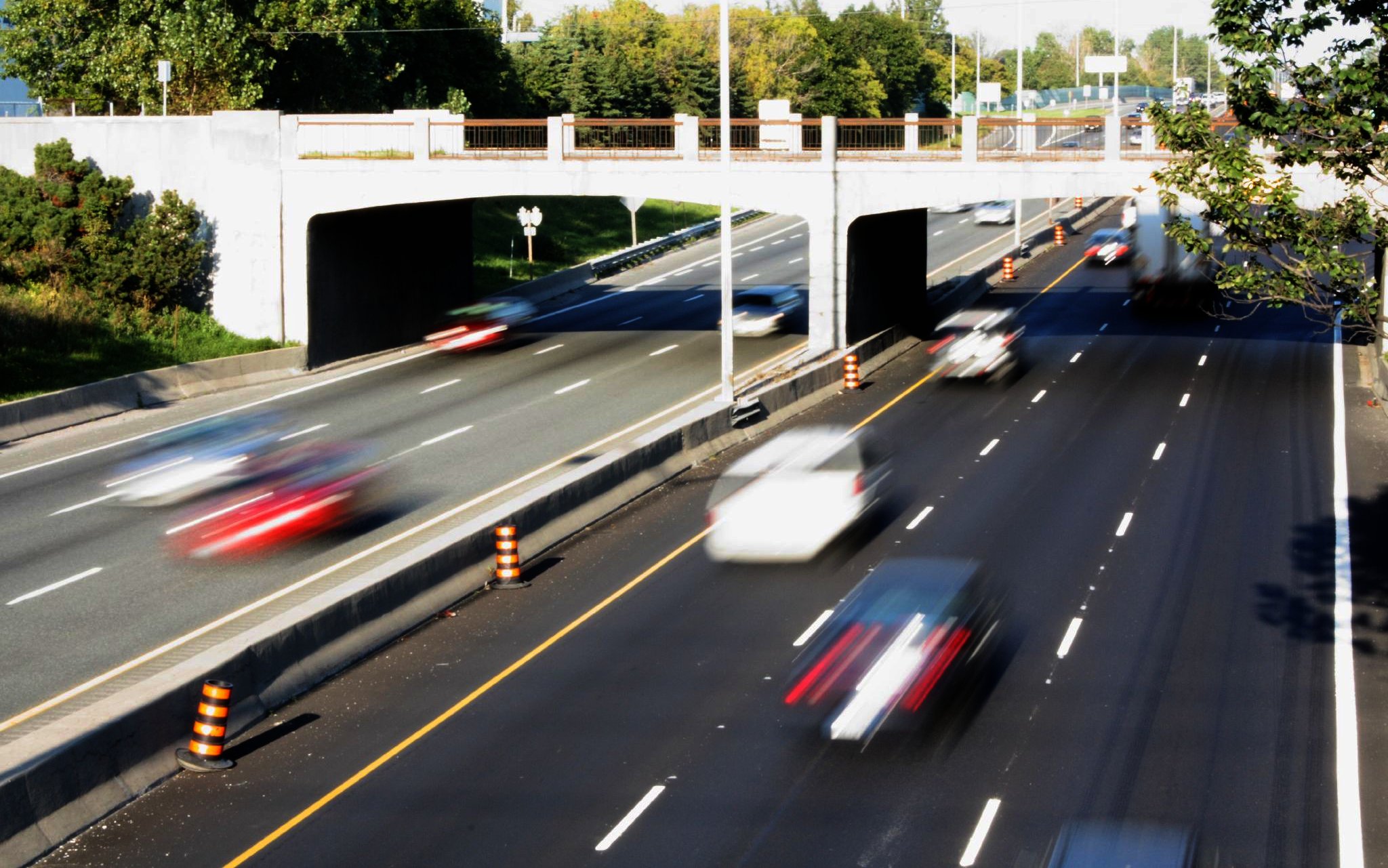
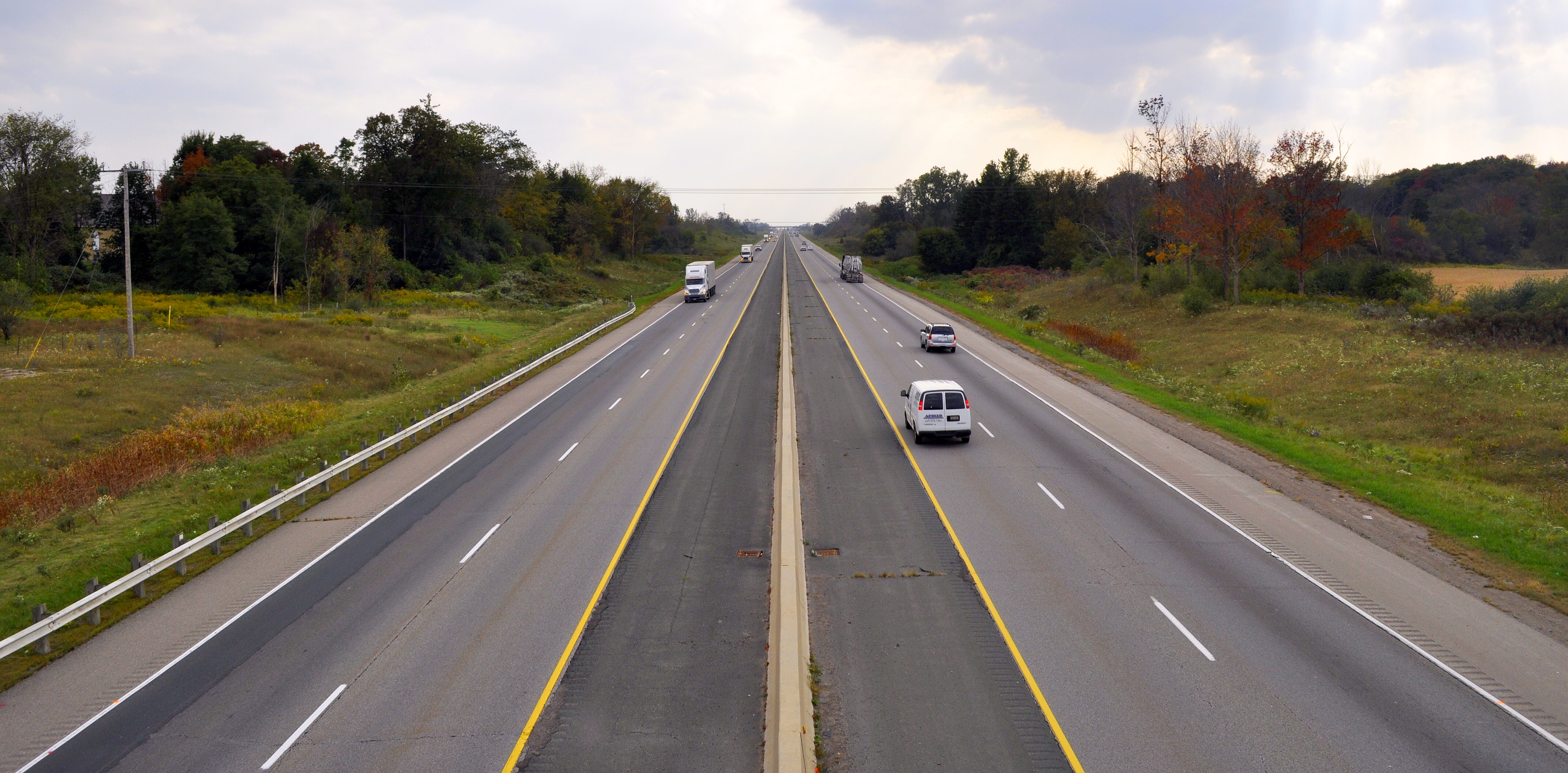
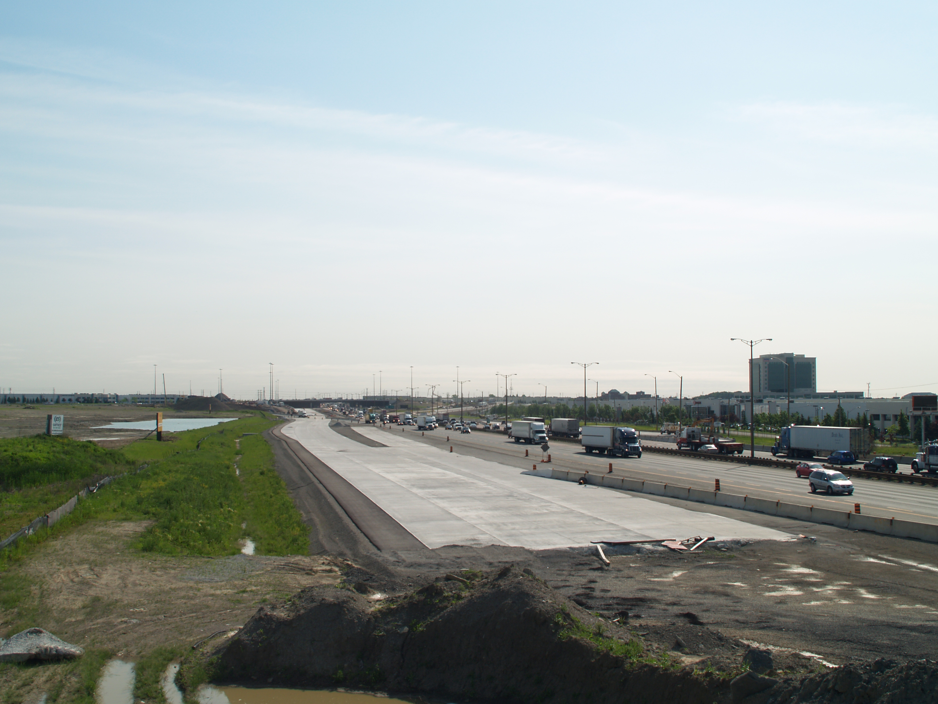
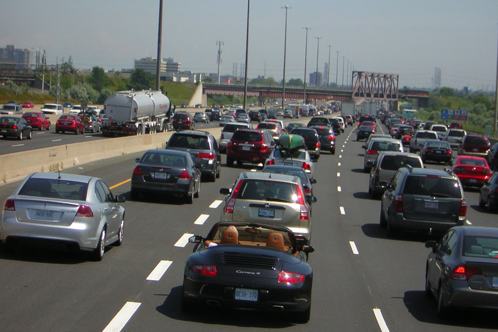
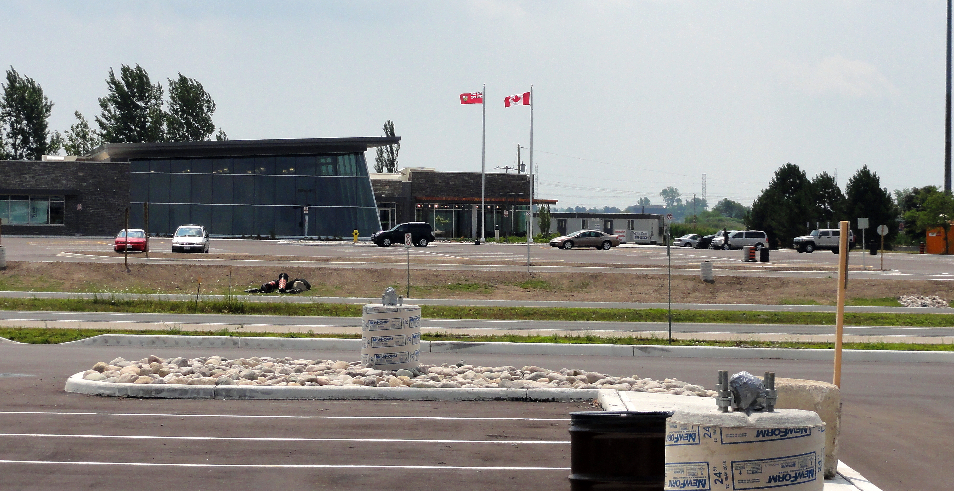
Wikimedia Foundation. 2010.