- Highbury Avenue
-
Highbury Avenue
Wenige Expressway
Formerly Highway 126Route information Maintained by City of London Length: 5 km (3.1 mi) History: Opened December 9, 1963
Widened in 1966
(as a two-lane expressway)
(to a four lane, grade-separated expressway)Major junctions North end: Wilton Grove Road South end: Hamilton Road Location Major cities: London Highway system Ontario municipal expressways (in alphabetical order) ← Harbour Expressway Highbury Avenue Lincoln M. Alexander Parkway → Highbury Avenue is an arterial road/expressway located in London and St. Thomas, Ontario. The speed limit, on the expressway portion is 100 km/h.[1]
For the citizens who live and work in both cities, Highbury Avenue is considered an essential commuter route between both cities and also to Highway 401 and Highway 402.
Contents
Route description

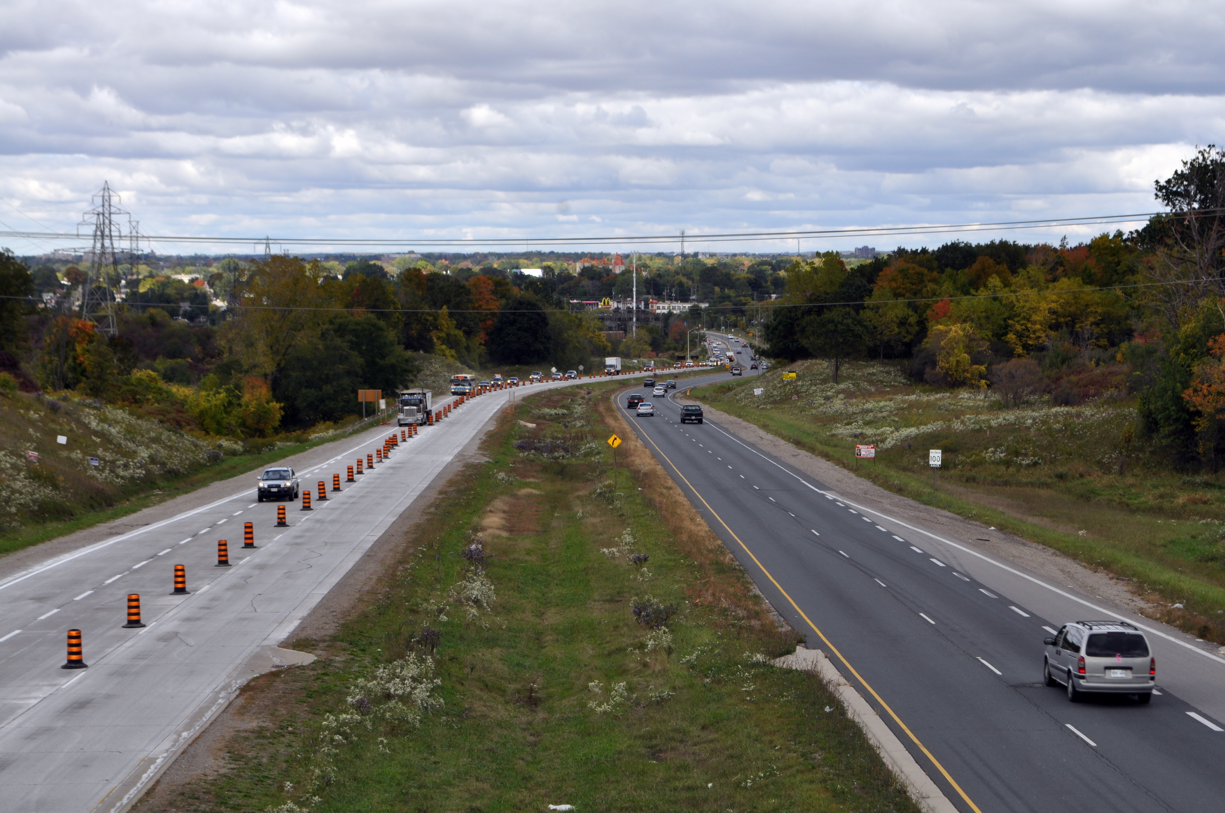
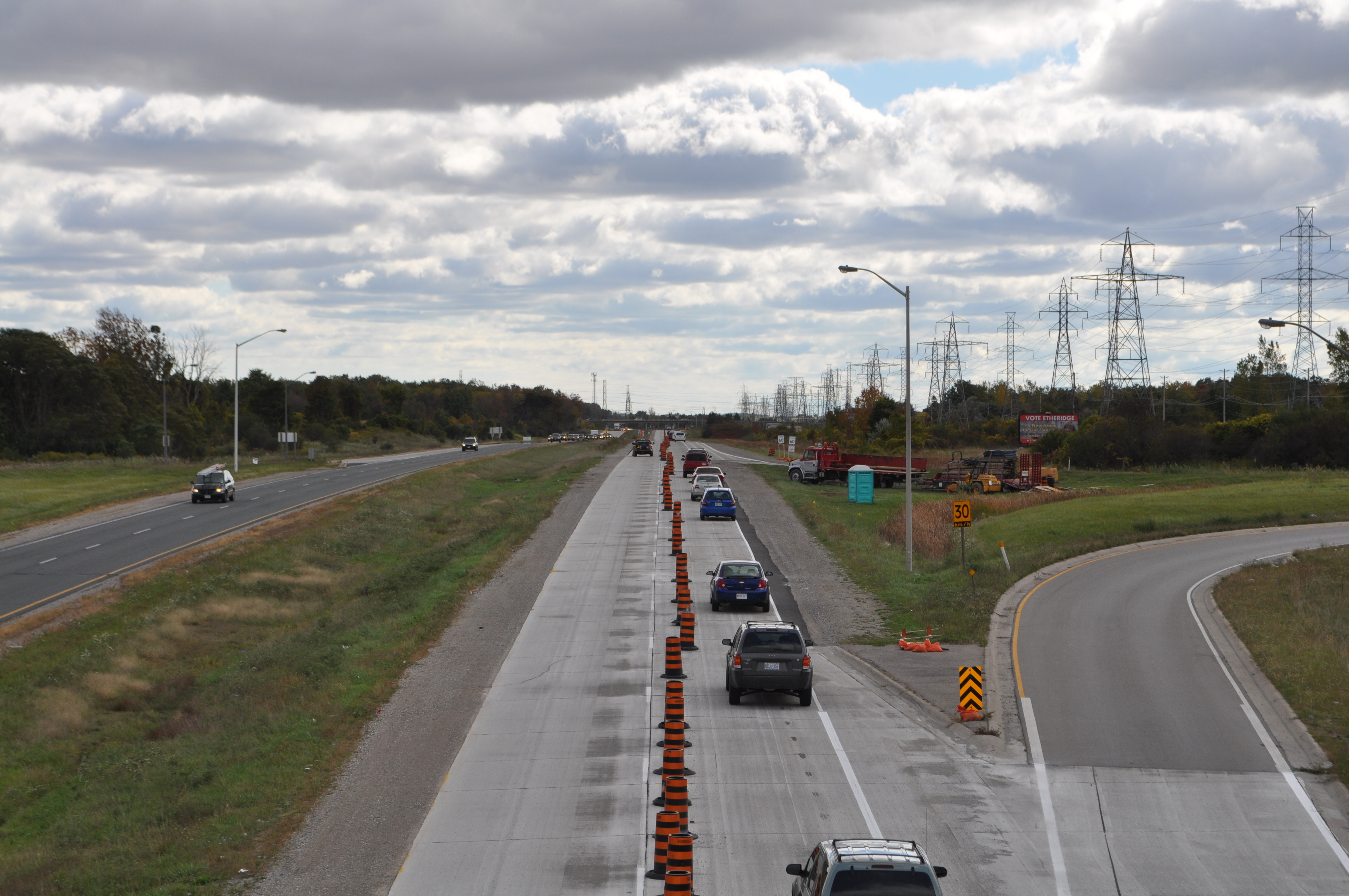
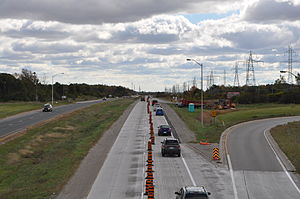 The Highbury Avenue expressway seen from the Commissioners Road overpass looking north and south respectively. The concrete southbound lanes were being rehabilitated at the time these photos were taken.
Highbury Avenue begins at South Edgeware Road in St. Thomas where it proceeds north as a two lane highway (Elgin County Road 30) until Wilton Grove Road in London. From there it briefly becomes a four-lane, 4.5 km (2.8 mi) expressway north from Highway 401 to Hamilton Road.[2] It then continues north as a four-lane arterial street through the rest of London.
At approximately Fanshawe Park Road, Highbury Avenue continues north from London as a two-lane highway (Middlesex County Road 23), where it ends at Elginfield Road (Highway 7).
History
The expressway portion was built in 1966.[3] This road was originally planned to be completed as part of a network of expressways to serve London along the Thames River. However, local opposition led to this expressway portion of Highbury ending at Hamilton Road..[4] The road was given provincial highway status as Highway 126 on December 9, 1963.[5] For a time the expressway portion of the road was unofficially named "George Wenige Expressway" after a former mayor of London, George Wenige. There were also plans to extend the expressway south to St. Thomas, but these plans were shelved.
In 1989, the interchange at the intersection of Bradley Avenue and Highbury was completed. In 1991, responsibility for Highway 126 was transferred from the provincial government to the City of London. Later in 1994, the Highbury Avenue interchange and overpass at Highway 401 was reconstructed. The reconstruction led to the cloverleaf interchange being converted to a Parclo-A4 interchange configuration with traffic lights, no longer being completely controlled-access (freeway-to-freeway).
Major intersections
The following table lists the major intersections along the portion of Highbury Avenue that was once assumed by the Ministry of Transportation of Ontario. The road continues north and south of these points, but distances are not available.
Location km[6] Destinations Notes London 0.0 County Road 37 (Wilton Grove Road) 0.8  Highway 401 – Windsor, Toronto
Formerly a cloverleaf interchange 1.8 Bradley Avenue 4.0 Commissioners Road Two additional ramps proposed 5.6 Hamilton Road At-grade intersection; End of expressway portion 7.6 Dundas Street Formerly Highway 2 11.7 Kilally Road End of former Highway 126; Highbury Avenue continues north as Middlesex County Road 23 References
- ^ Cameron Bevers. "The King's Highway 126". http://www.thekingshighway.ca/Highway126.htm. Retrieved November 27, 2010. "The four-lane freeway has a 100 km/h speed limit."
- ^ Cameron Bevers. "The King's Highway 126". http://www.thekingshighway.ca/Highway126.htm. Retrieved November 27, 2010. "Highbury Avenue Freeway is still a fully controlled-access route from Hamilton Road to the Highway 401 Interchange."
- ^ Cameron Bevers. "The King's Highway 126". http://www.thekingshighway.ca/Highway126.htm. Retrieved November 27, 2010. "In 1966, the entire section of Highway 126 lying to the south of Hamilton Road was converted into a four-lane controlled-access freeway."
- ^ Cameron Bevers. "The King's Highway 126". http://www.thekingshighway.ca/Highway126.htm. Retrieved November 27, 2010. "During the 1960s, several ambitious plans were developed to construct a series of freeways across London, in order to provide improved connections to Highway 401 from the central and northern half of the city. However, plans to extend the Highway 126 Freeway further north were eventually scrapped."
- ^ AADT Traffic Volumes 1955–1969 And Traffic Collision Data 1967–1969. Ontario Department of Highways. 1969. p. 112.
- ^ Ministry of Transportation of Ontario (April 1, 1989). Provincial Highways Distance Table. Government of Ontario. pp. 85. ISSN 0825-5350.
Roads in London, Ontario Provincial Highways: Freeways: Expressways: Veterans Memorial Parkway • Highbury AvenueMain North-South Arterial Roads: Hyde Park Road • Sanitorium Road • Boler Road • Colonel Talbot Road • Wonderland Road • Wharncliffe Road • Western Road • Ridout Street • Richmond Street • Wellington Road • Adelaide Street • Highbury Avenue • Clarke Road • Veterans Memorial ParkwayMain East-West Arterial Roads: Fanshawe Park Road • Gainsborough Road • Windermere Road • Sarnia Road • Huron Street • Oxford Street • Riverside Drive • Dundas Street • York Street • Byron Baseline Road • Springbank Drive • Horton Street • Hamilton Road • Commissioners Road • Southdale Road • Bradley Avenue • Exeter Road • Dingman Drive • Wilton Grove RoadControlled-access highways of Ontario 400-series highways Other highways Current: 2A · 11 · 58 · 115 · 137 · Conestoga Pkwy. · Dougall Pkwy. · E.C. Row Expwy. · Hanlon Pkwy. · Queensway · Thunder Bay Expwy.
Municipal: Black Creek Dr. · Burlington St. · Cootes Dr. · Don Valley Pkwy. · Gardiner Expwy. · Harbour Expwy. · Highbury Ave. · Lincoln M. Alexander Pkwy. · Queensway · Red Hill Valley Pkwy. · Vets Mem. Pkwy. · W.R. Allen Rd.
Proposed: GTA West Corridor · Halton–Peel Freeway · Mid-Peninsula Highway · Bradford Bypass · West Durham Link · East Durham LinkCounty roads in Ontario · Ontario numbered highways · Expressways and 400-series highways · King's Highways · Secondary highways · Tertiary and 7000-series highways · List of Ontario provincial highways · List of former provincial highways in Ontario · Highways in Ontario · List of Ontario expressways · Trans-Canada Highway · Connecting Link · Emergency Detour RouteCategories:- Roads in London, Ontario

Wikimedia Foundation. 2010.