- Ontario Highway 403
-
Highway 403
Chedoke Expressway 
Route information History: Proposed 1950s
Opened December 1, 1963[1] –
August 15, 1997[2]Major junctions West end:  Highway 401 – Woodstock
Lincoln M. Alexander Parkway – Hamilton

 Queen Elizabeth Way / Highway 407 – Burlington
 Highway 407 – Mississauga
East end: Highway 401 in Mississauga
(continues as Highway 410)Highway system Ontario provincial highways
400-series • Former←  Highway 402
Highway 404  →
→King's Highway 403, also known as Highway 403, is a 400-series highway in the Canadian province of Ontario that travels between Woodstock and Mississauga, branching off from and reuniting with Highway 401 at both ends and travelling south of it through Hamilton and Mississauga. It is concurrent with the Queen Elizabeth Way (QEW) for 22 km (14 mi) from Burlington to Oakville. Highway 403 is also known as the Chedoke Expressway or Chedoke Parkway within Hamilton. Although the Highway 403 designation was first applied in 1963 to a short stub of freeway branching off of the QEW, the entire route was not completed until August 15, 1997, when the Brantford to Ancaster section was opened to traffic.[2]
Contents
Route description
Woodstock – Burlington
Highway 403 begins at a junction with Highway 401 on the outskirts of Woodstock. The eastbound lanes split from eastbound Highway 401, whereas the westbound lanes merge into westbound Highway 401.[3] It travels along the back lot lines of the second concession south of former Highway 2, which Highway 403 largely serves as a bypass to.[citation needed] It passes beneath Oxford County Road 55 (formerly Highway 53) and curves southeast. After crossing into the third concession, it curves back to the east. The highway travels straight for some distance, meeting with the southern leg of Highway 24, which travels south to Simcoe.[3]
The highway crosses the Grand River to the south of Paris, then passes over former Highway 2 as it enters into Brantford. As it passes through Brantford, the highway angles southeast and passes beneath the northern leg of Highway 24 and then the Wayne Gretzky Parkway. It exits the small city to the east. Shortly after exiting Brantford, the highway curves northeast.[3] It travels between Jerseyville Road and former Highway 2 to Ancaster, jogging only to avoid cutting through Dunmark Lake.[citation needed] As the freeway enters Ancaster, it once again crosses former Highway 2 and dips through the southern side of the town.[3]

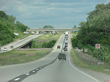
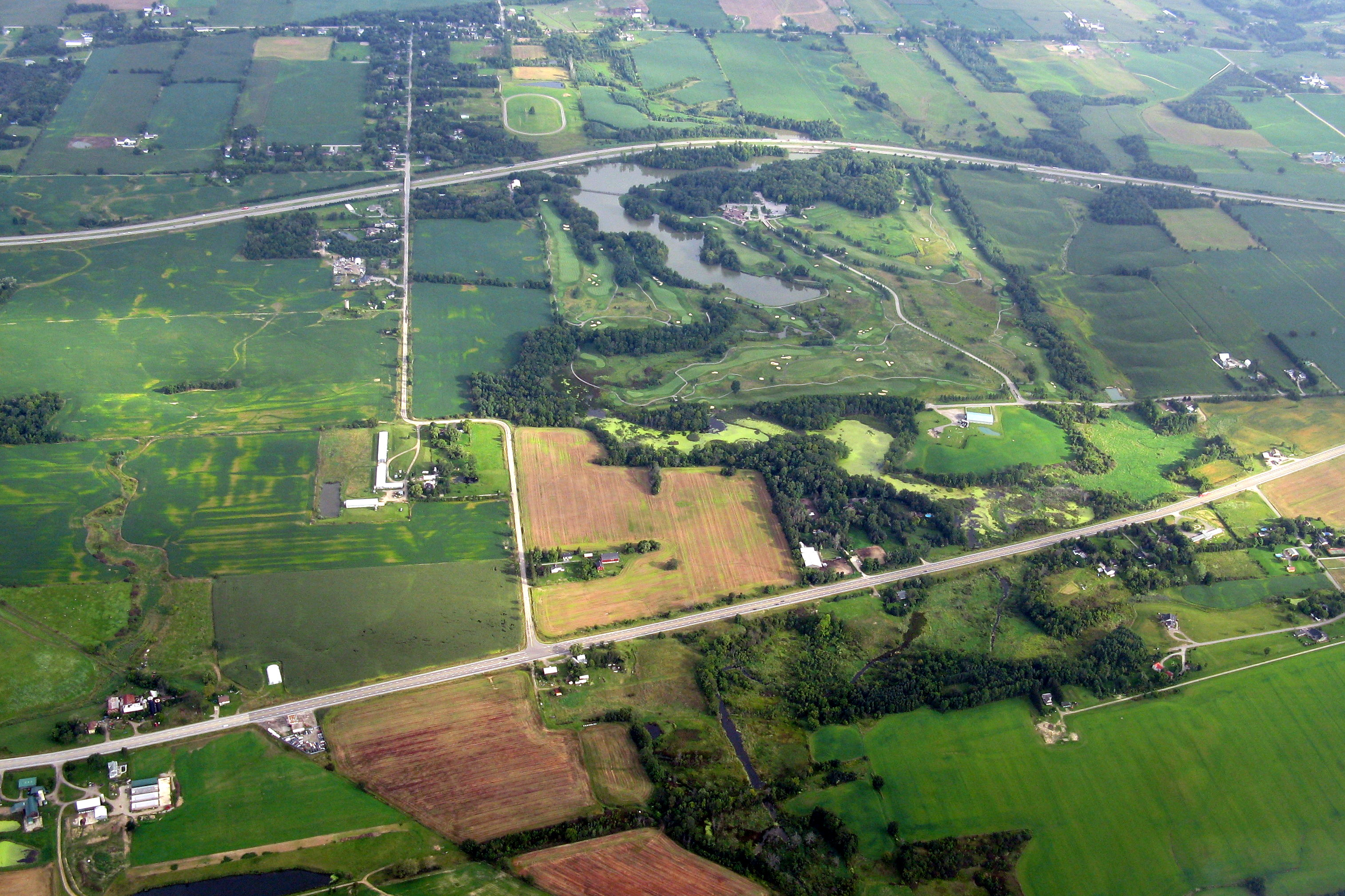
East of Ancaster, the freeway passes through a short greenbelt, with Hamilton Golf and Country Club lying to the north. A short divided section of Highway 6 meets the freeway and continues concurrently with it to the north and east. To the south, it travels to John C. Munro International Airport, Caledonia and Jarvis at Highway 3. Continuing, Highway 403 and Highway 6 curve north into Hamilton and pass the Lincoln M. Alexander Parkway before abruptly curving to the east and descending the Niagara Escarpment. Scenic views of Hamilton, its harbour, and a waterfall are both along this short, steep section. At the bottom of the escarpment the highway passes through a narrow, heavily developed corridor alongside former Highway 8. It passes beneath multiple bridges in a depressed trench, eventually curving north at a sharp corner and passing beneath still more bridges.[3] The highway returns to ground level alongside the Chedoke Creek, a now-channelized river from which the freeway may take its name.
As the freeway continues north, it crosses an isthmus between Hamilton Harbour and Cootes Paradise alongside several roads which it has served to replace. It circles around the northern shore of Hamilton Harbour and returns to an eastward orientation. The concurrency with Highway 6 ends at an interchange where Highway 403 continues east and Highway 6 travels north towards Guelph.[3] The freeway continues straight for several kilometres and meets the Queen Elizabeth Way and Highway 407 at the Freeman Interchange.
Oakville – Mississauga
 Highway 403 and the Queen Elizabeth Way converge at the Freeman Interchange in Burlington. Highway 407 ETR also begins at this junction.
Highway 403 travels concurrently with the QEW for 22.6 km (14.0 mi) between Freeman and Oakville, a straight section surrounded almost entirely by commercial units and warehouses. At the Ford Assembly Plant near the Halton–Peel regional boundary, Highway 403 branches off from the QEW and heads north for 5 km (3.1 mi) along the western edge of Mississauga. At that point it again meets Highway 407. Both freeway interchange, but curve to avoid each other. Highway 407 continues to the north and west, while Highway 403 curves east to follow alongside a hydro corridor through the centre of Mississauga.[3] From here to Highway 401, high-occupancy vehicle (HOV) lanes are present in the shoulder lanes for vehicles with at least one passenger.[citation needed] Pressed between residential subdivisions on both sides, the freeway passes beneath Erin Mills Parkway, dips slightly to the south and crosses the Credit River.[citation needed]
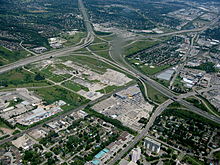
On the other side of the river, the freeway passes to the north of downtown Mississauga, as well as the Square One Shopping Centre, the largest mall in Ontario.[citation needed] It passes beneath Hurontario Street (once a section of Highway 10) and begins to widen. It abruptly curves to the north approaching Cawthra Road and widens further into a ten-lane collector-express system.[citation needed] This short section of highway passes beneath Eglinton Avenue and begins to diverge into a sprawling interchange approaching Highway 401. Access to Highway 410, which continues northward to Brampton, is provided from the collectors lanes.[3]
History
 Highway 2 near Woodstock was widened into a divided four lane highway by 1936 and is one of the precursors to Highway 403
The corridor that connects London and Hamilton has always been important to Ontario. In late October 1793, Captain Smith and 100 Queen's Rangers returned from carving The Governor's Road 32 km (20 mi) through the thick forests between Dundas and the present location of Paris. John Graves Simcoe was tasked with defending Upper Canada from America following the revolution and with opening the virgin territory to settlement. After establishing a "temporary" capital at York, Simcoe ordered an inland route constructed between Cootes Paradise at the tip of Lake Ontario and his proposed capital of London. By the spring of 1794, the road was extended as far as La Tranche, now the Thames River.[4] Today, most of this route forms part of Highway 2 and former Highway 5.[citation needed]
The paving of the divided four-lane Middle Road, with gentle curves, a grass median and grade-separated interchanges, would set the stage for the freeway concept. It was the first intercity freeway in North America when it opened in June 1939.[5] Thomas McQueston, the new minister of the Department of Highways and the man most responsible for the Middle Road, decided to apply the concept to sections of Highway 2 plagued with congestion.[6] A portion east of Woodstock was rebuilt in this fashion, but World War II would put an end to the ambitions of McQueston, at least temporarily.
Initial construction

The end of the Korean War heralded the resuming of freeway construction in Ontario; the advances in machinery more than made up for lost time.[6] The construction of Highway 401 across the province took first priority. However, the opening of the section from Highway 4 near London to Highway 2 east of Woodstock on May 31, 1957 would complete part of the route required between London and Hamilton.[7] By 1958, planning on Chedoke Expressway, or Controlled Access Highway 403 was well underway,[8] though plans for a four lane freeway between Woodstock and Hamilton were around as early as 1954.[9] The opening of the Freeman Bypass of the QEW in August 1958 provided a connection point for a new freeway,[10] and construction began between Freeman and Hamilton by 1961.[11] Highway 403 between Longwoods Road (Highway 2) and the QEW was officially opened to traffic on December 1, 1963 at a length of 9.0 km (5.6 mi).[12] Work was already underway on the next section of the Chedoke that would extend the freeway to Aberdeen Avenue.[13] This section was opened on July 9, 1965 and extended the freeway by 3.7 km (2.3 mi).[12]
Meanwhile on Highway 2, work had begun on a bypass of Brantford. The new freeway passed north of the town between Paris Road in the west and the junction of Highway 2 and Highway 53 in the east, a distance of 6.4 mi (10.3 km). This section opened on October 31, 1966.[12] A portion of the Brantford Bypass was itself bypassed in 1997 when the final section of Highway 403 was completed and is known as Garden Avenue.[14] However, the Brantford Bypass would remain an isolated section of Highway 403 for over 20 years.
Mississauga
 Highway 403 and QEW interchange in Oakville. The Ford Motor Plant is visible in the distance.
Planning for the segment of Highway 403 through Mississauga dates back to the late-1950s when the Hamilton Expressway appeared on the Metropolitan Toronto's regional transportation plan. It was to be a continuation of the Richview Expressway, which was ultimately never built, continuing from Toronto to Hamilton.[15] The plan showed the expressway's eastern terminus as the Highway 401 and Highway 427 interchange. As Toronto's anti-expressway movement gained momentum, plans shifted the Hamilton Expressway to the west near Etobicoke Creek. In 1962, the right-of-way alongside the hydro corridor from Burlington to Etobicoke Creek was protected after traffic studies indicated the need for a future freeway.[16] On May 25, 1965, the Department of Highways unveiled the Toronto Region Western Section Highway Planning Study. The plan designated Highway 403 north from Burlington and then parallel with the QEW to Highway 401 near Highway 27.[17]
Plans were modified when Bill Davis became premier in 1971. Davis initiated construction of Highway 410 along the Heart Lake Road corridor. The two lane highway opened in 1978, featuring a single directional and loop ramp at Highway 401 to provide access to and from Toronto. This interchange was a better connection point for Highway 403, and plans were revised to have it turn north at Cawthra Road. These plans were submitted and approved in 1978 by Mississauga, and construction began.
The new freeway opened in sections in the early 1980s. The first section between Cawthra Road and Highway 401 was opened August 18, 1980.[18] This was followed by a short section from Highway 5 (Dundas Street) south to the QEW at Ford Drive, which opened in mid-1981. Later that year, an extension to Erin Mills Parkway was opened on November 17, 1981.[19] The final section to be opened took the longest to complete, involving construction of two bridges over the Credit River valley. It opened on December 2, 1982. The cost of the entire 22 km (13.7 mi) Mississauga segment was $87 Million.[20]
Around the same period, the Ministry of Transportation began to study upgrading Highway 401 to a collector express system between Renforth Drive and Highway 403, and along Highway 403 between Highway 401 and Highway 10.[21] This took place throughout the 1980s, and was completed by 1985; The existing outermost ramps from Highway 403 to Highway 401 eastbound were re-designated to serve collector traffic, as a pair of flyover ramps were added inside the interchange to serve motorists in the express lanes.
 Highway 401 junction with Highways 403 and 410 in 1987, note the unused right-of-way in the middle of the interchange intended for future Highway 401 express lanes and flyover ramps to Highway 410.
The right-of-way originally intended for Highway 403 between Cawthra Road and Etobicoke Creek was eventually used for a controlled access arterial extension called Eastgate Parkway, which was planned beginning in 1982.[21][22] The extension was built between 1987 and 1990, incorporating a portion of Fieldgate Drive at the eastern end.
In the fall of 1991, alongside the widening of Highway 410 into a full freeway, construction began on the connecting ramps between Highway 403 and Highway 410, which pass under the existing bridge structures for Highway 401 collector traffic, while new overpasses were constructed in the center for Highway 401 express lanes. The loop ramp from Highway 410 southbound to Highway 401 eastbound was replaced by a semi-directional high-speed flyover, while a new directional ramp and semi-direction flyover were added to serve westbound 401 commuters. Prior to the opening of this link, traffic from both freeways was forced onto eastbound Highway 401.[23] The 2.2 km (1.4 mi) link opened on November 2, 1992 at a cost of $7.3 million.[24]
Bridging the gaps
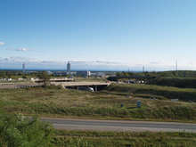
 Highway 403 eastbound at the Grand River bridge near Brantford.
A new segment of Highway 403 from Brantford to Highway 401 near Woodstock opened in 1990. During the construction of the flyover ramp where Highway 403 westbound terminates, Highway 401 westbound traffic was diverted to the partially completed flyover embankment in order to accelerate construction of the rest of the overpass. Highway 403 was briefly left with three discontinuous sections; Brantford-Woodstock, Hamilton-Ancaster, and Mississauga. As a temporary stopgap, traffic from the Woodstock segment was routed to Highway 2 in order to connect with the Hamilton segment. The last remaining gap between Brantford and Ancaster was plagued by numerous delays, and finally opened in 1997. Highway 2, which was the only parallel route before the completion of Highway 403, was subsequently downloaded.
Controversy
Though some officials considered Highway 403 to be a perfect example of a freeway construction process, it was not built without its share of controversy. Portions of the freeway through Mississauga were built alongside established communities, leading to angry homeowners associations pressuring the province for noise mitigation measures and compensation.
In the late-1980s and early-1990s, the Mississauga section of Highway 403 played host to over two dozen fatal accidents over a five-year period, one of the highest rates in North America at the time, despite being up to modern road standards. This led Peel Regional Police and the media to nickname it the 'Death Highway'.[25][26] In particular the stretch from Mavis Road to Erin Mills Parkway has been the site of numerous accidents. Highway 403 features a downward slope as motorists head eastbound towards the Mavis Road interchange, where drivers frequently complain of having to slam on the brakes when traffic comes to a standstill due to a sudden increase in volume, causing numerous rear-end collisions. There is also glare from the sun that causes vision problems throughout the day.[27]
Recent construction
The Hamilton-Brantford and Mississauga sections of Highway 403 were initially planned to be linked up, but that land was used instead for an extension of Highway 407.
After this decision, the province planned to renumber the Mississauga section as an extension of Highway 410, as that would have eliminated confusion with the unconnected Highway 403 segment in Woodstock/Hamilton, but that idea was later abandoned to avoid confusion for people accustomed to the "403" designation which has been use since 1982. Also, Highway 403 runs east-west for the most part, while Highway 410 is intended to run north-south (with future plans to have Highway 410 eventually run to Owen Sound).
The freeway was finally made continuous in 2002, when the section of the QEW which connects both segments was co-signed as Highway 403, a rarity for 400-series highways.[28]
 Highway 403 in Mississauga, showing HOV lanes in the median.
In 2002, the right shoulders between Erin Mills Parkway and Mavis Road were widened for GO Transit and Mississauga Transit to run express bus services.[29] In 2003, high-mast lighting was added to the previously unlit Mississauga section between Highway 407 and Eastgate Parkway. Due to land availability afforded by the hydro corridor which runs along the north side of the freeway, the high-mast poles are mounted on the north shoulder instead of in the median. This project preceded the widening of Highway 403 between Winston Churchill Blvd and Highway 401/410, which saw a High-occupancy vehicle (HOV) lane added in each direction; the project started in summer of 2004 and these opened on December 13, 2005. The HOV lanes and the dividing Ontario Tall Wall concrete barrier were constructed using the existing right-of-way provided by the grass median. The conventional truss lighting between Eastgate Parkway and Highway 401/410, which had been installed in 1986, was replaced by shoulder-mounted high-mast lighting in late 2004.
Sufficient right-of-way exists at the Highway 401-403-410 junction for a loop ramp from Highway 403 eastbound to Highway 401 westbound, and a directional ramp for vice versa, which would give Highway 401 eastbound traffic direct access to Cawthra Road, making it a full four-way interchange. These links will be completed when Highway 401 is widened to a 12-lane collector-express system west towards Hurontario Street.[citation needed]
Exit list
The following table lists the major junctions along Highway 403, as noted by the Ministry of Transportation of Ontario.[30]
Division Location km[30] Exit Destinations Notes Oxford County Norwich 0.0 Highway 401 west – LondonWestbound exit and eastbound entrance 5.4 6 County Road 55 – Eastwood, Cathcart Formerly Highway 53 Brant Brant 15.3 16 County Road 25 – Burford, Princeton 26.7 27  Highway 24 south – Simcoe
Rest Acres Road – ParisWestern end of Highway 24 concurrency Brantford 30.2 30 County Road 27
Oak Park Road33.1 33 County Road 202 (Paris Road) Formerly Highway 2 35.7 36 Highway 24 north (King George Road) – CambridgeEastern end of Highway 24 concurrency; formerly Highway 24A south 38.3 38 Wayne Gretzky Parkway 40.7 41 Garden Avenue – Cainsville Hamilton 55.2 55 Regional Road 52 (Trinity Road) – Copetown 58.5 58 Wilson Street Formerly Highway 2 60.3 60 Regional Road 16 (Fiddler's Green Road) Westbound exit and eastbound entrance 61.4 61  Highway 6 south
Garner RoadWestern end of Highway 6 concurrency 64.3 64 Lincoln M. Alexander Parkway
Rousseaux Street69.1 69 Aberdeen Avenue 70.5 70 Main Street Formerly Highway 8 72.8 73 York Boulevard Westbound exit and eastbound exit; formerly Highway 6 south 74.2 74 Highway 6 north – GuelphEastern end of Highway 6 concurrency Halton Region Burlington 77.5 78 Waterdown Road Originally designed only with an Eastbound exit and westbound entrance; full interchange opened on November 1, 2010[31] Highway 403 assumes exit numbers of QEW 81.7 100 Highway 407 eastEastbound exit and westbound entrance Queen Elizabeth Way – St. Catharines, Niagara FallsWestern end of QEW concurrency 82.5 101 Regional Road 18 (Brant Street) Westbound exit and eastbound entrance 84.4 102 Regional Road 1 (Guelph Line) 86.4 105 Walkers Line 88.5 107 Regional Road 20 (Appleby Line) 90.5 109 Regional Road 21 (Burloak Drive) Oakville 92.1 110 Service Road Access removed in 2008 to accommodate widening of the QEW 92.5 111 Regional Road 25 (Bronte Road) – Milton 94.6 113 3rd Line 97.7 116 Regional Road 17 (Dorval Drive) Kerr Street Westbound exit only 98.8 118 Regional Road 3 (Trafalgar Road) 101.2 119 Royal Windsor Drive Eastbound exit and westbound entrance; formerly Highway 122 104.3 123 Queen Elizabeth Way east – TorontoEastern end of QEW concurrency; Highway 403 exits mainline Highway 403 exit numbers resume 104 Regional Road 13 (Ford Drive) Eastbound exit and westbound entrance Upper Middle Drive East Westbound exit and eastbound entrance 106.3 106 Regional Road 5 (Dundas Street) Peel Mississauga 109.4 109 Highway 407111.4 111 Winston Churchill Boulevard 113.0 113 Regional Road 1 (Erin Mills Parkway) 117.6 117 Mavis Road, Centre View Drive 119.7 119 Hurontario Street Formerly Highway 10 121 Regional Road 17 (Cawthra Road)
Eastgate Parkway122.4 122 Eglinton Avenue Eastbound exit is via exit 121 125.2 125 Highway 401 east – TorontoEastbound exit and westbound entrance  Highway 403 continues north as
  Highway 410
 Highway 403 descends the Niagara Escarpment in Hamilton
References
- Sources
- ^ A.A.D.T. Traffic Volumes 1955–1969 And Traffic Collision Data 1967–1969. Ontario Department of Highways. 1970. p. 11.
- ^ a b "Highway 403 extension opens Friday". The Toronto Star. August 15, 1997. http://pqasb.pqarchiver.com/thestar/access/13473550.html?FMT=CITE&FMTS=CITE:FT&type=current&date=Aug+13%2C+1997&author=&pub=Toronto+Star&edition=&startpage=A.11&desc=Highway+403+extension+opens+Friday. Retrieved June 28, 2010.
- ^ a b c d e f g h Peter Heiler Ltd (2010). Ontario Back Road Atlas (Map). Cartography by MapArt. ISBN 978-1-55198-226-7.
- ^ Shragge p. 11
- ^ Stamp p. 12
- ^ a b Shragge, John G. (2007). "Highway 401 – The story". Archived from the original on March 28, 2008. http://web.archive.org/web/20080328001341/http://www.roadscholar.on.ca/lateststory.html. Retrieved February 12, 2010.
- ^ Ministry of Transportation and Communications pp. 8–9
- ^ Annual Report for the Fiscal Year (Report). Ontario Department of Highways. March 31, 1958. http://books.google.com/books?id=6f8iAQAAIAAJ&dq=Ontario+King%27s+Highways&q=C.A.H+403#search_anchor. Retrieved July 25, 2010.
- ^ Canadian Press (July 9, 1954). "4-Lane Road Start Seen". The Ottawa Citizen 112 (9): p. 2. http://news.google.com/newspapers?id=RSEvAAAAIBAJ&sjid=od0FAAAAIBAJ&dq=hamilton%20expressway%20toronto&pg=5770%2C1363721. Retrieved October 20, 2010.
- ^ Department of Highways p. 10
- ^ Annual Report for the Fiscal Year (Report). Ontario Department of Highways. March 31, 1961. http://books.google.com/books?id=ngAjAQAAIAAJ&dq=Ontario+King%27s+Highways&q=%22Highway+403%22#search_anchor. Retrieved July 25, 2010.
- ^ a b c Department of Highways p. 11
- ^ Ontario Department of Highways (1962). Ontario Road Map (Map). Cartography by C.P. Robins. Section R35–S35.
- ^ Ministry of Transportation of Ontario (April 1, 1989). Provincial Highways Distance Table. Government of Ontario. pp. 95–96. ISSN 0825-5350.
- ^ Toronto transportation plan, 1959
- ^ Ward, Brace (January 4, 1981). "403: A Trouble-Free Way". The Toronto Star: p. A16. "It was designated in 1962, when traffic studies showed that additional "freeway capacity" would be required to handle traffic volumes between Hamilton and Toronto."
- ^ "700 Million Freeways West of Metro". Globe and Mail (Toronto) 123 (36335): pp. 1, 25. May 26, 1966. "The program calls for construction of a 23-mile section of Highway 403, from Burlington to the Macdonald-Cartier Freeway, west of Highway 27; a 12-mile freeway from Belfield Drive in Etobicoke, running northwesterly around Brampton to Georgetown; and a five-mile freeway from Richview Road in Etobicoke to Woodbridge."
- ^ "New Highway Opens". Toronto Daily Star: p. A13. August 18, 1980. "A new 3.6-kilometre stretch of Highway 403 was to be opened to traffic this morning, as part of a plan to divert traffic from the Queen Elizabeth Way through Mississauga. The new section will run from Highway 401 southbound to the Eglinton-Cawthra Rd. interchange."
- ^ Dexter, Brian (November 17, 1981). "Highway 403 Section Open to Traffic Today". The Toronto Star: p. A18. "It runs west from Erin Mills Parkway north of Burnhamthorpe Road, to Highway 5 in Oakville, where a spur to the Queen Elizabeth Way at Ford Drive has been used by traffic for several months."
- ^ "$87 Million Highway 403 Complete As Last Leg Opens". The Toronto Star: p. A18. December 2, 1982.
- ^ a b "Ontario Government Notice". The Globe and Mail (Toronto): p. C4. February 17, 1982. "The Ministry of Transportation and Communications has undertaken a Preliminary Design Study to examine the upgrading of Highway 401 from Renforth Drive to Second Line West and Highway 403 from Highway 401 to Highway 10. The Preliminary Design Study has also examined the construction of the Highway 403 Extension, from Cawthra Rd. to Dixie Rd. In the mid 1970's some preliminary planning was completed for an express-collectors system on Highway 401 and 403 within Mississauga."
- ^ Meyers, C. (1986). 403 Arterial Extension. City of Mississauga Planning Department.
- ^ Mitchell, Bob (December 5, 1991). "Work Starts on 403-410 Link". The Toronto Star: p. MA2.
- ^ Mitchell, Bob (October 31, 1992). "403-410 Highway Link Ready, Seen As 'Boon' To Motorists". The Toronto Star: p. A24.
- ^ "Police, Jury Call for Steps to End Carnage on the 403". The Toronto Star: p. A04. January 9, 1993.
- ^ "Drivers Showing Short Tempers on Busy Highways". The Globe and Mail (Toronto): p. A10. August 3, 1993. "The 19-kilometre section of Highway 403 between Highways 401 and 5 is known as the Death Highway because it has one of the highest death rates of any highway in North America. There have been 27 fatal accidents on the section since 1987."
- ^ [1]
- ^ Ministry of Transportation, Ontario government improves provincial highway numbering, February 11, 2002
- ^ [2]
- ^ Ministry of Transportation of Ontario (2004). "Annual Average Daily Traffic (AADT) counts". Government of Ontario. http://www.raqsb.mto.gov.on.ca/techpubs/TrafficVolumes.nsf/tvweb?OpenForm&Seq=5. Retrieved February 26, 2010.
- ^ Fragomeni, Carmela (November 4, 2010). "New Burlington-Highway Interchange Open". The Hamilton Spectator (Metroland Media Group). http://www.thespec.com/news/local/article/273514--new-burlington-highway-interchange-open. Retrieved November 5, 2010.
- Bibliography
- Shragge, John; Bagnato, Sharon (1984). From Footpaths to Freeways. Ontario Ministry of Transportation and Communications, Historical Committee. ISBN 0-7743-9388-2.
- AADT Traffic Volumes 1955–1969 And Traffic Collision Data 1967–1969. Department of Highways. 1969.
External links
- Detailed route information for Highway 403
- Virtual Tour of Highway 403
- Google Maps: Highway 403 route
Controlled-access highways of Ontario 400-series highways Other highways Current: 2A · 11 · 58 · 115 · 137 · Conestoga Pkwy. · Dougall Pkwy. · E.C. Row Expwy. · Hanlon Pkwy. · Queensway · Thunder Bay Expwy.
Municipal: Black Creek Dr. · Burlington St. · Cootes Dr. · Don Valley Pkwy. · Gardiner Expwy. · Harbour Expwy. · Highbury Ave. · Lincoln M. Alexander Pkwy. · Queensway · Red Hill Valley Pkwy. · Vets Mem. Pkwy. · W.R. Allen Rd.
Proposed: GTA West Corridor · Halton–Peel Freeway · Mid-Peninsula Highway · Bradford Bypass · West Durham Link · East Durham LinkCounty roads in Ontario · Ontario numbered highways · Expressways and 400-series highways · King's Highways · Secondary highways · Tertiary and 7000-series highways · List of Ontario provincial highways · List of former provincial highways in Ontario · Highways in Ontario · List of Ontario expressways · Trans-Canada Highway · Connecting Link · Emergency Detour RouteCategories:- 400-series highways in Ontario


Wikimedia Foundation. 2010.