Chedoke Hospital

Chedoke Hospital
Chedoke Hospital
Hamilton Health Sciences
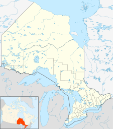
Chedoke Hospital is located in Ontario
{{{alt}}}
Location in Ontario
Geography
Location Hamilton, Ontario, Canada
Coordinates 43°14′18″N 079°54′59″W / 43.23833°N 79.91639°W / 43.23833; -79.91639 (Chedoke Hospital)Coordinates: 43°14′18″N 079°54′59″W / 43.23833°N 79.91639°W / 43.23833; -79.91639 (Chedoke Hospital)
Organization
Care system Public Medicare (Canada) (OHIP)
Services
Emergency department No
Helipad TC LID: CPJ3
History
Founded 1906
Links
Website http://www.hhsc.ca/body.cfm?ID=226
Lists Hospitals in Canada

The Chedoke Hospital is a non-acute care hospital in Hamilton, Canada. It is operated by Hamilton Health Sciences.

Chedoke houses many McMaster Children’s Hospital outpatient services, specializing in autism, developmental pediatrics & rehabilitation, and mental health. It holds the internationally-renowned Offord Centre for Child Studies. Other leading specialties include prosthetics & orthotics, chronic pain management, the regional joint assessment centre, and the Ontario breast screening program.

External Links

References


Wikimedia Foundation. 2010.

Игры ⚽ Поможем сделать НИР

Look at other dictionaries:

  • Chedoke Falls — See also: List of waterfalls in Hamilton, Ontario Chedoke Falls Chedoke Falls Location Hamilton, Ontario Coordinates …   Wikipedia

  • Chedoke Creek — The Chedoke Creek is an urban creek that runs through the west end of Hamilton, Ontario. It crosses the Bruce Trail and the Radial Trail. Much of the creek is diverted below ground in concrete piping. It is a few meters at the widest and is at a… …   Wikipedia

  • McMaster Children's Hospital — This article is about McMaster Children s Hospital. For other similarly named hospitals, see Children s Hospital (disambiguation). McMaster Children s Hospital Hamilton Health Sciences Geography Location …   Wikipedia

  • Hamilton General Hospital — Hamilton Health Sciences Hamilton General Hospital …   Wikipedia

  • Dundurn Street (Hamilton, Ontario) — Dundurn Castle at Dundurn Park. (Summer) See also: List of streets in Hamilton, Ontario Dundurn Street, is a Lower City arterial road in Hamilton, Ontario, Canada. It is a two way street that starts off at Mountain Face Park, Niagara Escarpment… …   Wikipedia

  • Mountview Falls (Hamilton, Ontario) — See also: List of waterfalls in Hamilton, Ontario Mountview Falls Location Hamilton, Ontario Type Classic Cascade Total height 10 m (33 ft) Total width …   Wikipedia

  • Cliffview Falls — See also: List of waterfalls in Hamilton, Ontario Cliffview Falls Location Hamilton, Ontario Coordinates …   Wikipedia

  • Denlow Falls — See also: List of waterfalls in Hamilton, Ontario Denlow Falls Location Hamilton, Ontario Type Horsetail Ribbon Cascade Total height 19 m (62 ft) Total width …   Wikipedia

  • Mohawk Road (Hamilton, Ontario) — Mohawk 4 Ice Centre Mohawk Road, is an Upper City (mountain) arterial road in Hamilton, Ontario, Canada. It is a two way street throughout that starts just West of Highway 403 Meadowlands and travels eastward linking up with the Lincoln M.… …   Wikipedia

  • Main Street (Hamilton, Ontario) — Main Street, looking East Main Street, is a Lower City arterial road in Hamilton, Ontario, Canada. It starts east of Wilson Street in Ancaster at White Chapel Cemetery as a two way street and switches over to a one way street (Eastbound) at… …   Wikipedia

Share the article and excerpts

Direct link
Do a right-click on the link above
and select “Copy Link”