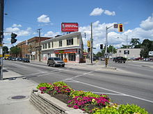
- Main Street (Hamilton, Ontario)
-
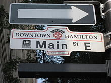
Main Street, is a Lower City arterial road in Hamilton, Ontario, Canada. It starts east of Wilson Street in Ancaster at White Chapel Cemetery as a two-way street and switches over to a one-way street (Eastbound) at Paradise Road South, in Westdale, where it continues up to the Delta where it once again switches over to a two-way street the rest of the way eastward and ends just past Parkdale Avenue at Roxborough Park.
Contents
History
Main Street was originally called Court Street, after the first courthouse that stood on it. It is now called Main Street because it formed the "main" concession line of Barton Township.[1]
On June 20, 1877, the first commercial telephone service in Canada began in Hamilton, Ontario.[2] Hugh Cossart Baker, Jr. learned of Alexander Graham Bell's invention in 1877 at the Philadelphia International Exposition and from there decided to test the communication tool in Hamilton.[3] Hugh Cossart Baker Jr. is credited with making the first telephone exchange in the British Empire from an office building (Exchange Building) at the corner of James and Main Street East which still stands there today (March 2007).[3]
In 1925, The first traffic lights in Canada went into operation at the Delta. (11 June, 1925).[4]
McMaster University arrived in Hamilton in 1930 from Bloor Street in Toronto. The total student population at McMaster University is well over 27,000. Almost two-thirds of the students come from outside the immediate Hamilton region.[5]
Built in 1931, Westdale Secondary School was immediately deemed the largest composite school in the British Empire, having cost $1.3 million to build and consisting of 4.7 hectares of building, grounds and athletic fields.[6] A number of famous celebrities from Hamilton are graduates of the school. Alumni members include, WNBA basketball player Shona Thorburn, SCTV alumni Eugene Levy[7], & Martin Short[8], Lincoln Alexander who served as the 24th Lieutenant-Governor of Ontario from 1985 to 1991, John C. Munro member of Parliament for Hamilton East (1962-1984), Canadian sportscaster Brian Williams, football players Jim Young & Russ Jackson, NHL players Harry Howell & Steve Staios, Gord Lewis member of the band Teenage Head, CFL powerman David Braley and Daniel Goldberg, Hollywood producer of Twins and Space Jam.[6]
Landmarks
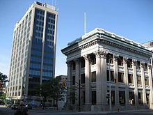
BDC Building, Main Street West
Note: Listing of Landmarks from West to East.
- White Chapel Cemetery
- CNIB building
- Westdale Sign Park
- Cootes Drive Park
- Canadian Martyrs Elementary School
- McMaster University
- McMaster Medical Centre
- McMaster Museum of Art
- Ronald V. Joyce Stadium, (McMaster University)
- David Braley Athletic Centre, (McMaster University)
- Dalewood Recreation Centre
- Hamilton Learning Centre
- Columbia International College of Canada
- Radio Stations:
- [1] AM 900 - CHML, news/talk
- [2] FM 95.3 - CING, ("Vinyl 95.3"), classic hits
- [3] FM 107.9 - CJXY, ("Y108"), classic rock (licensed to Burlington but marketed toward Hamilton)
- Westdale Secondary School (Hamilton's "Celebrity High")
- Highway 403 Overpass (bridge)
- Cathedral Park
- Dundurn Plaza (shopping)
- Locke Street Shopping district (Antique shops, Art galleries, Cafes & fine dining Restaurants)
- Scottish Rite Castle/ Masonic Centre, Originally the home of George Elias Tuckett, (1835-1900), Tuckett Tobacco Company owner + Hamilton's 27th Mayor in 1896. (just South of Main Street on Queen Street South[9]
- Hess Village
- 55 Hess (Apartments)
- Econo Lodge (hotel)
- Bay 200, residential apartment building (Hamilton's 10th-tallest building, just South of Main Street West)
- Hamilton-Wentworth District School Board Building
- Hamilton City Hall
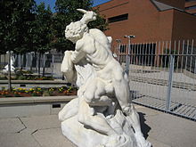
- Irving Zucker Sculpture Court
- Ronald V. Joyce Centre for the Performing Arts at Hamilton Place
- MacNab Street Presbyterian Church
- Hamilton Street Railway Bus terminal
- BDC Building
- United Family Court (old Hamilton Public Library building)
- Canadian Football Hall of Fame Museum
- Bank of Montreal Building (Hamilton) (converted to a National Law firm office)
- Landed Banking and Loan Company building
- Exchange Building (site of the first telephone exchange in the British Empire)
- John Sopinka Courthouse
- United Empire Loyalists statue (in front of the Hamilton Courthouse)
- The Hamilton Courthouse
- Ramada Plaza (hotel)
- Landmark Place (Hamilton's tallest building)
- First Place Hamilton, Seniors apartment building
- Indian Buffet Restaurant (formerly Don Cherry's Grapevine)
- St. Patrick Church
- St. Patrick Elementary School
- Cathedral Secondary School
- Grant Avenue Studios, (one block West of Wentworth Street South, 1-block South of Main on 38 Grant Avenue.)
- Columbia Elementary School
- Gage Park
- Hamilton Children's Museum (inside Gage Park)
- Gage Park Bandshell (concert stage)
- Gage Park fountain
- Memorial Elementary School
- Ottawa Street Shopping District - "Textile District"
- Delta Secondary School
- Montgomery Park
- Burlington Synchronized Swimming Club
- Queenston Traffic Circle (Queenston Road branches off from this point)
- Sir Winston Churchill Park
- Sir Winston Churchill Secondary School
- Parkdale Park
- Pat Quinn Parkdale Arena
- Roxborough Park
Communities
Note: Listing of neighbourhoods from West to East.[10]
- Ainsley Wood West
- Ainsley Wood North/ Ainsley Wood
- Cootes Paradise A/ Ainsley Wood East
- Westdale
- Strathcona/ Kirkendall North
- Central/ Durand
- Beasley/ Corktown
- Landsdale/ Stinson
- Gibson/ St. Clair
- Stipley/ Blakeley
- Crown Point West/ Delta West
- Crown Point East/ Delta East
- Homeside/ Bartonville
- Normanhurst
- McQuesten West
Parallel roads
Lower City Roads:
- Burlington Street, West/East
- Barton Street, West/East
- Cannon Street, West/East
- Wilson Street
- King William Street
- King Street, West/East
- Main Street, West/East; - Queenston Road
- Jackson Street, West/East
- Hunter Street, West/East
- Augusta Street
- Charlton Avenue, West/East
- Aberdeen Avenue
Niagara Escarpment (Mountain) Roads:
- Concession Street
- Queensdale Avenue West/ East
- Scenic Drive - Fennell Avenue, West/East
- Sanatorium Road
- Mohawk Road, West/East
- Limeridge Road West/East
- Lincoln M. Alexander Parkway - Mud Street, (Hamilton City Road 11)
- Stone Church Road, West/East
 ; Rymal Road, West/East
- Twenty Road
Intersecting roads
Note: Listing of streets from West to East.
- Cootes Drive
- Longwood Road, South
 Chedoke Parkway, (passes underneath King Street West bridge)
- Dundurn Street, South
- Locke Street, South
- Queen Street, South
- Hess Street, South
- Bay Street, South
- MacNab Street, South
- James Street, South
- Hughson Street, South
- John Street, South
- Catharine Street, South
- Ferguson Avenue, South
- Wellington Street, South
- Victoria Avenue, South
- Wentworth Street, South
- Sherman Avenue, South
- Gage Avenue, South
- Ottawa Street, North, South
- Kenilworth Avenue, North, South
- Parkdale Avenue, North, South
Gallery
References
- ^ Manson, Bill (2003). Footsteps In Time: Exploring Hamilton's heritage neighbourhoods. North Shore Publishing Inc. ISBN 1-896899-22-6.
- ^ "Chronolgy of the Regional Municipality of Hamilton-Ontario". http://epe.lac-bac.gc.ca/100/200/301/ic/can_digital_collections/cultural_landmarks/twps.html. Retrieved 2007-03-26.
- ^ a b Houghton, Margaret (2003). The Hamiltonians, 100 Fascinating Lives. James Lorimer & Company Ltd., Publishers Toronto. ISBN 1-55028-804-0.
- ^ Houghton, Margaret (2006). Vanished Hamilton Calender. North Shore Publishing. ISBN 1-896899-39-0.
- ^ "McMaster's Economic Impact on the Hamilton Community". McMaster University. Archived from the original on 2006-11-13. http://web.archive.org/web/20061113175818/http://www.mcmaster.ca/pres/chambercomm.html. Retrieved 2007-04-23.
- ^ a b "Celebrity High: Westdale Secondary Alumni" (Press release). The Hamilton Spectator. 2006-05-19. http://www.hamiltonspectator.com/NASApp/cs/ContentServer?pagename=hamilton/Layout/Article_Type1&c=Article&cid=1147989017565&call_pageid=1020420665036&col=1014656511815. Retrieved 2007-04-21.
- ^ Eugene Levy - Biography
- ^ Martin Short (I) - Biography
- ^ Bailey, Thomas Melville (1981). Dictionary of Hamilton Biography (Vol I, 1791-1875). W.L. Griffin Ltd.
- ^ "Hamilton Neighbourhood Boundaries, (map.hamilton.ca)" (PDF). Archived from the original on 2007-09-27. http://web.archive.org/web/20070927235056/http://map.hamilton.ca/Static/PDFs/General+Interest+maps/Overall+City/NeighbourhoodBoundaries.pdf. Retrieved 2007-05-11.
- MapArt Golden Horseshoe Atlas - Page 646/647/648 - Grids H5, J5, J6, J7, J8, H8, H9, H10, G10, G11, G12, G13, G14, G15, G16, G17, G18, G19
External links
Roads and streets in Hamilton, Ontario Lower City Arteries
(Primary)Aberdeen • Barton • Bay • Burlington • Centennial • Cootes • Dundurn • Gage • James • John • Kenilworth • King (Hamilton) • King (Dundas) • Main • Ottawa • Parkdale • Queen • Queenston • Victoria • Wellington • Wentworth • Woodward • YorkLower City Collectors
(Secondary)Mountain-access roads Beckett Drive • Claremont Access • Highway 20 • Highway 403 • James Street Access • Jolley Cut/ Arkledun Ave. • Kenilworth Access • Mount Albion • Red Hill Valley Parkway • Sherman Access • Upper Centennial ParkwayUpper City Arteries Concession • Fennell • Garth • Mohawk • Mountain Brow • Mud • Rymal • Stone Church • Upper Gage • Upper James • Upper Kenilworth • Upper Ottawa • Upper Paradise • Upper Sherman • Upper Wentworth • Upper Wellington • West 5th • Wilson (Ancaster)Upper City Collectors Municipal Expressways: Burlington • The Linc • Red Hill ValleyProvincial Highways Former Provincial Highways Numbered City Roads
(Formerly Regional Roads)5 • 8 • 20 • 56 • 65 • 97 • 99Former Numbered
Regional Roads2 • 52 • 53 • 203 • 216 • 222 • 223 • 243 • 248 • 253 • 260 • 299 • 305 • 330 • 331 • 341 • 344 • 364 • 399 • 411 • 412 • 424 • 425 • 430 • 434 • 445 • 450 • 455 • 458 • 501 • 503 • 508 • 528 • 535 • 551 • 597 • 610 • 613 • 614 • 622 • 626 • 633 • 634 • 637 • 639 • 640Roads in Ontario Categories:- Roads in Hamilton, Ontario
Wikimedia Foundation. 2010.


