- Charlton Avenue (Hamilton, Ontario)
-
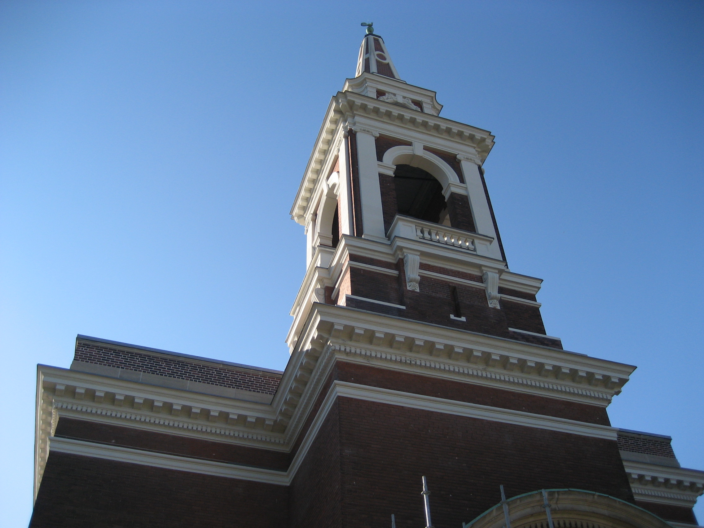
 Central Presbyterian Church
 See also: List of streets in Hamilton, Ontario
Charlton Avenue, is a Lower City collector road in Hamilton, Ontario, Canada. This collector road starts of just West of Dundurn Street as a one-way street (Westbound) up to James Street South where it then switches over to a two-way street the rest of the way eastward and ends at Wentworth Street South right in front of Mountain Face Park and the Escarpment Rail Trail.
Contents
History
Charlton Avenue was named after Benjamin Ernest Charlton, (1835-1901), teacher, manufacturer, politician and mayor of Hamilton. [1] Originally Charlton Street was named Hannah Street. [2]
Wentworth Street, at the base of the Niagara Escarpment (mountain) was the site of the city's second Incline railway (1895-1936). Back then, the Incline railway on Wentworth Street was known as the Eastend Incline Railway but was often called, The Mount Hamilton Incline Railway. [3][4] The city's first Incline railway on James Street South, (1892-1932), was known as the Hamilton & Barton Incline Railway. [3][4]
Landmarks
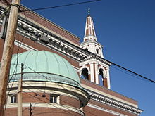 Central Presbyterian Church
 Caroline Street South, near Charlton Avenue West
Note: Listing of Landmarks from West to East.
- St. John The Evangelist Church
- Ryerson Middle School
- Locke Street Shopping district (Antique shops, Art galleries, Cafes & fine dining Restaurants)
- Hamilton Amateur Athletic Association Grounds
- Hamilton Tennis Club
- Central Presbyterian Church
- First Christian Reformed Church, Hamilton
- Durand Park
- James Street South Shopping District
- St. Joseph's Hospital
- McMaster University - Division of Cardiology, Dept. of Medicine, St. Joseph's Hospital
- Church of the Ascension (1-block north of Charlton Avenue on John Street South)
- Oakland Square (shopping plaza)
- Olympia Apartments, (Hamilton's 3rd-tallest building)
- Canadian Pacific Railway line
- Escarpment Rail Trail
- Mountain Face Park
- Wentworth Street Stairway (Access to the Upper City, "Mountain"), old site of the Wentworth Street Incline railway, (1895-1936)
- Bruce Trail
- Niagara Escarpment (mountain)
Communities
Note: Listing of neighbourhoods from West to East. [5]
- Kirkendall North
- Durand
- Corktown
- Stinson
Roads that are parallel with Charlton Avenue
Lower City Roads:
- Burlington Street, West/East
- Barton Street, West/East
- Cannon Street, West/East
- Wilson Street
- King William Street
- King Street, West/East
- Main Street, West/East - Queenston Road
- Jackson Street, West/East
- Hunter Street, West/East
- Augusta Street
- Charlton Avenue, West/East
- Aberdeen Avenue
Niagara Escarpment (Mountain) Roads:
- Concession Street
- Queensdale Avenue West/ East
- Scenic Drive - Fennell Avenue, West/East
- Sanatorium Road
- Mohawk Road, West/East
- Limeridge Road West/East
- Lincoln M. Alexander Parkway - Mud Street, (Hamilton City Road 11)
- Stone Church Road, West/East
 ; Rymal Road, West/East
- Twenty Road
Roads that cross Charlton Avenue
Note: Listing of streets from West to East.
- Dundurn Street, South
- Locke Street, South
- Queen Street, South
- Hess Street, South
- Caroline Street, South
- Bay Street, South
- MacNab Street, South
- James Street, South
- Hughson Street, South
- John Street, South
- Catharine Street, South
- Ferguson Avenue, South
- Wellington Street, South
- Victoria Avenue, South (Victoria Ave. mountain-access ramp flows over Charlton Ave.)
- Wentworth Street, South
See also
References
- ^ Bailey, Thomas Melville (1981). Dictionary of Hamilton Biography (Vol I, 1791-1875). W.L. Griffin Ltd.
- ^ Manson, Bill (2003). Footsteps In Time: Exploring Hamilton's heritage neighbourhoods. North Shore Publishing Inc. ISBN 1-896899-22-6.
- ^ a b "Hamilton Street Railway History". http://home.cc.umanitoba.ca/~wyatt/alltime/hamilton-on.html. Retrieved 2007-04-14.
- ^ a b "Hamilton Transit History". Archived from the original on 2009-10-25. http://www.webcitation.org/query?url=http://ca.geocities.com/hamiltontransithistory%40rogers.com/&date=2009-10-25+03:03:04. Retrieved 2007-04-14.
- ^ "Hamilton Neighbourhood Boundaries, (map.hamilton.ca)". Archived from the original on 2007-09-27. http://web.archive.org/web/20070927235056/http://map.hamilton.ca/Static/PDFs/General+Interest+maps/Overall+City/NeighbourhoodBoundaries.pdf. Retrieved 2007-05-11.
- MapArt Golden Horseshoe Atlas - Page 647 - Grids H10, G10, G11, G12, G13, G14
External links
- Durand Neighbourhood
- Kirkendall Neighbourhood
- Locke Street.com
- Locke Street South Shopping District
- Bruce Trail Association
- Hikes on the Bruce Trail
- Google Maps: Charlton Avenue (Hybrid)
Roads and streets in Hamilton, Ontario Lower City Arteries
(Primary)Lower City Collectors
(Secondary)Mountain-access roads Beckett Drive • Claremont Access • Highway 20 • Highway 403 • James Street Access • Jolley Cut/ Arkledun Ave. • Kenilworth Access • Mount Albion • Red Hill Valley Parkway • Sherman Access • Upper Centennial ParkwayUpper City Arteries Concession • Fennell • Garth • Mohawk • Mountain Brow • Mud • Rymal • Stone Church • Upper Gage • Upper James • Upper Kenilworth • Upper Ottawa • Upper Paradise • Upper Sherman • Upper Wentworth • Upper Wellington • West 5th • Wilson (Ancaster)Upper City Collectors Municipal Expressways: Burlington • The Linc • Red Hill ValleyProvincial Highways Former Provincial Highways Numbered City Roads
(Formerly Regional Roads)5 • 8 • 20 • 56 • 65 • 97 • 99Former Numbered
Regional Roads2 • 52 • 53 • 203 • 216 • 222 • 223 • 243 • 248 • 253 • 260 • 299 • 305 • 330 • 331 • 341 • 344 • 364 • 399 • 411 • 412 • 424 • 425 • 430 • 434 • 445 • 450 • 455 • 458 • 501 • 503 • 508 • 528 • 535 • 551 • 597 • 610 • 613 • 614 • 622 • 626 • 633 • 634 • 637 • 639 • 640 Bike and Hiking Trails in CanadaBruce Trail • Canol Heritage Trail • Chilkoot Trail • Confederation Trail • Cycloparc PPJ • East Coast Trail • Galloping Goose Regional Trail • International Appalachian Trail • Iron Horse Trail • La Cloche Silhouette Trail • Mantario Trail • Nipissing-North Arm Orienteering Trail • North Coast Trail • Oak Ridges Trail • P'tit Train du Nord • Rideau Trail • Route Verte • Trans Canada Trail • Waskahegan Trail • Waterfront Trail • West Coast Trail • WildsideCategories:
- Ontario road stubs
- Roads in Hamilton, Ontario


Wikimedia Foundation. 2010.