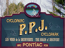
- Cycloparc PPJ
-
Cycloparc PPJ is a Canadian rail trail located in the Pontiac Regional County Municipality in Quebec, Canada[1].
The PPJ traverses 91.7 kilometres (57.0 mi) of hills and riverfront and enables hikers and cyclists to tour through points of interest such as Grand Calumet Island, the Vinton Plain and Coulonge Chutes near Fort-Coulonge. Slopes on the trail do not exceed 4%. The surface of the trail is made from a combination of stone and dust. No motor vehicles or hunting is permitted on the PPJ.
The trail is ideally suited for hikers and cyclists during the summer between May and October. There are numerous places to swim along the trail including the Ottawa River and nearby off-trail Fort William. There are 14 rest areas along the route.
The trail originates at Kilometer 0 in Wyman and ends at Allumette Island (L'Îles-aux-Allumettes). Many rest areas, picnic spots and observation points are found along the length of the PPJ. The trail crosses the Félix-Gabriel-Marchand Bridge, the second longest operational covered bridge in Canada.[2]
The trail is named after the Pontiac Pacific Junction Railway (PPJ) because it occupies the rail bed of this defunct railway company.
Contents
Wildlife and nature
The trail is populated with numerous animals and those traveling along the route will find deer, bear, beaver and moose commonplace. Motor vehicles are not permitted anywhere along the trail, providing a seren setting to spot local wildlife. Different fruits available for picking along the PPJ include blueberries, wild apples and raspberries.
Trail highlights
- 17.26 kilometres (10.7 mi) of pastoral bicycle ride,
- 18 kilometres (11.2 mi) of wetlands and valleys sceneries,
- 17.7 kilometres (11.0 mi) of meadows and forests,
- 18 kilometres (11.2 mi) along the Ottawa River shores,
- 19.7 kilometres (12.2 mi) on Allumette Island
See also
References
- ^ Pontiac Tourism Guide: "Official opening of the PPJ Cyclopark", May 12, 2008
- ^ "The "Mansfield" Marchand Bridge". Municipality of Mansfield-and-Pontefract. http://www.mansfield-pontefract.qc.ca/index.php?option=com_content&task=view&id=29&Itemid=43. Retrieved 2008-06-03.
External links
 Bike and Hiking Trails in CanadaBruce Trail • Canol Heritage Trail • Chilkoot Trail • Confederation Trail • Cycloparc PPJ • East Coast Trail • Galloping Goose Regional Trail • International Appalachian Trail • Iron Horse Trail • La Cloche Silhouette Trail • Mantario Trail • Nipissing-North Arm Orienteering Trail • North Coast Trail • Oak Ridges Trail • P'tit Train du Nord • Rideau Trail • Route Verte • Trans Canada Trail • Waskahegan Trail • Waterfront Trail • West Coast Trail • WildsideCategories:
- Adventure travel
- Hiking trails in Quebec
- Outaouais
- Rail trails in Quebec
Wikimedia Foundation. 2010.

