- Ontario
-
This article is about the Canadian province. For other uses, see Ontario (disambiguation).
Ontario 

Flag Coat of arms Motto: Ut Incepit Fidelis Sic Permanet (Latin)
("Loyal she began, thus she remains")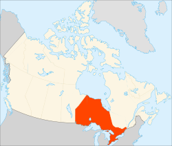
Capital Toronto Largest city Toronto Largest metro Greater Toronto Area Official languages English (de facto) Demonym Ontarian Government Type Constitutional monarchy Lieutenant Governor David Onley Premier Dalton McGuinty (Liberal) Legislature Legislative Assembly of Ontario Federal representation in Canadian parliament House seats 106 Senate seats 24 Confederation July 1, 1867 (1st, with QC, NS, NB) Area [1] Ranked 4th Total 1,076,395 km2 (415,598 sq mi) Land 917,741 km2 (354,342 sq mi) Water (%) 158,654 km2 (61,257 sq mi) (14.8%) Population Ranked 1st Total (2010) 13,210,667 [2] Density 13.8 /km2 (36 /sq mi) GDP Ranked 1st Total (2009) C$614 billion[3] Per capita C$43,847 (6th) Abbreviations Postal ON ISO 3166-2 CA-ON Time zone UTC-5 & -6 Postal code prefix K L M N P Flower White Trillium Tree Eastern White Pine Bird Great Northern Loon Website www.ontario.ca Rankings include all provinces and territories Ontario /ɒnˈtɛəri.oʊ/ is a province of Canada, located in east-central Canada.[4][5] It is Canada's most populous province[6] and second largest in total area.[1] It is home to the nation's most populous city, Toronto,[7] and the nation's capital, Ottawa.
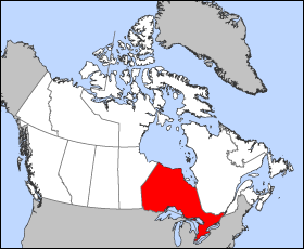
Ontario is bordered by Manitoba on its west, Hudson Bay on its north, Quebec on its east, and by three states of the United States to its south (from west to east): Minnesota, Michigan, and New York. Ohio and Pennsylvania are across Lake Erie. All but a small portion of Ontario's 2,700 km (1,677 mi) border with the United States follow inland waterways: from the west at Lake of the Woods, eastward along the major rivers and lakes of the Great Lakes/St. Lawrence River drainage system. These are the Rainy River, the Pigeon River, Lake Superior, the St. Mary's River, Lake Huron, the St. Clair River, Lake St. Clair, the Detroit River, Lake Erie, the Niagara River, Lake Ontario, and along the St. Lawrence River from Kingston, Ontario to the Quebec boundary just east of Cornwall, Ontario.
Ontario is sometimes conceptually divided into two regions, Northern Ontario and Southern Ontario. The great majority of Ontario's population and its arable land is located in the south. In contrast, the northern three-quarters of Ontario is sparsely populated.
The province is named after Lake Ontario, which is thought to have been derived from Ontarí:io, a Huron (Wyandot) word meaning "great lake",[8] or possibly skanadario which means "beautiful water" in the Iroquoian languages.[9] Ontario contains about 250,000 freshwater lakes.
Contents
Geography
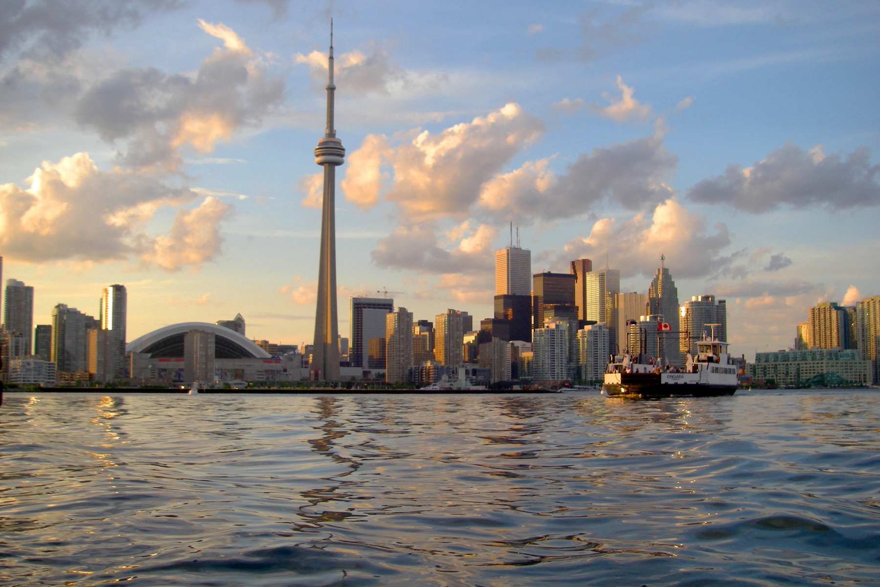
Main article: Geography of OntarioSee also: Census divisions of Ontario and Geography of Canada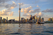 Toronto, the capital of Ontario.
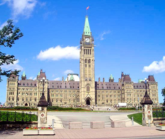
 Ottawa, the capital of Canada.
The province consists of three main geographical regions:
- The thinly populated Canadian Shield in the northwestern and central portions, which comprises over half the land area of Ontario; though this area mostly does not support agriculture it is rich in minerals and in part covered by the Central and Midwestern Canadian Shield forests, studded with lakes and rivers. Northern Ontario is subdivided into two sub-regions: Northwestern Ontario and Northeastern Ontario.
- The virtually unpopulated Hudson Bay Lowlands in the extreme north and northeast, mainly swampy and sparsely forested.
- Southern Ontario which is further sub-divided into four regions; Central Ontario (although not actually the province's geographic centre), Eastern Ontario, Golden Horseshoe and Southwestern Ontario (parts of which were formerly referred to as Western Ontario).
Despite the absence of any mountainous terrain in the province, there are large areas of uplands, particularly within the Canadian Shield which traverses the province from northwest to southeast and also above the Niagara Escarpment which crosses the south. The highest point is Ishpatina Ridge at 693 metres (2,274 ft) above sea level located in Temagami, Northeastern Ontario. In the south, elevations of over 500 m (1,640.42 ft) are surpassed near Collingwood, above the Blue Mountains in the Dundalk Highlands and in hilltops near the Madawaska River in Renfrew County.
The Carolinian forest zone covers most of the southwestern region of the province. The temperate and fertile Great Lakes-Saint Lawrence Valley in the south is part of the Eastern Great Lakes lowland forests ecoregion where the forest has now been largely replaced by agriculture, industrial and urban development. A well-known geographic feature is Niagara Falls, part of the Niagara Escarpment. The Saint Lawrence Seaway allows navigation to and from the Atlantic Ocean as far inland as Thunder Bay in Northwestern Ontario. Northern Ontario occupies roughly 87% of the surface area of the province; conversely Southern Ontario contains 94% of the population.
Point Pelee is a peninsula of Lake Erie in southwestern Ontario (near Windsor and Detroit, Michigan) that is the southernmost extent of Canada's mainland. Pelee Island and Middle Island in Lake Erie extend slightly farther. All are south of 42°N – slightly farther south than the northern border of California.
Climate
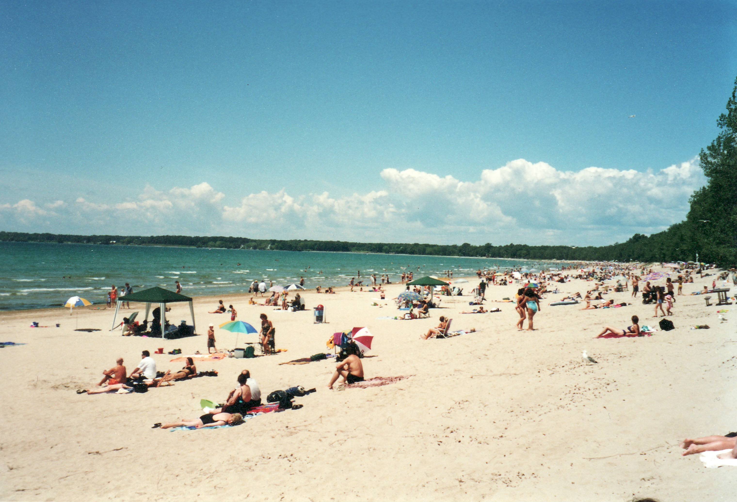
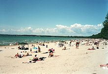 Summer at Sandbanks Provincial Park on Lake Ontario.
Ontario has three main climatic regions. Parts of Southwestern Ontario have a moderate humid continental climate (Köppen climate classification Dfa), similar to that of the inland Mid-Atlantic States and the Great Lakes portion of the Midwestern United States. The region has warm, humid summers and cold winters. Annual precipitation ranges from 750–1,000 mm (30–39 in) and is well distributed throughout the year with a usual summer peak. Most of this region lies in the lee of the Great Lakes making for abundant snow in some areas. Under the Köppen climate parameters, Point Pelee and Middle Island, the southernmost parts of Canada located close to the lake boundary with Ohio, are at the dividing line of a humid continental climate and a humid subtropical climate (Dfa/Cfa).
Central and Eastern Ontario have a more severe humid continental climate (Köppen Dfb). This region has warm and sometimes hot summers with colder, longer winters, ample snowfall and annual precipitation similar to the rest of Southern Ontario. Along the eastern shores of Lake Superior and Lake Huron, frequent heavy lake-effect snow squalls increase seasonal snowfall totals upwards of 3 m (9.8 ft) in some places.
The northernmost parts of Ontario — primarily north of 50°N have a subarctic climate (Köppen Dfc) with long, severely cold winters and short, cool to warm summers with dramatic temperature changes possible in all seasons. With no major mountain ranges blocking sinking Arctic air masses, temperatures of −40 °C (−40 °F) are not uncommon, snowfall remains on the ground for sometimes over half the year. Precipitation is generally less than 70 cm (28 in).
Severe and non-severe thunderstorms peak in summer. London, situated in Southern (Southwestern) Ontario, has the most lightning strikes per year in Canada, averaging 34 days of thunderstorm activity per year. In a typical year, Ontario averages 15 confirmed tornado touchdowns, though seldom they are destructive (the majority between F0 to F2 on the Fujita scale). Tropical depression remnants occasionally bring heavy rains and winds in the south, but are rarely deadly. A notable exception was Hurricane Hazel which struck Toronto, in October 1954. Winter storms can disrupt power supply and transportation, severe ice storms can also occur, especially in the east.
History
See also: History of Ontario and Timeline of Ontario historyTerritorial evolution
Land was not legally subdivided into administrative units until a treaty had been concluded with the native peoples ceding the land. In 1788, while part of the Province of Quebec (1763–1791), southern Ontario was divided into four districts: Hesse, Lunenburg, Mecklenburg, and Nassau.
In 1792, the four districts were renamed: Hesse became the Western District, Lunenburg became the Eastern District, Mecklenburg became the Midland District, and Nassau became the Home District. Counties were created within the districts.
By 1798, there were eight districts: Eastern, Home, Johnstown, London, Midland, Newcastle, Niagara, and Western.
By 1826, there were eleven districts: Bathurst, Eastern, Gore, Home, Johnstown, London, Midland, Newcastle, Niagara, Ottawa, and Western.
By 1838, there were twenty districts: Bathurst, Brock, Colbourne, Dalhousie, Eastern, Gore, Home, Huron, Johnstown, London, Midland, Newcastle, Niagara, Ottawa, Prince Edward, Simcoe, Talbot, Victoria, Wellington, and Western.
In 1849, the districts of southern Ontario were abolished by the Province of Canada, and county governments took over certain municipal responsibilities. The Province of Canada also began creating districts in sparsely populated Northern Ontario with the establishment of Algoma District and Nipissing District in 1858.
The borders of Ontario, its new name in 1867, were provisionally expanded north and west. When the Province of Canada was formed, its borders were not entirely clear, and Ontario claimed to eventually reach all the way to the Rocky Mountains and Arctic Ocean. With Canada's acquisition of Rupert's Land, Ontario was interested in clearly defining its borders, especially since some of the new areas it was interested in were rapidly growing. After the federal government asked Ontario to pay for construction in the new disputed area, the province asked for an elaboration on its limits, and its boundary was moved north to the 51st parallel north.[10]
The northern and western boundaries of Ontario were in dispute after Confederation. Ontario's right to Northwestern Ontario was determined by the Judicial Committee of the Privy Council in 1884 and confirmed by the Canada (Ontario Boundary) Act, 1889 of the Parliament of the United Kingdom. By 1899, there were seven northern districts: Algoma, Manitoulin, Muskoka, Nipissing, Parry Sound, Rainy River, and Thunder Bay. Four more northern districts were created between 1907 and 1912: Cochrane, Kenora, Sudbury and Timiskaming.[11]
European contact

Before the arrival of the Europeans, the region was inhabited both by Algonquian (Ojibwa, Cree and Algonquin) in the northern/western portions and Iroquois and Wyandot (Huron) tribes more in the south/east.[12] During the 17th century, the Algonquians and Hurons fought a bitter war against the Iroquois.[13] The French explorer Étienne Brûlé explored part of the area in 1610-12.[14] The English explorer Henry Hudson sailed into Hudson Bay in 1611 and claimed the area for England.
Samuel de Champlain reached Lake Huron in 1615, and French missionaries began to establish posts along the Great Lakes. French settlement was hampered by their hostilities with the Iroquois, who allied themselves with the British.[15] From 1634 to 1640, Hurons were devastated by European infectious diseases, such as measles and smallpox, to which they had no immunity.[16]
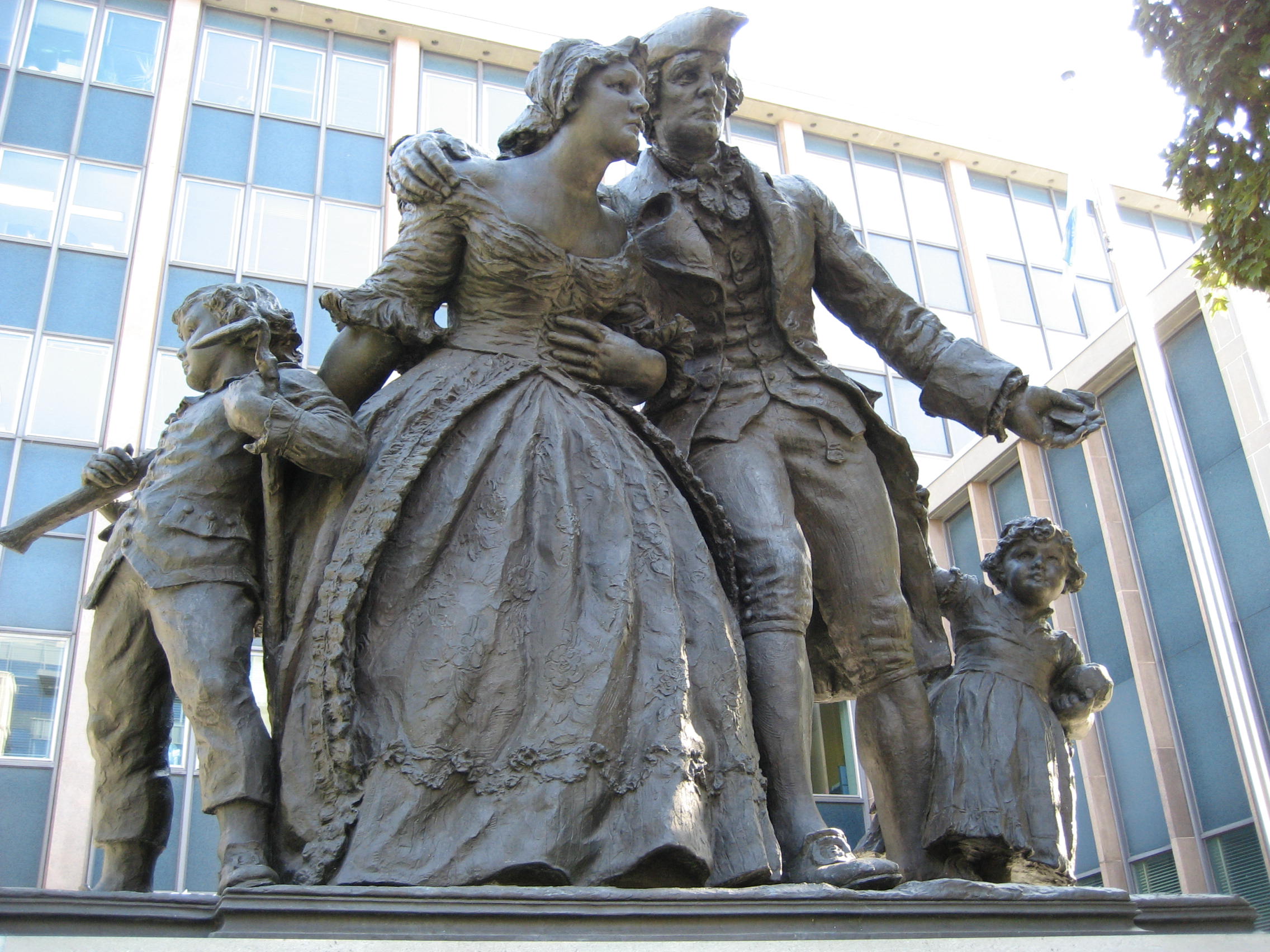
The British established trading posts on Hudson Bay in the late 17th century and began a struggle for domination of Ontario. The 1763 Treaty of Paris ended the Seven Years' War by awarding nearly all of France's North American possessions (New France) to Britain.[17] The region was annexed to Quebec in 1774.[18] From 1783 to 1796, the Kingdom of Great Britain granted United Empire Loyalists leaving the United States following the American Revolution 200 acres (81 ha) of land and other items with which to rebuild their lives.[15]
This measure substantially increased the population of Canada west of the St. Lawrence-Ottawa River confluence during this period, a fact recognized by the Constitutional Act of 1791, which split Quebec into the Canadas: Upper Canada southwest of the St. Lawrence-Ottawa River confluence, and Lower Canada east of it. John Graves Simcoe was appointed Upper Canada's first Lieutenant-Governor in 1793.[19]
Upper Canada
Main article: Upper CanadaAmerican troops in the War of 1812 invaded Upper Canada across the Niagara River and the Detroit River, but were defeated and pushed back by British regulars, Canadian fencibles and militias, and First Nations warriors. The Americans gained control of Lake Erie and Lake Ontario, however. During the Battle of York they occupied the Town of York (later named Toronto) in 1813. The Americans looted the town and burned the Parliament Buildings but were soon forced to leave.
After the War of 1812, relative stability allowed for increasing numbers of immigrants to arrive from Europe rather than from the United States. As was the case in the previous decades, this deliberate immigration shift was encouraged by the colonial leaders. Despite affordable and often free land, many arriving newcomers, mostly from Britain and Ireland, found frontier life with the harsh climate difficult, and some of those with the means eventually returned home or went south. However, population growth far exceeded emigration in the decades that followed. It was a mostly agrarian-based society, but canal projects and a new network of plank roads spurred greater trade within the colony and with the United States, thereby improving previously damaged relations over time.
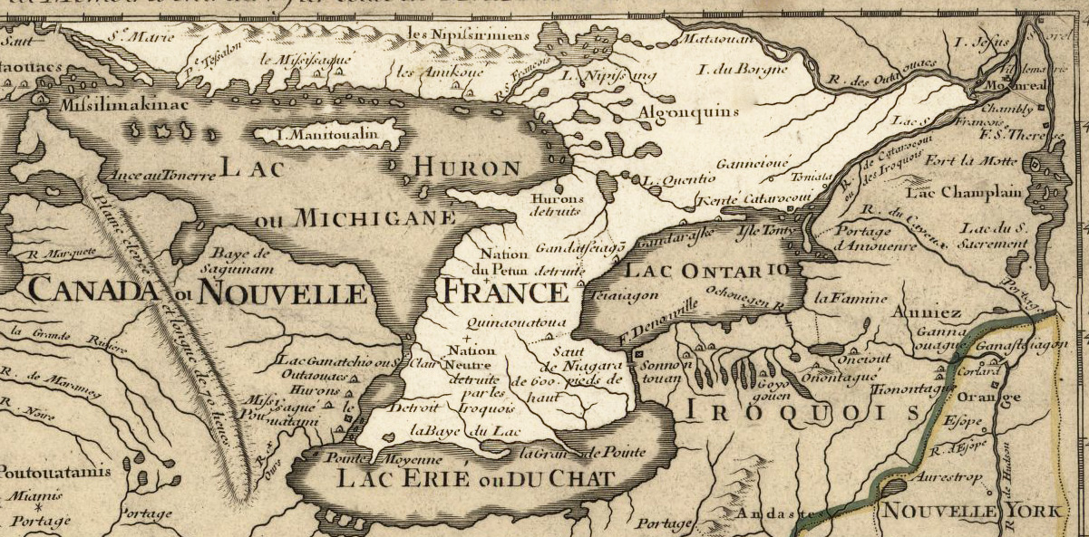
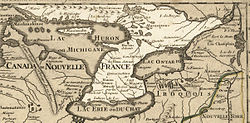 Lower Ontario in 1718, Guillaume de L'Isle map, approximate province area highlighted.
Meanwhile, Ontario's numerous waterways aided travel and transportation into the interior and supplied water power for development. As the population increased, so did the industries and transportation networks, which in turn led to further development. By the end of the century, Ontario vied with Quebec as the nation's leader in terms of growth in population, industry, arts and communications.[20]
Many in the colony however, began to chafe against the aristocratic Family Compact who governed while benefiting economically from the region's resources, and who did not allow elected bodies the power to effect change (much as the Château Clique ruled Lower Canada). This resentment spurred republican ideals and sowed the seeds for early Canadian nationalism. Accordingly, rebellion in favour of responsible government rose in both regions; Louis-Joseph Papineau led the Lower Canada Rebellion and William Lyon Mackenzie led the Upper Canada Rebellion.
Canada West
Although both rebellions were put down in short order, the British government sent Lord Durham to investigate the causes of the unrest. He recommended that self-government be granted and that Lower and Upper Canada be re-joined in an attempt to assimilate the French Canadians. Accordingly, the two colonies were merged into the Province of Canada by the Act of Union 1840, with the capital at Kingston, and Upper Canada becoming known as Canada West. Parliamentary self-government was granted in 1848. There were heavy waves of immigration in the 1840s, and the population of Canada West more than doubled by 1851 over the previous decade. As a result, for the first time the English-speaking population of Canada West surpassed the French-speaking population of Canada East, tilting the representative balance of power.
An economic boom in the 1850s coincided with railway expansion across the province, further increasing the economic strength of Central Canada. With the repeal of the Corn Laws and a reciprocity agreement in place with United States, various industries such as timber, mining, farming and alcohol distilling benefited tremendously.
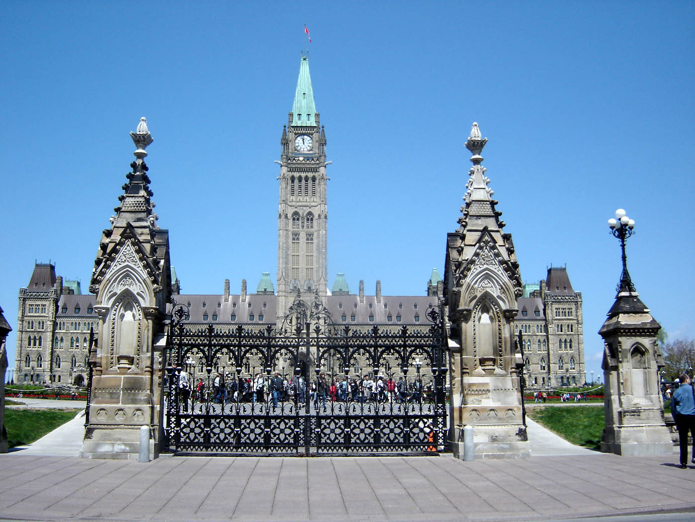
A political stalemate between the French- and English-speaking legislators, as well as fear of aggression from the United States during and immediately after the American Civil War, led the political elite to hold a series of conferences in the 1860s to effect a broader federal union of all British North American colonies. The British North America Act took effect on July 1, 1867, establishing the Dominion of Canada, initially with four provinces: Nova Scotia, New Brunswick, Quebec and Ontario. The Province of Canada was divided into Ontario and Quebec so that each linguistic group would have its own province. Both Quebec and Ontario were required by section 93 of the British North America Act to safeguard existing educational rights and privileges of Protestant and the Catholic minority. Thus, separate Catholic schools and school boards were permitted in Ontario. However, neither province had a constitutional requirement to protect its French- or English-speaking minority. Toronto was formally established as Ontario's provincial capital.
Provincehood
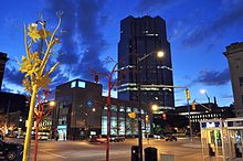 Downtown London at night.
Once constituted as a province, Ontario proceeded to assert its economic and legislative power. In 1872, the lawyer Oliver Mowat became Premier of Ontario and remained as premier until 1896. He fought for provincial rights, weakening the power of the federal government in provincial matters, usually through well-argued appeals to the Judicial Committee of the Privy Council. His battles with the federal government greatly decentralized Canada, giving the provinces far more power than John A. Macdonald had intended. He consolidated and expanded Ontario's educational and provincial institutions, created districts in Northern Ontario, and fought to ensure that those parts of Northwestern Ontario not historically part of Upper Canada (the vast areas north and west of the Lake Superior-Hudson Bay watershed, known as the District of Keewatin) would become part of Ontario, a victory embodied in the Canada (Ontario Boundary) Act, 1889. He also presided over the emergence of the province into the economic powerhouse of Canada. Mowat was the creator of what is often called Empire Ontario.
Beginning with Sir John A. Macdonald's National Policy (1879) and the construction of the Canadian Pacific Railway (1875–1885) through Northern Ontario and the Canadian Prairies to British Columbia, Ontario manufacturing and industry flourished. However, population increase slowed after a large recession hit the province in 1893, thus slowing growth drastically but only for a few short years. Many newly arrived immigrants and others moved west along the railway to the Prairie Provinces and British Columbia, sparsely settling Northern Ontario.
Mineral exploitation accelerated in the late 19th century, leading to the rise of important mining centres in the northeast like Sudbury, Cobalt and Timmins. The province harnessed its water power to generate hydro-electric power and created the state-controlled Hydro-Electric Power Commission of Ontario, later Ontario Hydro. The availability of cheap electric power further facilitated the development of industry. The Ford Motor Company of Canada was established in 1904. General Motors Canada was formed in 1918. The motor vehicle industry would go on to become the most lucrative industry for the Ontario economy during the 20th century.
In July 1912, the Conservative government of Sir James Whitney issued Regulation 17 which severely limited the availability of French-language schooling to the province's French-speaking minority. French Canadians reacted with outrage, journalist Henri Bourassa denouncing the "Prussians of Ontario". It was eventually repealed in 1927.
Influenced by events in the United States, the government of Sir William Hearst introduced prohibition of alcoholic drinks in 1916 with the passing of the Ontario Temperance Act. However, residents could distil and retain their own personal supply, and liquor producers could continue distillation and export for sale, which allowed this already sizable industry to strengthen further. Ontario became a hotbed for the illegal smuggling of liquor and the biggest supplier into the United States, which was under complete prohibition. Prohibition in Ontario came to an end in 1927 with the establishment of the Liquor Control Board of Ontario under the government of Howard Ferguson. The sale and consumption of liquor, wine, and beer are still controlled by some of the most extreme laws in North America to ensure that strict community standards and revenue generation from the alcohol retail monopoly are upheld. In April 2007, Ontario Member of Provincial Parliament Kim Craitor suggested that local brewers should be able to sell their beer in local corner stores; however, the motion was quickly rejected by Premier Dalton McGuinty.
The post-World War II period was one of exceptional prosperity and growth. Ontario, and the Greater Toronto Area in particular, have been the recipients of most immigration to Canada, largely immigrants from war-torn Europe in the 1950s and 1960s and after changes in federal immigration law, a massive influx of non-Europeans since the 1970s. From a largely ethnically British province, Ontario has rapidly become very culturally diverse.
The nationalist movement in Quebec, particularly after the election of the Parti Québécois in 1976, contributed to driving many businesses and English-speaking people out of Quebec to Ontario, and as a result Toronto surpassed Montreal as the largest city and economic centre of Canada. Depressed economic conditions in the Maritime Provinces have also resulted in de-population of those provinces in the 20th century, with heavy migration into Ontario.
Ontario has no official language, but English is considered the de facto language. Numerous French language services are available under the French Language Services Act of 1990 in designated areas where sizable francophone populations exist.
Demographics
Main article: Demographics of OntarioThe percentages add to more than 100% because of dual responses (e.g. "French and Canadian" response generates an entry in both the category "French Canadian" and the category "Canadian"). Groups with greater than 200,000 responses are included.
The majority of Ontarians are of English or other European descent. Slightly less than 5% of the population of Ontario is Franco-Ontarian, that is those whose native tongue is French, although those with French ancestry account for 11% of the population. In relation to natural increase or inter-provincial migration, immigration is a huge population growth force in Ontario, as it has been over the last two centuries. More recent sources of immigrants with large or growing communities in Ontario include Caribbeans, Asians, Latin Americans, Europeans, and Africans. Most populations have settled in the larger urban centres.
Ontario is the second most diverse province in terms of visible minorities after British Columbia, with 22.8% of the population consisting of visible minorities.[21] The Greater Toronto Area, Ottawa, Windsor, Hamilton and Waterloo Region are quite diverse metropolitan areas. Aboriginal peoples make up 2% of the population, with two-thirds of that consisting of North American Indians and the other third consisting of Métis. The number of Aboriginal people has been increasing at rates greater than the general population of Ontario.[22]
Ethnicity[23] Ethnic origins Responses % Total population 12,028,895 100 English 2,971,360 24.7 Canadian 2,768,870 23.0 Scottish 2,101,100 17.5 Irish 1,988,940 16.5 French 1,351,600 11.2 German 1,144,560 9.5 Italian 867,980 7.2 Chinese 644,465 5.4 East Indian 573,250 4.8 Dutch (Netherlands) 490,995 4.1 Polish 465,560 3.9 Ukrainian 336,355 2.8 North American Indian 317,890 2.6 Portuguese 282,870 2.4 Filipino 215,750 1.8 British, not included elsewhere 205,755 1.7 Jamaican 197,540 1.6 Welsh 182,825 1.5 Jewish 177,255 1.5 Russian 167,365 1.4 Hungarian (Magyar) 151,750 1.3 Spanish 149,160 1.2 Greek 132,440 1.1 American (USA) 113,050 0.9 Pakistani 91,160 0.8 Métis 87,090 0.7 Sri Lankan 85,935 0.7 Vietnamese 83,330 0.7 Romanian 80,710 0.7 African, not included elsewhere 75,500 0.6 Finnish 72,990 0.6 Korean 72,065 0.6 Croatian 71,380 0.6 Iranian 70,590 0.6 Population Year Census Figures Five-year
% changeTen-year
% changeRank among
provinces1851 952,004 n/a 208.8 1 1861 1,396,091 n/a 46.6 1 1871 1,620,851 n/a 16.1 1 1881 1,926,922 n/a 18.9 1 1891 2,114,321 n/a 9.7 1 1901 2,182,947 n/a 3.2 1 1911 2,527,292 n/a 15.8 1 1921 2,933,662 n/a 16.1 1 1931 3,431,683 n/a 17.0 1 1941 3,787,655 n/a 10.3 1 1951 4,597,542 n/a 21.4 1 1956 5,404,933 17.6 n/a 1 1961 6,236,092 15.4 35.6 1 1966 6,960,870 11.6 28.8 1 1971 7,703,105 10.7 23.5 1 1976 8,264,465 7.3 18.7 1 1981 8,625,107 4.4 12.0 1 1986 9,101,695 5.5 10.1 1 1991 10,084,885 10.8 16.9 1 1996 10,753,573 6.6 18.1 1 2001 11,410,046 6.1 13.1 1 2006a 12,160,282 6.6 11.6 1 Religion
The largest denominations by number of adherents according to the 2001 census were the Roman Catholic Church with 3,866,350 (34%); the United Church of Canada with 1,334,570 (12%); and the Anglican Church of Canada with 985,110 (9%).[28]
The major religious groups in Ontario, as of 2001, are:[29]
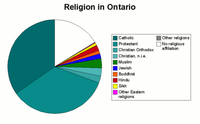 Religion in Ontario in 2001.[30]
Religion People % Total 11,285,545 100 Protestant 3,935,745 34.9 Catholic 3,911,760 34.7 No Religion 1,841,290 16.3 Muslim 352,530 3.1 Other Christians 301,935 2.7 Christian Orthodox 264,055 2.3 Hindu 217,555 1.9 Jewish 190,795 1.7 Buddhist 128,320 1.1 Sikh 104,785 0.9 Eastern Religions 17,780 0.2 Other Religions 18,985 0.2 Economy
Main article: Economy of Ontario
 The manufacturing sector is a major employer in Ontario.
 The Acura ZDX is built in Alliston. As of 2010, Ontario is the largest producer of automobiles in North America.
Ontario is Canada's leading manufacturing province accounting for 52% of the total national manufacturing shipments in 2004.[31] Ontario's largest trading partner is the American state of Michigan. The government of Ontario posted a record C$21.3 billion ($20.7 billion) deficit for the 2009-10 fiscal year.[32] The province’s net debt will rise to C$220 billion in 2010-11, or a record 37% of gross domestic product.[32]
Ontario's rivers, including its share of the Niagara River, make it rich in hydroelectric energy.[33] In 2009 Ontario Power Generation generated 70% of the electricity of the province, of which 51% is nuclear, 39% is hydroelectric and 10% is fossil fuel derived.[34] Much of the newer power generation coming online in the last few years is natural gas or combined cycle natural gas plants. OPG is not however responsible for the transmission of power, which is under the control of Hydro One. Despite its diverse range of power options, problems related to increasing consumption, lack of energy efficiency and aging nuclear reactors, Ontario has been forced in recent years to purchase power from its neighbours Quebec and Michigan to supplement its power needs during peak consumption periods.
An abundance of natural resources, excellent transportation links to the American heartland and the inland Great Lakes making ocean access possible via container ships, have all contributed to making manufacturing the principal industry, found mainly in the Golden Horseshoe region, which is the largest industrialized area in Canada, the southern end of the region being part of the North American Rust Belt. Important products include motor vehicles, iron, steel, food, electrical appliances, machinery, chemicals, and paper. Ontario surpassed Michigan in car production, assembling 2.696 million vehicles in 2004. Ontario has Chrysler plants in Windsor and Bramalea, two GM plants in Oshawa and one in Ingersoll, a Honda assembly plant in Alliston, Ford plants in Oakville and St. Thomas and Toyota assembly plants in Cambridge and Woodstock.
However, as a result of steeply declining sales, in 2005, General Motors announced massive layoffs at production facilities across North America including two large GM plants in Oshawa and a drive train facility in St. Catharines resulting in 8,000 job losses in Ontario alone. In 2006, Ford Motor Company announced between 25,000 and 30,000 layoffs phased until 2012; Ontario was spared the worst, but job losses were announced for the St. Thomas facility and the Windsor Casting plant. However, these losses will be offset by Ford's recent announcement of a hybrid vehicle facility slated to begin production in 2007 at its Oakville plant and GM's re-introduction of the Camaro which will be produced in Oshawa. On December 4, 2008 Toyota announced the grand opening of the RAV4 plant in Woodstock,[35] and Honda also has plans to add an engine plant at its facility in Alliston. Despite these new plants coming online, Ontario has not yet fully recovered following massive layoffs caused by the global recession; its unemployment rate was 7.7% (as of June 2011),[36] compared to 8.7% in Jan. 2010[37] and roughly 6% in 2007.
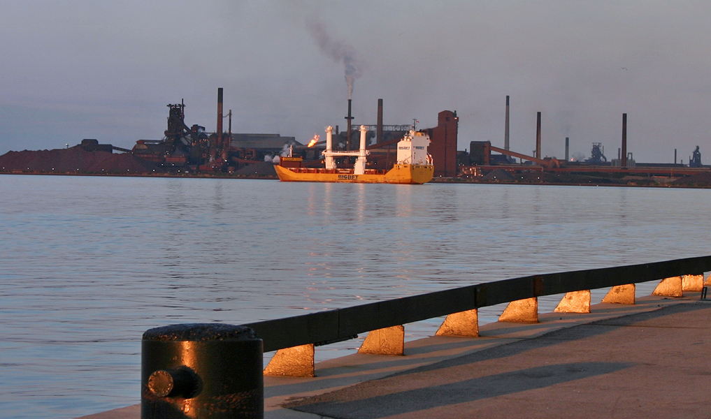
Toronto, the capital of Ontario, is the centre of Canada's financial services and banking industry. Neighbouring cities forming part of the Greater Toronto Area, such as Brampton, Mississauga and Vaughan, are large product distribution and IT centres, in addition to having various manufacturing industries. The information technology sector is also important, particularly in the Silicon Valley North section of Ottawa, as well as the Waterloo Region, where the world headquarters of Research in Motion (the developers of the BlackBerry smartphone) is located. Providing more than 19% of the local jobs and employing more than 13% of the entire local population, Canada's Federal Government is by far the largest single employer in the National Capital Region, which centres on the border cities of Ontario's Ottawa and Quebec's Gatineau.[38][39] Hamilton is the largest steel manufacturing city in Canada, and Sarnia is the centre for petrochemical production. Construction continues to employ more than 6½% of the province's work force as of June 2011.[40]
Mining and the forest products industry, notably pulp and paper, are vital to the economy of Northern Ontario. More than any other region, tourism contributes heavily to the economy of Central Ontario, peaking during the summer months owing to the abundance of fresh water recreation and wilderness found there in reasonable proximity to the major urban centres. At other times of the year, hunting, skiing and snowmobiling are popular. This region has some of the most vibrant fall colour displays anywhere on the continent, and tours directed at overseas visitors are organized to see them. Tourism also plays a key role in border cities with large casinos, among them Windsor, Cornwall, Sarnia and Niagara Falls, which attract many U.S. visitors.[41]
Agriculture
Once the dominant industry, agriculture occupies a small percentage of the population but still a large part of Southern Ontario's land area. As the following table shows, while the number of individual farms has steadily decreased and their overall size has shrunk at a lower rate, greater mechanization has supported increased supply to satisfy the ever increasing demands of a growing population base; this has also meant a gradual increase in the total amount of land used for growing crops.
Ontario Farming 1986 1991 1996 2001 2006 Number of Farms 72,713 68,633 67,520 59,728 57,211 Total Hectares 5,646,582 5,451,379 5,616,860 5,466,233 5,386,453 Acres 13,953,009 13,470,652 13,879,565 13,507,358 13,310,217 Planted
CropsHectares 3,457,966 3,411,667 3,544,927 3,656,705 3,660,941 Acres 8,544,821 8,430,438 8,759,707 9,035,916 9,046,383 Source: Statistics Canada, Census of Agriculture.[42] Wikipedia.org/Ontario
Cattle, small grains and dairy were the common types of farms in the 2001 census. The fruit, grape and vegetable growing industry is located primarily on the Niagara Peninsula and along Lake Erie, where tobacco farms are also situated.The Corn Belt covers much of the southwestern area of the province extending as far north as close to Goderich. Apple orchards are a common sight along the southern shore of Georgian Bay near Collingwood and along the northern shore of Lake Ontario near Cobourg. Tobacco production, centred in Norfolk County has decreased leading to an increase in some other new crop alternatives gaining popularity, such as hazelnuts and ginseng. The Ontario origins of Massey Ferguson, once one of the largest farm implement manufacturers in the world, indicate the importance agriculture once had to the Canadian economy.
Southern Ontario's limited supply of agricultural land is going out of production at an increasing rate. Urban sprawl and farmland severances contribute to the loss of thousands of acres of productive agricultural land in Ontario each year. Over 2,000 farms and 150,000 acres (61,000 ha) of farmland in the GTA alone were lost to production in the two decades between 1976 and 1996. This loss represented approximately 18% of Ontario's Class 1 farmland being converted to urban purposes. In addition, increasing rural severances provide ever-greater interference with agricultural production.
The 500,000, or so, acres (200,000 ha) comprising the black peat soil Holland Marsh, located just south of Lake Simcoe and near the town of Bradford West Gwillimbury (35 mi (56 km) north of Toronto) continues to be Canada's premier vegetable production center.
Energy
See also: Energy in Canada, Renewable energy in Canada, and Smart grid The CANDU Bruce Nuclear Generating Station on Lake Huron is the second largest nuclear power plant in the world.
The Green Energy and Green Economy Act, 2009 (GEA), takes a two-pronged approach to creating a renewable-energy economy. The first is to bring more renewable energy sources to the province and the second is the creation of more energy efficiency measures to help conserve energy. The bill would also appoint a Renewable Energy Facilitator to provide "one-window" assistance and support to project developers in order to facilitate project approvals.[43]
The approvals process for transmission projects would also be streamlined and for the first time in Ontario, the bill would enact standards for renewable energy projects. Homeowners would have access to incentives to develop small-scale renewables such as low- or no-interest loans to finance the capital cost of renewable energy generating facilities like solar panels.[43]
Ontario is home to Niagara Falls, which supplies a large amount of clean, hydroelectric energy for the province. The Bruce Nuclear Generating Station, the second largest nuclear power plant in the world, is also in Ontario and uses 8 CANDU reactors to power the province with clean, reliable energy.
Transportation
Historically, the province has used two major east-west routes, both starting from Montreal in the neighbouring province of Quebec. The northerly route, which was pioneered by early French-speaking fur traders, travels northwest from Montreal along the Ottawa River, then continues westward towards Manitoba. Major cities on or near the route include Ottawa, North Bay, Sudbury, Sault Ste. Marie, and Thunder Bay. The much more heavily travelled southerly route, which was driven by growth in predominantly English-speaking settlements originated by the United Empire Loyalists and later other European immigrants, travels southwest from Montreal along the St. Lawrence River, Lake Ontario, and Lake Erie before entering the United States in Michigan. Major cities on or near the route include Kingston, Oshawa, Toronto, Mississauga, Kitchener-Waterloo, Hamilton, London, Sarnia, and Windsor. This route was also heavily used by immigrants to the Midwestern US particularly in the late 19th century. Most of Ontario's major transportation infrastructure is oriented east-west and roughly follows one of these two original routes.
Roads
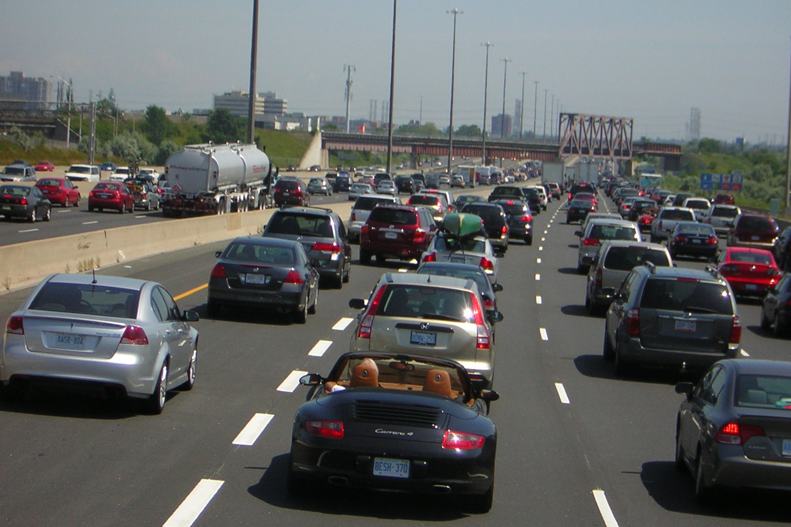
Main article: Roads in Ontario Highway 401 is the busiest highway in North America and among the busiest highways in the World.[44][45]
400-Series Highways make up the primary vehicular network in the south of province, and they connect to numerous border crossings with the U.S., the busiest being the Detroit–Windsor Tunnel and Ambassador Bridge (via Highway 401) and the Blue Water Bridge (via Highway 402). The primary highway along the southern route is Highway 401/Highway of Heroes, the busiest highway in North America[44][45] and the backbone of Ontario's road network, tourism, and economy,[44][45] while the primary highways across the north are Highway 417/Highway 17 and Highway 11, both part of the Trans-Canada Highway. Highway 400/Highway 69 connects Toronto to Northern Ontario. Other provincial highways and regional roads inter-connect the remainder of the province.
Waterways
The Saint Lawrence Seaway, which extends across most of the southern portion of the province and connects to the Atlantic Ocean, is the primary water transportation route for cargo, particularly iron ore and grain. In the past, the Great Lakes and St. Lawrence River were also a major passenger transportation route, but over the past half century passenger travel has been reduced to ferry services and sightseeing cruises.
Railways
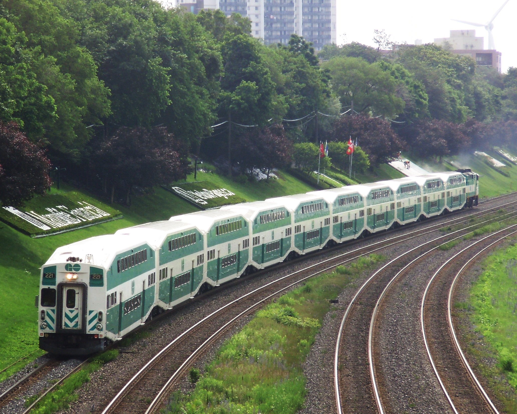
 A GO Transit commuter train.
Via Rail operates the inter-regional passenger train service on the Quebec City – Windsor Corridor, along with The Canadian, a transcontinental rail service from Toronto to Vancouver, and the Sudbury – White River train. Additionally, Amtrak rail connects Ontario with key New York cities including Buffalo, Albany, and New York City. Ontario Northland provides rail service to destinations as far north as Moosonee near James Bay, connecting them with the south.
Freight rail is dominated by the founding cross-country Canadian National Railway and CP Rail companies, which during the 1990s sold many short rail lines from their vast network to private companies operating mostly in the south.
Regional commuter rail is limited to the provincially owned GO Transit, and serves a trainbus network spanning the Golden Horseshoe region, with its hub in Toronto.
The Toronto Transit Commission operates the province's only subway and streetcar system, one of the busiest in North America. OC Transpo operates, in addition to bus service, the O-Train Light rail line in Ottawa.
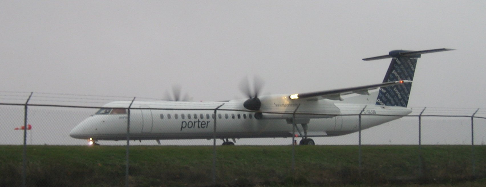
Air travel
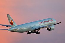 Air Canada is the largest airline operating in Ontario.
Toronto Pearson International Airport is the nation's busiest and the world's 29th busiest, handling over 30 million passengers per year. Other important airports include Ottawa Macdonald-Cartier International Airport and Hamilton's John C. Munro Hamilton International Airport, which is an important courier and freight aviation centre. Toronto/Pearson and Ottawa/Macdonald-Cartier form two of the three points in Canada's busiest set of air routes (the third point is Montréal-Pierre Elliott Trudeau International Airport).
Most Ontario cities have regional airports, many of which have scheduled commuter flights from Air Canada Jazz or smaller airlines and charter companies — flights from the larger cities such as Thunder Bay, Sault Ste. Marie, Sudbury, North Bay, Timmins, Windsor, London, and Kingston feed directly into Toronto Pearson. Bearskin Airlines also runs flights along the northerly east-west route, connecting Ottawa, North Bay, Sudbury, Sault Ste. Marie, and Thunder Bay directly without requiring connections at Toronto Pearson.
Isolated towns and settlements in the northern areas of the province rely partly or entirely on air service for travel, goods, and even ambulance services (MEDIVAC), since much of the far northern area of the province cannot be reached by road or rail.
Government
Further information: Monarchy in Ontario and Executive Council of Ontario
 The wordmark of the Government of Ontario, featuring a stylized version of the provincial flower, the trillium. This wordmark was introduced in late 2007.
 The previous wordmark of the Government of Ontario, which was in use from the late-1960s until 2007 (apart from the lettering used here).
The British North America Act 1867 section 69 stipulated "There shall be a Legislature for Ontario consisting of the Lieutenant Governor and of One House, styled the Legislative Assembly of Ontario." The assembly has 107 seats representing ridings elected in a first-past-the-post system across the province.
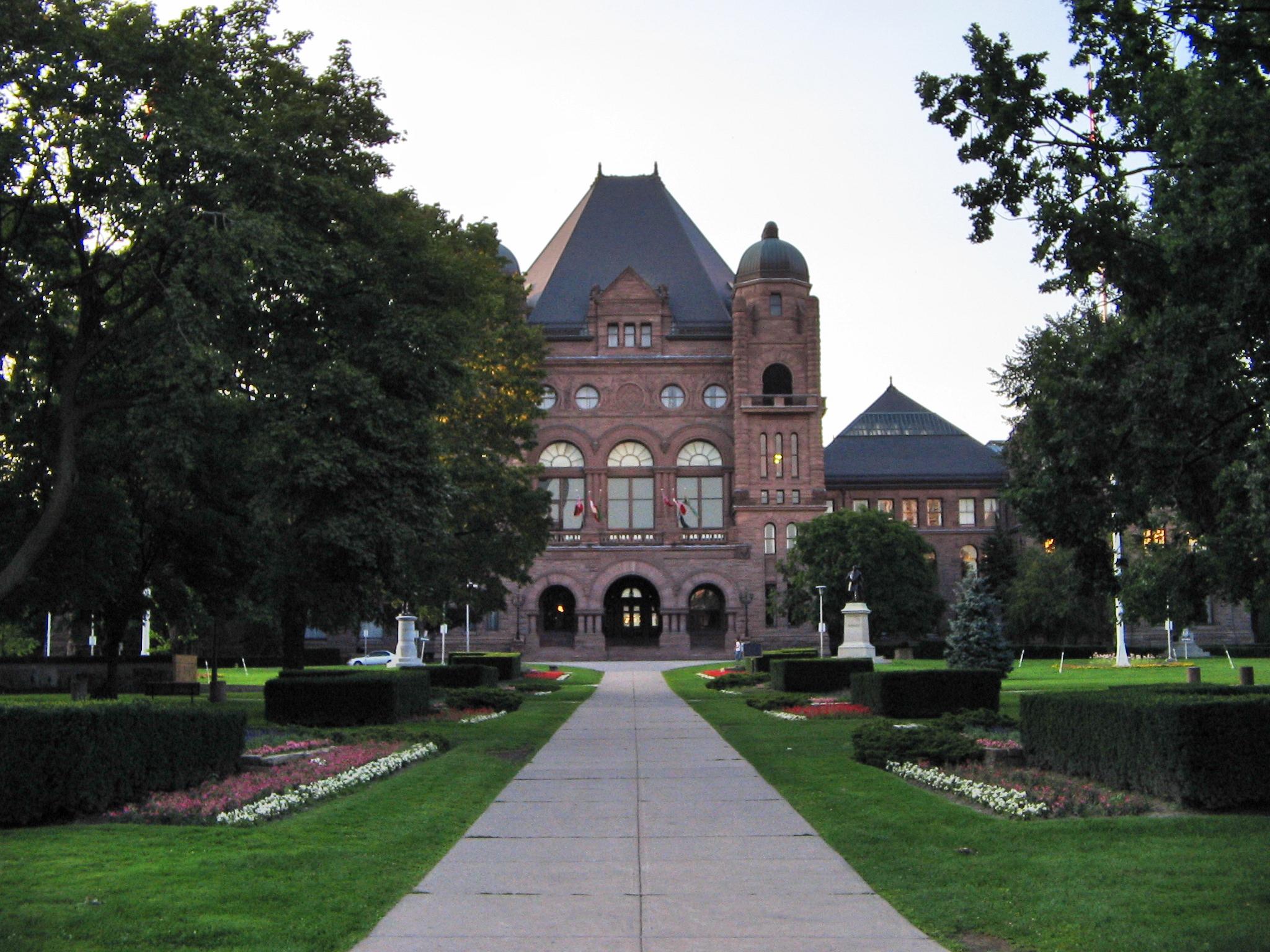
The legislative buildings at Queen's Park in Toronto are the seat of government. Following the Westminster system, the leader of the party holding the most seats in the assembly is known as the "Premier and President of the Council" (Executive Council Act R.S.O. 1990). The Premier chooses the cabinet or Executive Council whose members are deemed "ministers of the Crown."
Although the Legislative Assembly Act (R.S.O. 1990) refers to members of the assembly", the legislators are now commonly called MPPs (Members of the Provincial Parliament) in English and députés de l'Assemblée législative in French, but they have also been called MLAs (Members of the Legislative Assembly), and both are acceptable. The title of Prime Minister of Ontario, correct in French (le Premier ministre), is permissible in English but now generally avoided in favour of the title "Premier" to avoid confusion with the Prime Minister of Canada.
Politics
Main article: Politics of OntarioOntario has numerous political parties which run for election. Three political parties dominate election results: the Conservatives,Liberals,and NDP. In the last few decades the liberal Ontario Liberal Party, conservative Progressive Conservative Party of Ontario, and social-democratic Ontario New Democratic Party have all ruled the province at different times.
Ontario is currently under a Liberal government headed by Premier Dalton McGuinty. The present government, first elected in 2003, was re-elected on October 10, 2007. On October 6, 2011, the Ontario Liberal Party won a third mandate, although it lost seats and was reduced to a minority government capturing only 53 seats (as opposed to the 71 it won in 2007), with the Progressive Conservatives and NDP winning 37 seats and 17 seats, respectively.
In the 2011 Canadian federal election in Ontario the Conservatives were elected in 73 ridings, 22 went to the NDP, and 11 to the Liberals. The Green Party did not get a candidate elected in Ontario.
Urban areas
See also: Golden Horseshoe, National Capital Region (Canada), and Detroit-WindsorStatistics Canada's measure of a "metro area", the Census Metropolitan Area (CMA), roughly bundles together population figures from the core municipality with those from "commuter" municipalities.[46]
CMA (largest other included municipalities in brackets) 2001 2006 % Change Toronto CMA (Mississauga, Brampton, Pickering) 4,682,897 5,113,149 9.2% Ottawa CMA (Gatineau, Clarence-Rockland)* 1,067,800* 1,130,761* 5.9% Hamilton CMA (Burlington, Grimsby) 662,401 692,911 4.6% London CMA (St. Thomas, Strathroy-Caradoc) 435,600 457,720 5.1% Kitchener CMA (Cambridge, Waterloo) 414,284 451,235 8.9% St. Catharines CMA (Niagara Falls, Welland) 377,009 390,317 3.5% Oshawa CMA (Whitby, Clarington) 296,298 330,594 11.6% Windsor CMA (Lakeshore, LaSalle) 307,877 323,342 5.0% Barrie CMA (Innisfil, Springwater) 148,480 177,061 19.2% Sudbury CMA (Whitefish Lake, Wanapitei Reserve) 155,601 158,258 1.7% Kingston CMA 146,838 152,358 3.8% *Parts of Quebec (including Gatineau) are included in the Ottawa CMA. The entire population of the Ottawa CMA, in both provinces, is shown.
- Ten largest municipalities by population[24]
Municipality 1996 2001 2006 Toronto (Provincial capital) 2,385,421 2,481,494 2,503,281 Ottawa (National capital) 721,136 774,072 812,129 Mississauga 544,382 612,925 668,549 Hamilton 467,799 490,268 504,559 Brampton 268,251 325,428 433,806 London 325,669 336,539 352,395 Markham 173,383 208,615 261,573 Vaughan 132,549 182,022 238,866 Windsor 197,694 209,218 216,473 Kitchener 178,420 190,399 204,668 Education
Main article: Education in OntarioHigher education
Main article: Higher education in OntarioSee also: List of colleges in Ontario and List of universities in OntarioSongs and slogans
During the John Robarts government of the 1960s, the slogan "Is There Any Other Place You'd Rather Be?" was in use to promote tourism. During a blizzard early in 1971, highway travellers who were stranded at a Highway 401 service centre with Premier Robarts (already in his last months of office) asked him the slogan in an ironic twist.
In 1967, in conjunction with the celebration of Canada's centennial, the song "A Place to Stand" was introduced at the inauguration of Ontario's pavilion at the Expo 67 World's Fair, and became the background for the province's advertising for decades.
In 1973 the first slogan to appear on licence plates in Ontario was "Keep It Beautiful". This was replaced by "Yours to Discover" in 1982,[47] apparently inspired by a tourism slogan, "Discover Ontario," dating back to 1927.[48] Plates with the French equivalent, "Tant à découvrir", were made available to the public beginning in May 2008.[49] (From 1988 to 1990,[50] "Ontario Incredible"[51] gave "Yours to Discover" a brief respite.)
In 2007, a new song replaced "A Place to Stand" after four decades. "There's No Place Like This" is featured in current television advertising, performed by Ontario artists including Molly Johnson, Brian Byrne, Keshia Chanté,[52] as well as Tomi Swick and Arkells. The new song is featured on the Ontario Tourism website.
Famous residents
Please see List of people from Ontario.
See also
- Coat of arms of Ontario
- Flag of Ontario
- Great Seal of Ontario
- Caledonia Land Dispute
- Order of Ontario
- Scouting and Guiding in Ontario
- Symbols of Ontario
- Index of Ontario-related articles
Geography Lists - List of airports in Ontario
- List of cities in Ontario
- List of communities in Ontario
- List of premiers of Ontario
- List of lieutenant governors of Ontario
- List of professional sports teams in Ontario
Law Notes
- ^ a b "Canada's provinces and territories total area, land area and water area.". Statistics Canada. http://www40.statcan.ca/l01/cst01/phys01.htm. Retrieved 2007-01-05.
- ^ "Canada's population estimates: Table 2 Quarterly demographic estimates". Statcan.gc.ca. 2010-09-29. http://www.statcan.gc.ca/daily-quotidien/100929/t100929b2-eng.htm. Retrieved 2010-10-15.
- ^ "Ontario Financial Authority: About Ontario". ofina.on.ca. http://www.ofina.on.ca/ontario/aboutontario.htm. Retrieved 2011-08-24.
- ^ "Ontario." Merriam-Webster's Collegiate Dictionary, 11th ed. 2003. (ISBN 0-87779-809-5) New York: Merriam-Webster, Inc."
- ^ Ontario is located in the geographic eastern half of Canada, but it has historically and politically been considered to be part of Central Canada (along with Manitoba).
- ^ "Ontario is the largest province in the country by population". Statistics Canada. http://www40.statcan.ca/cgi-bin/getcans/sorth.cgi?lan=eng&dtype=fina&filename=demo02a.htm&sortact=2&sortf=6. Retrieved 2007-01-05.
- ^ "Population of census metropolitan areas (2001 Census boundaries)". Statistics Canada. http://www40.statcan.ca/l01/cst01/demo05a.htm. Retrieved 2007-01-05.
- ^ Mithun, Marianne (2000). The Languages of Native North America. Cambridge: Cambridge University Press. p. 312.
- ^ "About Canada // Ontario". Study Canada. pp. Last Paragraph-second last sentence. http://www.studycanada.ca/english/about-ont.htm. Retrieved 2011-04-23. "The name "Ontario" is generally thought to be derived from the Iroquois word Skanadario, meaning "beautiful water""
- ^ Mills, David (1877). Report on the Boundaries of the Province of Ontario. Toronto: Hunter, Rose & Co.. p. 347. http://books.google.com/books?id=BlYCAAAAMAAJ. Retrieved 2009-09-14.
- ^ "Early Districts and Counties 1788-1899". Archives of Ontario. 2006-09-05. http://www.archives.gov.on.ca/english/on-line-exhibits/maps/ontario-districts.aspx. Retrieved 2006-11-29.
- ^ "About Ontario; History: Government of Ontario". http://www.gov.on.ca/ont/portal/!ut/p/.cmd/cs/.ce/7_0_A/.s/7_0_252/_s.7_0_A/7_0_252/_l/en?docid=EC001034. Retrieved 2007-01-05.[dead link]
- ^ "Native America on the Eve of Contact". Digital History.
- ^ "Étienne Brûlé's article on Encyclopædia Britannica". Encyclopædia Britannica. http://www.britannica.com/eb/article-9016763/Etienne-Brule. Retrieved 2007-01-05.
- ^ a b "About Ontario; History; French and British Struggle for Domination". Government of Ontario. http://www.gov.on.ca/ont/portal/!ut/p/.cmd/cs/.ce/7_0_A/.s/7_0_252/_s.7_0_A/7_0_252/_l/en?docid=004520. Retrieved 2007-01-05.[dead link]
- ^ "The Contact Period". Ontarioarchaeology.on.ca.
- ^ "The Treaty of Paris (1763)". http://en.wikisource.org/wiki/Treaty_of_Paris_%281763%29. Retrieved 2007-01-05.
- ^ "The Quebec Act of 1774". http://www.solon.org/Constitutions/Canada/English/PreConfederation/qa_1774.html. Retrieved 2007-01-15.
- ^ "The Constitutional Act of 1791". Archived from the original on 2007-08-29. http://web.archive.org/web/20070829152801/http://home.cc.umanitoba.ca/~sprague/con91.htm. Retrieved 2007-01-15.
- ^ Virtual Vault, an online exhibition of Canadian historical art at Library and Archives Canada
- ^ "Ethnocultural Portrait of Canada Highlight Tables, 2006 Census". 2.statcan.ca. 2008-04-02. http://www12.statcan.ca/english/census06/data/highlights/ethnic/pages/Page.cfm?Lang=E&Geo=PR&Code=01&Table=1&Data=Dist&StartRec=1&Sort=5&Display=Page&CSDFilter=5000. Retrieved 2009-06-16.
- ^ StatCan - Native Population
- ^ "Ethnocultural Portrait of Canada Highlight Tables, 2006 Census". Statistics Canada. 2008-04-02. http://www12.statcan.ca/english/census06/data/highlights/ethnic/pages/Page.cfm?Lang=E&Geo=PR&Code=35&Data=Count&Table=2&StartRec=1&Sort=3. Retrieved 2009-07-08.
- ^ a b "Population and dwelling counts, for Canada, provinces and territories, and census subdivisions (municipalities), 2006 and 2001 censuses - 100% data". Statistics Canada, 2006 Census of Population. 2007-03-13. http://www12.statcan.ca/english/census06/data/popdwell/Table.cfm?T=302&SR=1&S=3&O=D&RPP=25&PR=35. Retrieved 2007-03-13.
- ^ "Population urban and rural, by province and territory (Ontario)". Statistics Canada. 2005-09-01. http://www40.statcan.ca/l01/cst01/demo62g.htm. Retrieved 2006-11-29.
- ^ "Canada's population". The Daily. Statistics Canada. 2006-09-27. http://www.statcan.ca/Daily/English/060927/d060927a.htm. Retrieved 2006-11-29.
- ^ "Selected Ethnic Origins1, for Canada, Provinces and Territories - 20% Sample Data". Statistics Canada. http://www12.statcan.ca/english/census01/products/highlight/ETO/Table1.cfm?Lang=E&T=501&GV=1&GID=35. Retrieved 2007-12-18.
- ^ "Selected Religions, for Canada, Provinces and Territories - 20% Sample Data". 2.statcan.ca. http://www12.statcan.ca/english/census01/products/highlight/Religion/Page.cfm?Lang=E&Geo=PR&View=1a&Code=35&Table=1&StartRec=1&Sort=2&B1=35&B2=All. Retrieved 2010-10-17.
- ^ "Population by religion, by province and territory (2001 Census) (Quebec, Ontario, Manitoba, Saskatchewan)". Statistics Canada. 2005-01-25. http://www40.statcan.ca/l01/cst01/demo30b.htm. Retrieved 2006-11-07.
- ^ Statistics Canada "2001 Community Profiles". Statistics Canada. 2006-12-14. http://www12.statcan.ca/english/Profil01/CP01/Details/Page.cfm?Lang=E&Geo1=PR&Code1=35&Geo2=PR&Code2=01&Data=Count&SearchText=ontario&SearchType=Begins&SearchPR=01&B1=All&Custom= Statistics Canada. Retrieved 2007-01-12.
- ^ Government of Ontario. "Ontario Facts: Overview". Archived from the original on 2007-01-29. http://web.archive.org/web/20070129072416/http://www.2ontario.com/facts/fact01.asp. Retrieved 2007-01-05.
- ^ a b "[http:/=/www.bloomberg.com/apps/news?pid=newsarchive&sid=aXMgXLp.uQLY Ontario to Sell C$39.7 Billion in Debt to Fund Gap (Update1)]". Bloomberg.com. March 25, 2010.
- ^ "Ontario is rich in hydroelectricity, especially areas near the Niagara River". Ontario Facts. Archived from the original on 2007-02-18. http://web.archive.org/web/20070218231700/http://www.2ontario.com/welcome/oout_508.asp. Retrieved 2007-02-02.
- ^ "Ontario Power Generation: Power Generation". Opg.com. http://www.opg.com/power/. Retrieved 2011-02-23.
- ^ "Toyota's opening a new chapter in Woodstock's industrial history". Woodstocksentinelreview.com. http://woodstocksentinelreview.com/ArticleDisplay.aspx?e=1346620. Retrieved 2010-10-17.
- ^ "Economic indicators, by province and territory (monthly and quarterly) - (Ontario)", June 2011, Statistics Canada
- ^ "Labour force, employed and unemployed, numbers and rates, by province - (Quebec, Ontario, Manitoba)", 2010, Statistics Canada
- ^ "Federal government employment, wages and salaries, by census metropolitan area - (Employment)", 2006 - 2010, Statistics Canada
- ^ "Labour force characteristics, unadjusted, by census metropolitan area (3 month moving average) - (Ottawa-Gatineau (Ont.-Que.), Ottawa (Ont.)-Gatineau (Que.), Ontario part, Ottawa (Ont.)-Gatineau (Que.), Quebec part)", 2010/2011, Statistics Canada
- ^ "Employment by major industry groups, seasonally adjusted, by province (monthly) - (Ontario)", June 2011, Statistics Canada
- ^ "Ontario". Ministry of Economic Development and Trade. Archived from the original on 2006-10-24. http://web.archive.org/web/20061024224855/http://www.2ontario.com/welcome/oo_000.asp. Retrieved 2006-11-29.
- ^ "Total farm area, land tenure and land in crops, by province (Census of Agriculture, 1986 to 2006) — (Ontario)", Statistics Canada, 2008-10-31, Retrieved 2011-07-30
- ^ a b "Ontario Unveils Green Energy and Green Economy Act, 2009". Renewableenergyworld.com. http://www.renewableenergyworld.com/rea/news/article/2009/02/ontario-unveils-green-energy-and-green-economy-act-2009?cmpid=WNL-Friday-February27-2009. Retrieved 2010-10-17.
- ^ a b c Ministry of Transportation (Ontario) (August 6, 2002). "Ontario government investing $401 million to upgrade Highway 401". Archived from the original on 2007-09-14. http://web.archive.org/web/20070914064434/http://ogov.newswire.ca/ontario/GPOE/2002/08/06/c0057.html?lmatch=&lang=_e.html. Retrieved 2006-12-20.
- ^ a b c Brian Gray (2004-04-10). "GTA Economy Dinged by Every Crash on the 401 - North America's Busiest Freeway". Toronto Sun, transcribed at Urban Planet. http://www.urbanplanet.org/forums/index.php?showtopic=3459. Retrieved 2007-03-18. "The "phenomenal" number of vehicles on Hwy. 401 as it cuts through Toronto makes it the busiest freeway in the world..."
- ^ Statistics Canada "Population and dwelling counts, for Canada, provinces and territories, census metropolitan areas and census agglomerations, 2006 and 2001 censuses - 100% data". Statistics Canada. 2008-11-05. http://www12.statcan.ca/english/census06/data/popdwell/Table.cfm?T=202&PR=35&S=0&O=A&RPP=50 Statistics Canada. Retrieved 2009-04-01.
- ^ "Ontario". 15q.net. 2007-02-24. http://www.15q.net/on.html. Retrieved 2009-05-06.
- ^ "| Library | University of Waterloo". Lib.uwaterloo.ca. http://www.lib.uwaterloo.ca/locations/umd/cart/ont_road_chart.html. Retrieved 2009-05-06.
- ^ "New French Slogan Licence Plate for Passenger Vehicles". Government of Ontario. 2010-06-10. http://www.mto.gov.on.ca/english/dandv/vehicle/frenchplate/frenchplate.shtml. Retrieved 2010-07-29.
- ^ "Official Ontario Road Maps Produced 1971-2006". Ontarioroadmaps.ca. http://www.ontarioroadmaps.ca/Official_Ontario/Official_Maps_producedB.htm. Retrieved 2010-10-17.
- ^ "Measuring the Returns to Tourism Advertising". Jtr.sagepub.com. 1998-08-01. http://jtr.sagepub.com/cgi/content/abstract/37/1/12. Retrieved 2011-09-16.
- ^ "There's more to discover in Ontario". Ontariotravel.net. http://www.ontariotravel.net/TcisCtrl?site=consumers&key1=home&language=EN&modus=otsplmen01. Retrieved 2010-10-17.
References
- Michael Sletcher, 'Ottawa', in James Ciment, ed., Colonial America: An Encyclopedia of Social, Political, Cultural, and Economic History, (5 vols., M. E. Sharpe, New York, 2006).
- Virtual Vault, an online exhibition of Canadian historical art at Library and Archives Canada
Further reading
- Beckett, Harry (2001). Ontario. Weigl. ISBN 189699085. http://books.google.ca/books?id=9Jx0lQMN53sC&lpg=PA1&dq=Ontario&pg=PA1#v=onepage&q&f=true.
- White, Randall (1985). Ontario, 1610-1985 : a political and economic history. Dundurn Press. ISBN 0919670989. http://books.google.ca/books?id=i_H444blkDgC&lpg=PP1&dq=Ontario&pg=PP1#v=onepage&q&f=true.
- Montigny, Edgar-André; Chambers,, Anne Lorene (2000). Ontario since Confederation : a reader. University of Toronto Press. ISBN 0802044441. http://books.google.ca/books?id=oSfenc15ISUC&lpg=PA3&dq=Ontario&pg=PP1#v=onepage&q&f=true.
- Celebrating One Thousand Years of Ontario's History: Proceedings of the Celebrating One Thousand Years of Ontario's History Symposium, April 14, 15, and 16, 2000. Ontario Historical Society, 2000. 343 pp.
- Baskerville, Peter A. Sites of Power: A Concise History of Ontario. Oxford U. Press., 2005. 296 pp. (first edition was Ontario: Image, Identity and Power, 2002). online review
- Chambers, Lori, and Edgar-Andre Montigny, eds. Ontario Since Confederation: A Reader (2000), articles by scholars
External links
- Canadian Government Atlas - Official Map of Ontario.
- CBC Digital Archives - Ontario Elections: Twenty Tumultuous Years
- Government of Ontario - Official website of the Provincial government.
- Ontario Visual Heritage Project - Non-profit documentary project about Ontario's history
- Tourism Ontario - Official tourism website of the Province of Ontario
Categories:- Ontario
- Provinces and territories of Canada
- States and territories established in 1867


Wikimedia Foundation. 2010.