- Moosonee, Ontario
-
Moosonee — Town — 

Logo
 Moosonee
Coordinates: 51°16′20″N 80°38′35″W / 51.27222°N 80.64306°WCoordinates: 51°16′20″N 80°38′35″W / 51.27222°N 80.64306°W Country  Canada
Province  Ontario
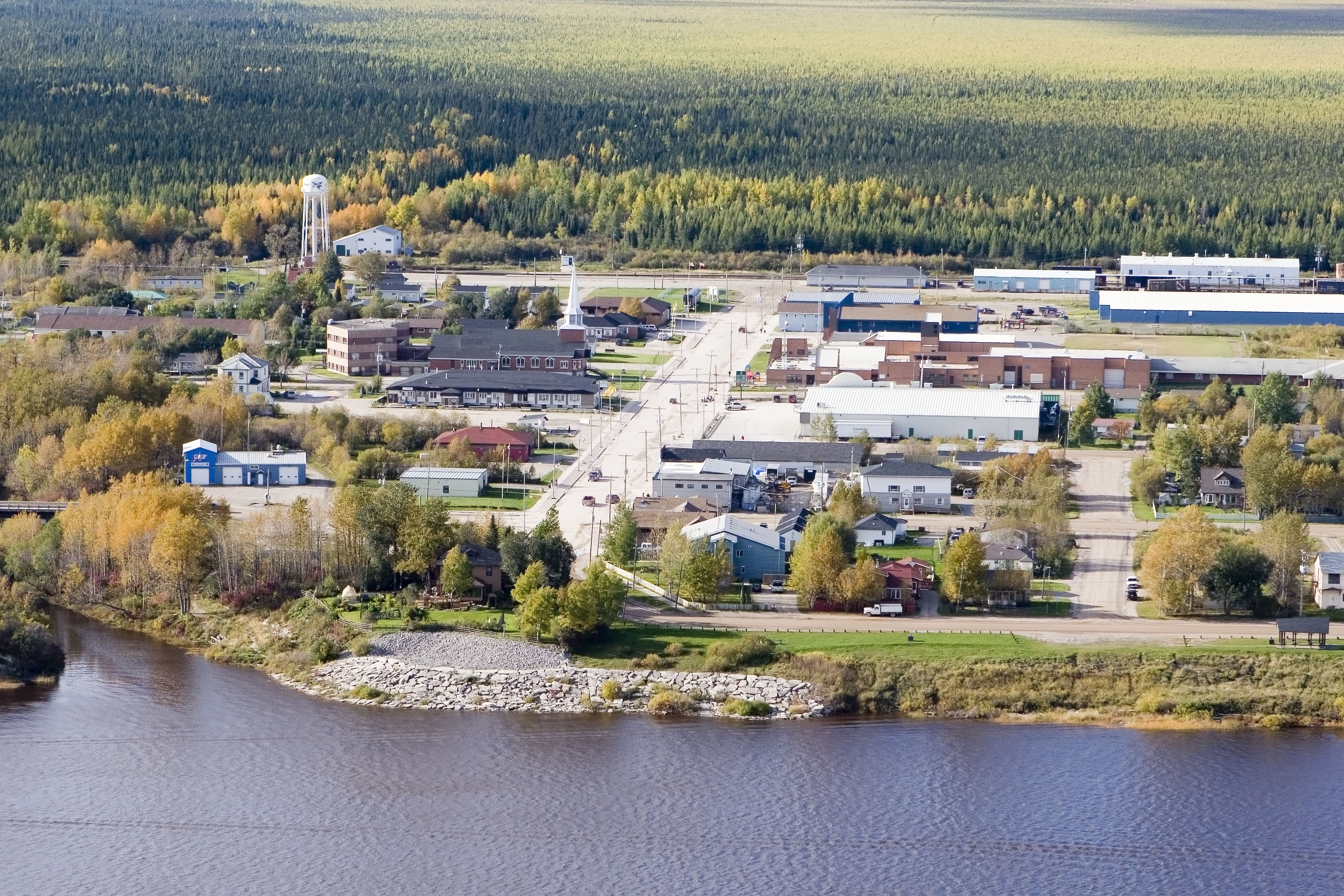
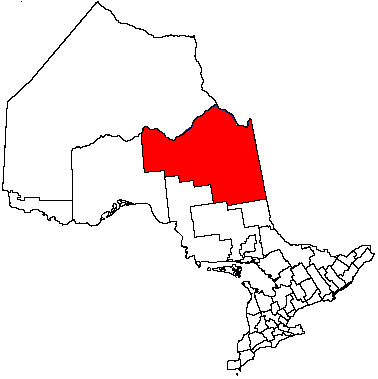
Region Northeastern Ontario District Cochrane Settled 1903 Incorporated 2001 Government - Mayor Victor Mitchell - Councillors List- MP Charlie Angus - MPP Gilles Bisson Area[1] - Land 555.35 km2 (214.4 sq mi) Population (2006)[1] - Total 2,006 - Density 3.6/km2 (9.3/sq mi) Time zone EST (UTC−5) - Summer (DST) EDT (UTC−4) Postal code P0L 1Y0 Area code(s) 705 Website www.moosonee.ca Moosonee is a town in northern Ontario, Canada, on the Moose River approximately 19 kilometres (12 mi) south of James Bay. It is considered as "the Gateway to the Arctic" and has Ontario's only saltwater port.[2] Nearby on Moose Factory Island is the community of Moose Factory to which it is connected by water taxi in the summer and ice road in the winter.
Moosonee is the railhead of the Ontario Northland Railway where goods are transferred to barges and aircraft for transport to more northerly communities. Moosonee is not particularly far north, being located at 51°N—which is roughly the same latitude as Saskatoon, Calgary, London, UK, and Berlin—but is isolated due to its lack of road access to the rest of Ontario. The community was the site of a fur trading post set up in 1903 by Révillon Frères, competitors to the Hudson's Bay Company which later bought out Révillon.
Moosonee formerly held the status of a Development Area, the only community in the province with that designation, and was governed by a locally elected board subject to formal appointment by the Ontario provincial government. It became incorporated as a town effective January 1, 2001, with an elected mayor and four person council. The most recent council took office on December 1, 2010 after being elected in the 2010 municipal elections on October 25, 2010. The mayor of Moosonee is Victor Mitchell and the councillors are Pauline Sackaney, Sandra Linklater, Arthur McComb and Bob Gravel.
Contents
History
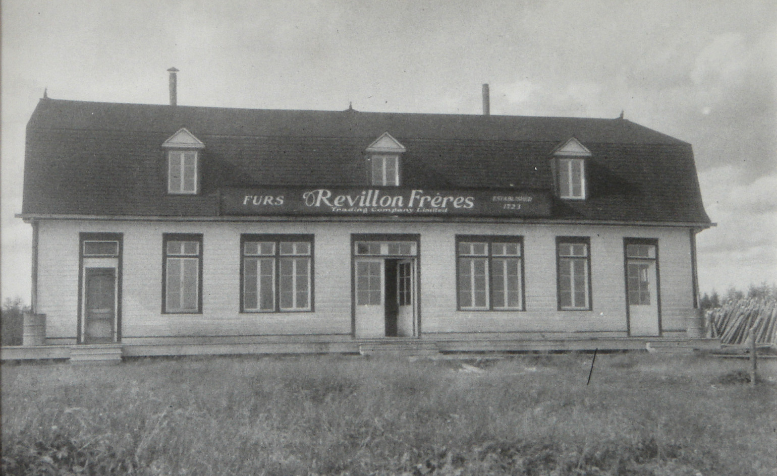
 Révillon Frères store in Moosonee
In 1900, Annie Hardisty and her two daughters were the first settlers on the site.[3] But the place really developed when on June 6, 1903, four canoes and a crew of 21 persons of the Révillon Frères company arrived on the banks of the Moose River near the much older Moose Factory to establish the Moose River Post. This Parisian furrier had ambitious plans to set up a chain of fur trading posts in direct competition with the Hudson's Bay Company, including five on James Bay. But it suffered a setback when their supply ship that carried all the provisions shipwrecked near Fort George.[4]
Consequently, Moose River Post became the most important location for Révillon Frères and was quickly expanded with a staff house, carpenter's shop, warehouse, and sawmill. The buildings were spaced far apart as a preventative measure to minimize the spread of fire. By 1912, it was reported that "the whole line of good substantial buildings, built principally for their French Canadian employees, stretches along the river front for nearly a mile northward from the residence of the inspector."[4]
Moose River Post (and Moose Factory) were prosperous but isolated. It was supplied only once per year by ship coming from Montreal around the Labrador Peninsula. Mail arrived only four times per year, twice by canoe and twice by toboggan. During World War I, Révillon Frères' chartered supply ship was requisitioned for war service. So from then on until 1932, the post was supplied by scows from Pagwa on the National Transcontinental Railway coming down the Pagwachuan, Kenogami, and Albany Rivers.[4]
In 1932, the Temiskaming and Northern Ontario Railway was extended from Cochrane to Moose River Post, that was renamed at that time to Moosonee, derived from the Cree word Moosoneek meaning "at the Moose (River)". In 1936, Révillon Frères sold its Canadian operations to the Hudson's Bay Company and the Moosonee post closed.[2][4] The HBC also exited the fur trade and opened a retail store in Moosonee (now Northern Store part of The North West Company). With the end of the fur trade business, Moosonee's economy became centered on transportation.[5]
In 1962, Moosonee became the site of RCAF Station Moosonee that was part of NORAD's Pinetree Line chain of radar stations. It closed in 1975 and some of its buildings were used by the Town after the closure, including the base swimming pool and recreation centre.[6]
In 1968, the town was classified as a Development Area Board. In November 2000, it was incorporated as the Town of Moosonee.[2]
Demographics
The population is 2,006 according to the Statistics Canada 2006 Census[1] and about 3,500 people by municipal government estimate.[5] Census figures for Moosonee may be inaccurate because of incomplete enumeration, a common problem with remote communities.[citation needed] About 85 per cent of the population are native Cree.[5] The number of total private dwellings is 658 of which 596 are occupied by usual residents. Population density per square kilometre is 3.6.[1]
Population trend:[7]
- Population in 2006: 2006 (2001 to 2006 population change: 4.7 %)
- Population in 2001: 1916
- Population in 1996: 1939
- Population in 1991: 1213
Services
Moosonee has two elementary schools, Moosonee Public School and Bishop Belleau Separate School (Roman Catholic) that offer kindergarten through grade eight. Bishop Belleau School also provides a French Language Instructional Unit for children who are entitled to be educated in French. There is a public high school, Northern Lights Secondary, that provides grades nine through twelve. Northern College's Moosonee campus provides some post-secondary programs.
Health services are provided through the Moosonee Clinic of James Bay General Hospital and the Weeneebayko Health Ahtuskaywin which operates Weeneebayko General Hospital in Moose Factory. Plans exist for the merger of the two hospitals.
Climate
Moosonee has a subarctic climate (Köppen Dfc), generally featuring long cold winters and short warm summers, with James Bay acting as a thermal reservoir to moderate spring and fall temperatures. Freeze-up on the Moose River normally occurs between late November and mid-December, with mean daily minimum January temperatures approximately −30 °C (−22 °F). Spring break-up, or spring thaw, usually occurs in April. Mean annual precipitation is approximately 660 millimetres (26.0 in), and mean annual snowfall is approximately 2,413 millimetres (95.0 in) (snow depth). Maximum accumulations of snow occur in mid-May. Severe thunderstorms can occur from time to time.
Climate data for Moosonee Month Jan Feb Mar Apr May Jun Jul Aug Sep Oct Nov Dec Year Humidex 7.2 8.9 26.6 29.6 36.8 39.3 44.7 43.4 40.8 28.8 20.7 12.9 44.7 Record high °C (°F) 7.2
(45.0)12.4
(54.3)19.4
(66.9)29
(84)34
(93)35
(95)37.8
(100.0)35
(95)32.2
(90.0)26.7
(80.1)18.9
(66.0)13.2
(55.8)37.8
(100.0)Average high °C (°F) −14.2
(6.4)−11
(12)−4.2
(24.4)3.7
(38.7)12.7
(54.9)18.8
(65.8)22.2
(72.0)20.8
(69.4)14.6
(58.3)7.6
(45.7)−0.8
(30.6)−10.8
(12.6)5 Daily mean °C (°F) −20.7
(−5.3)−18.4
(−1.1)−11.7
(10.9)−2.4
(27.7)6.2
(43.2)11.9
(53.4)15.4
(59.7)14.4
(57.9)9.4
(48.9)3.4
(38.1)−4.7
(23.5)−16.3
(2.7)−1.1 Average low °C (°F) −27
(−17)−25.7
(−14.3)−19.1
(−2.4)−8.6
(16.5)−0.3
(31.5)5
(41)8.5
(47.3)7.9
(46.2)4.1
(39.4)−0.8
(30.6)−8.6
(16.5)−21.7
(−7.1)−7.2 Record low °C (°F) −46.7
(−52.1)−46.1
(−51.0)−41.7
(−43.1)−31.7
(−25.1)−17.2
(1.0)−7
(19)−2.2
(28.0)−3.1
(26.4)−6.1
(21.0)−16.7
(1.9)−34.4
(−29.9)−44.4
(−47.9)−46.7
(−52.1)Wind chill −55.6 −53 −49.4 −36.8 −26.1 −9.6 −4 −5.3 −10 −20.4 −40.5 −51.5 −55.6 Precipitation mm (inches) 33.9
(1.335)22.7
(0.894)31.7
(1.248)39
(1.54)53.7
(2.114)71.1
(2.799)101.3
(3.988)75.8
(2.984)90
(3.54)73.3
(2.886)54.3
(2.138)34.7
(1.366)681.5
(26.831)Rainfall mm (inches) 0.7
(0.028)1.9
(0.075)7
(0.28)20.6
(0.811)46
(1.81)70.4
(2.772)101.3
(3.988)75.8
(2.984)88.7
(3.492)59.1
(2.327)20.2
(0.795)2.2
(0.087)493.9
(19.445)Snowfall cm (inches) 40.8
(16.06)25.4
(10)27.6
(10.87)19.2
(7.56)6.9
(2.72)0.7
(0.28)0
(0)0
(0)1
(0.4)14.9
(5.87)37.5
(14.76)39
(15.4)212.9
(83.82)Sunshine hours 94.3 134.7 159 190.3 218.3 221 250.1 222.1 131.5 87.8 58.3 62.8 1,830.1 Source: Environment Canada[8] Transportation
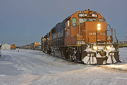 The Polar Bear Express at Moosonee Station
The main method of access is by Ontario Northland Railway which reached the town in 1932 and which provides passenger and freight train service to Cochrane.[5] Ontario Northland's Polar Bear Express train runs to Cochrane six days per week during the summer months and five days per week during the rest of the year. There are also two freight trains per week. During the summer and early fall shipping season, goods can be transported from Moosonee by barge. In January 2007, responsibility for the Port of Moosonee was transferred from the federal government to the Town of Moosonee.
The town is also accessible via the Moosonee Airport, served with scheduled flights of Air Creebec, and Moosonee Water Aerodrome.
Moosonee is inaccessible by road. The nearest road outside of Moosonee ends at Otter Rapids which is 148.9 kilometres (92.5 mi) south of Moosonee. During the early months of 2008, a winter road was open between Moosonee and the provincial road system at Otter Rapids. This road was built to support the twinning of the electric transmission lines that run from Otter Rapids to Moosonee. Local residents report it taking five or six hours to get to Timmins from Moosonee via Otter Rapids and Smooth Rock Falls. This road was not in service in 2009. In late 2009, members of the Moose Cree First Nation voted for the construction of a seasonal winter road south to Otter Rapids.
During the winter, ice roads are plowed and maintained on the ice across the Moose River to Moose Factory and winter roads are maintained to the coastal communities of Fort Albany, Kashechewan and Attawapiskat. In recent years, much of the traffic heading up north has been destined for the Victor Diamond Mine operated by De Beers Canada to the west of Attawapiskat.
Communications
Moosonee has a local radio station, CHMO 1450 AM that is generally operated by volunteers, plus a rebroadcasting facility for CBC Radio One Northern Ontario from CBCS-FM Sudbury on 1340 AM. CBLT (on channel 9) and TVOntario (channel 11) have low-powered rebroadcast transmitters in Moosonee. Most homes subscribe to either Creecable cable TV or a satellite TV service to augment the two locally available channels.
Ontera, formerly Ontario Northland Telecommunications, provides telecommunications service, including analog cellular (band B), in Moosonee (NPA-NXX 705-336). Digital cellular service began in December 2009 with limited access.
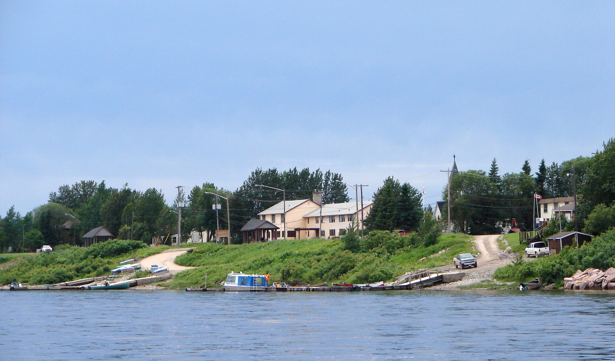
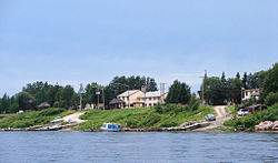 Waterfront of Moosonee
Attractions and tourism
Notable attractions in Moosonee include:
- Railway Car Museum - displaying the cultural history of the area in an old Baggage Car of the Temiskaming & Northern Ontario Railway.
- MNR Interpretive Centre - displays and videos at the office of the Ministry of Natural Resources highlighting the wildlife, geological, and geographical features of the region.
- Revillon Frères Museum - featuring the history of the Révillon Frères company (closed).
- Excursions to the bird sanctuaries of Shipsands Island and the Southern James Bay.
The Tidewater Provincial Park is on the nearby Prince Charles Island, adjacent to Moose Factory Island.
References
- ^ a b c d "Moosonee". 2006 Community Profiles. Statistics Canada. 2009-07-24. http://www12.statcan.ca/census-recensement/2006/dp-pd/prof/92-591/details/Page.cfm?Lang=E&Geo1=CSD&Code1=3556106&Geo2=PR&Code2=35&Data=Count&SearchText=Moosonee&SearchType=Begins&SearchPR=01&B1=All&Custom=. Retrieved 2009-08-20.
- ^ a b c "About Ontario: Moosonee". Queen's Printer for Ontario. http://www.ontario.ca/en/about_ontario/004660.html. Retrieved 2010-12-22.
- ^ "Moosonee Community Profile". Wakenagun Community Futures Development Corporation. http://www.wakenagun.ca/Adobe/moosonee.pdf. Retrieved 2010-12-22.
- ^ a b c d Revillon Frères, The Moosonee Development Area Board, 2002
- ^ a b c d "Main Page". Town of Moosonee. http://www.moosonee.ca. Retrieved 2009-08-20.
- ^ James Marsh. "Moosonee". The Canadian Encyclopedia. http://www.thecanadianencyclopedia.com/index.cfm?PgNm=TCE&Params=A1ARTA0005428. Retrieved 2010-12-22.
- ^ Statistics Canada: 1996, 2001, 2006 census, and Population and dwelling count amendments
- ^ "Moosonee UA Station". Canadian Climate Normals 1971–2000. Environment Canada. http://www.climate.weatheroffice.ec.gc.ca/climate_normals/results_e.html?Province=ALL&StationName=Moosonee&SearchType=BeginsWith&LocateBy=Province&Proximity=25&ProximityFrom=City&StationNumber=&IDType=MSC&CityName=&ParkName=&LatitudeDegrees=&LatitudeMinutes=&LongitudeDegrees=&LongitudeMinutes=&NormalsClass=A&SelNormals=&StnId=4168&&autofwd=1. Retrieved 2011-01-10.
External links
City 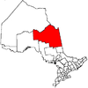
Towns Townships First Nations reserves Abitibi 70 • Constance Lake 92 • Factory Island 1 • Flying Post 73 • Fort Albany 67 • Moose Factory 68 • New Post 69 • New Post 69AUnorganized territories See also: Communities in Cochrane District • Census divisions of Ontario Categories:- Populated coastal places in Canada
- Municipalities in Cochrane District, Ontario
- Towns in Ontario
- Hudson's Bay Company trading posts


Wikimedia Foundation. 2010.