- Opasatika, Ontario
-
Township of Opasatika Highway 11 through Opasatika.
Country  Canada
Province  Ontario
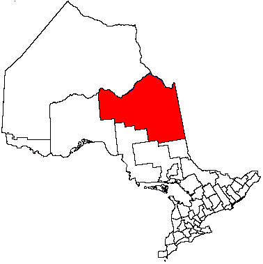
District Cochrane Incorporated Government – Mayor Françoise Lambert – Governing Body – MPs Carol Hughes (NDP) – MPPs Gilles Bisson Area[1] – Land 329.98 km2 (127.4 sq mi) Population (2006)[1] – Total 280 – Density 0.8/km2 (2.1/sq mi) Time zone Eastern (EST) (UTC-5) – Summer (DST) EDT (UTC-4) Postal code span Area code(s) 705 Website Township of Opasatika Opasatika is a township in the Canadian province of Ontario, located in the Cochrane District.
The main communities in the township are Opasatika and Lowther, both located along Highway 11 between Mattice and Harty. The ghost town of Reesor Siding, site of the 1963 Reesor Siding incident, is at the western edge of the township. The former Canadian Forces Station Lowther was located in the municipality.
Demographics
Population:[2]
- Population in 2006: 280 (2001 to 2006 population change: -13.8 %)
- Population in 2001: 325
- Population in 1996: 349
- Population in 1991: 388
Private dwellings, excluding seasonal cottages: 116 (total: 128)
Mother tongue:[1]
- English as first language: 12.5 %
- French as first language: 83.9 %
- English and French as first language: 0 %
- Other as first language: 3.6 %
References
External links
City 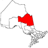
Towns Townships Black River-Matheson • Fauquier-Strickland • Mattice-Val Côté • Moonbeam • Opasatika • Val Rita-HartyFirst Nations reserves Abitibi 70 • Constance Lake 92 • Factory Island 1 • Flying Post 73 • Fort Albany 67 • Moose Factory 68 • New Post 69 • New Post 69AUnorganized territories See also: Communities in Cochrane District • Census divisions of OntarioCategories:- Township municipalities in Ontario
- Municipalities in Cochrane District, Ontario
- Ontario communities with large francophone populations
- Northern Ontario geography stubs

Wikimedia Foundation. 2010.