- Mattice-Val Côté, Ontario
-
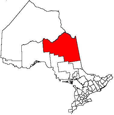
Township of Mattice-Val Côté Voyageur statue in Mattice. Bridge over the Missinaibi River is in the background.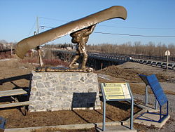 Location of Mattice-Val Côté in Ontario
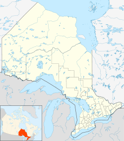
 Township of Mattice-Val Côté
Coordinates: 49°38′45″N 83°17′13″W / 49.64583°N 83.28694°WCoordinates: 49°38′45″N 83°17′13″W / 49.64583°N 83.28694°W[1] Country  Canada
Province  Ontario
District Cochrane Incorporated Government – Reeve Jean-Louis Brunet – Governing Body – MPs Carol Hughes (NDP) – MPPs Gilles Bisson Area – Total 414.64 km2 (160.1 sq mi) Elevation 232 m (761 ft) Population (2006) – Total 772 – Density 1.9/km2 (4.9/sq mi) Time zone Eastern Time Zone (UTC-5) – Summer (DST) Eastern Time Zone (UTC-4) Postal code FSA P0L Area code(s) 705, 249 Website matticevalcote.ca/mattice/?lang=en Mattice-Val Côté (2006 population 772) is an incorporated township in Cochrane District in Northeastern Ontario, Canada.[1] It is located approximately 30 kilometres (19 mi) east of Hearst and 70 kilometres (43 mi) west of Kapuskasing on Ontario Highway 11.
Mattice is located on the Missinaibi River, a historic fur-trading route that flows into the Moose River, then into James Bay. The river is a popular destination for canoers, known for its historical significance and its breathtaking views.
Contents
History
 Mattice
 Val Côté
Mattice was founded in the 1910s, fueled by the arrival of the Canadian Transcontinental Railway and free land given away by the government. Most residents came from the province of Quebec.
The history of Mattice-Val Côté and its residents is detailed in the two volume book Si Missinaïbi m'était conté. Volume I tells the story of the original settlers in the early 1920’s. Volume II tells the story of their descendants.[2]
Economy
A majority of residents work in nearby Hearst and Opasatika in the lumber industry. Opasatika's mill is now shut down. Other residents work in the service industry.
A group of local women entrepreneurs have banded together to open a clothing company which manufactures polar fleece clothing, ideal for the cold winter conditions of the area.
Tourist attractions
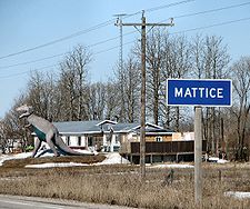
The Municipality of Mattice-Val Côté has set up a rest area on the river shore so that canoe enthusiasts can sleep, shower, rest and visit the sites. The municipality has also erected a sculpture depicting a voyageur portaging along the river.
Mattice is home to a historical First Nations cemetery, located two kilometers south of town. It had been abandoned in the 1940s but has now been cleaned up and can be accessed by road or by canoe on the Missinaibi River.
A rock museum opened in Val Côté in 2002.
Festivals
The Carnaval Missinaïbi (winter carnival) is held over the course of two weeks in the end of February/beginning of March every winter. Activities include snowmobile rallies, music concerts, and kids activities. The Carnaval is best known in the area for its generous prizes (vehicles and money) given away in the Carnival draw.
The first "journées médiévales" (Medieval Days) took place in the summer of 2006, inspired by a similar activity in a small Quebec town. The festival takes place at the baseball field of Mattice on the last weekend of August. This festival features the naming of a king and queen for the day, a competition to become a knight, a lot of family activities, a variety of different expositions and a meal without utensils.
Canadian Rivers Day has been celebrated for four years with organized trips on the Missinaibi River, educational sessions and family activities.
Sports
Residents and visitors enjoy outdoor sports such as hunting, fishing, snowmobiling, camping, swimming and canoeing. It is a popular spot for anglers and hunters.
Education
The local grade school is called École catholique St-François-Xavier where students go from kindergarten to grade 8. High school students are bussed to École Secondaire catholique Hearst.
Demographics
Canada census – Mattice-Val Côté, Ontario Community Profile 2006 Population:
Land area:
Population density:
Median age:
Total private dwellings:
Mean household income:772 (-13.4% from 2001)
414.64 km2 (160.09 sq mi)
1.9 /km2 (4.9 /sq mi)
41.5 (males: 42.4, females: 40.4)
376
$N/A
References: 2006[3]The majority of Mattice-Val Côté residents are French speaking. Most of the residents are also Caucasian, born in Canada for many generations, but different cultures can also be found such as Portuguese, First Nations, Finnish, Dutch and even Spanish (a couple). About 92% of the population is French but 96% speaks it.
References
- ^ a b "Mattice-Val Côté". Geographical Names Data Base. Natural Resources Canada. http://geonames.nrcan.gc.ca/search/unique_e.php?id=FEDRF&output=xml. Retrieved 2011-09-09.
- ^ (in French) Si Missinaïbi m'était conté-- : l'histoire vécue des pionniers de Mattice-Val Côté [If the story of Missinaïbi were told: the story of the lives of the pionneers of Mattice-Val Côté]. Mattice. 1986. OCLC 16983300. Vol I - L'histoire vécue des pionniers de Mattice-Val-Côté. Vol II- L'histoire des gens de Mattice-Val-Côté.
- ^ "2006 Community Profiles". Statistics Canada. Government of Canada. 2009-02-24. http://www12.statcan.ca/census-recensement/2006/dp-pd/prof/92-591/index.cfm?Lang=E. Retrieved 2009-02-24.
External links
City 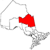
Towns Townships Black River-Matheson • Fauquier-Strickland • Mattice-Val Côté • Moonbeam • Opasatika • Val Rita-HartyFirst Nations reserves Abitibi 70 • Constance Lake 92 • Factory Island 1 • Flying Post 73 • Fort Albany 67 • Moose Factory 68 • New Post 69 • New Post 69AUnorganized territories See also: Communities in Cochrane District • Census divisions of OntarioCategories:- Township municipalities in Ontario
- Municipalities in Cochrane District, Ontario
- Ontario communities with large francophone populations
- Hudson's Bay Company trading posts


Wikimedia Foundation. 2010.