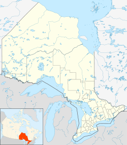
- Otter Rapids, Ontario
-
Otter Rapids — Community — Location of Otter Rapids in Ontario Coordinates: 50°10′57″N 81°38′23″W / 50.1825°N 81.63972°WCoordinates: 50°10′57″N 81°38′23″W / 50.1825°N 81.63972°W Country  Canada
Province  Ontario
Region Northeastern Ontario District Cochrane District Elevation 129 m (423 ft) Time zone Eastern Time Zone (UTC−5) - Summer (DST) Eastern Time Zone (UTC−4) FSA P0L Area code(s) 705, 249 Otter Rapids, also known as White Otter Rapids is an unincorporated place and dispersed rural community in geographic Pitt Township[1] in the Unorganized North Part of Cochrane District in Northeastern Ontario, Canada.[2] It is located 148.9 km south of Moosonee and 120 km north of Smooth Rock Falls.[3][4]
The community is on the west side (left bank) of the Abitibi River adjacent to the Otter Rapids Generating Station, downstream of the Abitibi Canyon Generating Station and community of Abitibi Canyon, and upstream of Coral Rapids.
Transportation
The Ontario Northland Railway runs through this community. Otter Rapids is also accessible by a gravel road that connects via Abitibi Canyon to Ontario Highway 634 at Fraserdale, and by an airstrip suitable for small aircraft.[5]
References
- ^ "Pitt" (PDF). Geology Ontario - Historic Claim Maps. Ontario Ministry of Northern Development, Mines and Forestry. http://www.geologyontario.mndmf.gov.on.ca/website/historic_claim_maps/P/Pitt.pdf. Retrieved 2011-10-14.
- ^ "Otter Rapids". Geographical Names Data Base. Natural Resources Canada. http://geonames.nrcan.gc.ca/search/unique_e.php?id=FDOIT&output=xml. Retrieved 2011-10-14.
- ^ "Newspaper". Timminstimes.com. http://www.timminstimes.com/ArticleDisplay.aspx?e=1549603. Retrieved 2010-07-30.
- ^ "Moosonee: Information from". Answers.com. http://www.answers.com/topic/moosonee. Retrieved 2010-07-30.
- ^ Ontario Geological Survey (2002-12-03). "Ontario Airborne Geophysical Surveys, Magnetic Data, Grid and Profile Data, ASCII and Geosoft (R) Formats, Coral Rapids Area - Purchased Data (GDS1213-REV)". Ontario Land Information Directory of Metadata for Geospatial Information Holdings. Ontario Ministry of Natural Resources. http://lioapp.lrc.gov.on.ca/edwin/EDWINCGI.exe?IHID=555&AgencyID=2. Retrieved 2010-07-30.
Categories:- Communities in Cochrane District, Ontario
Wikimedia Foundation. 2010.

