- Otter Rapids Generating Station
-
Otter Rapids Generating Station 
Otter Rapids Dam and Generating Station as seen from the Ontario Northland RailwayLocation of Otter Rapids Generating Station in Ontario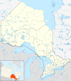

Country Canada Location Cochrane District, Ontario Coordinates 50°11′01″N 81°38′10″W / 50.18361°N 81.63611°WCoordinates: 50°11′01″N 81°38′10″W / 50.18361°N 81.63611°W[1] Status Operational Opening date September 26, 1961 Owner(s) Ontario Power Generation Dam and spillways Type of dam Embankment dam Spillways 1 Type of spillway Controlled chute Power station Turbines 4 x 46 MVA, 60 Hz, 138.4 RPM[2] Installed capacity 182 MW Website
opg.com/power/hydro/northeast plant group/otter rapids.aspOtter Rapids Generating Station is a dam and hydroelectric power plant located in geographic Pitt Township[3] in the Unorganized North Part of Cochrane District in Northeastern Ontario, Canada.[1] Owned by Ontario Power Generation, this 182 MW station[4] is part of the Northeast Plant Group.[5] The Ontario Northland Railway runs past this facility.[6]
Preliminary surveys of the site were conducted in 1945. In 1951 additional site information was gathered with studies and estimates refined. Approval under the Navigable Waters Protection Act was received in October 1958 and the first generating unit came online on September 26, 1961.[5]
The Otter Rapids Generating Station was the first of four generating stations completed on the Abitibi River in the James Bay watershed.
A community of employees and their families inhabited the adjacent colony called Otter Rapids. This community of over 1,000 people is well equipped a bank, post office, snack bar, grocery store, billiard hall, bowling alley, curling rink, hockey rink, fire hall, 10-bed hospital and auditorium.[5]
References
- ^ a b "Otter Rapids". Geographical Names Data Base. Natural Resources Canada. http://geonames.nrcan.gc.ca/search/unique_e.php?id=FDOIV&output=xml. Retrieved 2011-10-14.
- ^ Bomben, Stefano G; Pratt, Brian I (2001-05-02). "Pre-Outage Installation Of The Air Gap Monitoring System Reduces Outage Time And Saves Money" (PDF). User Conference on Machine Condition Monitoring – Orlando, Florida, USA – May 1-2, 2001. Archived from the original on 2006-05-26. http://web.archive.org/web/20060526193305/http://www.vibrosystm.com/pdf/OPG_OtterRapids.PDF. Retrieved 2011-10-14.
- ^ "Pitt" (PDF). Geology Ontario - Historic Claim Maps. Ontario Ministry of Northern Development, Mines and Forestry. http://www.geologyontario.mndmf.gov.on.ca/website/historic_claim_maps/P/Pitt.pdf. Retrieved 2011-10-14.
- ^ "OPG Generating Stations". Ontario Power Generation. January 2011. http://www.opg.com/power/OPGmap0309.pdf. Retrieved 2011-10-14.
- ^ a b c "Otter Rapids Station". Hydro - Northeast Plant Group. Ontario Power Generation. http://www.opg.com/power/hydro/northeast_plant_group/otter_rapids.asp. Retrieved 2011-10-14.
- ^ Martin, Douglas (1984-06-03). "Polar Bear Express". The New York Times. http://www.nytimes.com/1984/06/03/travel/polar-bear-express.html. Retrieved 2010-07-30.
External links
Categories:- Hydroelectric power stations in Ontario


Wikimedia Foundation. 2010.