- Albany River
Infobox River
river_name = Albany River

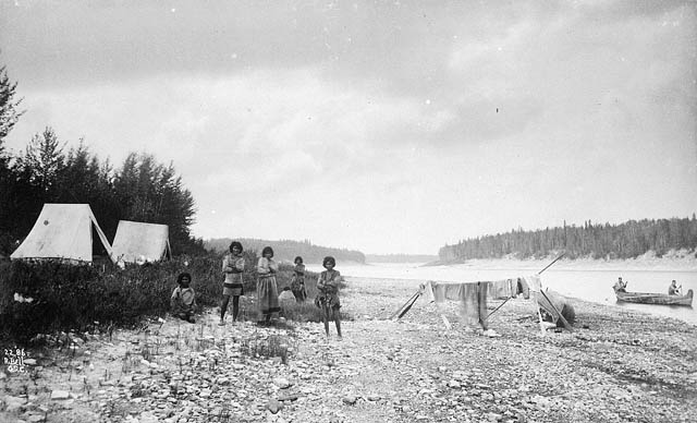
caption = AFirst Nation s encampment beside the Albany River, 1886
origin =Lake St. Joseph
mouth =James Bay
basin_countries =Canada
length = convert|980|km|mi|0
elevation = convert|371|m|ft|0 ["Encyclopædia Britannica Online" [http://www.britannica.com/eb/article-9005406/Albany-River Albany River] . Retrieved17 October 2007 .]
mouth_elevation = MSL convert|0|m|ft|0
discharge = 1,420 m³/s (50,1467 ft³/s) ["The Canadian Encyclopedia" [http://thecanadianencyclopedia.com/index.cfm?PgNm=TCE&Params=A1ARTA0000112 Albany River] . Retrieved17 October 2007 .]
watershed = convert|135200|km2|sqmi|0The Albany River is a river in
Northern Ontario which flows northeast fromLake St. Joseph inNorthwestern Ontario and empties intoJames Bay . It is convert|980|km|mi|0 long, making it the longest river inOntario . It is navigable for convert|400|km|mi|0. This river drains an area of convert|135200|km2|sqmi|0|. Tributaries of this river include theCat River ,Kenogami River ,Ogoki River , andDrowning River .For much of its length, the Albany River defines the boundary between the Kenora District and the Thunder Bay and Cochrane Districts. The land north of the Albany River was part of the
Northwest Territories until 1912, when it was transferred to Ontario in the "Ontario Boundaries Extension Act, 1912".A provincial waterway park has been established on the river north of
Wabakimi Provincial Park .The river was named after James, Duke of York and Albany, who later became King
James II of England .The
Hudson's Bay Company operated a trading post at Fort Albany at the mouth of this river, which was an important route during the days of the fur trade.See also
*
List of Ontario rivers External links
* [http://www.ontarioparks.com/English/alba.html Ontario Parks - Albany River]
References
Wikimedia Foundation. 2010.
