- Cold Creek Conservation Area
-
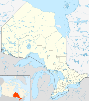
Cold Creek Conservation Area Location within Ontario Location King Township, Ontario, Canada Nearest city Bolton Coordinates 43°54′50″N 79°41′58″W / 43.9138°N 79.6995°WCoordinates: 43°54′50″N 79°41′58″W / 43.9138°N 79.6995°W[1] Area 190 hectares (470 acres) Established 1962 Official website Cold Creek Conservation Area, usually Cold Creek, is an ecologically diverse protected Area of Natural and Scientific Interest in south-central Ontario, Canada. The 190-hectare (470-acre) conservation area was opened on June 20, 1962 by Toronto and Region Conservation Authority.[2] It is located on the western end of King Township, overlapping the Oak Ridges Moraine. The Government of Ontario Ministry of Natural Resources classifies the area as a provincially-significant Area of Natural and Scientific Interest (Life Science) for its "provincially or regionally significant representative ecological features".[3][4] The area was also a site classified for the International Biological Program.[5] The Life Science area, known as Cold Creek Swamp,[6] is composed of a swamp[7] and forest.
Cold Creek has hiking trails that cover the Oak Ridges Moraine and a boreal peat bog, among others. At least 110 species of birds have been observed at Cold Creek.[8] Nest boxes are distributed throughout the conservation area to house birds and bats.
See also
References
- ^ "Cold Creek Conservation Area Map". Cold Creek Stewardship. http://coldcreek.ca/wp-content/CCCA-TH.pdf. Retrieved 2011-09-22.
- ^ "About TRCA". Toronto and Region Conservation Authority. Archived from the original on 2007-09-28. http://web.archive.org/web/20070928043407/http://www.trca.on.ca/Website/TRCA/Website.nsf/WebPage/AboutTRCA. Retrieved 2007-07-26.
- ^ "Natural Areas Report: COLD CREEK CONSERVATION AREA (ANSI)". Government of Ontario Ministry of Natural Resources. http://nhic.mnr.gov.on.ca/MNR/nhic/areas/areas_report.cfm?areaid=1142. Retrieved 2007-07-26.[dead link]
- ^ "Ontario Natural Area Types". Government of Ontario Ministry of Natural Resources. http://nhic.mnr.gov.on.ca/MNR/nhic/glossary/area_types.cfm. Retrieved 2007-07-26.
- ^ "Natural Areas Report: COLD CREEK CONSERVATION AREA (IBP)". Government of Ontario Ministry of Natural Resources. http://nhic.mnr.gov.on.ca/MNR/nhic/areas/areas_report.cfm?areaid=7612. Retrieved 2007-07-26.[dead link]
- ^ "Natural Areas Report: COLD CREEK SWAMP (Life Science)". Government of Ontario Ministry of Natural Resources. http://nhic.mnr.gov.on.ca/MNR/nhic/areas/areas_report.cfm?areaid=10357. Retrieved 2007-08-01.[dead link]
- ^ "Natural Areas Report: COLD CREEK SWAMP (Wetland)". Government of Ontario Ministry of Natural Resources. http://nhic.mnr.gov.on.ca/MNR/nhic/areas/areas_report.cfm?areaid=3800. Retrieved 2007-08-01.[dead link]
- ^ Milsom, David and Barry Wallace. "Birds at Cold Creek". Cold Creek Conservation Area. http://www.coldcreekca.ca/pages/BirdsatCC.htm. Retrieved 2007-07-26.
External links
Protected areas in Ontario National parks Provincial parks Conservation areas Boyd · Claireville · Cold Creek · Guelph Lake · Heber Down · Kortright Centre · Lake Laurentian · Mer Bleue · Mount Nemo · Rattlesnake Point · Spencer Gorge / Webster's Falls · more...UNESCO Biosphere Reserves Georgian Bay Littoral · Long Point · Niagara Escarpment (including Cheltenham Badlands) · Thousand Islands - Frontenac Arch · Wasaga BeachNational Historic Sites of Canada Central Experimental Farm · Dundurn Castle · Laurier House · Massey Hall · Montgomery's Tavern · Osgoode Hall · Parliament · Rideau Canal · Rideau Hall · more...Other areas Categories:- King, Ontario
- Parks in York Region
- Conservation areas in Ontario
- Areas of Natural and Scientific Interest
- Oak Ridges Moraine
Wikimedia Foundation. 2010.


