- Forest
-
This article is about a community of trees. For other uses, see Forest (disambiguation).
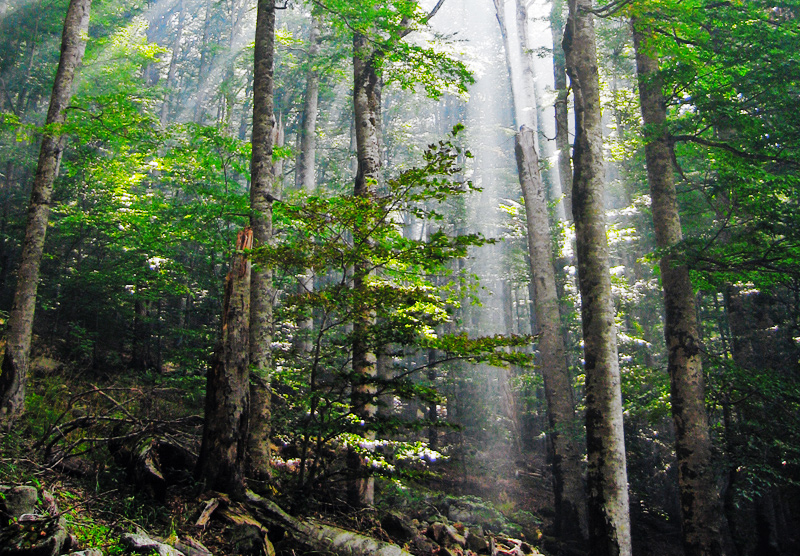
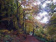 Mixed deciduous forest in Stara Planina, Serbia.
A forest, also referred to as a wood or the woods, is an area with a high density of trees. As with cities, depending where you are in the world, what is considered a forest may vary significantly in size and have various classification according to how and what of the forest is composed.[1][vague] These plant communities cover approximately 9.4% of the Earth's surface (or 30% of total land area), though they once covered much more (about 50% of total land area), in many different regions and function as habitats for organisms, hydrologic flow modulators, and soil conservers, constituting one of the most important aspects of the biosphere. Although forests are classified primarily by trees, the concept of a forest ecosystem includes additional species (such as smaller plants, fungi,[2] bacteria, and animals) as well as physical and chemical processes such as energy flow and nutrient cycling.
A typical forest is composed of the overstory (canopy or upper tree layer) and the understory. The understory is further subdivided into the shrub layer, herb layer, and sometimes also a moss layer. In some complex forests, there is also a well-defined lower tree layer. Forests are central to all human life because they provide a diverse range of resources, they store carbon, aid in regulating our climate, purify water and mitigate natural hazards such as floods. Forests also contain roughly 90% of the world terrestrial biodiversity.[3]
Contents
Etymology
The word "forest" comes from Middle English forest, from Old French forest (also forès) "forest, vast expanse covered by trees", believed to be a borrowing (probably via Frankish or Old High German) of the Medieval Latin word foresta "open wood". Foresta was first used by Carolingian scribes in the Capitularies of Charlemagne to refer specifically to the king's royal hunting grounds. The term was not endemic to Romance languages (e.g. native words for "forest" in the Romance languages evolved out of the Latin word silva "forest, wood"; cf. Italian, Spanish, Portuguese selva; Romanian silvă; Old French selve); and cognates in Romance languages, such as Italian foresta, Spanish and Portuguese floresta, etc. are all ultimately borrowings of the French word.
The exact origin of Medieval Latin foresta is obscure. Some authorities claim the word derives from the Late Latin phrase forestam silvam, meaning "the outer wood"; others claim the term is a latinisation of the Frankish word *forhist "forest, wooded country", assimilated to forestam silvam (a common practise among Frankish scribes). Frankish *forhist is attested by Old High German forst "forest", Middle Low German vorst "forest", Old English fyrhþ "forest, woodland, game preserve, hunting ground", and Old Norse fýri "coniferous forest", all of which derive from Proto-Germanic *furχísa-, *furχíþja- "a fir-wood, coniferous forest", from Proto-Indo-European *perkwu- "a coniferous or mountain forest, wooded height".
Uses of the word "forest" in English to denote any uninhabited area of non-enclosure are now considered archaic.[4] The word was introduced by the Norman rulers of England as a legal term (appearing in Latin texts like the Magna Carta) denoting an uncultivated area legally set aside for hunting by feudal nobility (see Royal Forest).[4][5] These hunting forests were not necessarily wooded much, if at all. However, as hunting forests did often include considerable areas of woodland, the word "forest" eventually came to mean wooded land more generally.[citation needed] By the start of the fourteenth century the word appeared in English texts, indicating all three senses: the most common one, the legal term and the archaic usage.[4]
Other terms used to mean "an area with a high density of trees" are wood, woodland, wold, weald, holt, frith and firth. Unlike forest, these are all derived from Old English and were not borrowed from another language. Some classifications now reserve the term woodland for an area with more open space between trees and distinguish among woodlands, open forests, and closed forests based on crown cover.[6]
Distribution
Forests can be found in all regions capable of sustaining tree growth, at altitudes up to the tree line, except where natural fire frequency or other disturbance is too high, or where the environment has been altered by human activity.
The latitudes 10° north and south of the Equator are mostly covered in tropical rainforest, and the latitudes between 53°N and 67°N have boreal forest. As a general rule, forests dominated by angiosperms (broadleaf forests) are more species-rich than those dominated by gymnosperms (conifer, montane, or needleleaf forests), although exceptions exist.
Forests sometimes contain many tree species only within a small area (as in tropical rain and temperate deciduous forests), or relatively few species over large areas (e.g., taiga and arid montane coniferous forests). Forests are often home to many animal and plant species, and biomass per unit area is high compared to other vegetation communities. Much of this biomass occurs below ground in the root systems and as partially decomposed plant detritus. The woody component of a forest contains lignin, which is relatively slow to decompose compared with other organic materials such as cellulose or carbohydrate.
Forests are differentiated from woodlands by the extent of canopy coverage: in a forest, the branches and the foliage of separate trees often meet or interlock, although there can be gaps of varying sizes within an area referred to as forest. A woodland has a more continuously open canopy, with trees spaced farther apart, which allows more sunlight to penetrate to the ground between them (also see: savanna).
Among the major forested biomes are:
- rain forest (tropical and temperate)
- taiga
- temperate hardwood forest
- tropical dry forest
Classification

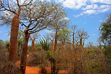 Spiny forest at Ifaty, Madagascar, featuring various Adansonia (baobab) species, Alluaudia procera (Madagascar ocotillo) and other vegetation
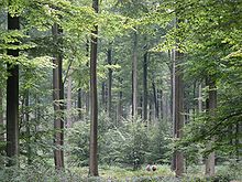 Even, dense old-growth stand of beech trees (Fagus sylvatica) prepared to be regenerated by their saplings in the understory, in the Brussels part of the Sonian Forest.
Forests can be classified in different ways and to different degrees of specificity. One such way is in terms of the "biome" in which they exist, combined with leaf longevity of the dominant species (whether they are evergreen or deciduous). Another distinction is whether the forests are composed predominantly of broadleaf trees, coniferous (needle-leaved) trees, or mixed.
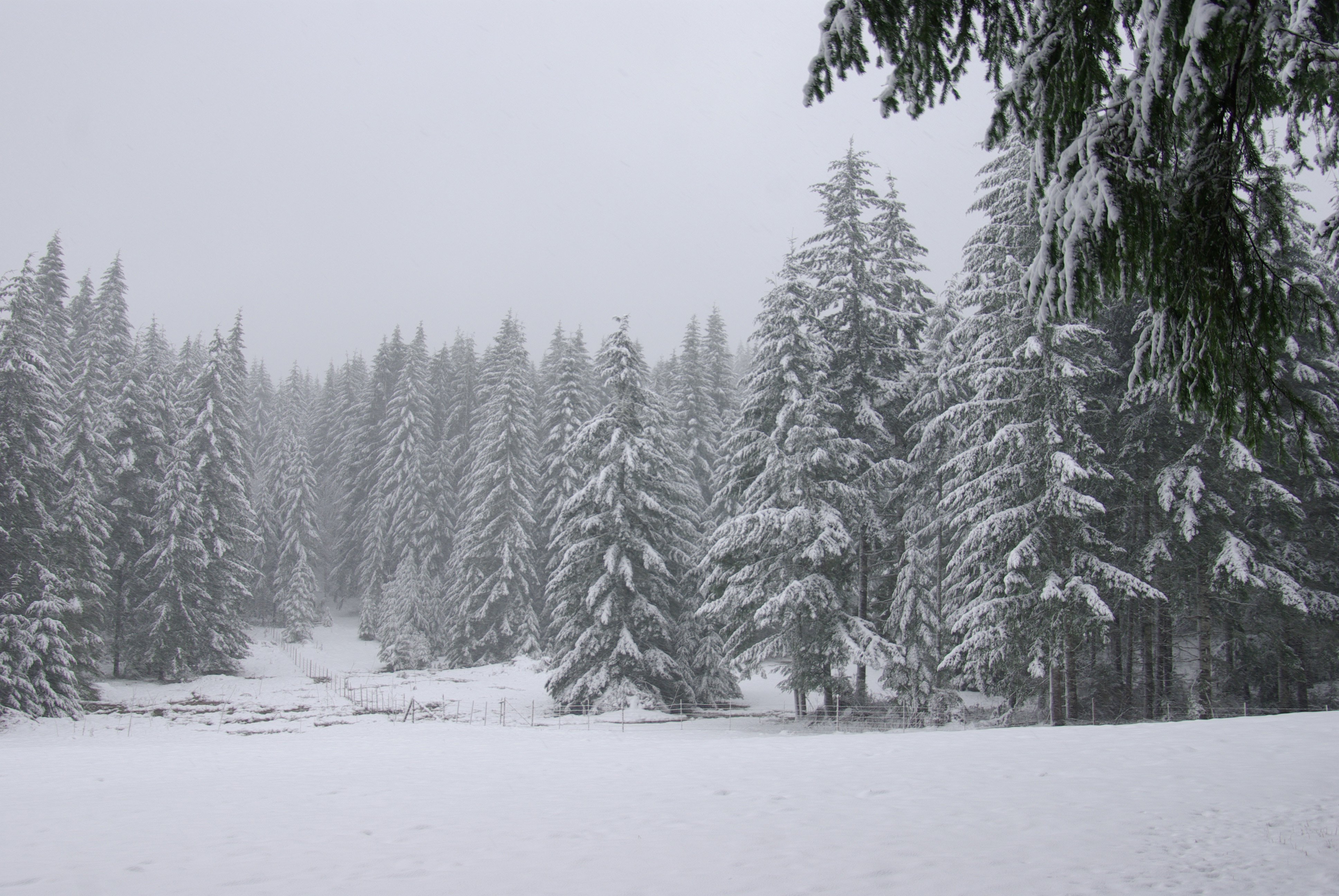
- Boreal forests occupy the subarctic zone and are generally evergreen and coniferous.
- Temperate zones support both broadleaf deciduous forests (e.g., temperate deciduous forest) and evergreen coniferous forests (e.g., temperate coniferous forests and temperate rainforests). Warm temperate zones support broadleaf evergreen forests, including laurel forests.
- Tropical and subtropical forests include tropical and subtropical moist forests, tropical and subtropical dry forests, and tropical and subtropical coniferous forests.
- Physiognomy classifies forests based on their overall physical structure or developmental stage (e.g. old growth vs. second growth).
- Forests can also be classified more specifically based on the climate and the dominant tree species present, resulting in numerous different forest types (e.g., ponderosa pine/Douglas-fir forest).
A number of global forest classification systems have been proposed, but none has gained universal acceptance.[7] UNEP-WCMC's forest category classification system is a simplification of other more complex systems (e.g. UNESCO's forest and woodland 'subformations'). This system divides the world's forests into 26 major types, which reflect climatic zones as well as the principal types of trees. These 26 major types can be reclassified into 6 broader categories: temperate needleleaf; temperate broadleaf and mixed; tropical moist; tropical dry; sparse trees and parkland; and forest plantations. Each category is described as a separate section below.
Temperate needleleaf
Temperate needleleaf forests mostly occupy the higher latitude regions of the northern hemisphere, as well as high altitude zones and some warm temperate areas, especially on nutrient-poor or otherwise unfavourable soils. These forests are composed entirely, or nearly so, of coniferous species (Coniferophyta). In the Northern Hemisphere pines Pinus, spruces Picea, larches Larix, silver firs Abies, Douglas firs Pseudotsuga and hemlocks Tsuga, make up the canopy, but other taxa are also important. In the Southern Hemisphere, most coniferous trees (members of the Araucariaceae and Podocarpaceae) occur in mixtures with broadleaf species that are classed as broadleaf and mixed forests.
Temperate broadleaf and mixed
Temperate broadleaf and mixed forests include a substantial component of trees in the Anthophyta. They are generally characteristic of the warmer temperate latitudes, but extend to cool temperate ones, particularly in the southern hemisphere. They include such forest types as the mixed deciduous forests of the United States and their counterparts in China and Japan, the broadleaf evergreen rainforests of Japan, Chile and Tasmania, the sclerophyllous forests of Australia, central Chile, the Mediterranean and California, and the southern beech Nothofagus forests of Chile and New Zealand.
Tropical moist
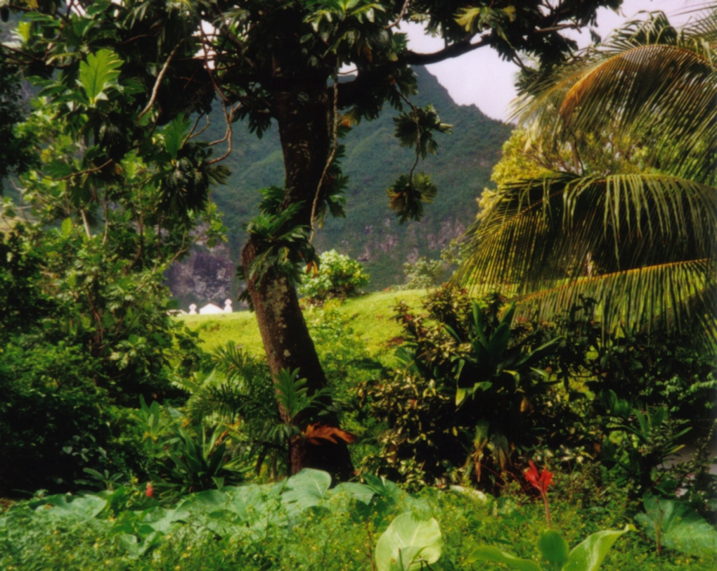
Tropical moist forests include many different forest types. The best known and most extensive are the lowland evergreen broadleaf rainforests include, for example: the seasonally inundated várzea and igapó forests and the terra firma forests of the Amazon Basin; the peat swamp forests and moist dipterocarp forests of Southeast Asia; and the high forests of the Congo Basin. The forests of tropical mountains are also included in this broad category, generally divided into upper and lower montane formations on the basis of their physiognomy, which varies with altitude. The montane forests include cloud forest, those forests at middle to high altitude, which derive a significant part of their water budget from cloud, and support a rich abundance of vascular and nonvascular epiphytes. Mangrove forests also fall within this broad category, as do most of the tropical coniferous forests of Central America.
Tropical dry
Tropical dry forests are characteristic of areas in the tropics affected by seasonal drought. The seasonality of rainfall is usually reflected in the deciduousness of the forest canopy, with most trees being leafless for several months of the year. However, under some conditions, e.g. less fertile soils or less predictable drought regimes, the proportion of evergreen species increases and the forests are characterised as "sclerophyllous". Thorn forest, a dense forest of low stature with a high frequency of thorny or spiny species, is found where drought is prolonged, and especially where grazing animals are plentiful. On very poor soils, and especially where fire is a recurrent phenomenon, woody savannas develop (see 'sparse trees and parkland').
Sparse trees and parkland
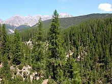
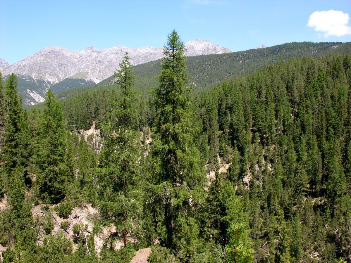
 Taiga forest near Saranpaul in the northeast Ural Mountains, Khanty-Mansi Autonomous Okrug — Yugra, Russia. Trees include Picea obovata (dominant on right bank), Larix sibirica, Pinus sibirica, and Betula pendula.
Sparse trees and parkland are forests with open canopies of 10-30% crown cover. They occur principally in areas of transition from forested to non-forested landscapes. The two major zones in which these ecosystems occur are in the boreal region and in the seasonally dry tropics. At high latitudes, north of the main zone of boreal forest or taiga, growing conditions are not adequate to maintain a continuous closed forest cover, so tree cover is both sparse and discontinuous. This vegetation is variously called open taiga, open lichen woodland, and forest tundra. It is species-poor, has high bryophyte cover, and is frequently affected by fire.
Forest plantations
Forest plantations, generally intended for the production of timber and pulpwood increase the total area of forest worldwide. Commonly mono-specific and/or composed of introduced tree species, these ecosystems are not generally important as habitat for native biodiversity. However, they can be managed in ways that enhance their biodiversity protection functions and they are important providers of ecosystem services such as maintaining nutrient capital, protecting watersheds and soil structure as well as storing carbon. They may also play an important role in alleviating pressure on natural forests for timber and fuelwood production.[citation needed]
Forest categories
 A temperate deciduous broadleaf forest, the Hasenholz, southeast of Kirchheim unter Teck, Baden-Württemberg, Germany
28 forest categories are used to enable the translation of forest types from national and regional classification systems to a harmonised global one:
Temperate and boreal forest types
- Evergreen needleleaf forest - Natural forest with > 30% canopy cover, in which the canopy is predominantly (> 75%) needleleaf and evergreen.
- Deciduous needleleaf forests - Natural forests with > 30% canopy cover, in which the canopy is predominantly (> 75%) needleleaf and deciduous.
- Mixed broadleaf/needleleaf forest - Natural forest with > 30% canopy cover, in which the canopy is composed of a more or less even mixture of needleleaf and broadleaf crowns (between 50:50% and 25:75%).
- Broadleaf evergreen forest - Natural forests with > 30% canopy cover, the canopy being > 75% evergreen and broadleaf.
- Deciduous broadleaf forest - Natural forests with > 30% canopy cover, in which > 75% of the canopy is deciduous and broadleaves predominate (> 75% of canopy cover).
- Freshwater swamp forest - Natural forests with > 30% canopy cover, composed of trees with any mixture of leaf type and seasonality, but in which the predominant environmental characteristic is a waterlogged soil.
- Sclerophyllous dry forest - Natural forest with > 30% canopy cover, in which the canopy is mainly composed of sclerophyllous broadleaves and is > 75% evergreen.
- Disturbed natural forest - Any forest type above that has in its interior significant areas of disturbance by people, including clearing, felling for wood extraction, anthropogenic fires, road construction, etc.
- Sparse trees and parkland - Natural forests in which the tree canopy cover is between 10-30%, such as in the steppe regions of the world. Trees of any type (e.g., needleleaf, broadleaf, palms).
- Exotic species plantation - Intensively managed forests with > 30% canopy cover, which have been planted by people with species not naturally occurring in that country.
- Native species plantation - Intensively managed forests with > 30% canopy cover, which have been planted by people with species that occur naturally in that country.
- *Unspecified forest plantation - Forest plantations showing extent only with no further information about their type, This data currently only refers to the Ukraine.
- *Unclassified forest data - Forest data showing forest extent only with no further information about their type.
Those marked * have been created as a result of data holdings which do not specify the forest type, hence 26 categories are quoted, not 28 shown here.[8]
Tropical forest types
- Lowland evergreen broadleaf rain forest - Natural forests with > 30% canopy cover, below 1,200 m (3,937 ft) altitude that display little or no seasonality, the canopy being >75% evergreen broadleaf.
- Lower montane forest - Natural forests with > 30% canopy cover, between 1200–1800 m altitude, with any seasonality regime and leaf type mixture.
- Upper montane forest - Natural forests with > 30% canopy cover, above 1,800 m (5,906 ft) altitude, with any seasonality regime and leaf type mixture.
- Freshwater swamp forest - Natural forests with > 30% canopy cover, below 1,200 m (3,937 ft) altitude, composed of trees with any mixture of leaf type and seasonality, but in which the predominant environmental characteristic is a waterlogged soil.
- Semi-evergreen moist broadleaf forest - Natural forests with > 30% canopy cover, below 1,200 m (3,937 ft) altitude in which between 50-75% of the canopy is evergreen, > 75% are broadleaves, and the trees display seasonality of flowering and fruiting.
- Mixed broadleaf/needleleaf forest - Natural forests with > 30% canopy cover, below 1,200 m (3,937 ft) altitude, in which the canopy is composed of a more or less even mixture of needleleaf and broadleaf crowns (between 50:50% and 25:75%).
- Needleleaf forest - Natural forest with > 30% canopy cover, below 1,200 m (3,937 ft) altitude, in which the canopy is predominantly (> 75%) needleleaf.
- Mangroves - Natural forests with > 30% canopy cover, composed of species of mangrove tree, generally along coasts in or near brackish or seawater.
- Disturbed natural forest - Any forest type above that has in its interior significant areas of disturbance by people, including clearing, felling for wood extraction, anthropogenic fires, road construction, etc.
- Deciduous/semi-deciduous broadleaf forest - Natural forests with > 30% canopy cover, below 1,200 m (3,937 ft) altitude in which between 50-100% of the canopy is deciduous and broadleaves predominate (> 75% of canopy cover).
- Sclerophyllous dry forest - Natural forests with > 30% canopy cover, below 1,200 m (3,937 ft) altitude, in which the canopy is mainly composed of sclerophyllous broadleaves and is > 75% evergreen.
- Thorn forest - Natural forests with > 30% canopy cover, below 1,200 m (3,937 ft) altitude, in which the canopy is mainly composed of deciduous trees with thorns and succulent phanerophytes with thorns may be frequent.
- Sparse trees and parkland - Natural forests in which the tree canopy cover is between 10-30%, such as in the savannah regions of the world. Trees of any type (e.g., needleleaf, broadleaf, palms).
- Exotic species plantation - Intensively managed forests with > 30% canopy cover, which have been planted by people with species not naturally occurring in that country.
- Native species plantation - Intensively managed forests with > 30% canopy cover, which have been planted by people with species that occur naturally in that country.
Forest loss and management
Main articles: Forestry, Logging and Deforestation
 Coastal Douglas fir woodland in northwest Oregon
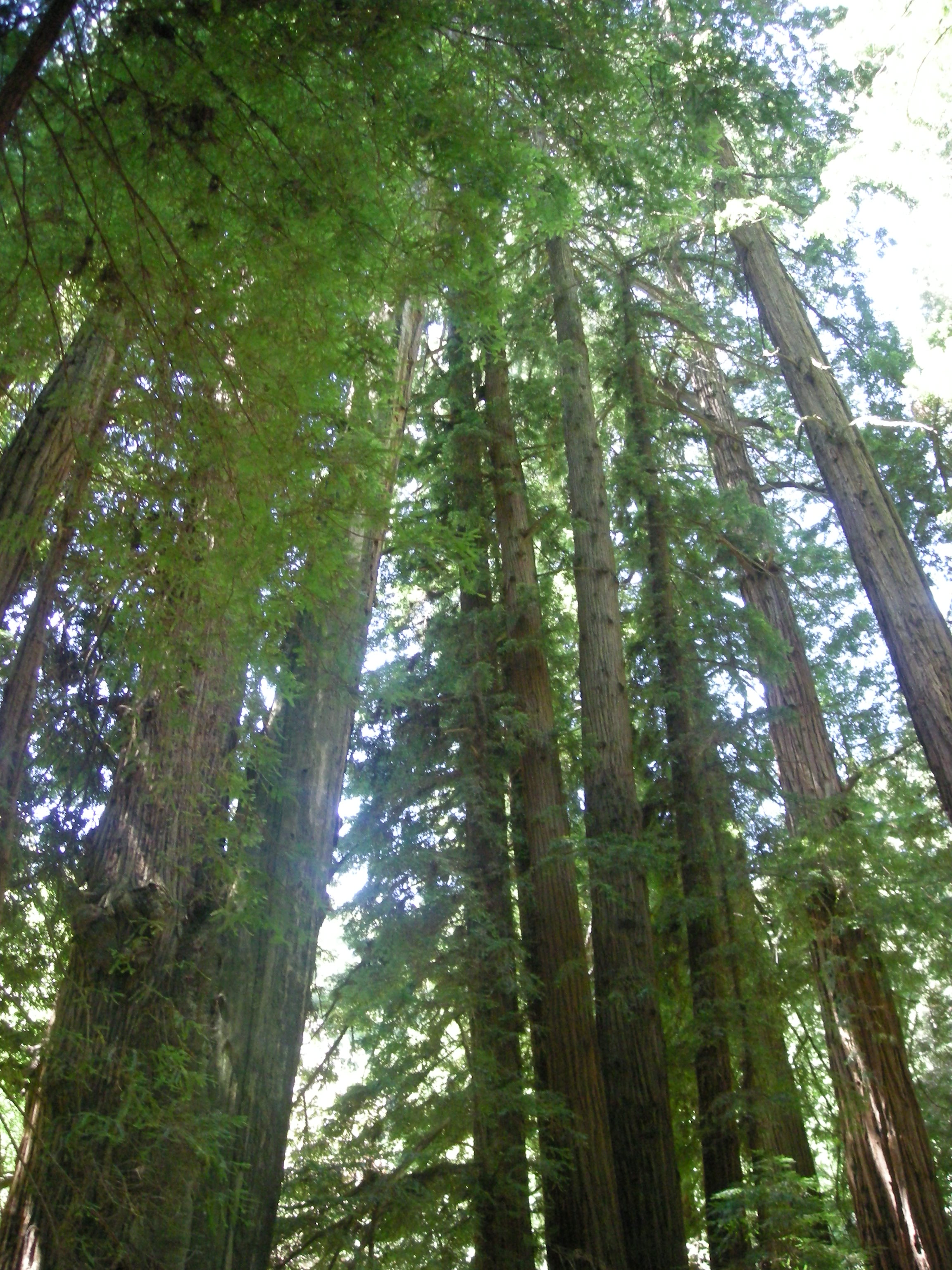
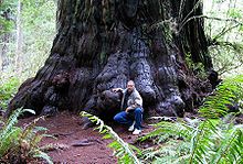 Redwood tree in northern California redwood forest, where many redwood trees are managed for preservation and longevity, rather than being harvested for wood production
The scientific study of forest species and their interaction with the environment is referred to as forest ecology, while the management of forests is often referred to as forestry. Forest management has changed considerably over the last few centuries, with rapid changes from the 1980s onwards culminating in a practice now referred to as sustainable forest management. Forest ecologists concentrate on forest patterns and processes, usually with the aim of elucidating cause and effect relationships. Foresters who practice sustainable forest management focus on the integration of ecological, social and economic values, often in consultation with local communities and other stakeholders.
Anthropogenic factors that can affect forests include logging, urban sprawl, human-caused forest fires, acid rain, invasive species, and the slash and burn practices of swidden agriculture or shifting cultivation. The loss and re-growth of forest leads to a distinction between two broad types of forest, primary or old-growth forest and secondary forest. There are also many natural factors that can cause changes in forests over time including forest fires, insects, diseases, weather, competition between species, etc. In 1997, the World Resources Institute recorded that only 20% of the world's original forests remained in large intact tracts of undisturbed forest.[9] More than 75% of these intact forests lie in three countries - the Boreal forests of Russia and Canada and the rainforest of Brazil. In 2006 this information on intact forests was updated using latest available satellite imagery.
Canada has about 4,020,000 square kilometres (1,550,000 sq mi) of forest land. More than 90% of forest land is publicly owned and about 50% of the total forest area is allocated for harvesting. These allocated areas are managed using the principles of sustainable forest management, which includes extensive consultation with local stakeholders. About eight percent of Canada’s forest is legally protected from resource development (Global Forest Watch Canada)(Natural Resources Canada). Much more forest land — about 40 percent of the total forest land base — is subject to varying degrees of protection through processes such as integrated land use planning or defined management areas such as certified forests (Natural Resources Canada).
These maps represent only virgin forest lost. Some regrowth has occurred but not to the age, size or extent of 1620 due to population increases and food cultivation. From William B. Greeley's, The Relation of Geography to Timber Supply, Economic Geography, 1925, vol. 1, p. 1-11. Source of "Today" map: compiled by George Draffan from roadless area map in The Big Outside: A Descriptive Inventory of the Big Wilderness Areas of the United States, by Dave Foreman and Howie Wolke (Harmony Books, 1992).'
By December 2006, over 1,237,000 square kilometers of forest land in Canada (about half the global total) had been certified as being sustainably managed (Canadian Sustainable Forestry Certification Coalition). Clearcutting, first used in the latter half of the 20th century, is less expensive, but devastating to the environment and companies are required by law to ensure that harvested areas are adequately regenerated. Most Canadian provinces have regulations limiting the size of clearcuts, although some older clearcuts can range upwards of 110 square kilometres (27,000 acres) in size which were cut over several years. China instituted a ban on logging, beginning in 1998, due to the destruction caused by clearcutting. Selective cutting avoids the erosion, and flooding, that result from clearcutting.[10]
In the United States, most forests have historically been affected by humans to some degree, though in recent years improved forestry practices has helped regulate or moderate large scale or severe impacts. However, the United States Forest Service estimates a net loss of about 2 million hectares (4,942,000 acres) between 1997 and 2020; this estimate includes conversion of forest land to other uses, including urban and suburban development, as well as afforestation and natural reversion of abandoned crop and pasture land to forest. However, in many areas of the United States, the area of forest is stable or increasing, particularly in many northern states. The opposite problem from flooding has plagued national forests, with loggers complaining that a lack of thinning and proper forest management has resulted in large forest fires.[11]
Old-growth forest contains mainly natural patterns of biodiversity in established seral patterns, and they contain mainly species native to the region and habitat. The natural formations and processes have not been affected by humans with a frequency or intensity to change the natural structure and components of the habitat. Secondary forest contains significant elements of species which were originally from other regions or habitats.
Smaller areas of woodland in cities may be managed as Urban forestry, sometimes within public parks. These are often created for human benefits; Attention Restoration Theory argues that spending time in nature reduces stress and improves health, while forest schools and kindergartens help young people to develop social as well as scientific skills in forests. These typically need to be close to where the children live, for practical logistics.
See also
- Agroforestry
- Ancient Woodland, an official classification of ancient forest in the United Kingdom.
- Biomass
- Biomass (ecology)
- Bioproduct
- Biosphere
- Boreal forest
- Canopy (biology)
- Close to nature forestry
- Cloud forest
- Chase (land)
- Deforestation
- Dendrometry
- Ecological succession
- Forest management
- Forest migration
- Forest pathology
- Intact forest landscape
- Jungle (terrain)
- Kelp forest (A forest made mostly if not entirely of Kelp; an underwater forest)
- Natural environment
- Natural landscape
- Old-growth forest (ancient forest, virgin forest, primary forest)
- Permaforestry
- Plantation
- Primeval forest, a term often used interchangeably with old growth forest
- Rainforest
- Red forest
- REDD-plus
- Rocky Mountains
- Silviculture
- Subalpine forest
- Taiga, a biome characterized by coniferous forests
- Temperate broadleaf and mixed forests
- Temperate coniferous forests
- Tree allometry
- Tree farm
- Tropical rainforest
- Tropical and subtropical coniferous forests
- Tropical and subtropical moist broadleaf forests
- Wildcrafting
- Woodland management
References
- ^ Lund, H. Gyde (coord.) 2006. 'Definitions of Forest, Deforestation, Afforestation, and Reforestation'. Gainesville, VA: Forest Information Services. Available from: ComcastNet-gyde.
- ^ Stamets, Paul (2005). Mycelium Running. Ten Speed Press. pp. 35. ISBN 1580085792.
- ^ Living Planet Report 2010. 2010. http://www.panda.org. Retrieved 19 April 2011.
- ^ a b c "forest, noun". Oxford English Dictionary online edition. Oxford University Press. http://www.oed.com/. Retrieved 2009-05-22.
- ^ "forest, noun". The American Heritage Dictionary of the English Language (3 ed.). Boston: Houghton Mifflin Company. 1996. ISBN 0-395-44895-6.
- ^ "What is a Forest?". Australian Government/Department of Agriculture, Fisheries, and Forestry/Rural Areas. March 28, 2007. http://www.daff.gov.au/brs/forest-veg/nfi/forest-info/what-is. Retrieved November 25, 2010.
- ^ Jenkins Martin D. , Groombridge Brian, World Atlas of Biodiversity: Earth's Living Resources in the 21st Century, World Conservation Monitoring Centre, United Nations Environment Programme, retrieved 20 March 2007 [1].
- ^ United Nations Environment Programme, World Conservation Monitoring Centre, Background to Forest Mapping & Data Harmonisation, retrieved 20 March 2007 [2]
- ^ World Resources Institute, 1997. The Last Frontier Forests: Ecosystems and Economies on the Edge
- ^ Ban on Logging Saves Forests
- ^ Wildfires Ignite Forest Management Debate
External links
- Forests in danger
- Roadmap to Recovery: The World's Last Intact Forest Landscapes
- Global Forest Resources Assessment 2005 by the FAO
- CoolForests.org - Conservation Cools the Planet
- Google - public data "Forest area (sq. km)"
- Luck Baker, Andrew (18 November 2008). "The first forests - Discovery 2008". BBC Online. http://www.bbc.co.uk/worldservice/specials/948_discovery_2008/page12.shtml.
- "The World's 10 Most Threatened Forest Hotspots". Conservation International. 2 February 2011. http://www.conservation.org/newsroom/pressreleases/Pages/The-Worlds-10-Most-Threatened-Forest-Hotspots.aspx.
Categories:- Forests
- Habitats
- Trees
- Ecosystems


Wikimedia Foundation. 2010.