- Claireville Conservation Area
-
The Claireville Conservation Area, one of the largest tracts of land owned by the Toronto and Region Conservation Authority (TRCA), is unique.[1] It was acquired in 1957 to construct a flood control dam and reservoir after the destruction caused by Hurricane Hazel. The park is a 848 hectare (2,100 acre) parcel of conservation land located on the west branch of the Humber River in Brampton, Ontario, Canada. Claireville contains significant natural and cultural heritage features, and has outstanding recreation, tourism and educational facilities and programs. The Etobicoke Field Studies Centre[2] is located in the southern corner of Claireville and provides programs for student from Grade 1 to Grade 6. Located in the northern corner of the park is the Claireville Ranch[3], it provides horse riding lessons, trail riding and other group activities. The Indian Line Campground[4] is located at the southern tip of the park, in the Regional Municipality of Peel. It offers 245 serviced and unserviced campsites.
Contents
Characteristic features
The landscape of the park is diverse. Its characteristic features are numerous creeks and ravines, flat plains, and rolling hills enriching the forested landscape. The TRCA has declared an early 20th century farmhouse in the northern part of Claireville as a heritage property, major restoration began in 2005. The park is home to the Eastern Coyote, Wood Duck, Chimney Crayfish, Deer, Muskrat, Common Garter Snake. The parks varied landscape can be admired from many vantage points. In 2003 the HSBC BANK[5] donated the funds to plant the HSBC Forest at the Claireville Conservation Area. The park is a favorite with local dog owners, bird watchers and wildlife photographers.
Natural area enhancement plan
A multi-year natural area enhancement plan has been developed for Claireville. Some of the recommended activities of this plan include: Protecting and enhancing significant blocks of interior forest habitat and reforestation. Enhancing public use and access to internal trail network and, installing wildlife structures such as nest boxes for waterfowl and song birds; brush piles for small mammals and in-water structural habitats like stumps, logs, and rocks for a variety of fish[6] and amphibian species.
 Claireville Wetlands
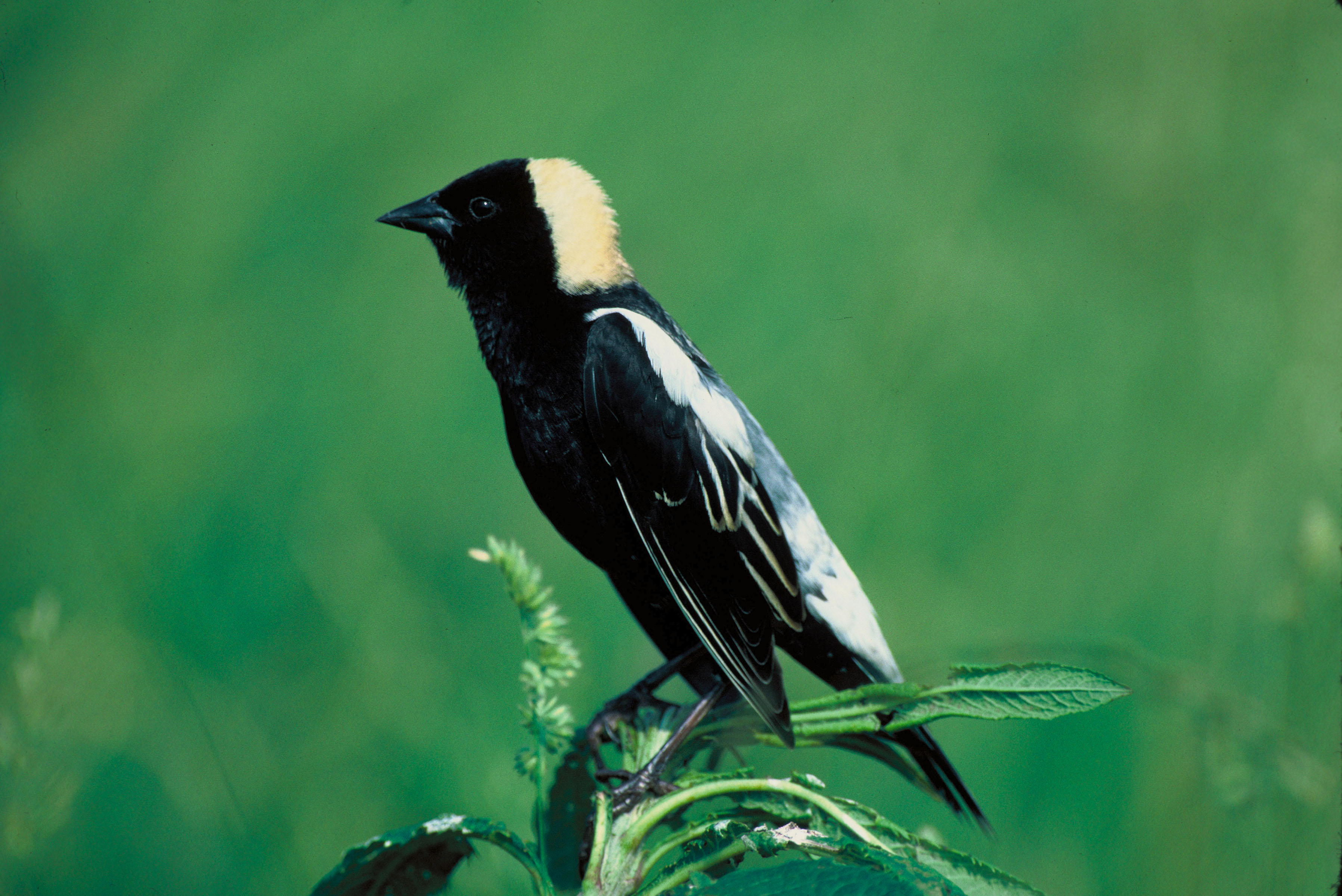
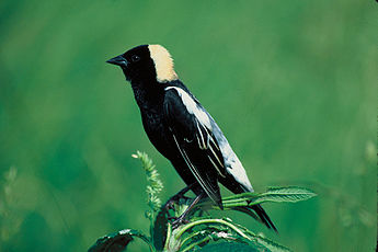 Bobolink
Birds
Dozens of bird species can be seen. Some use the park as a stop on their migratory route, others breed in the park. Bring your binoculars and a field guild. Claireville is the largest conservation area owned by the TRCA. in the Greater Toronto Area.
In open fields
In the forest
- Rose-breasted Grosbeak
- Pileated Woodpecker
- Red-eyed Vireo
- Blue Jay
- American Robin
- Great-Crested flycatcher
- Hairy Woodpecker
- Scarlet Tanager
Semi-Open Brush
- Northern Oriole
- Eastern Kingbird
- Field Sparrow
- House Wren
- Yellow Shafted Flicker
- Indigo Bunting
- Grey Catbird
- Brown Thrasher
Ponds, Marshes, River banks
- Wood Duck
- Tree Swallow
- Mallard
- Song Sparrow
- Bank Swallow
- Rough-Wing Swallow
- Eastern Phoebe
- Cliff Swallow
Location
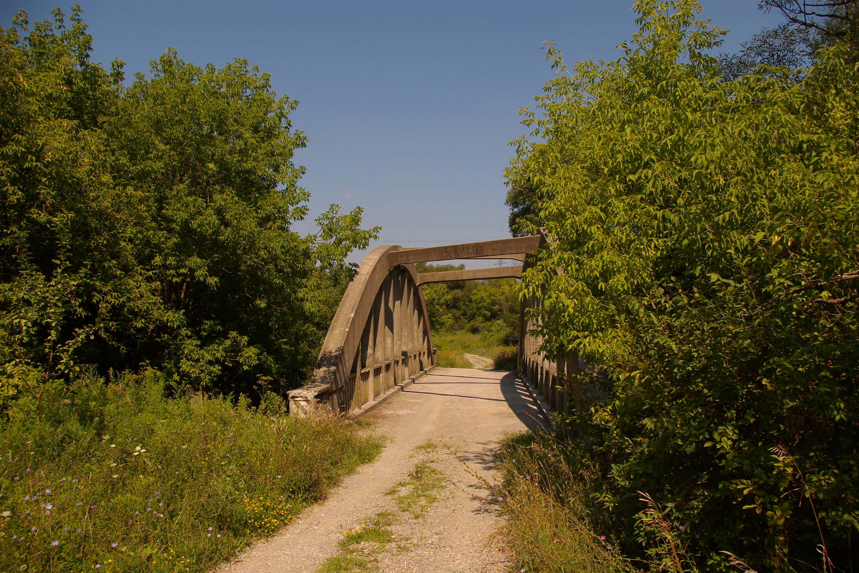
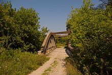 Bridge crossing on West Humber River
Parking is available at the east and north gates, and at the HSBC forest area. The south gate is located on Gorewood Rd, the east gate is on Regional Road 50 just north of Steeles ave. (The Etobicoke Field Studies Centre is just a short walk from this gate). The north entrance is located at the intersection of McVean Dr. and Regional Road 107. (This is the Claireville Ranch entrance). The northern most area of the park is the HSBC forest, it is located on McVean Dr. 1 km north of Regional Road 107.
External links
References
- ^ The Toronto and Region Conservation Authority is in charge of running the Claireville Conservation Area [1]
- ^ The Etobicoke Field Studies Centre website. [2]
- ^ The Ranch is located in the northern part of Claireville. This is their website. [3]
- ^ Family campground on the banks of the Humber River, beside Claireville Dam. Find out more here [4]
- ^ HSBC is one of the largest banking groups in the world. [5]
- ^ Common year round are: BROWN BULLHEAD, CARP, CREEK CHUB, GOLDFISH, LARGEMOUTH BASS, PUMPKINSEED, ROCK BASS, WHITE SUCKER and the seasonal YELLOW PERCH
Protected areas in Ontario National parks 
Provincial parks Conservation areas Boyd · Claireville · Cold Creek · Guelph Lake · Heber Down · Kortright Centre · Lake Laurentian · Mer Bleue · Mount Nemo · Rattlesnake Point · Spencer Gorge / Webster's Falls · more...UNESCO Biosphere Reserves Georgian Bay Littoral · Long Point · Niagara Escarpment (including Cheltenham Badlands) · Thousand Islands - Frontenac Arch · Wasaga BeachNational Historic Sites of Canada Central Experimental Farm · Dundurn Castle · Laurier House · Massey Hall · Montgomery's Tavern · Osgoode Hall · Parliament · Rideau Canal · Rideau Hall · more...Other areas Brampton Geography Buildings and structures Organization Events Politics Media Education Peel District School Board · Dufferin-Peel Catholic District School Board · Sheridan College, Brampton Campus · Algoma University, Brampton CampusTransportation Coordinates: 43°45′16″N 79°38′32″W / 43.754435°N 79.642189°W
Categories:- Conservation areas in Ontario
- Brampton


Wikimedia Foundation. 2010.