- Etobicoke
Infobox Settlement
official_name = City of Etobicoke (Dissolved)
other_name =
native_name =
nickname =
motto =
imagesize =
image_caption =
flag_size =
image_
seal_size =
image_shield =
shield_size =
image_blank_emblem =
blank_emblem_size =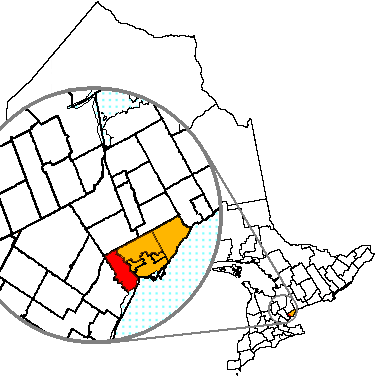
mapsize =
map_caption = Location of Etobicoke (red) compared to the rest of Toronto (yellow).
pushpin_
pushpin_label_position =
subdivision_type = Country
subdivision_name =Canada
subdivision_type1 = Province
subdivision_name1 =Ontario
subdivision_type2 =
subdivision_name2 =
subdivision_type3 =
subdivision_name3 =
subdivision_type4 =
subdivision_name4 =
government_type =
leader_title =Mayor
leader_name =David Miller (Toronto Mayor)
leader_title1 = Governing Body
leader_name1 =Toronto City Council
leader_title2 =MPs
leader_name2 =Roy Cullen ,Michael Ignatieff ,Borys Wrzesnewskyj
leader_title3 =MPPs
leader_name3 =Shafiq Qaadri ,Donna Cansfield ,Laurel Broten
leader_title4 =
leader_name4 =
established_title =Established
established_date =1 January 1850 (township)
established_title2 =
established_date2 =1 January 1967 (borough)
established_title3 = IncorporatedAmalgamation
established_date3 = June 1983 (city)1 January 1998
area_magnitude =
unit_pref =
area_footnotes =ref label|Stats_Canada|1|1(sc)
area_total_km2 = 123.93
area_land_km2 =
area_water_km2 =
area_total_sq_mi =
area_land_sq_mi =
area_water_sq_mi =
area_water_percent =
area_urban_km2 =
area_urban_sq_mi =
area_metro_km2 =
area_metro_sq_mi =
population_as_of = 2001 census
population_footnotes =ref label|Stats_Canada|1|1(sc)
population_note =
settlement_type = Dissolved city
population_total = 338,117
population_density_km2 = 2728.3
population_density_sq_mi =
population_metro =
population_density_metro_km2 =
population_density_metro_sq_mi =
population_urban =
population_density_urban_km2 =
population_density_urban_mi2 =
timezone = EST
utc_offset = -5
timezone_DST = EDT
utc_offset_DST = -4
latd= |latm= |lats= |latNS=
longd= |longm= |longs= |longEW=
elevation_footnotes =
elevation_m =
elevation_ft =
postal_code_type = Postal code span
postal_code =M8V-M9C, M9P-M9R, M9V-M9W
area_code =416, 647
website =
footnotes =Etobicoke (pronEng|ɛˈtoʊbɨkoʊ audio|etobicoke.ogg|listen) is the western portion of the City of
Toronto ,Ontario ,Canada , with an official population of 338,117 [http://www12.statcan.ca/english/Profil01/CP01/Details/Page.cfm?Lang=E&Geo1=CSD&Code1=3520019&Geo2=PR&Code2=35&Data=Count&SearchText=etobicoke&SearchType=Begins&SearchPR=01&B1=All&Custom=] as measured by the 2001 Census and 334,491 people as of the 2006 Census. While it only contains 13% of Toronto's population, it occupies about 20% of the total land area. It is bordered on the south byLake Ontario , on the east by the Humber River, on the west by the city of Mississauga and directly next to the borderPearson International Airport , on the north by the city of Vaughan, and on the north west by the City of Brampton.History
Different groups of First Nations peoples used the land that is now Etobicoke at different times. As the
Algonquins gradually moved west from the Atlantic to Lake Erie, it is almost certain that they would have occupied this land at some point. By the time they were mostly settled on the shores of Georgian Bay, The Huron-Wendat were the primary residents of the north shore of Lake Ontario and, somewhere in the 1600s, they were pushed out by theHaudenosaunee (Iroquois ) people. After continued harassment from the south, a coalition of theOjibway ,Odawa andPotawatomi Algonquin nations, known as the Three Fires, gradually pushed the Haudenosaunee off this land and theMississaugas settled there by 1695, fishing and growing crops more locally in the summer and hunting further afield in the winter. [Mississaugas of the New Credit First Nation and Praxis Research Associates. Date unknown. "The History of the Mississaugas of the New Credit First Nation." Hagersville, ON: Author.]It is thought that the French explorer,
Étienne Brûlé , was the first European to visit the area, circa 1615.The name "Etobicoke" was derived from the Mississauga word "wah-do-be-kang" ("wadoopikaang") [Nichols, John D. and Earl Nyholm. 1994. "A Concise Dictionary of Minnesota Ojibwe". Minneapolis: University of Minnesota Press] , meaning "place where the black/wild
alder s grow", which was used to describe the area betweenEtobicoke Creek and the Humber River.Etobicoke was intended by the British to be included in the
Toronto Purchase of 1787.cite web|url = http://www.kingswayratepayers.com/histetobicoke.htm|title = A Brief History of Etobicoke] However, whether the western boundary of the purchase was theHumber River orEtobicoke Creek was disputed. TheMississauga Indians allowed British surveyorAlexander Atkins to survey the disputed land, and eventually the dispute was settled, with the Mississauga recognising the purchase as extending to Etobicoke Creek, and the British paying an additional 10shilling s for the purchase.The first provincial land surveyor,
Augustus Jones , also spelled it as "ato-be-coake". Etobicoke was finally adopted as the official name in 1795 on the direction ofLieutenant Governor John Graves Simcoe .Settlers began to move in from Britain. Early settlers of Etobicoke included many of the
Queen's Rangers , who were given land in the area by Lieutenant Governor Simcoe to help protect the new capital of Upper Canada. In 1795 the HonourableSamuel Bois Smith , a captain in theQueen's Rangers , received a grant of 1530 acres, extending fromKipling Avenue to Etobicoke Creek, and north toBloor Street .cite web|url = http://www.newtorontohistorical.com/Early%20History.htm|title = Early History|publisher = New Toronto Historical Society] The firstland patent was issued to SergeantPatrick Mealey onMarch 18 ,1797 for a plot on the west side ofRoyal York Road on Lake Ontario.cite web|url = http://www.etobicokehistorical.com/Stories/Beginnings/body_beginnings.html|title = Beginnings!|author = Bob Given|publisher = Etobicoke Historical Society] More land was given to the members of the Queen's Rangers between Royal York Road and Kipling Road south of Bloor Road.The census of 1805 counted 84 people in the township of Etobicoke. In 1806
William Cooper built agrist mill andsaw mill on the west bank of the Humber river, just south ofDundas Street . The 1809 census counted 137 residents. The Dundas Street bridge opened in 1816, making the township more accessible.On
May 18 ,1846 theAlbion Road Company was incorporated. Its purpose was to build and maintain a road to the north-west corner of Etobicoke, where a new community was planned. At the same time,John Grubb , who had already foundedThistletown , hired land surveyorJohn Stughton Dennis to plan a community at the intersection ofIslington Avenue and Albion Road, to be namedSaint Andrew's . Plan 6 for this community was registered onOctober 15 ,1847 . The French master ofUpper Canada College ,Jean du Petit Pont de la Haye , contracted land surveyorJames McCallum Jr to create a plan for the community planned by the Albion Road Company, and Plan 28 was registered forClaireville onOctober 12 ,1849 .The township of Etobicoke was incorporated on
January 1 ,1850 .cite web|url = http://www.toronto.ca/archives/records_etobicoke.htm|title = Etobicoke Records|publisher = City of Toronto] The first meeting of the town council was held on January 21st. Present at the meeting were reeve William Gamble, vice-reeveW. B. Wadsworth and aldermenMoses Appleby ,Thomas Fisher andJohn Geddes .cite web|url=http://www.etobicokehistorical.com/Stories/Municipal_Government/municipal_government.html|title = Our Municipal Government|author = Robert A Given|publisher = Etobicoke Historical Society] The council convened monthly meetings at a variety of places. In 1850, the population of the township was 2904.In 1881, the population of Etobicoke township was 2976.
In 1911, the community of
Mimico was incorporated on land taken from Etobicoke township. [cite web|url = http://www.torontofamilyhistory.org/chronology.html|title = Toronto Chronology]New Toronto was incorporated onJanuary 1 ,1913 . Early on there was talk of merging Mimico and New Toronto. A 1916 referendum on amalgamating the two communities was approved by the residents of Mimico, but rejected by residents of New Toronto. In 1920, the village of New Toronto became the town of New Toronto. Long Branch was incorporated in 1931.In 1954, Etobicoke Township became a part of the newly-formed regional government, the Municipality of
Metropolitan Toronto ("Metro").In 1967, the township of Etobicoke was merged with three small lakeside municipalities — Long Branch, New Toronto, and Mimico — to form the borough of Etobicoke. The borough was reincorporated as a city in 1983.
In 1998, six local municipalities (including Etobicoke) and the Metropolitan Toronto government merged to form the amalgamated city of Toronto.
Demographics
In 2001, Etobicoke was 65.2% White, 12% South Asian, 9% Black, 3% Chinese, 2% Latin American, 2% Filipino, 1% Korean, 1% West Asian, 1% Arab, and 4% Other. [http://www12.statcan.ca/english/Profil01/CP01/Details/Page.cfm?Lang=E&Geo1=CSD&Code1=3520019&Geo2=PR&Code2=35&Data=Count&SearchText=Toronto&SearchType=Begins&SearchPR=35&B1=All] Approximately 46% of the population are immigrants.
Culture
Etobicoke has the lowest population density out the former cities and boroughs that currently make up the city of Toronto. This is mainly due to its expanses of industrial lands. Several major freeways are routed through the area, making the area ideal for automobile-based transportation. Public transit does not serve the area well, with few rapid transit connections.
Many exceptions to Toronto's gridded street matrix are found in Etobicoke. A number of overpasses and awkward intersections, such as Bloor/Kipling/Dundas West, have been created in an effort to reconcile the grid with these planning anomalies.
Etobicoke has numerous public parks, notable among them is "James Gardens" on the banks of the Humber River. The park includes seasonal flowers, walkways, a rock garden, streams, and waterfalls. It is a very popular site for taking
wedding photographs. The Humber Bay park is mostly located in Etobicoke.The central/southern areas of Etobicoke are better served by public transit and closer to the city centre. These areas, such as
Markland Wood ,The Kingsway andNew Toronto , consist of large green spaces, numerous parks, golf courses (includingSt. George's Golf and Country Club , ranked 3rd best in Canada) [http://www.scoregolf.com/golf-course-guide/name.cfm/St-Georges-Golf-Country-Club-facility-overview/Toronto/Ontario/x10-11871-001/] , numerous restaurants and cafes, and fine boutiques. Residential development consists primarily of single-family dwellings. Kingsway South neighbourhood has attracted many affluent individuals and families (as of 2001, over 50% of households have an income in excess of C$100,000/year) [http://www.toronto.ca/demographics/pdf3/cpa15.pdf] , and remains one of Toronto's more prominent neighbourhoods.The central areas of Etobicoke, although farther from the subway line, are still well-served by public transit buses. These neighbourhoods are generally
middle class .Unfortunately, some areas in Etobicoke have become neglected, "inner-ring" suburbs, such as
Rexdale .Car culture infrastructure built in the 1960s is in a state of disrepair. These areas are dominated by unadorned, single-story development and treeless, tarmac-covered prairie. Deflated real estate values have made these areas concentrated areas of poverty and crime. These central and northern areas of Etobicoke contain numerous high-density apartment complexes set in the middle of sizable, open fields and parks.Etobicoke is home to
Humber College ,University of Guelph-Humber , Woodbine Race Track and Slots,Woodbine Centre and Sherway Gardens Shopping Centre.Mayors and Reeves of Etobicoke
* 1850 William Gamble, Reeve
* 1851-1854 Joseph Smith, Reeve
* 1855-1857 Alexander McFarlane, Reeve
* 1858-1864 Edward Musson, Reeve
* 1865-1870 William Wallace, Reeve
* 1873 John Clark, Reeve
* 1874-1876 William Wallace, Reeve
* 1877-1884 Matthew Canning, Reeve
* 1885-1896 John D. Evans, Reeve
* 1897-1900 David L. Streight, Reeve
* 1901 John T. Carr, Reeve
* 1902-1905 John Bryans, Reeve
* 1906 Franklin E. Shaver, Reeve
* 1907 John D. Evans, Reeve
* 1908 John Gardhouse, Reeve
* 1909 Russell S. Warner, Reeve
* 1910-1912 John Gardhouse, Reeve
* 1913-1917 Charles Silverthorn, Reeve
* 1918 James Dandridge, Reeve
* 1919-1920 William G. Jackson, Reeve
* 1921-1924 William J. Gardhouse, Reeve
* 1925-1926 T.A.C. Tier, Reeve
* 1927-1929 J. Ray Price, Reeve
* 1930-1931 Robert Marshall, Reeve
* 1932 William J. Gardhouse, Reeve
* 1934-1936 William A. Armstrong, Reeve
* 1937 William L. Stephens, Reeve
* 1938-1943 William A. Armstrong, (resigned Feb. 1943) Reeve
* 1943-1946 F.A.C. Butler, Reeve
* 1947-1952 Clive M. Sinclair, K.C., Reeve
* 1953-1956 W. Beverley Lewis, Reeve
* 1957-1962 H.O. Waffle, Reeve
* 1963-1966 John P. MacBeth, Reeve
* 1967-1972 Edward A. Horton, Mayor
* 1973-1983C. Dennis Flynn , Mayor
* 1984-1993 Bruce Sinclair, (effectiveSeptember 4 ,1984 ), Mayor
* 1994-1998Doug Holyday , MayorEducation
Public schools in Etobicoke are overseen by the
Toronto District School Board . High schools includeWeston Collegiate Institute ,Central Etobicoke High School ,Etobicoke Collegiate Institute , founded in 1928,Kipling Collegiate Institute ,Lakeshore Collegiate Institute ,Martingrove Collegiate Institute ,North Albion Collegiate Institute ,Richview Collegiate Institute , founded in 1958,Silverthorn Collegiate Institute ,Thistletown Collegiate Institute ,West Humber Collegiate Institute , founded in 1966,Etobicoke School of the Arts , founded in 1981,Scarlett Heights Entrepreneurial Academy , and theSchool of Experiential Education , an alternative school founded in 1971.In addition to the public school system, Etobicoke is home to several
Catholic school s, overseen by theToronto Catholic District School Board . These include Michael Power/St. Joseph,Bishop Allen Academy , Don Bosco (formerly Keiller Mackay Collegiate Institute),Father John Redmond , Father Henry Carr, Holy Child,Nativity of Our Lord Elementary School , and Monsignor Percy Johnson.Other schools include Humberwood Downs J.M.A., West Humber Junior, Smithfield, Elmbank, Humbercrest and Missisauga private school.
West Glen Junior School, located on Cowley Avenue, educates in grades JK-5. The school was founded in 1953 and the principal is Jeanette Lang. An English-language school, it is attended by around 240 students.
port
The area is home to the local Etobicoke & District
Cricket League. Etobicoke has a localsoccer team known as theEtobicoke Football Club . It is home to theEtobicoke Kangaroos Australian rules football club, participating in theOntario Australian Football League . It is home to the EtobicokeRingette Association, competing in the Central Ontario Ringette League.Etobicoke Canucks is in theGreater Toronto Hockey League . There is the Etobicoke Dolphins Girls Hockey Assosiation who play in the LLFHL (Lower Lakes Female Hockey League). It is also home to theEtobicoke Rangers baseball team in theCentral Ontario Baseball Association with three minor league teams (all named Etobicoke Rangers, one junior, one senior midget and one junior midget) all of whom play out of Connorvale Park.Notable residents or natives
*Jane Siberry , singer/songwriter/poet
*Michael Seater , actor
* Mike Bullard, talk show host
* Manny Fernandez, professional hockey player
*Stephen Harper ,Prime Minister of Canada . AttendedRichview Collegiate Institute .
*J.S. Woodsworth , social activist and founding leader of theCo-operative Commonwealth Federation , the precursor to theNew Democratic Party
*Dave Foley , actor
* Stash Cairo, writer
*Dan Redican , actor/writer
*Brendan Shanahan , professional hockey player
*Catherine O'Hara , actress.
*Robin Duke , actress.
*Stephen Valiquette , professional hockey player.
*June Callwood , social activist
*Trent Frayne , journalist
*Allan Rock , former Minister of Health & Canadian Ambassador to the United Nations, AttendedRichview Collegiate Institute
*Keanu Reeves , actor ("The Matrix ")
* Mark Napier - professional hockey player
*Stephen Valiquette -New York Rangers goalie.
*David Bolland - hockey player, London Knights, member of the National Canadian Junior Hockey Team
*Paul Stalteri - professional soccer player
*Dave Bidini - musician, theRheostatics , author "On a Cold Road"; "Tropic of Hockey"
*Martin Tielli - musician, theRheostatics
*Tim Vesely - musician, theRheostatics
*Dave Clark - musician, theRheostatics andThe Dinner Is Ruined
*Ghetto Concept - hip-hop artists. Pioneers in Toronto's hip-hop scene (Rexdale )
*Kiefer Sutherland - main actor for TV series, 24. AttendedMartingrove Collegiate Institute .
*Mike Lobel - actor. Attended Etobicoke School of the Arts.
*Nicole Stamp - host ofReach For The Top . AttendedRichview Collegiate Institute .
*Emily Haines - singer. AttendedEtobicoke School of the Arts .
*Chris Buck - portrait & advertising photographer, grew up in Etobicoke.
*Estella Warren - model/actress. AttendedSilverthorn Collegiate Institute .
*Douglas Wright - model/musician. AttendedEtobicoke Collegiate Institute .
*Ken Dryden - politician and former NHL goaltender. AttendedEtobicoke Collegiate Institute .
*Tim Bardsley - ex-politician, now lawyer
*Seth Bullock - well known U.S Marshal. Also portrayed in HBO's series Deadwood.
*Jerry Howarth -Toronto Blue Jays radio announcer since 1981. Coaches boys basketball atEtobicoke Collegiate Institute .
*Katheryn Winnick - actress
*Jeff Healey , rock musician
*Anastasia Phillips - actress
*Kim Mitchell - singer/songwriter, member ofMax Webster , DJ on Q107
*Peter Zezel - former hockey player, played for theToronto Maple Leafs
*Wayne Gretzky - professional hockey player, attendedWest Humber Collegiate Institute
*Cali Timmins - actress. AttendedRichview Collegiate Institute .
*Elwy Yost - television host
*Graham Yost - screenwriter
*Paul Watson (journalist) -Pulitzer Prize -winning journalist. AttendedRichview Collegiate Institute .
*Jason Spezza - professional ice hockey playerOttawa Senators ee also
*List of neighbourhoods in Etobicoke
Notes
[http://www.etobigo.ca EtobiGO.ca is the portal for all things Etobicoke! From restaurant reviews to weather and traffic.]
References
* [http://www12.statcan.ca/english/Profil01/CP01/Details/Page.cfm?Lang=E&Geo1=CSD&Code1=3520019&Geo2=PR&Code2=35&Data=Count&SearchText=Toronto&SearchType=Begins&SearchPR=35&B1=All Community Profile: Etobicoke city (dissolved), Ontario; Statistics Canada]
*"Inside Toronto" - The Weekender;March 27 ,2005
* [http://www.newtorontohistorical.com/ New Toronto Historical Society]
* [http://www.flickr.com/photos/etobicokesouth/tags/etobicoke/ Photographs of Etobicoke]
* [http://www.toronto.ca/committees/council_profiles/pdf/west_ethnocultural.pdf Etobicoke Ethnocultural Profile][http://www.etobigo.ca EtobiGO.ca is the portal for all things Etobicoke! From restaurant reviews to weather and traffic.]
Wikimedia Foundation. 2010.