- Ontario Highway 417
-
See also: Queensway (Ottawa)
Highway 417

Queensway 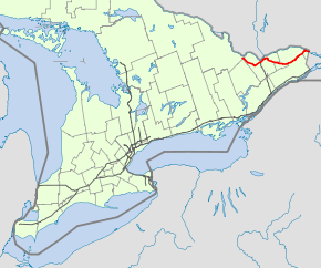
Route information Length: 181.4 km[1] (112.7 mi) Existed: 1971[citation needed] – present Major junctions East end:  A-40 towards Montreal, QC
 Highway 34 – Vankleek Hill
 Highway 138 – Casselman
 Highway 416 – Nepean
 Highway 7 – Stittsville
West end:  Highway 17 – Arnprior
Highway system Ontario provincial highways
400-series • Former←  Highway 416
Highway 420  →
→King's Highway 417, also known as Highway 417 and the Queensway through Ottawa is a 400-series highways in the Canadian province of Ontario which connects Montreal (via A40) with Ottawa. It is the backbone of the transportation system in the Ottawa region, where it is known as the Queensway (from the Ottawa Road 174 interchange to the Highway 7). It extends from the Quebec border (near Hawkesbury) to Arnprior, where it continues westward as Highway 17. The eastern section from the Quebec border to the east side of Ottawa opened in the 1970s. Sections west of Ottawa have been under construction since the mid-1990s, in three phases, with the latest section to Arnprior opening in 2005.
Contents
Route description
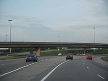
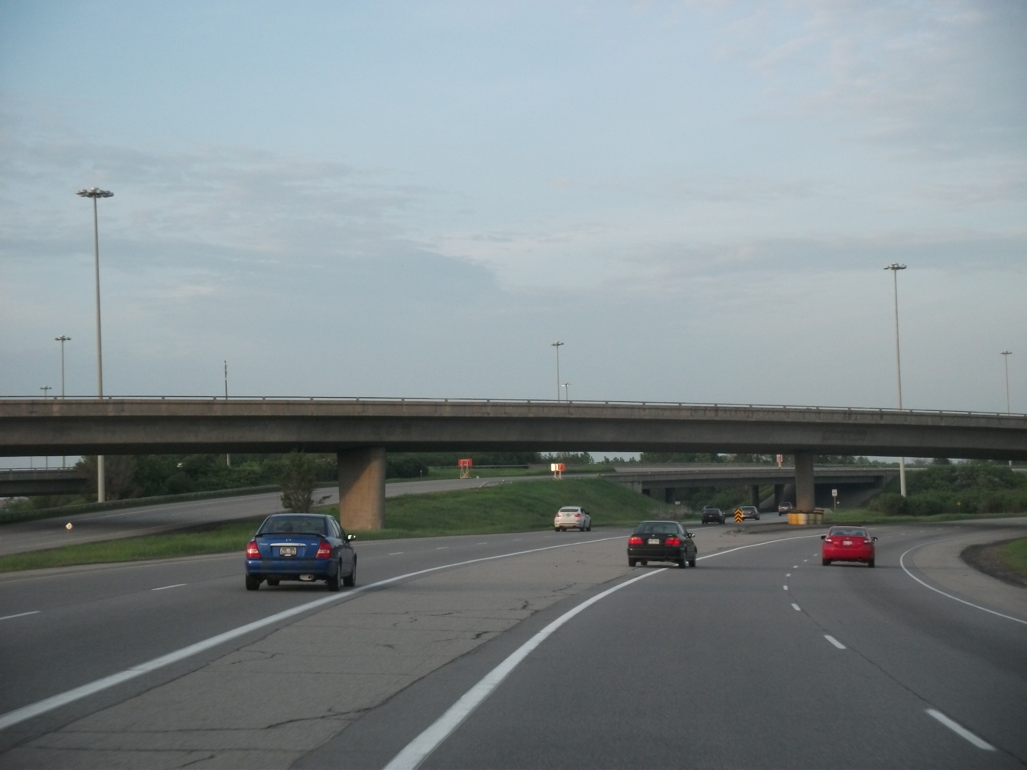
 Highway 417 in Ottawa near the Highway 416 interchange, showing an HOV lane in the eastbound carriageway
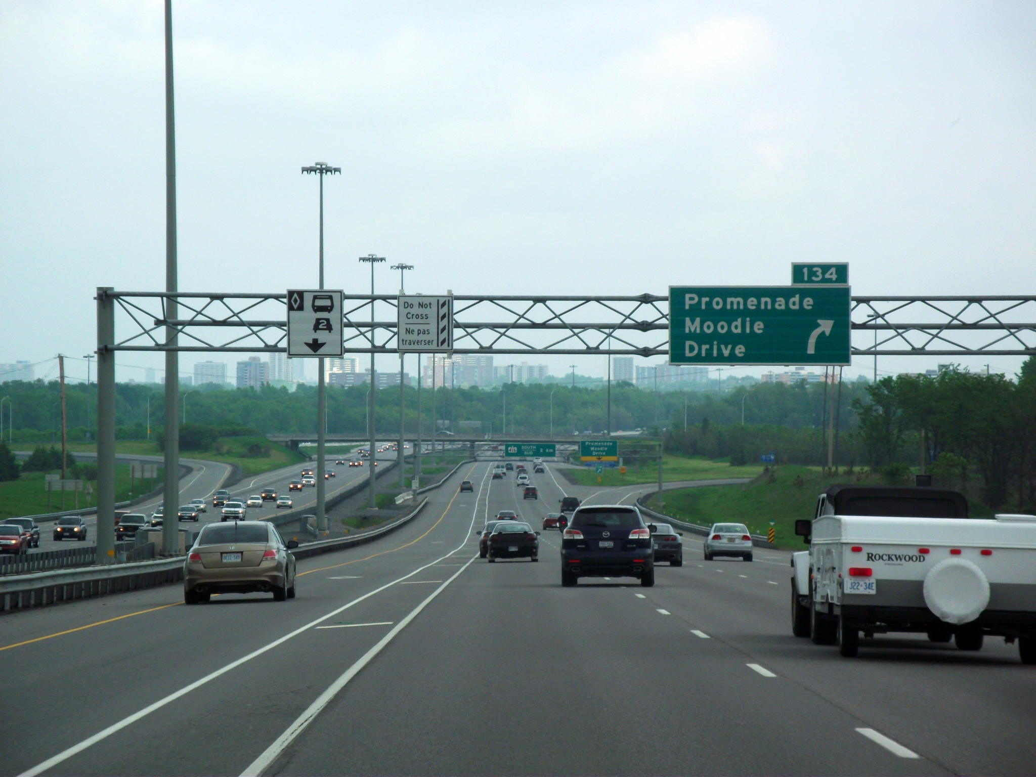
 Highway 417 facing east at the Split
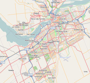 Map of Highway 417 in Ottawa (The Queensway)
Highway 417 is often quite congested through Ottawa, but currently there is no expansion planned through the city centre. An Ottawa bypass beltway plan was briefly discussed in 2001-2003, but is now on the political backburner. In 2007, the Ontario Ministry of Transportation (MTO) began planning an extensive upgrade of the infrastructure of the Queensway along Highway 417 from Highway 416 eastward to Anderson Road.[2]
- Highest Volume: 168,600 AADT from Rochester Street (Exit 122) to Parkdale Avenue (Exit 121B)
- Lowest Volume: 12,100 AADT from Barb Road (Exit 17) to Highway 17 (Exit 9)
History
The first sections of the Queensway that were eventually made part of the 417 alignment were constructed in the early 1960s. The central zone of Queensway was gradually extended both eastward and westward through Ottawa in the late 1960s and 1970s. As the Queensway/417 was extended, a section of Highway 17 through the city "disappeared", although the two sections of Highway 17 were directly linked by Highway 417. This comprises most of the Queensway. In the eastern part of Ottawa, at an interchange known as "the split", Highway 417 was built on a new alignment that bypassed the existing Highway 17. Highway 17 resumed east of "the split", with its short freeway section constituting the rest of the Queensway route, before 1998 provincial downloading put it into doubt. Near the Quebec border, Highway 17 again met up with and terminated with Highway 417, shortly before 417 turns into Autoroute 40. After 1998, when Highway 17 became Ottawa Regional Road 174, Highway 417 assumed the Trans-Canada Highway designation all the way to its eastern terminus.
For many years, Highway 417 was one of the few isolated 400-series highways without direct freeway access to the "backbone" of the network, Highway 401, until the completion of Highway 416 in 1999.
Future
The MTO plans to further extend the 417 westerly through the Ottawa Valley by twinning and realigning the existing Highway 17 to a four-lane freeway past Arnprior, where Highway 417 currently ends. No immediate construction timelines have been announced, but route planning by MTO has been completed to Pembroke. In August 2006, construction began on a connection at Exit 145 with an announced four-lane expansion of Highway 7 to Carleton Place from the west side of Ottawa.
The 417 currently has 42 interchanges from the Quebec border to Arnprior, with more planned as the highway is extended westward. Unlike other highways in Ontario and most of North America, exits are numbered from east to west. After much planning on other segments of Highway 17 in Sudbury, and North Bay it has raised speculation on expansion.
Exit list
Division Location Exit Destinations Notes Prescott and Russell East Hawkesbury 5 CR 4 / CR 14 (Prescott and Russell Road) – Chute-à-Blondeau, Saint Eugene 9 CR 17 – Hawkesbury, Rockland Westbound exit and eastbound entrance 17 CR 10 (Barb Road) – Vankleek Hill, Saint Eugene Stormont, Dundas and Glengarry North Glengarry 27 Highway 34 / CR 34 – Alexandria, Vankleek Hill, Hawkesbury, Mirabel Airport35 CR 23 / CR 31 (McCrimmon Road) – Alexandria, Saint Bernardin 51 Highland Road (CR 9, CR 20) - Saint Isidore, Maxville The Nation, North Stormont 58 Highway 138 (CR 8) – Monkland, CornwallThe Nation 66 CR 7 (Saint Albert Road) – Casselman, Crysler, Saint Albert The Nation, Russell 79 CR 5 (Limoges Road) – Limoges, Embrun, Crysler Ottawa 88 RR 33 (Rockdale Road) – Vars, Russell, Embrun 96 RR 41 (Boundary Road) – Metcalfe, Marionville, Russell, Carlsbad Springs 104 RR 27 (Anderson Road) 110 Walkley Road (RR 43) 112 Innes Road (RR 30) 113A RR 174 east – Orléans, Rockland 113B Aviation Parkway Westbound exit and eastbound entrance 115 St. Laurent Boulevard 117 Riverside Drive, Vanier Parkway 118  To A-5 / Nicholas Street, Mann Avenue, Lees Avenue – Gatineau
To Macdonald-Cartier Bridge 119 Metcalfe Street, Catherine Street 120 Kent Street Eastbound exit 121A RR 31 (Bronson Avenue) – Ottawa Airport No eastbound entrance; former Hwy 31 121B Rochester Street Eastbound exit and westbound entrance 122 Parkdale Avenue - Ottawa Hospital 123 Island Park Drive Westbound exit 124 Carling Avenue, Kirkwood Avenue 126 Maitland Avenue - Nepean 127 Woodroffe Avenue - Nepean Signed as exits 127A (north) and 127B (south) westbound 129 Pinecrest Road, Greenbank Road - Nepean 130 Bayshore Drive, Richmond Road (RR 36), Acres Road 131  Highway 416 south to Highway 401 – Ottawa Airport
134 RR 59 (Moodie Drive) 138 RR 49 (March Road, Eagleson Road) – Kanata 139 Castlefrank Road, Kanata Avenue Westbound exit and eastbound entrance 140 Terry Fox Drive (RR 61) 142 RR 88 (Palladium Drive) 144 RR 5 (Carp Road) – Stittsville, Carp 145  Highway 7 west / TCH – Toronto, Carleton Place
155 RR 49 (March Road) – Almonte, Carp 163 Panmure Road 169 RR 20 (Kinburn Side Road) – Pakenham, Kinburn 180 RR 29 – Arnprior, Carleton Place References
- ^ Ministry of Transportation of Ontario (2004). "Annual Average Daily Traffic (AADT) counts". Government of Ontario. http://www.raqsb.mto.gov.on.ca/techpubs/TrafficVolumes.nsf/tvweb?OpenForm&Seq=5. Retrieved February 26, 2010.
- ^ [1]
External links
Controlled-access highways of Ontario 400-series highways Other highways Current: 2A · 11 · 58 · 115 · 137 · Conestoga Pkwy. · Dougall Pkwy. · E.C. Row Expwy. · Hanlon Pkwy. · Queensway · Thunder Bay Expwy.
Municipal: Black Creek Dr. · Burlington St. · Cootes Dr. · Don Valley Pkwy. · Gardiner Expwy. · Harbour Expwy. · Highbury Ave. · Lincoln M. Alexander Pkwy. · Queensway · Red Hill Valley Pkwy. · Vets Mem. Pkwy. · W.R. Allen Rd.
Proposed: GTA West Corridor · Halton–Peel Freeway · Mid-Peninsula Highway · Bradford Bypass · West Durham Link · East Durham LinkCounty roads in Ontario · Ontario numbered highways · Expressways and 400-series highways · King's Highways · Secondary highways · Tertiary and 7000-series highways · List of Ontario provincial highways · List of former provincial highways in Ontario · Highways in Ontario · List of Ontario expressways · Trans-Canada Highway · Connecting Link · Emergency Detour RouteRoads in Ottawa Provincial Highways Major Arteries 4th Line · Tenth Line · Airport · Albion · Bank · Baseline · Blair · Bronson · Carling · Carp · Cedarview · Conroy · Donnelly · Dwyer Hill · Eagleson · Elgin · Fallowfield · Greenbank · Hazeldean · Heron · Hunt Club · Innes · King Edward · March · Merivale · Mitch Owens · Moodie · Montreal · Parkdale · Prince of Wales · Regional Road 174 · Richmond · Rideau · River · Riverside · Robertson · St. Joseph · St. Laurent · Strandherd · Terry Fox · Vanier · Walkley · Wellington · WoodroffeCollectors/Secondary Arteries Albert · Alta Vista · Bankfield · Beechwood · Booth · Brookfield · Gladstone · Hawthorne · Hog's Back · Jockvale · Katimavik · Kent · Laurier · Lees · Leitrim · Main · Maitland · Meadowlands · Metcalfe · Nicholas · North Gower · O'Connor · Old Prescott · Osgoode Main · Pinecrest · Preston · Russell · Slater · Smyth · Somerset · Sparks · St. Patrick · Sussex · Tremblay · TrimFederal arteries Categories:- 400-series highways in Ontario
- Trans-Canada Highway


Wikimedia Foundation. 2010.