- Conestoga Parkway
-
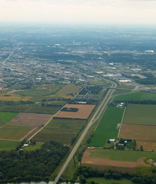
Conestoga Parkway


Conestoga Expressway Route information Length: 31.1 km[1] (19.3 mi) Existed: 1960s – present Major junctions West end: 
 Highway 7 / Highway 8 near Baden Highway 8 – Cambridge
Highway 7 – GuelphTo: 350 metres (380 yd) north of King Street North interchange Location Major cities: Kitchener, Ontario, Waterloo, Ontario Highway system The Conestoga Parkway is a freeway in the Regional Municipality of Waterloo, in the Canadian province of Ontario. It runs northeast/southwest through the cities of Kitchener and Waterloo, and is connected to Highway 401 via the Highway 8 Freeport Diversion and King Street East.
Contents
Route description
The multiplex of Highway 7 and Highway 8 enters the city of Kitchener as a controlled-access freeway from the west; it takes on the name Conestoga Parkway at the Trussler Road exit at the western edge of the city. The Parkway (and the multiplex) continues east until Highway 8 (as the Freeport Diversion) branches off toward the southeast via an interchange. At this point, the Conestoga Parkway turns northward and becomes Highway 7.
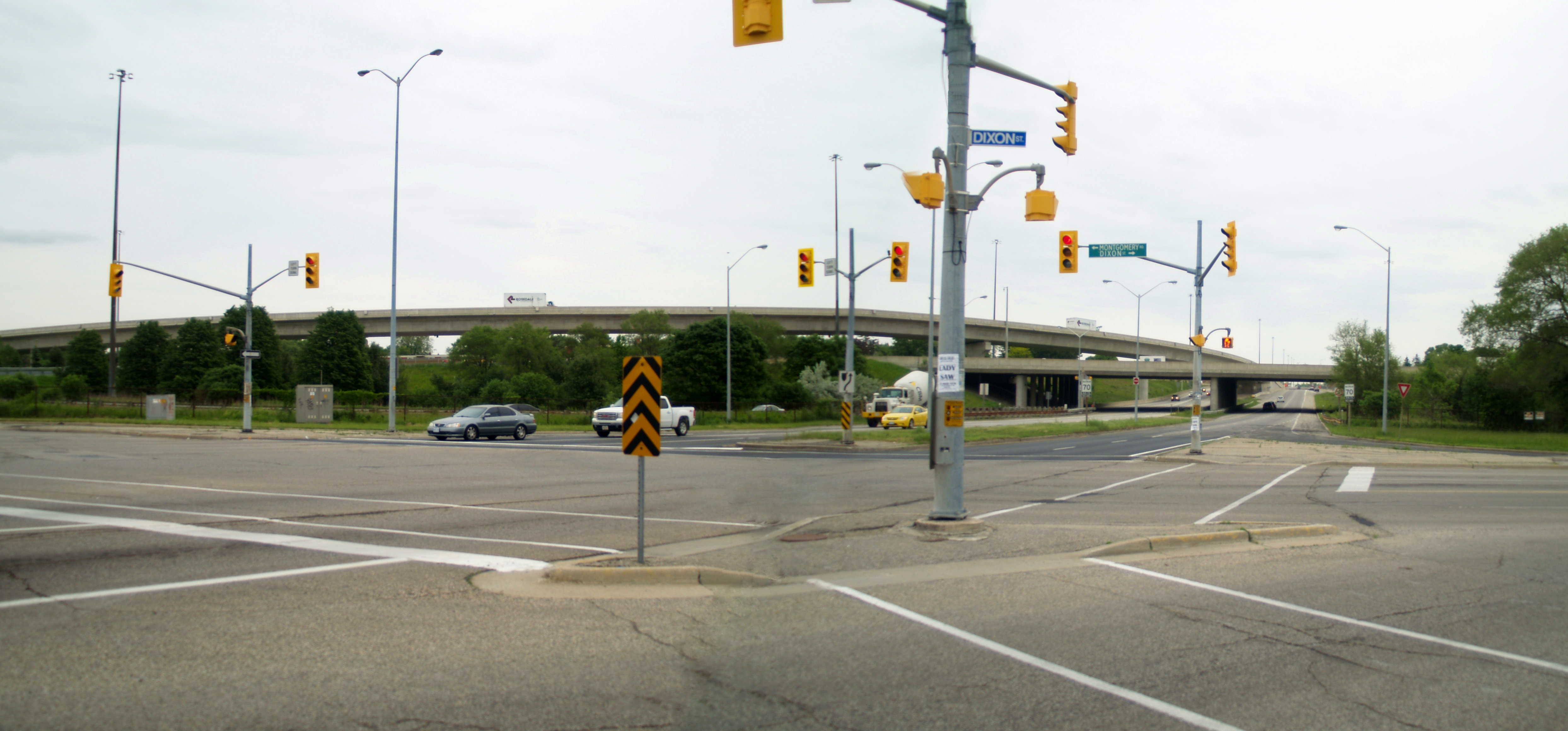
 Highway 85 facing south at the northern end of the Conestoga Parkway
At the Victoria Street exit, the Parkway sheds its Highway 7 designation and becomes Highway 85 (which had been known as Highway 86 until May 1, 2003). It continues through the city of Waterloo towards St. Jacobs, where the freeway alignment ends and becomes Regional Road 85, or Arthur Street South.
While it is officially known as the Conestoga Parkway, it is often referred to by locals as the Conestoga Expressway or simply The Expressway. The name no longer appears on signage, however, and is little known outside the immediate area.
Note that the Parkway is merely a controlled-access portion of the various numbered highways, all of which continue for some distance as open-access highways beyond the freeway section. Thus, the freeway has the distinction of being one of the few Ontario-maintained freeways not numbered according to the 400-Series Highway network, even though it is busier and wider than many rural 400-series highways, because the freeway upgrade has put together only parts of existing routes. The 400-series highways are intended to be full freeways for their entire length.
The speed limit on the Conestoga Parkway is 90 km/h (55 mph). It was previously 100 km/h, but was lowered due to collisions across the median. Highway 7/8 between Courtland Avenue and Fischer-Hallman Road has an abnormally narrow median, and overpasses are single structures with simple curbs as median dividers instead of the usual Jersey barrier or Ontario tall-wall. The portion of Highway 7/8 (from Trussler Road to Wilmot Centre Road/Foundry Street) converted into a freeway in the 1990s does not have this deficiency, nor do the portions of the Parkway signed as Highways 7 and 85.
History
 The Conestoga Parkway facing northbound at the Kitchener–Waterloo boundary
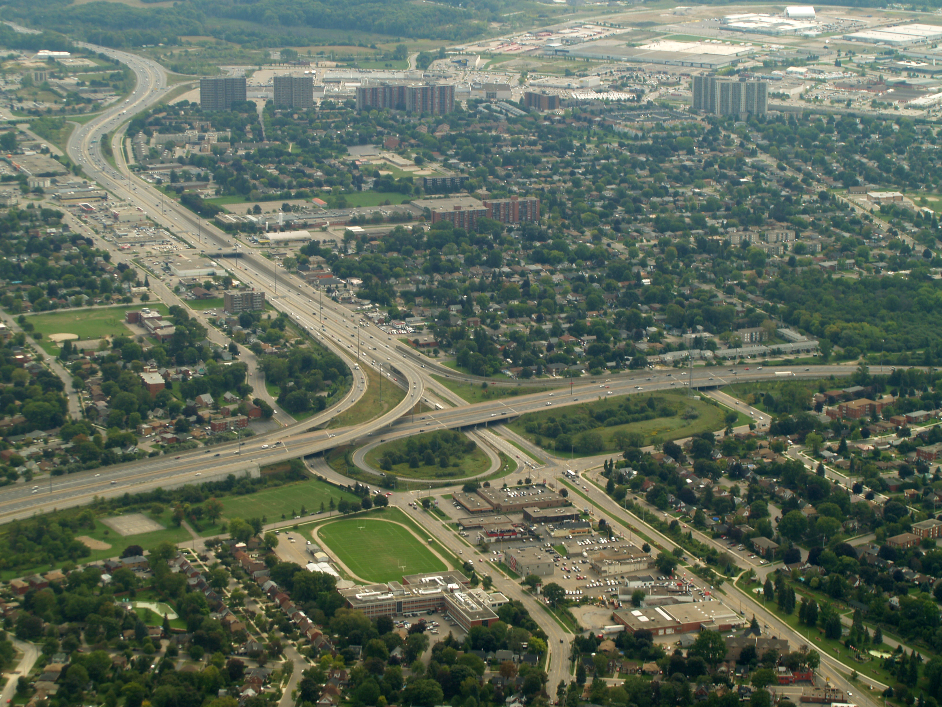
The parkway is one of the busiest roads in the region. It was completed as a four-lane freeway in the late 1960s, with the exception of the short eight-lane collector-express system serving Highway 7/Victoria Street and Wellington Street. The interchange between Highway 8 and the Conestoga Parkway was opened in 1970. Mainline traffic on Highway 8 could continue under the Conestoga, where the route defaults to King Street, to enter downtown Kitchener. The Conestoga east/north of this junction serves as a bypass of King Street.
At the time, the Conestoga Parkway and Highway 8 Freeport Diversion freeways were isolated from the 400-series highway network, as the Freeport Diversion ended at an at-grade Y-junction with King Street East. Traffic from the Freeport Diversion was treated as the mainline traffic at this interchange and King East continued to a cloverleaf interchange with Highway 401.
A direct freeway connection between Highway 401 and the Conestoga was made possible when a new bypass (secretly designated as Highway 7187, and signed with Highway 8 and Highway 401 trailblazers) was opened in 1987; it featured a Y-junction with Highway 401 to serve traffic east of that junction. The cloverleaf interchange with the existing Highway 8 had several ramps realigned, and it continues to serve 401 traffic west of that junction.
In 1993, a four-lane extension to Baden was opened, linking up with an existing undivided four-lane expressway at New Hamburg.
Since the late 1990s, the Conestoga has undergone extensive reconstruction between Courtland Avenue and Lancaster Street, with the addition of an Ontario "tall-wall" concrete median barrier and high-mast lighting replacing the conventional mercury truss lights. The widening project resulted that stretch of the Parkway being expanded to at least six lanes by using the grass median, and eight lanes between Highway 8 and Victoria Street/Frederick Street by using the right-of-way afforded by the shoulders. In 2004, extensive improvements were completed around the former obsolete and bottlenecked "half-cloverleaf" junction with the freeway section of Highway 8, that links it to the 401. This included a new flyover semi-directional ramp from Conestoga westbound to Highway 8 eastbound, while the ramp in the opposite direction was realigned to allow it to carry two lanes of traffic at a higher speed.
 Interchange between Conestoga Parkway and Freeport Diversion
An observation which may seem odd for those new to the highway is the stark difference in the congested, inefficient exit for Highway 7/Victoria Street, when compared with the high-capacity but underused Wellington Street exit just north of it. Both exits are served by a collector-express system. This is due to the 'foresight' that Highway 7 would be redirected as a controlled-access highway and attached to the existing Wellington Street interchange; these plans have languished for over 30 years and are still in the planning stages.
Future
Opposition has arisen due to the new alignment of Highway 7 passing through environmentally sensitive lands. The new Highway 7 freeway proposal linking up the Conestoga in Waterloo and the Hanlon Parkway in Guelph bypasses the existing Highway 7/Victoria Street. The plans also call for a complex 4-level interchange with the Conestoga Parkway and Wellington Street, a rarity outside of the Greater Toronto Area. Its $25 million cost represents a quarter of the $100 million budget for the total project, with the high cost partly due to the difficulty in land acquisition to accommodate the flyover ramps.
In addition to the proposed Highway 7 freeway between Waterloo and Guelph, the MTO has long term plans to widen and reroute Highway 7/8 westward to Stratford. How this will affect the village of Shakespeare, which the open highway currently bisects, is a particular sticking point.
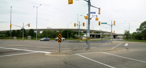 The Conestoga Parkway interchanges with the Freeport Diversion. The flyover was constructed to remedy a partial cloverleaf infamous for weaving.
Exit list
The following is a list of exits along the parkway. The exits on Conestoga Parkway are not numbered, and likely never will be due to the multiple designations used, which would make it impossible to have consistent kilometre posts.
Municipality Direction Intersecting Roads Interchange Type Wilmot Township Waterloo Regional Road 51, Foundry St., Wilmot Centre Rd. Parclo AB2 Waterloo Regional Road 12, Notre Dame Dr., Queen St. Parclo A2 Kitchener Waterloo Regional Road 70, Trussler Rd., Ira Needles Blvd. Parclo A2 Waterloo Regional Road 58, Fischer-Hallman Rd. Parclo AB2 Eastbound Waterloo Regional Road 4, Ottawa St. S. Waterloo Regional Road 28, Homer Watson Blvd. (one loop ramp)
Parclo (half, only one loop ramp) Westbound Waterloo Regional Road 28, Homer Watson Blvd. Diamond (half) Waterloo Regional Road 53, Courtland Ave. E. Parclo AB2 Highway 8, King St. Bypass High-speed trumpet with King Street access to and from southern Highway 8 Waterloo Regional Road 4, Ottawa St. N. Parclo A2 Northbound Highway 7, Waterloo Regional Road 61, Bruce St. Highway 7, Waterloo Regional Road 55, Victoria St. N.
Stretched Diamond (with Bruce St.) Southbound Highway 7, Waterloo Regional Road 62, Edna St. Highway 7, Waterloo Regional Road 55, Victoria St. N.
Stretched Diamond (with Edna St.) Northbound Riverbend Dr. Shirley Ave. Parclo AB4 Northbound Wellington St. N. Southbound Wellington St. N. Riverbend Dr. Shirley Ave.
Waterloo Southbound Waterloo Region Route 29 South, Lancaster St. W. Diamond (quarter) Waterloo Regional Road 9, Bridgeport Rd. E. Parclo AB3 Northbound Waterloo Regional Road 57 East, University Ave. E. Parclo AB4 Northbound Waterloo Regional Road 57 West, University Ave. E. Southbound Waterloo Regional Road 57, University Ave. E. Waterloo Regional Road 15, King St. N. Parclo A3 Waterloo Regional Road 50, Northfield Dr. W. Parclo B2 Woolwich Township Waterloo Regional Road 15, King St. N. Parclo A2 At this point, the divided freeway and Highway 85 (formerly Highway 86 until 2003) ends, and Arthur Street S. (Waterloo Regional Road 85) begins to St.Jacobs and Elmira.
See also
- List of Ontario expressways
- List of Ontario provincial highways
- 400-series highways
References
- ^ Ministry of Transportation of Ontario (2007). "Annual Average Daily Traffic (AADT) counts". http://www.raqsb.mto.gov.on.ca/techpubs/TrafficVolumes.nsf/tvweb?OpenForm&Seq=5. Retrieved September 17, 2011.
Regional Roads in Waterloo Region, Ontario North-South Regional Roads East-West Regional Roads Highways and Expressways Roads in Ontario The King's Highways of Ontario Current highwaysFormer highways- 2A
- 2B
- 2S
- 3B
- 4A
- 5A
- 7B
- 8A
- 12B
- 14
- 15A
- 18
- 18A
- 22
- 24A
- 25
- 27
- 29
- 30
- 31
- 32
- 35A
- 35B
- 36
- 38
- 39
- 40B
- 42
- 43
- 44
- 45
- 46
- 47
- 48B
- 50
- 51
- 52
- 53
- 54
- 55
- 56
- 57
- 59
- 68
- 70
- 73
- 74
- 75
- 76
- 78
- 79
- 80
- 81
- 82
- 83
- 84
- 86
- 87
- 88
- 90
- 91
- 92
- 95
- 96
- 97
- 98
- 99
- 100
- 103
- 104
- 106
- 107
- 109
- 110
- 111
- 114
- 116
- 117
- 119
- 120
- 121
- 122
- 123
- 126
- 128
- 131
- 133
- 134
- 135
- 136
- 169
- 400A
- 401A
County roads in Ontario · Ontario numbered highways · Expressways and 400-series highways · King's Highways · Secondary highways · Tertiary and 7000-series highways · List of Ontario provincial highways · List of former provincial highways in Ontario · Highways in Ontario · List of Ontario expressways · Trans-Canada Highway · Connecting Link · Emergency Detour Route Buildings Centre In The Square • Fairview Park Mall • Grand River Hospital • Kitchener City Hall • Kitchener Memorial Auditorium Complex • Kitchener Public Library • St. Mary's General HospitalTransportation Museums List of municipalities in Ontario Categories:- Roads in Waterloo Region, Ontario
- Ontario provincial highways
- Parkways in Ontario


Wikimedia Foundation. 2010.