- Ontario Highway 8
-
Highway 8
Route information Existed: 1920 – present Major junctions West end:  Highway 21 – Goderich
 Highway 7 – Stratford
 Highway 85 – Kitchener
 Highway 401 – Cambridge
East end:  Highway 5 (near Dundas)
Location Major cities: Stratford, Kitchener, Cambridge, Hamilton Towns: Goderich, Clinton Highway system Ontario provincial highways
400-series • Former←  Highway 7
Highway 9  →
→Provincial Highway 8 is a provincially maintained highway in the Canadian province of Ontario. Its total length is 138.5 km, though it was once much longer, running farther east from Hamilton to Niagara Falls, before the Queen Elizabeth Way replaced its role.
Contents
History
Highway 8 is one of the oldest provincial highways in Ontario, having first been established in 1918. Up until the early 1970s, the highway was much longer than its current length, extending from Goderich through Kitchener-Waterloo, Cambridge, and Hamilton to Niagara Falls. However, in 1970, the Government of Ontario decided that the stretch of Highway 8 between Winona (just east of Hamilton) and Niagara Falls was no longer of major transportation significance, since by this time most traffic used the Queen Elizabeth Way (QEW), just to the north, to go between the two locales. Accordingly, the province downloaded this section of the highway to the newly-formed Regional Municipality of Niagara, which designated the road as Regional Road 81. In 1998, the provincial government of Mike Harris carried another downloading of the highway to municipal authorities; this time the section between the town of Peters Corners (near Dundas) and Winona was transferred to the Regional Municipality of Hamilton-Wentworth.[1]
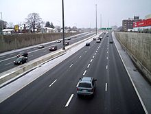 Highway 8 with the interchange with the Conestoga Parkway seen in the distance. The new concrete median barrier and retaining wall on the right side were part of a multiyear project to improve the capacity of the junction. Photographed from the Franklin Street overpass.
In 2004, extensive improvements were completed around the former obsolete and bottle-necked "half-cloverleaf" interchange of the Conestoga Parkway and Highway 8 in Kitchener. This included a new flyover semi-directional ramp from Conestoga westbound to Highway 8 eastbound, while the ramp in the opposite direction was realigned to allow it to carry two lanes of traffic at a higher speed.
In 2002-2004 the Highway 8 freeway was widened from four to eight lanes from the interchange to just east of Franklin Street, which necessitated moving one retaining wall and a new overpass with Franklin Street. Since 2006, work has been underway to widen the freeway to eight lanes, including the Fairway Road interchange. By 2011, this work had been completed to approximately 1 km. east of the Fairway Road exit. The Grand River construction project aimed at carrying 3 lanes of traffic in each direction is due for completion in the fall of 2012.
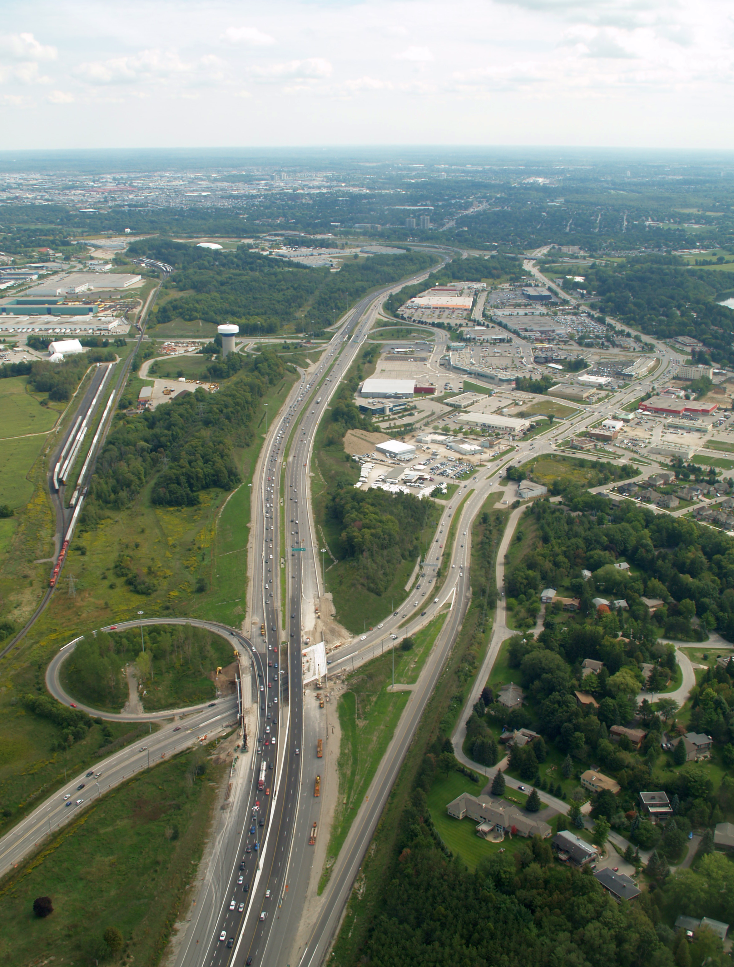
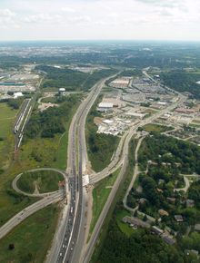 An aerial view of the interchange between Highway 8 (Freeport Diversion) and King Street East in Kitchener. The Highway 8 designation leaves the Freeport Diversion for King Street at this interchange.
Route description
Goderich–Kitchener
Highway 8 begins at its western terminus in downtown Goderich, at the junction with Highway 21. It travels eastward as a normal city road, running through Stratford (where it begins overlapping with Highway 7). At New Hamburg, the combined Highway 7/8 becomes a 4-lane controlled-access highway, becoming a freeway just west of Baden, and continues into Kitchener (where the 7/8 freeway is known as the Conestoga Parkway).
As the Conestoga Parkway runs through Kitchener, Highways 7 and 8 split off from one another, with Highway 8 turning southeastward via an interchange. The interchange between Highway 8 and the Conestoga Parkway was opened in 1970. Mainline traffic on Highway 8 heading northwest could continue under the Conestoga, where the route defaults to King Street, to enter downtown Kitchener. The Conestoga east/north of this junction serves as a bypass of King Street.
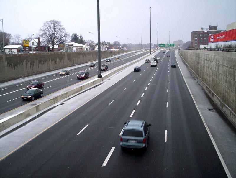
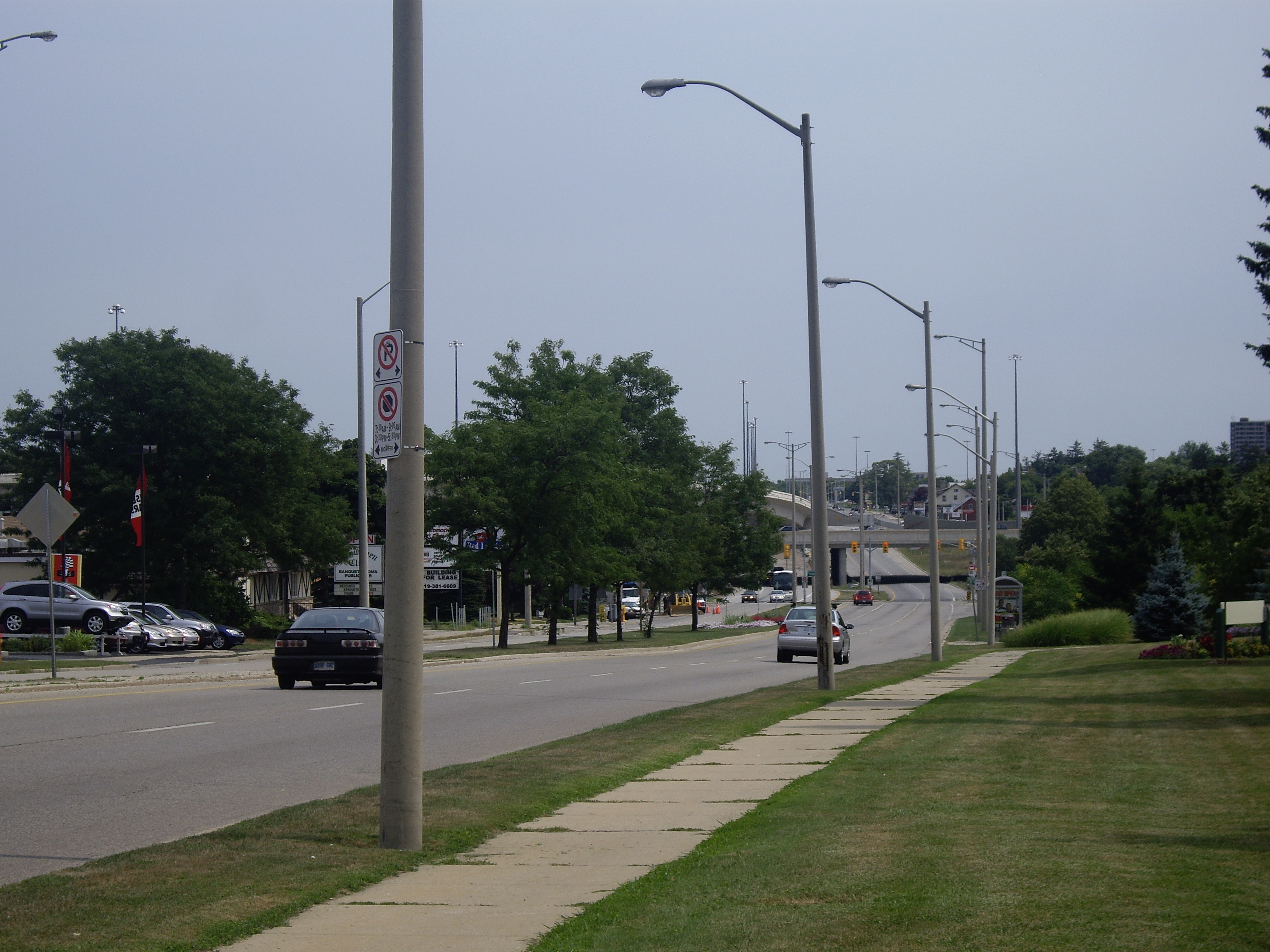
 King Street north of the interchange with the Conestoga Parkway and Highway 8, looking south. King Street traffic has no direct access to the parkway.
Highway 8 continues along as four-lane freeway, which is also known as the Freeport Diversion or King Street Bypass, until another junction with King Street East. From that point, Highway 8 continues on King Street East. Originally, the Freeport Diversion ended at an at-grade Y-junction with King Street East. Traffic from the Freeport Diversion was treated as the mainline traffic at that interchange. In 1987, the Freeport Diversion was extended to provide a freeway link to Highway 401 eastbound, free of interruptions. However, as the Highway 8 designation continues along King Street East, the portion of the Freeport Diversion between Highway 8 and Highway 401 is numbered Highway 7187, though this designation is not public. The existing cloverleaf interchange between Highway 401 and Highway 8 (King Street East) had several ramps realigned to allow connections with the Freeport Diversion (Highway 7187), and it continues to serve 401 traffic west of that junction.
Kitchener–Hamilton
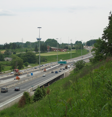 Highway 8 crosses the Grand River along the Freeport Diversion
Highway 8 then enters Cambridge, following city streets such as Shantz Hill Road, Fountain Street, King Street, Coronation Boulevard, and Dundas Street. It then continues as a normal road out of Cambridge and into Hamilton, meeting with Highway 5 in the town of Peters Corners.
Beyond this point, the road is no longer technically a King's Highway, and is officially designated as Hamilton Road 8, though numerous road signs and local custom still refer to it as Highway 8. From Peter's Corners, Highway 8 continues through West Flamborough before turning south to descend the Niagara Escarpment into Dundas. In Dundas, Highway 8 follows King Street East, then turns south onto Main Street. Main Street changes names at Governor's Road to become Osler Drive. Once Highway 8 crosses the boundary into Hamilton proper, the road resumes the name Main Street.
Highway 8 continues as Main Street through the Westdale neighbourhood of Hamilton, passing McMaster University, until it reaches Paradise Road just west of Highway 403. At this point Highway 8 splits into two roads as it passes through the Hamilton downtown core. Highway 8 eastbound follows Main Street, which becomes a multilane one-way street from Paradise Road until its eventual intersection with King Street near Kensington Avenue in East Hamilton. Highway 8 westbound follows King Street, which is also a multilane one-way street between Kensington Avenue and Paradise Road, and then briefly follows Paradise Road itself to reconnect with Main Street. East of the intersection of King Street and Main Street, the two directions of Highway 8 merge together, and the highway continues to follow Main Street.
At the meeting of Main St. with Queenston Road, Highway 8 leaves Main Street and follows Queenston Road to continue its eastbound journey. East of Gray Road the designation of Queenston Road is dropped. Thereafter the road is simply named Highway 8 until reaching Winona, where it becomes Niagara Regional Road 81.
Exit list
- Freeport Diversion and King Street Bypass
Destinations Notes King Street - Downtown Kitchener Westbound exit and eastbound entrance  Highway 7 west / Highway 8 west – Stratford
Westbound exit and eastbound entrance Highway 7 east to Highway 85 – Guelph, WaterlooWestbound exit and eastbound entrance Weber Street, Fairway Road RR 8 to Highway 401 west – Cambridge, LondonEastbound exit and westbound entrance; former Hwy 8 RR 38 (Sportsworld Drive, Maple Grove Road) Highway 401 east – TorontoEastbound exit and westbound entrance References
External links
The King's Highways of Ontario Current highwaysFormer highways- 2A
- 2B
- 2S
- 3B
- 4A
- 5A
- 7B
- 8A
- 12B
- 14
- 15A
- 18
- 18A
- 22
- 24A
- 25
- 27
- 29
- 30
- 31
- 32
- 35A
- 35B
- 36
- 38
- 39
- 40B
- 42
- 43
- 44
- 45
- 46
- 47
- 48B
- 50
- 51
- 52
- 53
- 54
- 55
- 56
- 57
- 59
- 68
- 70
- 73
- 74
- 75
- 76
- 78
- 79
- 80
- 81
- 82
- 83
- 84
- 86
- 87
- 88
- 90
- 91
- 92
- 95
- 96
- 97
- 98
- 99
- 100
- 103
- 104
- 106
- 107
- 109
- 110
- 111
- 114
- 116
- 117
- 119
- 120
- 121
- 122
- 123
- 126
- 128
- 131
- 133
- 134
- 135
- 136
- 169
- 400A
- 401A
County roads in Ontario · Ontario numbered highways · Expressways and 400-series highways · King's Highways · Secondary highways · Tertiary and 7000-series highways · List of Ontario provincial highways · List of former provincial highways in Ontario · Highways in Ontario · List of Ontario expressways · Trans-Canada Highway · Connecting Link · Emergency Detour RouteCategories:- Ontario provincial highways
- Roads in Hamilton, Ontario
- Roads in Waterloo Region, Ontario


Wikimedia Foundation. 2010.