- Ontario Highway 148
-
Highway 148
Route information Maintained by the Ministry of Transportation of Ontario Length: 7.0 km[3] (4.3 mi) Existed: 1983[1][2] – present Major junctions West end: MacKay Street, Pembroke East end:  Route 148 – Mansfield-et-Pontefract
Highway system Ontario provincial highways
400-series • Former←  Highway 144
Highway 169  →
→King's Highway 148, commonly referred to as Highway 148, is a provincially maintained highway in the Canadian province of Ontario. The highway acts as an extension of Route 148 in Quebec, once connecting it with Highway 17, the Trans-Canada Highway, near Pembroke. It was shortened to its present terminus in 1997, and now connects downtown Pembroke to the provincial border. Highway 148 follows a route that was once part of Highway 17 and Highway 62 until the Pembroke Bypass opened in the early 1980s.
The 7.0-kilometre (4.3 mi) route of Highway 148 takes it along the Ontario shoreline of the Ottawa River from the outskirts of Pembroke to the opposite shore as L'Isle-aux-Allumettes, where it crosses the river into Quebec. The section of the highway within Pembroke is locally maintained under a Connecting Link agreement.
Contents
Route description
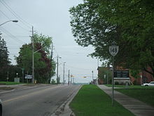 Highway 148 within Pembroke
Highway 148 connects Pembroke to the Quebec border at L'Isle-aux-Allumettes, a distance of 5 km (3.1 mi). It originally connected to Highway 17 west of Pembroke, and was 15.1 km (9.4 mi) long.[4] However, its length was truncated on April 1, 1997 when the province downloaded responsibility for the portion from Highway 17 to Boundary Street.[5] At that time, the connecting link status of Highway 148 through Pembroke itself was revised, and the current signed terminus of the highway is now Mackay Street, which was formerly Highway 41.[4][6] Approximately 11,400 vehicles drive along Highway 148 on an average day, with just under half that many crossing from or into Quebec.[3]
Provincial control of Highway 148 begins at the Pembroke boundary, approximately 60 m (200 ft) northwest of Angus Campbell Drive. From there, the route travels southeast through the urban-rural fringe of the city, passing east of two large shopping complexes. After passing west of the community of Pleasant View, the route enters a rural area and curves south alongside farmland.[7]
At a four-way stop with channelized right turn lanes, drivers must turn to remain on the highway. To the south is Renfrew County Road 40, which continues to Highway 17 at the southern end of the Pembroke Bypass. Highway 148 continues east, crossing the Ottawa Valley Railway and the entrance to Hazley Bay before entering the community of Cotnam Island. The highway curves northeast and crosses the Ottawa River, entering Quebec midspan.[7]
History
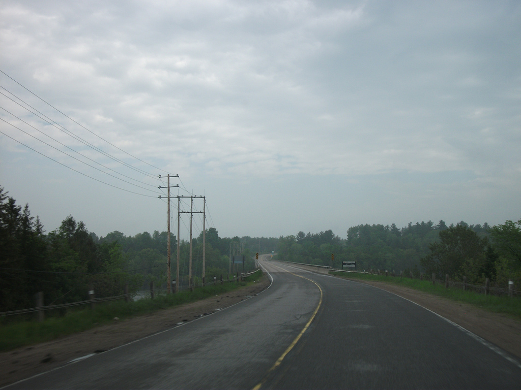
 Highway 148 ends at the Ottawa River, where it crosses into Quebec
Highway 148 follows the route of what was the northernmost section of Highway 62, prior to 1983. Highway 17 was also signed concurrently with Highway 62 between Round Lake Road and Renfrew County Road 40, as it followed the Ottawa River in the Pembroke area at that time.[8] By the end of 1983, the Pembroke Bypass opened to traffic, diverting Highway 17 to the west.[9][1] In the process, Highway 62 was truncated at the new bypass; the removed section was redesignated Highway 148, giving it the same number as the route in Quebec that it served to connect with the Trans-Canada Highway.[2] Highway 148 was 14.4 km (8.9 mi) long. However, its length was truncated on April 1, 1997 when the province downloaded responsibility for the portions between Highway 17 and Highway 41 to the Town of Pembroke and County of Renfrew.[5] The Pembroke Connecting Link agreement shares the responsibility for Highway 41 northeast of Highway 17 and for Highway 148 from Highway 41 to Cedar Lane between the province and the town.[10]
Major intersections
The following table lists the major junctions along Highway 148. The entirety of the highway is located within Renfrew County.[7]
Location[7] km[3][4] Destinations Notes −8.1  Highway 17 – North Bay, Ottawa
Section decommissioned in 1997[5] Pembroke 0.0 Mackay Street formerly Highway 41; beginning of Highway 148 portion of Pembroke Connecting Link agreement[10] 2.0 Cedar Lane End of Pembroke Connecting Link agreement[10] Laurentian Valley 3.5 County Road 29 (Drive In Road) 5.2 County Road 40 (Greenwood Road) – Ottawa, Cobden Cotnam Island 7.0 Ontario–Quebec border Highway 148 continues east as Quebec Route 148 1.000 mi = 1.609 km; 1.000 km = 0.621 mi
Concurrency terminus • Closed/Former • Incomplete access • UnopenedReferences
- ^ a b Provincial Highways Construction Projects. Ministry of Transportation and Communications. 1982–83. p. XXVIII.
- ^ a b Ministry of Transportation and Communications (1984/85). Ontario Road Map (Map). Cartography by Cartography Section. Section C14.
- ^ a b c Ministry of Transportation of Ontario (2008). "Annual Average Daily Traffic (AADT) counts". Government of Ontario. http://www.raqsb.mto.gov.on.ca/techpubs/TrafficVolumes.nsf/tvweb?OpenForm&Seq=5. Retrieved November 9, 2011.
- ^ a b c Ministry of Transportation of Ontario (April 1, 1989). Provincial Highways Distance Table. Government of Ontario. pp. 88–89. ISSN 0825-5350.
- ^ a b c Highway Transfers List (Report). Ministry of Transportation of Ontario. April 1, 1997. p. 7.
- ^ Google, Inc. Google Maps – Signage indicating the "start" of Highway 148 and "end" of Highway 41 in downtown Pembroke (Map). Cartography by Google, Inc. http://maps.google.ca/maps?q=Pembroke&hl=en&ll=45.825988,-77.110548&spn=0.028649,0.077162&sll=49.891235,-97.15369&sspn=27.195944,79.013672&t=h&z=14&layer=c&cbll=45.825884,-77.110552&panoid=k_oitLFRcFCNABTcEPoz9w&cbp=12,35.24,,1,-1.2. Retrieved June 24, 2010.
- ^ a b c d Peter Heiler (2010). Ontario Back Road Atlas (Map). Cartography by MapArt. p. 82, section K51–L52. ISBN 978-1-55198-226-7.
- ^ Ontario Department of Highways (1970). Ontario Road Map (Map). Cartography by C.P. Robins. Section O–P27.
- ^ Highway 17 New Pembroke Bypass Design Study (Report). Ministry of Transportation and Communications. 1980.
- ^ a b c Contract Management and Operations Branch (2011). Highway Connecting Link List (Report). Ministry of Transportation of Ontario.
The King's Highways of Ontario Current highwaysFormer highways- 2A
- 2B
- 2S
- 3B
- 4A
- 5A
- 7B
- 8A
- 12B
- 14
- 15A
- 18
- 18A
- 22
- 24A
- 25
- 27
- 29
- 30
- 31
- 32
- 35A
- 35B
- 36
- 38
- 39
- 40B
- 42
- 43
- 44
- 45
- 46
- 47
- 48B
- 50
- 51
- 52
- 53
- 54
- 55
- 56
- 57
- 59
- 68
- 70
- 73
- 74
- 75
- 76
- 78
- 79
- 80
- 81
- 82
- 83
- 84
- 86
- 87
- 88
- 90
- 91
- 92
- 95
- 96
- 97
- 98
- 99
- 100
- 103
- 104
- 106
- 107
- 109
- 110
- 111
- 114
- 116
- 117
- 119
- 120
- 121
- 122
- 123
- 126
- 128
- 131
- 133
- 134
- 135
- 136
- 169
- 400A
- 401A
County roads in Ontario · Ontario numbered highways · Expressways and 400-series highways · King's Highways · Secondary highways · Tertiary and 7000-series highways · List of Ontario provincial highways · List of former provincial highways in Ontario · Highways in Ontario · List of Ontario expressways · Trans-Canada Highway · Connecting Link · Emergency Detour RouteCategories:- Ontario provincial highways


Wikimedia Foundation. 2010.