- Ontario Highway 62
-
Highway 62
Route information Maintained by the Ministry of Transportation of Ontario Length: 165.8 km[1] (103.0 mi) Existed: 1937 – present Major junctions South end:  Highway 33 in Bloomfield
 Highway 401 in Belleville
 Highway 7 in Madoc
 Highway 28 in Bancroft
North end:  Highway 127 at Maynooth
Highway system Ontario provincial highways
400-series • Former←  Highway 61
Highway 63  →
→King's Highway 62, commonly referred to as Highway 62, is a provincially maintained highway in the Canadian province of Ontario. The highway travels south-north from Highway 33 at Bloomfield in Prince Edward County, through Belleville, Madoc and Bancroft, to Maynooth, where it ends at a junction with Highway 127.
Prior to 1998, the road extended north and east of Maynooth through Barry's Bay, and ended in Pembroke. This section highway was redesignated Hastings County Road 62, Renfrew County Road 62, and Renfrew County Road 58. The concurrency with Highway 60 from Barry's Bay to Highway 512 outside Killaloe was removed after downloading. The section between Foxboro to Bloomfield was previously part of Highway 14.
Contents
Route description
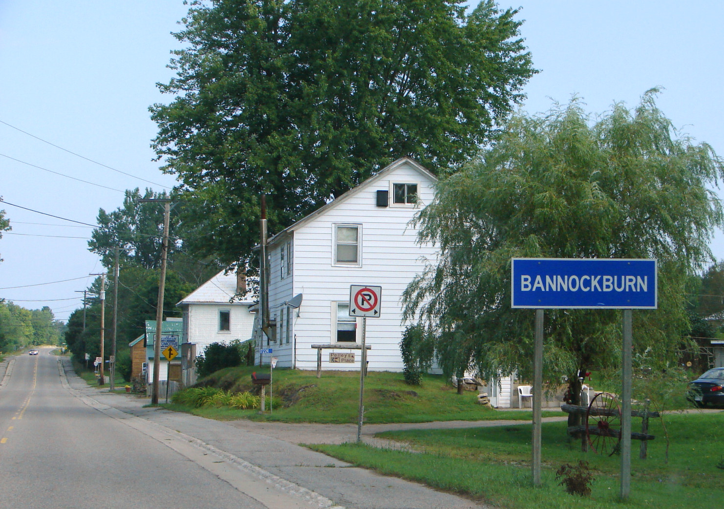
 Highway 62 passing through Bannockburn
Highway 62 begins in the community of Bloomfield at a junction with Highway 33, the Loyalist Parkway. From there it winds north through the communities of Huff's Corners, Crofton, Mountain View and Fenwood Gardens before crossing the Norris Whitney Bridge over the Bay of Quinte into Belleville. Immediately south of Mountain View, the highway skirts the CFB Mountain View military base. Within urbanized Belleville, Highway 62 serves as the primary north–south route. The highway interchanges with Highway 401 at Exit 543 and exits the urban section of Belleville. From here, the highway continues straight north until its path is interrupted by the Moira River, immediately south of Foxboro, which the highway bypasses to the west. The former route of the highway through the town is now known as Ashley Street. The highway continues along the bypass of Foxboro, merging back onto the Madoc Colonization Road at Halloway. It follows this colonization road north to Highway 7 in Madoc, passing through a mixture of farmland and shrubbery; the occasional forest interrupts the shorter vegetation, as well as the community of Crookston. Immediately. North of Madoc, the highway follows the Hastings Colonization Road.[2]
History
 Highway 62 north of Bancroft
Highway 62 was first assumed by the Department of Highways (DHO) in 1937. On April 1 of that year, the DHO merged with the Department of Northern Development.[3] Following the merger, many new highways through central and northern Ontario were designated. One of these was the Madoc–Pembroke Road, which became Highway 62 on August 11, 1937.[4] Originally, the route followed the Hastings Colonization Road, which was quickly determined to be too rough to upgrade. A new alignment, apparently named the Faulkner Highway,[5] was constructed to the east between Millhaven and L'Amable in the late 1930s. This bypass was opened to traffic on March 22, 1939.[6] Subsequently, the bypassed portion of the highway was decommissioned on April 11.[7]
At the time of its assumption, Highway 62 was split into two segments. The first section travelled from Madoc to Barry's Bay, the second from Pembroke to the community of Bonnechere, on the northwestern shore of Round Lake. It was originally planned to unite these segments by building a new highway mostly following the route of Paugh Lake Road. This section was never built, and so Highway 62 remained separated for a quarter century.[8]
Portions of Highway 62 were transferred to local jurisdictions in 1997 and 1998. On April 1, 1997, the section from the Laurentian Valley – Killaloe, Hagarty and Richards boundary east to Highway 17 was transferred to Renfrew County.[9] On January 1, 1998, the section northeast of Highway 127 in Maynooth was transferred to Hastings and Renfrew counties. The concurrency with Highway 60 was discontinued as a result of this transfer.[10]
Major intersections
The following table lists the major junctions along Highway 62. In addition, it includes some minor junctions that are noted by the Ministry of Transportation of Ontario.[1]
Division Location[2] km[1] Destinations Notes Prince Edward County 0.0 Highway 33 east (Loyalist Parkway) – Picton, Kingston5.3 County Road 1 (Scoharie Road) 8.4 County Road 4 – Gilbert Mills 12.4 County Road 14 (Burr Road) – Demorestville 24.8 County Road 28 – Rossmore 25.8 County Road 3 – Rossmore Highway 62 crosses the Bay of Quinte on the Norris Whitney Bridge Hastings Belleville 26.9 Beginning of Belleville Connecting Link agreement 32.2 Highway 401 – Toronto, KingstonEnd of Belleville Connecting Link agreement Foxboro 36.7 Ashley Street Original route of Highway 14 Lennox and Addington 38.8 County Road 5 (Frankford Road) – Frankford 40.1 County Road 14 (Foxboro–Stirling Road) – Stirling Formerly Highway 14 Hastings West Huntingdon Station 50.9 County Road 8 (Stirling Road (west) / Moira Road (east)) – Moira Crookston 61.3 County Road 38 (Crookston Road) – Campbellford, Tweed Madoc 68.5 Shoreline Road Beginning of Madoc Connecting Link agreement 71.2 Highway 7 – Peterborough, PerthEnd of Madoc Connecting Link agreement Bannockburn 87.2 Bannockburn Road – Cooper Millbridge Old Hastings Road Original route of Highway 62; Hastings Colonization Road Limerick 119.3 County Road 620 (Coe Hill Road) – Ormsby L'Amable 134.1 Bay Lake Road / Detlor Road – Detlor Bancroft 139.6 Beginning of Bancroft Connecting Link agreement Highway 28 – Lakefield, Denbigh147.4 End of Bancroft Connecting Link agreement Hastings Highlands 154.0 Hybla Road – Hybla Maynooth 165.8 Highway 127 – WhitneyReferences
- ^ a b c Ministry of Transportation of Ontario (2007). "Annual Average Daily Traffic (AADT) counts". http://www.raqsb.mto.gov.on.ca/techpubs/TrafficVolumes.nsf/tvweb?OpenForm&Seq=5. Retrieved August 13, 2011.
- ^ a b Peter Heiler (2010). Ontario Back Road Atlas (Map). Cartography by MapArt. p. 34–35, 46, 62, section S45–G50. ISBN 978-1-55198-226-7.
- ^ Shragge, John; Bagnato, Sharon (1984). From Footpaths to Freeways. Ontario Ministry of Transportation and Communications, Historical Committee. p. 71. ISBN 0-7743-9388-2.
- ^ Annual Report (Report). Department of Highways. March 31, 1938. pp. 80–81.
- ^ The Economic Base in Northern Hastings County. The Canadian Association of Geographers. p. 31. http://books.google.ca/books?ei=I1dqTvveHZXOM7XGja4F&client=firefox-a&cd=1&id=GhdJAQAAIAAJ&dq=%22Faulkner+Highway%22+Hastings&q=%22old+Hastings+road%22#search_anchor. Retrieved September 9, 2011.
- ^ Annual Report (Report). Department of Highways. March 31, 1939. p. 84.
- ^ Annual Report (Report). Department of Highways. March 31, 1940. p. 93.
- ^ Ontario Department of Highways (1938–39). Ontario Road Map (Map). Cartography by C.P. Robins. Section O3–P5.
- ^ Highway Transfers List (Report). Ministry of Transportation of Ontario. April 1, 1997. p. 7.
- ^ Highway Transfers List - “Who Does What” (Report). Ministry of Transportation of Ontario. June 20, 2001. pp. 6, 13.
External links
The King's Highways of Ontario Current highwaysFormer highways- 2A
- 2B
- 2S
- 3B
- 4A
- 5A
- 7B
- 8A
- 12B
- 14
- 15A
- 18
- 18A
- 22
- 24A
- 25
- 27
- 29
- 30
- 31
- 32
- 35A
- 35B
- 36
- 38
- 39
- 40B
- 42
- 43
- 44
- 45
- 46
- 47
- 48B
- 50
- 51
- 52
- 53
- 54
- 55
- 56
- 57
- 59
- 68
- 70
- 73
- 74
- 75
- 76
- 78
- 79
- 80
- 81
- 82
- 83
- 84
- 86
- 87
- 88
- 90
- 91
- 92
- 95
- 96
- 97
- 98
- 99
- 100
- 103
- 104
- 106
- 107
- 109
- 110
- 111
- 114
- 116
- 117
- 119
- 120
- 121
- 122
- 123
- 126
- 128
- 131
- 133
- 134
- 135
- 136
- 169
- 400A
- 401A
County roads in Ontario · Ontario numbered highways · Expressways and 400-series highways · King's Highways · Secondary highways · Tertiary and 7000-series highways · List of Ontario provincial highways · List of former provincial highways in Ontario · Highways in Ontario · List of Ontario expressways · Trans-Canada Highway · Connecting Link · Emergency Detour RouteCategories:- Ontario provincial highways


Wikimedia Foundation. 2010.