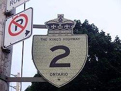
- Ontario Highway 2
-
Highway 2

Route information Length: 1.1 km[1] (0.7 mi) History: Established in 1794 as the Governor's Road and on August 21, 1917 as The Provincial Highway Major junctions West end: Gananoque eastern limits East end:  Highway 401
Location Major cities: Gananoque Highway system Ontario provincial highways
400-series • Former← Highway 673 Highway 3  →
→King's Highway 2, usually referred to simply as Highway 2 is a provincially maintained highway in Ontario. Once the primary east–west route across the southern end of the province, Highway 2 became mostly redundant in the 1960s following the completion of Highway 401, which more or less bypassed it. Consequently, most of the 837.4 km (520.3 mi) length of Highway 2 was deemed a local route and removed from the provincial highway system on January 1, 1998, with the exception of a 1-kilometre (0.62 mi) section east of Gananoque.
Contents
Route description
Highway 2 is currently a stub of its former self. At just over 1 kilometre (0.62 mi) in length, it is one of the shortest provincial highways in Ontario. Its primary purpose is to provide a provincial route between westbound Thousand Islands Parkway and eastbound Highway 401. Highway 2 begins unsigned at the eastern town limits of Gananoque, and travels east a short distance before gently curving northward. It interchanges with the Thousand Islands Parkway, once referred to as "Highway 2S" prior to becoming a temporary part of the 401 in 1952, and continues forward. The highway passes through the rural-urban fringe of Gananoque, with several country homes to the east and a car pool parking lot to the west. Approaching Highway 401, the road bends to the right and passes over the superhighway. A small lake is nestled at the northeast corner of the interchange. Highway 2 ends at the westbound 401 offramp (interchange 648), while the roadway continues as County Road 2 along the former provincial route.
Numerous connecting links exist along urban sections of the former route of Highway 2. These sections were downloaded to the municipalities in which they reside before 1998. As such, when the Ministry of Transportation shortened Highway 2 on January 1, 1998, the signs along these connecting routes were not removed. These signs are still posted in places such as Windsor, London, and Toronto.[citation needed] In parts of Toronto, markers direct drivers along Lake Shore Boulevard west of downtown, and Lake Shore Boulevard, Coxwell Avenue (changed from the old route on Woodbine Avenue), and Kingston Road east of downtown.[2]
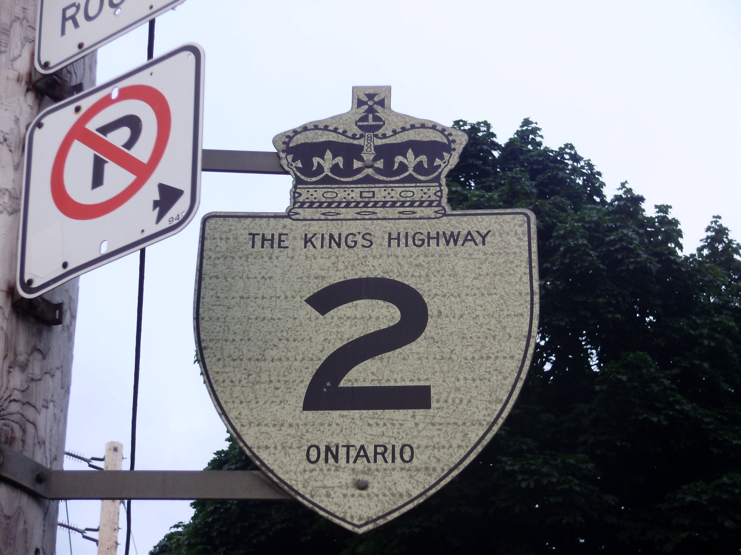
 A Highway 2 reassurance marker in Mimico.
Before the deletion of Highway 2, most of which took place on January 1, 1998, it was a continuous road from Highway 3 in Windsor to the Quebec border. It now has the following designations:[3]
- Essex County: E.C. Row Expressway, County Road 22 and part of County Road 42 (the rest was Highway 2 before the E.C. Row was built)
- Chatham-Kent: Chatham-Kent Road 2
- Middlesex County: Longwoods Road except in London
- Oxford County: County Road 2 except in Woodstock
- Brant: Brant Highway 2 except in Brantford
- Hamilton: Wilson Street, Main Street, Paradise Rd., King Street, Dundurn Street, York Boulevard
- Halton Region: Plains Road, King Road, North Shore Boulevard, Lake Shore Road
- Peel Region: Southdown Road, Lakeshore Road
- Toronto: Lake Shore Boulevard, Gardiner Expressway, Woodbine Avenue and Kingston Road
- Durham Region: Kingston Road (Ajax and Pickering), Dundas Street (Whitby), King Street (Oshawa), Durham Highway 2 (not to be confused with Durham Road 2 (Simcoe Street)
- Northumberland County: County Road 2
- Hastings County: County Road 2
- Lennox and Addington County: County Road 2
- Frontenac County: County Road 2; Kingston Road 2 within Kingston city limits
- Leeds and Grenville County: County Road 2
- Stormont, Dundas and Glengarry County: County Road 2 except in Cornwall
History
Highway 2 was the first roadway assumed under the maintenance of the Department of Highways (today's Ministry of Transportation of Ontario). The 73.5-kilometre (45.7 mi) section from the Rouge River to Smith's Creek, now Port Hope, was inaugurated on August 21, 1917 as The Provincial Highway. On June 7, 1918, the designation was extended east to the Quebec border.[4]
Footpaths
 A painting of Kingston Road east of Toronto in the 1830s.
The forerunners to Highway 2 are numerous paths constructed during the colonization of Ontario. While some portions may have existed as Indian trails for hundreds of years, the first recorded construction along what would become Highway 2 was in late October 1793, when Captain Smith and 100 Queen's Rangers returned from carving The Governor's Road 20 miles (32 km) through the thick forests between Dundas and the present location of Paris. John Graves Simcoe was given the task of defending Upper Canada (present day Ontario) from America following the revolution and with opening the virgin territory to settlement. After establishing a "temporary" capital at York, Simcoe ordered an inland route constructed between Cootes Paradise at the tip of Lake Ontario and his proposed capital of London. By the spring of 1794, the road was extended as far as La Tranche, now the Thames River, in London. In 1795, the path was connected with York. The recently immigrated native American Asa Danforth was awarded the task, for which he would be compensated $90 per mile.[5] Beginning on June 5, 1799, the road was extended eastwards. Danforth was hired once more, and tasked with clearing a 10-metre (33 ft) road east from York through the bush, with 5 metres (16 ft) (preferably in the centre) cut to the ground. It was carved as far as Port Hope by December,[6] and to the Trent River soon after. Danforth's inspector and acting surveyor general William Chewett declared the road "good" for use in the dead of winter, but "impassible" during the wet summers, when the path turned to a bottomless mud pit. He went on to suggest that rather than setting aside land for government officials which would never be occupied, the land be divided into 200 acres (81 ha) lots for settlers who could then be tasked with statute labour to maintain the path.[6] Danforth agreed, but the province insisted otherwise and only four settlers took up residence along the road; like many other paths of the day, it became a quagmire.[7]
Danforth's road did not always follow the same path as today's Kingston Road. Beginning near Victoria Park Avenue and Queen Street East, the road can be traced along Clonmore Avenue, Danforth Road, Painted Post Drive, Military Trail and Colonel Danforth Trail. Other sections of the former roadway exist near Port Hope and Cobourg,[8][9] as well as within Grafton.[10] Otherwise the two roads more or less overlap. As the route straying through Scarborough avoided many of the settlers who had taken up residence near the lake, Danforth's road was bypassed by 1814 by William Cornell and Levi Annis. The Cornell Road (as it was known for a short time) shortened the journey from Victoria Park to West Hill, but remained mostly impassible like Danforth's route to the north. Finally succumbing to increasing pressures, the government raised funds to straighten the road and extend it to Kingston. The work was completed by 1817 and the road renamed The Kingston Road.
The Provincial Highway
Beginning in 1935, McQuesten applied the concept of a second roadway to several projects along Highway 2:[11] a 4 mi (6.4 km) stretch west of Brockville,[12][13] a 4.5 km (2.8 mi) stretch from Woodstock eastward,[12] and a section between Birchmount Road and east of Morningside Avenue in Scarborough Township.[13] When widening in Scarborough reached the Highland Creek ravine in 1936, east of Morningside, the Department of Highways began construction on a new bridge over the large valley, bypassing the former alignment around West Hill.[14] From here the highway was constructed on a new alignment to Oshawa, avoiding construction on the congested Highway 2.[15] As grading and bridge construction neared completion between Highland Creek and Ritson Road in September 1939, World War II broke out and gradually money was siphoned from highway construction to the war effort.[11]
A portion of the highway in the area of Morrisburg was permanently submerged by the creation of the St. Lawrence Seaway in 1958. The highway was rebuilt along a Canadian National Railway right-of-way in the area to bypass the flooded region. The town of Iroquois was also flooded, but was relocated 1.5 kilometres north rather than abandoned. This event led to the nickname of The Lost Villages for a number of communities in the area.[16]
On January 1, 1998, most of the former length of Highway 2 was downloaded. Downloading transfers the highway from provincial responsibility to the counties or municipalities that each section lies within, with the route losing its King's Highway designation in the process. Only a short section remains, east of Gananoque.
Major intersections
Location km Destinations Notes Gananoque 0.0 Western terminus is at the gated entrance to Gananoque Leeds and Grenville Thousand Islands Parkway 1.1 Highway 401 – Kingston, BrockvilleEastern terminus is at the offramp from westbound 401 See also
References
- Footnotes
- ^ Google, Inc. Google Maps – Highway 2 length and route (Map). Cartography by Google, Inc. http://maps.google.com/maps?f=d&source=s_d&saddr=44.338518,-76.144872&daddr=Ontario+King%27s+Hwy%2FCounty+Road+2%2FON-2+E&hl=en&geocode=%3BFYKkpAId7kp2-w&mra=dme&mrcr=0&mrsp=0&sz=18&sll=44.337908,-76.143864&sspn=0.002172,0.005681&ie=UTF8&ll=44.341085,-76.139009&spn=0.008686,0.022724&t=h&z=16. Retrieved June 16, 2010.
- ^ Google Maps Street View, accessed November 2009
- ^ Former Ontario Highways
- ^ Shragge p.73
- ^ Shragge p.11
- ^ a b Shragge p.13
- ^ Brown p. 93
- ^ Google, Inc. Google Maps – Danforth Road near Port Hope (Map). Cartography by Google, Inc. http://maps.google.ca/maps?f=d&source=s_d&saddr=Dale+Rd%2FRegional+Road+74&daddr=Slater+St&hl=en&geocode=FQZxnwIdZldW-w%3BFcpEnwIdsVVX-w&mra=dme&mrcr=0&mrsp=1&sz=14&sll=43.991333,-78.15279&sspn=0.0247,0.052614&ie=UTF8&ll=43.997507,-78.193817&spn=0.049395,0.105228&t=h&z=13. Retrieved June 7, 2010.
- ^ Google, Inc. Google Maps – Danforth Road near Cobourg (Map). Cartography by Google, Inc. http://maps.google.ca/maps?f=d&source=s_d&saddr=Densmore+Rd&daddr=W+Rd&hl=en&geocode=FbBDnwIdW2NX-w%3BFQRlnwId7gJZ-w&mra=dme&mrcr=0&mrsp=1&sz=14&sll=43.996952,-78.04842&sspn=0.024698,0.052614&ie=UTF8&ll=43.992568,-78.10421&spn=0.098799,0.210457&t=h&z=12. Retrieved June 7, 2010.
- ^ Google, Inc. Google Maps – Old Danforth Road in Grafton (Map). Cartography by Google, Inc. http://maps.google.ca/maps?f=d&source=s_d&saddr=Ontario+King's+Hwy%2FCounty+Road+2&daddr=43.9900019,-78.0223557+to:Benlock+Rd&hl=en&geocode=FbZDnwIdFGpZ-w%3BFfE7nwIdLXlZ-ynfsjrT_dvViTFcSSKTow4Ezw%3BFThEnwIdbsRZ-w&mra=dme&mrcr=0&mrsp=0&sz=14&sll=43.985713,-78.009281&sspn=0.024703,0.052614&ie=UTF8&t=h&z=14&via=1. Retrieved June 7, 2010.
- ^ a b Shragge, John G. (2007). "Highway 401 - The story". Archived from the original on March 28, 2008. http://web.archive.org/web/20080328001341/http://www.roadscholar.on.ca/lateststory.html. Retrieved February 12, 2010.
- ^ a b Google, Inc. Google Maps – "Dual Highway" 2 east from Woodstock (Map). Cartography by Google, Inc. http://maps.google.com/maps?f=d&source=s_d&saddr=Dundas+St+E&daddr=43.142018,-80.672565&hl=en&geocode=FTwtkgId_TAw-w%3B&mra=dme&mrcr=0&mrsp=1&sz=15&sll=43.140922,-80.674582&sspn=0.013121,0.02738&ie=UTF8&ll=43.136819,-80.700245&spn=0.052486,0.10952&t=h&z=13. Retrieved March 8, 2010.
- ^ a b "Highway Conditions In Eastern Ontario". The Ottawa Citizen 94 (127): p. 29. November 13, 1936. http://news.google.ca/newspapers?id=jPAuAAAAIBAJ&sjid=z9sFAAAAIBAJ&dq=highway%20woodstock%20ontario&pg=5736%2C2815251. Retrieved February 16, 2010.
- ^ Brown p. 105
- ^ Shragge pp. 93–94
- ^ "The Lost Villages". The Lost Villages Historical Society. http://www.lostvillages.ca/en/html/map_of_villages.html. Retrieved September 30, 2007.
- Bibliography
- Brown, Ron (1997). Toronto's Lost Villages. Polar Bear Press. ISBN 1-896757-02-2.
- Shragge, John; Bagnato, Sharon (1984). From Footpaths to Freeways. Ontario Ministry of Transportation and Communications, Historical Committee. ISBN 0-7743-9388-2.
External links
The King's Highways of Ontario Current highwaysFormer highways- 2A
- 2B
- 2S
- 3B
- 4A
- 5A
- 7B
- 8A
- 12B
- 14
- 15A
- 18
- 18A
- 22
- 24A
- 25
- 27
- 29
- 30
- 31
- 32
- 35A
- 35B
- 36
- 38
- 39
- 40B
- 42
- 43
- 44
- 45
- 46
- 47
- 48B
- 50
- 51
- 52
- 53
- 54
- 55
- 56
- 57
- 59
- 68
- 70
- 73
- 74
- 75
- 76
- 78
- 79
- 80
- 81
- 82
- 83
- 84
- 86
- 87
- 88
- 90
- 91
- 92
- 95
- 96
- 97
- 98
- 99
- 100
- 103
- 104
- 106
- 107
- 109
- 110
- 111
- 114
- 116
- 117
- 119
- 120
- 121
- 122
- 123
- 126
- 128
- 131
- 133
- 134
- 135
- 136
- 169
- 400A
- 401A
County roads in Ontario · Ontario numbered highways · Expressways and 400-series highways · King's Highways · Secondary highways · Tertiary and 7000-series highways · List of Ontario provincial highways · List of former provincial highways in Ontario · Highways in Ontario · List of Ontario expressways · Trans-Canada Highway · Connecting Link · Emergency Detour RouteCategories:- Defunct Ontario provincial highways
- Ontario provincial highways
- Roads in Hamilton, Ontario


Wikimedia Foundation. 2010.