- Stormont, Dundas and Glengarry United Counties, Ontario
Infobox Settlement
name =
official_name = Stormont, Dundas and Glengarry United Counties
other_name =
native_name =
nickname =
settlement_type =County
total_type =
motto =
imagesize =
image_caption =
flag_size =
image_
seal_size =
image_shield =
shield_size =
image_blank_emblem =
blank_emblem_type =
blank_emblem_size =
imagesize =
image_caption =
flag_size =
image_
seal_size =
image_shield =
shield_size =
image_blank_emblem =
blank_emblem_type =
blank_emblem_size =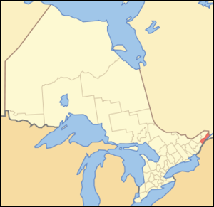
mapsize = 300px
map_caption = Location of Stormont, Dundas and Glengarry United Counties
mapsize1 =
map_caption1 =
image_dot_
dot_mapsize =
dot_map_caption =
dot_x = |dot_y =
pushpin_
pushpin_label_position =
pushpin_map_caption =
pushpin_mapsize =
subdivision_type = Country
subdivision_name = CAN
subdivision_type1 = Province
subdivision_name1 = ONT
subdivision_type2 =
subdivision_name2 =
seat_type =County seat
seat =Cornwall
parts_type =Municipalities
parts_style =
parts =
p1 = City
p2 =Cornwallp3=Townships
p4=North Dundas
p5=North Glengarry
p6=North Stormont
p7=South Dundas
p8=South Glengarry
p9=South Stormontp10=Indian reserve
p11 =Akwesasne
government_footnotes =
government_type =
leader_title =
leader_name =
leader_title1 =
leader_name1 =
established_title = Established
established_date = 1850
area_magnitude =
unit_pref =Imperial
area_footnotes =cite web |url=http://www12.statcan.ca/english/census06/data/profiles/community/Details/Page.cfm?Lang=E&Geo1=CD&Code1=3501&Geo2=PR&Code2=35&Data=Count&SearchText=Stormont,%20Dundas%20and%20Glengarry&SearchType=Begins&SearchPR=35&B1=All&Custom= |title=Community highlights for Stormont, Dundas and Glengarry |accessdate=2007-12-28 |date= |work= |publisher=]
area_total_km2 =
area_land_km2 =3306.86
area_water_km2 =
area_total_sq_mi =
area_land_sq_mi =1276.79
area_water_sq_mi =
area_water_percent =
elevation_footnotes =
elevation_m =
elevation_ft =
elevation_max_m =
elevation_max_ft =
elevation_min_m =
elevation_min_ft =
population_as_of =2006
population_footnotes =
population_note =
population_total =110399
population_density_km2 =33.4
population_density_sq_mi =86.5
timezone = EST
utc_offset = -5
timezone_DST = EDT
utc_offset_DST = -4
coor_type =
latd= |latm= |lats= |latNS=
longd= |longm= |longs= |longEW=
postal_code_type =
postal_code =
area_code =
website = [http://www.sdg.on.ca/ www.sdg.on.ca]
footnotes =Stormont, Dundas and Glengarry United Counties is a
county andcensus division inOntario ,Canada . The county seat is Cornwall.The county borders with
Quebec to the east andNew York to the south; the only census division in Ontario to border both Quebec and theUnited States .Stormont, Dundas and Glengarry had a total population of 110,399 in the
Canada 2006 Census .History
The county comprises six of the original eight Royal Townships of
Upper Canada : Lancaster, Charlottenburgh, Cornwall, Osnabruck, Willamsburgh and Matilda. These six townships were divided into 12 a few years after their creation. Each set of four townships became one of three separate counties: Lancaster, Charlottenburgh, Kenyon and Lochiel became Glengarry County, Cornwall, Osnabruck, Finch and Roxborough became Stormont County, and Williamsburgh, Matilda, Winchester and Mountain became Dundas County. The three counties were later united to form the current county.The townships of Cornwall, Osnabruck, Williamsburgh and Matilda were impacted by the creation of the
St. Lawrence Seaway in 1958, when construction plans required the flooding of a number of communities along the shore of theSt. Lawrence River . Ten communities in Cornwall and Osnabruck, known collectively asThe Lost Villages , were abandoned and completely flooded, while one community each in Williamsburgh and Matilda were relocated to higher ground.The 12 townships were amalgamated back into six, although along different boundaries from the original Royal Townships, in 1998.
Municipalities
City
* Cornwall
Townships
* North Dundas
* North Glengarry
* North Stormont
* South Dundas
* South Glengarry
* South StormontIndian reserve
*
Akwesasne Politics
Dennis Fife, the mayor of North Stormont, currently also serves as the county warden.
Most of the county, with the exception of North Glengarry, constitutes the federal and provincial electoral district of
Stormont—Dundas—South Glengarry . North Glengarry is part of the electoral district ofGlengarry—Prescott—Russell . Both districts are currently represented by Conservative MPs federally (Guy Lauzon andPierre Lemieux ), and by Liberal MPPs provincially (Jim Brownell andJean-Marc Lalonde ).ee also
*
Census divisions of Ontario References
External links
* [http://www.sdg.on.ca/ United Counties of Stormont, Dundas and Glengarry (SD&G)]
Wikimedia Foundation. 2010.