- Ontario Highway 38
-
Highway 38
Frontenac County Road 38 Route information Maintained by City of Kingston, Frontenac County Length: 67.0 km[2] (41.6 mi) Existed: April 25, 1934[1] – January 1, 1998[2] Major junctions South end:  Highway 401 in Kingston
North end:  Highway 7 near Sharbot Lake
Location Counties: Frontenac Major cities: Kingston Towns: South Frontenac Township, Central Frontenac Township Villages: Hartington, Harrowsmith, Verona, Godfrey, Parham, Tichborne, Sharbot Lake Highway system Ontario provincial highways
400-series • Former←  Highway 37
Highway 40  →
→King's Highway 38, commonly referred to as Highway 38, was a provincially maintained highway in the Canadian province of Ontario. The road connects Highway 401 in Kingston with Highway 7 west of Perth.
Highway 38 was designated in 1934 and remained relatively unchanged throughout its existence aside from some minor diversions. At the beginning of 1998, the entire highway was transferred to the City of Kingston and Frontenac County. It is now designated as Frontenac County Road 38 throughout its length.
Contents
Route description
County Road 38 is a north–south route located within Frontenac County in eastern Ontario. The southern terminus is at Highway 401 north of the urban area of Kingston, while the northern terminus is at Highway 7 north of the town of Sharbot Lake, approximately 36 kilometres (22 mi) west of Perth. The road carrying County Road 38 continues south of Highway 401 as Gardiners Road.[3]
There are several communities located along County Road 38 between Kingston and Sharbot Lake, including (from south to north) Harrowsmith, Verona, Godfrey and Parham. The western side of Frontenac Provincial Park is accessible from the route near Verona and Godfrey.[3]
History
Highway 38 was first assumed by the Department of Highways on April 25, 1934, connecting Highway 2 with Highway 7.[1] While the department initially constructed some diversions to improve the alignment of the route, which followed several concession roads north of Cataraqui, the route remained relatively unchanged from when it was established to when it was decommissioned.
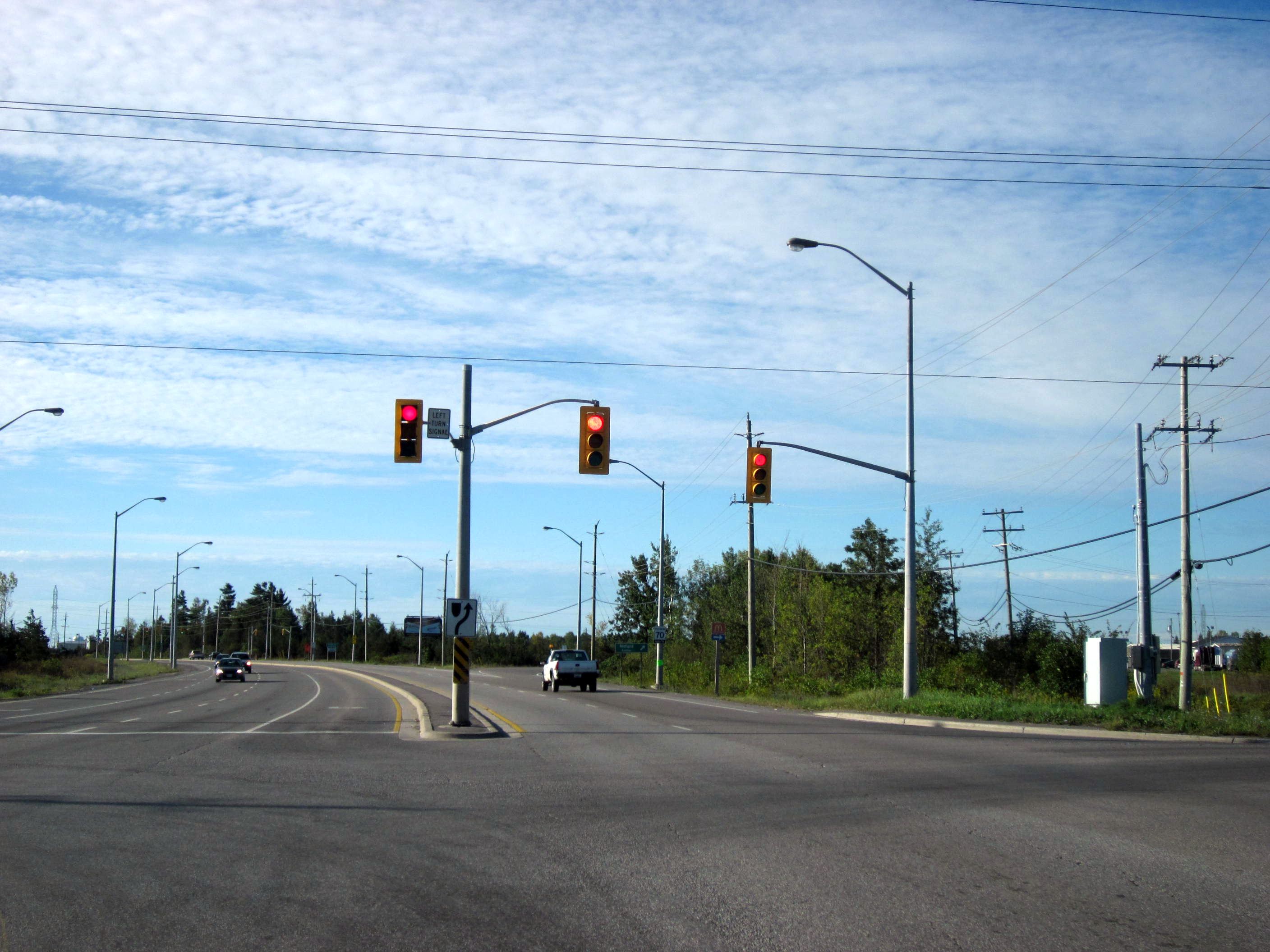
 Former Highway 38 south of Highway 401 as it enters Kingston
On January 1, 1998, the entirety of Highway 38 was transferred to the County of Frontenac and the City of Kingston.[2] It has since been designated as Frontenac County Road 38.[3]
Major intersections
The following table lists the major junctions along Highway 38. The entirety of the highway is located within Frontenac County.
Location km[4] Destinations Notes Kingston 0.0 Highway 401 – Toronto, CornwallCentral Frontenac 67.0 Highway 7 – Perth, Ottawa, Madoc1.000 mi = 1.609 km; 1.000 km = 0.621 mi References
- ^ a b Annual Report (Report). Department of Highways. March 31, 1935. p. 119.
- ^ a b c Highway Transfers List - “Who Does What” (Report). Ministry of Transportation of Ontario. June 20, 2001. pp. 5.
- ^ a b c Peter Heiler Ltd (2010). Ontario Back Road Atlas (Map). pp. 36, 48, section X54–D55. ISBN 978-1-55198-226-7.
- ^ Ministry of Transportation of Ontario (2007). "Annual Average Daily Traffic (AADT) counts". http://www.raqsb.mto.gov.on.ca/techpubs/TrafficVolumes.nsf/tvweb?OpenForm&Seq=5. Retrieved September 14, 2011.
External links
The King's Highways of Ontario Current highwaysFormer highways- 2A
- 2B
- 2S
- 3B
- 4A
- 5A
- 7B
- 8A
- 12B
- 14
- 15A
- 18
- 18A
- 22
- 24A
- 25
- 27
- 29
- 30
- 31
- 32
- 35A
- 35B
- 36
- 38
- 39
- 40B
- 42
- 43
- 44
- 45
- 46
- 47
- 48B
- 50
- 51
- 52
- 53
- 54
- 55
- 56
- 57
- 59
- 68
- 70
- 73
- 74
- 75
- 76
- 78
- 79
- 80
- 81
- 82
- 83
- 84
- 86
- 87
- 88
- 90
- 91
- 92
- 95
- 96
- 97
- 98
- 99
- 100
- 103
- 104
- 106
- 107
- 109
- 110
- 111
- 114
- 116
- 117
- 119
- 120
- 121
- 122
- 123
- 126
- 128
- 131
- 133
- 134
- 135
- 136
- 169
- 400A
- 401A
County roads in Ontario · Ontario numbered highways · Expressways and 400-series highways · King's Highways · Secondary highways · Tertiary and 7000-series highways · List of Ontario provincial highways · List of former provincial highways in Ontario · Highways in Ontario · List of Ontario expressways · Trans-Canada Highway · Connecting Link · Emergency Detour RouteCategories:- Ontario provincial highways

Wikimedia Foundation. 2010.