- Ontario Highway 410
-
Highway 410
Route information Length: 20.3 km[3] (12.6 mi) History: Opened 1979[1] – November 15, 2009[2] Major junctions South end: 
 Highway 401 / Highway 403 – Mississauga
 Highway 407 – Brampton
North end:  Highway 10 (Hurontario Street) – Caledon
Highway system Ontario provincial highways
400-series • Former←  Highway 409
Highway 416  →
→King's Highway 410, also known as Highway 410 and colloquially as the four-ten, is a 400-series highway in the Canadian province of Ontario that connects Highways 401 and 403 to Highway 10, through Greater Toronto's western suburbs of Mississauga and Brampton. Its total length is slightly over 20 kilometres (12 mi).
A notable feature of Highway 410 is the four-level interchange with Highways 401 and 403 which includes a large flyover ramp from Highway 401 eastbound to Highway 410 northbound. From Highway 401 to Steeles Avenue, Highway 410 has a wide grassy median with the capacity for two additional lanes in each direction.
Contents
Route description
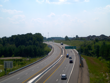
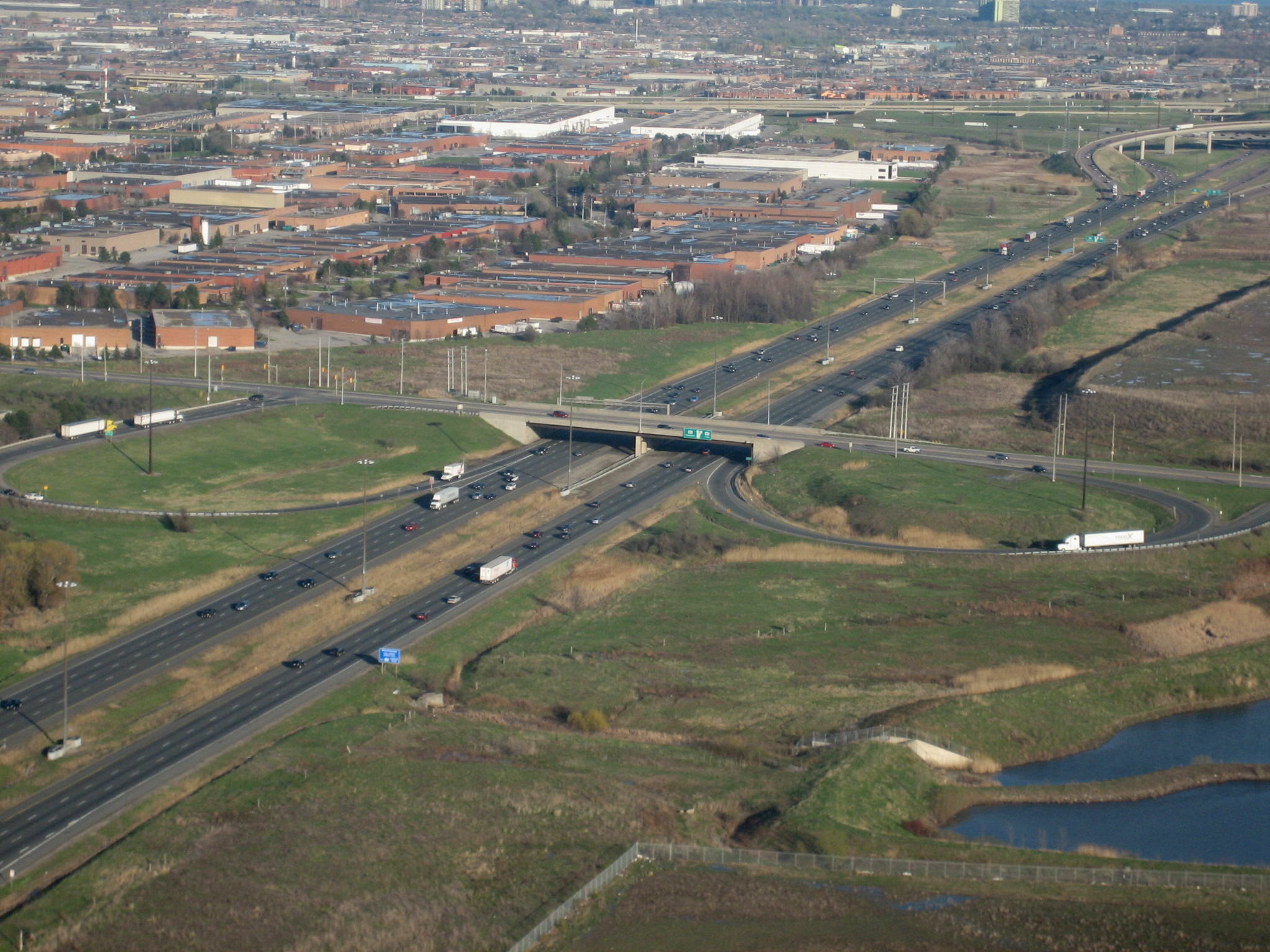
 The 410 and Courtneypark Drive
Highway 410 is a commuter freeway and a bypass of Brampton, acting as the southward continuation of Highway 10. The highway is also a continuation of Highway 403 from the south, which ends at the 401. The freeway begins as several ramps converge from Highway 401 north of the large interchange.[4] Maintaining a straight north-westward course, it passes beneath Courtney Park Drive and Derry Road, with a slight jog to the right between the two underpasses. The freeway then intersects Highway 407 as it crosses into Brampton and passes beneath an electrical corridor. Veering to the right once again, the freeway enters a second industrialized area and returns to its northwest–southeast orientation. It passes beneath Steeles Avenue and later Queen Street East, the former Highway 7, now Peel Regional Road 107. From this point north to Bovaird Drive, the two highways were concurrent. Passing north of Queen Street, the highway exits the industrial area and enters residential subdivisions.
Throughout this section, Highway 410 is placed within a ditch below grade. It passes beneath several roads until Bovaird Drive. The recently completed extension begins at this point,[5] as Highway 410 passes to the west of Trinity Common and diverges from its straight path into greenspace and alongside the Heart Lake Conservation Area.[6] As it passes beneath Mayfield Road, the highway makes a sharp turn to the west and descends through the Etobicoke Creek valley.[7] After rising back to level ground, it curves north, passing beneath Valleywood Drive. The central concrete median and high-mast lighting end as the freeway becomes Highway 10. It continues north as a four-lane undivided road to Orangeville, Shelburne and eventually Owen Sound.[8]
History
 Until 1990, Highway 410 did not connect with Highway 403, and existed as a Super 2 north of Highway 401
Ontario Premier Bill Davis, who was known as "Brampton Billy", initiated the construction of Highway 410 along the Heart Lake Road corridor during his administration. The first step in the 1970s was redirecting of Highway 403's (Mississauga section) eastern terminus towards Highway 401 instead of having it continue towards Highway 427 as originally planned. Highway 410 was then added to the 401-403 junction as a partial interchange with Highway 401 (eastbound only) and the rest of Highway 410 was constructed as a two-lane freeway. The two lane highway opened in 1978, featuring a single directional and loop ramp at Highway 401 to provide access to and from Toronto. This interchange was a better connection point for Highway 403, and plans were revised to have it turn north at Cawthra Road. These plans were submitted and approved in 1978 by Mississauga, and construction began.
By the early 1980s, the northern part of Highway 410 from Clark Boulevard to Bovaird Drive was a limited-access 4 lane expressway; Clark Boulevard and Queen Street were the original interchanges at the time. This section was widened to six lanes in the late 1990s.[citation needed]
In the late eighties and early 1990s, Highway 410 was expanded alongside the construction of Highway 407. The freeway was widened to 6 lanes south of Clark Boulevard, with much of the work involving the twinning of the existing carriageway, the original lanes were re-designated for northbound traffic. High-mast lighting was installed and new interchanges were added with Courtneypark Drive and Derry Road. The Courtneypark Drive overpass was widened from two to five lanes, while the Derry Road junction was designed with braided ramps to accommodate the Highway 407 clover-stack junction undergoing construction nearby.
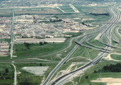
In the fall of 1991, alongside the widening of Highway 410 into a full freeway, construction began on the connecting ramps between Highway 403 and Highway 410, which pass under the existing bridge structures for Highway 401 collector traffic, while new overpasses were constructed for Highway 401 express lanes. The loop ramp from Highway 410 southbound to Highway 401 eastbound was replaced by a semi-directional high-speed flyover, while a new directional ramp and semi-direction flyover were added to serve westbound 401 commuters. Prior to the opening of this link, traffic from both freeways was forced onto eastbound Highway 401.[9] The 2.2 km (1.4 mi) link opened on November 2, 1992 at a cost of $7.3 million.[10]
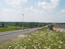
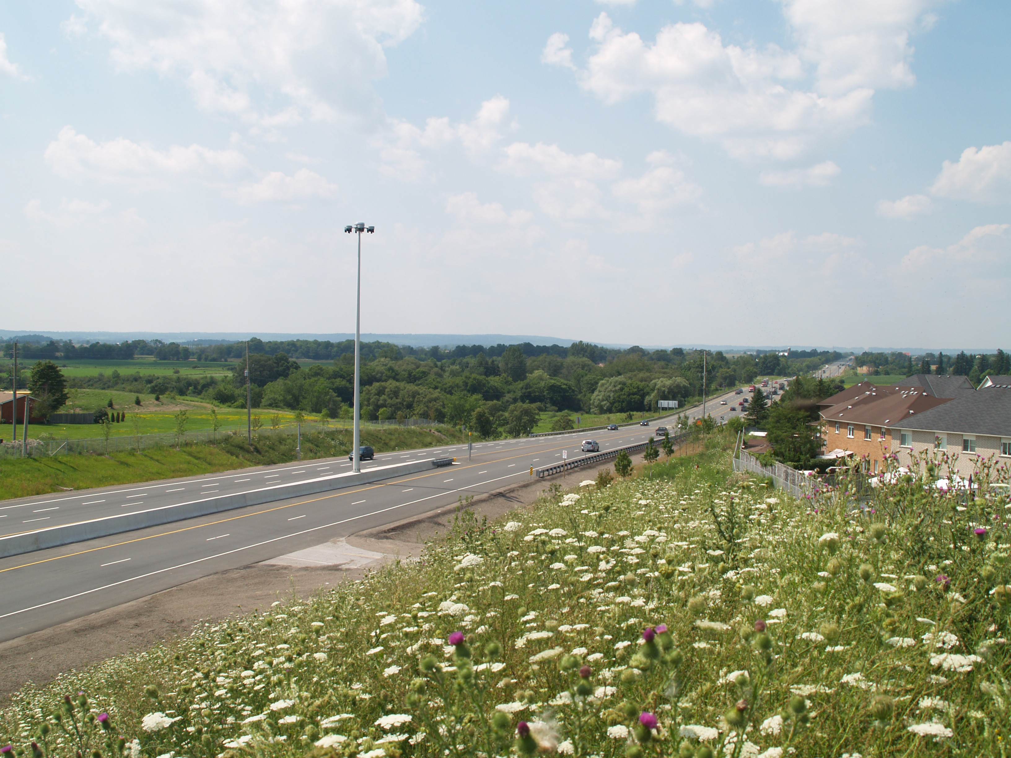
 The new 410 extension crossing Etobicoke Creek. Note the placeholders for high-mast lighting on the median.
Extension
The extension beyond Boivard Drive to Hurontario was conceived as part of the ultimate plan for Highway 410 when it was under construction in 1982.[11] It would take until 2003 for construction to begin.[12] Planning for the 8.5 km (5.3 mi) freeway began with the submitting of an Environmental Assessment by the MTO in October 1995.[13] The assessment was approved without a hearing by the Minister of Environment and Energy on March 5, 1997.[14] The next several years were spent on engineering and design. The new section, planned and built as a four lane freeway, was constructed on a new alignment in order to bypass the Heart Lake Conservation Area. It was completed in phases: initially to the new eastward extension of Sandalwood Parkway, later to Mayfield Road and finally to Highway 10 north of Sandalwood.[15]
Ernie Eves officially announced the extension on June 23, 2003; construction subsequently began on the first phase.[12][15] On May 15, 2006 construction began on the second phase between Sandalwood Parkway and Mayfield Drive.[5] The first two phases were built by Dufferin Construction and opened together in mid–late 2007; the northbound lanes were opened by the beginning of September and the southbound lanes by the end of the month. Upon its opening, trucks were prohibited from driving along it due to concerns of them travelling on the two lane Mayfield Road; this ban has since been lifted.[16] Construction on the third phase between Mayfield Road and Highway 10 began in August 2007.[7] The entire extension was completed and opened to traffic on November 16, 2009. Additional work continued in the months that followed to clean up the land surrounding the new freeway.[2]
Exit list
 Highway 410 ends as Highway 10 begins
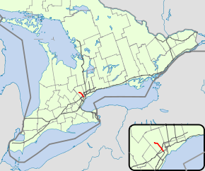
The entirety of Highway 410 is located within the Regional Municipality of Peel.[8]
Location km Exit Destinations Notes  Highway 410 continues south as Highway 403
 Mississauga 0.0 Highway 401 – London, Toronto1.9 2 Courtneypark Drive East Northbound exit and southbound entrance 3.4 3 Regional Road 5 (Derry Road) Brampton 4.9 5 Highway 4077.0 7 Regional Road 15 (Steeles Avenue) 9.4 9 Clark Boulevard Northbound exit and southbound entrance 10.0 10 Regional Road 107 (Queen Street)
Regional Road 6 westSouth end of Highway 7 concurrency 11.6 12 Williams Parkway 13.1 13 Regional Road 107 (Bovaird Drive)
Regional Road 10 eastNorth end of Highway 7 concurrency 14.9 15 Sandalwood Parkway 17.6 18 Regional Road 14 (Mayfield Road) Caledon – 21 Hurontario Street
Valleywood Boulevard Highway 410 continues north as Highway 10 1.000 mi = 1.609 km; 1.000 km = 0.621 mi References
- ^ GTA West Corridor (April 2010). GTAW - Area Transportation System Alternatives Report (Report). Government of Ontario. p. 46. http://gta-west.com/pdf/4-9-10/GTAW%20-%20Area%20Transportation%20System%20Alternatives%20Report%20-%20Main%20Report%20and%20Appendices.pdf. Retrieved April 13, 2010.
- ^ a b Abrey, Heather (November 20, 2009). "Hwy 410 extension causing confusion". Caledon Enterprise (North Peel Media Group). http://www.caledonenterprise.com/caledon/article/81020. Retrieved July 25, 2010.
- ^ Ministry of Transportation of Ontario (2007). "Annual Average Daily Traffic (AADT) counts". http://www.raqsb.mto.gov.on.ca/techpubs/TrafficVolumes.nsf/tvweb?OpenForm&Seq=5. Retrieved March 20, 2011.
- ^ Peter Heiler Ltd. (2008). Golden Horseshoe (Map). pp. 459, 466, section E44–F45. ISBN 978-1-55198-877-1.
- ^ a b Ministry of Transportation of Ontario (May 15, 2006). "Highway 410 Extension Will Benefit Brampton And Caledon Residents". Government of Ontario. http://www.skyscrapercity.com/showthread.php?t=350611. Retrieved November 3, 2011.
- ^ "The real reason for the inaction on the Highway 410 extension?". Caledon Citizen. June 7, 2006. http://www.caledoncitizen.com/news/2006-06-07/editorial/013.html. Retrieved April 12, 2011.
- ^ a b Ministry of Transportation of Ontario (2007). Start of Contract (Report). Government of Ontario. http://www.town.caledon.on.ca/contentc/townhall/departments/publicworks/Highway410.pdf. Retrieved April 12, 2011.
- ^ a b Peter Heiler Ltd (2010). Ontario Back Road Atlas (Map). Cartography by MapArt. ISBN 978-1-55198-226-7.
- ^ Mitchell, Bob (December 5, 1991). "Work Starts on 403-410 Link". The Toronto Star: p. MA2.
- ^ Mitchell, Bob (October 31, 1992). "403-410 Highway Link Ready, Seen As 'Boon' To Motorists". The Toronto Star: p. A24.
- ^ http://www.citizen.on.ca/news/2007-09-06/local_news/009.html
- ^ a b http://www.cdbi.org/news/articles/2003/dcn072603.pdf
- ^ http://www.ene.gov.on.ca/environment/en/industry/assessment_and_approvals/environmental_assessments/projects/STDPROD_082773.html?page=2
- ^ http://www.downloads.ene.gov.on.ca/files/eaab/hwy410_brampton_NoA.pdf
- ^ a b Waud, Charles (December 2009). "The Long Awaited, Highly Publicized "410 Highway to Glory..."". Brampton Board of Trade. Archived from the original on August 15, 2010. http://web.archive.org/web/20100815061500/http://bramptonbot.com/president-dec09.html. Retrieved November 3, 2011.
- ^ Ministry of Transportation of Ontario (August 23, 2007). "McGuinty Government Moving Forward With Highway 410 Extension". Government of Ontario. http://www.newswire.ca/en/releases/archive/August2007/23/c9450.html. Retrieved March 14, 2010.
External links
Controlled-access highways of Ontario 400-series highways Other highways Current: 2A · 11 · 58 · 115 · 137 · Conestoga Pkwy. · Dougall Pkwy. · E.C. Row Expwy. · Hanlon Pkwy. · Queensway · Thunder Bay Expwy.
Municipal: Black Creek Dr. · Burlington St. · Cootes Dr. · Don Valley Pkwy. · Gardiner Expwy. · Harbour Expwy. · Highbury Ave. · Lincoln M. Alexander Pkwy. · Queensway · Red Hill Valley Pkwy. · Vets Mem. Pkwy. · W.R. Allen Rd.
Proposed: GTA West Corridor · Halton–Peel Freeway · Mid-Peninsula Highway · Bradford Bypass · West Durham Link · East Durham LinkCounty roads in Ontario · Ontario numbered highways · Expressways and 400-series highways · King's Highways · Secondary highways · Tertiary and 7000-series highways · List of Ontario provincial highways · List of former provincial highways in Ontario · Highways in Ontario · List of Ontario expressways · Trans-Canada Highway · Connecting Link · Emergency Detour RouteCategories:- 400-series highways in Ontario


Wikimedia Foundation. 2010.