- Hurontario Street
-
Hurontario Street is a roadway running in Ontario, Canada between Lake Ontario at Mississauga and Lake Huron's Georgian Bay at Collingwood.
Within the cities of Mississauga and Brampton, it is a major urban thoroughfare. Between Caledon and Orangeville, it is part of busy Highway 10, which leaves the Hurontario Street alignment north of Orangeville to head for Owen Sound. From Orangeville to Glen Huron, it is a hilly, discontinuous concession road. North of there, it is part of former Highway 24 until its terminus in Collingwood.
Within much of the city of Brampton, this road is known as Main Street.
Hurontario is one of the busiest transit corridors in the '905 Region' of the Greater Toronto Area. A light rail transit line is tentatively planned to be built along the street in Mississauga and the southern half of Brampton (see Hurontario-Main Street LRT).
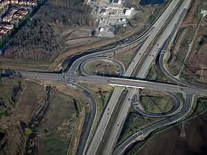
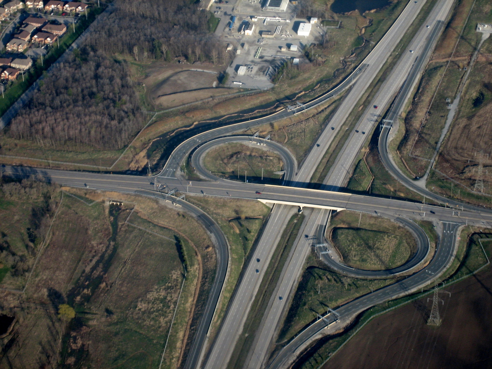
As of November 15, 2009, there is a permanent discontinuity of sorts immediately outside the northern border of Brampton, in Caledon, where Hurontario Street meets Highway 410. The street changes into Valleywood Boulevard at the Highway 410 overpass. Northbound traffic must follow the sign for Highway 10 by turning right to enter the cloverleaf ramp to Highway 410. Southbound Hurontario Street (Highway 10) traffic must now take an exit ramp to continue south on Hurontario.
Nomenclature
The street is commonly referred to solely as "Highway 10" by traffic reporters, and even by residents in the cities of Mississauga and Brampton (with the exception of the latter's downtown area), rather than by its street names – a situation made even more peculiar by the fact that the provincial highway designation is defunct in these cities. The most likely reason for this is that the areas along the road were developed during the suburban era after its identity as a highway was firmly entrenched. The Ministry of Transportation's traffic camera continues to identify Hurontario as "Hwy 10" as well.[1] However, the street name predominates in Collingwood.
In Mississauga and Brampton, the construction of Highway 410 (as well as the road's increasingly suburban nature) was responsible for the removal of provincial highway status. The current provincially-maintained route into Brampton and Mississauga from the north consists of Highways 410 and 403.
The intersection of Hurontario and Dundas is also known as 5 and 10, a reference to the former highway numbers of the two streets.
Attractions and institutions along Hurontario Street
Attractions and institutions along Hurontario Street in urban Peel Region include:
- Historic Port Credit
- Square One Shopping Centre
- Britannia Farm
- Peel District School Board Headquarters, Mississauga.
- Dufferin-Peel Catholic District School Board Headquarters, Mississauga.
- A. Grenville and William Davis Courthouse, Brampton.
- Shoppers World, Brampton
- Peel Heritage Complex
- Rose Theatre
References
- ^ "COMPASS Traffic Cameras - QEW - Halton, Peel Regions". Ministry of Transportation of Ontario. April 2008. http://www.mto.gov.on.ca/english/traveller/compass/camera/burlington/camhome.htm. Retrieved 2008-04-26.
Roads in Mississauga Arteries (Primary Roads): Collectors (Secondary): Regional Roads: Highways and Expressways: Categories:- Roads in Mississauga
Wikimedia Foundation. 2010.