- Highway 401 (Ontario)
Infobox road
state=ON
type=Hwy
route=401
alternate_name=Macdonald-Cartier Freeway
Highway of Heroes
Express Toll Route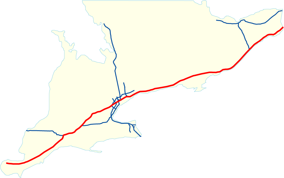
length_km=815
length_ref=Ministry of Transportation of Ontario , [http://www.raqsb.mto.gov.on.ca/techpubs/TrafficVolumes.nsf/tvweb?OpenForm&Seq=5 2004 Annual Average Daily Traffic] ] Highway 401's distance measurements are from the foot of theAmbassador Bridge to theQuebec border, while the roadway officially starts at the interchange of Highway 3, a full 13-km shorter. Sources: http://www.thekingshighway.ca, Rand McNally Atlases, and the Ministry of Transportation]
length_round=1
direction_a=West
terminus_a=jct|state=ON|Hwy|3 in Windsor
direction_b=East
terminus_b=jct|state=QC|A|20 towardsMontreal, QC
junction=jct|state=ON|Hwy|402 in London
jct|state=ON|Hwy|403 in Woodstock
jct|state=ON|Hwy|8 in Kitchener
jct|state=ON|Hwy|407 nearMilton, Ontario
jct|state=ON|Hwy|410 inMississauga
jct|state=ON|Hwy|427 inToronto
jct|state=ON|Hwy|400 in Toronto
jct|state=ON|Hwy|404/Don Valley Parkway in Toronto
jct|state=ON|Hwy|35/jct|state=ON|Hwy|115 in Clarington
jct|state=ON|Hwy|62 in Belleville
jct|state=ON|Hwy|15 in Kingston
jct|state=ON|Hwy|137 near Gananoque
jct|state=ON|Hwy|416 nearBrockville
jct|state=ON|Hwy|138 in Cornwall
established=1938 (parts as Highway 2A),
1947 (numbered in 1952) [http://www.thekingshighway.ca/ TheKingsHighway] ]
commons=category
previous_type=Hwy
previous_route=400
next_type=Hwy
next_route=402The King's Highway 401 (also known as the Macdonald-Cartier Freeway) is a
highway that extends acrossSouthern Ontario ,Canada . It is the longest 400-Series Highway in Ontario, and one of the widest and busiest highways in the world.cite web
url = http://ogov.newswire.ca/ontario/GPOE/2002/08/06/c0057.html?lmatch=&lang=_e.html
title = Ontario government investing $401 million to upgrade Highway 401
publisher = Ministry of Transportation
date =2002-08-06
accessdate = 2007-03-18
quote = Highway 401 is one of the busiest highways in the world and represents a vital link in Ontario's transportation infrastructure, carrying more than 400,000 vehicles per day through Toronto.] [cite web
url = http://www.urbanplanet.org/forums/index.php?showtopic=3459
title = GTA Economy Dinged by Every Crash on the 401 - North America's Busiest Freeway
author = Brian Gray
publisher = "Toronto Sun ", transcribed at Urban Planet
date =2004-04-10
accessdate = 2007-03-18
quote = The "phenomenal" number of vehicles on Hwy. 401 as it cuts through Toronto makes it the busiest freeway in North America...] In fact, the highway has the distinction of being North America's busiest freeway. [http://www.thekingshighway.ca/Highway401.htm] [http://www.urbanplanet.org/forums/index.php?showtopic=3459] Together withQuebec Autoroute 20 , it is the road transportation backbone of theQuebec City-Windsor Corridor , along which over half of Canada's population resides. Colloquially, the road is known simply as the 401, spoken as "four-oh-one."On
August 24 ,2007 , the stretch of highway betweenToronto (from Highway 404/Don Valley Parkway ) and Trenton (from Glen Miller Road) was given the additional name Highway of Heroes, in honour ofCanadian Forces personnel killed during the War in Afghanistan. [http://www.msnbc.msn.com/id/26393964/]History
The need for a four-lane bypass of Highway 2 in the
Oshawa area was growing in the early 1930s, as the simple two-lane road could no longer handle the growing levels of traffic. The idea for a roadway similar to Middle Road in Peel County was led byThomas McQueston , then head of the Department of Highways.Construction began on two portions of Highway 401 before the beginning of
World War II : the new Kingston Road from Highland Creek toOshawa , (modern day Former Highway 2A) bypassing the Kingston Road (Highway 2), and the scenic highway from Gananoque toBrockville , also bypassing a portion of Highway 2. The former was built because of heavy traffic between Toronto and Oshawa, and the latter to connect with theThousand Islands Bridge (opened 1937). In late 1941 or early 1942, the scenic highway was opened to local traffic as agravel road , [Department of Highways, Ontario , Annual Report for the Fiscal Year EndingMarch 31 st, 1942, p. 9] and numbered Highway 2S, for "Highway 2 Scenic" (as opposed to the popular, but incorrect, idea of "Highway 2 South", since the road does lie fully south of Highway 2). Paving of the south side, the future eastbound lanes, was completed several years later. [http://books.google.com/books?id=r0e-8PU_4dsC&dq=%22new+kingston+road%22+oshawa&q=%22highway+2s&pgis=1#search Annual Report By Ontario Dept. of Highways, Ontario Dept. of Agriculture and Food, Ontario Dept. of Public Works, 1940, 1941, 1949]Construction of the first segment of the highway (originally designated Highway 2A) from Highland Creek to
Oshawa was initiated in 1938. The highway was designed to bypass a congested section of nearby Highway 2. Much of the grading and a number of structures were completed before the onset of theSecond World War , at which time most of the construction work was suspended. This section was finally completed and opened to traffic in 1947.During
World War II , the provincial government undertook a number of surveys and studies to determine the most desirable route for the new limited-access highway.The highway was redesignated "Highway 401" in 1952. The last segment, between Gananoque and
Brockville , was completed in 1968 to bypass a section along theSt. Lawrence River that included at-grade intersections and private entrances, now called the "Thousand Islands Parkway ". The last at-grade intersection on the present alignment was at Joyceville Road, east of Kingston, which was converted to an interchange with the final 1968 construction.Much of the current routing of Highway 401 across
Toronto was built in 1954 (when the entire area was north of the city) as the "Toronto By-Pass". The road ended temporarily at theWeston Road interchange (now Exit 357), while a bridge across the Humber River was constructed for the road to be extended westwards. This bridge was never used, as just a few months later,Hurricane Hazel damaged it so badly that it had to bedynamite d and completely rebuilt. This delayed Highway 401's completion in the Toronto area for nearly a year. [ [http://www.thekingshighway.ca/PHOTOS/Hwy401photos2.htm TheKingsHighway.ca - History on Highway 401] ]Through much of the 1950s, motorists were annoyed with the perceived snail's pace of constructing the freeway, and had pressured the provincial government to speed up the completion of Highway 401, with much of the public supporting turning Highway 401 into a tolled road to accelerate construction. To do this, the provincial government had assigned the "Select Committee on Toll Roads and Highway Financing" in 1955 to consider any benefits or disadvantages from this [ [http://www.roadscholar.on.ca/lateststory.html Highway 401 - the Story.html ] ] . The resulting report from the committee was in by 1956, and the result was that tolling the roadway would be extremely detrimental. Tolls would appear on the 400-series network, if only temporarily. When the
St. Lawrence Seaway was built in the late 1950s, drivers on theQueen Elizabeth Way paid tolls on the newly-built Garden City and Burlington Bay skyways until 1973, as a way to recover the costs of construction and upgrades.During the late 1950s, the road was extended from Windsor to London as an at-grade
Super 2 , before being twinned in the 1960s (the segment from Windsor to Tilbury was completed as a four-lane freeway), with the eastbound carriageway being built first. This is still evident today, as many bridges overcreek s andstream s in the area have different ages and appearances. The section from Windsor to Tilbury was among the original sections built, from 1952-1958, with the Tilbury Bypass (from Exit 56 to Exit 63) being constructed in 1961, with the Tilbury-London section opening in 1963. In 1957, the London-Woodstock section opened, as a four-lane divided freeway from Highway 4's interchange (just west of London), to Highway 2's interchange (just east of Woodstock). The road would later be extended to Kitchener in 1961, where it was linked to the Kitchener-Toronto-Oshawa section.In 1964, Highway 401 was diverted from its former alignment in
Windsor, Ontario along what is nowDougall Parkway , to its current terminus with Highway 3, with the overpass carrying Highway 3's westbound lanes being built in 1956 in anticipation of the extension. [http://www.thekingshighway.ca/PHOTOS/Hwy401photos4.htm TheKingsHighway.ca - History on Highway 401] ] The former alignment became Highway 401A (a secret designation, much like Highway 400A in Barrie). At this time, Highway 401 was also twinned from Windsor (interchange with Highway 98, now Provincial Road) to the eastern interchange (Exit 63) with Highway 2 in Tilbury, with two new lanes being constructed north of the existing lanes. The new carriageway became the westbound lanes, while the original two-lane carriageway became the east-bound lanes. This twinning from Windsor to Tilbury was completed in 1965. By 1968, all of Highway 401 was twinned to a minimum of four lanes.In 1965,
Premier of Ontario John Robarts designated Highway 401 the "Macdonald-Cartier Freeway", in honour of SirJohn A. Macdonald and SirGeorge-Étienne Cartier , theProvince of Canada 's most important Fathers of Confederation, and in recognition of Canada's upcoming Centennial Celebrations in 1967. This name is found on maps and official documents, but seldom used in conversation or on modernroad sign s. Macdonald's name is misspelled on Internet mapping services such as Google Maps and Microsoft Virtual Earth in spite of repeated requests to data supplier Navteq to correct the error. A 1961 proposal to name the highway the "Leslie M. Frost Thruway" after the recently retired Premier of Ontario was approved by the provincial cabinet, but was not carried out.Highway of Heroes
On
24 August 2007 , the Ministry of Transportation (MTO) announced that the stretch of Highway 401 from Glen Miller Road inTrenton, Ontario toDon Valley Parkway /Highway 404 inToronto would bear the additional name "Highway of Heroes" in honour of Canada's fallen soldiers, notably those who have died on duty in Afghanistan. This stretch of the freeway is often travelled by aconvoy ofvehicle s carrying a fallensoldier 's body with his or herfamily fromCFB Trenton to thecoroner 's office in Toronto, at the Centre for Forensic Sciences.Since 2002, when the first of Canada's fallen soldiers were returned from Afghanistan, crowds from the communities along this stretch of the 401 lined the overpasses to pay their respects as the convoy passes. The highway's designation as the "Macdonald-Cartier Freeway" will remain throughout the freeway's length. [ [http://www.citynews.ca/news/news_14055.aspx City News] ] [ [http://toronto.ctv.ca/servlet/an/local/CTVNews/20070824/online_petition_070824/20070824/?hub=TorontoHome CTV.ca] ] From the Don Valley Parkway to Trenton, large signs and several smaller reassurance markers with the new designation have been added to this stretch of the 401. Similar to the older and discontinued M-C Freeway shields installed in the 1960s, the King's Highway shields along with two shields with a poppy symbol (one with 401 designation and two with poppies with text Highway of Heroes and Autoroute des héros) appear after each on ramp along the route.

Carnage Alley
The section of Highway 401 between Windsor and London has become known as "Carnage Alley", particularly since 1988, when a long string of particularly violent and deadly
accident s occurred in this section. These accidents have occurred because of the road's initial 1950s design, particularly narrow lanes, soft shoulders, and a narrow grass median which have been insufficient in preventing cross-directional collisions. This stretch ofhighway is also the busiesttruck route inNorth America .This segment of Highway 401 was the site of Canada's deadliest automobile
pile-up . An 87-vehicle crash occurred on the freeway just east of theManning Road interchange and truck inspection center, during a thick fog onSeptember 3 1999 (Labour Day weekend). The MTO immediately added paved shoulders andrumble strip s, and provided funding for additional police to be hired to patrol this stretch. TheCanadian Automobile Association (CAA) described these steps as a "quick-fix", as their preferred solution is to replace the grass median with a concrete barrier and an additional lane per direction; this is a long-term plan of the Ministry. For more on this, read below.One of the more accident-prone parts of the freeway is at Exit 109 (Victoria Road, formerly Highway 21, now Chatham-Kent Roads 17/21). The freeway curves immediately east of the interchange and many people are not used to a curve near an interchange, particularly on the Windsor-London stretch of freeway, which is mainly straight.
As a result of such accidents which can shut down the freeway, there is the implementation of province-wide "
Emergency Detour Route s" (labelled "EDR" along freeways and exits). These EDRs are signed at exits, and along parallelcounty road s (which may or may not have been downgraded/former provincial highways) or major arterial roads in towns and cities to help motorists detour around an accident and find their way back to the freeway if a stretch of it is closed for any reason. However, this diverts high speed highway traffic on to low speed country roads, creating congestion due to the reduced capacity of the road.peeding and tailgating
Many of the accidents described earlier are attributed to excessive speeding and
tailgating (following too closely), causing many motorists in Ontario to consider having the MTO raise the speed limit on 400-series highways from 100 km/h (60 mph) to 110-120 km/h (70-75 mph), bringing the network in line with comparable freeway networks in theUnited States ,Europe , and other provinces such asAlberta . The speed limit was reduced from 70 mph (pre-metric) in 1974 by act of Provincial Parliament. The basis for this reduction was improved safety, unlike the reductions in US speed limits at the same time, which were ostensibly to save fuel. Recently, to combat excessive speeding, the Ontario Provincial Legislature, on the recommendation of the Ministry of Transportation and theOntario Provincial Police , has passed a law that allows police to immediately suspend the driver’s licence and impound the vehicle involved for seven days in the case of "excessive speeding" (driving 50 km/h over the limit, or over 150 km/h on 400-series highways).Transport truck s are also going to be limited byspeed governor s to 105 km/h, (65 mph) the same as in nearbyOhio , with mixed public sentiment on the matter. In contrast with proposals for raising the speed limit, there has been growing grass roots support for a revival ofphoto-radar with a twist: the total proceeds from photo-radar fines are diverted to a specific charity such as a local hospitalemergency room (where many highway traffic accident victims end up) overcoming previous objections to photo-radar where fines were perceived by the public to be mixed with the government's general tax revenue. However, the perception that photo-radar will reduce excessive speeding has been shown to be false.Fact|date=July 2008Overview
Highway 401 begins at Highway 3, 13 km (8 mi) from the
Detroit River on the outskirts of Windsor (not at theMichigan border as some mistakenly assume, though the exits on the freeway are listed as distances from theAmbassador Bridge ) and ends at theQuebec border, 818 km (508.28 mi) away. There are 18 rest areas or service centres (oases) located along the route, allowing motorists to access services without leaving the highway. A plaque was erected at the Mallorytown oasis, located on the last section of the freeway to be completed, stating that the 401 was the longest non-toll freeway under a single highway authority in North America. (Today the section ofInterstate 10 in Texas holds this record.)Major freeway junctions are located at these roads and highways: 402,
Highbury Avenue (London), 403, 8, 6, 407, 410, 427, 400,Allen Road (Toronto ), 404 andDon Valley Parkway (Toronto), 35 and 115, 416.Quebec Autoroute 20 continues the highway at its eastern end.There are no direct interchanges with U.S.
Interstate highway s, but Interstates 75, 94, 96 and 375 inDetroit, Michigan , andInterstate 81 in New York State are each a short distance away, via Highways 3, the former 3B, and 137, leading to theAmbassador Bridge , theDetroit-Windsor Tunnel , and theThousand Islands Bridge , respectively. Highway 402 also links Highway 401 to I-69/I-94 via theBluewater Bridge inSarnia, Ontario . An extension to a potentialborder crossing withMichigan in the western portion of Windsor may eventually connect to a spur Interstate inDetroit, Michigan , but no routing on the extension has been determined yet.Transportation corridor
The 401 is one of the world's busiest highways, with an estimated Annual Average Daily Traffic (AADT) of over 500,000 in 2006, between the
Weston Road and Highway 400 interchanges in Toronto. Due to its triple use as the main trade, commuting and recreational corridor in Ontario, 24-hour traffic volumes can exceed the 500,000 level on some days. The just-in-time inventory systems of the highly integratedauto industry inMichigan and Ontario have made the highway the busiesttruck route in the world. Highway 401 also includes the continent's busiest multi-structure bridge at Hogg's Hollow in Toronto (four structures for the highway's four roadway beds). The first of these structures served as a bypass for Highway 11, and was built in 1929, with the three others being built more recently.The 401 is a strategically important highway in Canada, as it connects the populous Southern Ontario region with Quebec and Michigan, while also connecting to most other major highways in the province. The 401 also acts as a 'short cut' between
Detroit andBuffalo, New York (viaQueen Elizabeth Way and Highway 403), and is used by many American motorists for this reason. The highway also serves as the principal connection toMontreal and points east, includingNew England , becoming Autoroute 20 at the Quebec border. The border crossing at Windsor andDetroit is the busiest trade crossing in the world, and although the 401 itself does not physically extend the last few kilometres into Detroit, it is the only route from Toronto to Windsor and on toInterstate 75 (aside from theBluewater Bridge in Sarnia via Highway 402 and I-69/I-94). A future expansion of the Windsor-Detroit border crossing, which will include a freeway bypass of the existing Highway 3, may result in Highway 401 having a direct freeway link to the border. The route and type of roadway built is causing much debate in the Windsor area, with the city opting for a partially covered roadway with parks on top. However, the provincial and federal governments of Canada are seemingly opting for a cheaper less-effective solution, likely to be a simple at-grade highway extending to the new crossing. Some 40% of Canada-U.S. trade travels the highway, representing one-third of Canada's foreign trade, and 4% of all U.S. foreign trade. However, it is not part of theTrans-Canada Highway .Collector-express sections
Today the stretch of Highway 401 that passes through the
Greater Toronto Area ranges from 6 to 18 lanes.Islington Avenue to Brock Road
The section that now runs through
Toronto was a rural roadway that was entirely outside of the Toronto city limits when first opened, and was originally referred to as the Toronto Bypass. The new freeway attracted development all along its length. As the city'ssuburb s grew, it quickly became an urban commuter road, rather than a long-distance bypass route as was originally planned, leading to extensive traffic jams.This was a problem/opportunity solved and built upon to some extent by implementing separate
express and collector lanes , similar to the express/local set-up of theDan Ryan Expressway in Chicago. Transfers, such asThe Basketweave allow traffic to move from the express to collector lanes and vice versa.Though Highway 401's collectors are intended more for urban commuters, they enjoy equal access to intersecting freeways as the express lanes do, such as at the junctions with Highway 404 and somewhat with Highway 400, so their use is not restricted to local traffic. It also facilitates road maintenance, as the MTO can to close off either the express or collector lanes for night repairs or upgrades. By contrast, the collector-express system on Highway 427 separate out two streams of traffic; the express lanes connect the QEW/Gardiner with 401 and exclusively lead to freeway-to-freeway ramps, while the collector lanes link up the arterials Highway 27 and Browns Line and have interchanges with local traffic.
By 1967 Highway 401 was widened from four lanes to 12 or more through Toronto from
Islington Avenue toWarden Avenue .In the early 1970s the collector express lanes were extended to Neilson Road and eastward to Brock Road by 1997.The main
collector-express setup with a minimum 12 lane cross-section currently stretches from Islington Avenue to Brock Road. Highway 409 which branches off from Highway 401 just west of Islington toToronto Pearson International Airport has been unsuccessful in diverting traffic volumes; the 10 lane segment between Islington and Highway 427 is highly congested as a result. The existing 401-427 interchange is considered one of the worst bottlenecks since it only allows eight lanes of traffic (four in each direction) to pass through the interchange. It initially only allowed six lanes of through traffic until a widening project was completed in 2005; a major reconstruction of the junction is needed to meet current demands estimated at five-to-six lanes.An alternative plan to the collector-express setup was to construct a bypass of Highway 401. This project was revived in 1987 and opened in 1997 as the toll road Highway 407 ETR to parallel Highway 401 in the
Greater Toronto Area .ignage
In order to make sure drivers are not confused by signs appearing in other lanes, colours have been assigned to both Collector and Express Lanes. Collector lanes (handling traffic merging from and to exits) are blue while Express Lane signs are green. Due to the urban nature of the road, all signs are mounted overhead on gantries. The green signs list up to three upcoming exits (for example: Leslie St, Bayview Ave, Yonge St, 4 km). However, the mileage indicated on the signs do not indicate the actual distance to the next exit, they only indicate the distance to the next transfer to the collectors. Once in the collector lanes, the blue signs direct and inform drivers of the distance until the exit ramp (for example: Leslie Street, 1 km).
Highway 403/410 to Highway 427
Highway 401 has a separate
collector-express system inMississauga between the junctions with Highways 403/410 and Highway 427. This was completed in 1986, concurrent with the expansion of the 401-403 interchange and the addition of two express flyover ramps and includes an eastbound collector-express transfer known as the "Tunnel." At 18 lanes wide this is the widest section of Highway 401, although at the present only nine lanes are designated for 401 through traffic (as express lanes) while the collector lanes serve as direct connections or ramp extensions from 403/410 to 427.The existing 401/427 interchange remains a bottleneck to possible east expansion of this configuration that would link it up with the Islington-Brock collector-express system. Another choke point is at the 403/410 interchange since the 401 narrows down to eight lanes west of that junction. However, that junction has been designed with westward expansion of the collector-express system in mind; several prerequisite projects to accommodate widening from 403/410 to
Mississauga Road were underway in the late 1990s, including a new interchange atMavis Road and the reconstruction of the Mississauga Road and Derry Road overpasses.Future expansion and upgrades
In the 1950s, Highway 401 had initially been constructed as a four lane divided highway but the narrow grass median has since proven insufficient in preventing cross-directional collisions. In 1999, the Windsor-London stretch of Highway 401 was infamously dubbed as "Carnage Alley" after several fatal accidents, including an 87 vehicle pileup on Labour Day weekend during thick fog that claimed seven lives just east of the
Manning Road interchange and truck inspection center. Much work has involved replacing the median strip with an "Ontario tall-wall " concrete barrier and often an extra lane per direction. Due to this pile-up, the Ministry of Transportation began erecting signs that say "Fatigue Kills, Take A Break" and "Tailgating Kills, Leave Some Space" along the route between Windsor and London. These were later applied to other notoriously dangerous stretches of provincial highways across the province. [ [http://www.onthighways.com/hwy_401_images/Hwy401_p3_images.htm Hwy 401 - Page 3 - Ridgetown to London - Images ] ]Areas currently being upgraded are between Windsor and Tilbury, around the City of Kingston, the London area, from Stevenson Road in
Oshawa to Highway 35/115, from Port Hope to Cobourg, and west from Cambridge towards Woodstock. This will be followed later by staged upgrades between Trenton and Belleville, and eventually the remaining sections between Cobourg and Kingston. Upgrading the final rural sections between Tilbury, Chatham and London, and from Cornwall to the Quebec Boundary remain beyond the 35-year planning horizon at this time.Windsor-area upgrades and extensions
On
14 November 2005 , the joint Canadian-American committee studying the options for expanding the Windsor - Detroit border crossing announced that its preferred option was to directly extend Highway 401 westward, using a new bridge or tunnel to cross theDetroit River and interchange withInterstate 75 somewhere between the existingAmbassador Bridge span and Wyandotte. The exact route of this new highway connection has not yet been determined [cite news |first=Anne |last=Jarvis |authorlink= |author= |coauthors= |title=Second span on west side, group urges / Binational committee rejects Schwartz Report truck bypass |url=http://www.canada.com/windsor/windsorstar/news/story.html?id=0114a7c0-c303-4bb4-82d1-83ff9bbc6e99 |format= |work= |publisher=Windsor Star |id= |pages= |page= |date=15 November 2005 |accessdate=2006-11-23 |quote= |archiveurl= |archivedate= ] .In the
14 February 2008 issue of "The Windsor Star ", it was reported that the MTO was buying properties and making offers to buy other properties on the southwest side of Windsor for a potential extension of Highway 401. The area where the MTO is reportedly purchasing property is just south ofE.C. Row Expressway , parallel to the existing freeway, where there is light development. Currently, the area is mostly rural, with a few newer houses with older ones as well, along with mostly-undeveloped parks and nature preserves (seeNeighbourhoods of Windsor, Ontario#West_Side for more information on this neighbourhood). Currently, the Ministry of Transportation has stated tentative plans for the extension of Highway 401 by travelling up Highway 3/Talbot Road/Huron Church Road , before branching west towards E.C. Row Expressway, heading towards the river towards a new bridge toInterstate 75 . The cost for the access route/extension is estimated to be at $1.5 billion, but does not include expropriating homes and businesses along Highway 3 and in the "Yawkey Bush" neighbourhood. This plan follows the "GreenLink " proposal drafted up by theDetroit River International Crossing and theWindsor City Council .Home owners along the newly-built Chappus Street subdivision have stated they are worried that their land values will weaken if they are sandwiched between E.C. Row and Highway 401, as their houses (and the extension of Chappus Street) were built around 2003, while area developer Ashraf Botros claims that his plans for a much larger subdivision around Chappus Street now have to be scuttled from this potential extension. [cite news |first=Craig |last=Pearson |authorlink= |author= |coauthors= |title=Ont. buying land for Highway 401 route |url=http://www.canada.com/windsorstar/story.html?id=9ec7a01e-af9f-4e0c-936d-c09f6cf0ef4a&k=49700 |format= |work= |publisher=
Windsor Star |id= |pages= |page=A1 |date=14 February ,2008 |accessdate=2008-02-14 |quote= |archiveurl= |archivedate= ] .On
March 3 ,2008 , theMichigan Department of Transportation and the MTO (in partnership withTransport Canada and theFederal Highway Administration of the United States, and theDetroit River International Crossing group) completed a joint assessment on the soils along theDetroit River , on both the American and Canadian sides to determine if the ground in the area was strong enough to support the weight of a proposed bridge over the river. The technical analysis had determined the soils along the river can indeed support the weight of a new bridge. This was a grave concern of all parties involved in the bridge construction process, due to the nearbyWindsor Salt Mine's activities only a kilometer (0.6 mile) or so away, and the soils in the area being ofclay andsand ysediment . [ [http://www.tc.gc.ca/mediaroom/releases/nat/2008/08-h063e.htm Border transportation partnership reaches milestone - March 3, 2008 ] ]On
May 1 ,2008 , a new proposed highway called the Windsor-Essex Parkway, will be connected extending Highway 401 to a new inspection plaza and river crossing in West Windsor. This project will cost about $1.6 billion but the parkway will put heavy trucks off local streets and there will be several tunnels so local residents can cross over the parkway with ease. There will be side roads running parallel along the parkway for local traffic. [ [http://www.mto.gov.on.ca/english/news/provincial/2008/080501.htm The Detroit River International Crossing Study Team Announces Preferred Access Road] ]Essex County upgrades
The vast majority of the Essex County upgrades have been completed and opened to traffic. The only parts remaining to be upgraded are from 3 km west of Manning Road, to Highway 401's terminus in Windsor at Highway 3, which will be upgraded pending the approval of a new border crossing. This part of freeway has become a widened, concrete-paved six-lane freeway separated by an Ontario Tall-Wall barrier. Despite having a substantial increase in potential vehicle capacity, this section remains the newest and most lightly-travelled of any six-lane stretch of freeway in Ontario (as most freeways of more than six lanes are found in major urban areas, such as the
Greater Toronto Area , London, Kitchener, and Ottawa).Highway 3 to Essex County Road 19
The "
Windsor Star " has reported that the stretch of Highway 401 from Highway 3 (its westernterminus ) to where the road widens to three lanes per direction (3 km west of Manning Road) will remain as a four-lane route until a route to a potential new border crossing has been finalized. The MTO intends on upgrading this section, particularly its dangerous interchange with Highway 3 (sharp curves, poor lines of sight, aging overpass structure) when a new bridge and freeway corridor has been chosen. The road widens from four lanes to six lanes just after approaching the former westbound truck inspection station.County Road 19 to County Road 42
Highway 401 is seeing a complete overhaul and expansion between the city of
Windsor, Ontario andTilbury, Ontario , in response to the 87-car pile-up that killed 8 onSeptember 3 ,1999 . The road is being expanded from two lanes per direction with a narrow grass median to three lanes per direction (with concrete pavement),rumble strips , a concrete divider, and newer overpasses at Highway 77, French Line Road (St. Joachim Road), and two are planned for Puce Road, Belle River Road, and Former Rochester Township 3rd Concession Road (Eastern Lakeshore). [ [http://www.roadinfo.mto.gov.on.ca/english/traveller/construction/maps/Map.asp?No=1 Ministry of Transportation Road Construction Information] ]The next phase for upgrading and widening Highway 401 in Essex County is currently under way and will stretch from Belle River Road/Essex Road 27 to Highway 77, widening each carriageway from two to three lanes, with a concrete barrier, and should be completed by November 2007. This construction zone is roughly the same size as the previous two, at 10.6 km in length. [ [http://www.am800cklw.com/news.php#5433 CKLW-AM 800] ]
Aside from the addition of one lane per direction and a tall-wall barrier, two emergency ramp connectors that are intended to be used only during emergency highway closures, construction, and similar circumstances to permit traffic to move off the freeway (and emergency vehicles onto it) have been constructed. Built near Oxford Road 3 and Trussler Road, the ramps are an unprecedented addition to the Ontario highway system. [ [http://onthighways.com/hwy_401_images/Hwy401_OxCons_images.htm onthighways.com on the highways.com] ] .
Other emergency accesses have been built in Essex County where the road was recently widened from 4 to 6 lanes, but these are gravel, and all are alongside overpasses, for use by ambulances, firetrucks, and police cars in emergencies only.
This is currently in stages, and will eventually close the 4-lane gap between the two 6-lane sections (London/Wellington Road-Woodstock/Highway 403 and Kitchener/Waterloo Road 97 (Cedar Creek Drive)-
Toronto ).The first segment in Oxford County to see the upgrades is from Waterloo RR 97 to Oxford CR 3, with further upgrades planned from Oxford CR 3 to Highway 403. Several large upgrades will be carried out here:
* The interchange of Towerline Road and Middletown Line (Exit 236, just north of Highway 403) has been completely rebuilt and redesigned, as its former ramp configuration was extremely dangerous (short ramps with tight curves leading from an intersection just 30 feet/10 meters from the freeway, requiring a driver to "floor it" to get up to speed in time).
* The aging and sagging overpass structure at Towerline Road has been replaced, making this a long-overdue upgrade.
* Thecloverleaf interchange with Former Highway 2 (Exit 238, which was the final remaining cloverleaf with two divided highways in the province) is now converted into aparclo interchange, as cloverleafs are no longer up to the Ministry of Transportation's safety standards (mostly from weaving). This was not a disruptive construction contract, as the traffic volumes at the interchange (on Highway 2) were actually quite low (which is also why the cloverleaf interchange worked smoothly) since former Highway 2 has been all but replaced by Highway 403 in the early 1990s. This leaves the Highway 4/401 interchange in London, Highway 62/401 interchange in Belleville, and the former Highway 88/Highway 400 interchange in Bradford as the lastcloverleaf interchange s on a 400-series highway.Mississauga upgrades
There are plans to widen the Mississauga stretch from six lanes to 12 lanes from the 403-410 interchange to the Credit River, and 10 lanes to Mississauga Road; this has recently been a major bottleneck due to the reduced capacity west of the junction. Actual construction on the expansion is slated to start in 2008 at the earliest, but for the last decade, numerous prerequisite projects have been undertaken.
The 403-410 interchange, which was under construction from the 1970s until 1995, is designed in mind for westward expansion of the collector-express system. The Highway 401 collector overpass structures crossing Highway 410 each of which have an additional lane which is currently unused. There is also an available right-of-way for a loop ramp from Highway 403 northbound to Highway 401 west and a direction ramp in the opposite direction, which is designed to improve access from Cawthra Road; this project would make the 403-410 interchange a full four-way interchange.
The Kennedy Road overpass, opened in the early 1990s just west of the 403-410 junction, is wide enough to accommodate expansion of the 12 lane collector-express system. The Derry Road underpass have been widened to accommodate this in the late 1990s. An interchange has been added with Mavis Road in 1999, which has been extended north to Highway 401 and beyond, and the overpass abutments are designed to allow future lengthening so fourteen lanes can pass under. In 2002, the Mississauga Road four-lane overpass was replaced with an eight lane structure that can span fourteen lanes, while the interchange ramps were also realigned to support higher speeds.
The main obstacles to Highway 401 expansion are the aging Second Line, Creditview Road, and Hurontario Street (the bridge structure and ramps were realigned in the 1970s from its original cloverleaf configuration)
overpass es, which were completed in the early 1960s and place height restrictions on vehicles passing under. They will be demolished and replaced as part of the reconstruction.Recently, the Ministry of Transportation also has mid-term plans to construct
HOV lane s along Highway 401 from Mississauga Road to the 403/410 interchange. They have also announced long-term plans to further extend the HOV lanes further west to Milton.cite web
url = http://www.mto.gov.on.ca/english/traveller/hov/summary2007.htm
title = Ontario’s High Occupancy Vehicle Lane Network: Summary of the Plan for the 400-Series Highways in the Greater Golden Horseshoe
publisher = Ministry of Transportation
date = 2007-05-24
accessdate = 2007-05-24
quote = Figure 2 proposes a vision for “growing the corridors” by building on existing HOV lanes. This involves extending the HOV lanes on Highways 400 and 404 farther north and adding lanes to other key sections such as Highway 401 in Peel Region.]Durham Region area upgrades
Highway 401 in Durham Region between Stevenson Road and Highway 35/115 (approximately 23.4km) has been resurfaced.
As this is the oldest stretch of freeway in use (having been constructed between 1938 and 1942), the road is seeing many upgrades, including the opening of new interchanges with longer ramps and better safety features, while older ones (such as the former Harwood Avenue interchange being replaced by the newly-built Salem Road interchange, 1 km to the east) have been closed off and removed.
The Park Road exit, (Exit 416) has been replaced by new on/off ramps located at Stevenson Road in
Oshawa . Construction on the interchange began September 7, 2005. Currently, ramps from Stevenson Road to the Westbound 401 are open. [cite web
url = http://newsdurhamregion.com/news/article/85902
title = Stevenson interchange open
publisher =Metroland Media Group
date =2007-09-14
accessdate = 2007-10-04] This project is set to be complete by 2010 at a total cost of $65,097,000.00. [cite web
url = http://www.roadinfo.mto.gov.on.ca/english/traveller/construction/maps/Contract.asp?No=2&No=2005-2014%20475930000
title = Ministry of Transportation Contract No. 2005-2014 475930000
publisher = Ministry of Transportation
date =2002-06-06
accessdate = 2007-09-19]Further west in Ajax Highway 401 between Carruthers Creek and Church Street has been widened from four to five lanes.
Traffic cameras
To manage traffic, the Ontario Ministry of Transportation (MTO) installed the
Freeway Management System - COMPASS , the most advanced of its kind in the world when it was deployed in 1991 byDelcan Corporation . Using a combination of CCTV cameras, vehicle detection loops and LED changeable message signs, the MTO Traffic Operations Centre can obtain a real-time assessment of traffic conditions and alert highway travellers of collisions and construction. The system currently stretches from Highway 403,Mississauga to Harwood Avenue, Ajax, and is likely to be extended westward and eastward as Highway 401 is reconstructed and upgraded.Volume Information (2005)
*Highest Volume AADT: 426,400 at Highway 400, Exit 359
*Highest Volume SAWDT: 498,700 at Highway 400, Exit 359
*Lowest Volume AADT: 5,800 at Tunnel Route in WindsorAADT = Average Annual Daily Traffic
SAWDT = Summer Average WeekDay TrafficMajor cities
Listed below are notable cities along the route of Highway 401, from west to east. Bolded cities are officially-designated
control cities for signs.cite web | title=Highway 401 directions from Windsor to Quebec border | accessdate=2006-11-23 | publisher=Google Maps | url=http://maps.google.com/maps?f=d&hl=en&saddr=42.233665,-82.987204&daddr=45.208688,-74.347757&sll=42.236271,-82.989006&;sspn=0.052617,0.102997&ie=UTF8&z=6&t=h&om=1]*
Windsor
*Chatham-Kent
*London
*Ingersoll
*Woodstock
*Kitchener-Waterloo
*Cambridge
*Guelph
*Milton
*Mississauga
*Toronto
*Pickering
*Ajax
*Whitby
*Oshawa
*Bowmanville
*Port Hope
*Cobourg
*Trenton
*Belleville
*Kingston
*Brockville
*CornwallTrivia
In the late 1980s to late 1990s, the stretch of Highway 401 eastbound around Milton and westbound around Whitby had chevrons painted in the middle of each lane. Signs advised motorists to keep at least two chevrons apart, in essence warning them not to follow too closely. Some of these chevrons remain intact in the lanes in Whitby, although some of the signs stating their use have since been removed.
Highway 401 is the widest highway in the world in a total number of through lanes with 18 in
Mississauga .Fact|date=November 2007In 1986, the Canadian writer George Elliot published "God's Big Acre: Life in 401 Country", a series of vignettes and portraits collected along the Windsor-Quebec corridor of the 401.
Until the late 1990s, Highway 401 had blue signs near Windsor and the Greater Toronto Area stating nearby
Interstate highway s in theUnited States as "Advantage: I-75 I-80 I-90". Advantage was Mainline Automated Clearance System that processed trucks electronically. Trucks were fitted with transponders that relayed location, date, time, weight and axle information. This allowed trucks to bypass truck inspection stations if they already have been inspected. It also improved processing times at truck inspection stations.An example of the sign:
Bridges, overpasses and underpasses
There are a variety of overpasses used on the 401. Older spans were concrete bridges with copper railings. These overpasses have been replaced with either
Box girder bridge orGirder bridge where the 401 has been widened.In older sections of the 401 over rivers,
Truss bridge are used to span across the waterway.ervice centres
The service centres are located at the following points on Highway 401 and contain the following services * [http://www.findmapping.com/toronto-montreal/highway401.php View Map] :]
Lane configuration from west to east
ee also
* 400-series highways
*List of Ontario provincial highways
*Hogg's Hollow Bridge
*The Basketweave References
External links
* [http://www.mto.gov.on.ca Ontario Ministry of Transportation]
* [http://www.mto.gov.on.ca/english/traveller/compass/camera/camhome.htm Live COMPASS 401 Traffic Cameras through the Greater Toronto Area]
* [http://www.kingshighway.ca/photos/highway/401 Photographs of the Macdonald-Cartier Freeway (Highway 401)]
* [http://www.onthighways.com/highway_401.htm Highway 401 at OntHighways.com]
* [http://www.thekingshighway.ca/Highway401.htm Highway 401 History at thekingshighway.ca]
* [http://www.roadscholar.on.ca/lateststory.html Highway 401 - the Story]
* [http://www.tdrc.ca/ontrstops.html Truck Stops Within Ontario]
* [http://www.tatravelcenters.com/taweb/Content/Location.aspx?uid=361 TravelCenters of America (operators of the Woodstock/Ingersoll Service Centers]
* [http://members.aol.com/Hwys/OntHwys/OntHwys401Hist.html Highway 401 History]
Wikimedia Foundation. 2010.