- Ontario Highway 10
-
Highway 10
Hurontario Street Route information Length: 136 km[3] (85 mi) History: Established September 1848[1]
Designated February 26, 1920[2]Major junctions South end: Northern terminus of  Highway 410 – Caledon
 Highway 9 – Orangeville
 Highway 89 – Shelburne
North end: 
 Highway 21 / Highway 26 – Owen Sound
Location Major cities: Owen Sound, Brampton Towns: Markdale, Shelburne, Orangeville, Caledon Highway system Ontario provincial highways
400-series • Former←  Highway 9
Highway 11  →
→King's Highway 10, commonly referred to as Highway 10 and historically as the Toronto–Sydenham Road, is a provincially maintained highway in the Canadian province of Ontario. The highway connects the northern end of Highway 410 with the city of Owen Sound on the southern shores of Georgian Bay, passing through the towns of Orangeville and Shelburne as well as several smaller villages along the way.
The highway was established in 1920 as one of the original provincial highways. It was extended south by 1937 to Highway 2 in Port Credit. That same year, it became the site of the first interchange in Canada at The Middle Road. Since the late 1990s, the southern end has been truncated to its current terminus north of the Brampton–Caledon border.
Route description
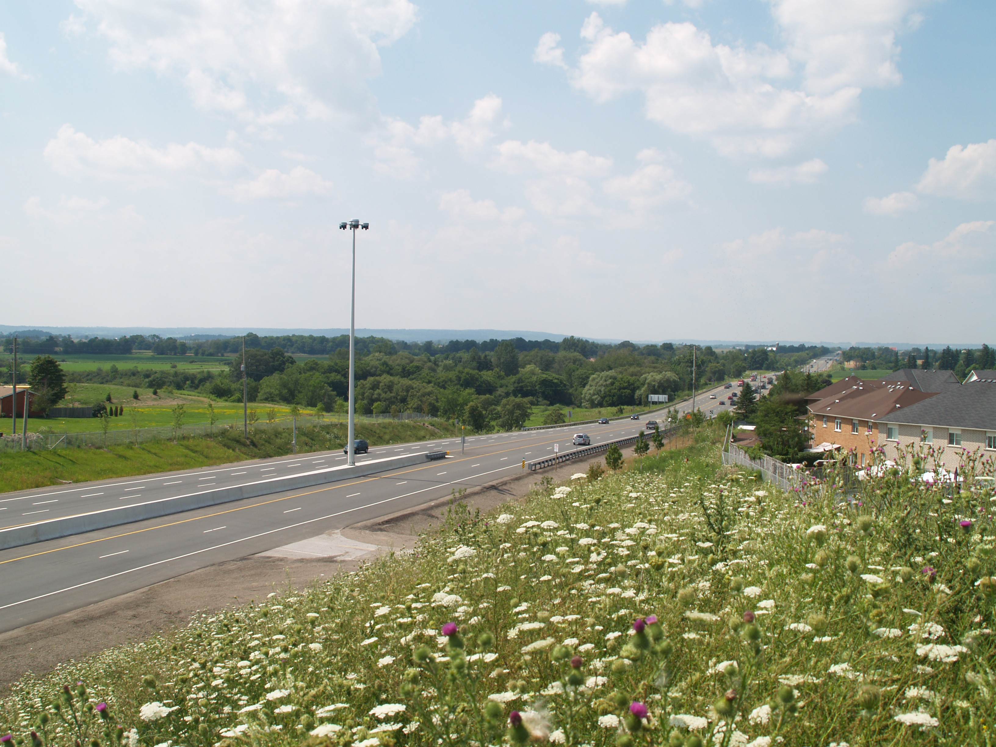
 Highway 410 ends as Highway 10 begins
Highway 10 follows a route originally carved through the virgin forests of Upper Canada in 1848. Its route has remained largely unchanged since that time, and the highway still divides many of the towns it serves, with the exception of Orangeville. It acts as the base concession road for the Regional Municipality of Peel; perpendicular sidelines are divided into East and West halves in several cases by the highway.
Beginning at its southern end in Caledon, Highway 10 passes to the west of Sandalwood, a private community on the suburban fringe of the Greater Toronto Area. The highway presses north-west and rises gently over the Niagara Escarpment, a World Biosphere Reserve. Immediately to the west are the Forks of the Credit, a deep glacial ravine and provincial park regarded for its scenery. The highway passes between several large quarries and enters Caledon Village. Continuing, it reaches Orangeville at Highway 9. The highway passes to the east of Orangville on a bypass, avoiding the business district. At the north end of the bypass, the highway curves and proceeds directly north towards the village of Primrose at Highway 89.
Highway 10 turns west, becoming concurrent with Highway 89 for a short distance, into the town of Shelburne. The concurrency ends in the centre of Shelburne, as Highway 10 splits and turns north and then resumes its north-west course. From Shelburne to Owen Sound, the road follows the course of the Toronto–Sydenham Road, a colonization road that predates the division of the land in this area. As such, the road follows a meandering path at an angle to the survey grid.
History
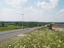
 Highway 10 through Caledon.
Historically, Highway 10 follows a 19th-century stage coach route known as the Toronto–Sydenham Road that ran north from Highway 5 in Cooksville through Brampton, Orangeville and Shelburne to Owen Sound. It was first designated as a provincial highway on February 26, 1920 when the newly formed Department of Highways assumed the road.[4] It was later extended when the provincial government assumed the road running south to Highway 2 in Port Credit on the north shore of Lake Ontario. At that point, the total length of the highway was 166 km.
In 1968, a by-pass around Orangeville was completed.
In 1998, the Mike Harris government, seeking to balance the provincial budget, off-loaded responsibility for the southernmost 31 km running through Brampton and Mississauga onto their respective municipal governments. This segment became known as Hurontario Street.
In 2009, Highway 410 was connected to Highway 10 about 500 metres north of Highway 10's southernmost terminus at the border of Brampton. The 500-metre "orphaned" segment is now discontinuous, and while still technically part of the highway, is only linked to the rest of the highway via a suburban road, and is signed "Hurontario Street" rather than "Highway 10".
Also in 2009, a major project to widen single-lane sections of the southern portions of the highway was completed, and the highway is now four lanes wide from Highway 410 north to Shelburne. From Shelburne north to Owen Sound, it remains two-lane highway with several "passing lanes" in hillier regions.
During winter, the northern stretches of the highway that pass through the snowbelt region of Grey County are subject to poor visibility and road closings during windy conditions or winter storms.
References
- Sources
- ^ Shragge 1984, p. 40.
- ^ Shragge 1984, p. 74.
- ^ Ministry of Transportation of Ontario (2004). "Annual Average Daily Traffic (AADT) counts". Government of Ontario. http://www.raqsb.mto.gov.on.ca/techpubs/TrafficVolumes.nsf/tvweb?OpenForm&Seq=5. Retrieved February 26, 2010.
- ^ Shragge 1948, p. 74.
- Bibliography
- Shragge, John; Bagnato, Sharon (1984). From Footpaths to Freeways. Ontario Ministry of Transportation and Communications, Historical Committee. ISBN 0-7743-9388-2.
The King's Highways of Ontario Current highwaysFormer highways- 2A
- 2B
- 2S
- 3B
- 4A
- 5A
- 7B
- 8A
- 12B
- 14
- 15A
- 18
- 18A
- 22
- 24A
- 25
- 27
- 29
- 30
- 31
- 32
- 35A
- 35B
- 36
- 38
- 39
- 40B
- 42
- 43
- 44
- 45
- 46
- 47
- 48B
- 50
- 51
- 52
- 53
- 54
- 55
- 56
- 57
- 59
- 68
- 70
- 73
- 74
- 75
- 76
- 78
- 79
- 80
- 81
- 82
- 83
- 84
- 86
- 87
- 88
- 90
- 91
- 92
- 95
- 96
- 97
- 98
- 99
- 100
- 103
- 104
- 106
- 107
- 109
- 110
- 111
- 114
- 116
- 117
- 119
- 120
- 121
- 122
- 123
- 126
- 128
- 131
- 133
- 134
- 135
- 136
- 169
- 400A
- 401A
County roads in Ontario · Ontario numbered highways · Expressways and 400-series highways · King's Highways · Secondary highways · Tertiary and 7000-series highways · List of Ontario provincial highways · List of former provincial highways in Ontario · Highways in Ontario · List of Ontario expressways · Trans-Canada Highway · Connecting Link · Emergency Detour RouteCategories:- Ontario provincial highways
- Orangeville, Ontario
- Owen Sound
- Proposed roads in Canada
- Roads in Brampton

Wikimedia Foundation. 2010.