- Merivale Road (Ottawa)
-
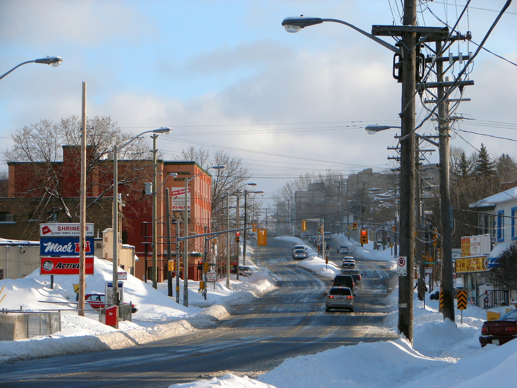
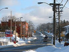 Merivale Road near Kirkwood Avenue looking south. The steep drop of the eastern end of the southern Ottawa escarpment can be seen here as the road approaches the Ottawa River.
Merivale Road is an arterial road in the western part of Ottawa, Ontario, Canada. It starts at Island Park Drive just north of Highway 417 and continues south until it ends at Prince of Wales Drive in Rideau Glen. South of Clyde Avenue, Merivale is known as Ottawa Road #17, while north of Clyde it is Ottawa Road #63.
From Island Park Drive to Carling Avenue the road is as a small collector route, passing the Westgate Shopping Centre. South of Carling Avenue it is a minor arterial road that goes through the Carlington residential neighborhood. It passes just west of the Central Experimental Farm, land owned by the federal Government of Canada.
South of Baseline Road, Merivale Road turns (it is actually the continuation of Clyde Avenue and Maitland Avenue) and becomes a major arterial route through a commercial district that contains several major malls, dozens of restaurants and radio and CTV broadcast facilities (CJOH-TV, though this last was badly damaged by fire in 2010). During the 1950s through the 1990s prior to the City of Nepean's amalgamation with the city of Ottawa, this area of Merivale Road formed the largest commercial shopping district within the city of Nepean and a major shopping area for the National Capital region. During the 1950s and 1960s several major box stores, such as Towers, Miracle Mart, Pascals, and Kmart, were located along Merivale Road along with major Canadian grocery chains such as Steinberg's and Dominion. The late 1970s saw the building of Merivale Mall at the intersection of Merivale and Viewmont Road on the site of a former farm house and farm lands. It contained the box store Woolco as one of its major anchor stores. The building of the Meadowlands Mall at the intersection of Merivale Road and Meadowlands Road took place around this time, but it contained no large box stores. The late 1970s also saw the waning of popularity of many of the other box stores along Merivale, while the recession of the 1980s put pressure on all the merchants of the area. Towers, Miracle Mart, and Pascals were closed during the late 1970s and early 1980s, and eventually they were followed by Kmart in the mid-1980s. Grocery stores Steinbergs and Dominion likewise closed during this period. After sitting derelict for a time, a series of major renovations of the affected strip malls these stores occupied took place in the late 1980s and early 1990s. Large retailers such as Staples, Winners, Zellers and restaurant chains such as The Olive Garden and eventually Red Lobster took the places vacated by the older stores.
This area of Merivale Road also leads to the City of Nepean's first experiment in promoting industrial development through the creation of industrial parks. The Colonnade Road Industrial Park at the intersection of Merivale and Colonnade lies just to the south of Viewmount Road and is/was the location for branches, production facilities and headquarters of many large high tech companies such as Gandalf Technologies, and Mitel as well as OC Transpo's south west garage facilities. Through the 1980s it was also home to Ottawa's largest Flea Market at the time, the Colonnade Flea Market (the Flea Market has since been renamed to the Bentley Flea Market and relocated further south on Merivale to 7 Cleopatra Drive).
During the 1990s another major commercial area was developed further south on Merivale road located at the intersection of Hunt Club Road. This was precipitated by the extension of the Hunt Club Road west across the Rideau River creating a new intersection with Merivale Road in what used to be a rural farming field. This area includes various large box stores such as Canadian Tire, Petsmart, Rona, Costco and the Brick as well as various large restaurant chains such as Boston Pizza and Eastside Mario's, fast food places such as Burger King and A&W, car dealerships, workout gyms and smaller specialty stores.
South of Hunt Club Road, Merivale runs through an industrial district with many small businesses which during the 1970s and 1980s was the second location for intense industrial development lead by the City of Nepean. This area also contains extensive oil and fuel storage depots.
South of the intersection of Merivale and Slack Road, Merival enters the neighbourhood of Country Place which is largely suburban and one of the few communities in Ottawa which is not on city water and which sits in an area of Ottawa known as the Green Belt; an area protected from further urban development. South of this Merivale passes through rural farming fields leading to Rideau Glen, just east of the growing subdivision of Barrhaven.
Speed limits
Speed limits vary throughout this long stretch:
- Between Island Park Drive and the Central Experimental Farm, the speed limit is 50 km/h.
- Between the Central Experimental Farm and MacFarlane Road in the industrial district the speed limit is 60 km/h.
- A small section afterwards has a speed limit of 50 km/h while the rest of the road from north of Fallowfield Road to Prince of Wales Drive the speed limit is 80 km/h.
Major intersections
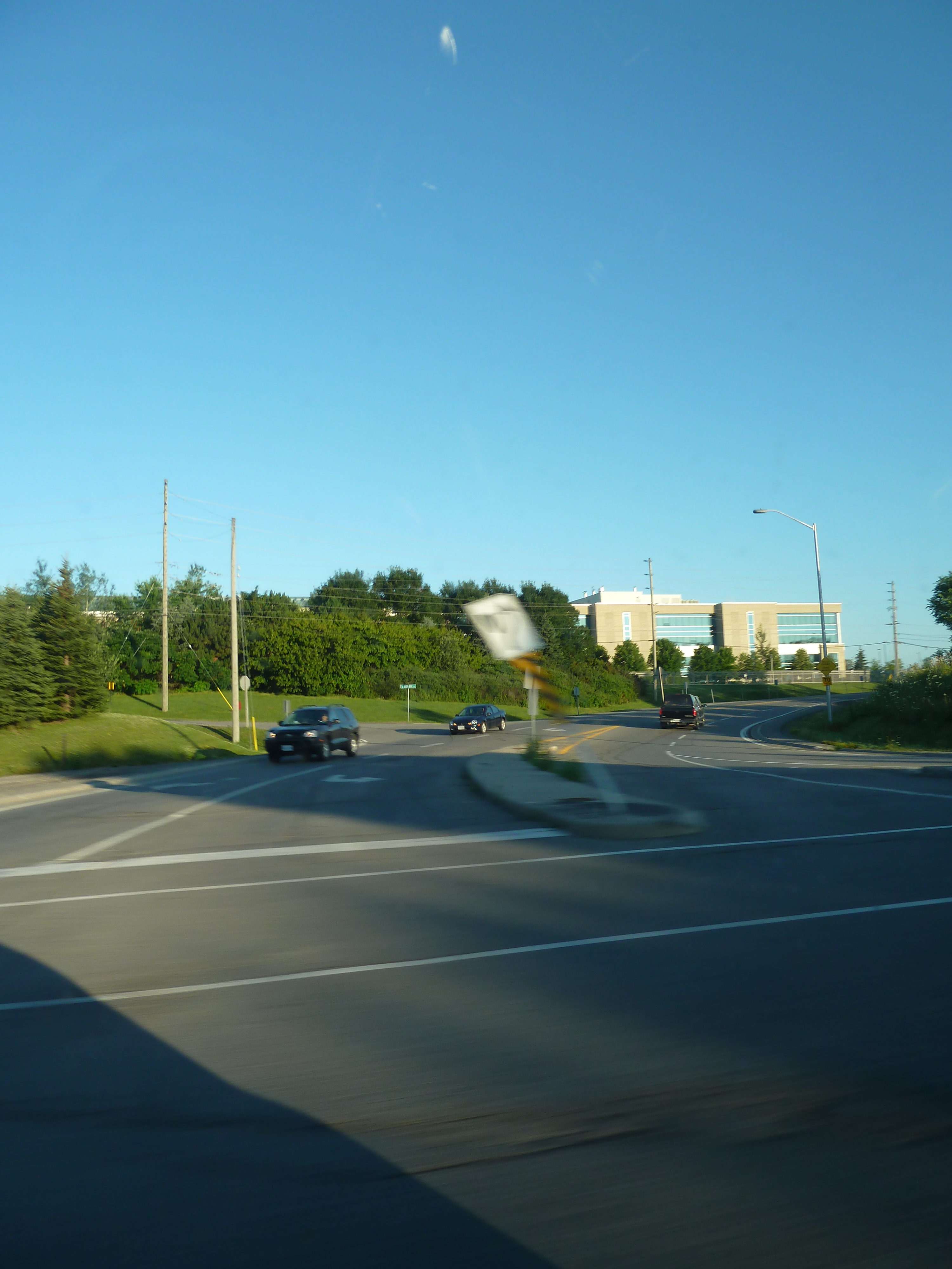
 The end of Merivale Road and Prince of Wales Drive
- Carling Avenue
- Kirkwood Avenue
- Baseline Road
- Clyde Avenue
- Meadowlands Drive
- Hunt Club Road
- Fallowfield Road
- Prince of Wales Drive
Future
There are plans to widen this road to four lanes from MacFarlane Road to Fallowfield Road in the future due to the increasing size of Barrhaven.
Roads in Ottawa Provincial Highways Major Arteries 4th Line · Tenth Line · Airport · Albion · Bank · Baseline · Blair · Bronson · Carling · Carp · Cedarview · Conroy · Donnelly · Dwyer Hill · Eagleson · Elgin · Fallowfield · Greenbank · Hazeldean · Heron · Hunt Club · Innes · King Edward · March · Merivale · Mitch Owens · Moodie · Montreal · Parkdale · Prince of Wales · Regional Road 174 · Richmond · Rideau · River · Riverside · Robertson · St. Joseph · St. Laurent · Strandherd · Terry Fox · Vanier · Walkley · Wellington · WoodroffeCollectors/Secondary Arteries Albert · Alta Vista · Bankfield · Beechwood · Booth · Brookfield · Gladstone · Hawthorne · Hog's Back · Jockvale · Katimavik · Kent · Laurier · Lees · Leitrim · Main · Maitland · Meadowlands · Metcalfe · Nicholas · North Gower · O'Connor · Old Prescott · Osgoode Main · Pinecrest · Preston · Russell · Slater · Smyth · Somerset · Sparks · St. Patrick · Sussex · Tremblay · TrimFederal arteries Categories:- Roads in Ottawa
Wikimedia Foundation. 2010.