- County of Brant
-
- For the defunct provincial electoral district known as "Brant County", see Brant (provincial electoral district).
County of Brant — Single-tier city — Paris, Ontario
Coordinates: 43°07′N 80°22′W / 43.117°N 80.367°WCoordinates: 43°07′N 80°22′W / 43.117°N 80.367°W Country  Canada
Province  Ontario
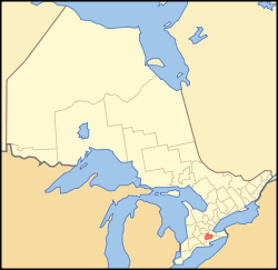
Settled 1793 Formed 1851 (county) Formed 1999 (single-tier city) Government - Mayor Ron Eddy - Federal riding Brant - Prov. riding Brant Area[1] - Land 843.10 km2 (325.5 sq mi) Population (2006)[1] - Total 34,415 - Density 40.8/km2 (105.7/sq mi) Time zone EST (UTC-5) - Summer (DST) EDT (UTC-4) Postal Code N0E, N3L Area code(s) 519 and 226 Website www.brant.ca The County of Brant (2006 population 34,415) is a single-tier municipality and a census division in the Canadian province of Ontario. Despite its name, it is not a county by the standard definition, as all municipal services are handled by a single level of government. The county has service offices in Burford, Paris and St. George.
It is a small, predominantly rural municipality in Southern Ontario, approximately 100 kilometres southwest of Toronto. It is bordered by the Region of Waterloo, the City of Hamilton, Haldimand County, Norfolk County, and Oxford County. The County abuts the Greenbelt.
Geographically, the city of Brantford is surrounded by the County of Brant. In Statistics Canada's census data, the Brant census division also includes Brantford and the Six Nations and New Credit reserves, although none of these is part of Brant's municipal government. The census division of Brant, inclusive of all four distinct municipalities, had a population of 125,099 in the 2006 census.
Contents
Communities
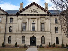 Brant County Courthouse
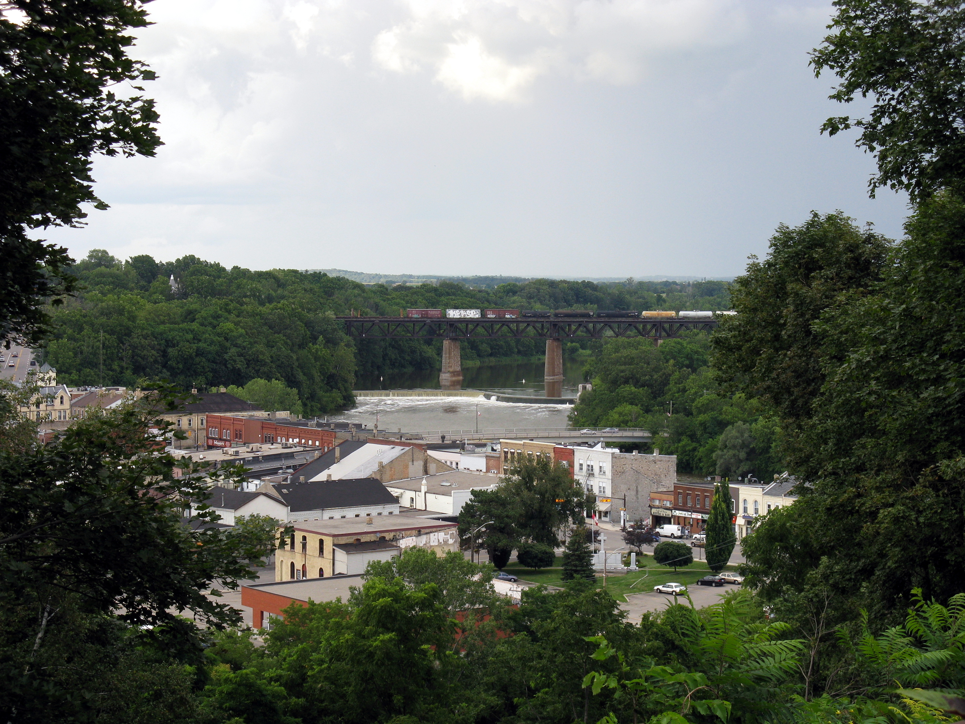
The primary centres in Brant are Paris, St. George and Burford. Smaller communities in the municipality include Bishopsgate, Burtch, Cainsville, Cathcart, East Oakland, Etonia, Fairfield, Falkland, Glen Morris, Gobles, Harley, Harrisburg, Hatchley, Langford, Lockie, Maple Grove, Middleport, Mount Pleasant, Mount Vernon, New Durham, Newport, Northfield, Northfield Centre, Oakland, Onondaga, Osborne Corners, and Scotland.
Historical townships
The area had previously been part of Wentworth & Oxford County. Brant County was formed in 1851 and originally consisted of:[2]
- Brantford Township (Brantford, Paris, Mount Pleasant, Cainsville), Area 71,122 acres (287.82 km2). First settlement made before 1810. The township was organized in 1840.
- Burford Township (Burford, Scotland), Area 71,122 acres (287.82 km2). First of the midland townships to have settlers. Surveyed in 1793, four families settled on the land before 1800.
- Oakland Township (Scotland, Oakland), Area 10,676 acres (43.20 km2). Originally called the Townsend Gore, then the Burford Gore, but organized a separate municipality in 1850.
- Onondaga Township (Onondaga, Middleport), Area 20,613 acres (83.42 km2). First settled in 1838. The formal surrender of the township by the Indians did not take place until 1839.
- South Dumfries Township (Paris, St. George, Glen Morris), Area 46,265 acres (187.23 km2).
- Tuscarora Township (Six Nations Indian Reserve, New Credit Indian Reserve), created in 1784.
In 1999, the county was reorganized and all its individual municipalities, except Brantford, were amalgamated into a single-tier municipality with city status. As of December 31, 1998, all of the original townships were still intact, except for the incorporation of the Town of Paris.
Local organizations
Local organizations include the Kinsmen Club of Brantford, and Sustainable Brant dedicated to saving the disappearing farmland.
The County of Brant Public Library is the public library serving the communities in the county of Brant, Ontario, Canada. It has 5 branches located in Paris, Burford, Scotland, St. George, and Glen Morris, Ontario. The system's main branch, in Paris, Ontario, was originally a Carnegie Library, having received an endowment from Carnegie in 1902.
Album of Honour
 War Monument in Brantford, Ontario
The Album of Honour for Brant County is a book compiled in 1946 by the Kinsmen Club of Brantford to commemorate those of Brantford, the County of Brant and the peoples of the Six Nations who served Canada during the Second World War. [3] The book lists the names of the Brant County men and women who served in World War II. There are more than 3,500 photographs. In addition, local companies provided the names of employees who served in this war. The book is kept on the Digital Archives Page at the Brantford Public Library. [4]
Demographics & geography
Canada census – County of Brant Community Profile References: 2006[5] 2001[6] -
-
- N/A = Data Not Available
-
Population trend:[7]
- Population in 2006: 34,415
- Population in 2001: 31,669
- Population total in 1996: 29,800
- Brantford (township): 6487
- Burford (township): 5858
- Oakland (township): 1377
- Onondaga (township): 1650
- Paris (town): 8987
- South Dumfries (township): 5441
- Population in 1991:
- Brantford (township): 6509
- Burford (township): 5733
- Oakland (township): 1398
- Onondaga (township): 1519
- Paris (town): 8600
- South Dumfries (township): 4624
References
- ^ a b "Brant (City) community profile". 2006 Census data. Statistics Canada. http://www12.statcan.gc.ca/census-recensement/2006/dp-pd/prof/92-591/details/page.cfm?Lang=E&Geo1=CSD&Code1=3529005&Geo2=PR&Code2=35&Data=Count&SearchText=Brant&SearchType=Begins&SearchPR=01&B1=All&Custom=. Retrieved 2011-02-07.
- ^ Province of Ontario -- A History 1615 to 1927 by Jesse Edgar Middletown & Fred Landon, 1927, Dominion Publishing Company, Toronto
- ^ http://66.207.114.162/genealogy/pdfs/AlbumHonour.pdf
- ^ The Brantford Public Library - Virtual War Memorial
- ^ "2006 Community Profiles". Statistics Canada. Government of Canada. 2009-02-24. http://www12.statcan.ca/census-recensement/2006/dp-pd/prof/92-591/index.cfm?Lang=E. Retrieved 2009-02-24.
- ^ "2001 Community Profiles". Statistics Canada. Government of Canada. 2007-02-01. http://www12.statcan.ca/english/profil01/CP01/Index.cfm?Lang=E. Retrieved {{{2001_access_date}}}.
- ^ Statistics Canada: 1996, 2001, 2006 census
External links
- County of Brant website
- Brant Tourism
- Kinsmen Club of Brantford Inc.
- County of Brant Public Library
- Brant County War Memorials Committee
- Our Brant local history wiki
- History of the County of Brant - Warner, Beers and Co.
- History of the County of Brant - F. Douglas Reville, Volume I
- History of the County of Brant - F. Douglas Reville, Volume II

Blandford-Blenheim North Dumfries Norwich 
Hamilton  Brant (completely surrounds Brantford)

Norfolk County, Six Nations of the Grand River Haldimand County Categories:


Wikimedia Foundation. 2010.