- List of cities in Canada
-
This is a list of incorporated cities of Canada in alphabetical order categorized by province. More thorough lists of communities are available for each province.
A map showing the provincial capitals and provinces of Canada Contents
Federal, provincial and territorial capitals
- Canada: Ottawa
- Alberta: Edmonton
- British Columbia: Victoria
- Manitoba: Winnipeg
- New Brunswick: Fredericton
- Newfoundland and Labrador: St. John's
- Nova Scotia: Halifax
- Ontario: Toronto
- Prince Edward Island: Charlottetown
- Quebec: Quebec City
- Saskatchewan: Regina
- Northwest Territories: Yellowknife
- Nunavut: Iqaluit
- Yukon: Whitehorse
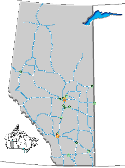
Alberta
Grande PrairieWetaskiwin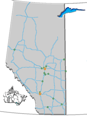
Distribution of cities in Alberta To qualify as a city in Alberta, a sufficient population size (10,000 people or more) must be present and a majority of the buildings must be on parcels of land smaller than 1,850 square metres.[1] A community is not always incorporated as a city even if it meets these requirements. The urban service areas of Fort McMurray and Sherwood Park are hamlets recognized as equivalents of cities, but remain unincorporated. Nine towns are also eligible for city status but remain incorporated as towns.
- Source: Areas, populations and densities from Statistics Canada, 2006 Census of Canada[2]
British Columbia
In British Columbia, a community can be incorporated as a city if its population exceeds 5,000.[3] Once so incorporated, a city does not lose this status even if its population later declines; the once-thriving city of Greenwood, for example, now has a population of just 625 people.
Manitoba

City Population (2006)[5] Area (km²) Location Remarks Brandon 41,511 465.16 49°50′36″N 99°57′02″W / 49.84334°N 99.95044°W Dauphin 7,906 12.65 51°09′00″N 100°02′59″W / 51.15007°N 100.0497°W Flin Flon 5,594 11.55 54°46′07″N 101°52′38″W / 54.76848°N 101.8772°W Smallest city in Manitoba
Portion of city also located in Saskatchewan
(numbers for Manitoba portion only)Portage la Prairie 12,728 24.67 49°58′22″N 98°17′26″W / 49.97277°N 98.29043°W Selkirk 9,515 24.87 50°08′33″N 96°52′15″W / 50.14250°N 96.87070°W Steinbach 11,066 25.57 49°31′32″N 96°41′05″W / 49.52564°N 96.68467°W Thompson 13,446 17.18 55°44′47″N 97°51′00″W / 55.74630°N 97.85012°W Winkler 9,106 17.02 49°10′48″N 97°56′18″W / 49.17991°N 97.93844°W Winnipeg 633,451 464.01 49°54′00″N 97°08′20″W / 49.89990°N 97.13888°W Capital of Manitoba
Largest city in ManitobaNew Brunswick

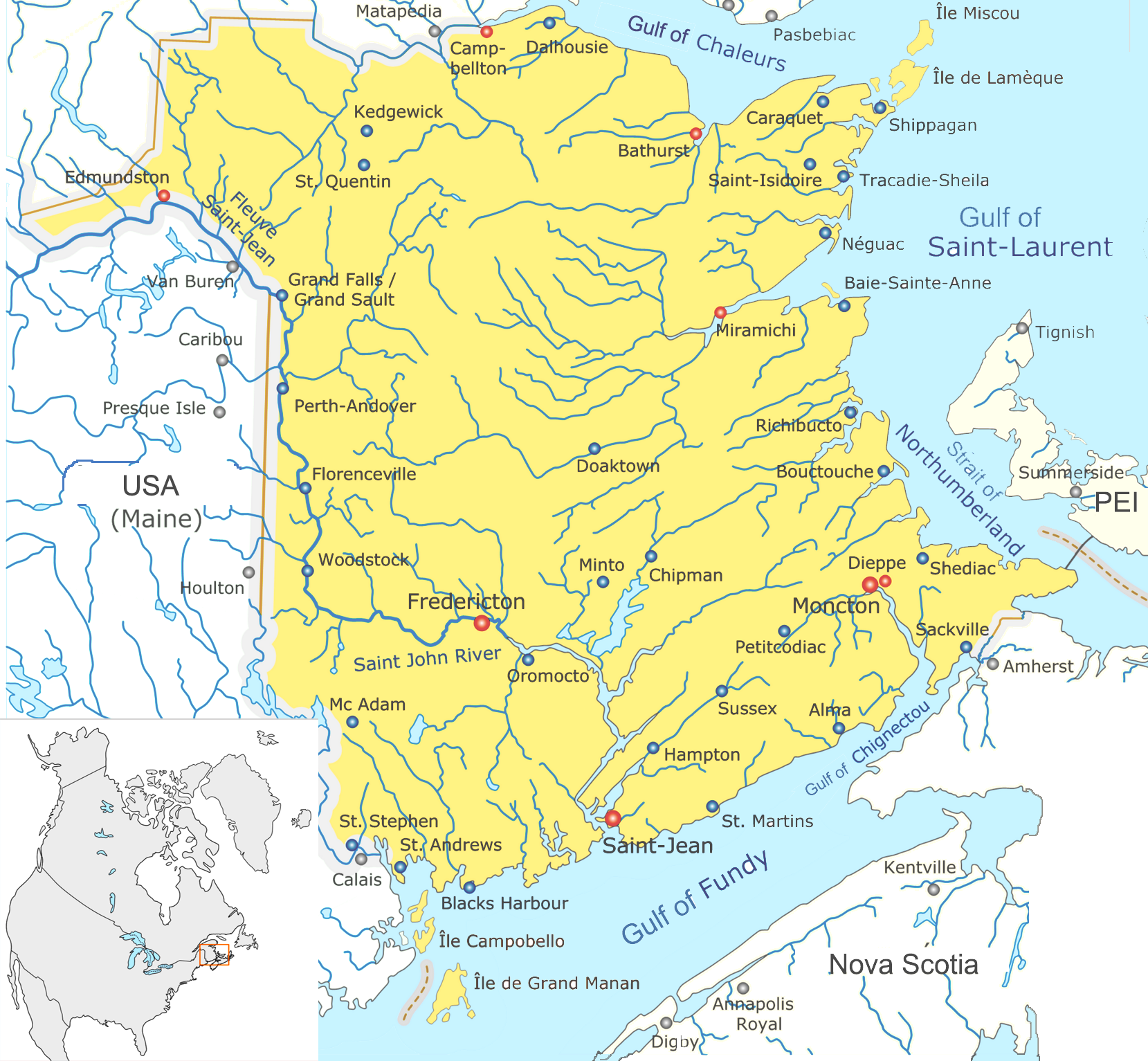
City Population (2006)[6] Area (km²) Location Remarks Bathurst 12,714 47°37′05″N 65°39′04″W / 47.61814°N 65.65112°W Campbellton 7,384 48°00′27″N 66°40′22″W / 48.00751°N 66.67272°W Smallest city in New Brunswick Dieppe 18,565 46°05′40″N 64°44′54″W / 46.09443°N 64.74844°W Part of the Moncton Census Metropolitan Area Edmundston 16,643 47°21′47″N 68°19′34″W / 47.36292°N 68.32603°W Fredericton 50,535 45°57′49″N 66°38′35″W / 45.96354°N 66.64307°W Capital of New Brunswick Miramichi 18,129 47°01′53″N 65°28′05″W / 47.03127°N 65.46817°W Moncton 64,128 46°05′17″N 64°46′38″W / 46.08799°N 64.77711°W Part of the Moncton Census Metropolitan Area Saint John 68,043 45°16′24″N 66°03′53″W / 45.27320°N 66.06478°W Largest city in New Brunswick
Part of the Saint John Census Metropolitan AreaNewfoundland and Labrador
City Population (2006)[7] Area (km²) Location Remarks Corner Brook 20,083 48°57′03″N 57°56′59″W / 48.95083°N 57.94966°W Smallest city in Newfoundland and Labrador Mount Pearl 24,671 47°31′07″N 52°48′21″W / 47.51866°N 52.80579°W Part of the St. John's Metropolitan Area St. John's 100,646 47°33′41″N 52°42′46″W / 47.56149°N 52.71266°W Capital of Newfoundland and Labrador
Largest city in Newfoundland and Labrador
Part of the St. John's Metropolitan AreaNorthwest Territories
As in the other two Canadian territories, the only incorporated city in the Northwest Territories is its capital, Yellowknife.
- Yellowknife - territorial capital 62°27′17″N 114°22′35″W / 62.45466°N 114.3764°W
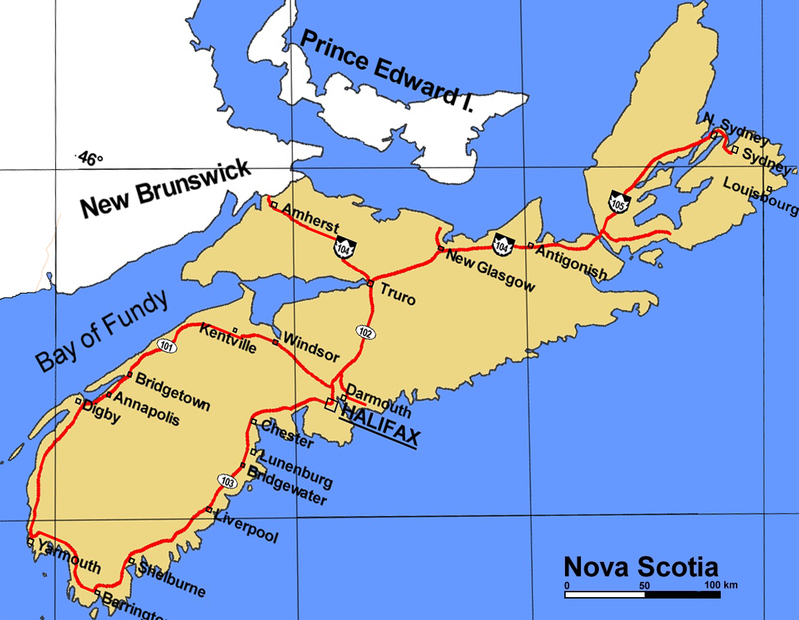
Nova Scotia
Nova Scotia no longer has any incorporated cities, as they were amalgamated into Regional Municipalities in the 1990s.
- Halifax - provincial capital and Metropolitan Area, now part of the Halifax Regional Municipality 44°38′56″N 63°34′31″W / 44.64887°N 63.57531°W
- Sydney - former city, now part of the Cape Breton Regional Municipality 46°08′11″N 60°11′44″W / 46.13631°N 60.19551°W
- Dartmouth - formerly the second largest city in Nova Scotia, now a Metropolitan Area and part of the Halifax Regional Municipality. 44°39′50″N 63°34′05″W / 44.66389°N 63.56818°W
As in the other two Canadian territories, the only incorporated city in Nunavut is its capital, Iqaluit.
- Iqaluit - territorial capital 63°42′40″N 68°19′39″W / 63.71105°N 68.32749°W
Ontario
In Ontario, city status is conferred by the provincial government, generally upon the request of the incorporated municipality. A municipality may apply for city status anytime after its population surpasses 10,000. This status is not automatically conferred on a community that reaches this population target, but must be requested by the municipality and granted by the provincial Ministry of Municipal Affairs and Housing. Not all municipalities which reach this population target have pursued city designation (as, for example, Markham, Ajax and Oakville, which in 2006 had census populations of ca. 262,000, 93,000, and 166,000 respectively, but are still designated as towns.) Once designated a city, however, a municipality does not lose this status even if its population later falls back below 10,000 (as, for example, Dryden.)
City status may also be conferred on some rural counties which have been amalgamated such that all municipal governance takes place at the county level with no further municipal subdivisions. Thus, city status in Ontario does not always connote a primarily urbanized community.
Prince Edward Island
- Charlottetown - provincial capital/largest city 46°14′52″N 63°07′13″W / 46.24785°N 63.12019°W
- Summerside 46°23′35″N 63°47′25″W / 46.39316°N 63.79023°W
Quebec
In Quebec, provincial law does not currently distinguish between towns and cities — one designation, ville, covers both types of communities regardless of size, as the French language lacks a widely-used term to distinguish town and cities in general. A ville might be informally referred to as a town or a city in English, but this is an arbitrary and subjective distinction. Quebec does, however, distinguish between villes and other types of incorporated municipalities, such as municipalités and villages autochthones. Quebec did at one time distinguish between villes and cités, but no longer does.
All municipalities in Quebec which have ville status are listed here, regardless of whether they are considered towns or cities in unofficial usage.
Saskatchewan
In Saskatchewan, towns must have a population of 5,000 or more[10] and meet other criteria in order to incorporate as a city, although in the early 20th century several centres such as Saskatoon and Regina were granted city status despite having a smaller population. The City of Melville retains its city status despite dropping below 5,000 people in the 1990s. Kindersley, with a population that fluctuates around the 5,000 mark, has applied for city status in recent years.
Yukon
As in the other two Canadian territories, the only incorporated city in the Yukon is its capital, Whitehorse. Dawson was also previously incorporated as a city, but when the criteria were changed in the 1980s, its status was reduced to that of a town due to population. Through special provision, however, it is officially the town of the city of Dawson.
- Whitehorse - territorial capital 60°43′15″N 135°03′09″W / 60.72092°N 135.0524°W
See also
- History of cities in Canada
- List of the 100 largest municipalities in Canada by population
- List of the 100 largest metropolitan areas in Canada
- List of the 100 largest cities and towns in Canada by area
- List of towns in Canada
- List of cities and towns of Upper Canada
- List of cities in North America
- List of city nicknames in Canada
- Origins of names of cities in Canada
References
- ^ Alberta Queen's Printer (2010-01-01). "Municipal Government Act - Revised Statutes of Alberta 2000, Chapter M-26 (Section 82)". http://www.qp.alberta.ca/574.cfm?page=m26.cfm&leg_type=Acts&isbncln=9780779745739. Retrieved 2010-06-03.
- ^ Statistics Canada (2007). "Population and dwelling counts, for Canada, provinces and territories, and census subdivisions (municipalities), 2006 and 2001 censuses - 100% data (Alberta)". http://www12.statcan.gc.ca/census-recensement/2006/dp-pd/hlt/97-550/Index.cfm?TPL=P1C&Page=RETR&LANG=Eng&T=302&SR=1&S=1&O=A&RPP=9999&PR=48&CMA=0. Retrieved 2010-06-03.
- ^ Government of British Columba - Local Government Act
- ^ Statistics Canada (2007). "Population and dwelling counts, for Canada, provinces and territories, and census subdivisions (municipalities), 2006 and 2001 censuses - 100% data (British Columbia)". http://www12.statcan.gc.ca/census-recensement/2006/dp-pd/hlt/97-550/Index.cfm?TPL=P1C&Page=RETR&LANG=Eng&T=302&SR=1&S=1&O=A&RPP=9999&PR=59&CMA=0. Retrieved 2010-06-19.
- ^ Statistics Canada (2007). "Population and dwelling counts, for Canada, provinces and territories, and census subdivisions (municipalities), 2006 and 2001 censuses - 100% data (Manitoba)". http://www12.statcan.gc.ca/census-recensement/2006/dp-pd/hlt/97-550/Index.cfm?TPL=P1C&Page=RETR&LANG=Eng&T=302&SR=1&S=1&O=A&RPP=9999&PR=46&CMA=0. Retrieved 2010-06-19.
- ^ Statistics Canada (2007). "Population and dwelling counts, for Canada, provinces and territories, and census subdivisions (municipalities), 2006 and 2001 censuses - 100% data (New Brunswick)". http://www12.statcan.gc.ca/census-recensement/2006/dp-pd/hlt/97-550/Index.cfm?TPL=P1C&Page=RETR&LANG=Eng&T=302&SR=1&S=1&O=A&RPP=9999&CMA=0&PR=13. Retrieved 2010-06-19.
- ^ Statistics Canada (2007). "Population and dwelling counts, for Canada, provinces and territories, and census subdivisions (municipalities), 2006 and 2001 censuses - 100% data (Newfoundland and Labrador)". http://www12.statcan.gc.ca/census-recensement/2006/dp-pd/hlt/97-550/Index.cfm?TPL=P1C&Page=RETR&LANG=Eng&T=302&SR=1&S=1&O=A&RPP=9999&CMA=0&PR=10. Retrieved 2010-06-19.
- ^ Statistics Canada (2007). "Population and dwelling counts, for Canada, provinces and territories, and census subdivisions (municipalities), 2006 and 2001 censuses - 100% data (Ontario)". http://www12.statcan.gc.ca/census-recensement/2006/dp-pd/hlt/97-550/Index.cfm?TPL=P1C&Page=RETR&LANG=Eng&T=302&SR=1&S=1&O=A&RPP=9999&CMA=0&PR=35. Retrieved 2010-06-19.
- ^ Statistics Canada (2007). "Population and dwelling counts, for Canada, provinces and territories, and census subdivisions (municipalities), 2006 and 2001 censuses - 100% data (Quebec)". http://www12.statcan.gc.ca/census-recensement/2006/dp-pd/hlt/97-550/Index.cfm?TPL=P1C&Page=RETR&LANG=Eng&T=302&SR=1&S=1&O=A&RPP=9999&CMA=0&PR=24. Retrieved 2010-06-19.
- ^ ;Saskatchewan Queen's Printer. "The Cities Act (Chapter C-11.1 of The Statutes of Saskatchewan, 2002)". http://www.qp.gov.sk.ca/documents/english/Statutes/Statutes/c11-1.pdf. Retrieved 2010-06-04.
- ^ Statistics Canada (2007). "Population and dwelling counts, for Canada, provinces and territories, and census subdivisions (municipalities), 2006 and 2001 censuses - 100% data (Saskatchewan)". http://www12.statcan.gc.ca/census-recensement/2006/dp-pd/hlt/97-550/Index.cfm?TPL=P1C&Page=RETR&LANG=Eng&T=302&SR=1&S=1&O=A&RPP=9999&CMA=0&PR=47. Retrieved 2010-06-19.
External links
List of cities in North America Sovereign states Antigua and Barbuda · Bahamas · Barbados · Belize · Canada · Costa Rica · Cuba · Dominica · Dominican Republic · El Salvador · Grenada · Guatemala · Haiti · Honduras · Jamaica · Mexico · Nicaragua · Panama · Saint Kitts and Nevis · Saint Lucia · Saint Vincent and the Grenadines · Trinidad and Tobago · United States
Dependencies and
other territoriesAnguilla · Aruba · Bermuda · Bonaire · British Virgin Islands · Cayman Islands · Curaçao · Greenland · Guadeloupe · Martinique · Montserrat · Puerto Rico · Saint Barthélemy · Saint Martin · Saint Pierre and Miquelon · Saba · Sint Eustatius · Sint Maarten · Turks and Caicos Islands · United States Virgin Islands
Categories:- Lists of cities in Canada


Wikimedia Foundation. 2010.