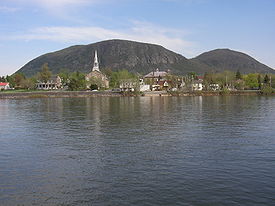
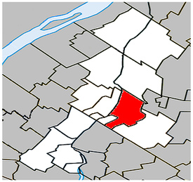
- Mont-Saint-Hilaire, Quebec
-
For other uses, see Saint-Hilaire (disambiguation).
Mont-Saint-Hilaire, Quebec — Town — Ville de Mont-Saint-Hilaire Location within La Vallée-du-Richelieu Regional County Municipality. Coordinates (100, rue du Centre-Civique [1]): 45°33′54″N 73°11′28″W / 45.565°N 73.19111°W Country  Canada
Province  Quebec
Region Montérégie (16) RCM La Vallée-du-Richelieu Established March 12, 1966 Electoral Districts
Federal
Chambly—BorduasProvincial Borduas Government[1][2][3] [1] - Mayor Michel Gilbert - Federal MP(s) Matthew Dubé (NDP) - Quebec MNA(s) Pierre Curzi (PQ) Area[4] - Land 44.29 km2 (17.1 sq mi) Population (2006)[4] - Total 15,720 - Density 354.9/km2 (919.2/sq mi) - Change (2001-06)  10.2%
10.2%- Dwellings 6,325 Time zone EST (UTC-5) - Summer (DST) EDT (UTC-4) Postal code(s) J3H Area code(s) 450 Access Routes[5]

 A-20 / TCH
 Route 116
Website ville.mont-saint-hilaire.qc.ca Mont-Saint-Hilaire is an off-island suburb of Montréal in southeastern Québec, Canada on the Richelieu River in the Regional County Municipality of La Vallée-du-Richelieu. The population as of the Canada 2006 Census was 15,720.
A significant deposit of the semi-precious mineral Sodalite is located near Mont-Saint-Hilaire.
Contents
Demographics
Population
Population trend[6]
Census Population Change (%) 2006 15,720  10.2%
10.2%2001 14,270  9.2%
9.2%1996 13,064  6.5%
6.5%1991 12,267 N/A Language
Mother tongue language (2006)[4]
Language Population Pct (%) French only 14,540 93.32% English only 610 3.92% Both English and French 60 0.39% Other languages 370 2.37% Transportation
Mont-Saint-Hilaire is served by the Mont-Saint-Hilaire commuter rail station on the Agence métropolitaine de transport's Mont-Saint-Hilaire Line. Local bus service is provided by the CIT de la Vallée du Richelieu.
Attractions
- Art Station
- Museum of arts of Mont-Saint-Hilaire
- Art center Ozias Leduc
- Manoir Rouville-Campbell
- Saint-Hilaire church
McGill's Gault Nature Reserve resides over the thousand hectares of primeval forest land, used for research and recreation purposes.
See also
References
- ^ a b Ministère des Affaires Municipales et Régions: Mont-Saint-Hilaire
- ^ Parliament of Canada Federal Riding History: CHAMBLY--BORDUAS (Quebec)
- ^ Chief Electoral Officer of Québec - 40th General Election Riding Results: BORDUAS
- ^ a b c 2006 Statistics Canada Community Profile: Mont-Saint-Hilaire, Quebec
- ^ Official Transport Quebec Road Map
- ^ Statistics Canada: 1996, 2001, 2006 census
External links

Richelieu River
Saint-Mathieu-de-BeloeilSaint-Charles-sur-Richelieu 
Richelieu River
Beloeil
Sainte-Marie-Madeleine  Mont-Saint-Hilaire

Otterburn Park Saint-Mathias-sur-Richelieu Saint-Jean-Baptiste
Coordinates: 45°34′N 73°12′W / 45.567°N 73.2°W Administrative divisions of Montérégie (Region 16)
Regional county municipalities
and equivalent territoriesBrome-Missisquoi · La Haute-Yamaska · Acton · Pierre-De Saurel · Les Maskoutains · Rouville · Le Haut-Richelieu · La Vallée-du-Richelieu · Longueuil · Marguerite-d'Youville · Roussillon · Les Jardins-de-Napierville · Le Haut-Saint-Laurent · Beauharnois-Salaberry · Vaudreuil-Soulanges
Municipalities Cowansville · Granby · Sorel-Tracy · Saint-Hyacinthe · Saint-Jean-sur-Richelieu · Chambly · Saint-Basile-le-Grand · Mont-Saint-Hilaire · Belœil · Brossard · Saint-Lambert · Boucherville · Saint-Bruno-de-Montarville · Longueuil · Sainte-Julie · Varennes · La Prairie · Candiac · Sainte-Catherine · Saint-Constant · Mercier · Châteauguay · Beauharnois · Salaberry-de-Valleyfield · Pincourt · Vaudreuil-Dorion · Saint-Lazare
Administrative divisions of Quebec Categories:- Cities and towns in Quebec
- Incorporated places in Montérégie
- Greater Montreal
- Montérégie geography stubs
Wikimedia Foundation. 2010.


